
A few people asked if I was planning to complete the high points in any particular order.
The short answer is no.
As you can see on the map on this page, the peaks are pretty scattered (there isn’t really a cluster of ‘shortest’ or ‘tallest’ to try ascending or descending height order), weather and conditions can be unpredictable, and it would just be a bit of a logistical nightmare. 🙂
That said, I’m a bit cheesy. I noticed that Torre has an elevation of 1,993 meters, which also happens to be the year I was born! I thought it would make sense to start at ‘the beginning’. It’s not the most epic of starts, as it’s just a drive-up to the summit (more on this later). I decided to snag a cheap flight from London for the last weekend in March, and so the journey began on an early Saturday morning. I landed in Porto around lunchtime, picked up the rental car (only €25 for a Fiat 600 from Budget, right at their airport location!), and headed to Matosinhos for a quick lunch of a smoothie and eggs. Odd combination, sure, but they met my mess of dietary requirements…and were somehow the best eggs I’d ever had. The place was called Negra Café – I’d recommend it! I’ve bookmarked essentially every stop on this trip in a map at the bottom of this post.
For the first night, I had booked Hospedaria Santa Cruz in Seia, right at the foot of Serra da Estrela Natural Park. That gave the option to head up from there to Torre (Portugal’s highest point) at sunset that day, or sunrise the following. I decided to check into the hospedaria first and squeeze in a quick nap. This was a nice, quiet spot with really comfortable beds, and it’s a perfect home base when exploring the natural park. There’s so much more to see in it than just Torre, so I’m aware that this trip was way too short! The owner is very sweet and helpful – we were chatting about my plans, and I asked if she’d recommend Torre at sunset or sunrise (to avoid crowds). She said that sunset would be more beautiful, and it turned out that she would be very right.
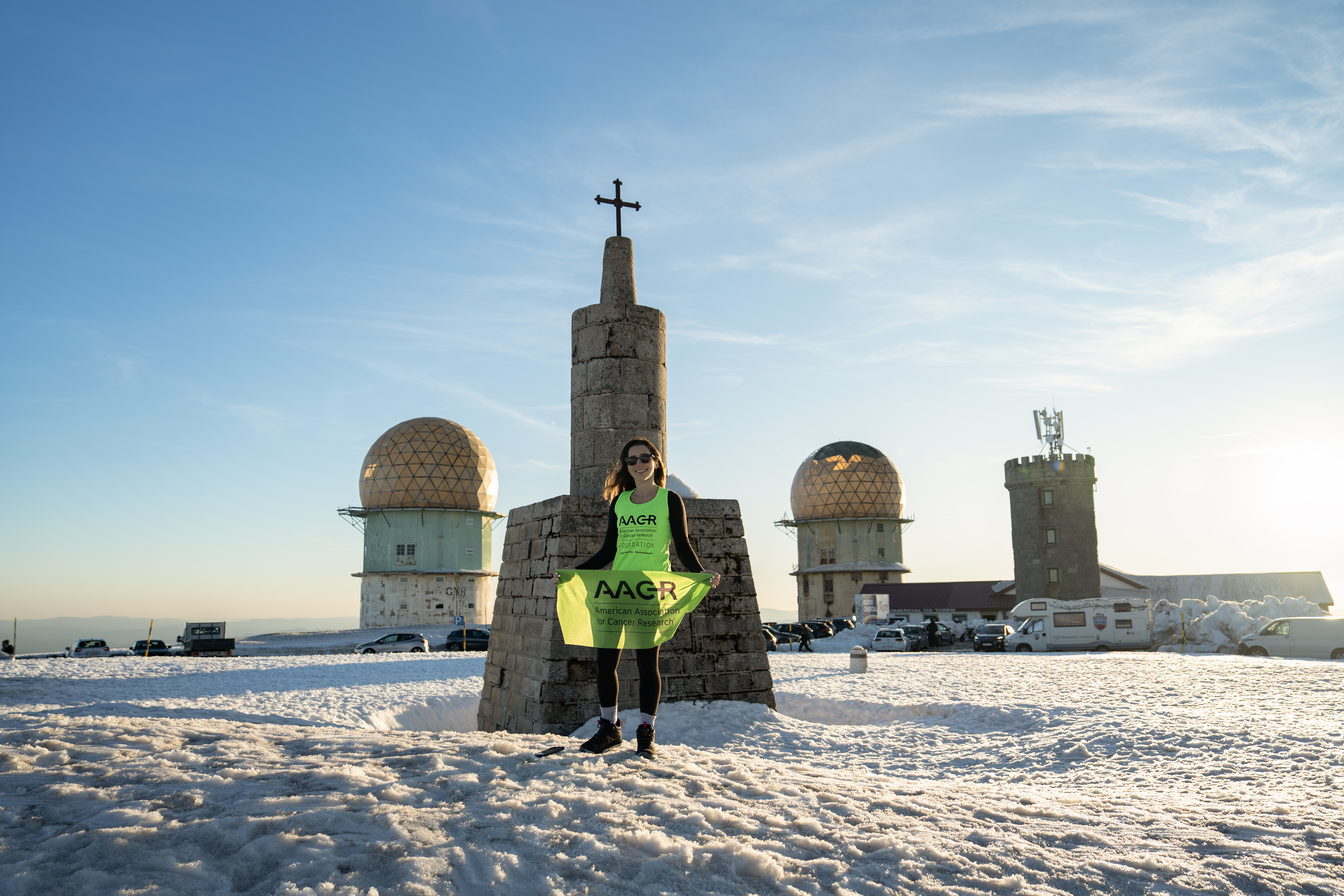
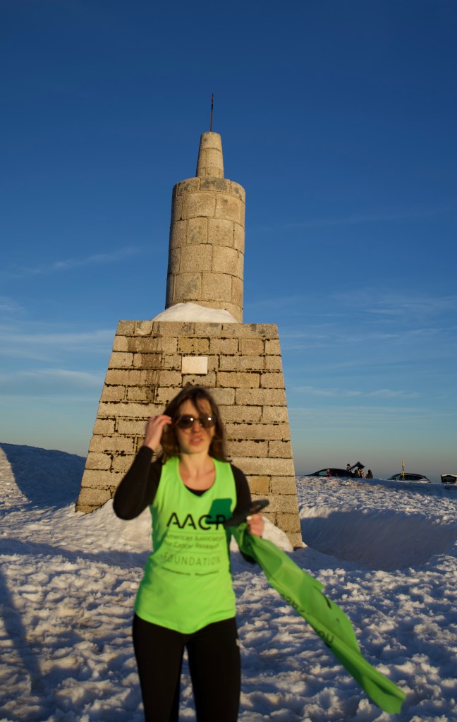
Torre – Highest Point of Portugal
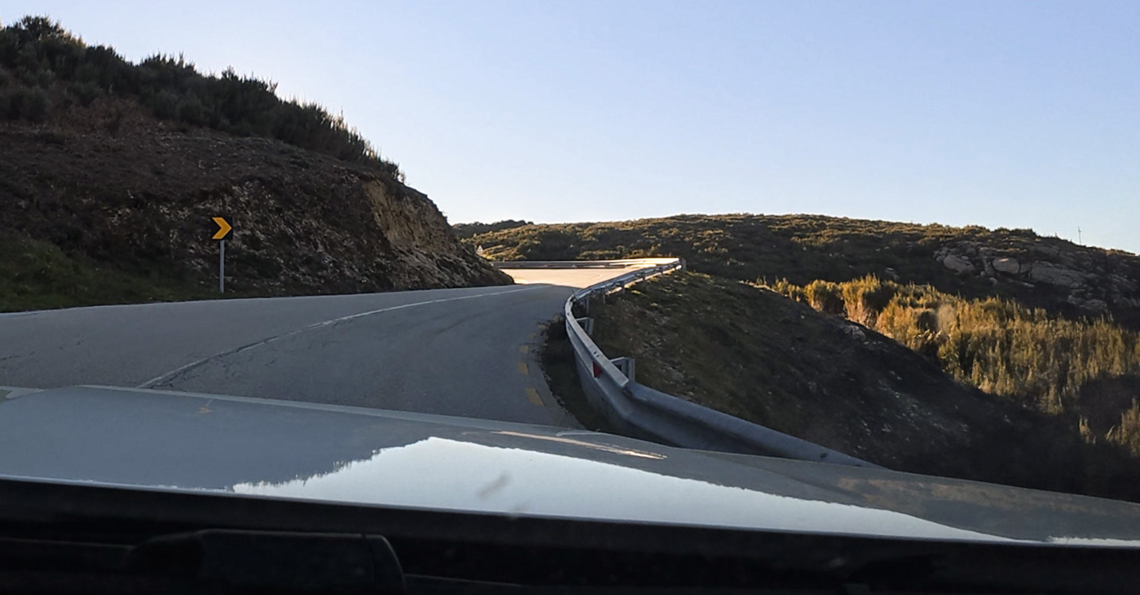
I started the 45-minute drive up to the summit. The drive first passes through quaint towns before ascending quickly up the mountain. It was golden hour, which is definitely when I’d recommend starting the drive.
Now for a quick sidebar about why I chose to drive up when this park is full of trails in every direction. I am following a rule of not using chairlifts or gondolas on ascents when hiking paths are available. With this mountain, it’s not very prominent, as evidenced by the fact that you can drive up in a normal vehicle on well-paved roads. This makes it feel more similar to high points in countries like Belgium or Denmark, where it’s tricky to determine what the appropriate ‘start point’ would be. There is a popular route to Torre from a lake on the drive up, but that’s just it…it’s an arbitrary starting point along a drive. I looked on trail mapping apps and found a full route from Alvoco da Serra, but there were no recent reports, and the ones there mostly referenced an overgrown path and erosion. I’m a proponent of ‘leave no trace’ on trails, so I couldn’t find enough information to determine if this would be a responsible route to take.
That said, if anyone familiar with the area knows of a route that feels base-to-summit and is acceptable to take without damaging the flora or trespassing on private property, I’d want to check it out! Of everyone I could find who’s completed the Crown of Europe challenge, they seemed to either drive up (though I’ve heard some hardcore cyclists do bike up) or opt for Pico in the Azores instead (geographically in Africa, but part of Portugal). That’s a mountain I’d love to hike someday, even if it’s not part of my current list for this challenge! If you’re interested in the nuances of peak selections, those ramblings are on The Challenge. 🙂
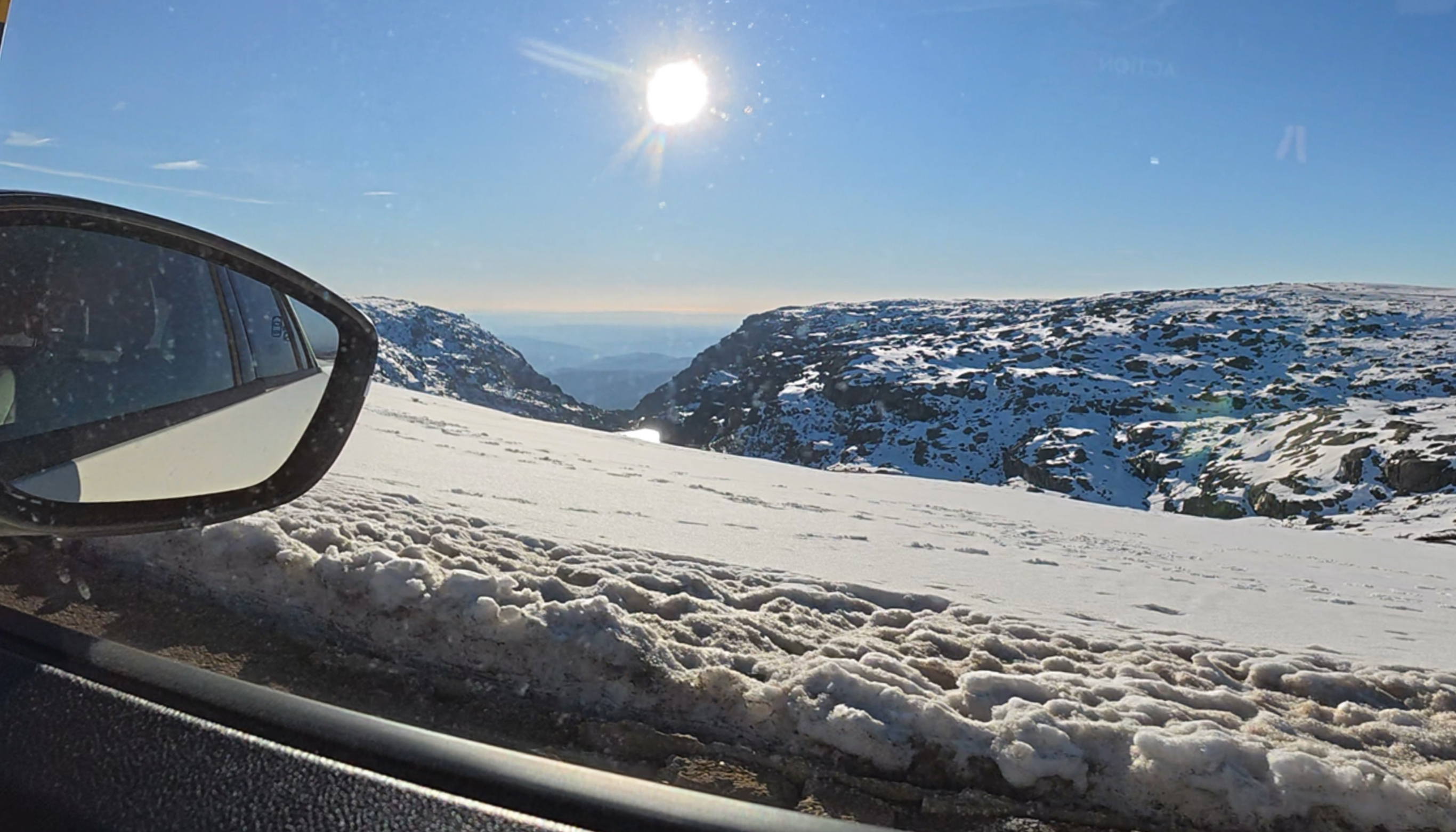
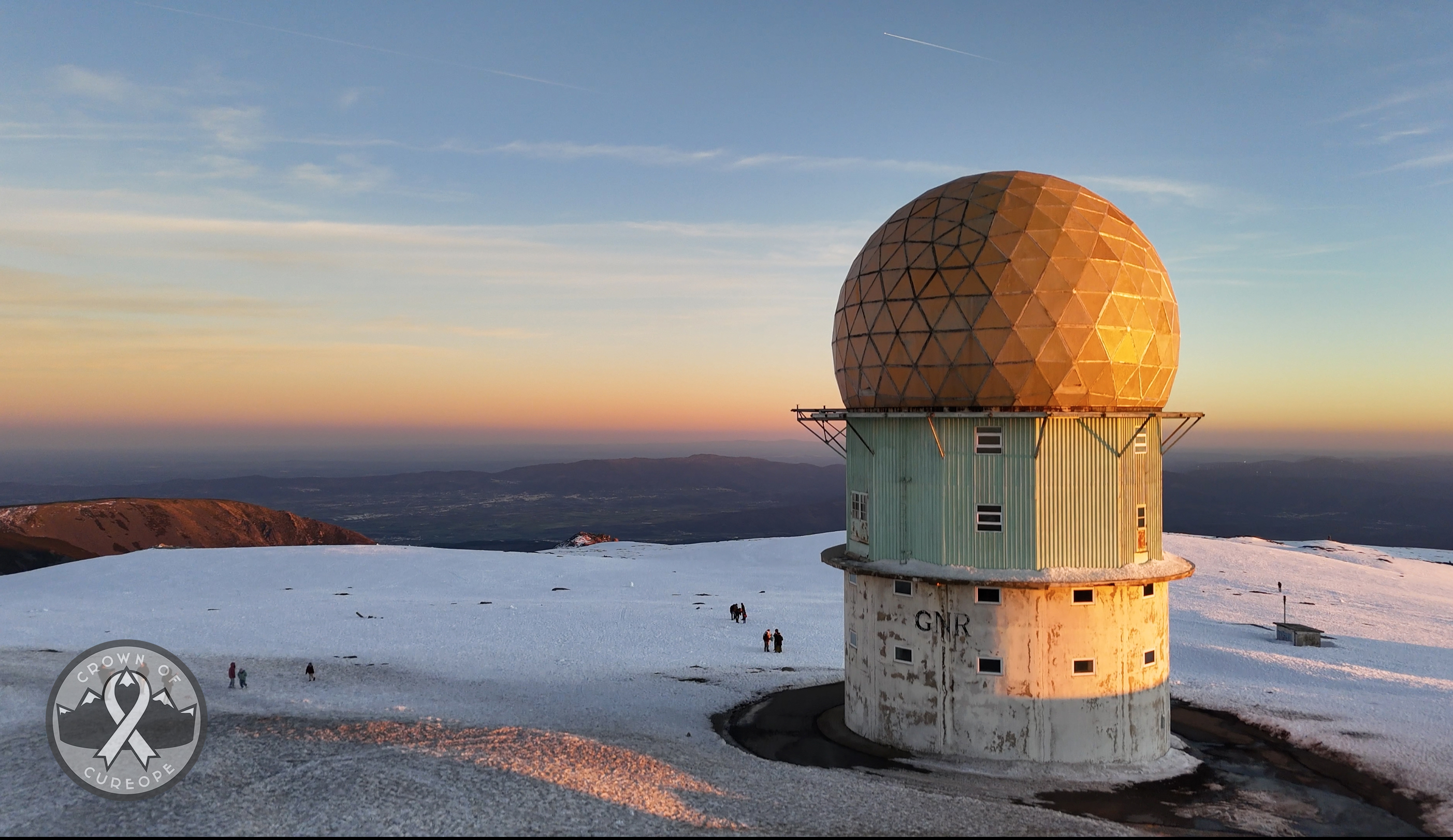
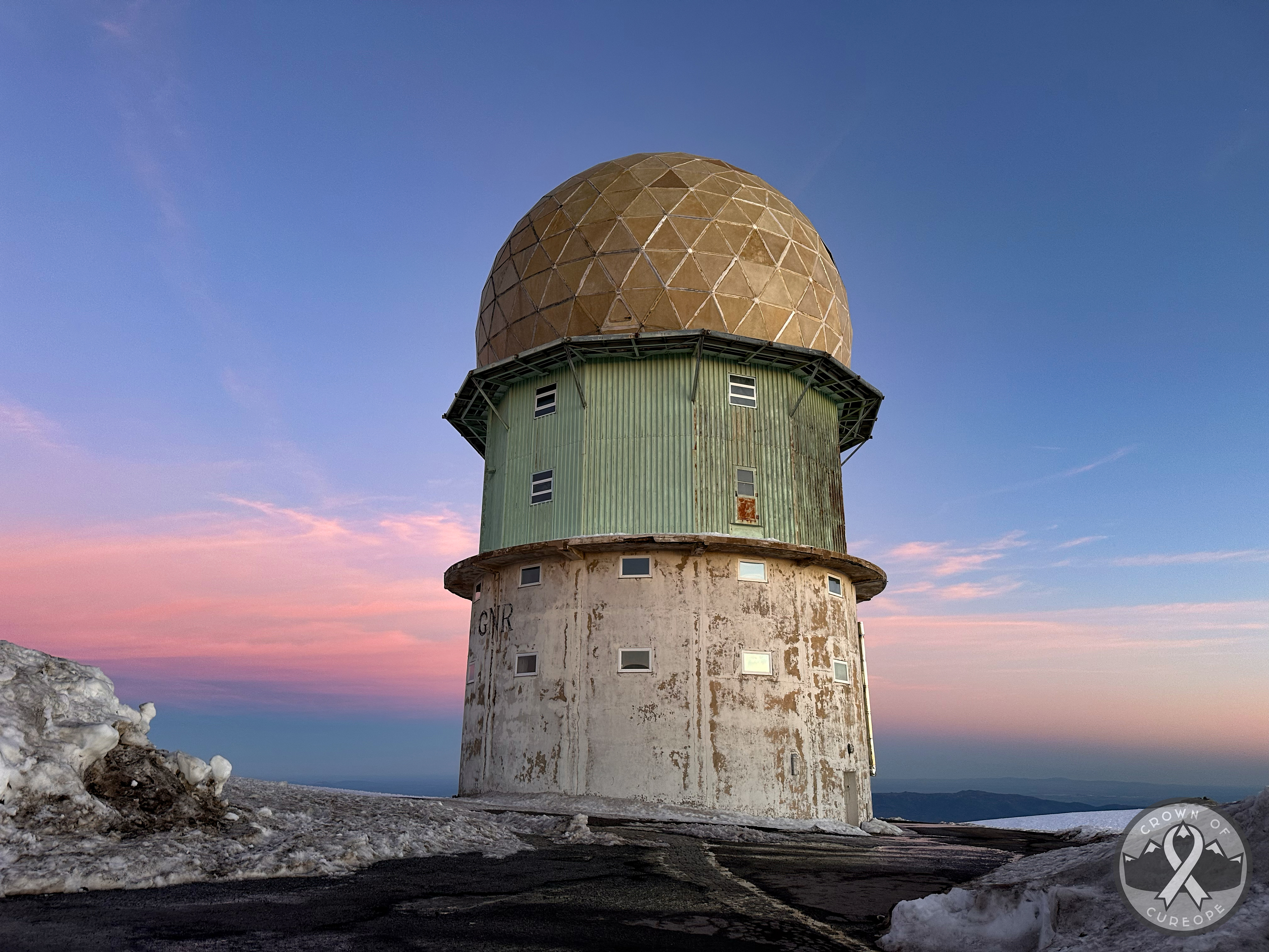
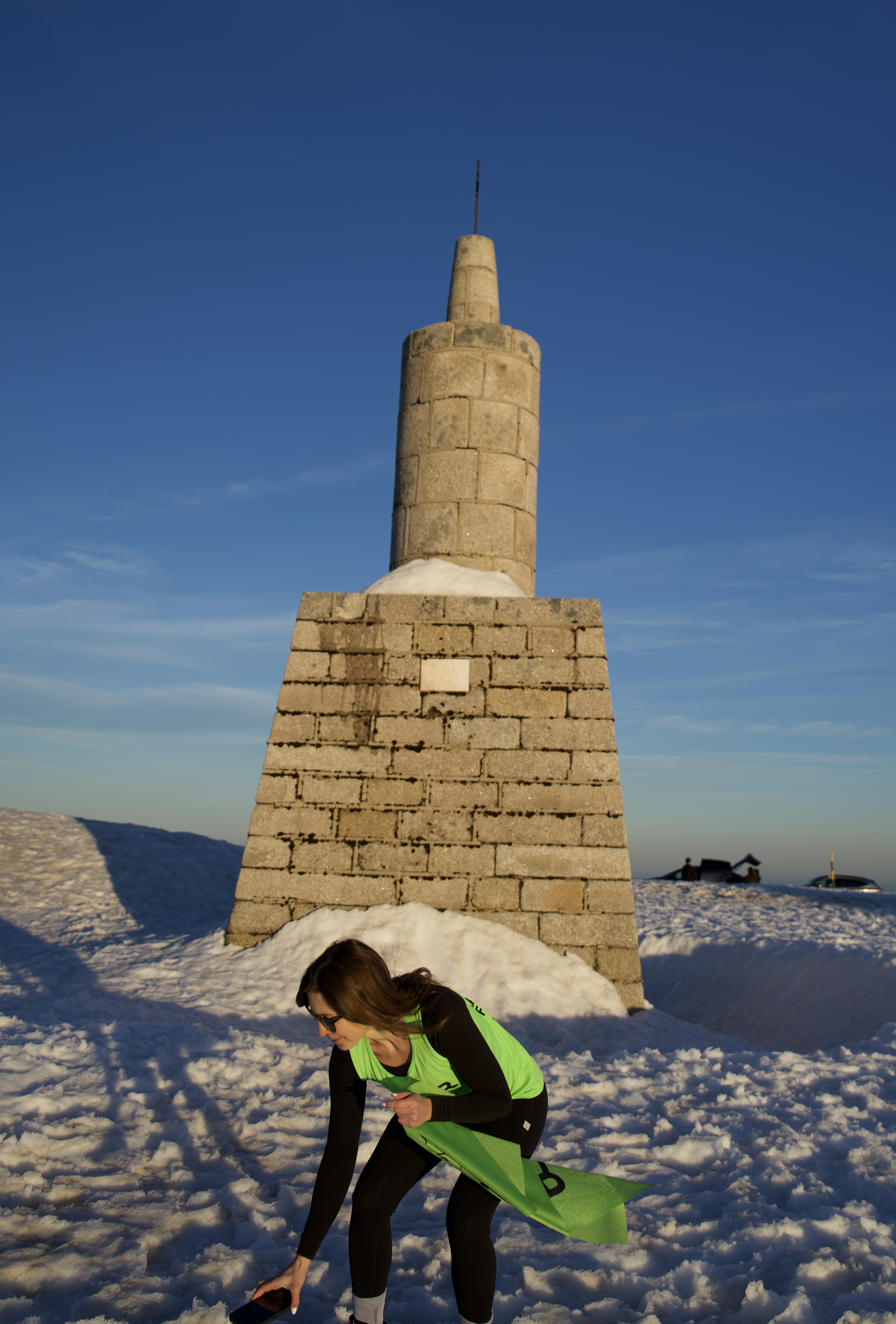
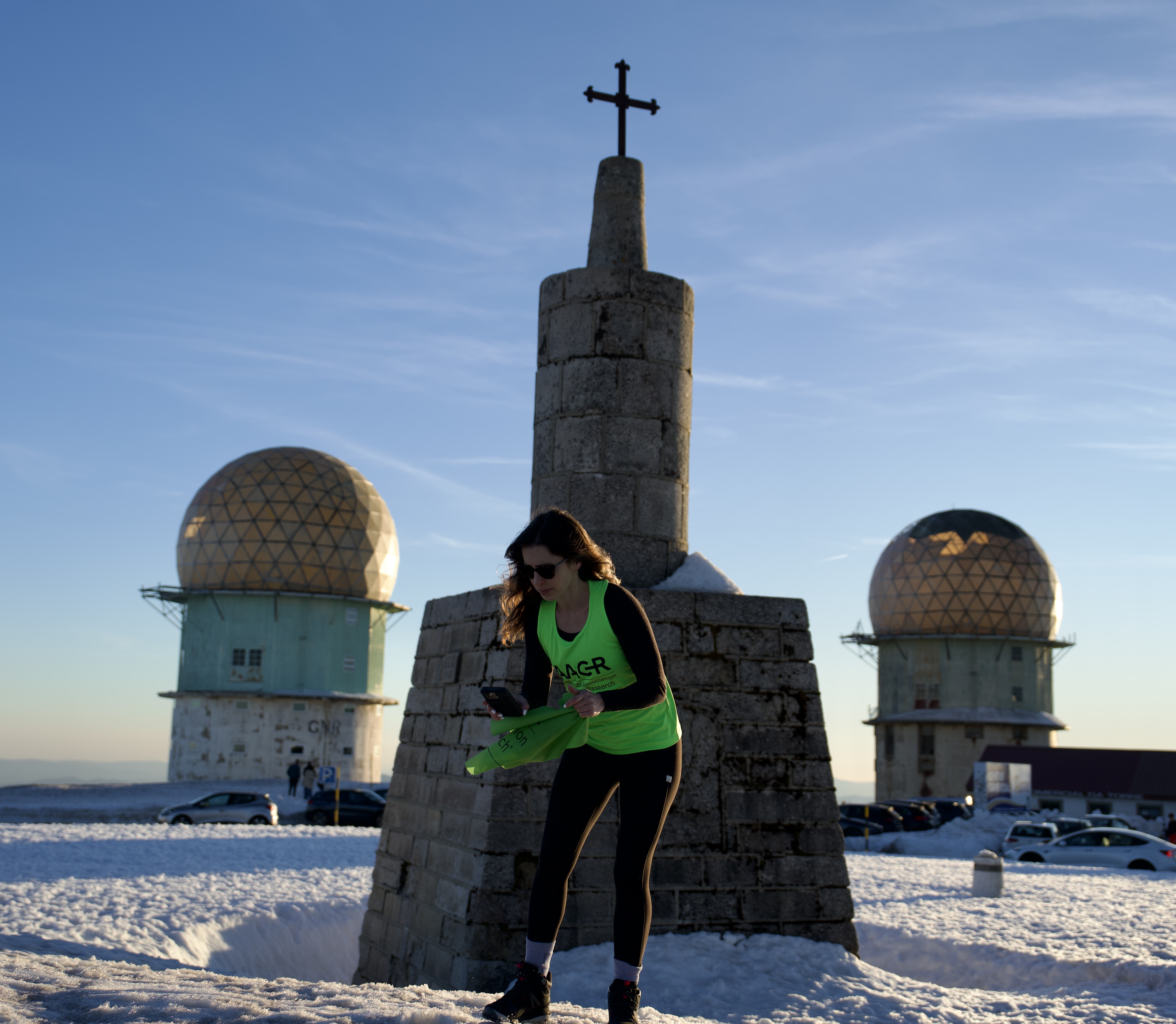
On the drive up, the seasons changed quickly from spring back to winter. There was quite a bit of snow still at the top. In fact, there’s a ski resort up there with 3 lifts and almost 6 kilometers of slopes. It generally stays open until April, and this season was no exception. I arrived at the top after the lifts closed for the day, so the remaining crowds were either sledding, glissading (butt sledding), or just walking around. This was the first warm, sunny weekend in a while- they’d just had snow the week prior. This meant that there was a bit of a queue for parking at the top. After around 15 minutes, I’d snagged a spot and started prepping the photo gear (after a quick restroom stop – they’re free here!).
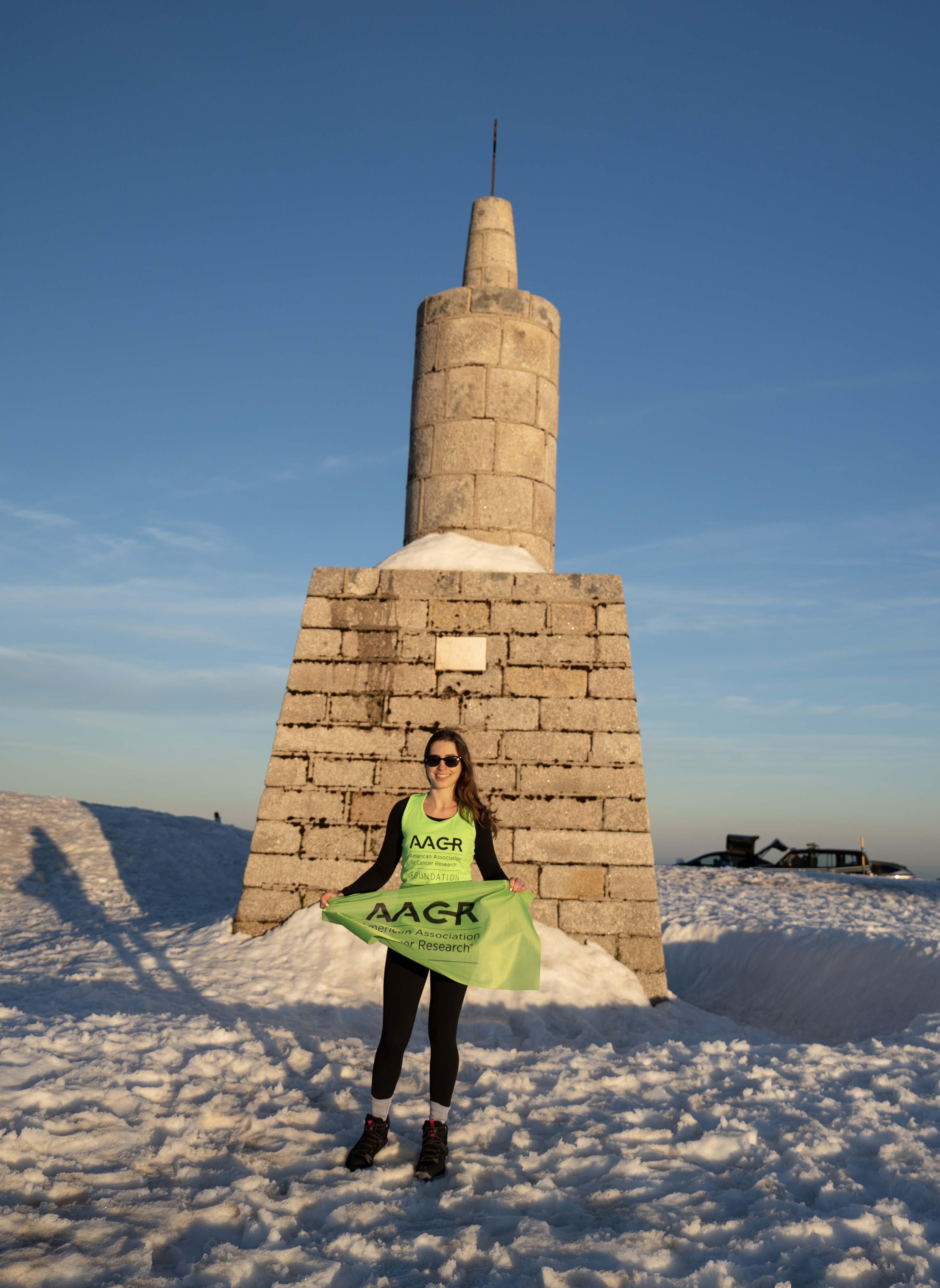
I made a beeline to the spot I’m standing in, at the center of the roundabout, which is the natural high point (1,993m, although maybe a bit higher here due to the snow). Back in the early 1800s, King João VI had a 7-meter tower (“Torre” in Portuguese) built to ’round up’ the highest elevation to 2,000m. I don’t believe that the tower is open to the public, but the general consensus is to cite ‘natural high points’, not human-built structures, so I wasn’t that set on going in anyway.
There’s one other country on the list that did something like this: Belgium. Their high point, Signal de Botrange, sits at 694m, so they built a 6-meter staircase (to nowhere) for visitors to stand at exactly 700m. I guess this all means I can round up my birth year (& age down) by 7 years! 🙂
This is the first stop of the challenge, so I’m still getting used to which shots to take with which gear, how to hold the lightweight flag when the wind’s going nuts, and how to function with frozen hands. That said, this bit took probably 30 minutes, but the true ‘high point’ stayed empty that whole time! Everyone was gathered on the other side of the buildings, where the sunset views were best.
To add to the difficulty, my camera’s remote wasn’t working, so I used a combination of the interval shooting setting and ImagingEdge on my phone to focus the shots. I’ll throw some of the resulting ‘blooper’ chaos shots at the end of this post.
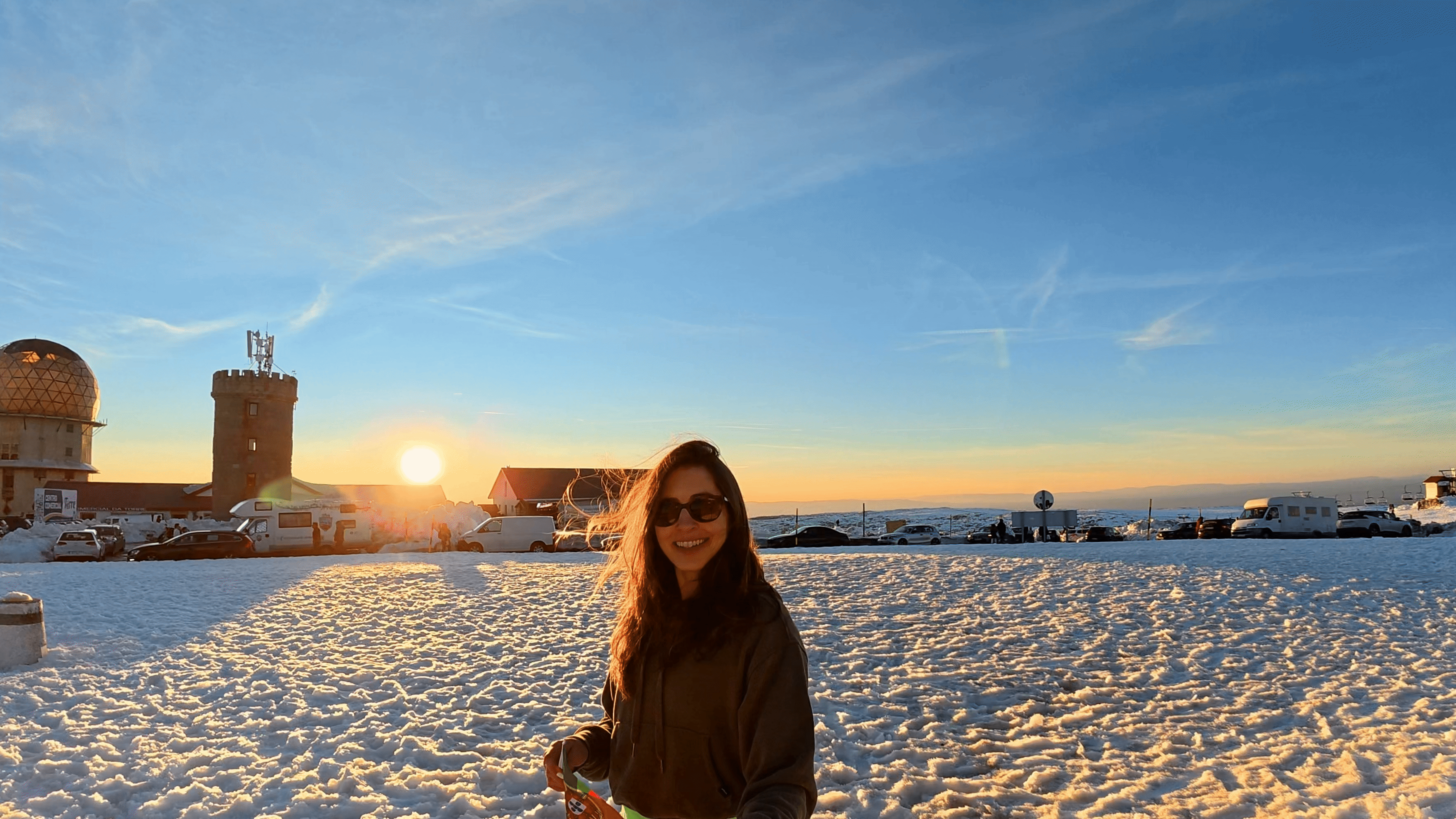
The sunset colors hadn’t fully emerged yet, but I was already blown away by how stunning the views were. I’d heard how beautiful it was meant to be, but I thought that the cars, buildings, and crowds might take away from it. It turns out that’s all concentrated in a small area, with plenty of space to find solitude if you want to. If you make it to this area of Portugal in early spring, it’s really worth a stop here.
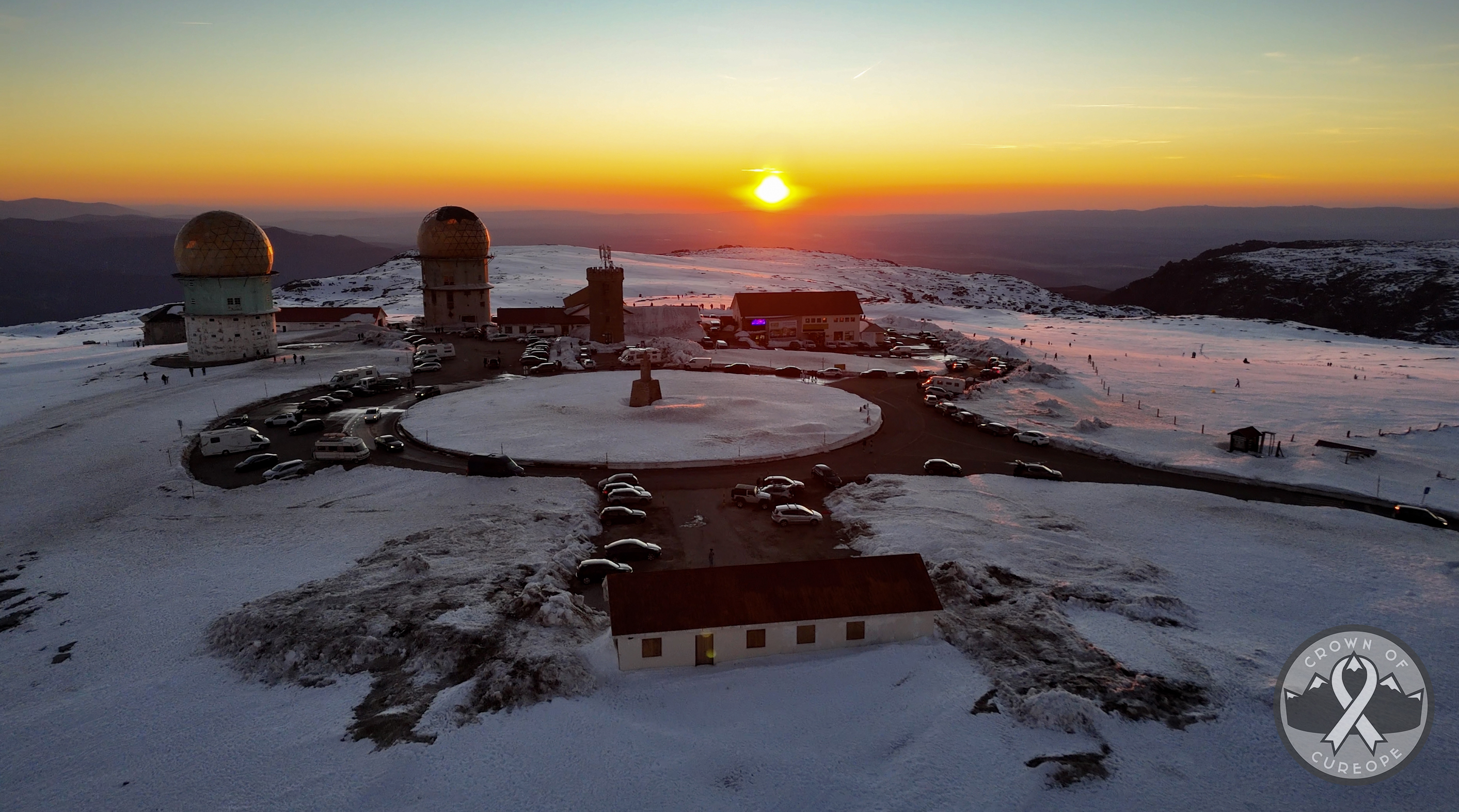
After wrapping up with the cameras, it was time to send the drone up for a few minutes. My goal was to make it fairly quick, as some areas had people around who probably wouldn’t appreciate a drone buzzing overhead (nor is it allowed directly over large crowds).
The results of this short flight are in my YouTube video (coming soon!!), but here are a couple of screen grabs 🙂
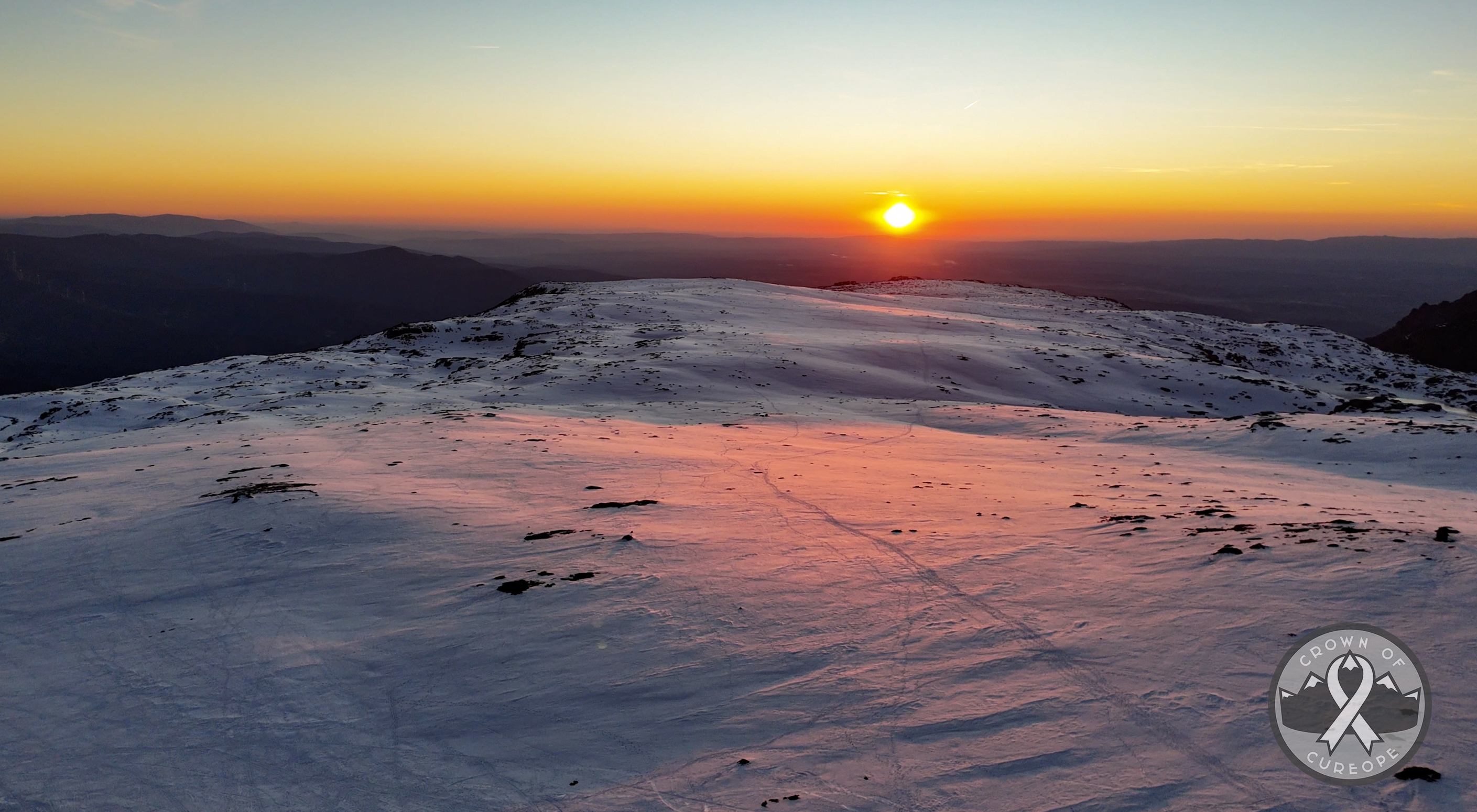
The colors were unreal.
As the sun continued to set, the colors expanded from vibrant yellows and oranges to glowing pinks and muted purples, before the whole palette went to a range of peaceful pastels. The horizon line stayed vibrant the entire drive back to town. It was a perfect way to close out peak #1.
I stopped for a quick grocery run on the way back to the hospedaria, as the plan was to have a quick bite, sleep early, and rise early for more exploring around the park. Unfortunately, I got sick that night. Fortunately, I woke up (later than planned) feeling great and ready for more exploring!
Serra da Estrela Natural Park, Continued
One of the places that was top of my list after Torre was Covão dos Conchos. This is worth looking up – it’s essentially a perfectly round spillway out of a lake that looks like a portal to another world. It’s a drone photographer’s dream 🙂 Recent trail reports suggested that hikers were turning around if they lacked winter gear (there was heavy snowfall the week before), and I had opted not to bring any for this short trip. This is a place I’d love to come back and hike to, so if you’re planning a trip to this area, definitely throw it on the list! It’s under 10 kilometers (under 6 miles) round trip, so it takes some time versus the drive-up spots in the park, but it isn’t too strenuous. The map can be found here.
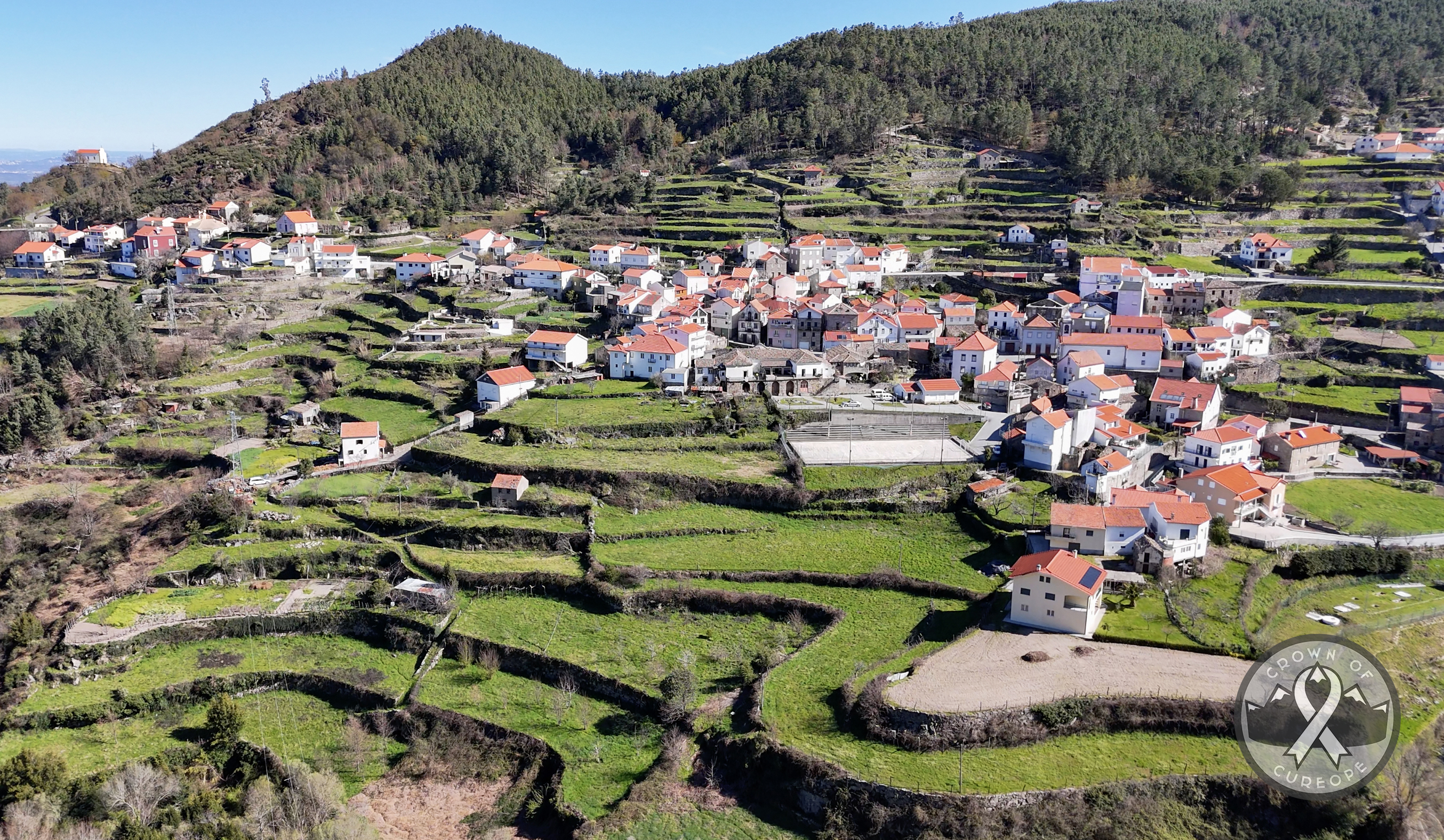
Given the late start, I selected two spots in the park that were more accessible and still beautiful: Poço da Broca da Barriosa and Piódão (recommended by this blog post by Jarda Zaoral, which includes some incredible drone shots). I headed off on a scenic drive through the park. At one point, a view opened up to my right over a picturesque village, and I pulled over to fly the drone. It turned out that this village was Alvoco da Serra, the one I’d come across in my research about hiking to Torre!
The grassy terraces here may look a bit like rice terraces you’d see in southeast Asia, and they are agricultural terraces created to allow for easier farming in a mountainous area. But, they’re not for rice! Despite Portugal’s status as the 4th largest rice producer in the EU (and largest consumer per capita…at 18 kg per year), rice is grown further south of this area.
The roads throughout the park are typical European mountain roads (narrow, winding along cliff edges), but they were very well paved. If you visit, don’t forget that Portugal gets snow, so check conditions and bring an appropriate vehicle!
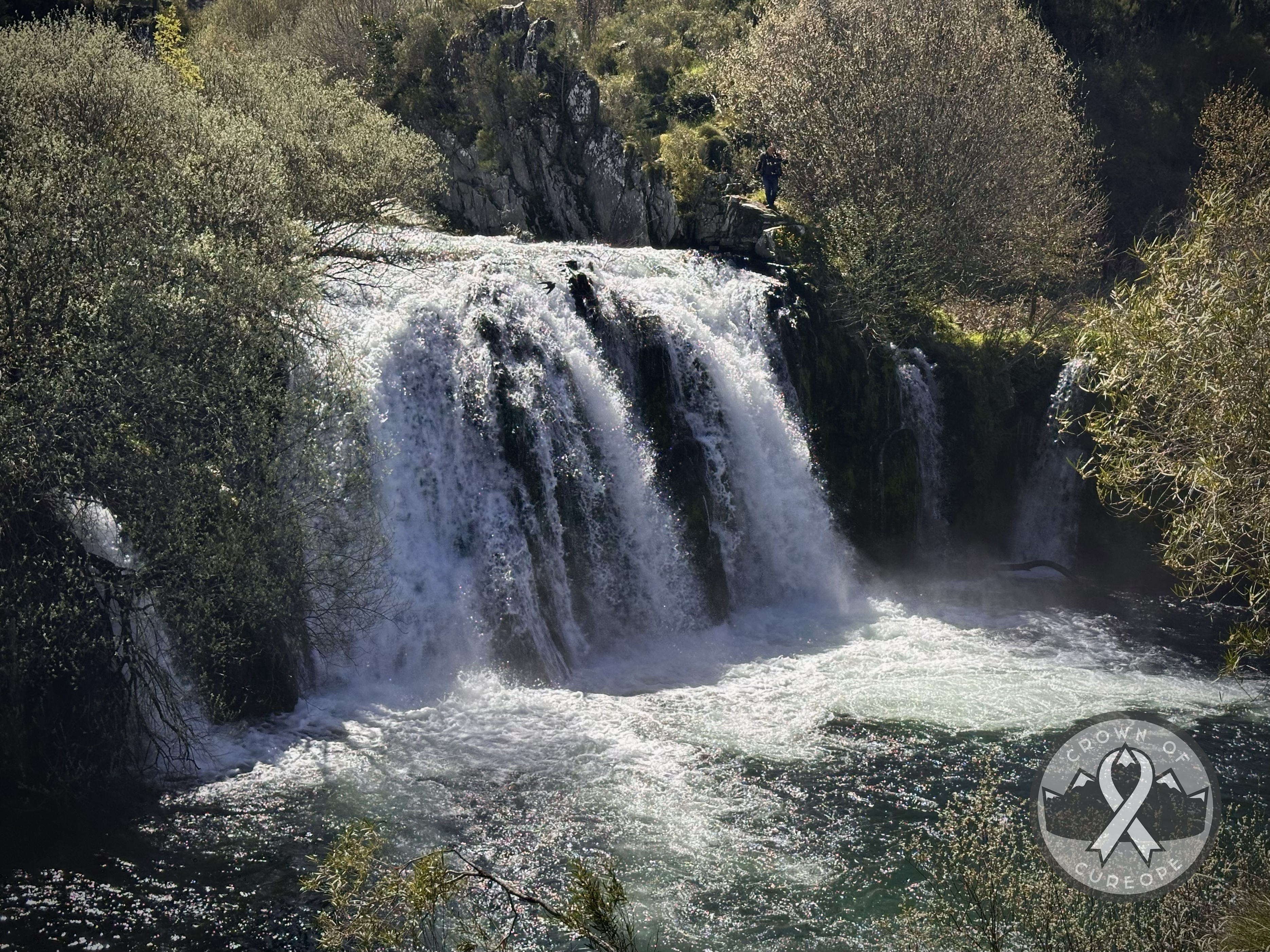
Poço da Broca da Barriosa
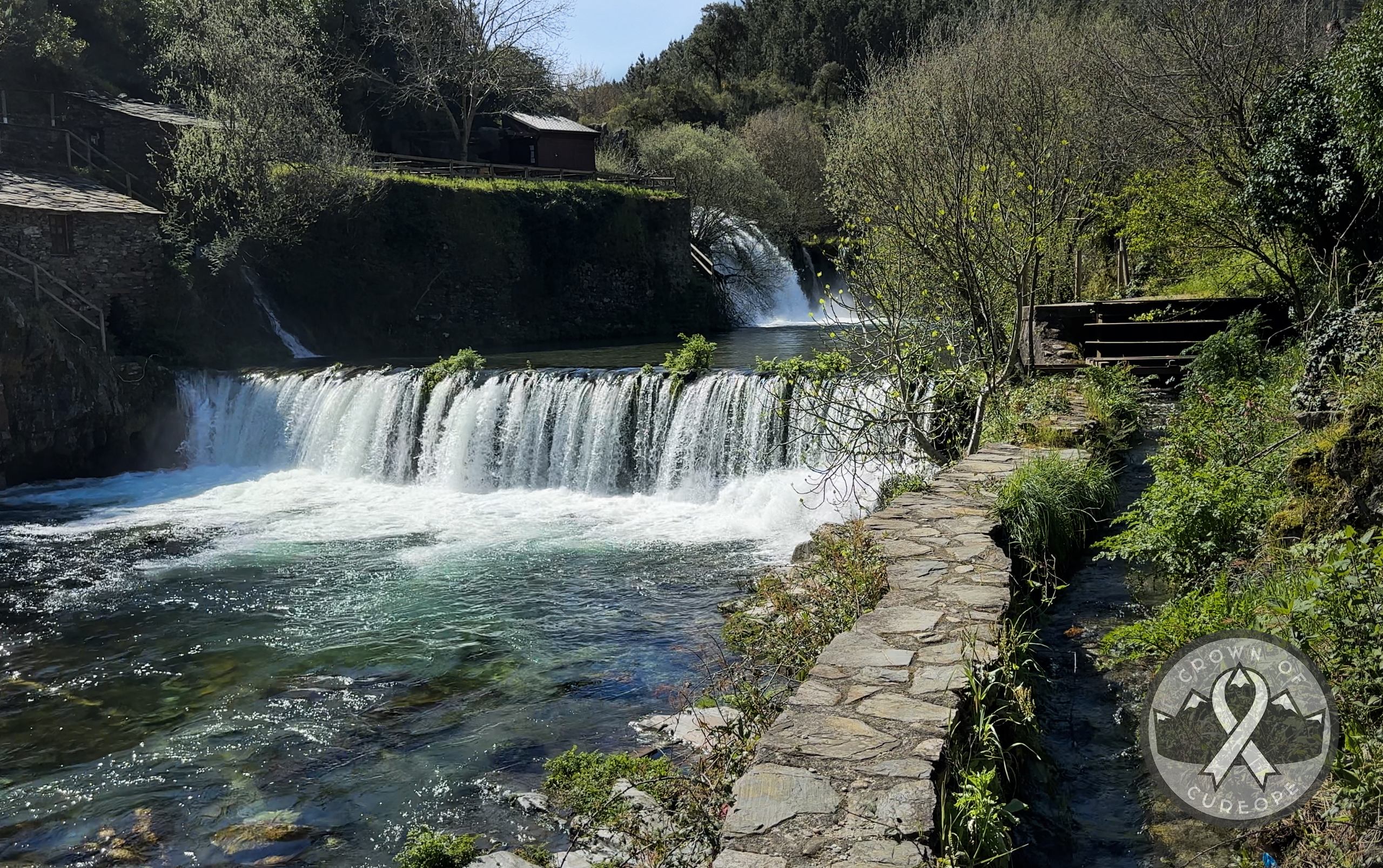
20 minutes later, I pulled into the small parking area for Poço da Broca (translates to Well of Broca, and Barriosa is the village it’s near). It fits fewer than 10 cars and was full, but I lucked out that a large group was leaving. I had the place to myself! There is a short path alongside the falls and other smaller offshoots to get closer to the water. There are two main viewpoints: one of the first falls that’s best from the stone ledge that runs alongside it (but careful of the drop-off there), and another viewing platform of the second falls a bit further along. Those are taller than the first, but still stand at only ten meters. It still looks beautiful and impressive!
In the summer, this place is a good spot to go for a swim or a picnic on the rocks. I would think that parking would be even busier in the peak summer season, but everything I’ve read says it never really gets too crowded. Plus, there’s a restaurant there (so, bathrooms!), right on the water. No special vehicles are needed to get to here, and there’s no hiking effort required. It was only a 40-minute drive from Seia, where I’d stayed the night before, and it was only a 10-minute detour on the way to Piódão.
Piódão
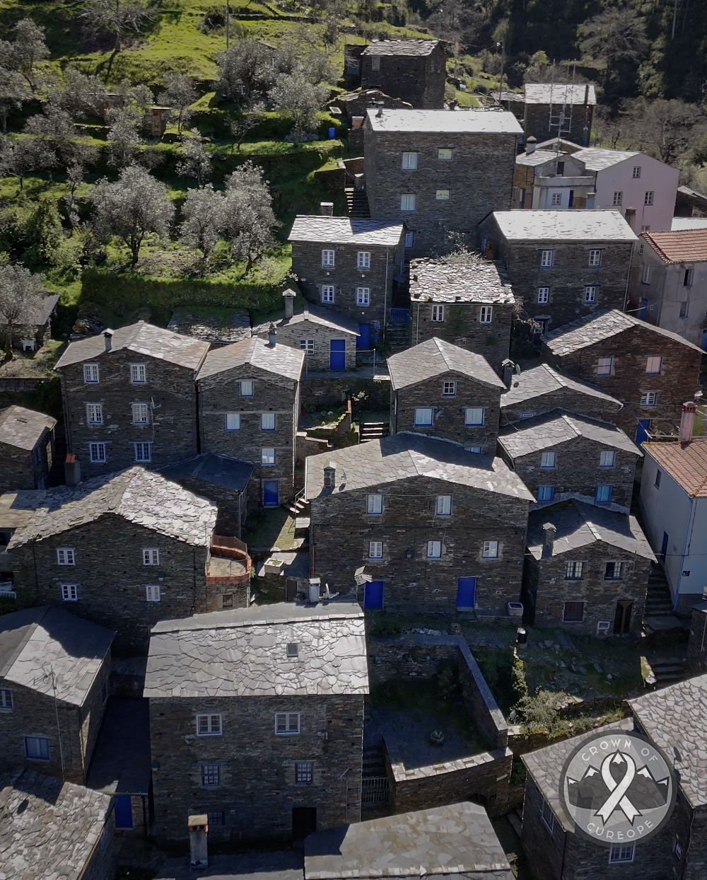
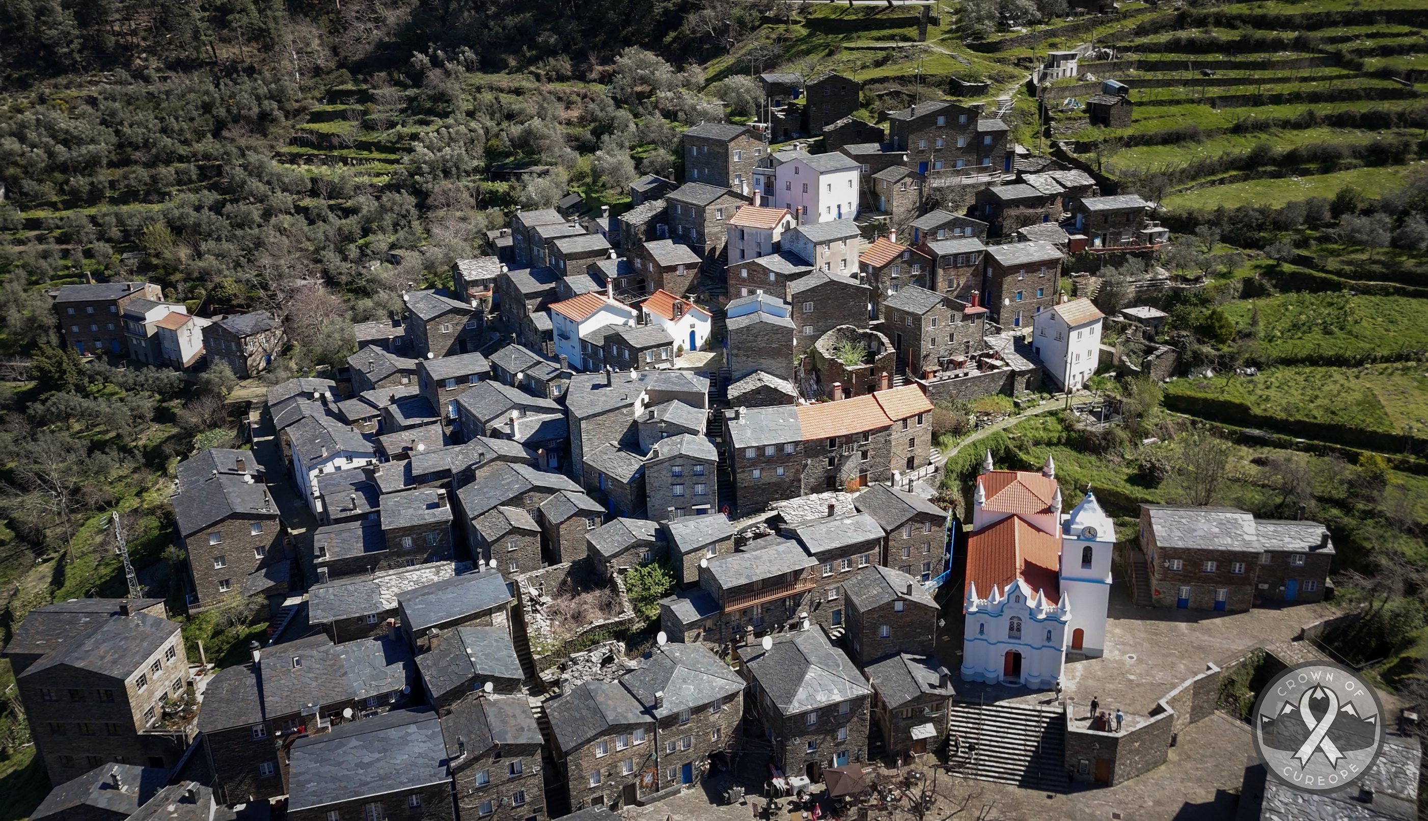
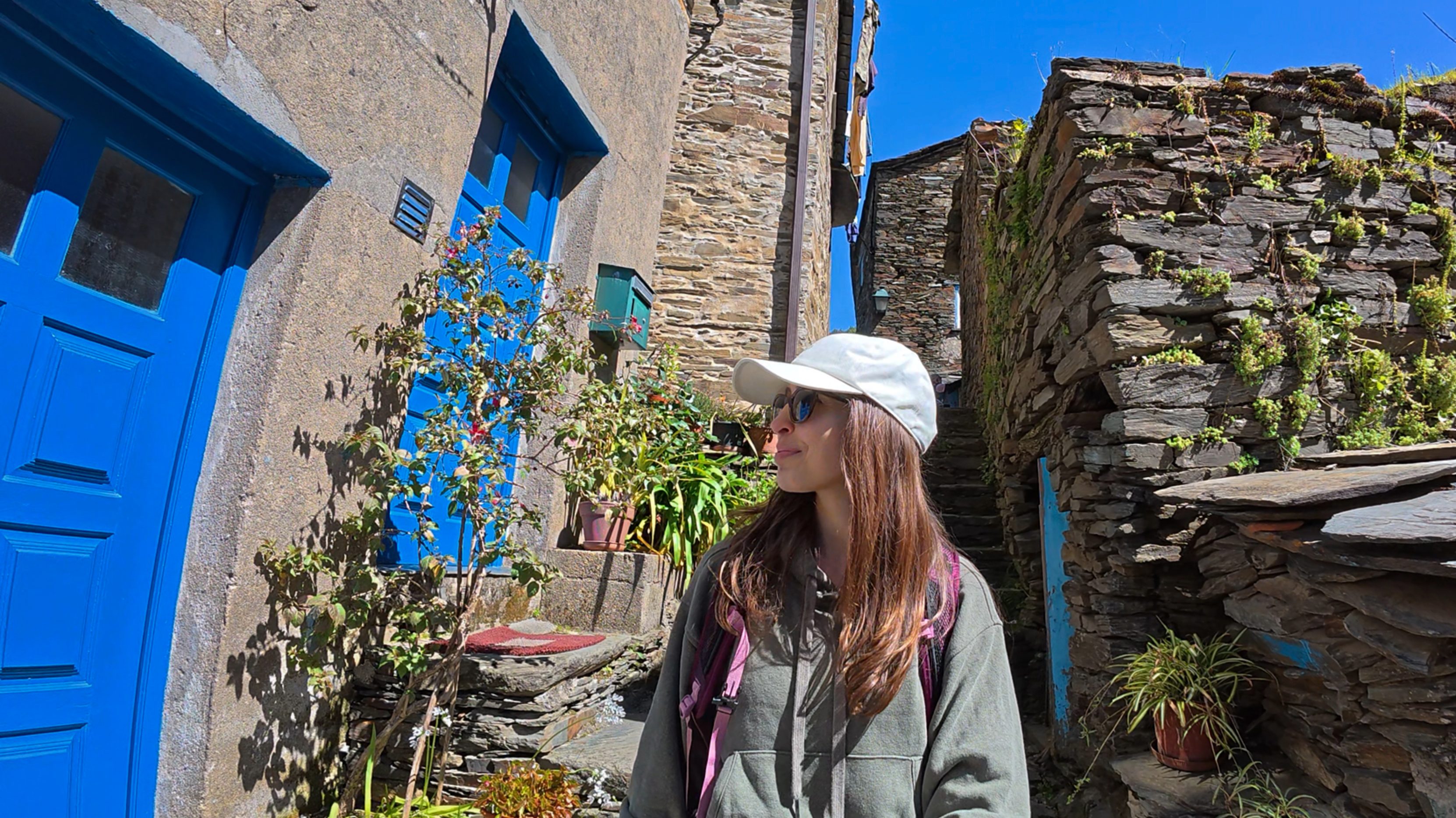
Then, it was time to drive onward to Piódão, less than 30 minutes away. Piódão is one of Portugal’s 12 Historical Villages, and it’s the only one without a castle. That said, it has its own centerpiece: a bright white church, the Igreja Matriz de Piódão. This really stood out against the mostly gray/brown, uniform look of the rest of the village. The gray/brown comes from schist rock that’s widely available in the region, so it was used for both the houses themselves and the walkways. Both the church and the village houses have blue accents, apparently because it was the only paint color available in the village. It’s pretty remote, even more so before it was connected to the main road in 1974, so it was difficult to bring supplies.
The village itself was formed in the 1200s (medieval times) in a nearby area, before they relocated in the 1400s to where it currently stands. The church looked different back then – it was remodeled to its current white-and-blue exterior in the 1800s, around the time the first local roads were built. I couldn’t really find information about materials used for the church, but it seem to be the only structure not made primarily of the schist rock.
Can you spot it in the photo below?
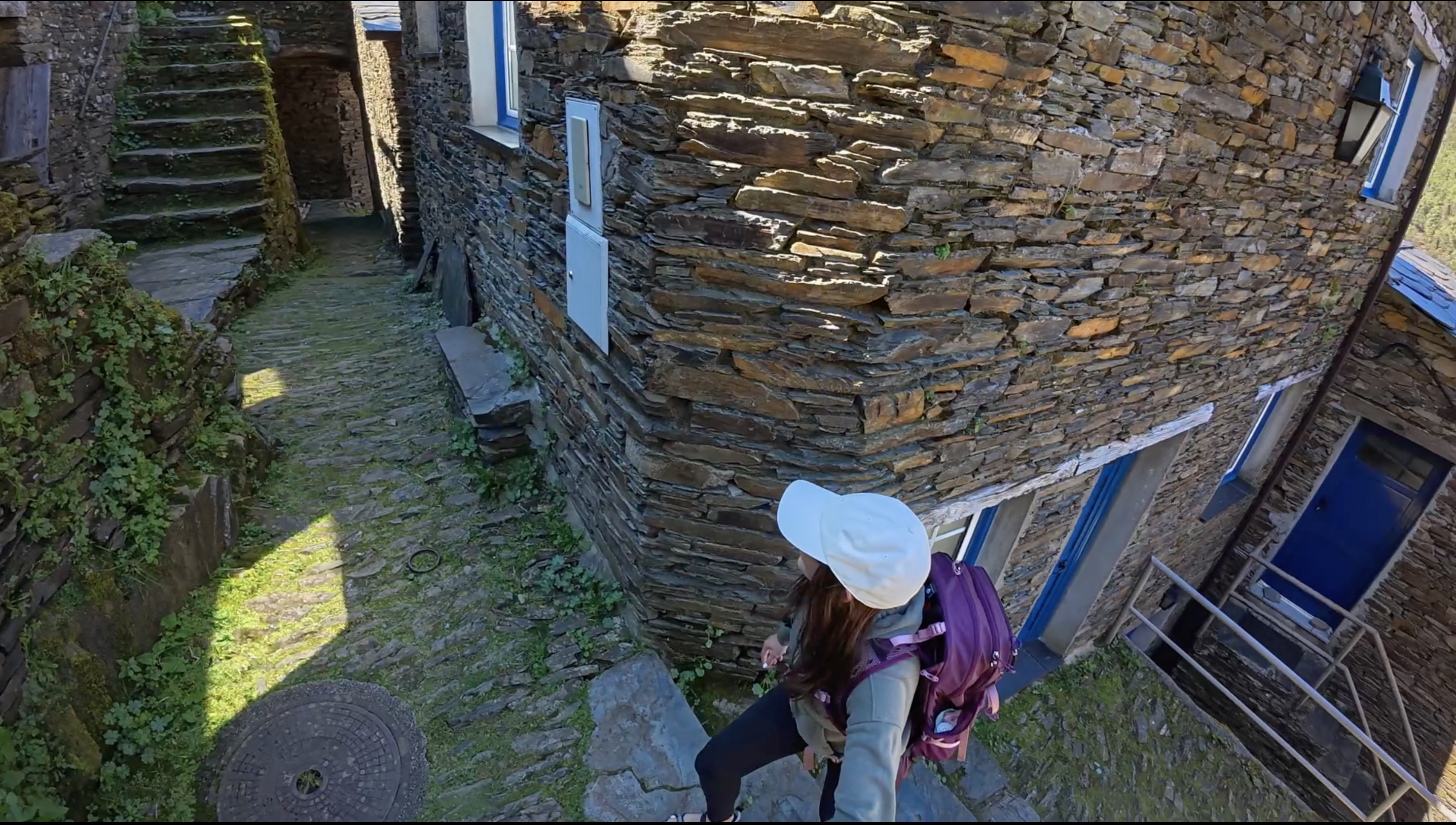
Given that it’s a historical village, there have been no real expansions for parking or access points. A single road goes in, and the (free) parking is along a road that winds right outside of the main square. It was a sunny Saturday in late March, so it was busier than usual for the season. Still, I managed to find a parking spot after only circling once. In peak season, I’d recommend going early to avoid the crowds. Despite the relatively full parking, I often had the narrow alleyways to myself. It was such a fun place to explore, and with its many stairs, it definitely made up for the lack of effort getting to Portugal’s highest point.
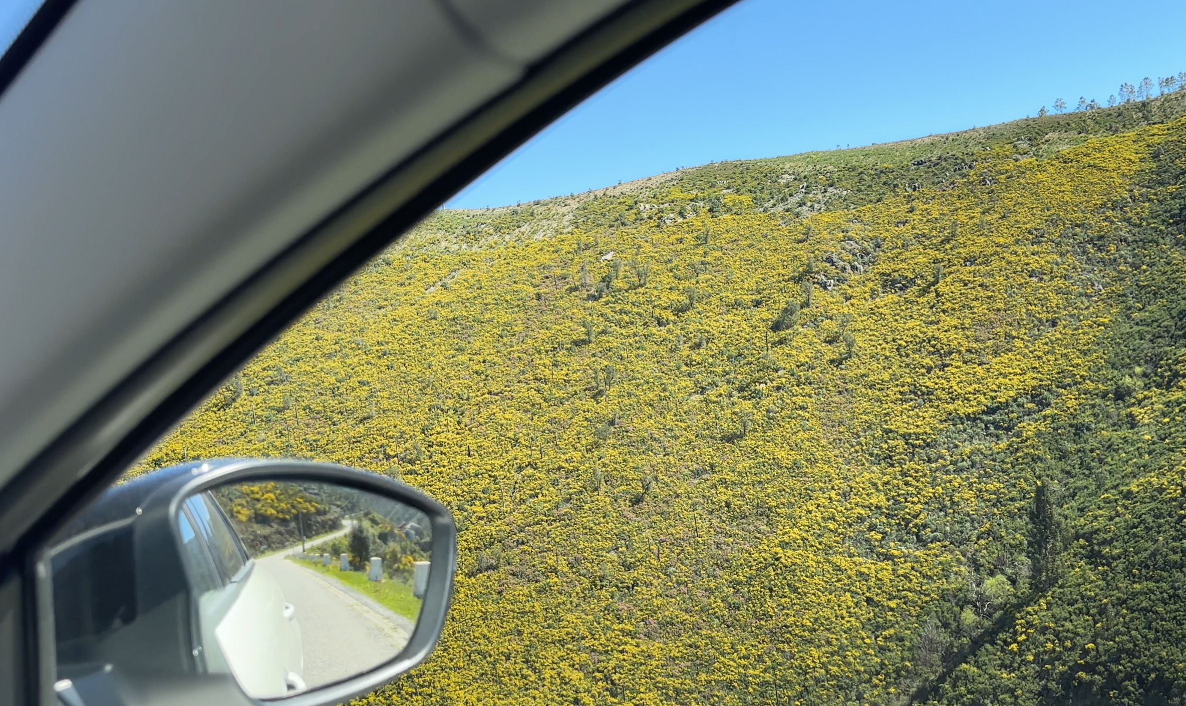
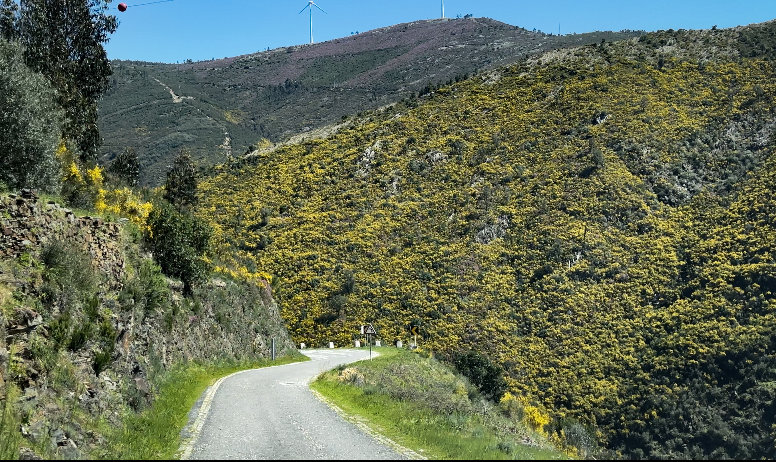
After a stop at the FREE bathrooms (always a win), I said goodbye to Serra da Estrela and began the 2.5-hour drive back to Porto. The views continued for the first hour of that drive, with unexpected blankets of spring wildflowers turning the landscape yellow:
Porto
I arrived in Porto and went to check in at Gallery Hostel, where I’d booked a 3-bed dorm for the night. It would be a short stay, as my flight was at 6am the next morning, but I wish I could have stayed longer – such a nice and well-equipped place!
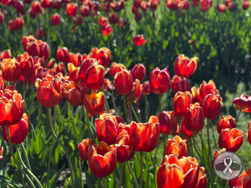
I quickly dropped my things off and headed out to attempt to see as much of the city as possible in the 2 hours (I thought) I had before sunset. The first stop was Jardins do Palácio de Cristal, a barely-10-minute walk down the road from the hostel. Tulips were already in bloom, and the lighting was turning golden. With more time, I’d have explored more of that area, as there are sections around the other side of the arena that are popular spots to watch the sunset, overlooking the Douro River. But, I had a different sunset spot in mind!
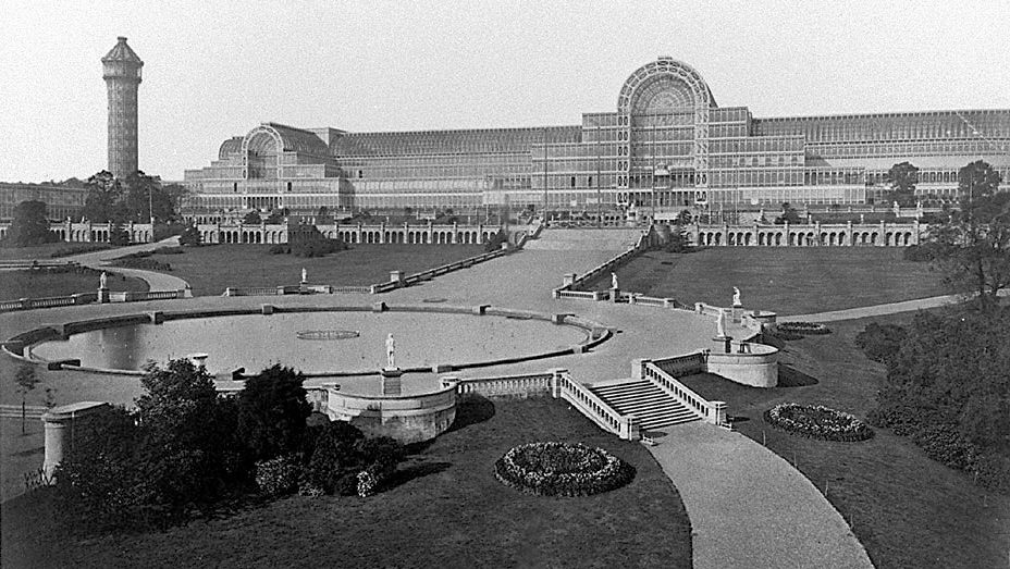
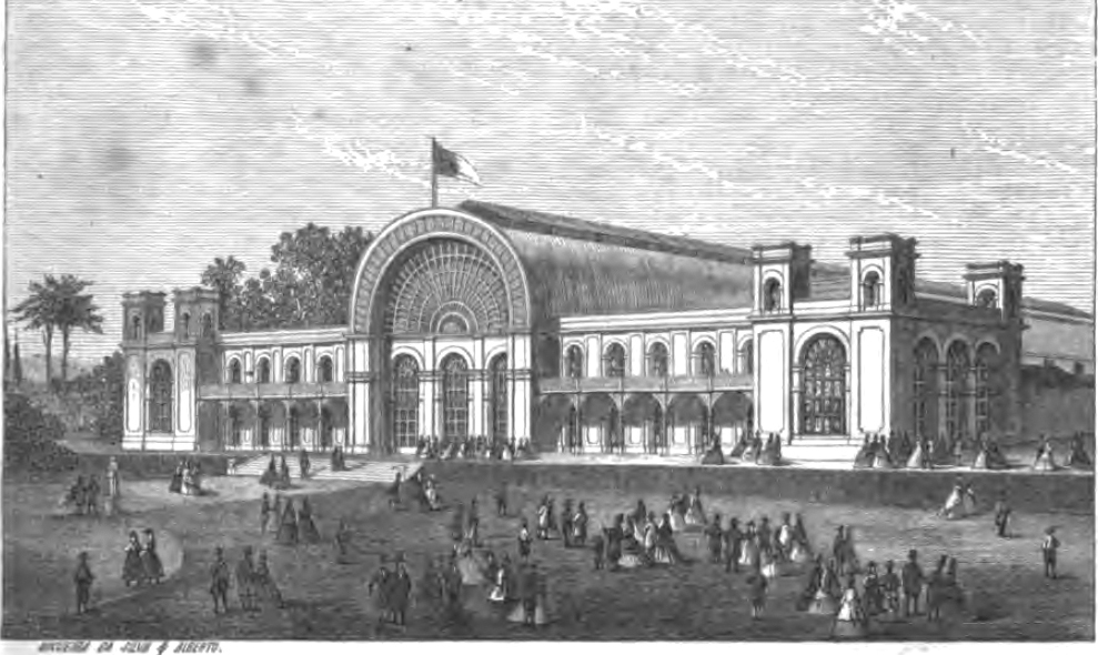
Historical blurb: Despite being called Crystal Palace Park, the palace it’s named after is no longer standing, as it was replaced by the arena that’s there now. Any Londoners wondering if this has any relation to the Crystal Palace neighborhood there? It does! The London spot used to be home to the original Crystal Palace from the 1851 Great Exhibition in Hyde Park (the first world’s fair!). After being disassembled and rebuilt in Sydenham Hill the following year, it stood until 1936 before it was destroyed by a fire. That palace had inspired the home for the 1865 International Exhibition (another world’s fair) hosted in Porto, which stood until 1951, when it was demolished to build an arena. That arena’s first event was the 1952 Roller Hockey World Cup. So, unfortunately, neither of these can be seen today. Here’s what they looked like back then:
Despite being (I thought) short on time, I decided to squeeze in a quick bite to eat at a Brazilian place up the road. They have really tasty tapioca + açaí combos, and it’s all naturally gluten-free! The place is called Açaí Concept Caffé Galiza. I was clearly too hungry to remember to take photos in the gardens (just a few videos), so enjoy the only photo I got on my phone (of the tulips) 🙂 If you’re thinking of visiting, here is their website.
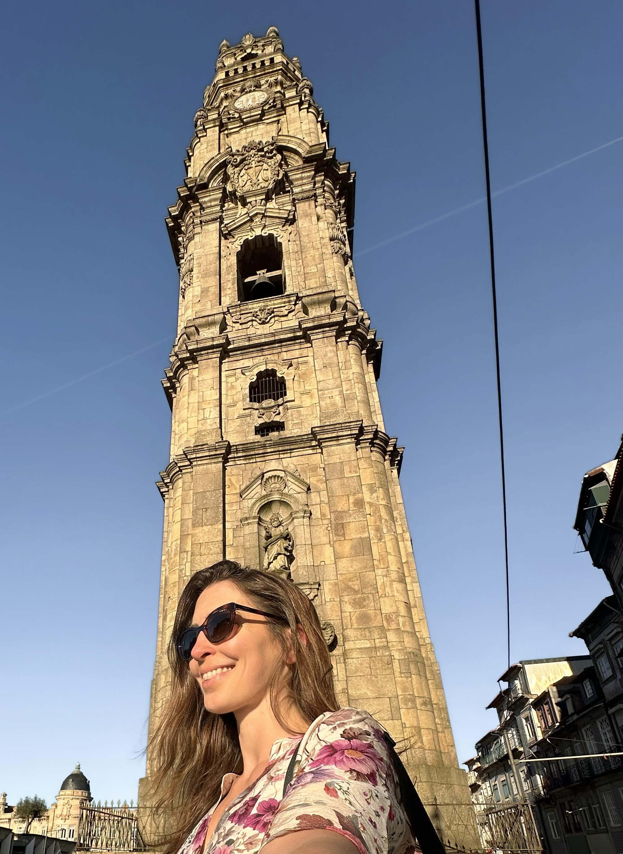
After that, it was already 6pm, and the sun had set at 7pm the night before. I still had the whole historical center of the city to explore, so I grabbed an Uber to Torre dos Clérigos as my starting point for a little self-guided walking tour. The city is pretty small, so an Uber would normally be unnecessary with a less crammed schedule.
This tower has a 225-step staircase to a bell tower with views over the city, as the city slopes down to the river from here (and the tower stands at just over 75m, in contrast to the shorter buildings throughout the historical center). I’d done my steps for the day in Piódão and didn’t have enough time, but if you decide to go, there is a fee!
From there, I continued past Rua das Flores, a pedestrian-only road cutting through the city center that dates back to 1521, to the Porto Cathedral (Sé do Porto). This cathedral is even older, dating back to the 1100s, although initial construction did take a few centuries. It’s changed a lot over the years, too. As I headed up the stairs to its sunset-facing terrace, I started to hear some beautiful live music. I figured that if I couldn’t make it to my planned sunset spot in time, this one would do!
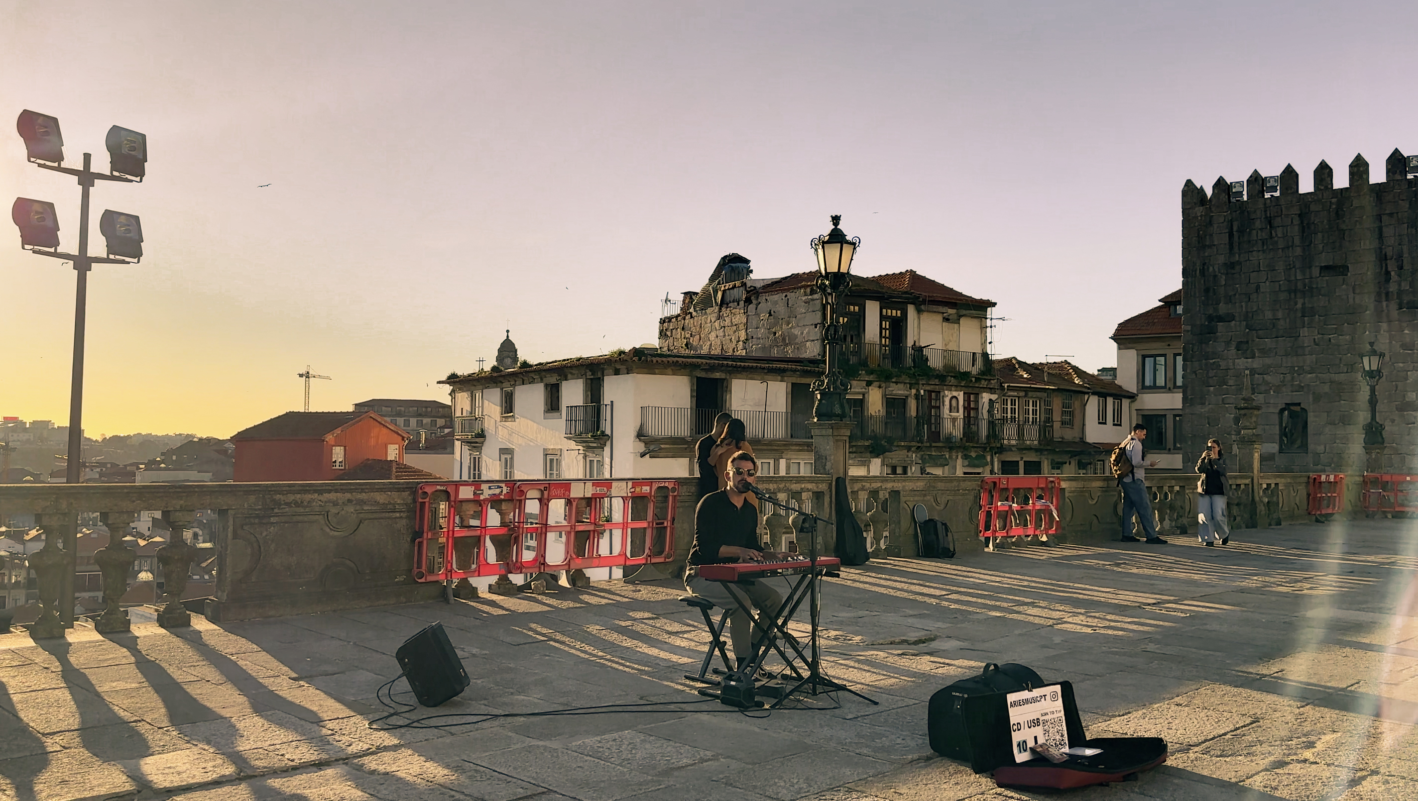
The musician is Portugal-based André Carneiro, and he performed old classics like Felicità and newer(ish) busking classics like Let Her Go (Passenger), the Sound of Silence (Disturbed), Perfect (Ed Sheeran), and more – all setting a ‘perfect’ atmosphere 🙂
As I was listening, I noticed that it was nearly 7pm, and the sun was still above the horizon. That’s when I realized that daylight savings had kicked in for Europe, and that I’d lost an hour of sleep the night before. The sun would be setting at 8pm, not 7pm. There was still time for a bit more exploring!
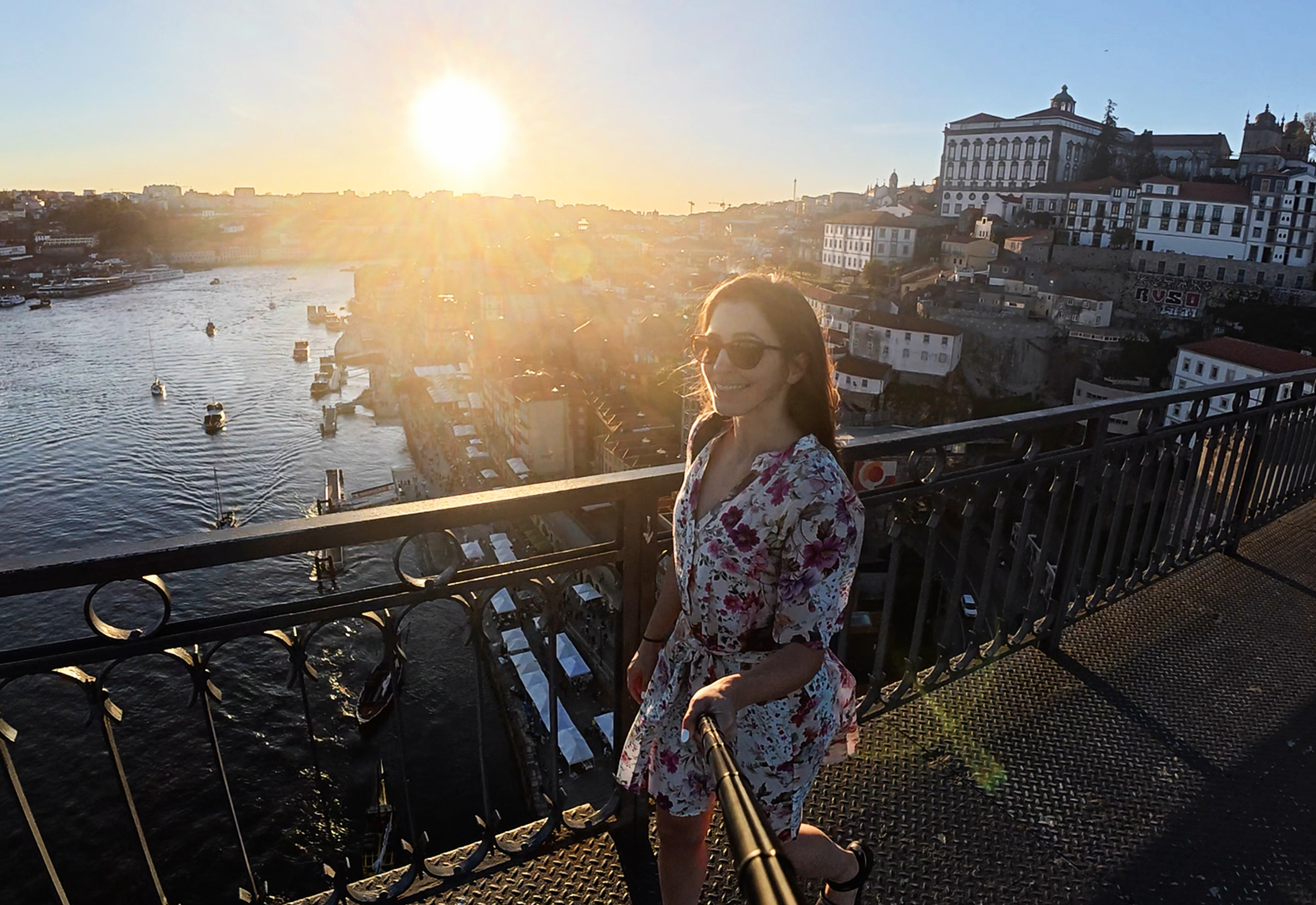
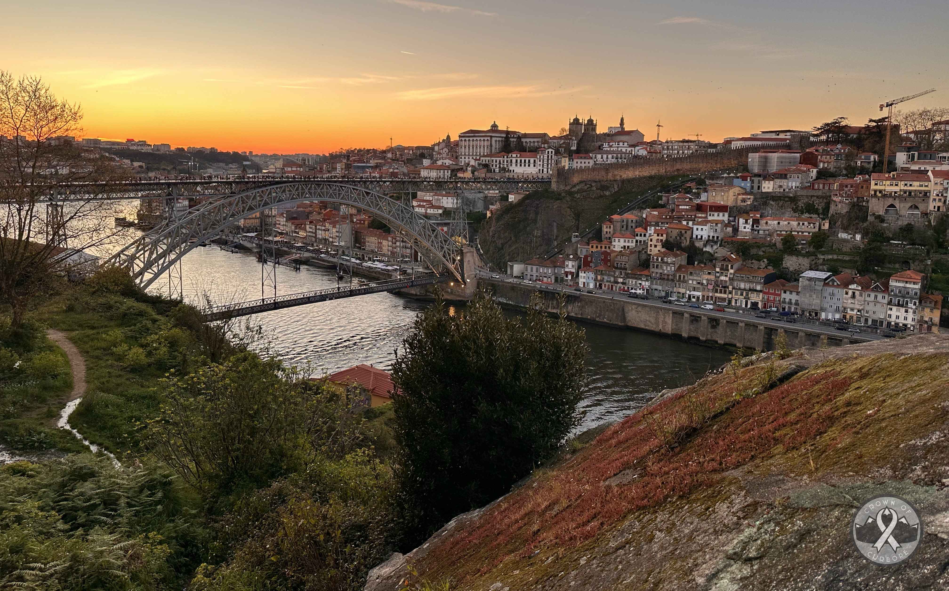
I headed to the Dom Luís I Bridge, a bi-level arch bridge that was once the longest of its type in the world at 172m (564 ft). Now, arch bridges in China hold the top 6 spots at over 530m, with the US coming in 7th and 8th place (that one’s partly in my home state, NJ!). This is an impressive bridge that came about after a contest was held to address transportation issues in a growing city. Théophile Seyrig, former partner of Gustave Eiffel, owned the project. Nowadays, the upper and lower levels each connect distinct parts of the city, with the lower portion containing a number of waterfront restaurants and shops. The upper portion has many winding pathways and lookout points, one of which had massive crowds and a band playing!
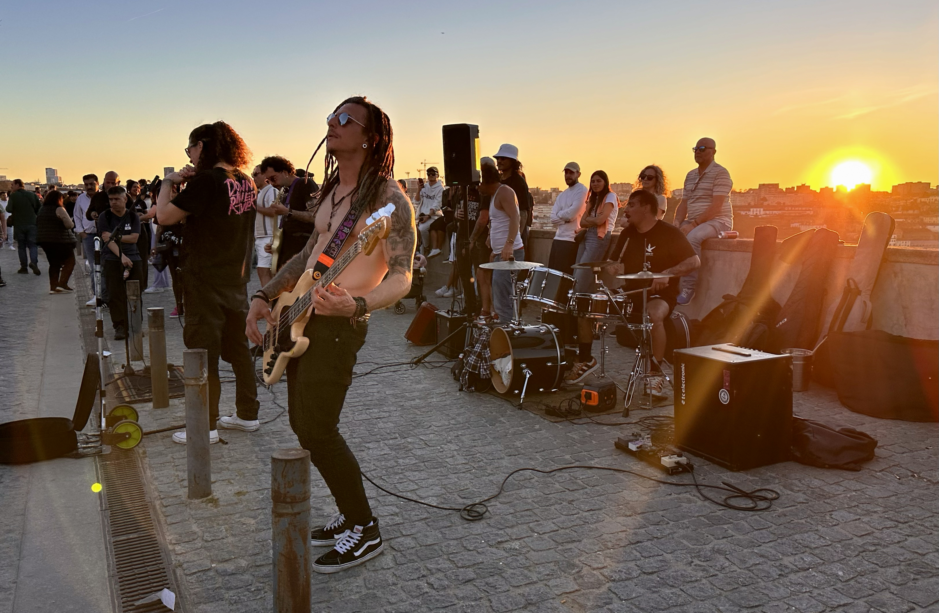
It was clear that Porto was happy to be having its first summer-like Saturday evening. The band was Down the River, and I had to look up their genre because they had some variety (from what sounded like heavy metal to Red Hot Chili Peppers): nu-metal and new rock. The crowd was loving it! I listened to them until the sun nearly set, at which point I started on a 5-minute stroll past the Mosteiro da Serra do Pilar, toward a random boulder I’d found on Google Maps. Only around 10 other people had the same idea that evening, so it was a quiet alternative to the area I’d left behind. Coming down from the boulder was a couple who had just gotten engaged, and they happened to be from NJ! 🙂
After the sun dipped below the horizon, I returned to the concert area and listened to an older man with a jukebox belting out some ABBA for a dancing crowd. Just like the night before, the colors stayed vibrant even post-sunset. Feeling grateful for two of the best sunsets I’d ever seen during this short trip, I returned to the hostel to get a few hours of sleep pre-flight.
It turned out one of my roommates would be getting up every hour without the best hostel etiquette for lights/noise…so at 3:30am, I gave up on more sleep, turned off my 4am alarm, and headed to the airport. This trip had flown by, and it set a high bar for the rest of the challenge 🙂
Thank you!!
Thanks so much for reading the FIRST blog post of the Crown of Cureope challenge! It’s also my first blog post ever…so please let me know if you run into any technical difficulties or have any feedback! 🙂 Also, a HUGE thank you to the donors so far!!! You managed to get us to $725 at the time of this summit, and $950 as of posting this (with some company matches on the way bringing us to over $1,000 – worth looking into if your employer offers this!).
I’ve thrown some donation buttons around the website, but here’s another one 🙂 every bit is appreciated.
I have 4 countries to catch you up on, and more planned in the next few months. Thanks for following along and supporting this challenge ❤
Map of this trip:
Bloopers…

Leave a comment