

Luxembourg was the first stop in the BeNeLux country high points, all of which I completed in the same day – they’re that close together! I’d found some cheap flights for April 11-12 (a Friday to Saturday), as well as a car rental for less than 30 euros. My flight landed on time, thankfully, and my first stop was the rental car counter.
There, I was warned about something I’d never heard of before: “Speed Week“. I assumed it must be some sort of racing event. Apparently not. Luxembourg was one of over 20 European countries (within ROADPOL member countries) participating in a week of cracking down on speeding, with “no room for going over”. While speeding can be dangerous, I was recently fined 250 CHF for “speeding” on a deserted mountain road in Switzerland. The limit there alternated frequently between 70 and 50 kmh (31 to 43.5 mph), and during one of those transitions, I didn’t slow down quite quickly enough and was flashed going 62 kmh. There were no crosswalks, blind curves, or anything else that would make going 12 kmh (7 mph) over the limit for a few seconds dangerous. Anyway, word of warning for driving around Europe, in general…there are cameras everywhere, and fines can be hefty! You might not find out until months later, when the rental company passes on the charge, with their own processing fees added.
The High Point
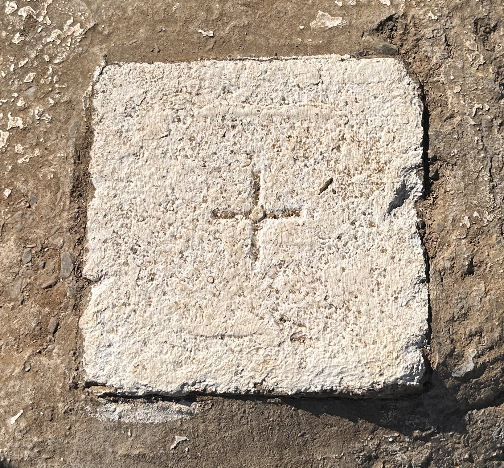
The highest point in Luxembourg, Kneiff, can be reached in just 1 hour from the airport. It is marked with a white slab along a farm road (it’s a bit gravelly, so take it slow in a rental car!). It’s not flashy like the towers and other markers found on other high points. There’s no post office, no summit cross, no trig point. I was actually expecting to have some trouble spotting the marker along the road; previous photos I’d seen showed overgrown grass everywhere. Now, it’s a proper destination, complete with a large sign and picnic table!
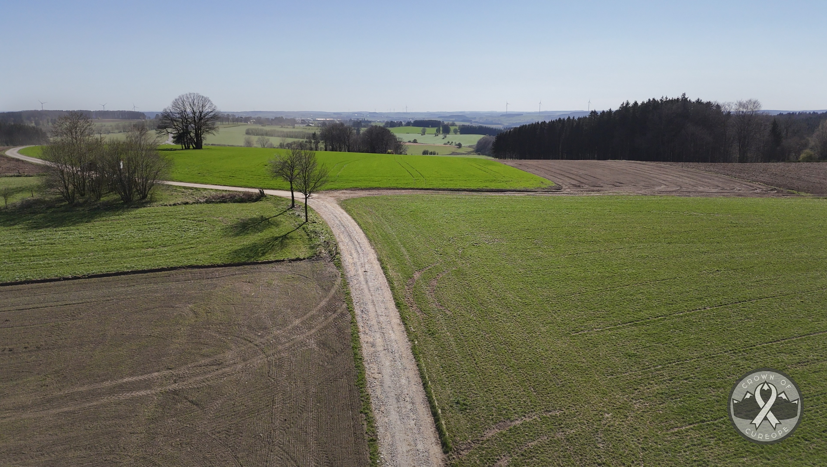
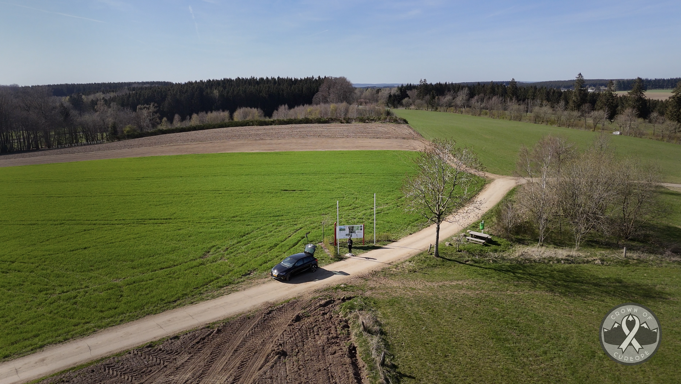
There was even a slightly cleared area to tuck my car off the road a bit. This was handy, as a large tractor came barreling by after 20 minutes…but not without completely blasting my open trunk with a cloud of dirt. Photographers beware, keep your gear protected! Aside from the farmer, there wasn’t a soul around. My expectations were kind of low, but I liked this high point. Very peaceful 🙂
Until 1990, no one even knew this was the highest point. Buurgplaatz stood at 558.8m, about a kilometer down the road. (Had I realized at the time that it was so close, I might have stopped over there too!) In 1990, cartographers discovered that Kneiff stood barely over a meter higher than Buurgplaatz. This appears to be the story of many not-so-mountainous countries in the challenge, like Denmark and Belgium. Without a clear mountain peak rising over the landscape, cartographers battle over the highest pebble.
Elevation measurements aside, this is a beautiful country. It’s small, but there are actually 6 countries smaller than it in this challenge, by area. Luxembourg is 2,586 square kilometers and its border measures 359 km around. You could walk the entire border in 3 days at a leisurely pace (…if you didn’t stop to eat or sleep). The country still packs a lot within its borders. Even in the fairly short (1 hour) drive from the airport to this high point, you pass through the Valley of the Seven Castles. I admittedly didn’t plan far ahead enough to make time to visit these, but I’d love to on a return trip someday. Note that several seem to be closed, some only have access to the garden areas, etc. – so definitely research each in advance! I’ve linked them all in the BeNeLux map at the end of this post.
After Kneiff, I drove just 45 minutes to the highest point of Belgium. This and the Netherlands are detailed in their respective blog posts, so feel free to check those out! 🙂
(CONTINUED FROM BELGIUM BLOG POST)
Luxembourg City

After a morning exploring Liège, I headed for Luxembourg City, under 2 hours away. It was a warm, sunny Saturday, but it still wasn’t too difficult to find a place to park centrally. I was having issues with my eSIM at first, and I hadn’t researched the city much, so my route took shape just by walking to whatever looked cool in the distance. My first stop was…a bank? Probably the most beautiful “savings bank” I’ve ever seen!
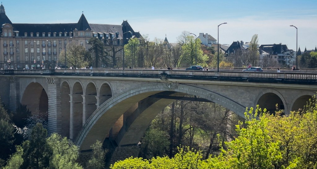
From there, views opened up toward the Adolphe Bridge, facing the other side of the city. I could tell from my downloaded offline maps that there was a lot to see over there, so across the bridge I went!
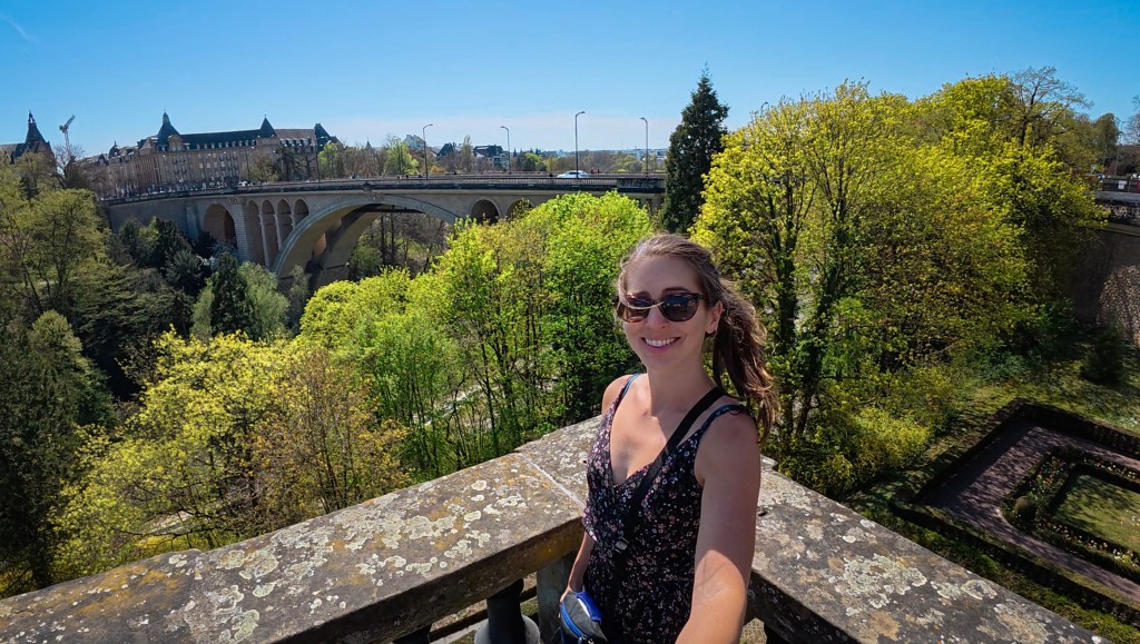
When this bridge was finished (in 1903), it had the largest masonry (stone) arch of any bridge in the world (84m). Nowadays, 23 bridges in China exceed it, along with 4 in Europe. Of the European ones, a 90-meter arch was built just 2 years later in Germany (the Syratal Viaduct). Then Slovenia joined in with one barely a meter longer than Luxembourg’s (the Solkan Bridge). In 1919, Pont de la Libération in France surpassed all of these at 96m. That one is still the largest in Europe. The 122-year-old Adolphe Bridge (Pont Adolphe) is also referred to as the “new bridge”…because the other main bridge, the Passarelle, is 42 years older.
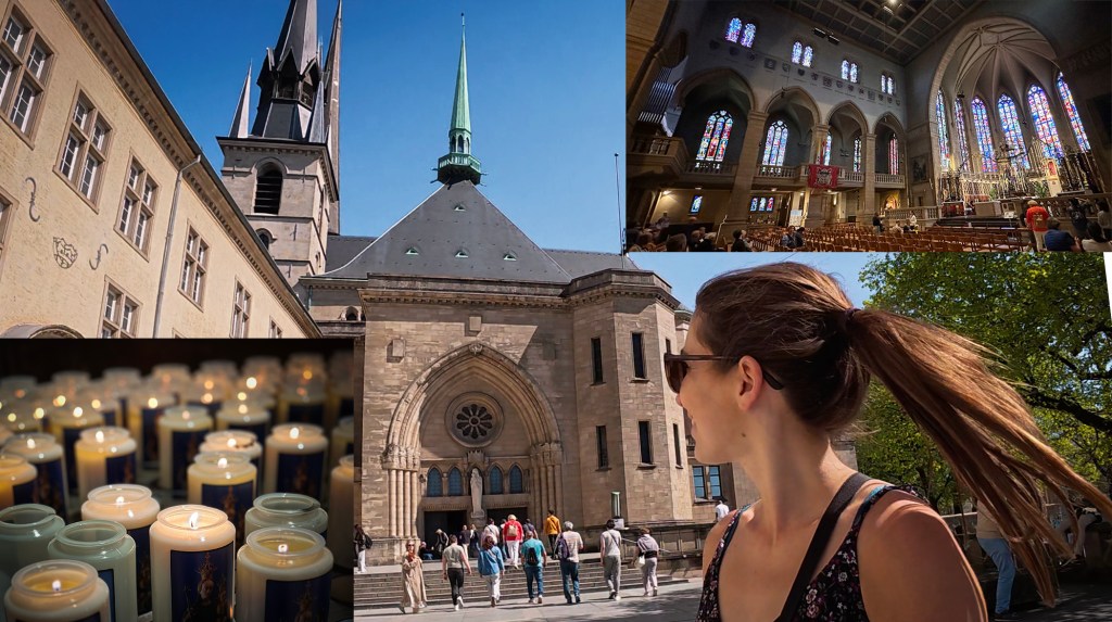
I could hear live music, louder than what I’d expect from buskers. As I passed the Place der Nation and arrived at the Place de la Constitution, I walked into some sort of mini outdoor music festival. There were some food stands and a lineup of bands that would be playing the whole day under a covered stage. I spent some time there taking in the views and the music, then walked over to the next thing in the distance – a cathedral! Finally, my eSIM started working, and I discovered that this was the Notre Dame Cathedral. It has no relation to the Parisian one. It translates to Our Lady, so it’s a common name for churches and cathedrals around the world, in various languages.
Speaking of languages, Luxembourg has its own: Luxembourgish! It’s been recognized as the national language since 1984, although French and German are also official languages (with French as the legislative language). If you’re unsure of what to speak here, French is your best bet. One last rabbit hole to go down here: when I was looking at a website to link for more information on the cathedral, I noticed that the official website has those three languages in the dropdown, but also Portuguese (no English)! A quick search revealed that 14.5%-23% (depending on the source) of the population of Luxembourg holds Portuguese citizenship. That makes them the second-largest cultural group there, after native Luxembourgers!
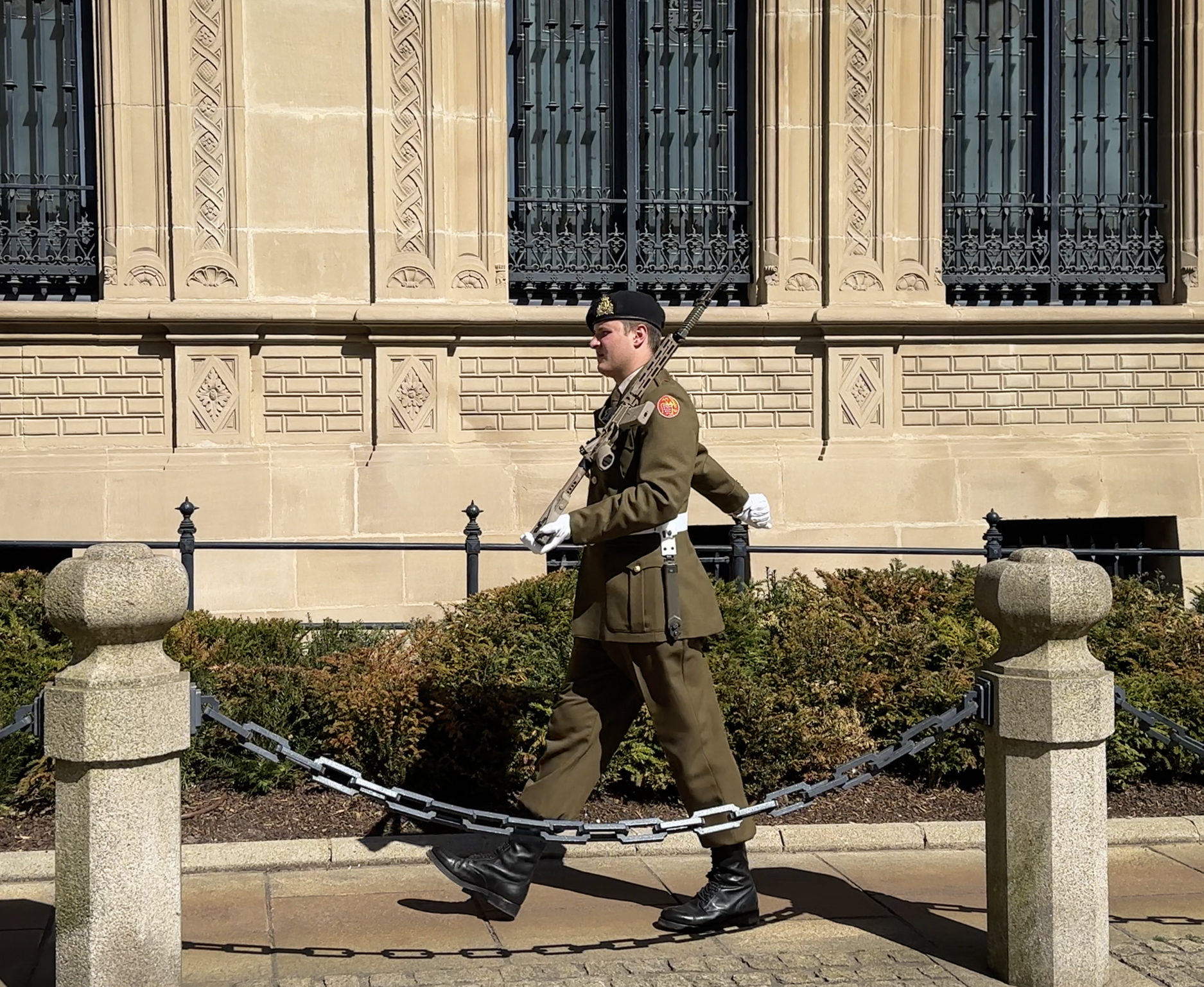
After lighting some candles in the cathedral, I continued my self-guided walking tour through Place Guillaume II to the Palais Grand-Ducal. It’s possible to take a tour of it in the summer months, and the official website has a lot of interesting history about the country. It wasn’t quite summer when I was there, but I was still lucky to be passing by right as a soldier was taking his post.

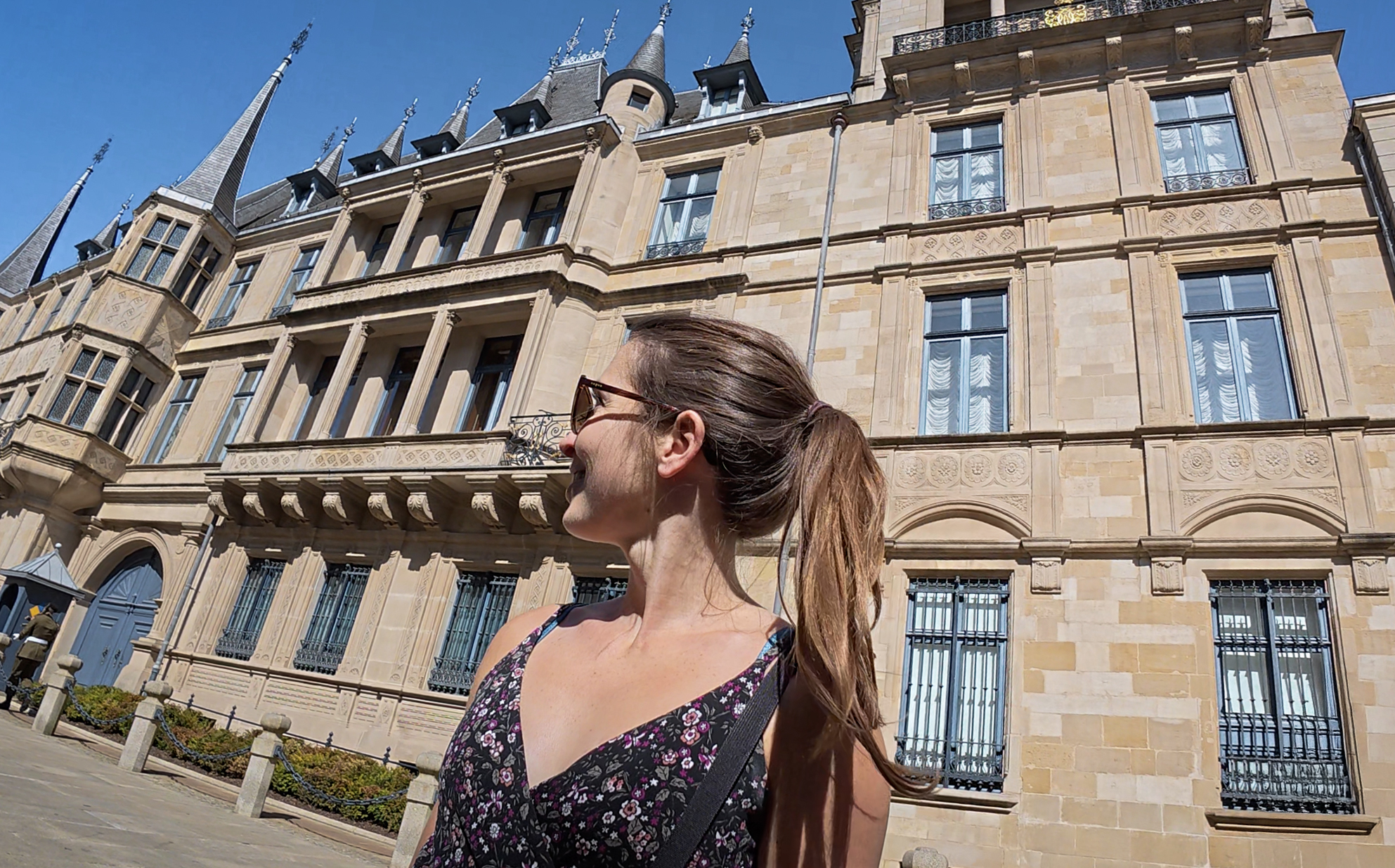
The palace was built in 1572, nearly 20 years after the original structure was destroyed by a gunpowder explosion in 1554. That original one was built in 1418 as a town hall. The new structure also served as a town hall, and it wasn’t until 1890 that it became the official residence of the grand ducal family. Today, they don’t actually live there (their principal residence is Berg Castle). If history isn’t interesting to you, there is a chocolate shop right across from it.
Resisting the urge to stop in a chocolate shop after just coming from Belgium that morning…I continued onward toward Chemin de la Corniche, a scenic walkway overlooking Neimënster.
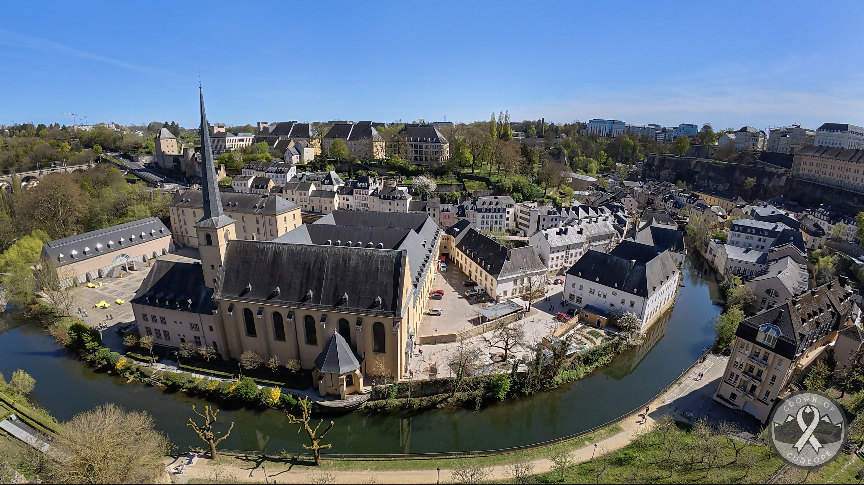
To get to Neimënster, it’s necessary to walk all the way around to Pont du Grund (I say “all the way” – I remember it feeling longer, but Google Maps estimates it at 8 minutes, then 3 minutes further to the square…maybe I was stopping for too many photos). While Luxembourg has 1,200 bridges, this particular area didn’t have too many options to get across. Since it’s kind of hilly in parts, and it doesn’t always have straight paths, fully exploring it really takes a full day or two. You probably need even more if any activities are part of the plan (e.g., tours, museums, sit-down restaurants – this small city has 11 Michelin stars across 8 restaurants).
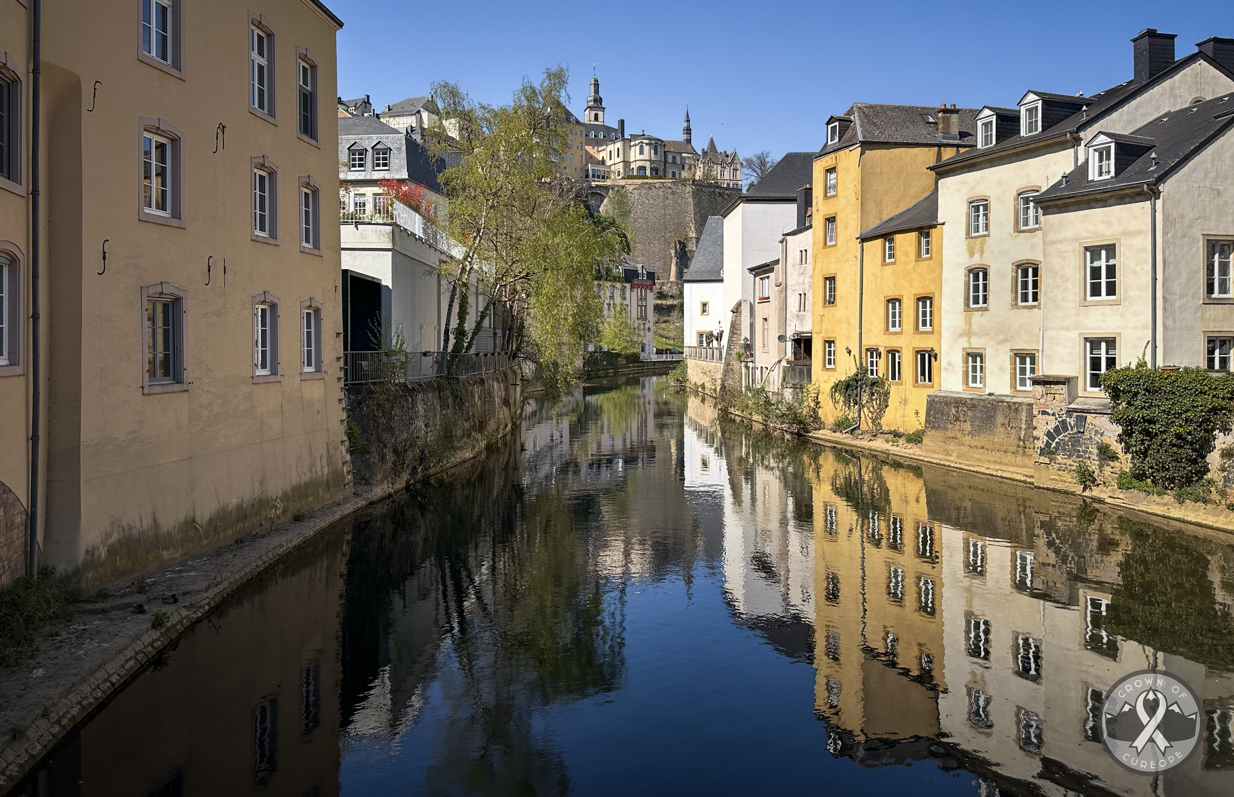
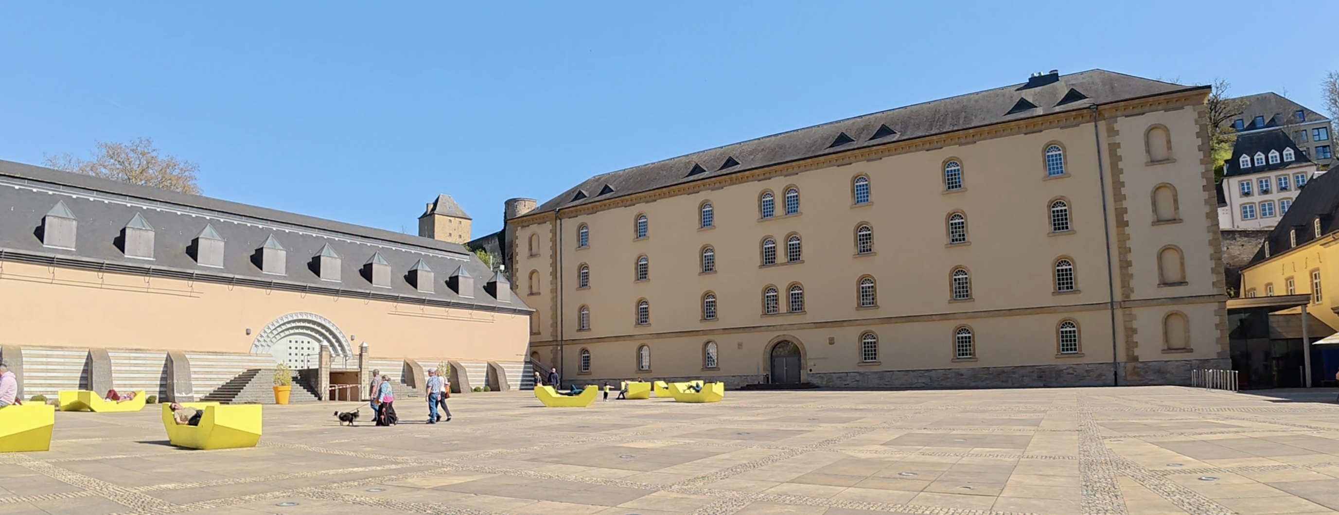
The walk is really scenic, even if I was a bit jealous watching some tourists sitting comfortably in a cute train. Soon, I was at the square. To one side, there was a fortress peeking from behind the buildings in the square. To the other, views right along the river and up to the Casemates du Bock. It’s easier to show the 360 views via Instagram, so feel free to check out my Luxembourg highlights there! (:

I’d gone into this trip thinking it would be one of the more relaxing ones. Just a few drive-up high points, each only a 45-minute drive from the next, in countries known to be quite flat by European standards. It turns out that it’s really tempting to charge up to higher ground for better views, so I ended up getting some unforeseen training in! I would vaguely regret this when walking the 14-mile Seven Sisters route the next day, back in England. (:
After a quick detour up some stairs around Neimënster, I went back across the river via the Pont du Stierchen (“Stier” in German is “bull”, and “chen” is the diminutive to make it sound small/cute). In trying to find out why it’s called this, as I didn’t see any bull decorations, I learned that this bridge is rumored to be haunted by the ghost of a man who was often drunk. He can only be seen by horses and drunk people, and he can appear as several different animals, including a bull. I would be driving in the next couple of hours back to the airport, so I was unable to test this myth.
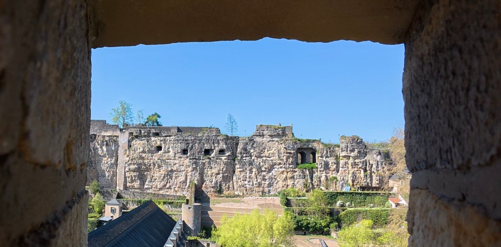
From there, I was trying to get to the Casemates du Bock, a series of underground tunnels built into the cliff I’d been looking at from Neimënster, which used to be a key part of the city’s defense system. It’s also a UNESCO World Heritage Site (since 1994)! It looked like I should be able to pop right up to them, but it was a ~10-minute walk looping around the back of the cliffs to arrive on the top, where the entrance is. There are set hours, and tickets must be purchased to enter (10 euros for adults, 8 for students and seniors, 5 for children 4-12, and free for children under 4). Given that I was there fairly close to the closing time, and it seemed to be really crowded, I decided to just walk along the top. Up there, a man with a cute dog was flying a kite. That’s in the Instagram highlights. Anyway, here’s some more info on this interesting spot if you’d like to check it out for yourself!
THANK YOU ❤
Thanks for reading my third Crown of Cureope blog post. At the time I stood on the top of Luxembourg, we had raised $950!! I really appreciate your contributions- they’re all going directly to the American Association for Cancer Research to fund lifesaving discoveries.
Next up, Belgium! 🙂
Map of this trip:

Leave a comment