
7 Irish Passports
When I first started planning this challenge, I was looking around for anyone who had done something similar before, and I eventually came across Ian O’Brien’s Instagram page, @eur_up_ian. In June 2023, Ian completed 28 peaks in 28 days (the 27 EU country high points + UK) to raise funds (€100k!!) for EOPD.ie, an Ireland-based Early Onset Parkinson’s Disease support group. Since that challenge, he’s organized a couple of group trips per year to European high points. This year, the trips were 1) Bosnia and Croatia in late May, and 2) Austria, Slovenia, and Germany in late June. Unfortunately, my Andorra trip conflicted with the second trip, but I was fortunate to join the first one! (:
Ian describes his trips as “full-on”, and this is accurate. Mine started off with an extra twist, though. The rest of the group would be flying out of Dublin into Dubrovnik and driving up to Tjentište together, getting in after midnight. Flights to Dubrovnik were a bit pricey from London, so I planned to fly into Sarajevo and take the last bus to Tjentište from there – I hadn’t been to Bosnia and Herzegovina (BiH)’s capital, Sarajevo, so I hoped to explore for a quick 3 hours before my bus. Actually, I hadn’t really been to BiH at all…except twice when crossing through the 20-kilometer stretch the divides the Croatian coast. Unfortunately, I would still need to make another trip there, because…
Traveling Light
My flight had a 50-minute layover in Warsaw. I didn’t think much of possible checked luggage issues, as it’s a common route with both legs operated by the same airline: LOT. The first flight got in a few minutes early, and the leg from Warsaw to Sarajevo was delayed nearly 30 minutes (of which we were held in the shuttle bus for 20, doors closed, standing). Plenty of extra time to get bags loaded in. Right…?
As we started to land in Sarajevo, we hit some pretty extreme turbulence. There must have been 5 different attempts to descend through the storm clouds, but each time the plane got rocked around, the pilots pulled back up to try again somewhere else. We touched down 20 minutes later than the pre-landing announcement suggested. I was soon at baggage claim doing my usual AirTag checks. For the first time in my life…I saw the dreaded “Warsaw – Now”. My bag hadn’t made it. I waited around a bit longer, just in case it was a glitch, with 4 or 5 others from my flight. I then headed to the service desk, where I was told that lost bags can’t be delivered on weekends and it was unlikely it would arrive that day (a Friday). As the trip involved staying in a new place every night, it was quickly apparent that I wouldn’t get my bag that trip. I thought through all possible options – renting a car so I could follow the group and then loop back and grab it on the way to Croatia, staying in Sarajevo and skipping the Bosnia hike but rejoining for Croatia, and abandoning the trip entirely and flying back. At this point, it was 2 hours until my bus would leave from a station down the road.
I did a quick inventory of what I had. Thankfully, when my helmet wasn’t fitting properly into my 2-sided hard shell luggage during packing, I checked my baggage allowance and saw that I could take an overhead cabin bag. I shifted the helmet into a duffel, then padded it with one hiking outfit. I threw in my waterproof shell and hiking boots to fill it up a bit more. In my checked luggage, back in Warsaw, were my…trekking poles, micro spikes, gaiters, phone charger (lightning port chargers are more rare in Europe these days), via ferrata gear, fleeces / insulating layers, gloves, mittens, hand and toe warmers, pajamas, non-hiking outfits, enough gluten-free food to last most of the trip, all toiletries, and even the AACR flag.
@aussiepeakexplorer had completed this hike a few days before and warned about significant snowfall and ice on the trail. I knew there was a good chance of no summit. Still, I decided to prepare as best I could, and I was lucky to find an Intersport inside a small shopping center, a 5-minute cab ride away. I rushed in and grabbed trekking poles, then popped into the nearby grocery store for replacement trail snacks. I made stops in a few other stores for other essentials, then booked it over to the bus stop.
While Bosnian is a Slavic language that typically uses the Latin alphabet (rather than Cyrillic like nearby Serbia, Montenegro, and North Macedonia), Cyrillic is still used, and many signs are printed in it around Sarajevo. The bus stop looked like stepping back in time…as did the bus itself.
This bus was one of three departing that day for Tjentište, with this one operated by Sons (purchased through Traveling.com). It was actually very on-time by Balkan standards, 6 minutes late! Bring cash, because there’s apparently a “station tax” of 2 Bosnian marks, which was around a euro at the time. It’s unclear whether this is legit or a scam where attendants pocket the money, but either way, it’s easier to just pay the small fee than dispute it in Bosnian, for most people.
Aside from one larger station along the way, there are no real “stops” – you just need to tell the bus driver when to pull over along the side of the road. After around 2 hours, I arrived to the hotel and checked into the group’s 2 large rooms.
The hotel is located within Bosnia’s oldest national park: Sutjeska.
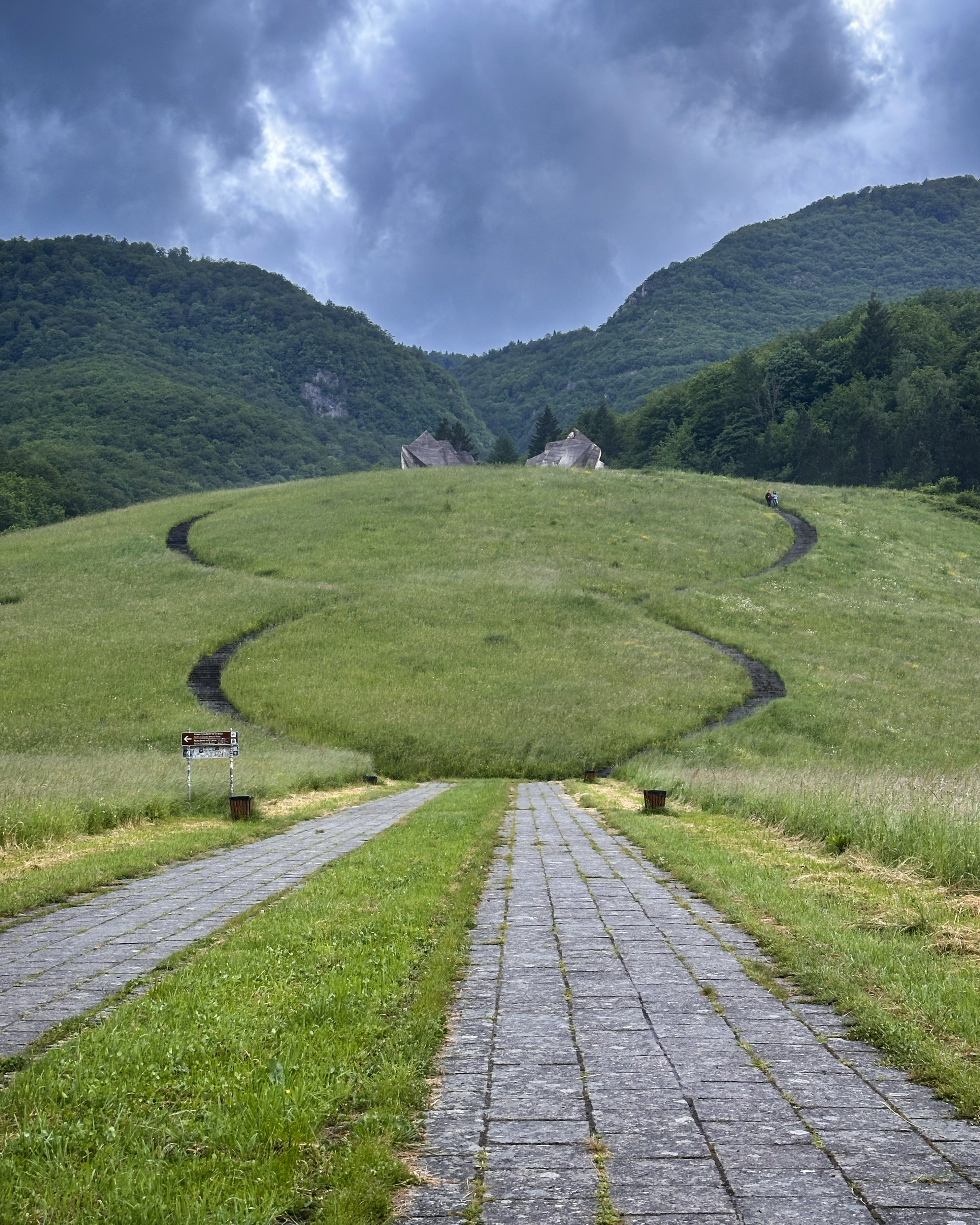
It was established as a national park in 1962 and is known for both its historical significance (the Battle of Sutjeska in 1943) and natural beauty. Tjentište is conveniently at the foot of the mountain road that leads to Prijevor, the trailhead of Maglić (best driven in a 4×4). All of this is within the national park, but note that entry fees are collected along the road to Prijevor!
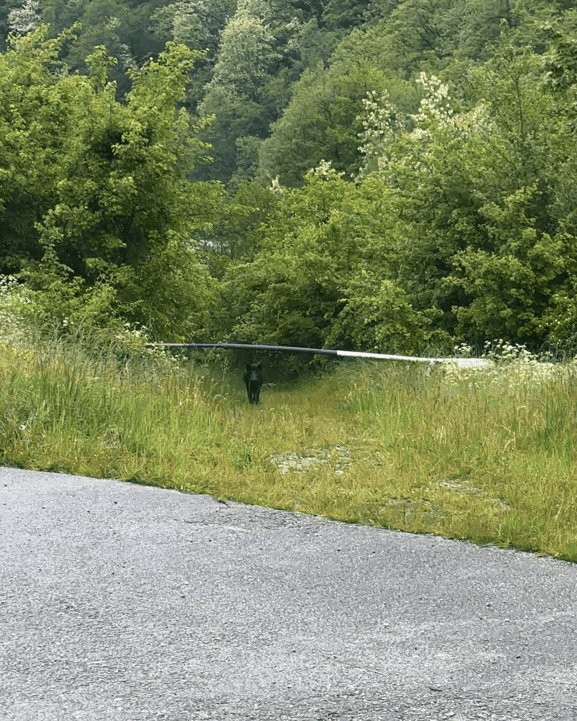
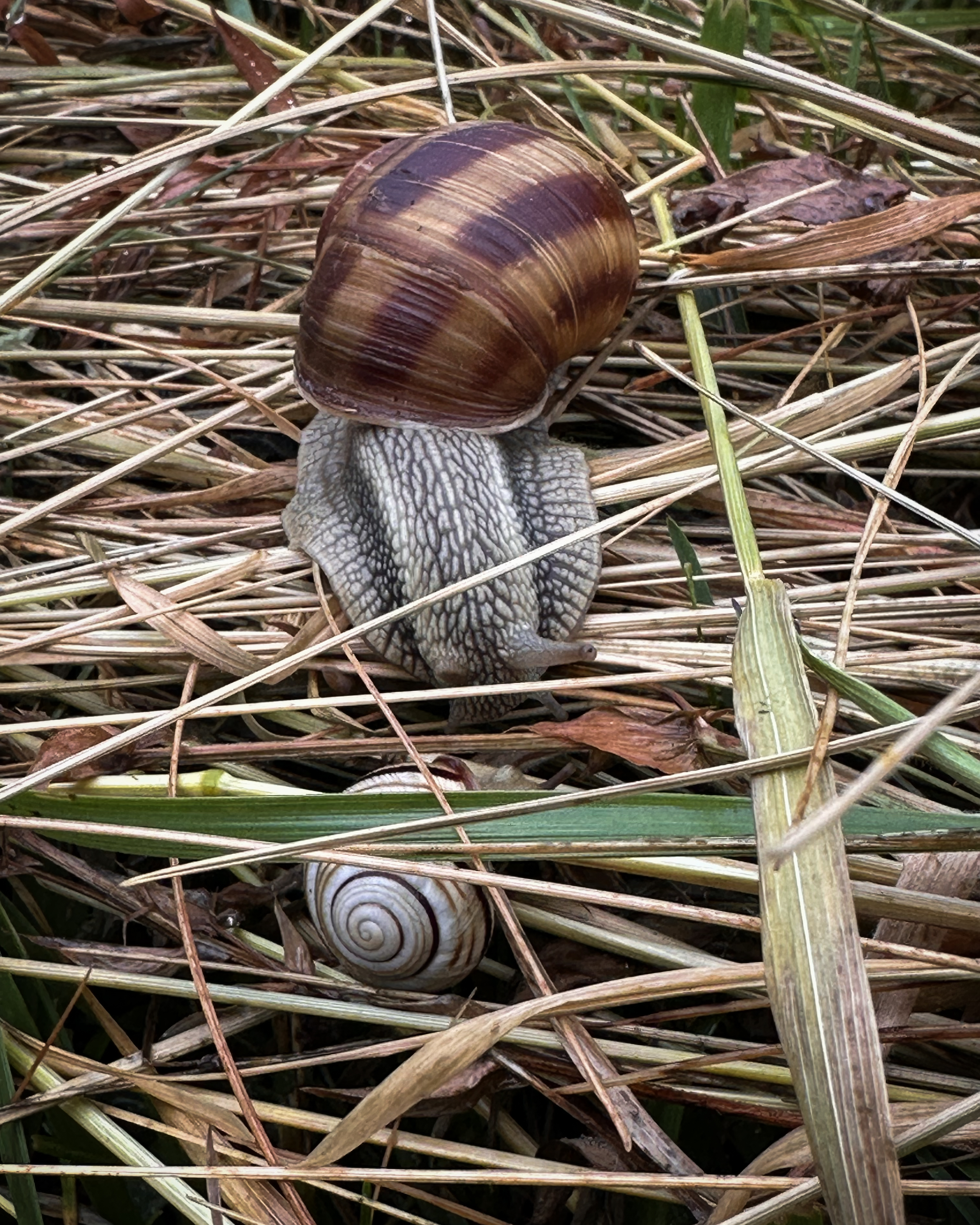
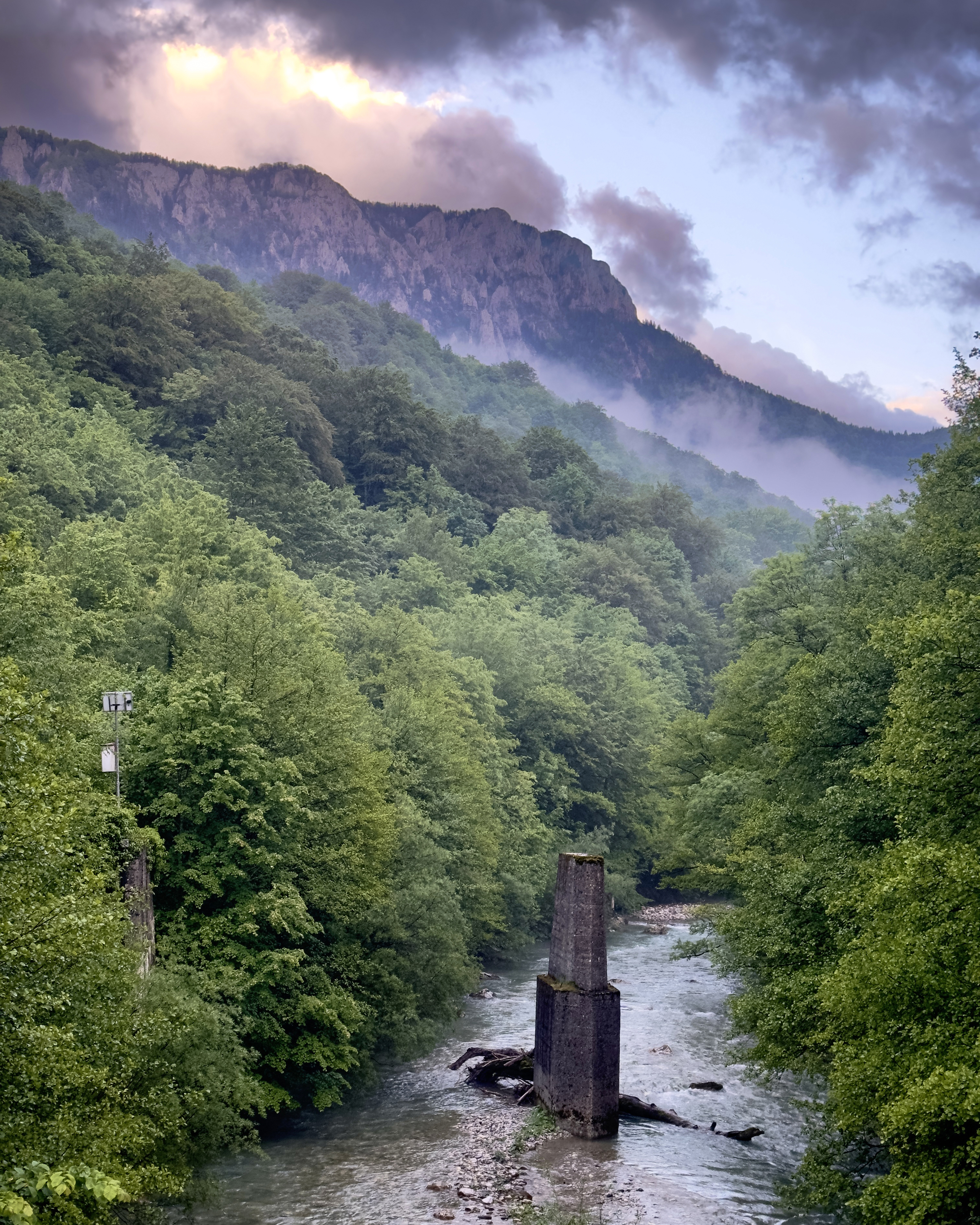
When I arrived in Tjentište, I went for a walk along the main road, which was home to many snails, beautiful views, and some eerie wild boars peeking out of the fog. There are a few simple shops to stock up on any last-minute supplies.
In one of these shops, I was chatting with a local mountain guide who informed me that an American man had passed on Maglić just a month prior. Apparently, it was during icy conditions. Given the forecast, I was a bit concerned about my winter gear still in Warsaw. However, despite our planned circular route, it is possible to descend back the same way. I was ready to bail at the first sign of sketchy conditions, but hoped that somehow the path would be clear.
The Group Arrives
At around 2am, Ian and the other 5 hikers arrived from Dubrovnik, after a slightly delayed flight. All in all, not the best day for travel luck…
We headed to breakfast, then waited for our guide to arrive to take us to Prijevor. The forecast looked much better, so we were all cautiously optimistic. There was heavy fog as we arrived at the starting point, but I was grateful to be with this fun group, summit or not!

The plan was to summit Maglić, then descend via a longer route into Montenegro around Trnovačko Lake, returning to the same starting point. I admittedly didn’t know these plans ahead of time, as I was deep in planning for other summits and knew Ian had the planning under control (after pulling off the crazy logistics of his 28 summits in 28 days). I had assumed we’d take the standard out-and-back path and was really glad that we did this circular one instead- it took me into my 32nd-ever country just before turning 32! (: Also, the views are incredible descending toward the lake, even on a foggy day.
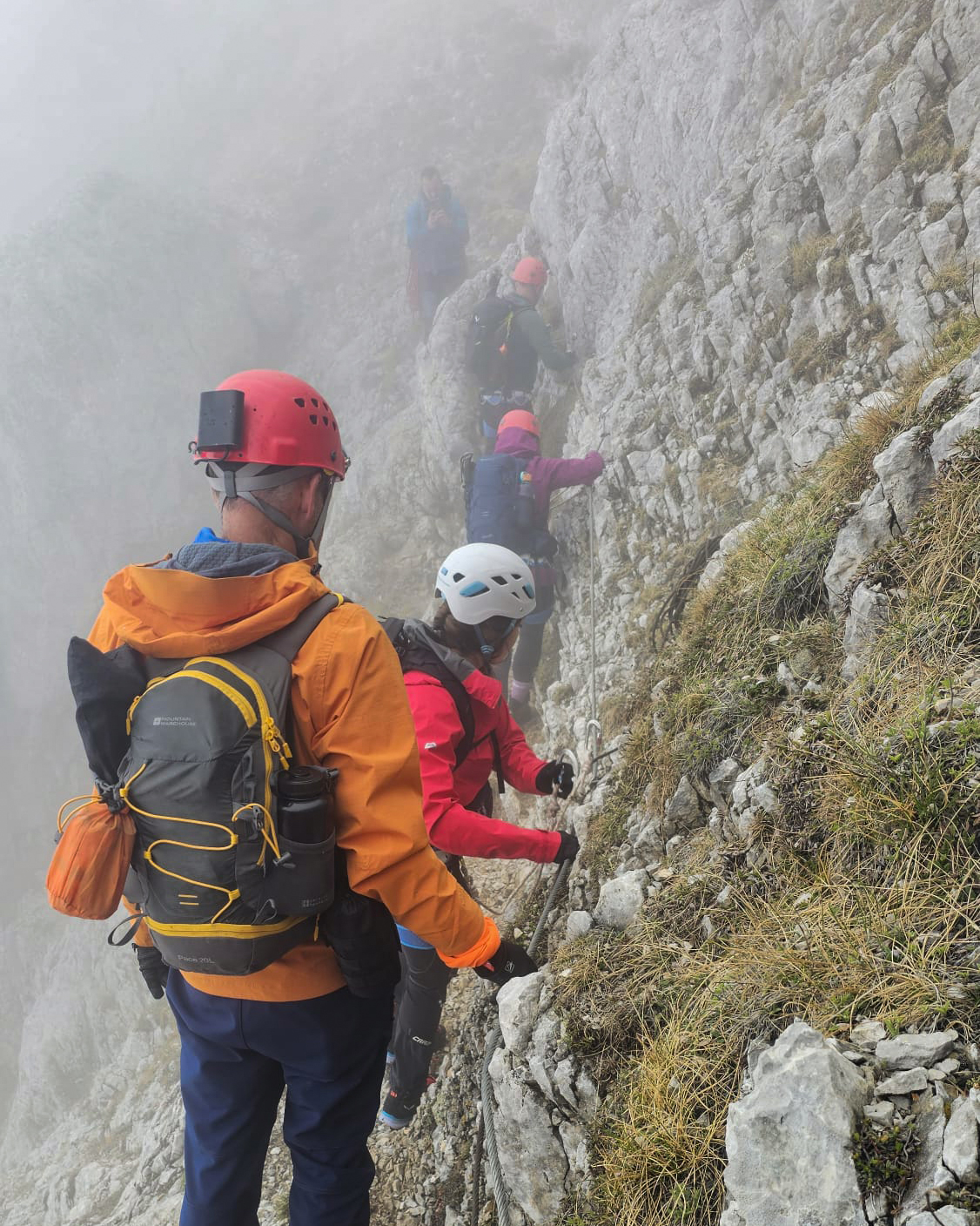
Most people completing this summit take one of these routes (circular, or out-and-back via the same ascent path). That steep ascent involves a via ferrata section near the top, although in good conditions, I don’t think the gear is necessary. Always judge based on your comfort level and conditions, though!
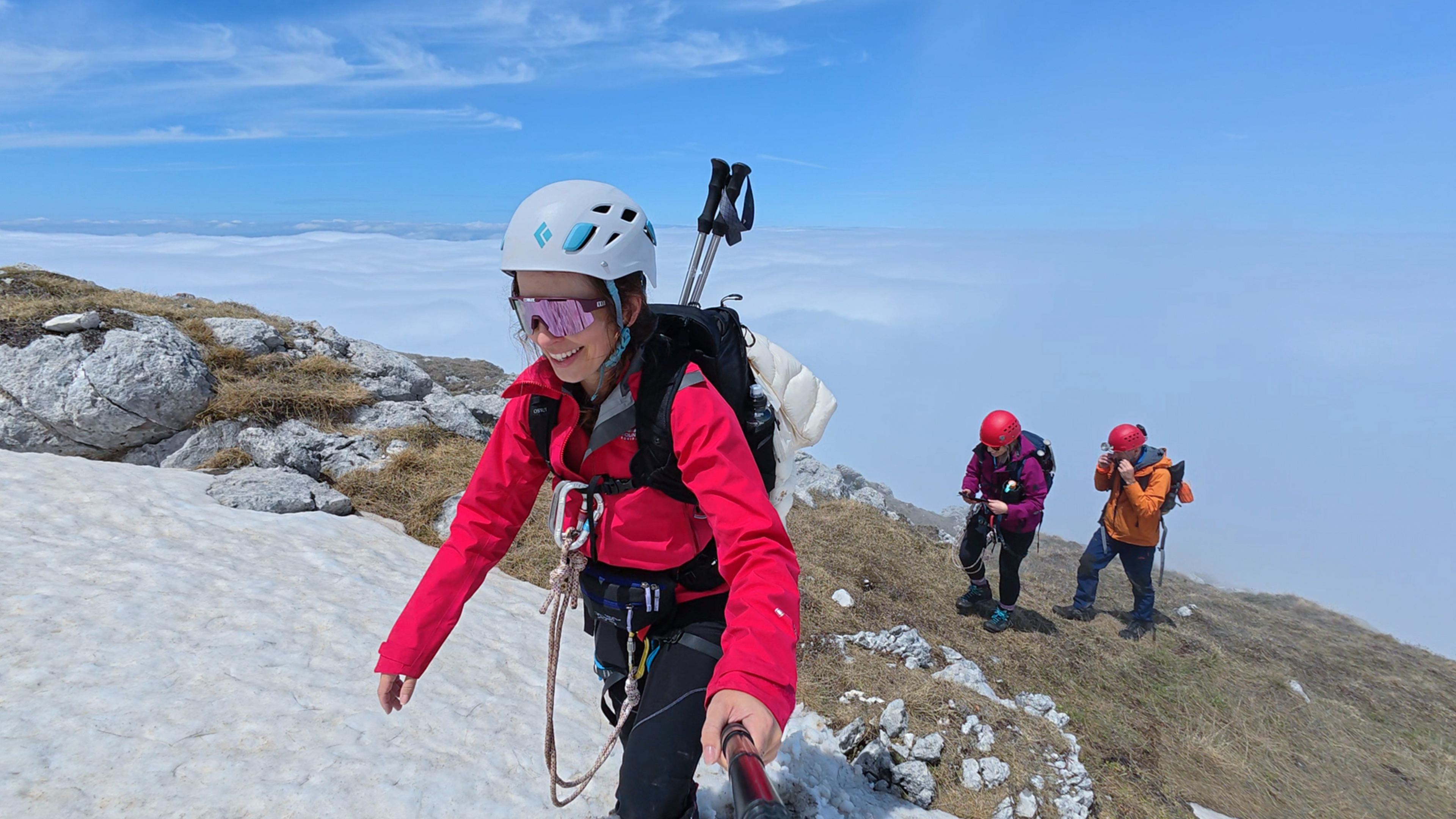
The guide distributed helmets and packed up some harnesses and via ferrata gear for us. Then, we set off!
The Hike
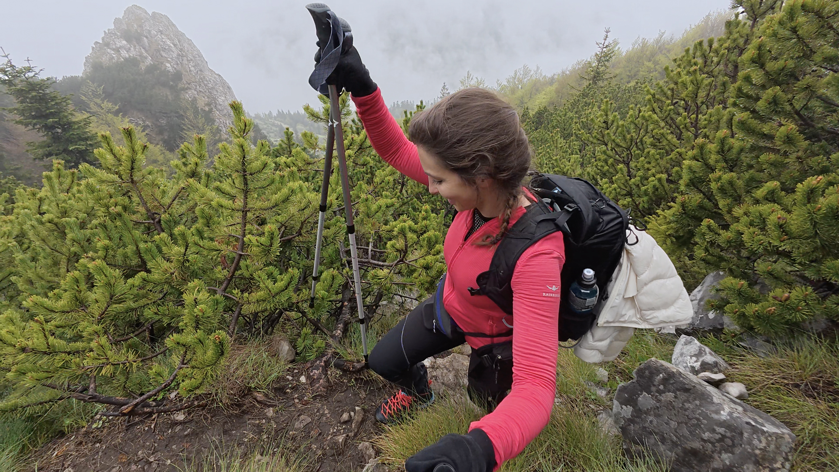
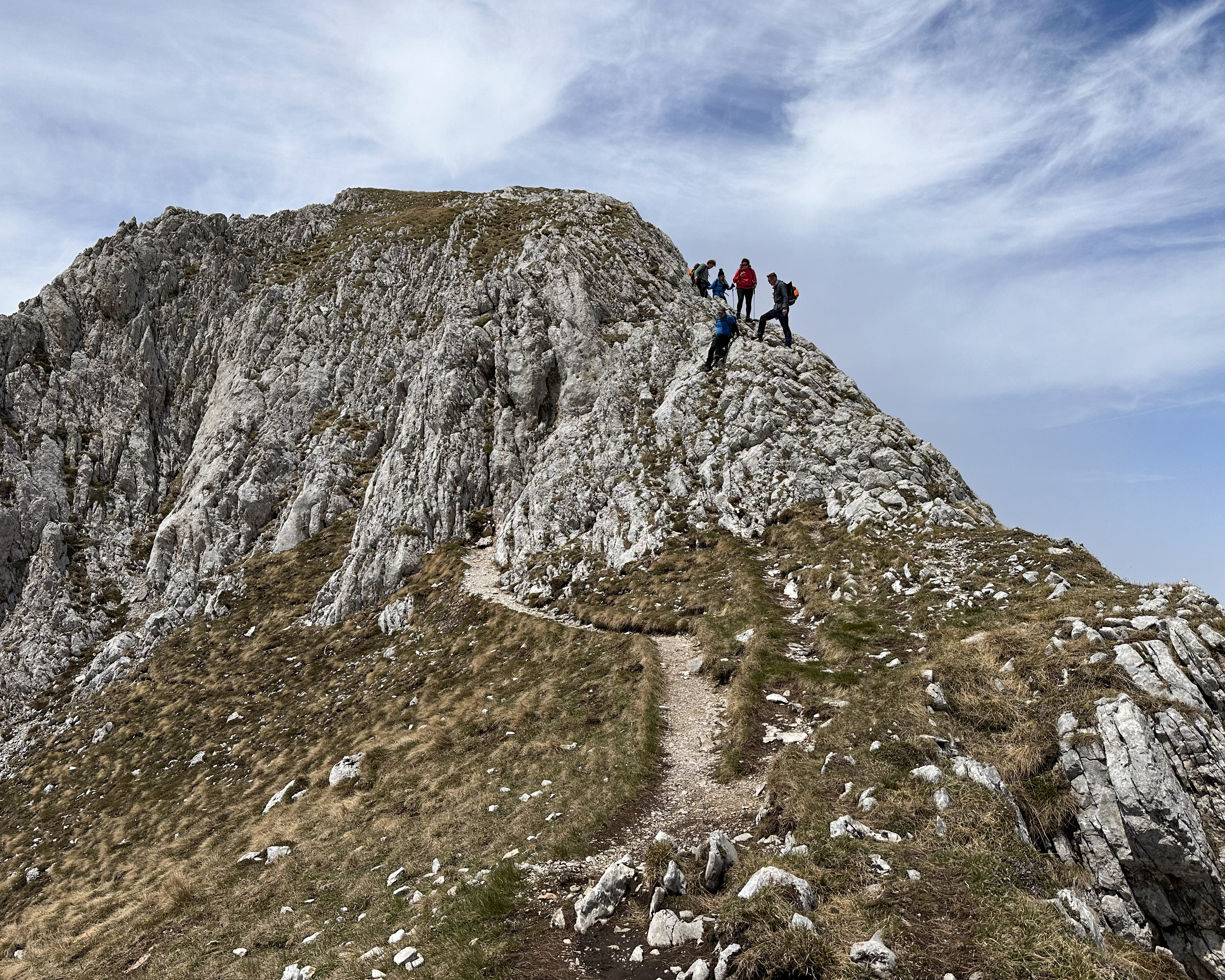
The early sections were a bit muddy and quite steep. I was very happy to have found those last-minute hiking poles, even if I was missing my usual ones! Still, no sign of snow so far. No sign of much of anything except for whatever was a few meters ahead, really.
The ascent is around 670 meters of elevation gain over just under 2 kilometers. Short, but very, very steep! The loop we were doing would be 1,150 meters of gain in ~12.5 kilometers, so the Montenegrin portion would be adding a lot to the day. But it’s worth it!!
Nearer to the top, the path becomes more of a via ferrata. Nothing is too technical, and it’s a bit debatable whether it’s a true via ferrata, but it’s definitely fun! The fog made it look extra dramatic:
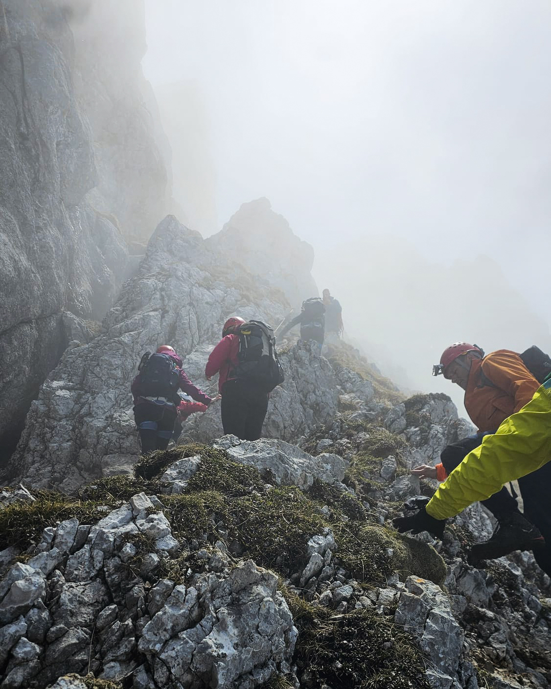
We finally had our first glimpse of sunlight peeking through the clouds. Luck of the Irish?
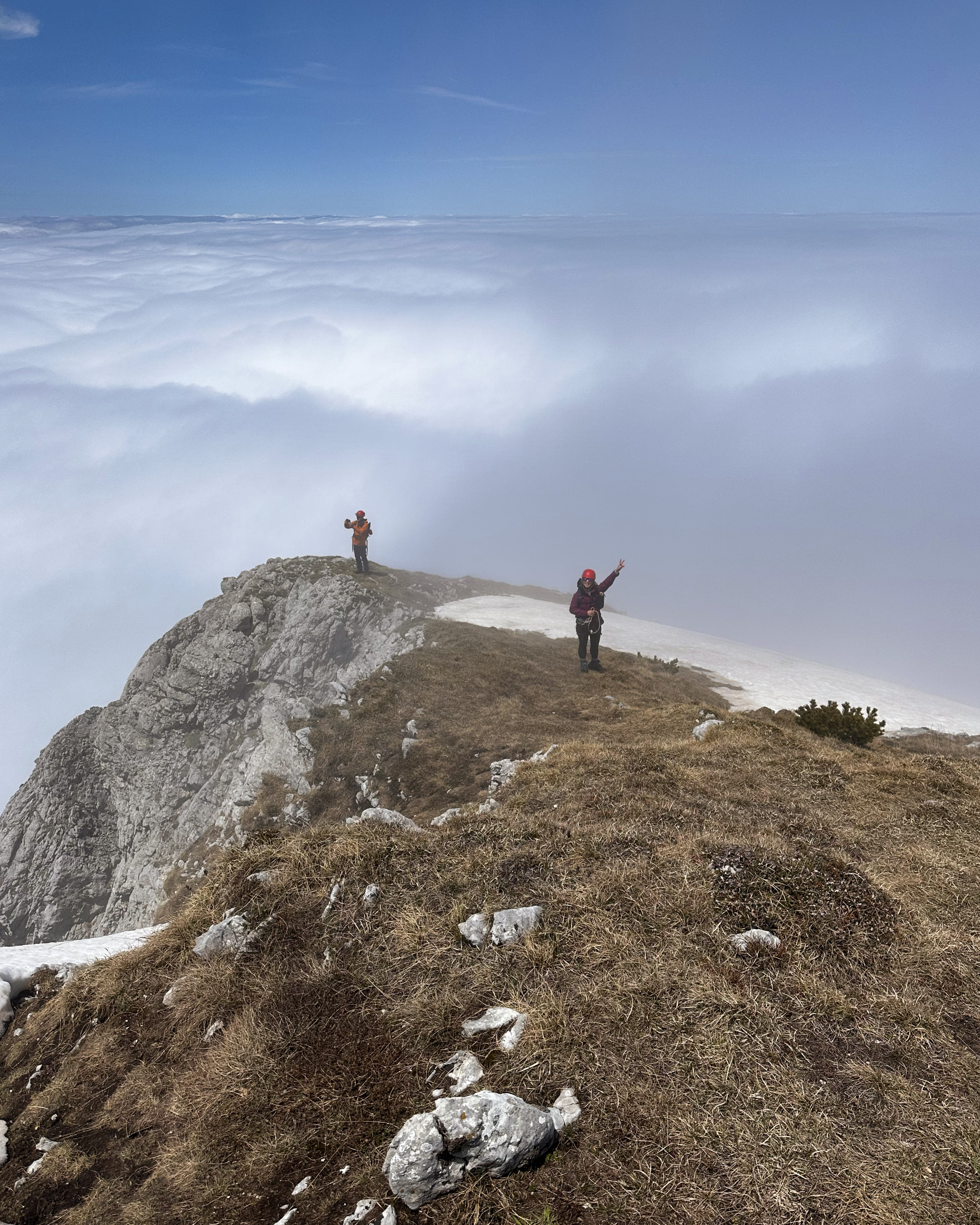
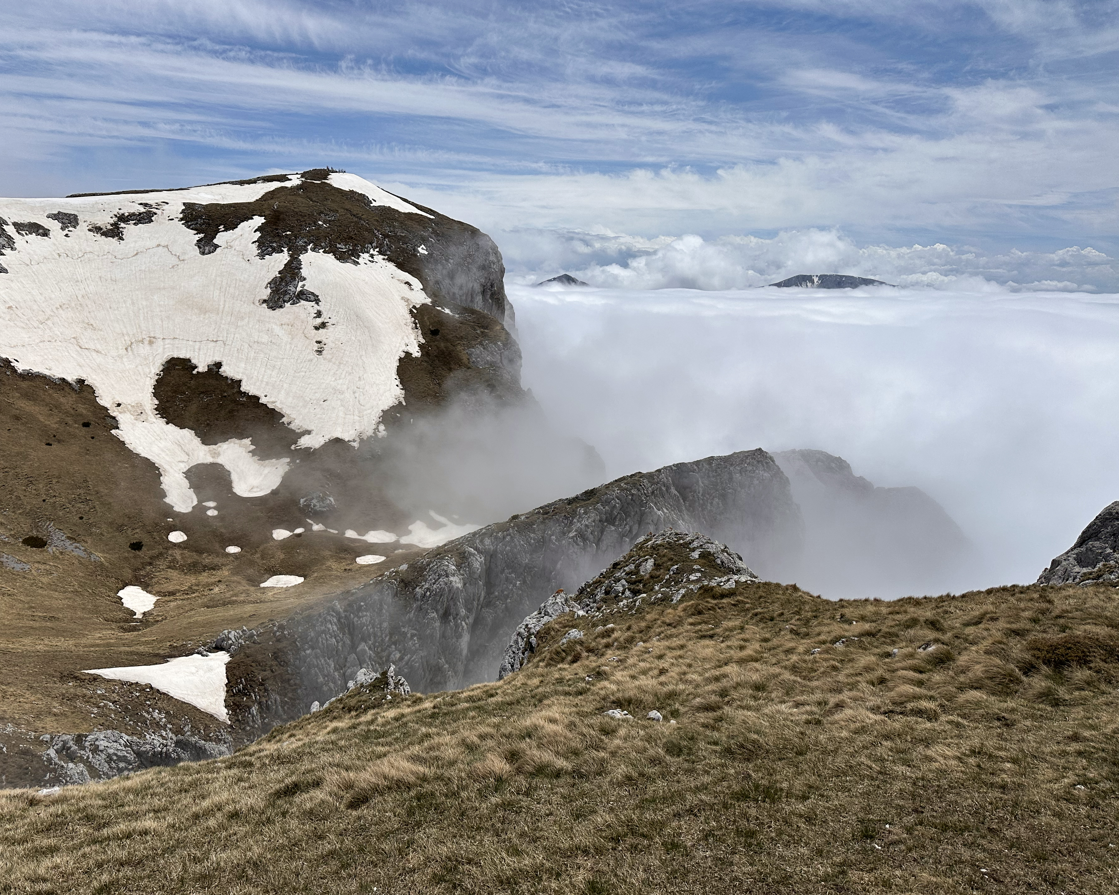
As we popped out above the final section of cables, we were welcomed with a beautiful cloud inversion and blue skies.
There was only one brief section of snow, and there would only be one more similar crossing the whole day. We really lucked out with the improvement in conditions, versus just days before! No spikes needed.
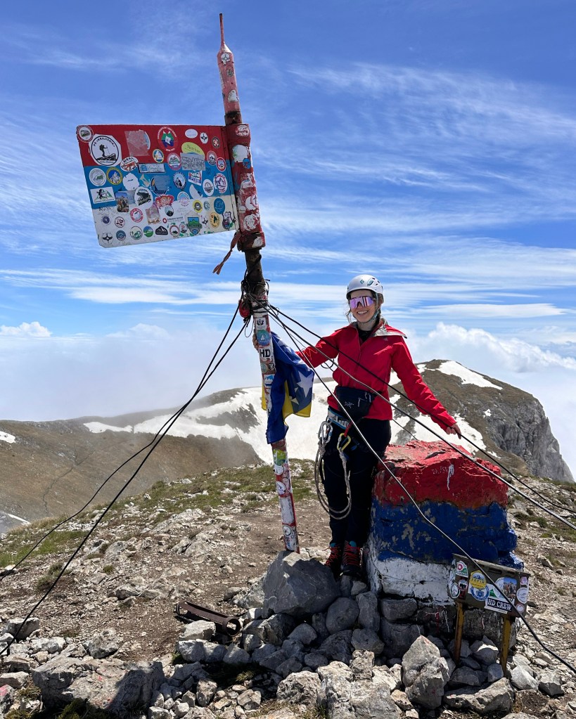
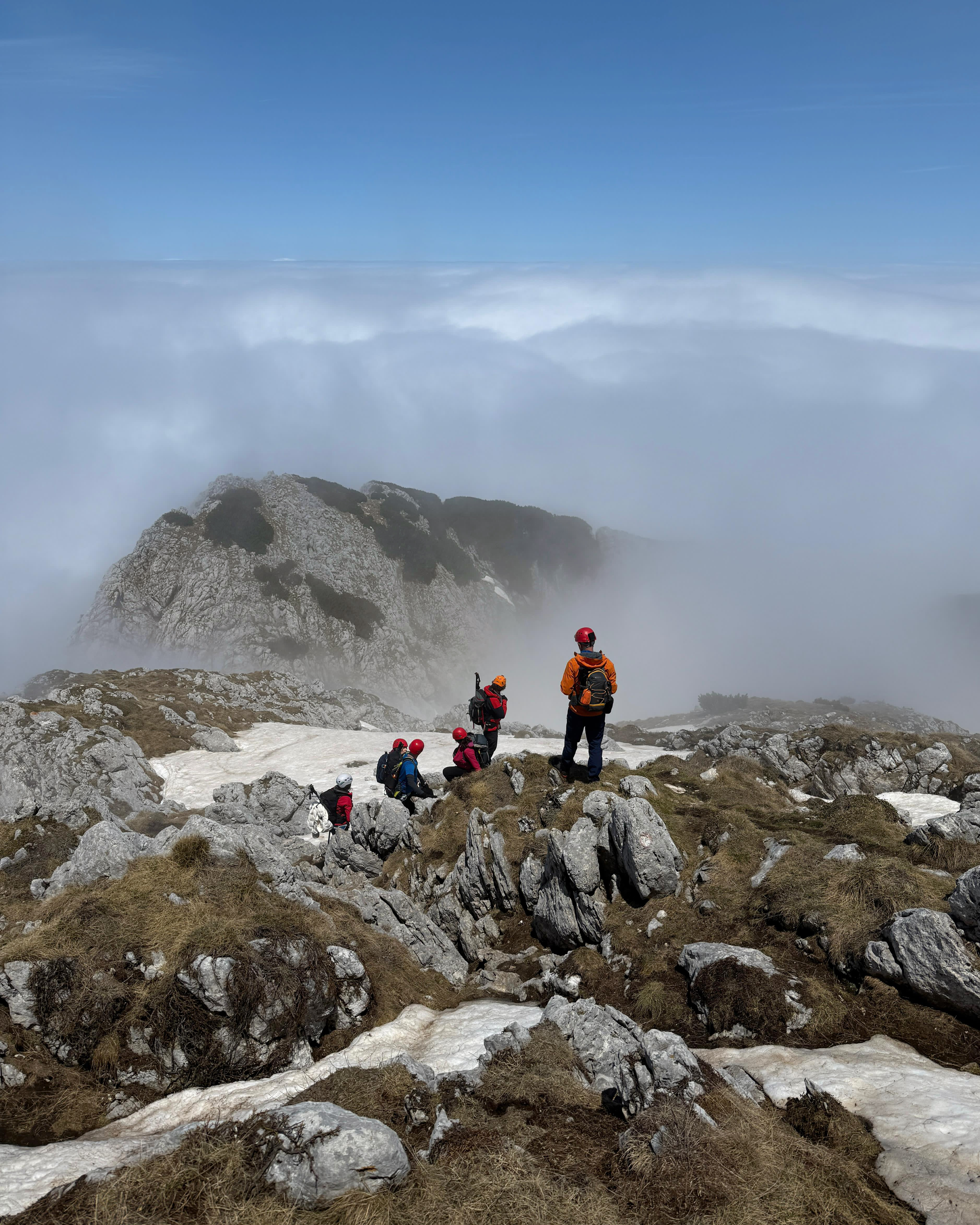
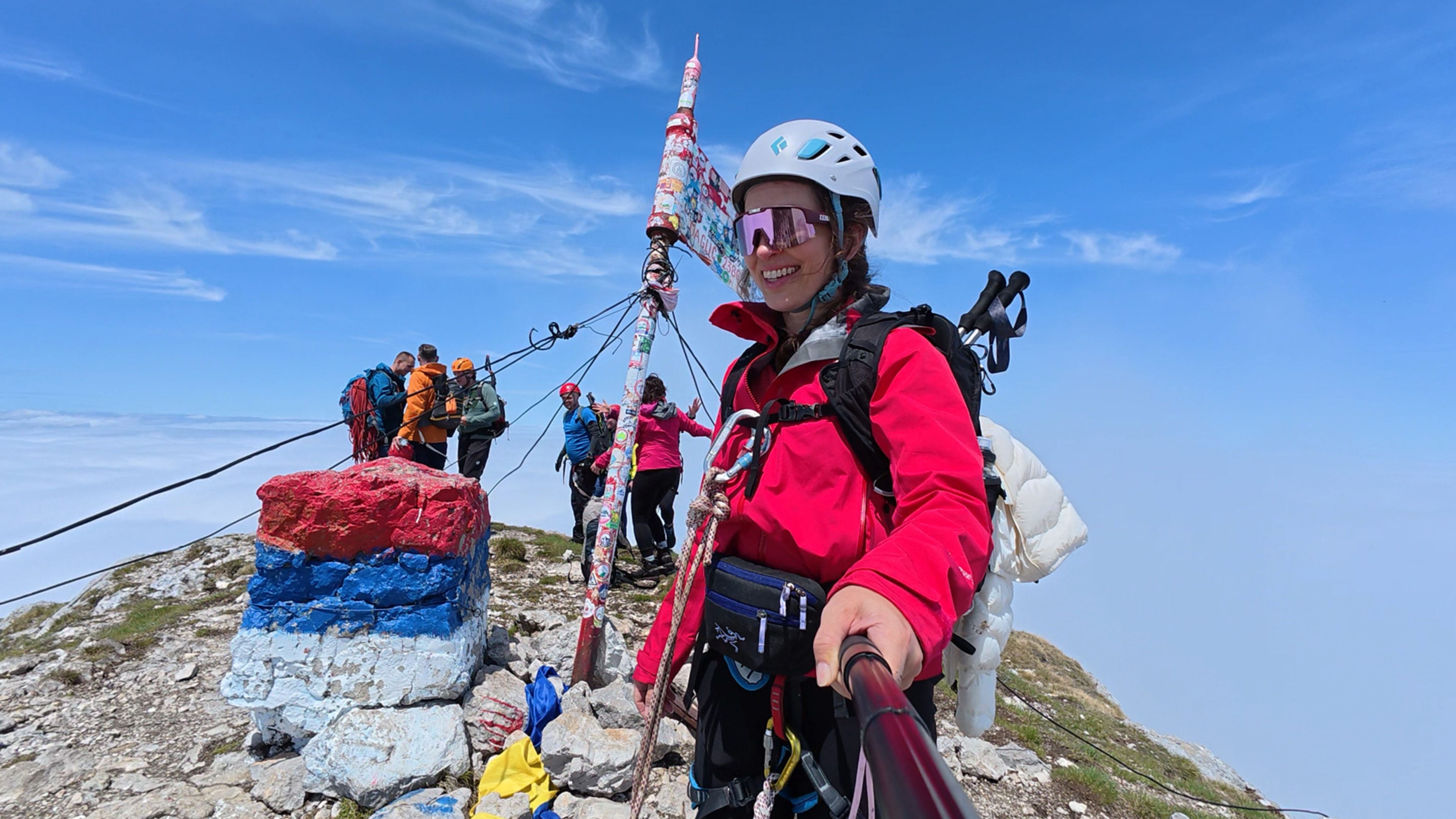
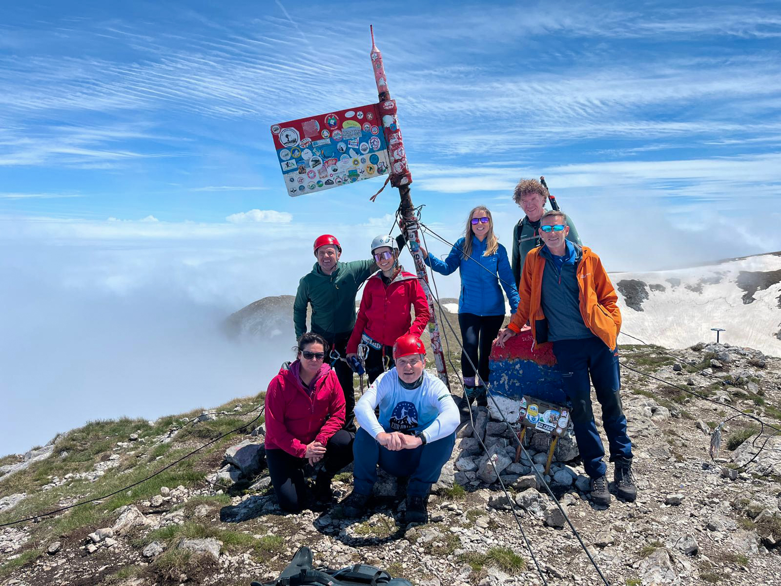
The group made the final push to the summit, where we had it to ourselves for a few minutes. We took some photos, signed the summit register, then chatted with the group that reached after us. Their guide was standing around engraving cups – not something I expected to see on a summit!
From the summit, we looked across to Volujak, BiH’s second-highest peak. The path off of Maglić continues toward it, and it’s easily added to the route for anyone wanting to tick off both peaks. We were on a schedule and proceeded past it, toward Montenegro.
As we sat down for a snack break, our guide casually mentioned that we were in Montenegro. This was the first time I’d realized the route crossed a border, so it was exciting news! I’d be back in Montenegro later that summer for its high point, Zla Kolata (though this one will now be a 2026 attempt – more on this in the Kosovo blog post).
The descent was really pretty grueling. We zig-zagged through steep patches of grass and dirt. There’s footage of this in my Instagram highlights – it’s pretty entertaining. The descent brought us back down into the fog, but it did clear occasionally to reveal a beautiful lake below, which was our next stop on the route: Trnovačko Lake.
That August, I went on a Balkans hiking trip with Why Not Adventures. Tia (the founder) ran another trip right after, focusing on Montenegro, and this lake was one spot they visited. That made it even more special, since she puts together some great itineraries. (:
The lake was deserted, aside from someone collecting national park entry fees. This was one advantage of the season and weather forecast!
Mostar
Finally, we were back at the 4×4, stopped at the hotel to grab our things, and then continued on the ~2.5-hour drive to Mostar. We arrived at night, which is actually a pretty magical time to see the famous Stari Most (Old Bridge). It’s been a UNESCO World Heritage Site since 2005.
The name “Mostar”, derived from mostari (“bridge keepers”), was first mentioned in 1474, when there was only a wooden suspension bridge to connect the diverse religious and ethnic communities of Mostar. The original bridge, built from 1557 to 1566, was commissioned by Suleiman the Magnificent and designed by mimar Hayruddin (student of mimar Sinan) (mimar = architect). It was destroyed in the war (1993) but rebuilt in 2004, using some original materials salvaged from the river.
From Mostar, we continued to a hotel closer to the base of Dinara, which would be the next day’s objective. And yes, I did eventually get my luggage back – more on this in the next blog post, which is part 2 of this trip: Croatia!
THANK YOU ❤
Thanks for reading my eleventh Crown of Cureope blog post. At the time I stood on the top of Bosnia and Herzegovina, we had raised $1,295 for the American Association for Cancer Research to fund lifesaving discoveries. We’ve since surpassed this by a few hundred more (took a bit of time to catch up on these posts!). There’s still a bit further to go to hit this year’s goal – any amount helps! (: (: (:

Leave a comment