
Kilometers to Miles
We headed out on our cross-country drive, from west to east, at around 8am. We had nearly 4 hours of driving ahead of us.
Crossing from the Republic of Ireland into Northern Ireland is pretty uneventful. I don’t even remember seeing a sign. What I did notice, however, was that the speed limit signs no longer made any sense. 30 kilometers per hour on a road with good visibility and few pedestrian crossings? It seemed a bit slow…and that was because it was really meant to be 30 miles per hour. All I can recommend if you’ll be driving between these countries is to familiarize yourself with where you can flip between miles and kilometers on your vehicle’s dashboard.
Since Brendan has done these routes multiple times, including with some other fellow Crown of Europe hikers, I hadn’t done much research aside from basic stats and terrain. I didn’t realize that this path was essentially sea to summit, so it was a pleasant surprise that the parking lot was right across the street from the sea! We parked at the Newcastle Donard Car Park. It’s a free, public lot, which is great…but it does mean it gets crowded on a nice summer Sunday. Our afternoon arrival proved somewhat lucky, as some were heading out after lunch (there’s a pub there) or wrapping up their hikes. It did take around 15 minutes for us both to find a spot (the downside to my backup plan of hauling my car around Ireland versus carpooling – if you didn’t read the Ireland blog post, it’s a long story involving food poisoning and a last-minute ferry change).
At around 1pm, we headed off to start the hike!
The Hike
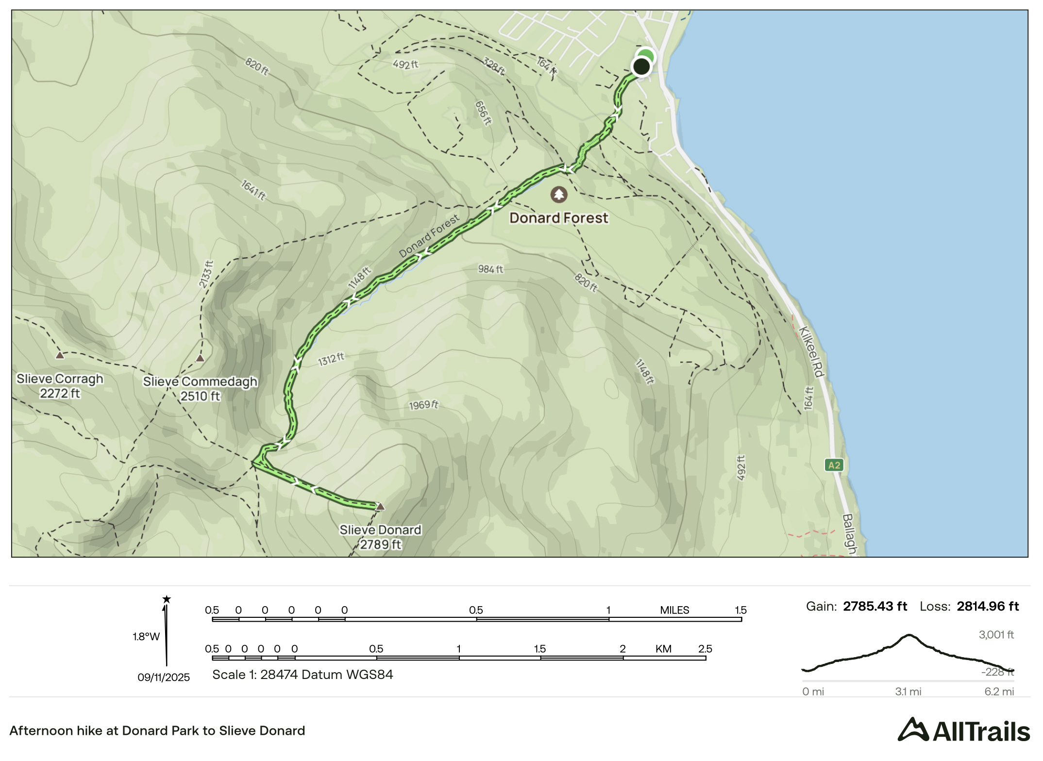
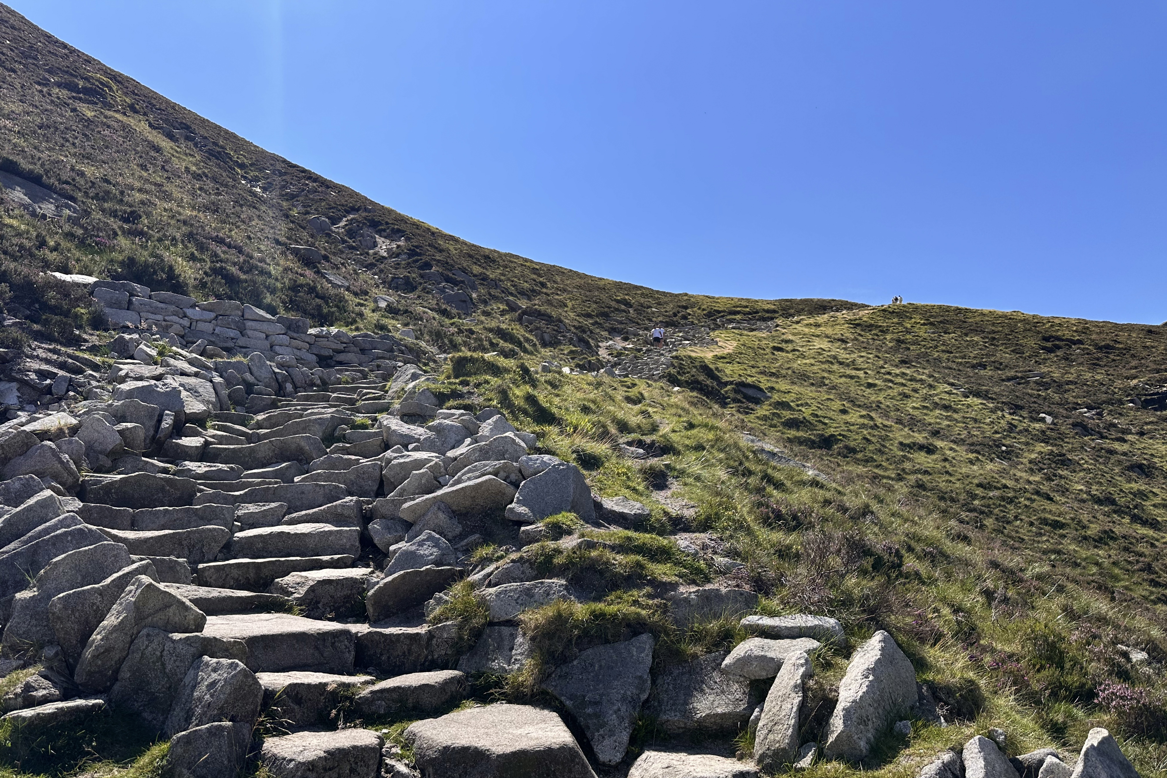
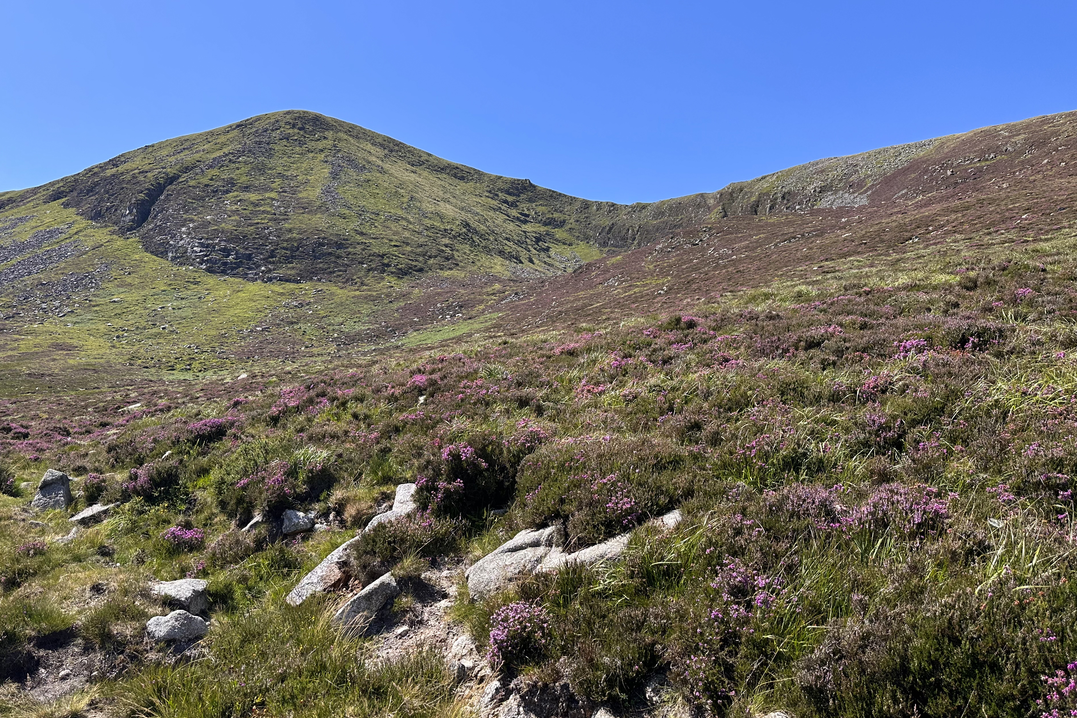
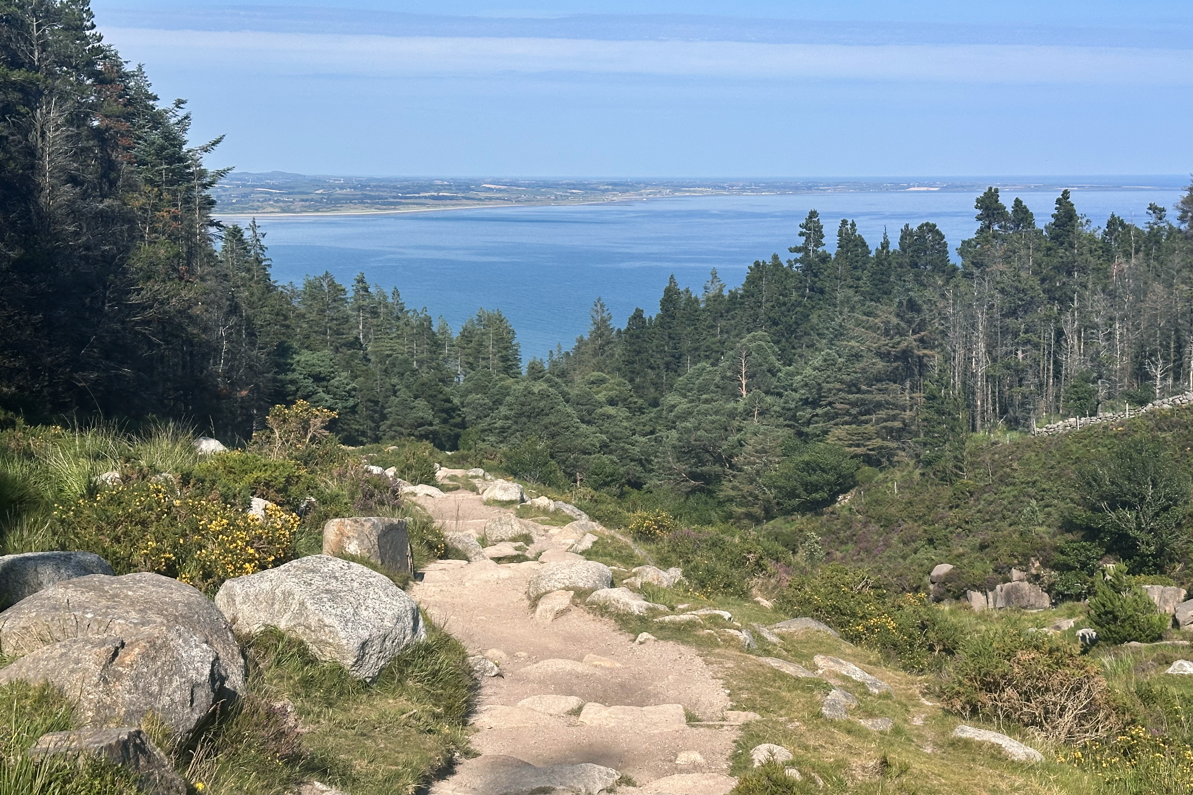
The trail stats for this route look fairly similar to Carrauntoohil, with 50 fewer meters of ascent and 3 fewer kilometers of distance. Despite this being the second day in a row of hiking, this one felt a bit easier. The path starts up through the forest, with the sea slowly coming back into view. Once the terrain opens up, there are well-maintained, rocky steps for most of the remainder.
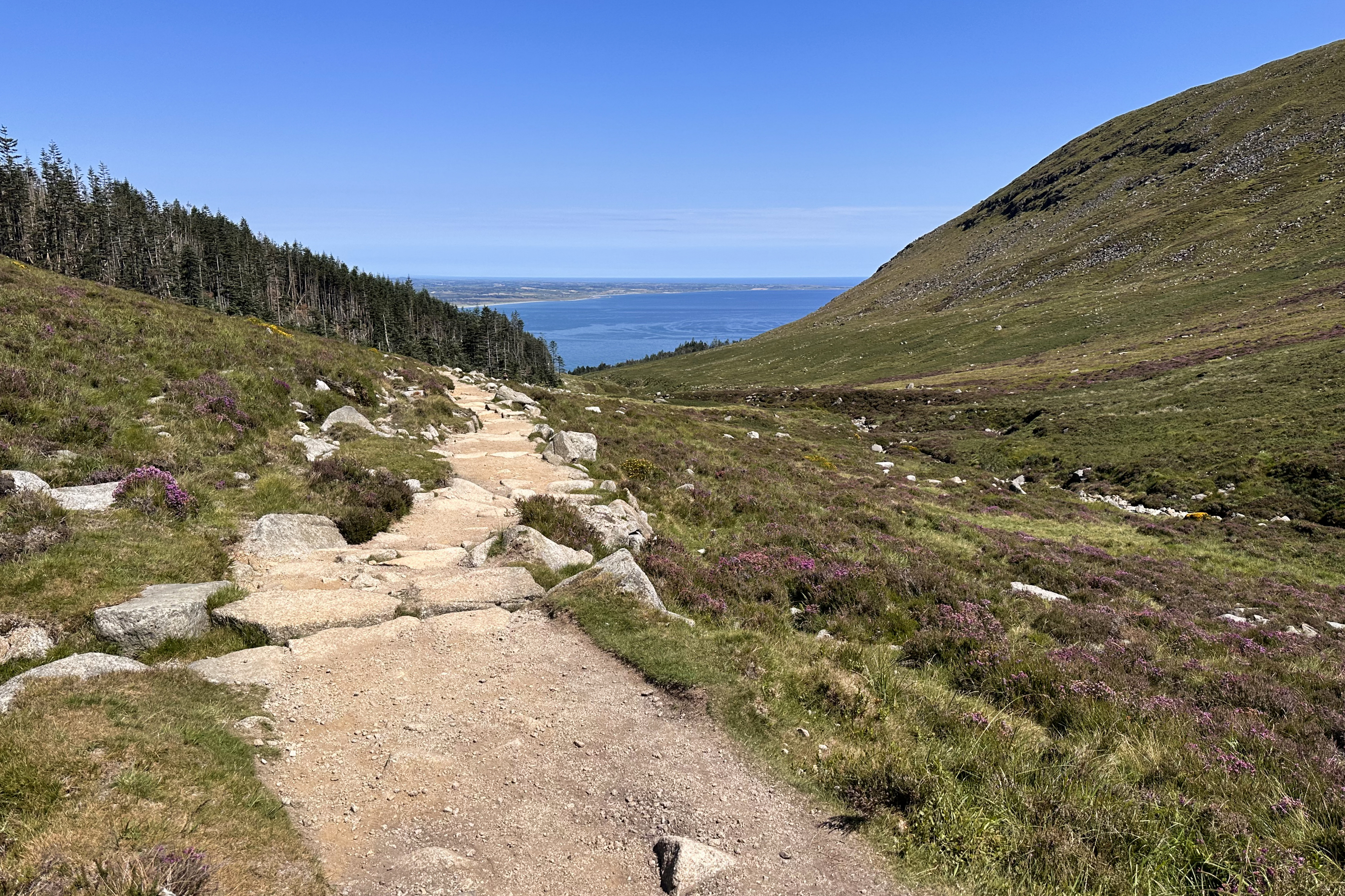
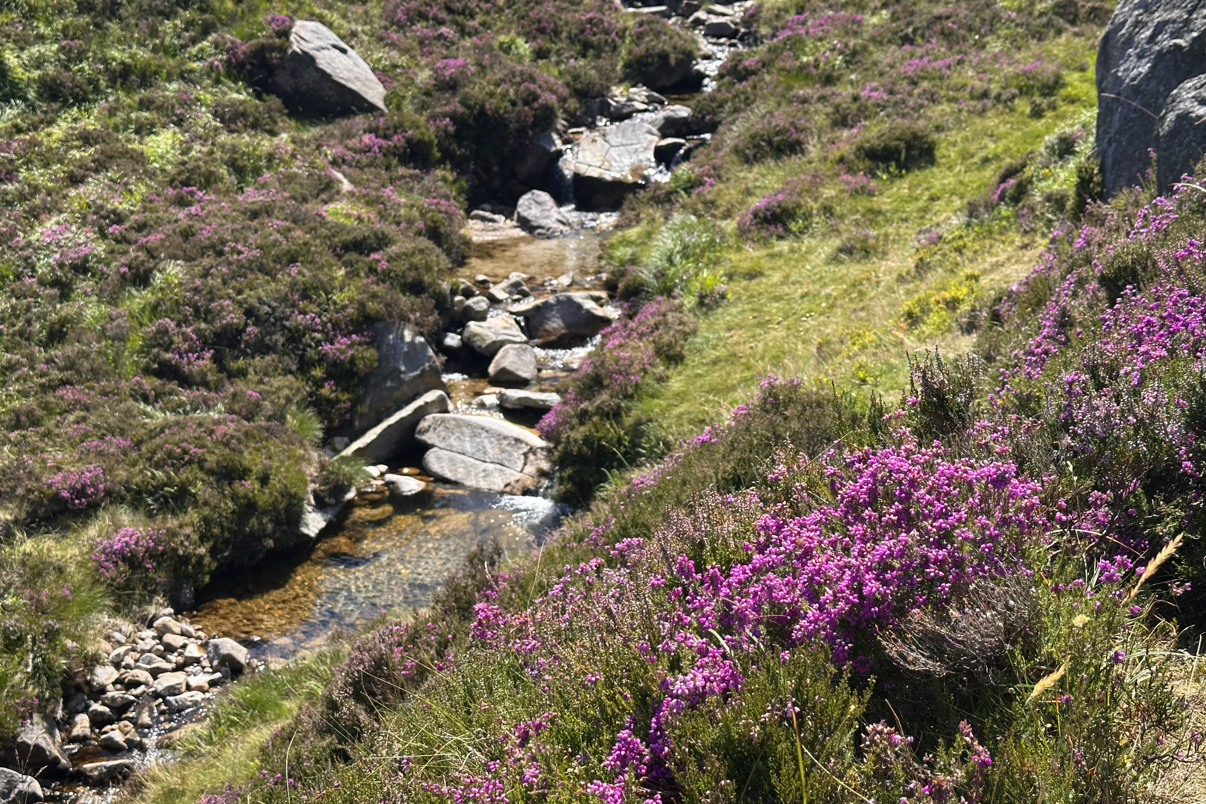
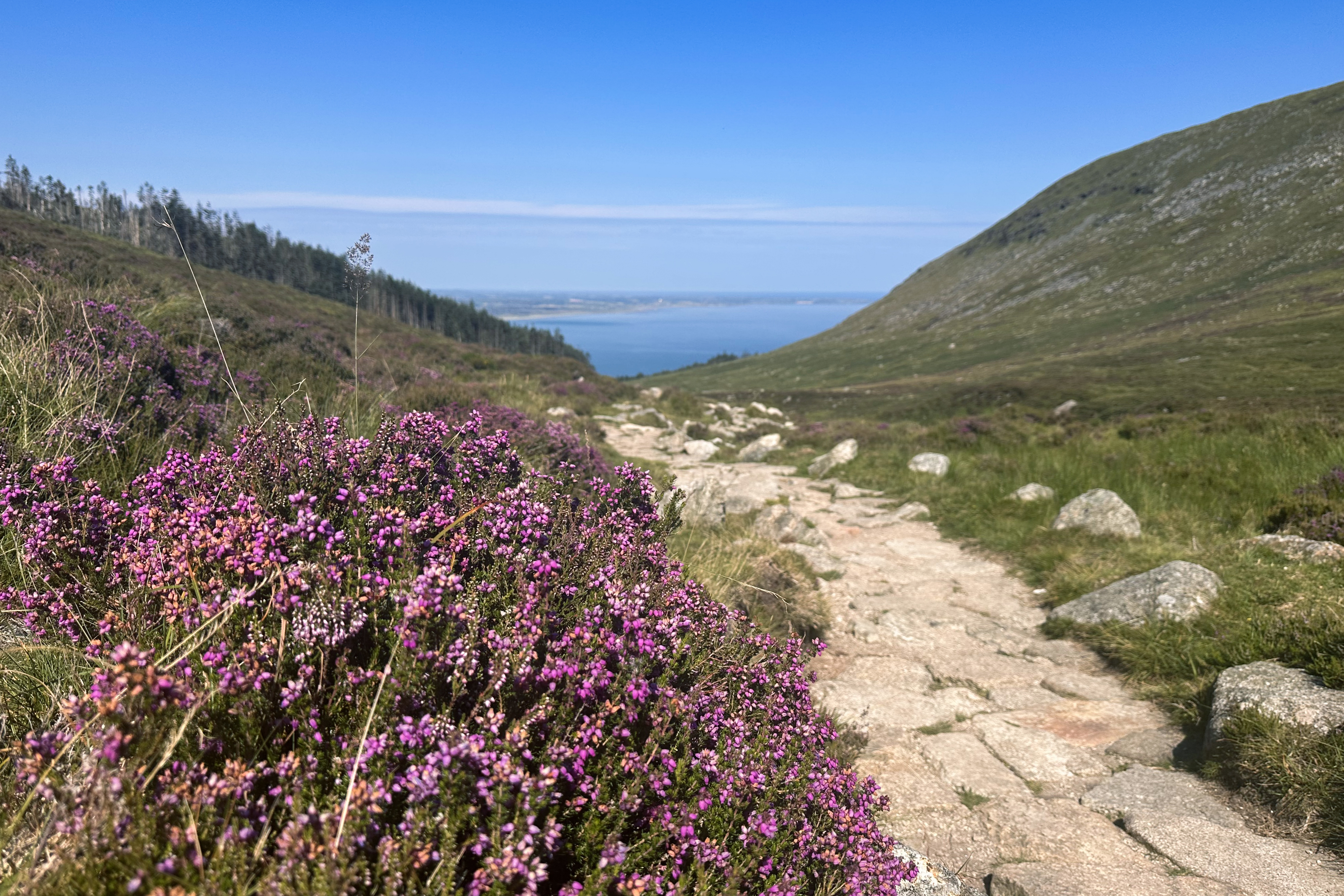
Just as in Andorra, I seemed to have caught this peak at the perfect time for some special flowery hues: purple heather everywhere!
There are many paths up to this summit, and some of those converge at the spot below.
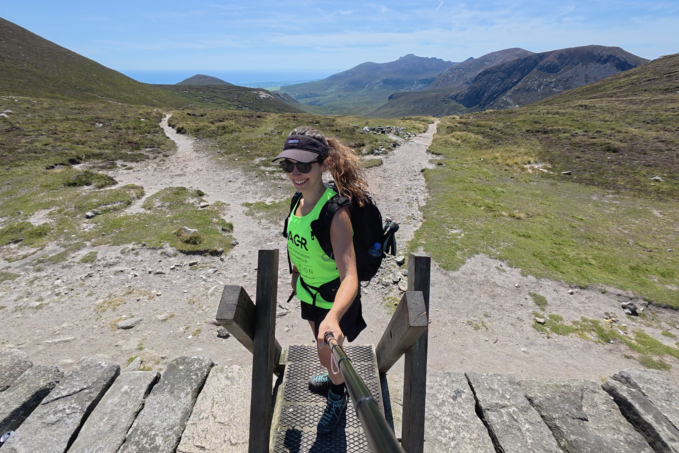
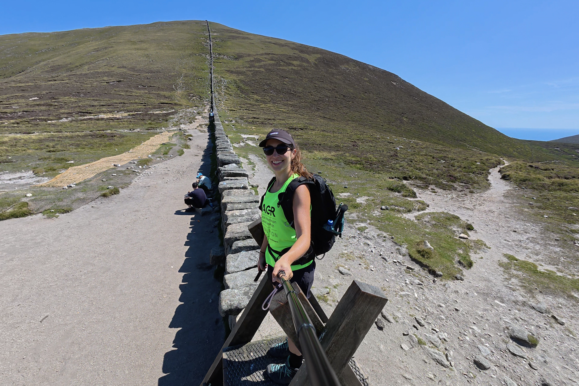
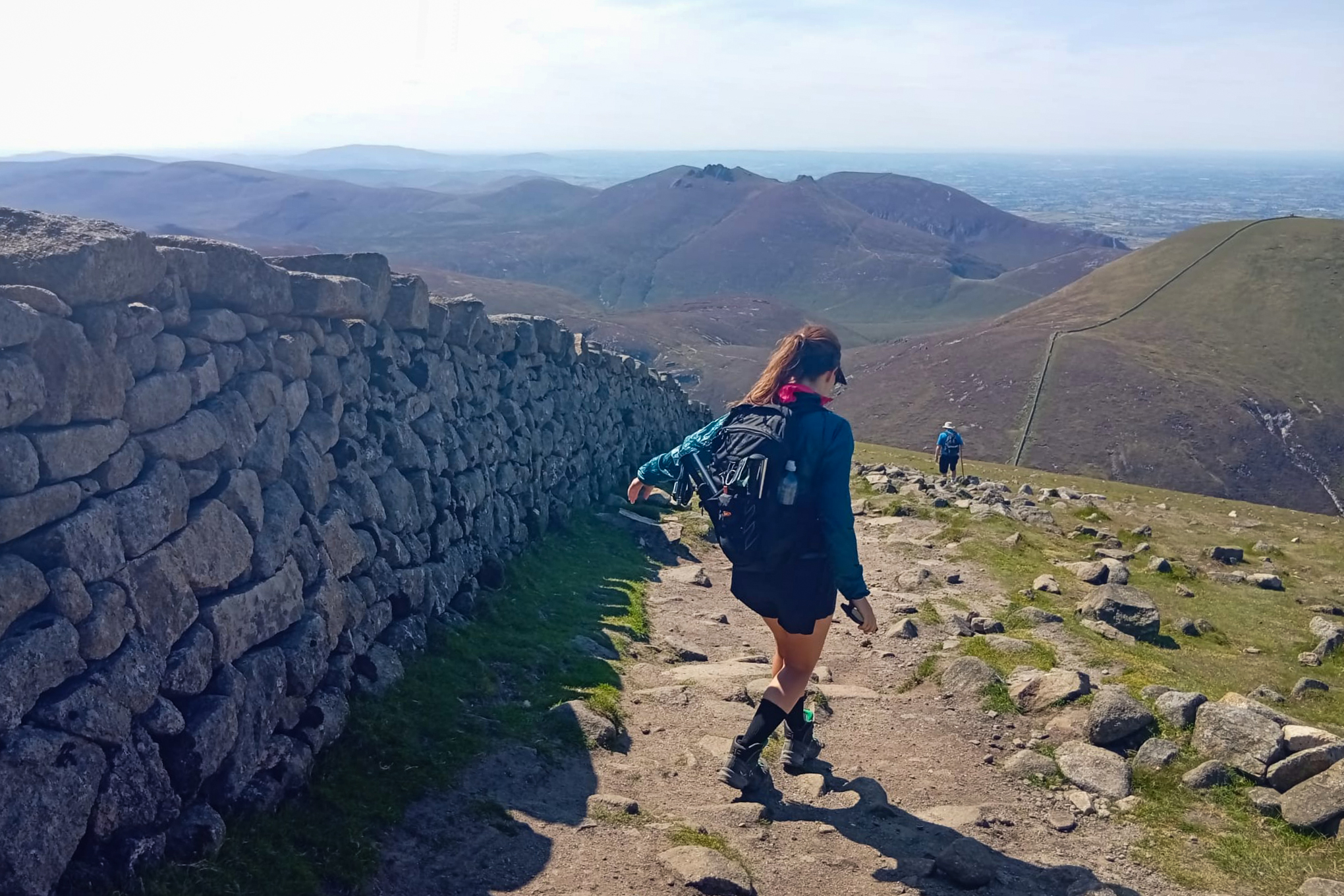
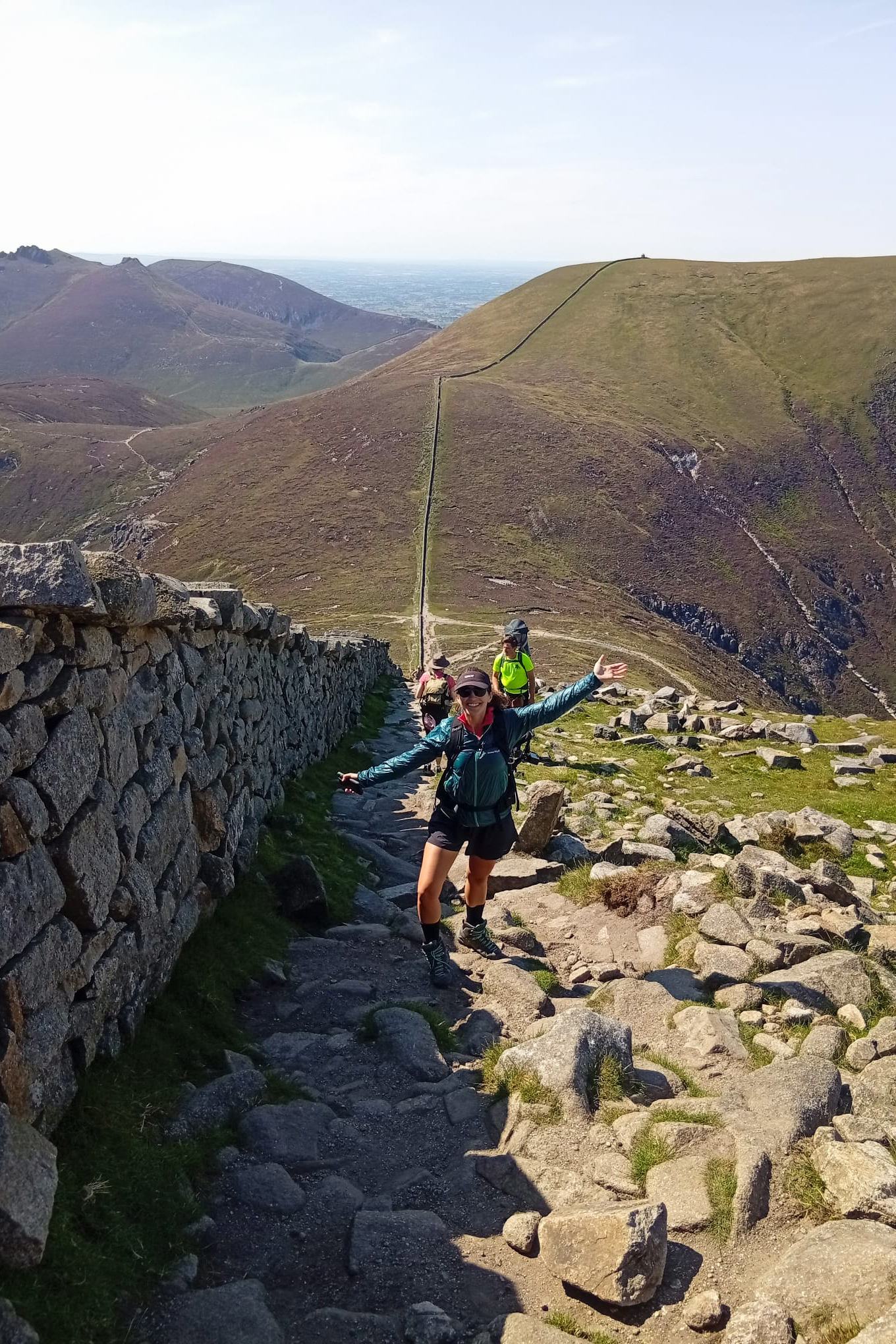
This marks the start of when the trail joins up to follow the Mourne Wall for the rest of the way.
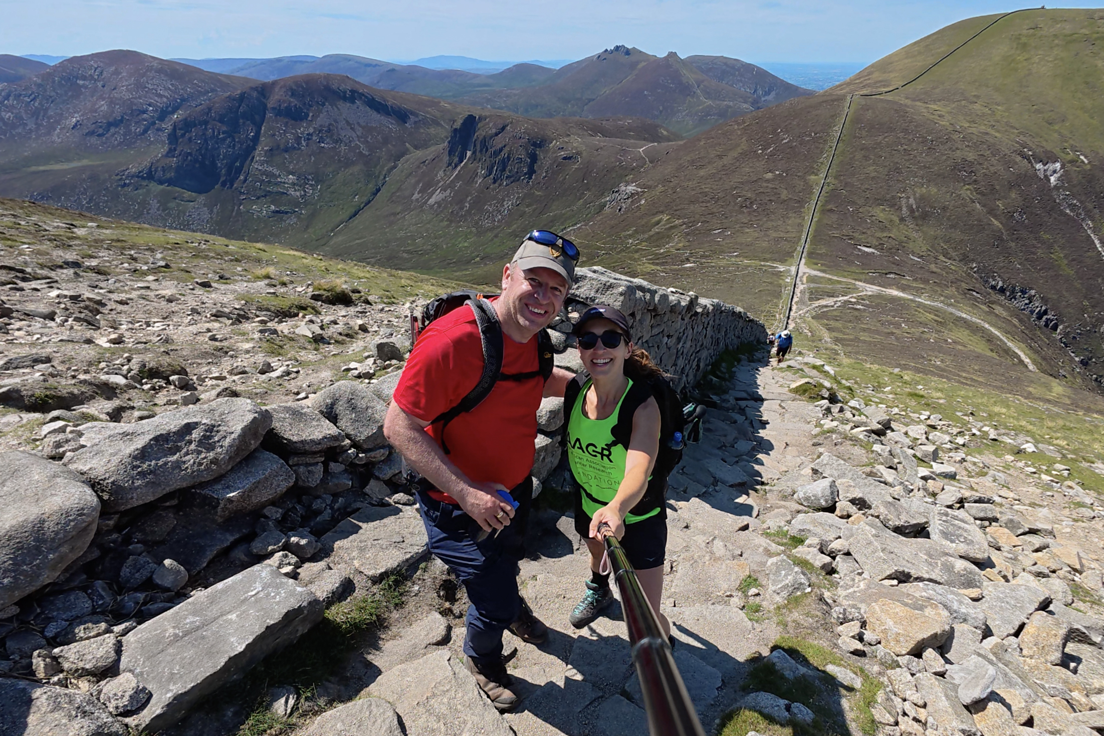
The Mourne Wall is 22 miles long and was built from 1904 to 1922. It passes over 15 of the highest mountains around Newcastle and was intended to prevent animals from contaminating the water supply. If you have time, you can actually walk this whole wall! It would definitely make for an interesting point-to-point, tackling this peak along the way, if you can swing the logistics.
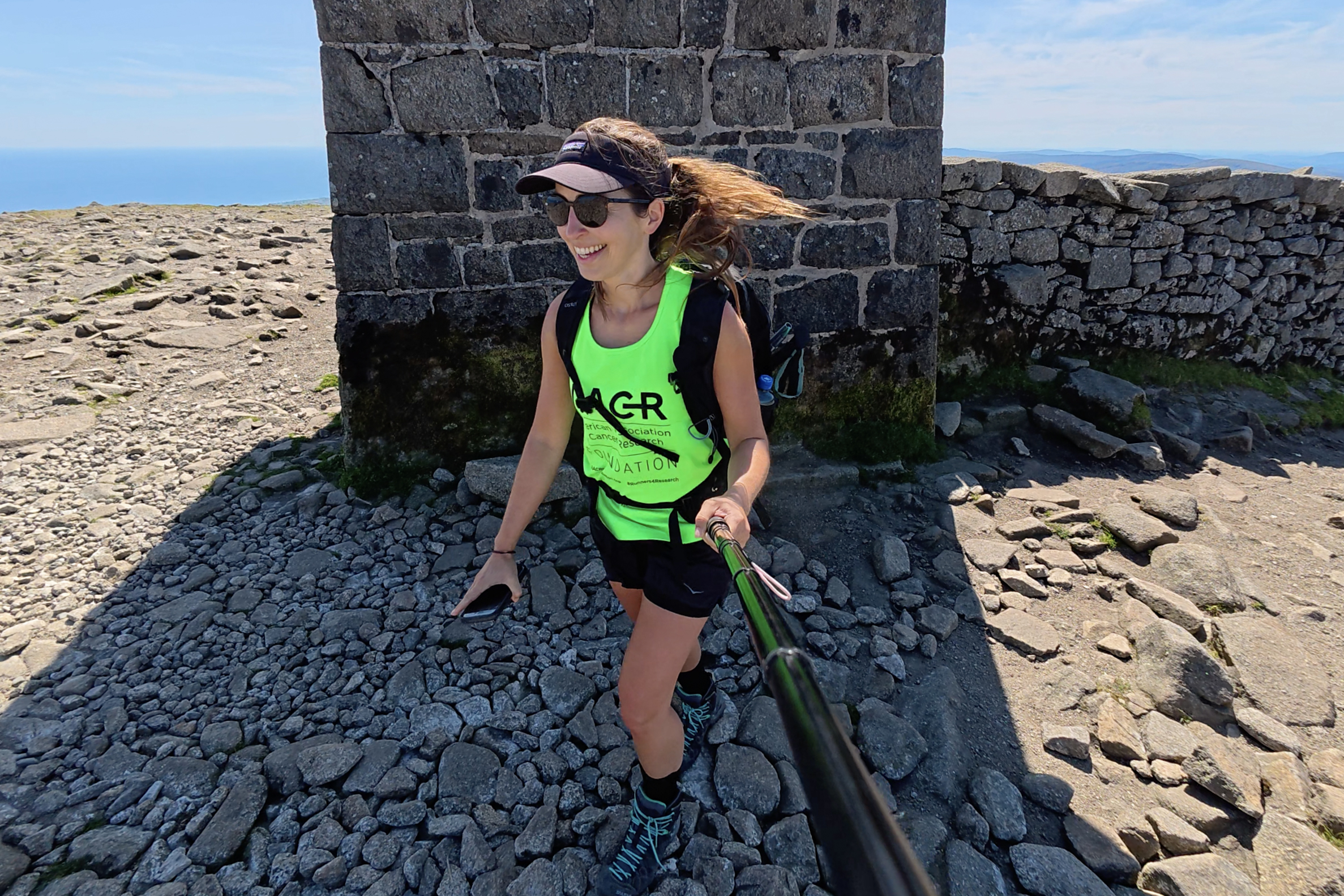
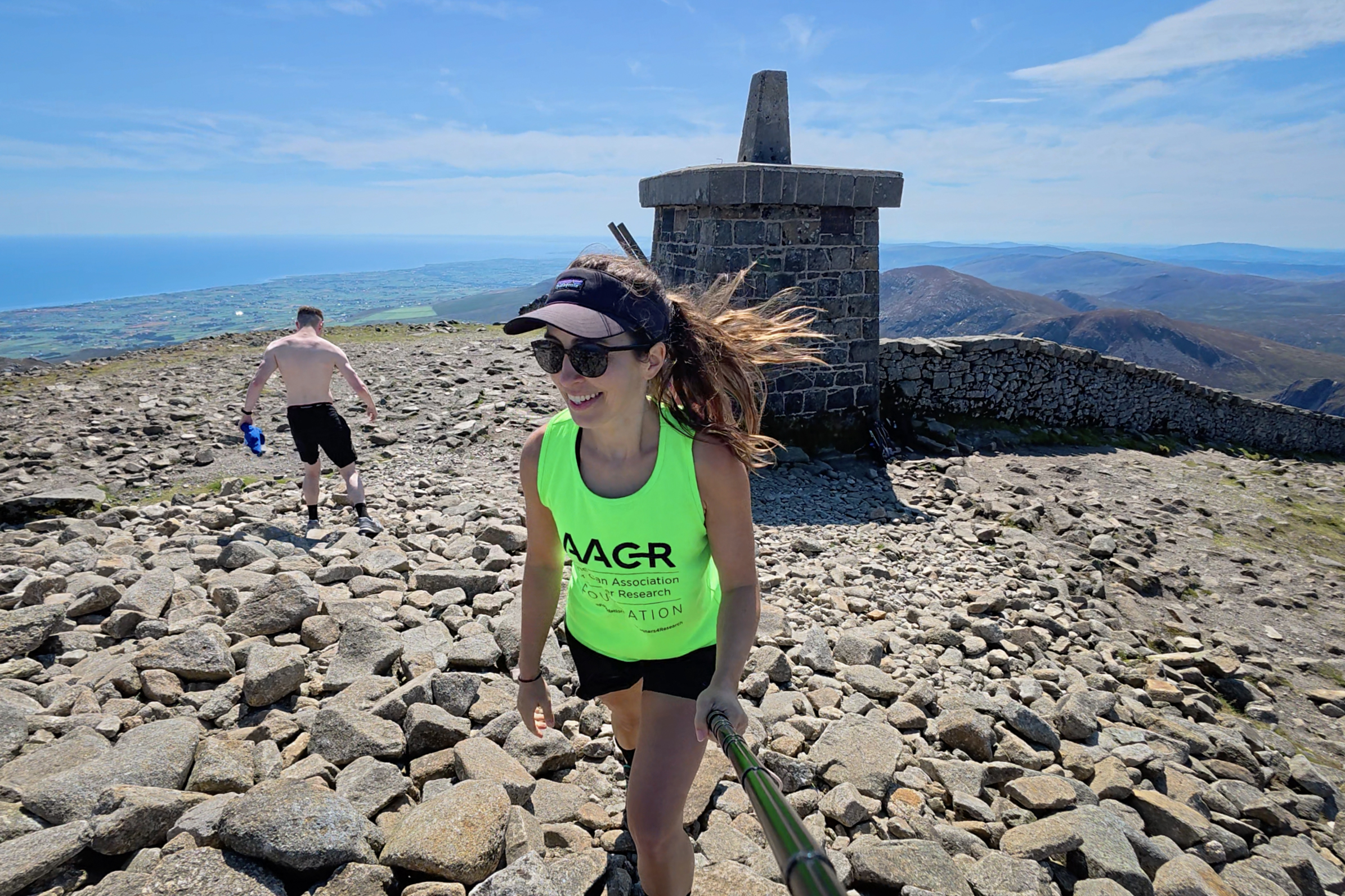
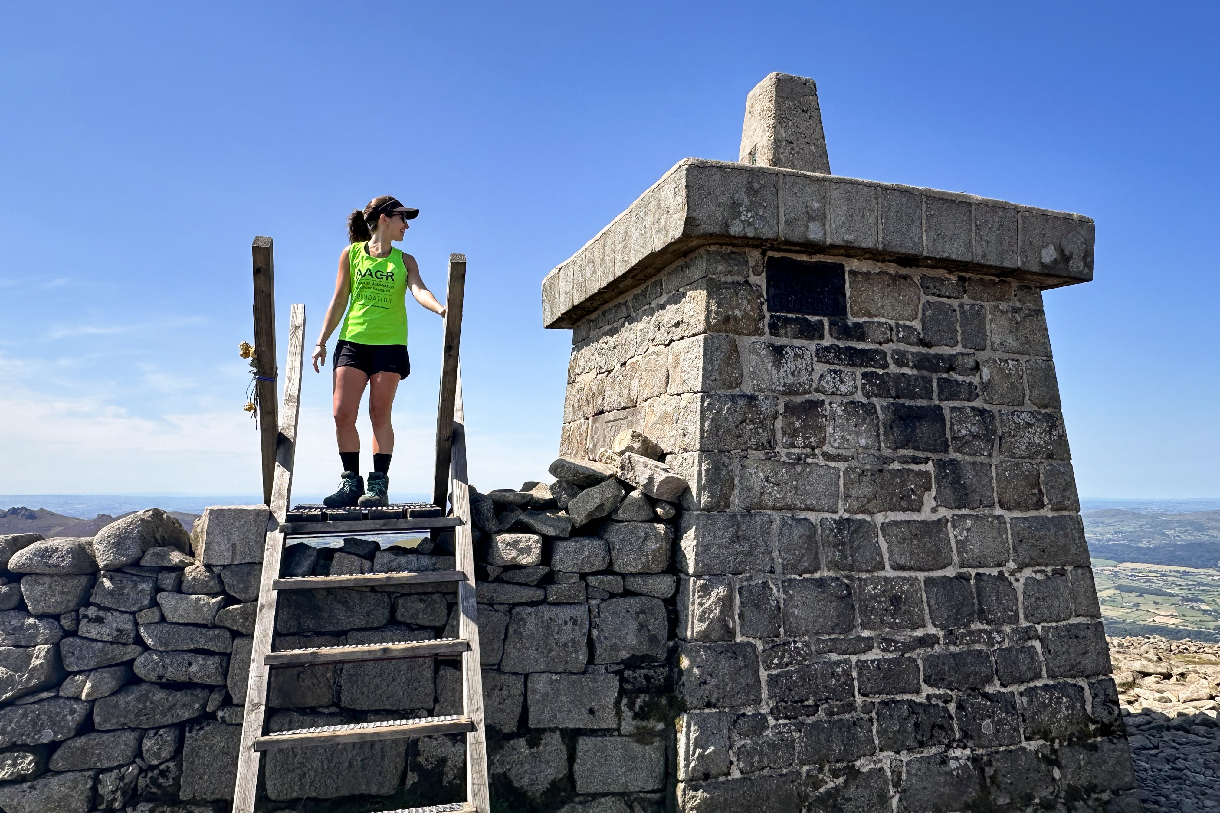
Within 2 hours, we were already on the summit. It was as beautiful a day as with Carrauntoohil, yet there were the strongest winds of any hike to this point. To see just how strong…this is best captured on video (in the Instagram highlights).
At the summit, we ran into a group of hikers also there for a fundraising + hiking challenge. I just went to have a look at their page, 32 Alternative Highs for Haiti, and it looks like they’ve just reached their goal of €3,200 3 weeks ago! They were on a mission to reach the highest point of the 32 counties in Ireland, with funds raised going toward disability assistance in Haiti.
After around a half hour on the summit, including a traditional summit snack break, we started the descent.
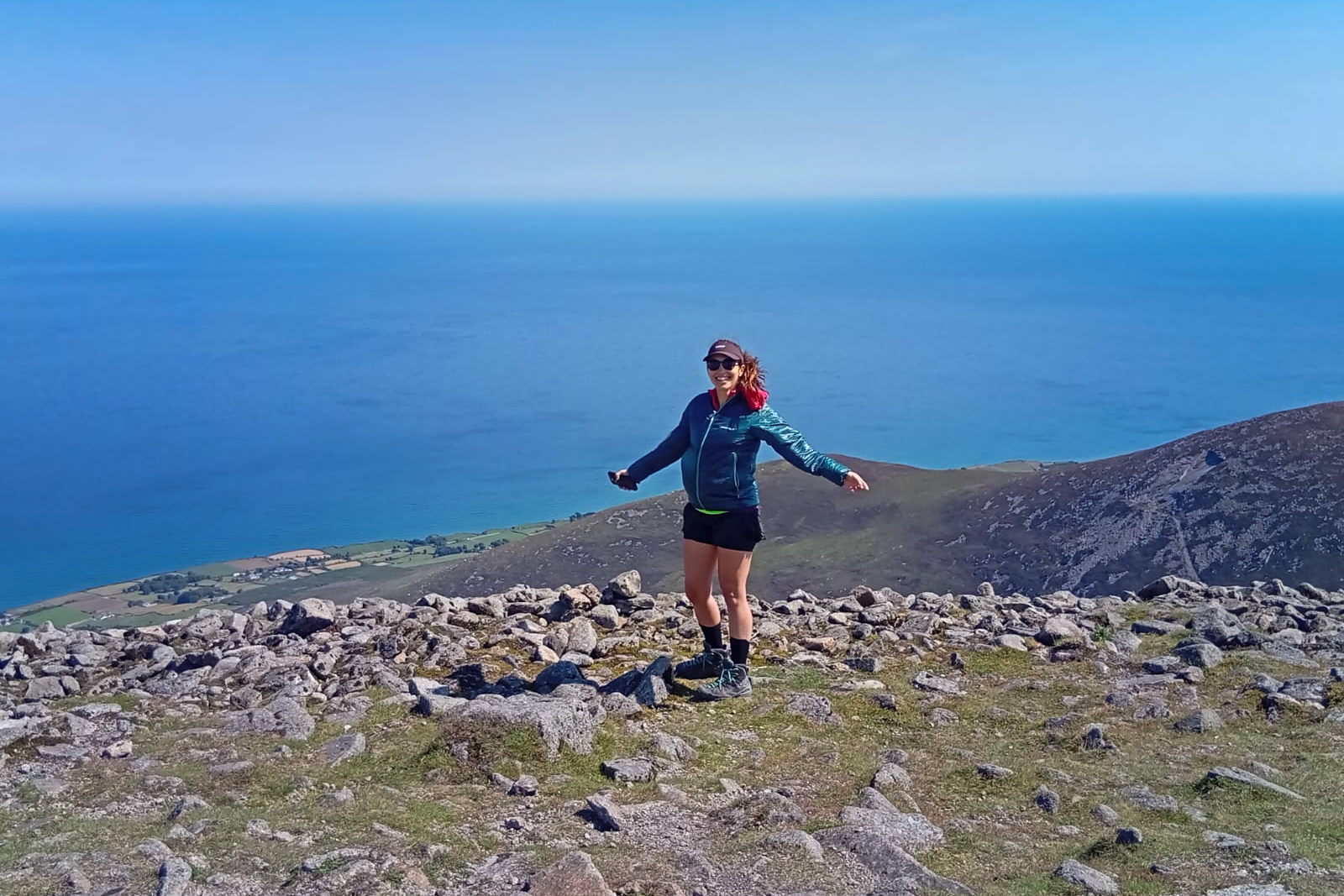
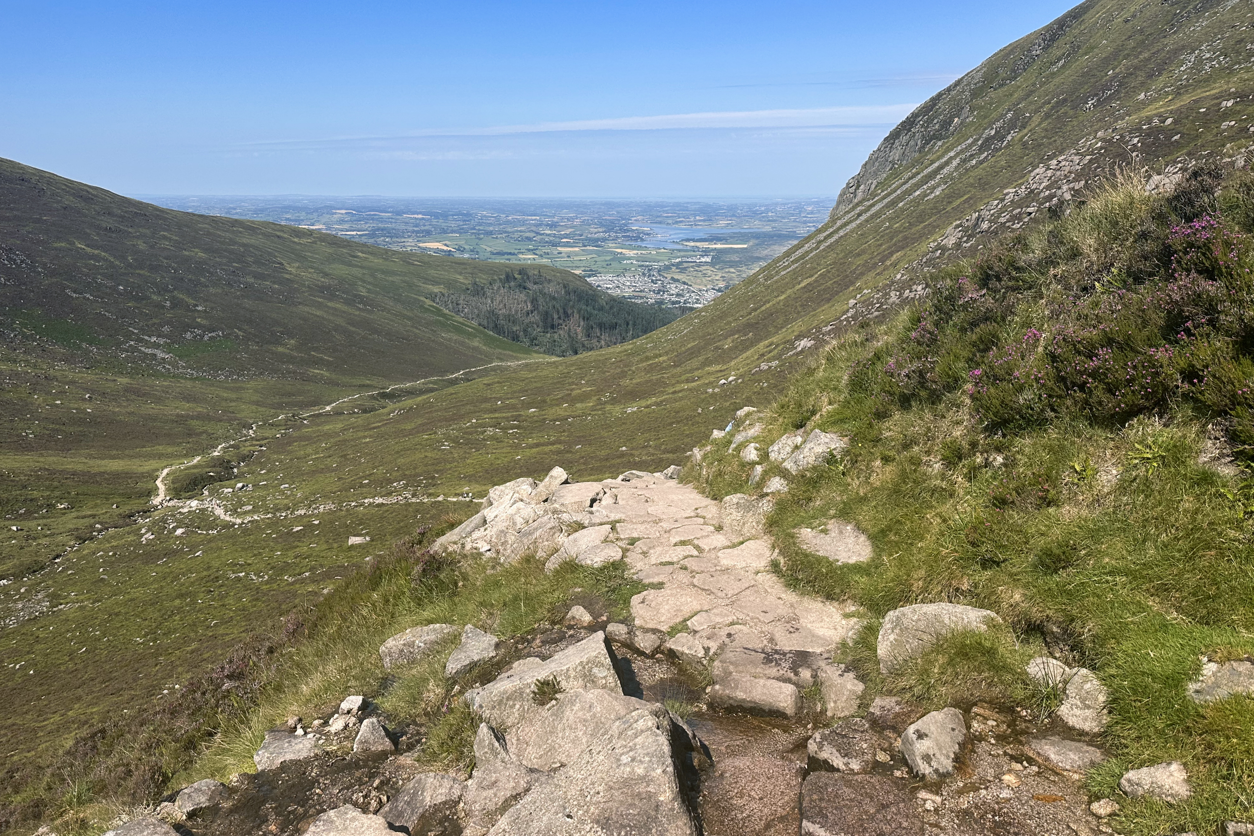
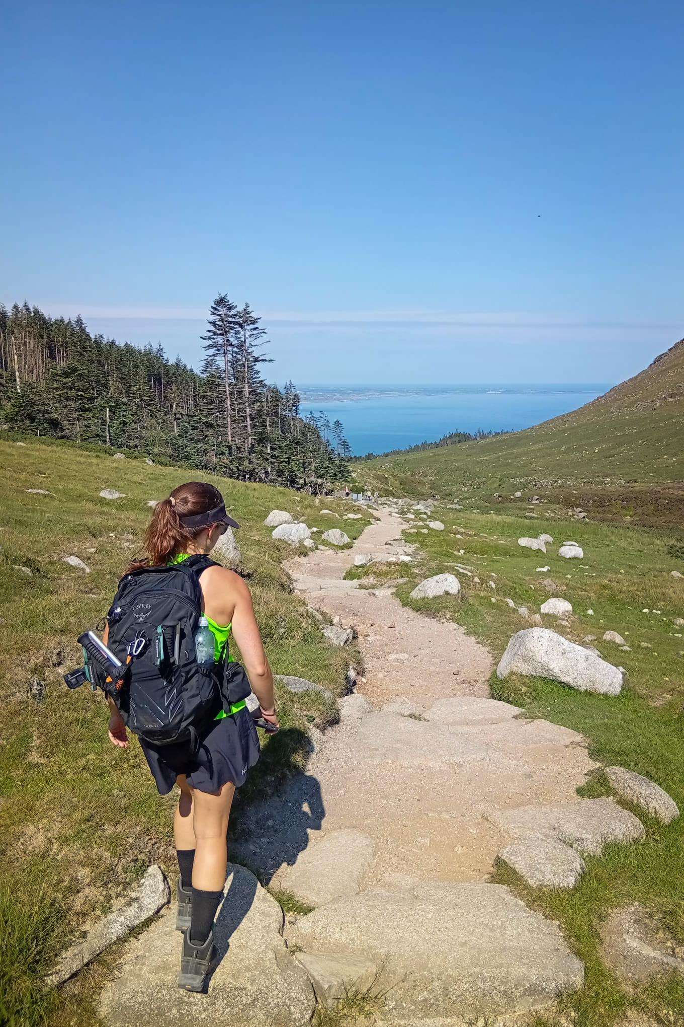
The way down is even nicer, not just because it’s less strenuous, but because the views are just sprawled out in front of you the whole way!
Aaaand some non-selfie photos – thanks Brendan!!
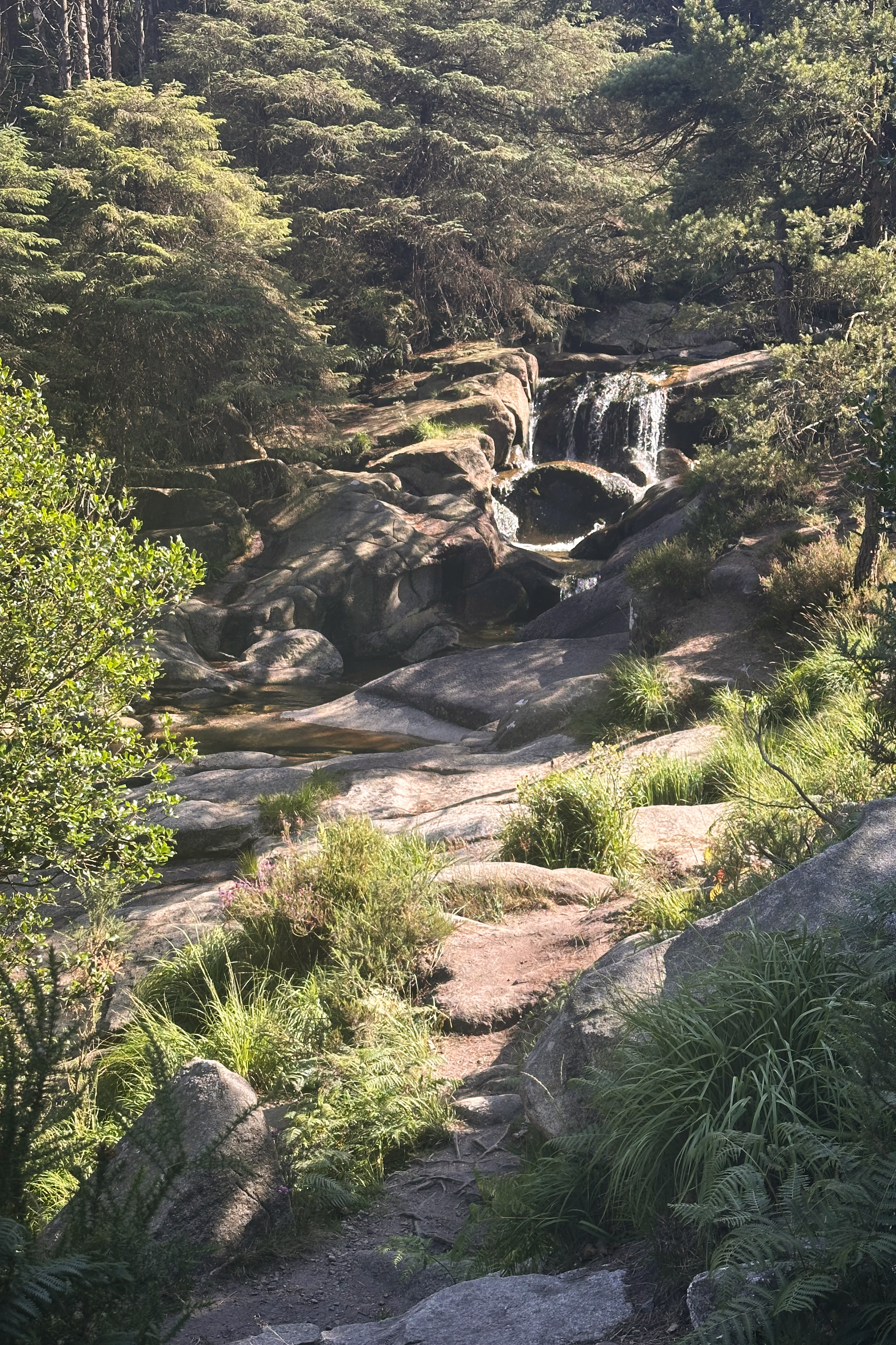
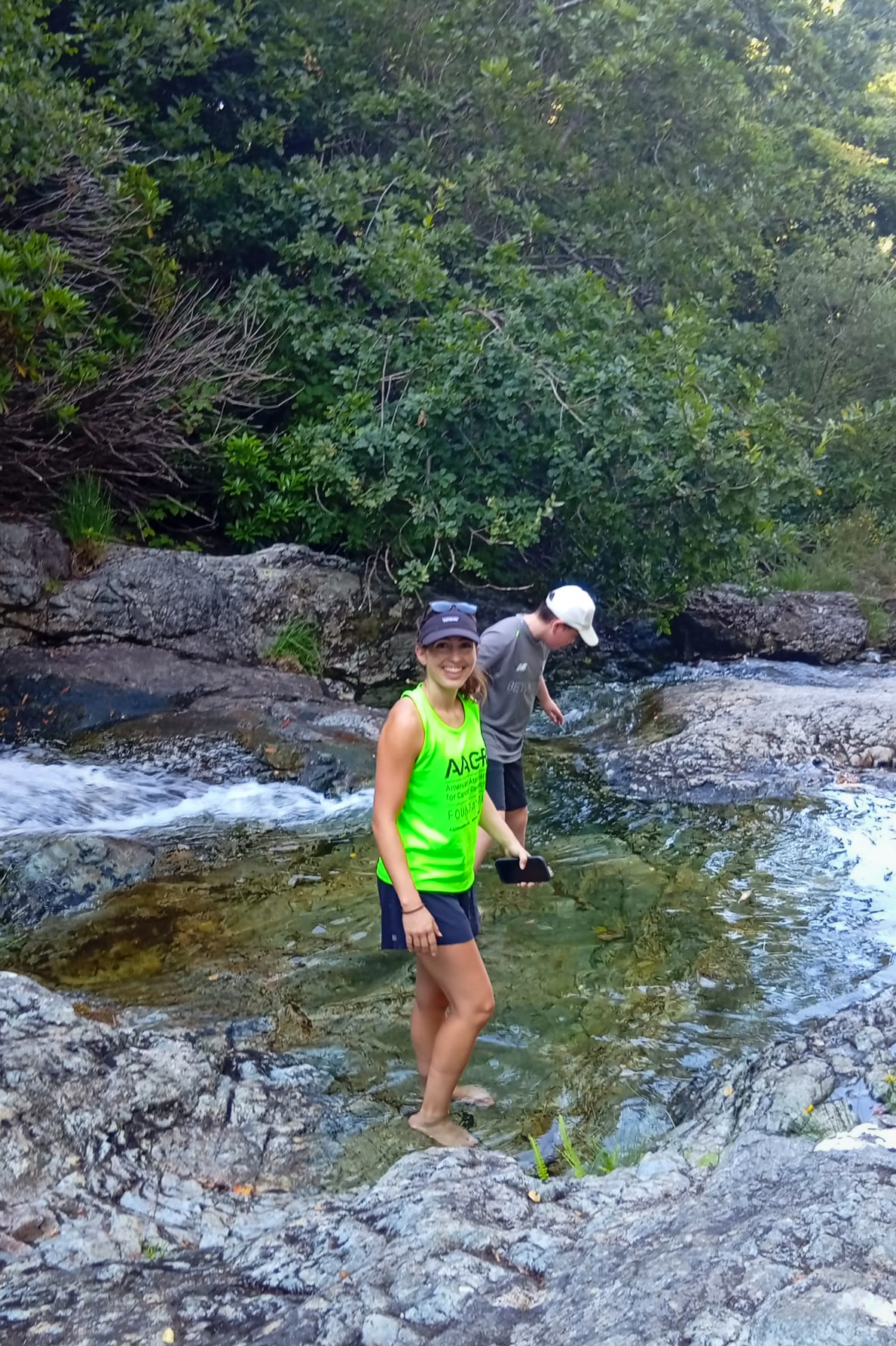
It took about the same time as the ascent, largely because I wanted to stop to ice my Achilles in the stream we’d seen on the way up.
With 2/2 weekend hiking goals completed, we celebrated with a dinner at the pub in the parking lot, which turned out to be a pretty nice spot (and huge!). Then, it was onward to the Dublin ferry for me (and back west for Brendan), which departed at 10:35pm and arrived back to Wales at 2am. It was thankfully on time, and I was somehow still feeling alert. It was too late to drive back into that campsite, so I decided to complete as much of the 5-hour drive back to London as possible, planning to stop into a hotel or taking naps if needed. Somehow, I was able to make it back in one go, without hotels or naps, just fueled by some Twirls (chocolates). No coffee needed…probably because I was in too much shock about the lack of traffic on British motorways.
And so, after 3 changes in distance units that day (miles <> kilometers) and over 10 hours of total driving, I slept until the afternoon and successfully destroyed my sleep schedule for the week (or just got myself onto the NYC time zone of most of my work colleagues, depending how you look at it). This was only a taste of Northern Ireland, so I hope to return to explore it more properly. It’s not too far away! (:
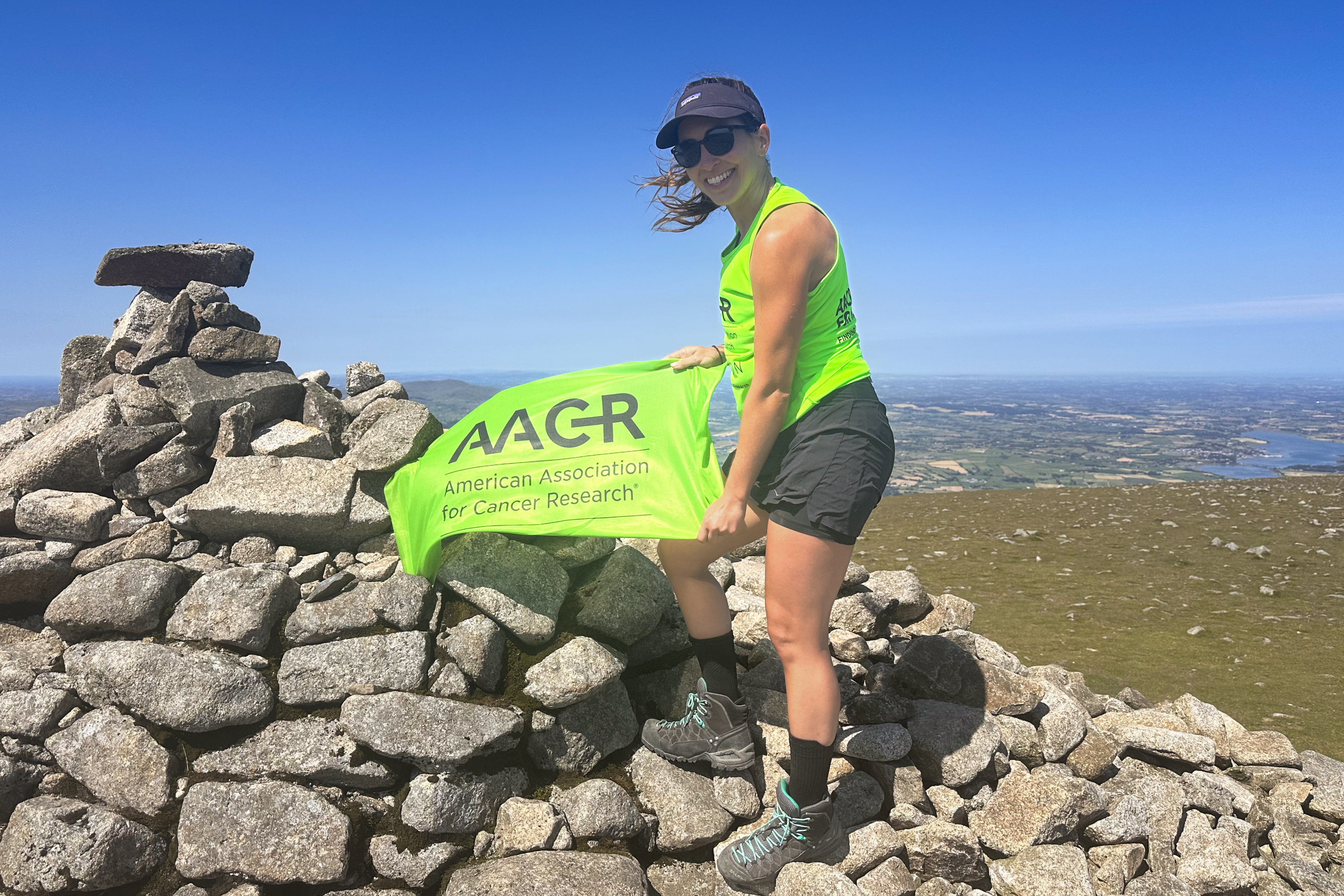
As Carrauntoohil was dedicated to my aunt Alison’s sister, Jen, this sister peak is dedicated to Alison herself, a breast cancer survivor. Breast Cancer Awareness Month (October) may have ended 2 weeks ago, but early detection is key year-round. Ladies, check for lumps and keep up with imaging!! 1 in 8 women in the US will be diagnosed in their lifetime. Take a look at my Instagram highlights for Northern Ireland, where I repost some resources and perspectives from stage 0 through 4. This is one area where research has REALLY made an impact and continues to!
THANK YOU ❤
Thanks for reading my sixteenth Crown of Cureope blog post! At the time I stood on the top of Northern Ireland, we had raised $1,620 for the American Association for Cancer Research to fund lifesaving discoveries. As of publishing this post, we are at $1,710 raised of our $2,500 2025 target. There’s still a bit further to go to hit this year’s goal – any donations are appreciated!!

Leave a comment