
Book-A-Rest in Bucharest, Part 1
Bucharest, or București, is the capital of Romania and marked the start of a one-way trip covering the Romanian and Moldovan high points. To add to the confusion, Moldoveanu is the highest point of Romania (not Moldova), and the capital of Moldova (Chișinău) looks a lot like a city on the other side of Romania, near the Hungarian border (Chișineu-Criș). Their population counts each start with 72, but one has 2 zeroes, and the other adds 2 more. There are overnight trains to both of these destinations, so be careful…more on that in the Moldova blog post. (:
I arrived on a Saturday, the first day of my 1-month “sabbatical” (Europeans might not call it this). It was pretty late, so my first introduction to the city was just the cab window views (including of the Arcul de Triumf) and a stuffed potato spot called Copt de Fericire. Then, it was time for another cab to the hotel. Bucharest is pretty small and walkable, but the Zugspitze wet-shoe-running-through-the-storm kicked off a problem that required surgery just days before this trip. I was still in recovery, not even sure if the hike would happen on Monday and minimizing walking to give it the best chance. That said, Bolt operates there, and rides are very cheap!
On Saturday, there was time for a bit of sightseeing before picking up a car in the evening. It was 40+ degrees that day (Celsius)…so, wounded toe or not, the motivation to cover a lot of ground was low. The first stop was the Palatul Parlamentului, or “Palace of Parliament”. My overheated and dehydrated brain took zero photos, so a video of it is in the Instagram highlights! The visit didn’t go past the lobby, as there were no available tours. At least it was air conditioned and had free restrooms, plus a free art exhibit!
I didn’t learn until later that I’d just seen the heaviest building in the world, weighing 4.1 million tons. The Great Pyramid of Giza is estimated to be around 6 million tons but isn’t considered a habitable building. Otherwise, nothing else really comes close. Apparently, there’s a long and controversial story behind this involving a large earthquake and rebuild of the city (even parts not damaged by the disaster). I won’t go into it here, but it’s an interesting piece of history (if you can call four decades ago history…it’s not exactly the oldest landmark in Bucharest!).
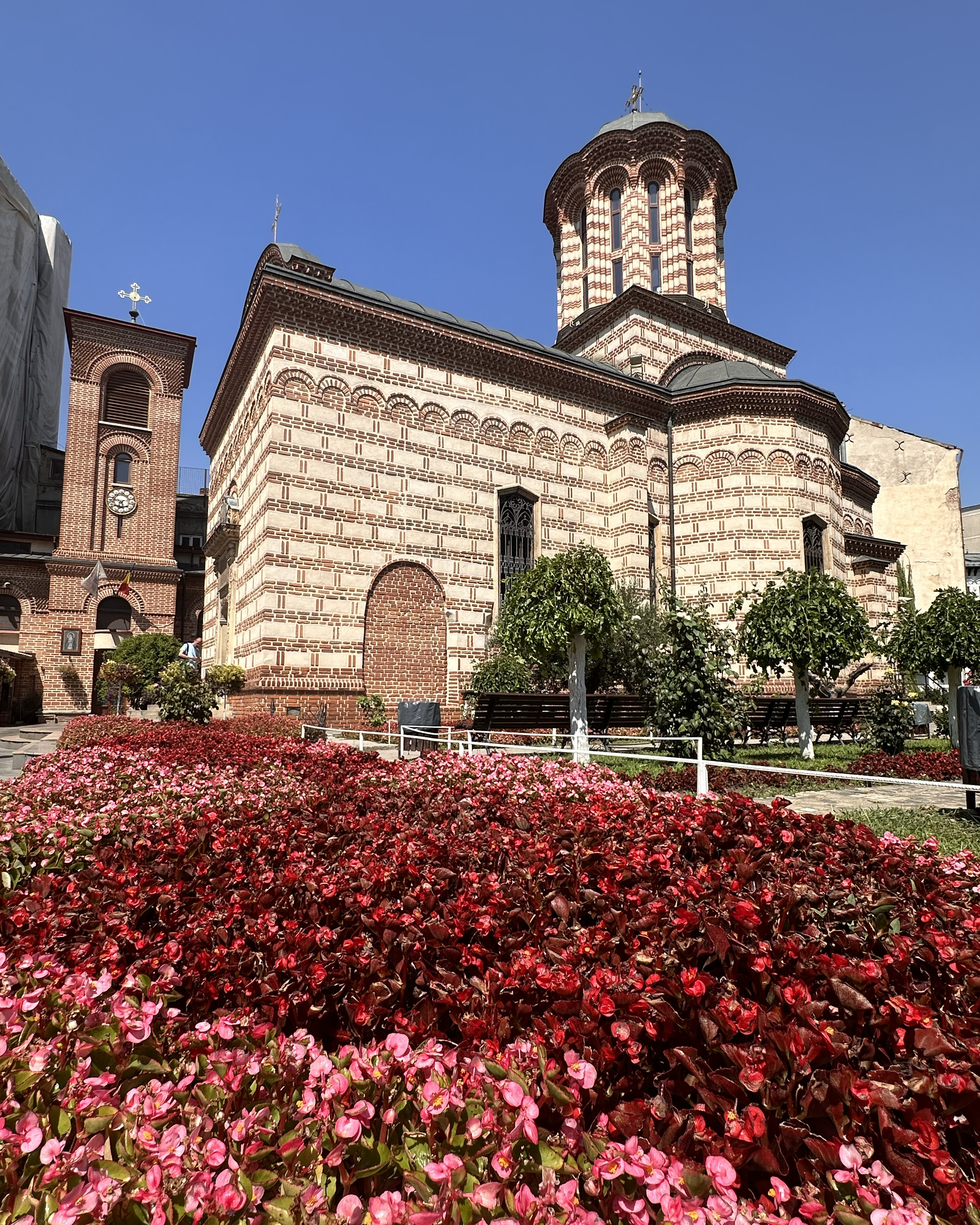
Next, it was just a kilometer over to the Church of Stavropoleos Monastery, a place with centuries, rather than decades, of history.
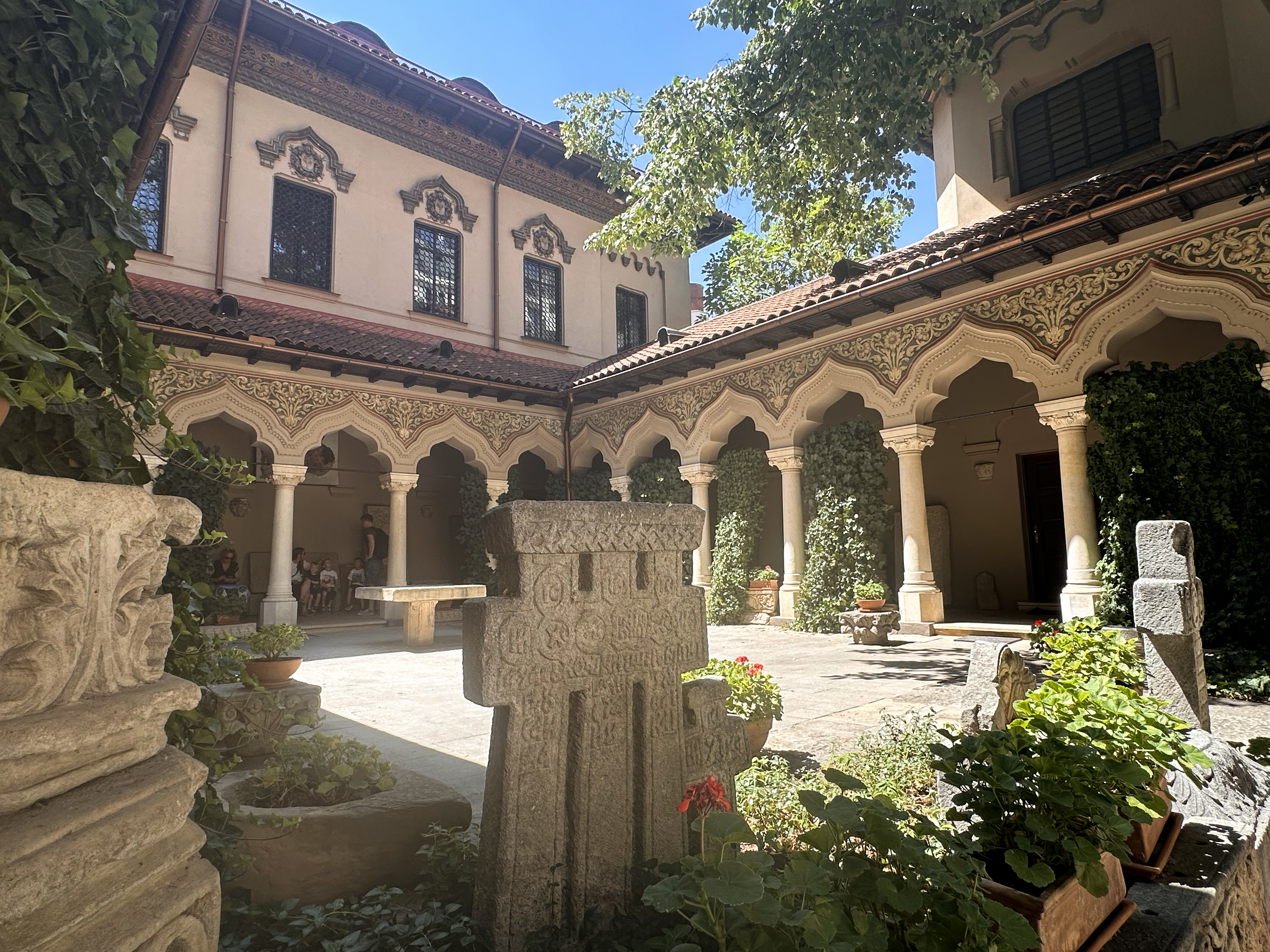
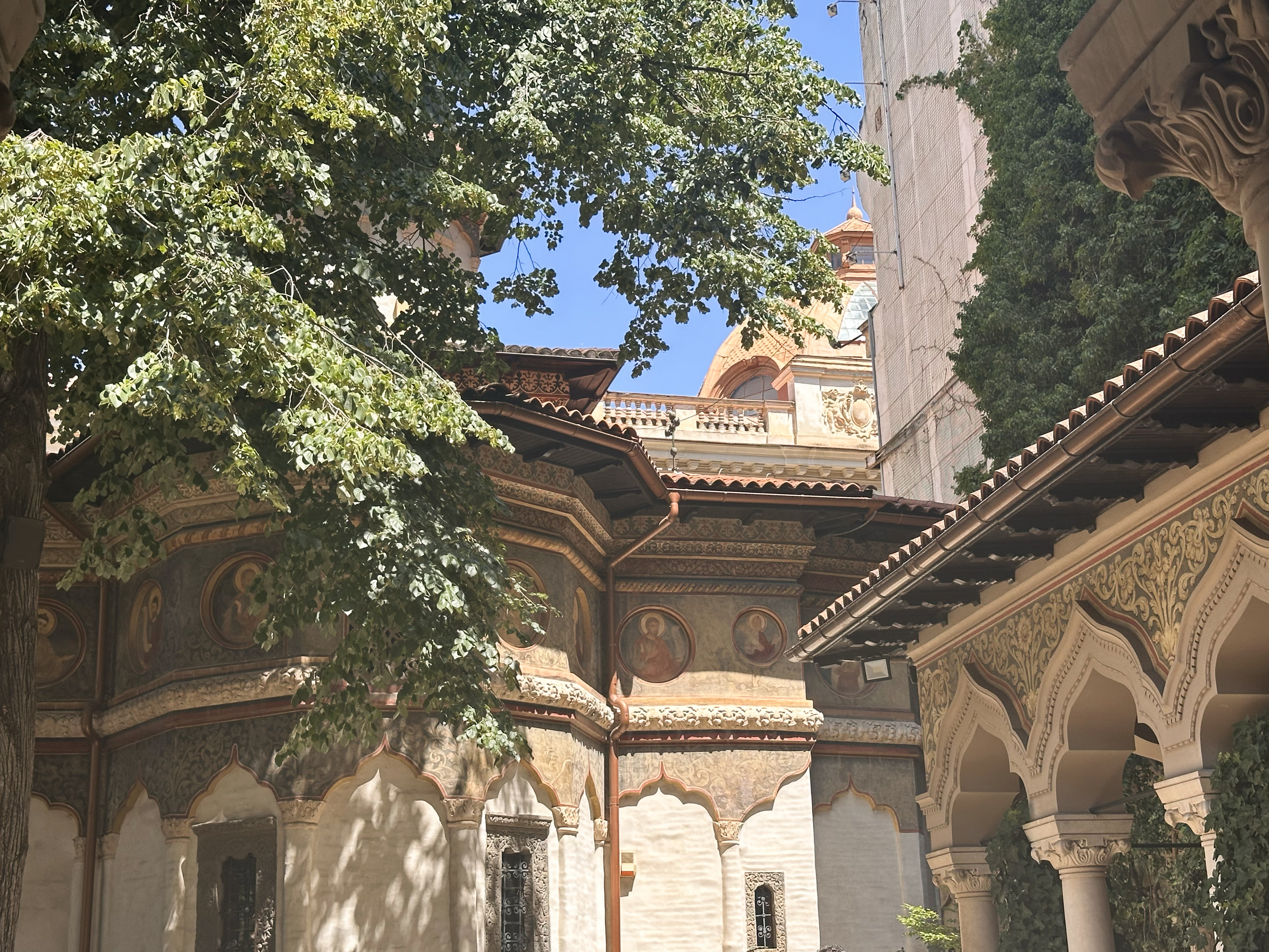
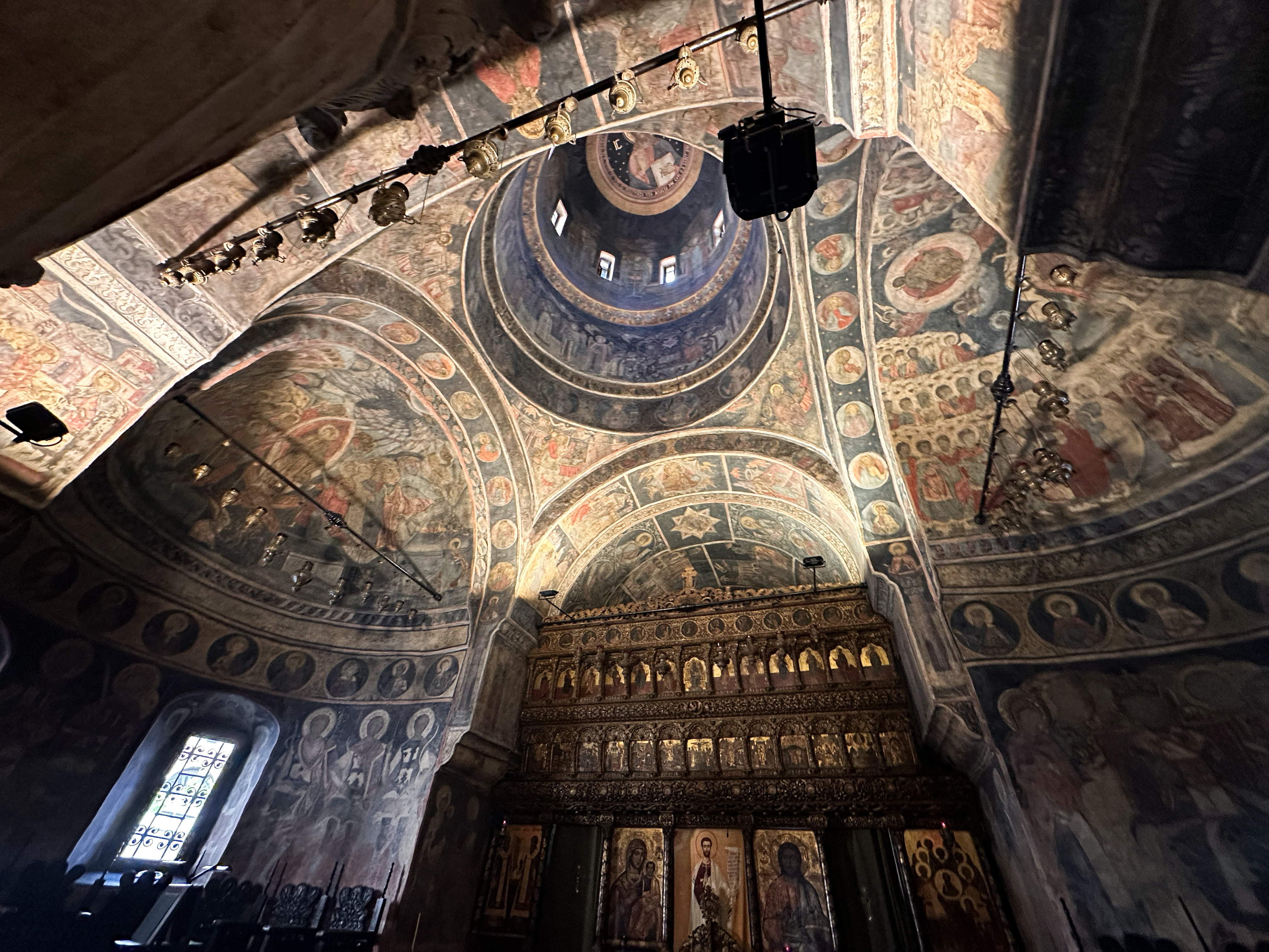
This church was built in 1724, and it’s free to visit both the chapel and grounds. It’s not too large and didn’t take much time to explore, but the architecture is pretty intricate. There are stone carvings and stuccowork, and there’s more history than is evident just from walking around (it’s not a museum with many information panels or anything). Apparently, it used to also be an inn, which covered the church’s expenses. In the late 1800s, an earthquake collapsed the dome, and the original inn and monastery were demolished. The church was spared, and the monastery portion was later rebuilt and the site preserved.
A few other stops are shown in the Instagram highlights, since the hot weather didn’t inspire more than a few quick videos. The first was Bob George coffee bar, one that claimed in its window to be the “only Romanian Roastery in Top 100 Worldwide Roasteries 2024”. It was pretty empty inside, with just 4.3 stars out of 5 on Google, but I liked it! (: Next was a quick stop inside the Cărturești Carusel bookstore, known for its architecture and top-floor teahouse. It was nice and worth a visit, but it has more of a tourist attraction vibe than a quiet, cozy bookshop. For food, a nice spot also with unique decor is called Aubergine. The most memorable part was probably the air conditioning, which says something about the weather…because the food was great.
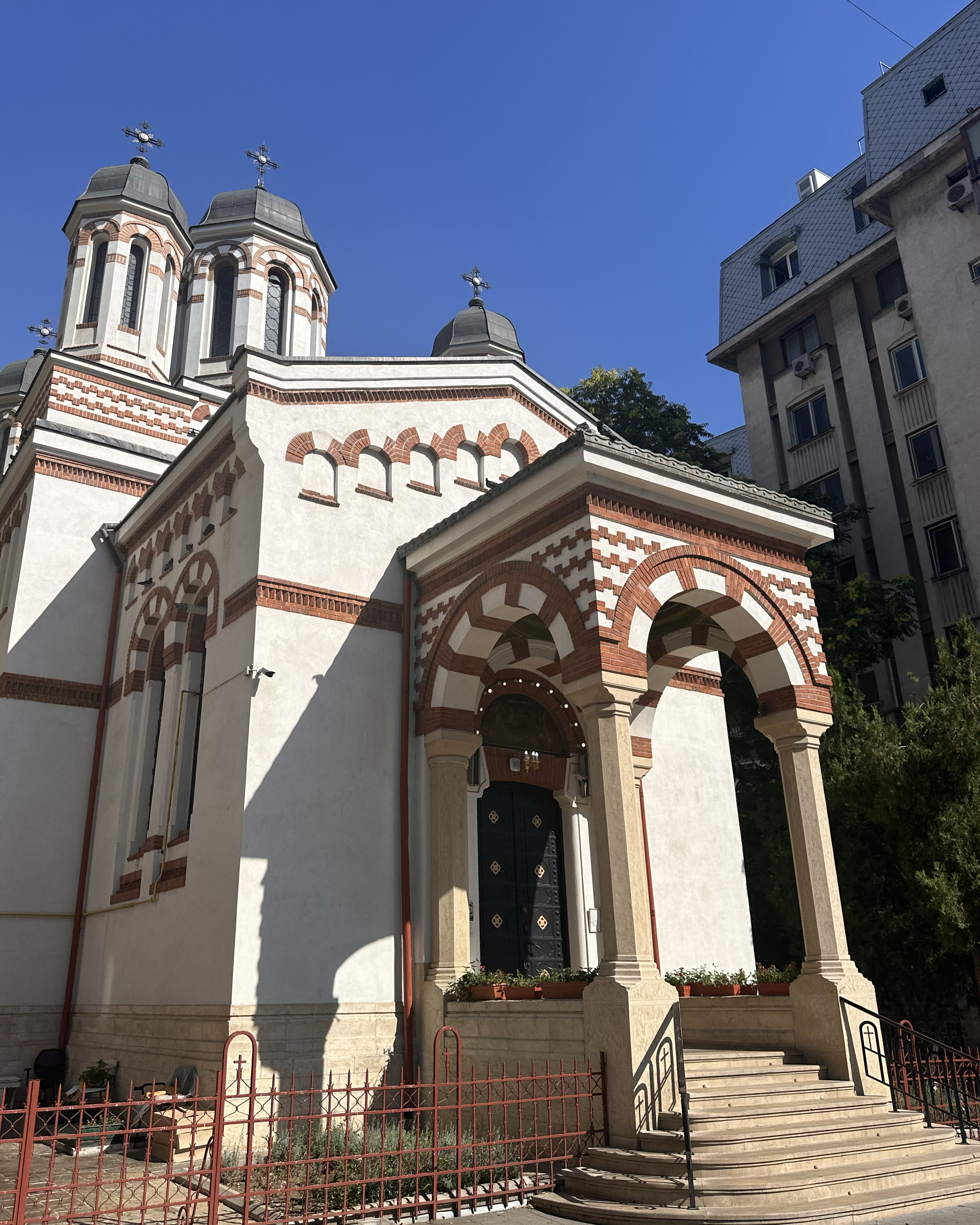
A few more stops included St. Anthony’s Church and Zlǎtari Church. St. Anthony’s is considered the oldest surviving church in Bucharest, while Zlǎtari Church is known for something a bit more eclectic: housing the right arm of St. Cyprian the Mage (third-century patron saint of necromancers, witches, and sorcerers). If you need a spell or curse lifted, apparently touching that arm will do the trick.
At 5pm, it was time to pick up the rental car and leave the traffic-ridden, partially closed streets of Bucharest behind (JLo concert), as well as the oppressive heat. It was a ~2.5-hour drive to the hotel in Nucșoara, which was the closest possible spot to stay before the “fun” part…a drive of somewhere between 1 and 2 hours (depending on the driver, risk tolerance with a rental car, up- vs. downhill, and possibly the lighting) on barely a road.
Even the drive to Nucșoara was interesting, to say the least. It started off with 1.5 hours of city traffic and open highway, before turning to more local roads through villages. Some observations: the villages did not appear to have starts nor ends, homes seemed to follow an equivalent style to the Magic Gardens in Philadelphia (i.e. use whatever you have), and villagers seemed to spend this pleasant Sunday evening perched on ledges along the road, chatting in the presence of cows or just strolling down the middle of the road. Between the chaotic drivers of Bucharest and chaotic pedestrians near the Făgăraș Mountains, I’m not sure which required better reflexes, Romania or the water bottle interception (mid-climb on Zugspitze, 3rd Germany highlight).
Leading up to this next part of the trip, there were 2 uncertainties: 1) would I be able to hike at all with the toe situation and 2) would the weather hold? The weather part was of particular concern after the chaos in Germany the previous week. For this trip, I was traveling with Sven, whom I’d met in Slovenia while he was on a backpacking trip around the world. It turned out that he’d be heading to Romania at the start of my work sabbatical…and you’ll see in the next section some of the many reasons why I don’t recommend doing this hiking route alone. He introduced me to a weather app called Windy, which allows you to compare different weather models, some of which are better for certain forecast components (wind, precipitation, storms, etc.) than others. After using it many times now, I can say it’s one of the most useful tools out there to be safe in the mountains. According to this app, there was some chance of storms starting in the early afternoon on our intended hiking day (Monday), increasing in likelihood later on.
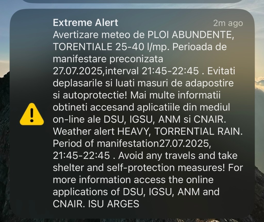
To decide on a start time, we had to consider not only the hike duration, but also the drive on the barely-road mentioned above. In stormy conditions, the road can become impassable. Shortly after arriving to the hotel and settling in, the power went out while I was showering, then the skies seemed to open outside. Our phones blasted the alert shown here. This didn’t bode well for road conditions, but the app did suggest it wouldn’t continue all night at that level.
At around 10:45pm, we started our attempt to get in 5 hours of sleep before…a 3:45am start. It would leave enough time to get ready and tackle a road neither of us had been on, but @aussiepeakexplorer (completed this peak several times) did suggest that these alerts are common (“you won’t die”), our car would be sufficient, and that we should “have a crack” and head out by 4, start by 5:30, and get back before the heat and maybe storms hit. Worst case, turn around. With the help of earplugs to drown out the thunder and downpour, some sleep was eventually possible.
The Hike
I had heard about two main approaches to this summit: one from Bâlea Lake, and another shorter (but less common) approach from Stâna lui Burnei. The main route from the lake generally involves a stay in Cabana Podragu. I’d heard mixed things about that hut and was short on time, so we opted for the shorter option.
Here is a map of the circular route:
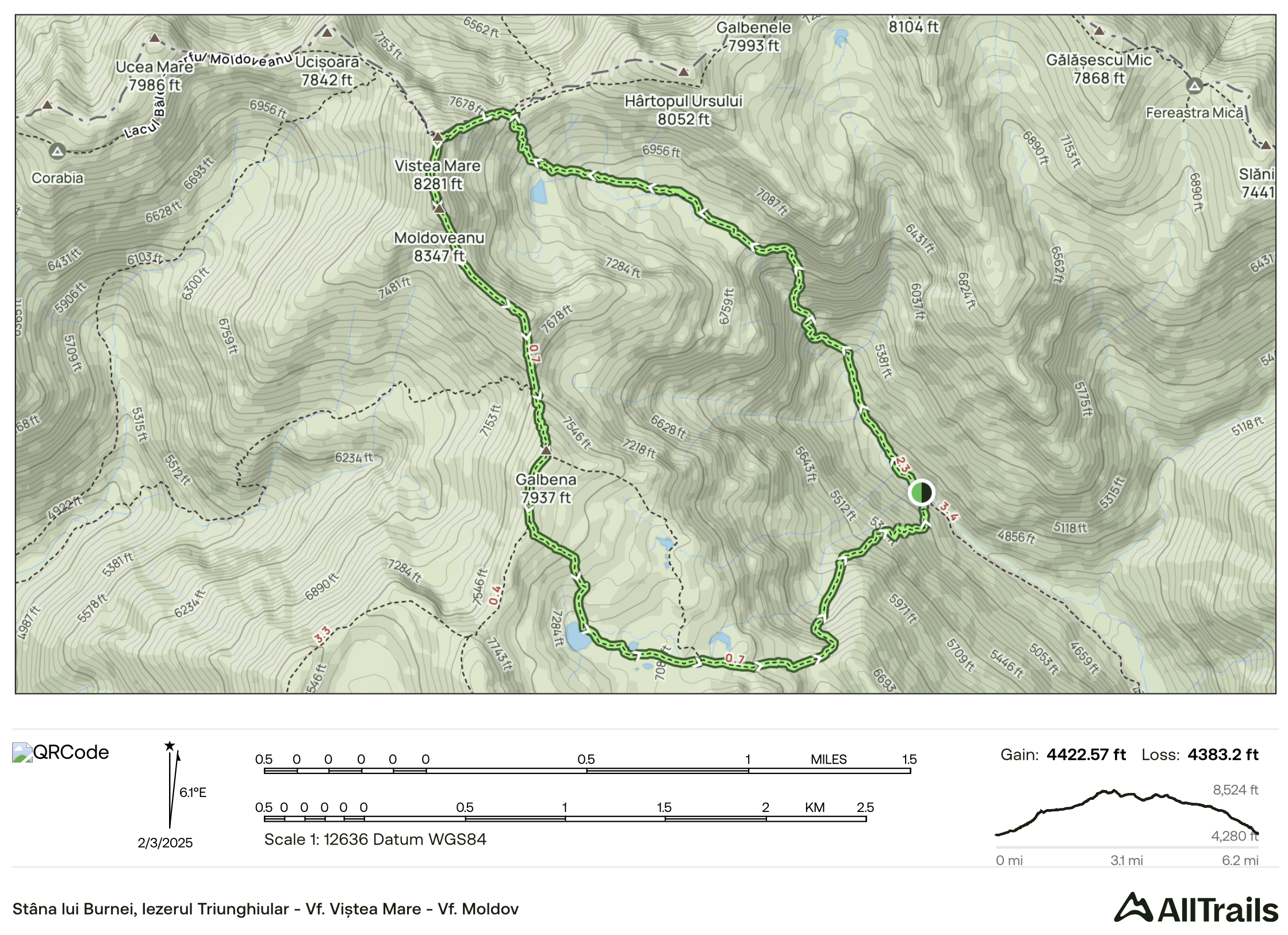
The hike covers nearly 1,350 meters of elevation gain and 10 kilometers. However, as the road has been collapsed for a while, there’s a bit of extra elevation gain and distance (maybe 50 meters up and just around half a kilometer). Note that the ascent is shorter (distance-wise) than the descent in this circular option, but there is also the option to return the same way. It’s not so steep that you need to make the full loop, and this way does add a bit of ascent right after the initial descent from the summit. Still, it’s worth it for the scenery.
So…why don’t more people just take this shorter approach to the summit, rather than a two-day trek from the lake? It has its challenges.
The story resumes with the dreaded 3:45am alarm clock.
We did a final check of the weather…stable enough. We were on the gravel road by 4:20am. Unfortunately, I have zero footage of this drive and can only describe it. The gravel road quickly became a narrow, uneven mess. With the sun not yet up and potholes full of water from the previous night’s storm, each puddle was a bit of a gamble with our Kia Sportage rental (not the worst option, but not high-clearance). Any cell signal dropped off fairly quickly after leaving the hotel, with no signs of life/help anywhere if the car would have had issues. It took 2 hours to travel 35 kilometers. On the way, we came to realize why this region (Transylvania) inspired vampire legends like Dracula. There was low, eerie fog, silence, no living creatures in sight, spooky shacks, and even cages along the side of the road (we came to realize, later, in daylight, that these were for rocks). We saw maybe 3 cars the whole way to the trailhead, and it was not clear what any of them were doing at this hour on a Monday (none went all the way to the hike). All of this combined to create an optimal setting for a horror movie.
At a certain point, the road had collapsed, and it was impossible to drive further. We were warned about this, so we reversed and found a spot to pull off with just a camper van around. We hit the trail just before 7am, after a quick breakfast and getting our things sorted.
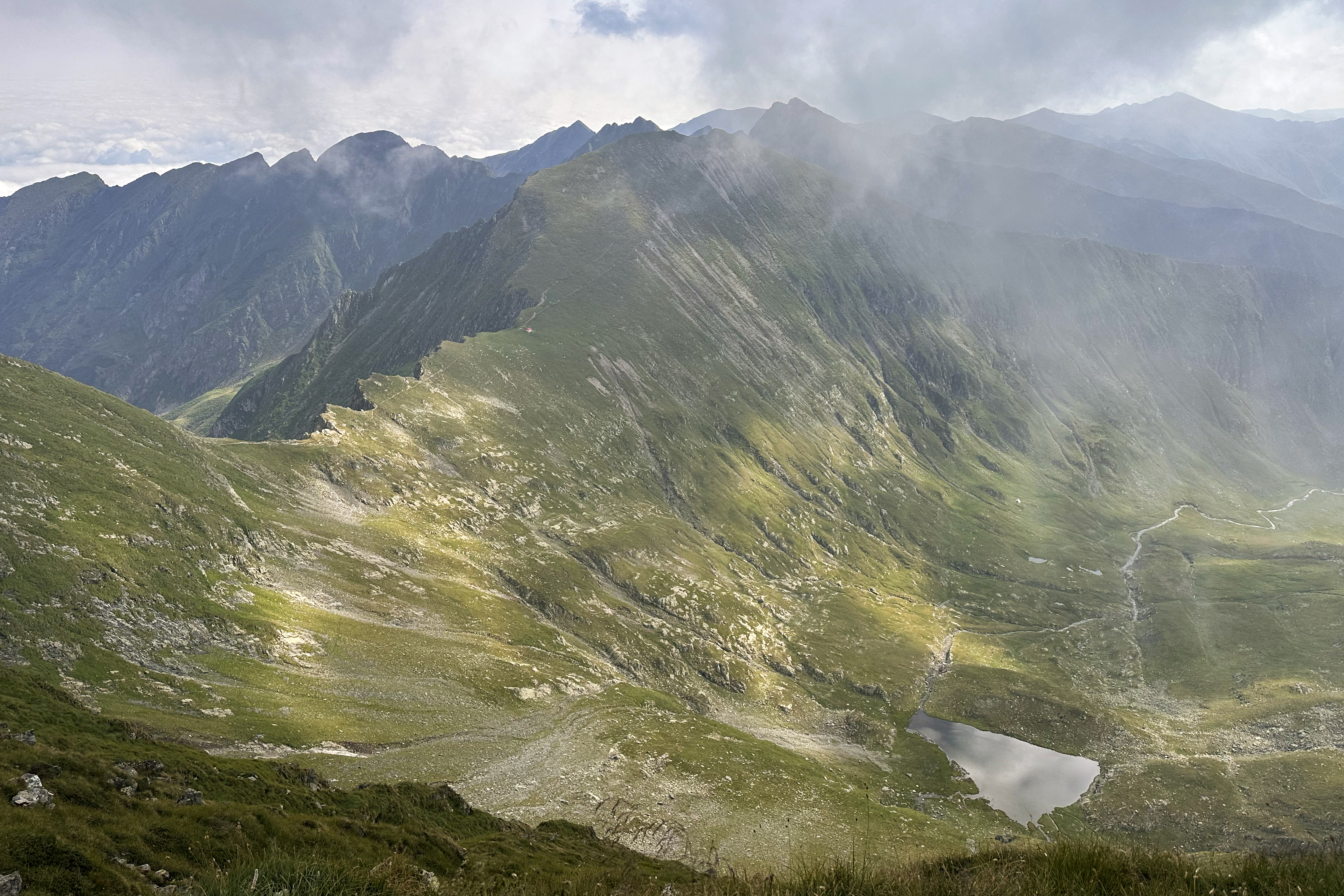
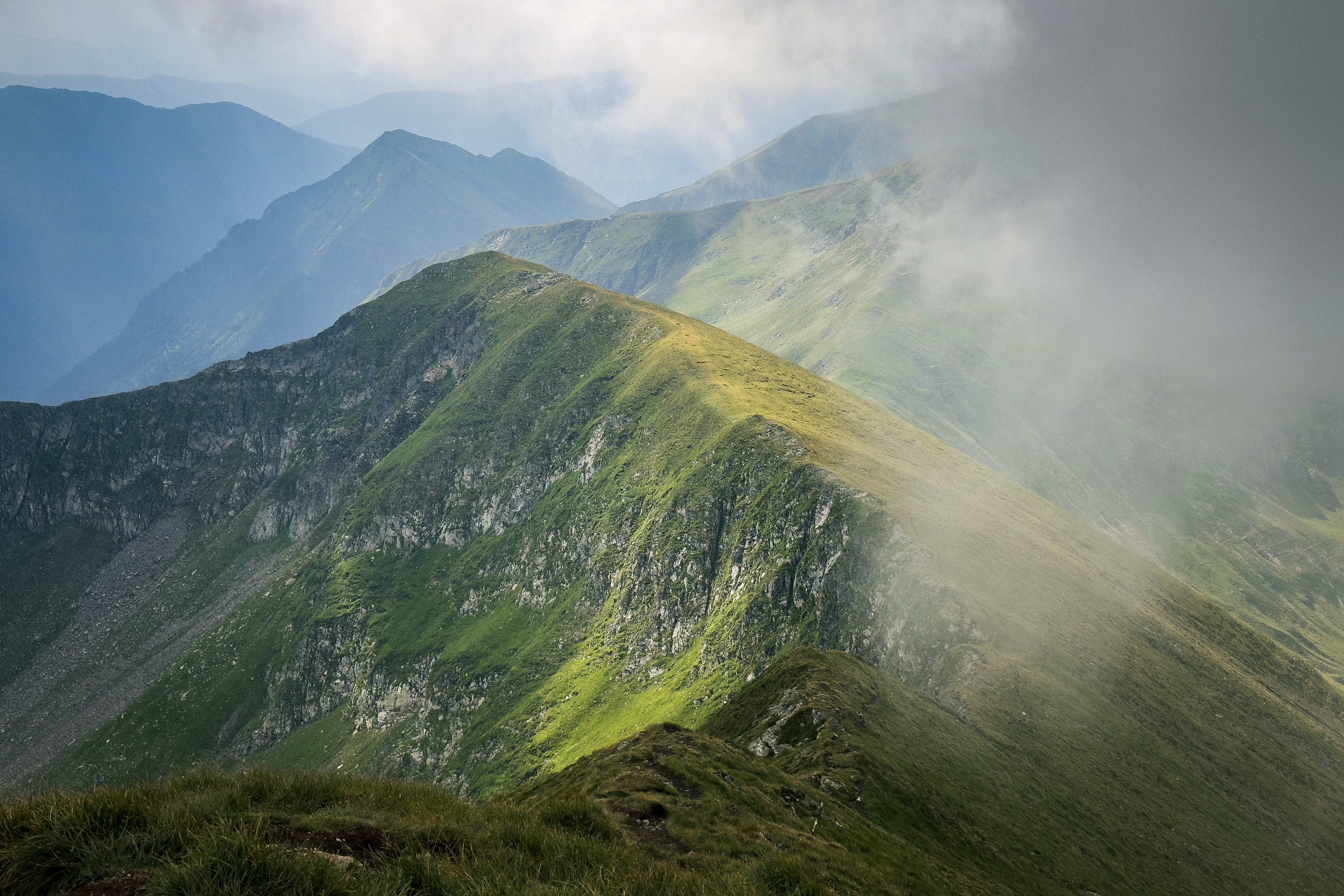
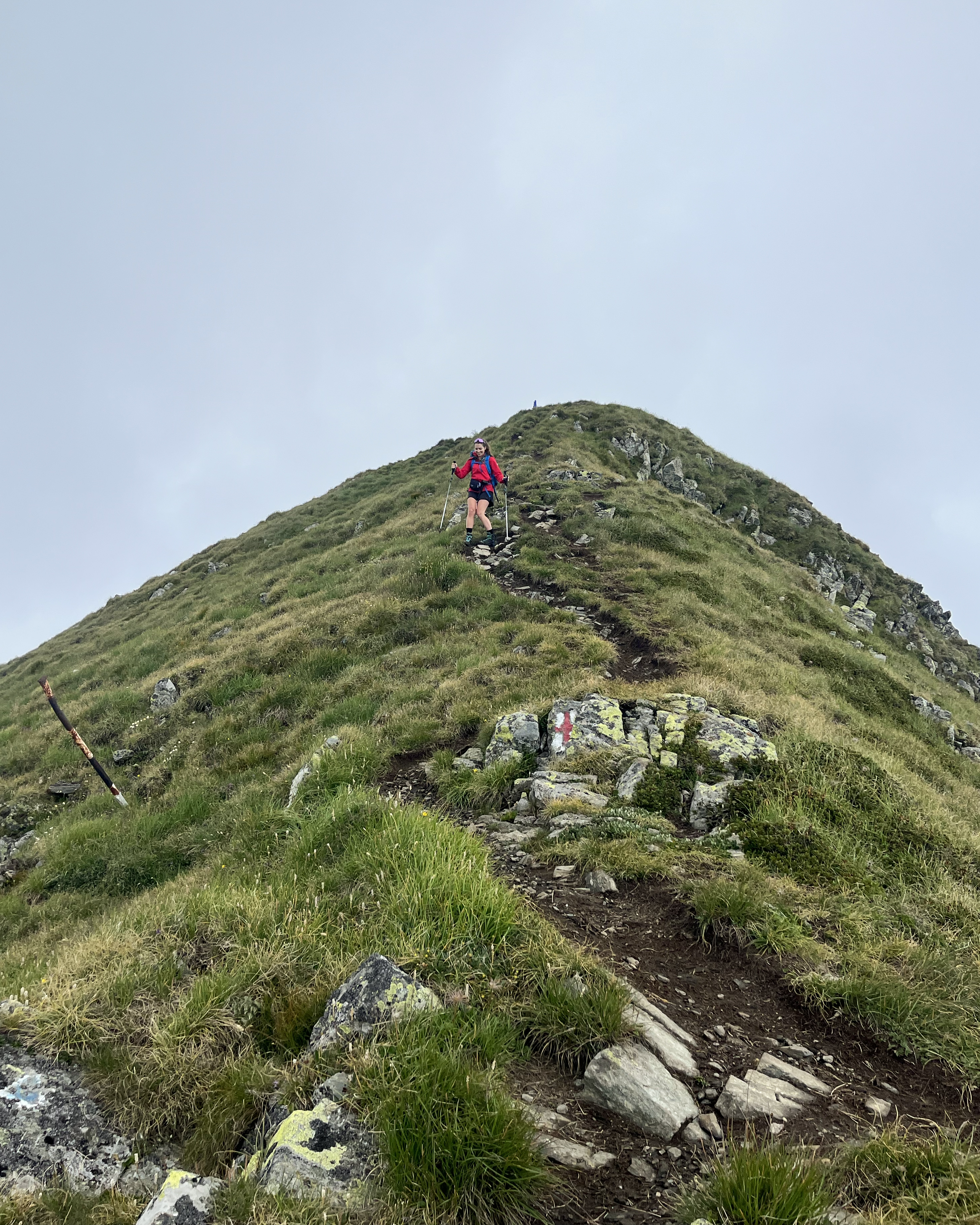
The original start of the trail (before the road collapsed and added distance) is marked by this small hut. There’s an information sign, but otherwise nothing really happening at this hour on a Monday. The path is straightforward and leads through Valea Rea, or “Evil Valley”. The ascent begins pretty steeply in the beginning, before allowing for some active recovery across these scenic portions:
Aside from the occasional farm animals, there wasn’t a soul in sight. After another fairly steep ascent, we finally emerged onto the pass with views of the “main route” from the lake.
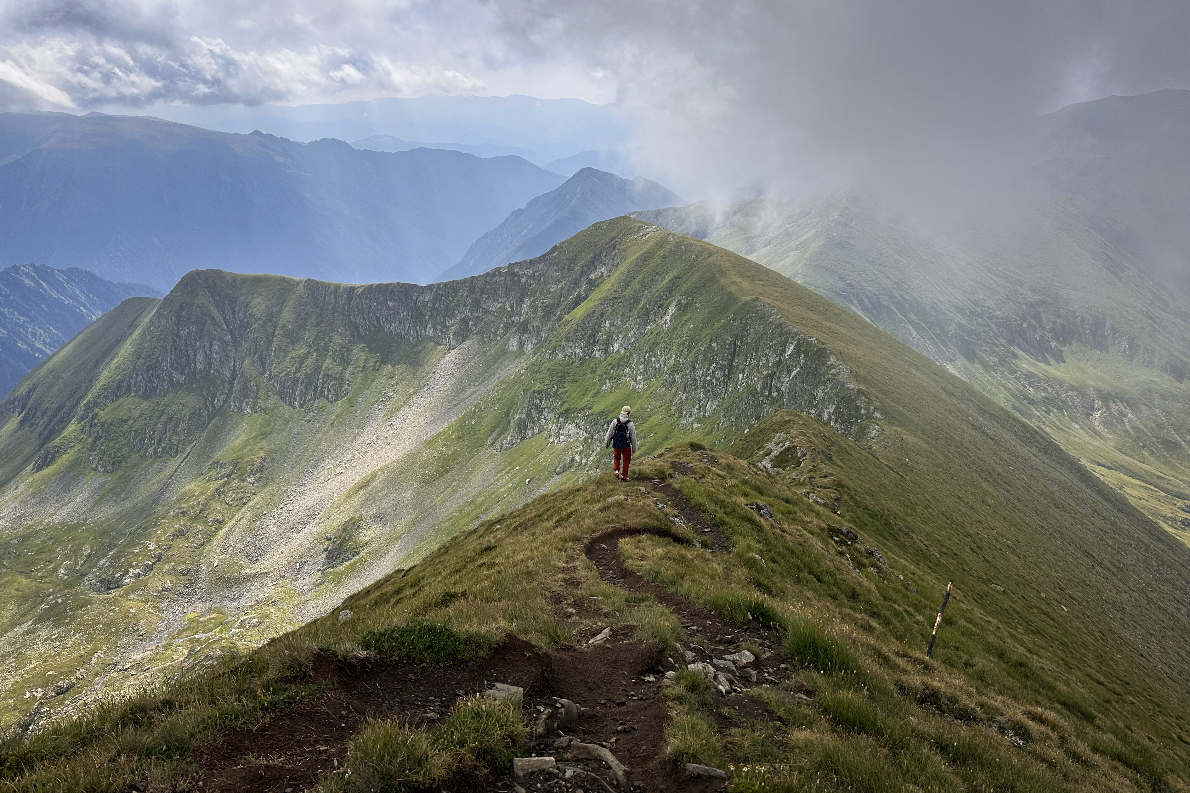
From here, the summit was in view, although it kept tucking behind a thick fog. We picked up the pace a bit, in case the clouds turned into anything more ominous.
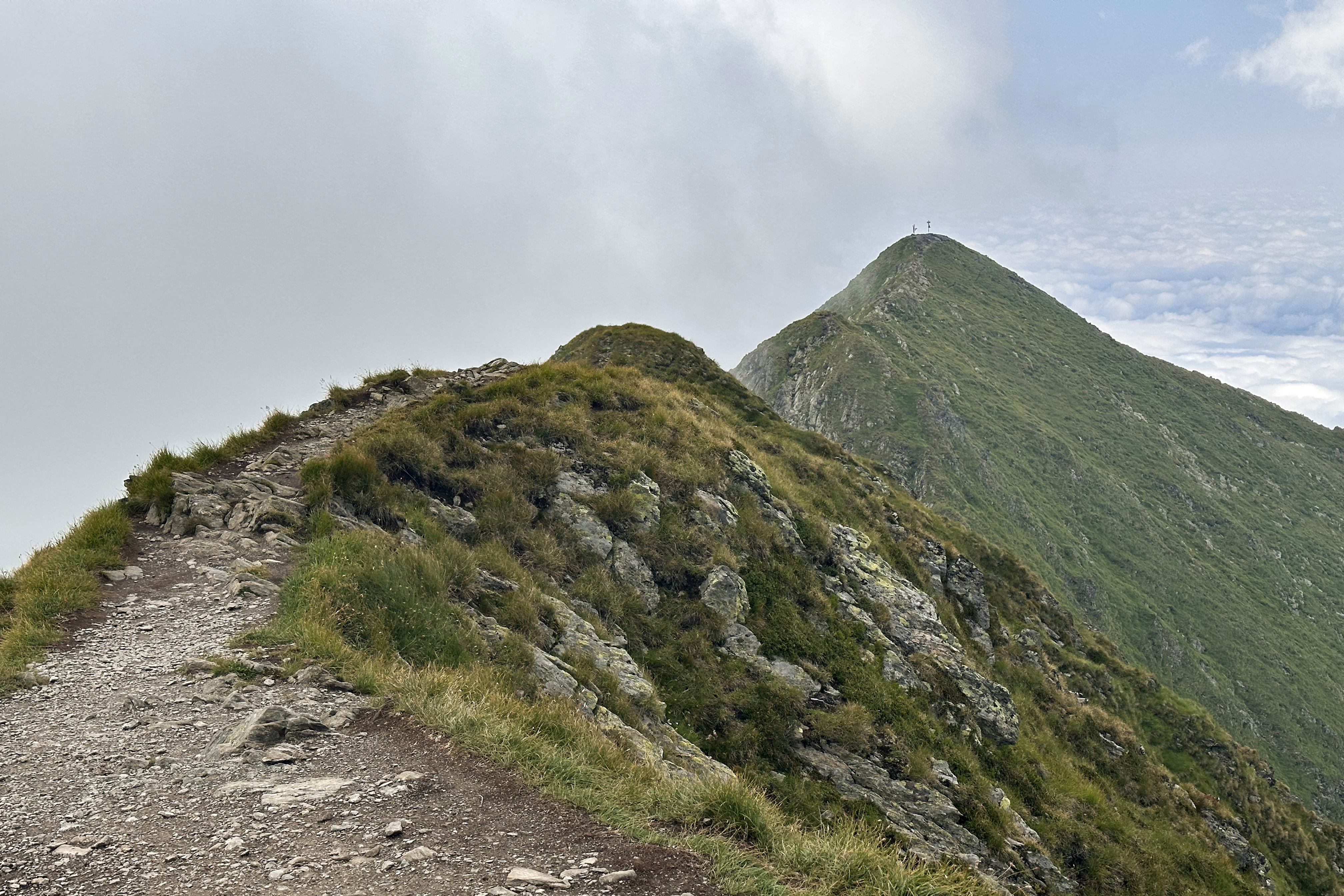
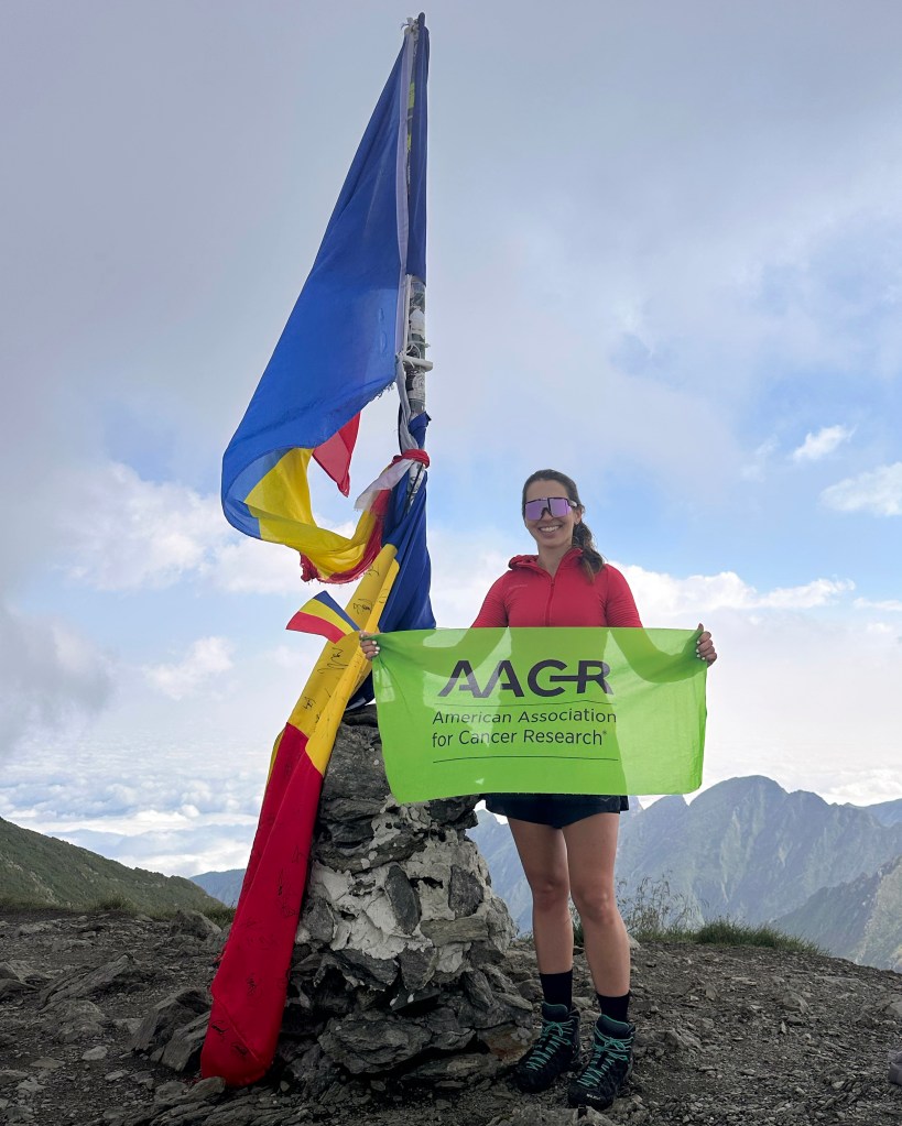
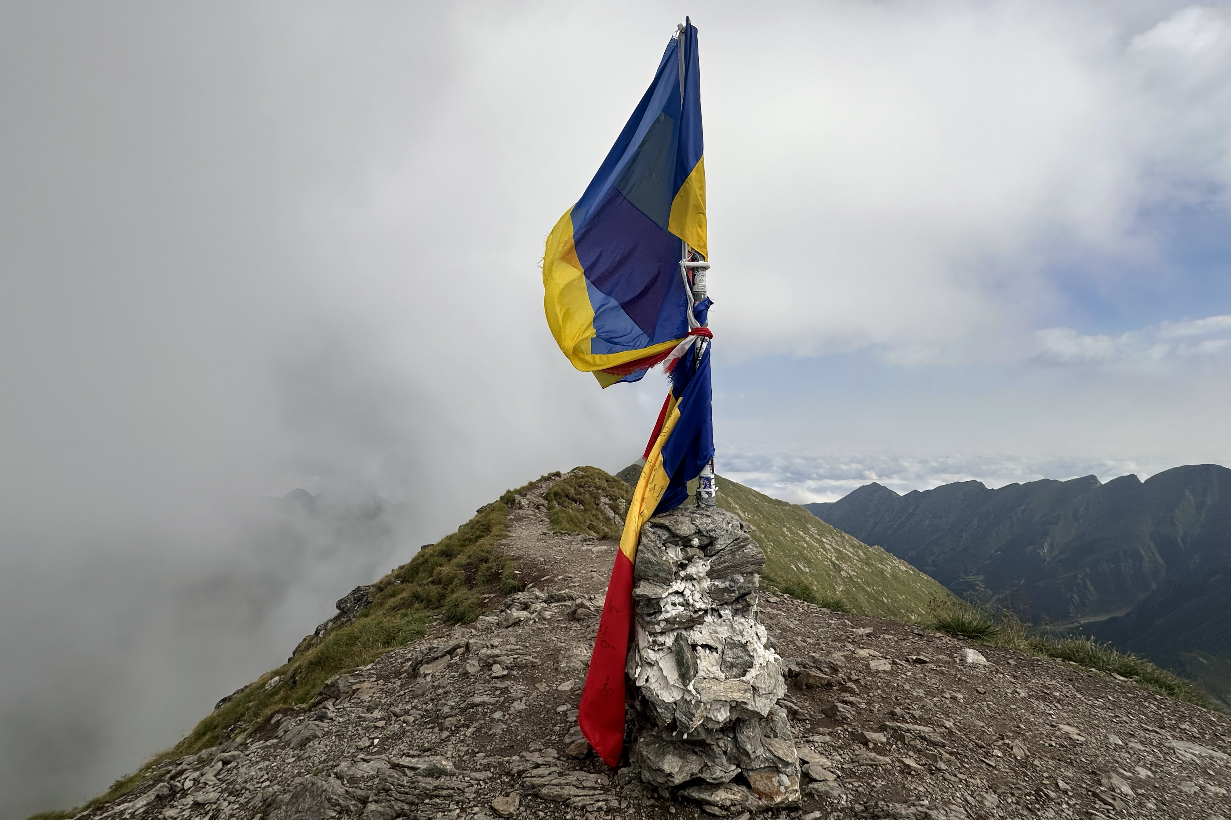
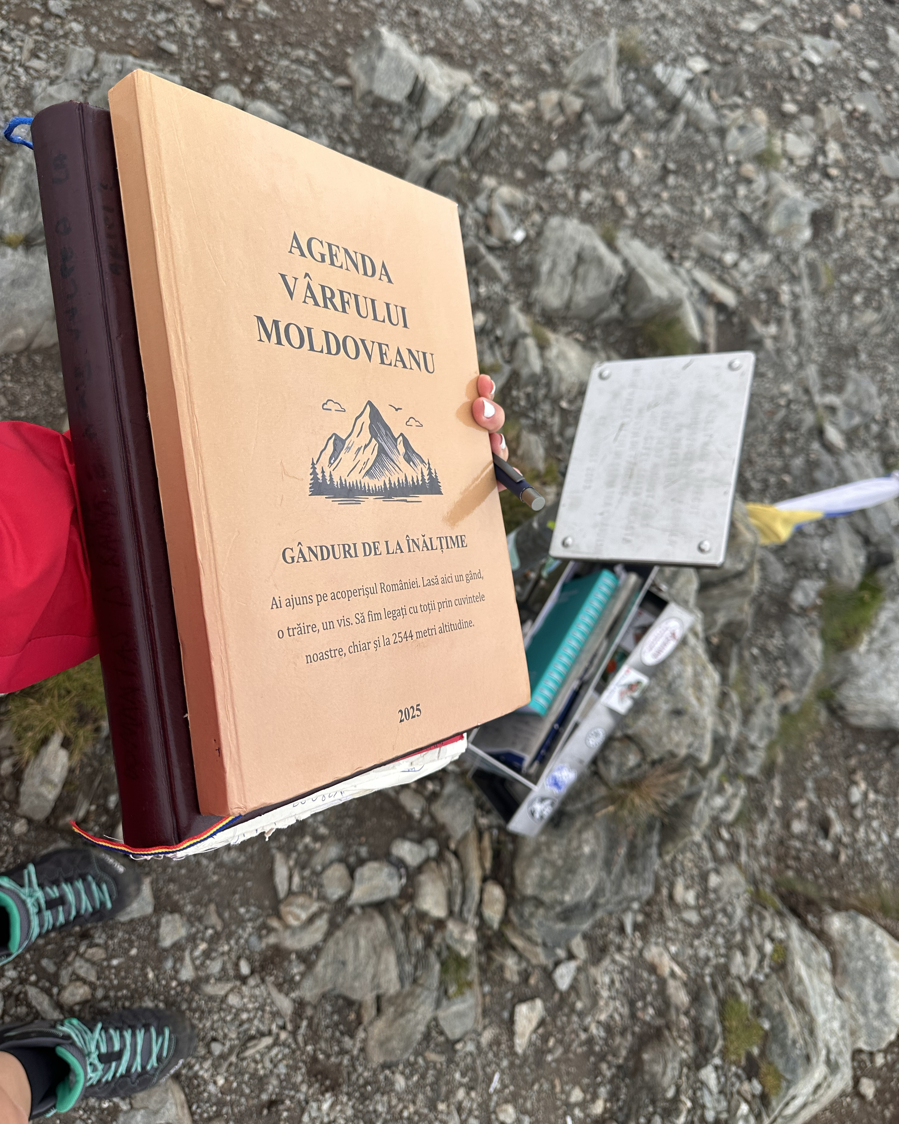
Just after 10am, we arrived at the summit!!
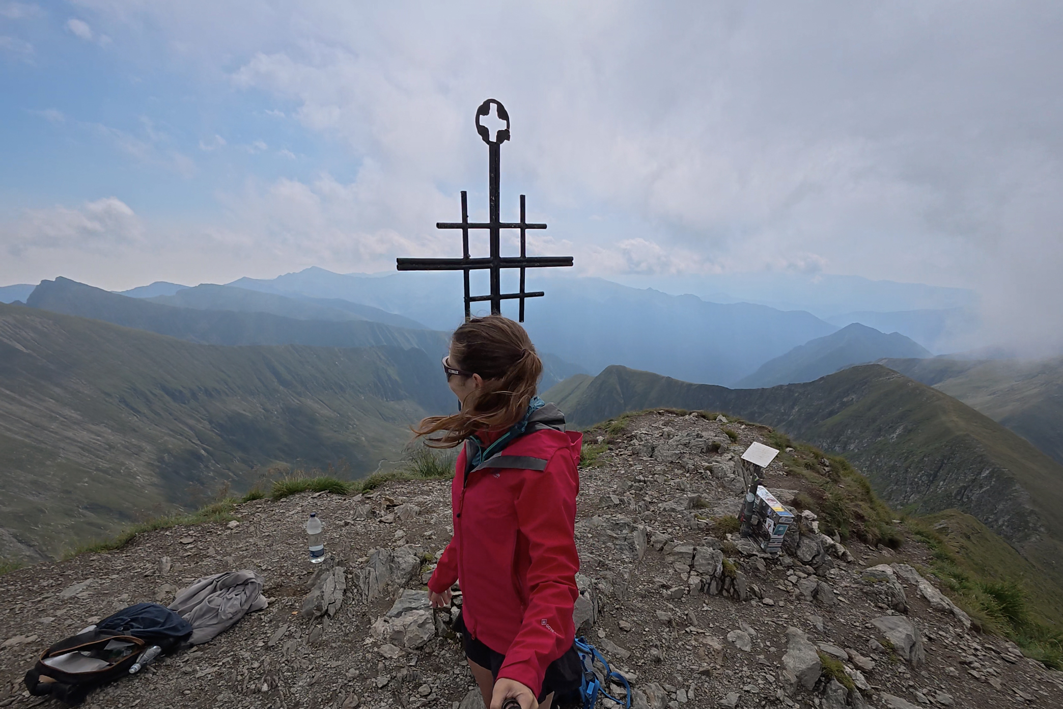
At first, the clouds stayed pretty thick and didn’t seem to be lifting. Hoooowever, when they finally did…it revealed incredible landscapes bathed in dramatic lighting:
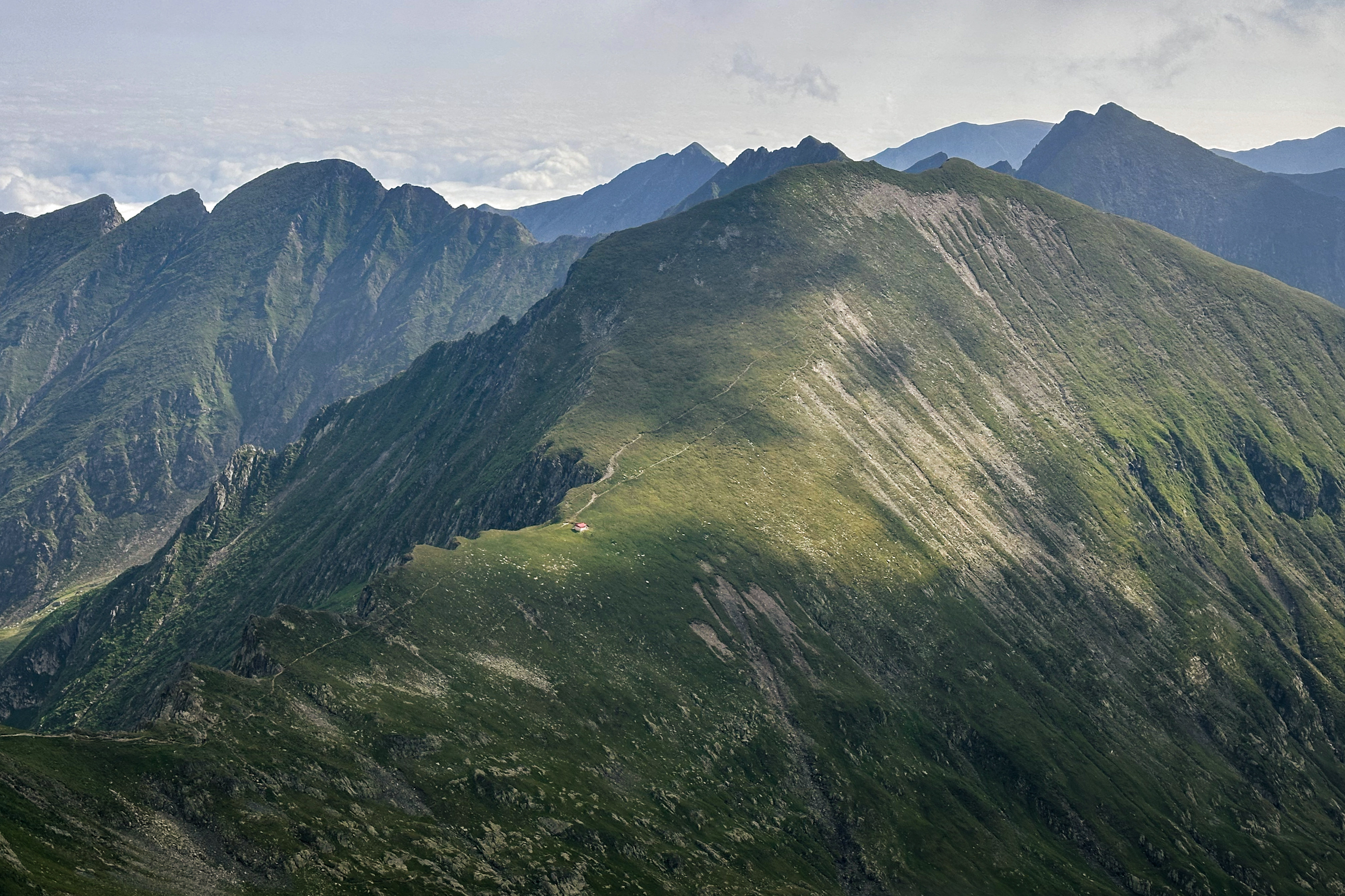
At the summit, the clouds began to lift more fully. We decided to continue to complete the circular, as we were making pretty good time. After leaving a quick note in the logbook, we were off:
The views just got better and better.
From the initial descent, it appeared that the circular would just continue down into the valley more gradually. I clearly didn’t zoom in enough to the topo, because there would be one more ascent on the way. It was pretty warm already, so it wasn’t the most welcome exertion, but it was somehow comforting to know it was less than we’d have faced walking on perfectly flat ground in sweltering Bucharest. There were triple-digit temps there, for those who observe Fahrenheit. (:
On the way, we saw some shepherd dogs in the distance. Romania is pretty notorious for these, and as much caution is required with them as with bears. They may be cute, but their mission is to defend the herd, which certainly complicates things when that herd blocks your only path down. One of the dogs started heading toward us. Our only defense was a small can of bear spray we’d grabbed in Bucharest (from Montrek Sport) as a precaution, and my set of hiking poles.
We stopped for a bit, and before long, a shepherd came into view. We aimed toward him, slowly, and it turned out that he spoke German. He told us that the herd has 2,000 sheep!! We were a bit too busy watching our step (we were off the path at this point, in uneven grass) and avoiding the sheep, so there’s no footage of this moment. Up to this point, we’d run into only one other pair of hikers who were heading down from the summit in the other direction. The mountain might get crowded on summer weekends at peak times, but otherwise…very peaceful, if you survive the sheep! (:
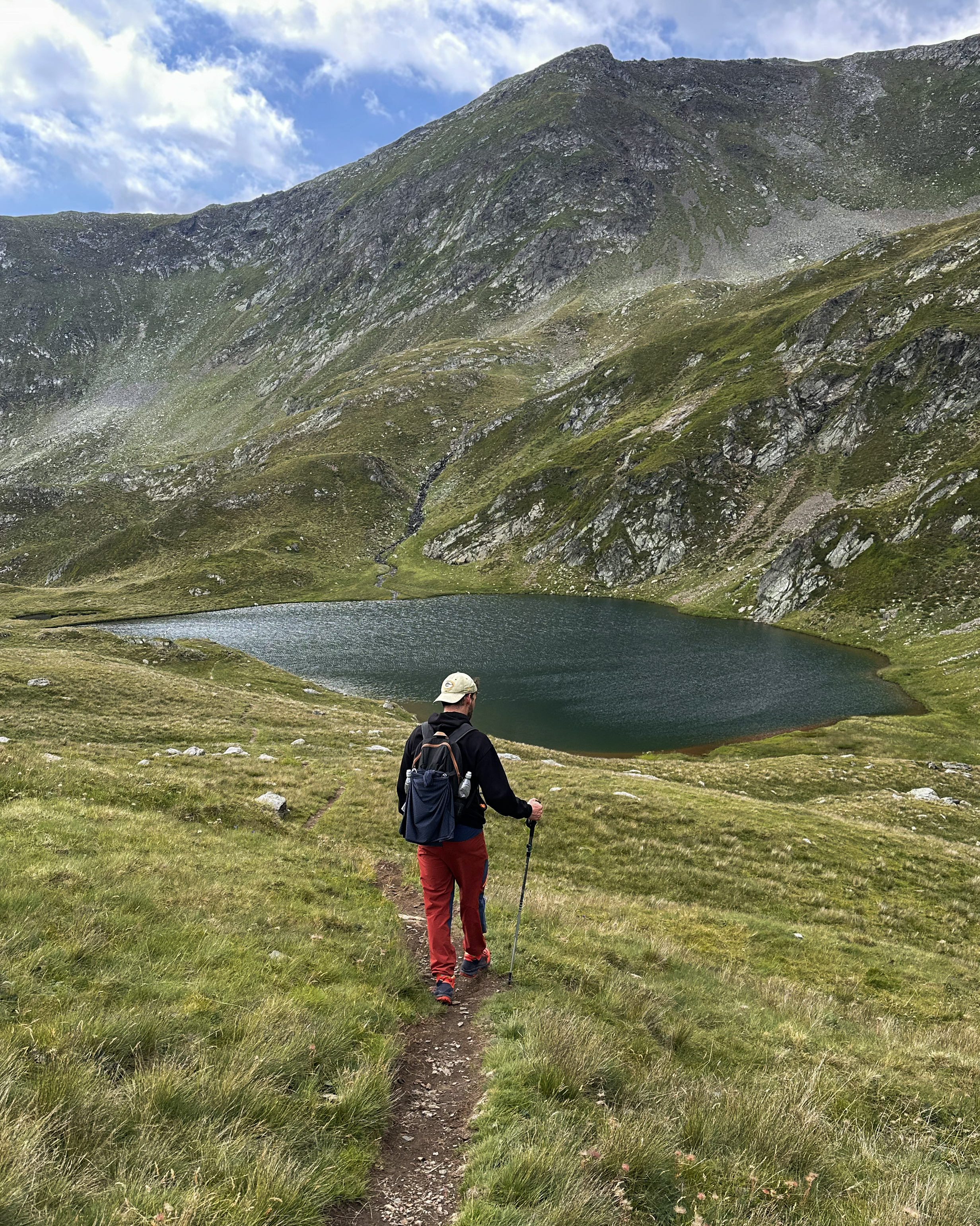
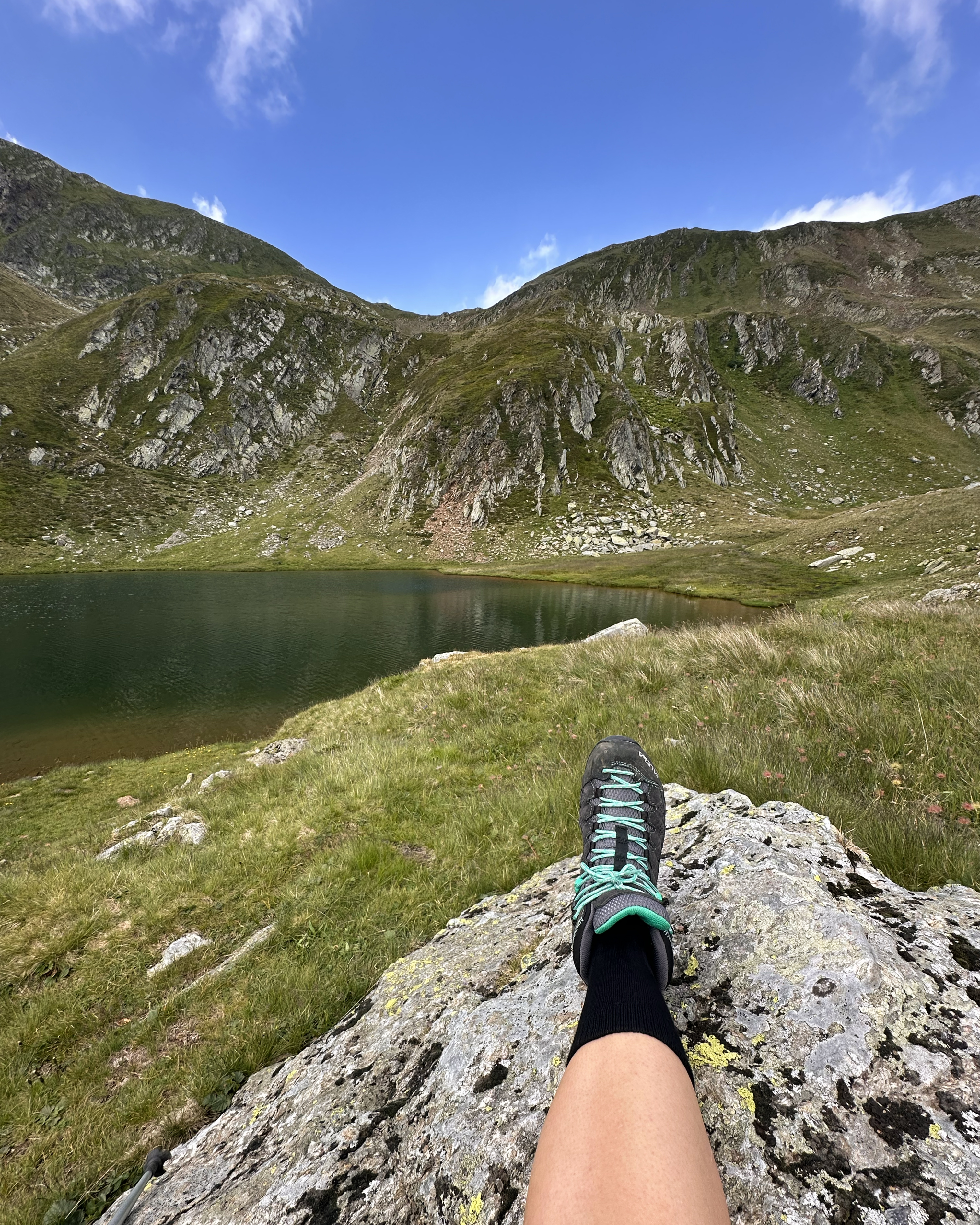
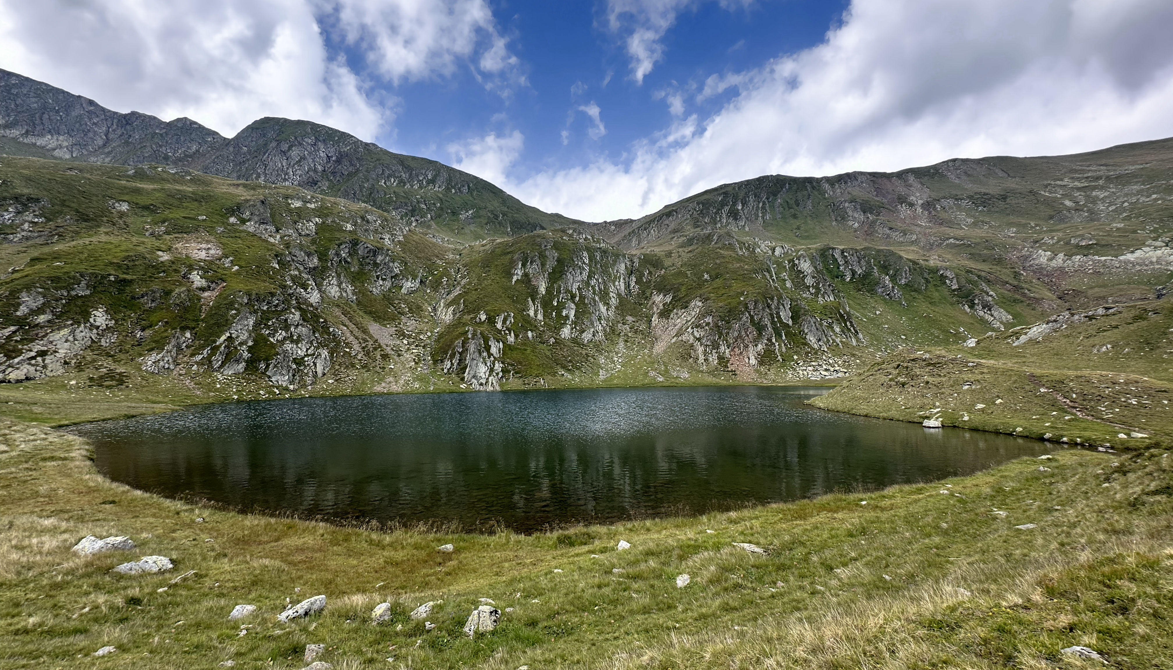
After a quick rest for the toe, we continued on a nice path to the next small lake.
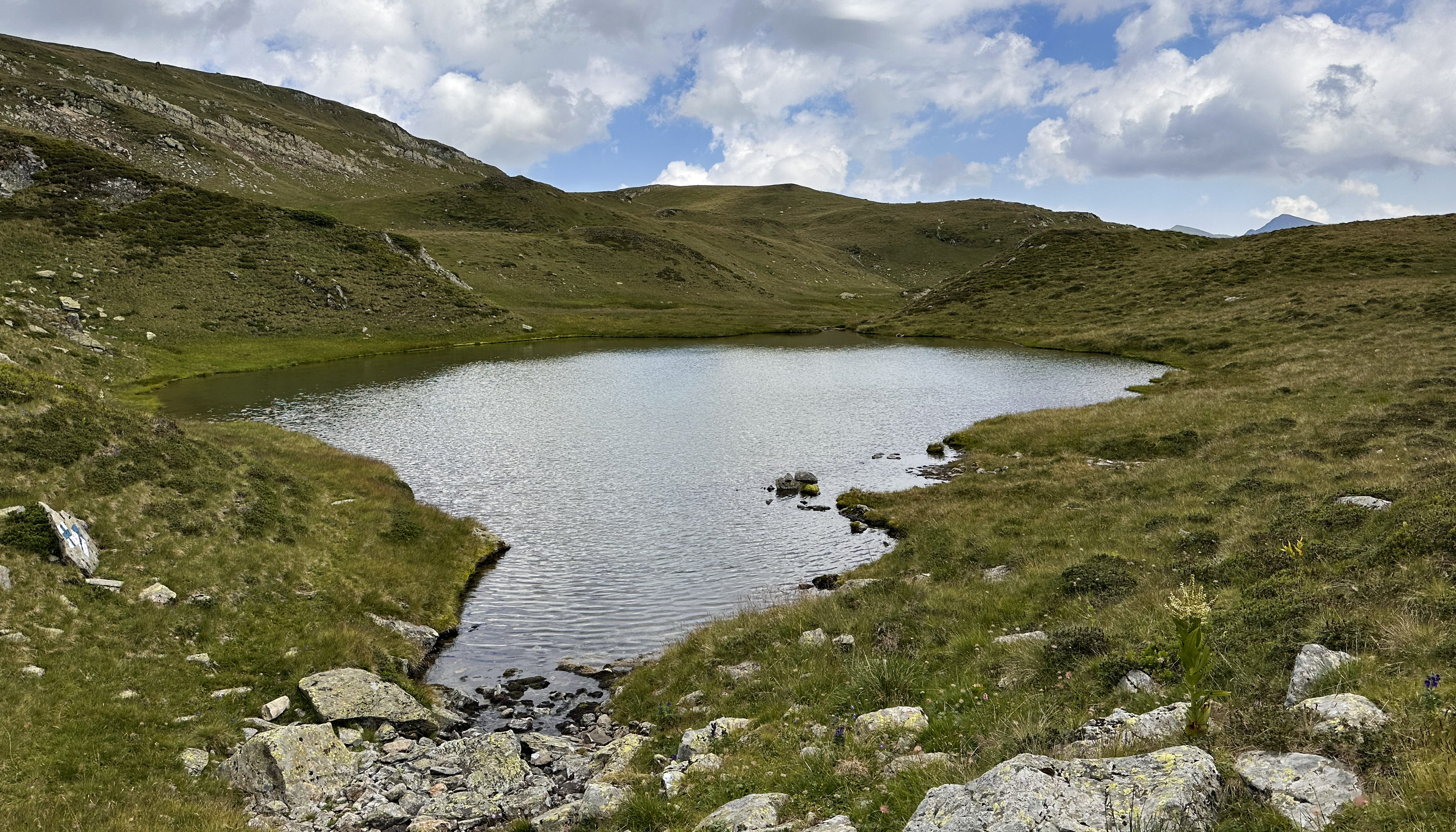
This is where the map plays with your emotions. It looks like the end is near, with just a bit more meandering to a final steep descent. Steep is an understatement on this last portion, and it goes on for ages. The hike was incredible right up to this relentless, slippery descent through the woods. There is no footage of this. I realized that I was capable of managing two of three things during this trip: photography, toe suffering, and other struggles. The toe was a constant, so with other struggles (sketchy road, two thousand sheep, rough descent), photography dropped off. (:
Finally, we were back at the car. We were surprised to see that 10+ cars had appeared, presumably belonging to people a bit more optimistic about the weather forecast. I drove on the way in, and Sven drove on the way out. It took barely over an hour and somehow resulted in no damage to the rental car, nor a full heart attack for the passenger. See the earlier comment about factors driving a time of ~1 versus 2 hours. Some of these videos are in the Instagram highlights!
That evening, we returned to Bucharest, dropped off the car, checked into the hotel, and went to grab some tacos from a place called El Magüey. Whether it was from the effort of the hike or just London lowering my taco standards, they tasted amazing. As did the gelato at the next stop. It finally started to rain, so we retreated back to the hotel, ending a long but successful day (which began way too early).
Book-A-Rest in Bucharest, Part 2
This day would look similar to the first day in Bucharest, but instead of a 5pm rental car pickup, we had a 7:10pm overnight train. Even with all that time, the heat wave was not making sightseeing any more appealing. We caught up on some sleep, had breakfast, and repacked for the next leg of the trip. It was a lazy day, revisiting the same coffee shop and restaurant, then heading over to the train station. We made a quick stop at a nearby grocery store, which turned into a longer stop when a woman in the checkout line dropped and shattered a bottle of whiskey. Then, of course, our train was on the opposite end of the tracks. Still, we made it! (:
Onward to Moldova
This was the end of the Romania portion, as my return flight to London would be from Moldova. (:
THANK YOU ❤
Thanks for reading my eighteenth Crown of Cureope blog post! At the time I stood on the top of Romania, we had raised $1,620 for the American Association for Cancer Research to fund lifesaving discoveries. As of publishing this post, we are at $2,525 raised of our $2,500 2025 target. We hit this year’s goal on Giving Tuesday…thank you!!!!!!!! It’s still not too late to donate – the challenge is far from over, and fundraising efforts will continue through 2026.

Leave a comment