
A (z)LOT(y) of Logistics
On the Balkans trip (see the Korab and Gjeravica blog posts), I met fellow hiker and American expat Sara Randall! After both completing Triglav within a day of each other back in July (discovered later), we wanted to take on another beautiful, scrambly European high point: Rysy. Since these plans were a bit last-minute, no huts were available, so we decided to head up and down in a day. There are 2 main routes up to the summit: one starting from Poland, and one from Slovakia. The main one from the Polish side passes by Morskie Oko (“Eye of the Sea”) lake, and the less technical (and slightly shorter) approach from Slovakia starts from Štrbské Pleso. The most straightforward way to do Rysy in a day, logistically, is to go up and down from the Slovak side, with a quick crossing to the Polish summit to tag the official Polish high point. We weren’t looking for straightforward, though…we wanted views and variety! (:
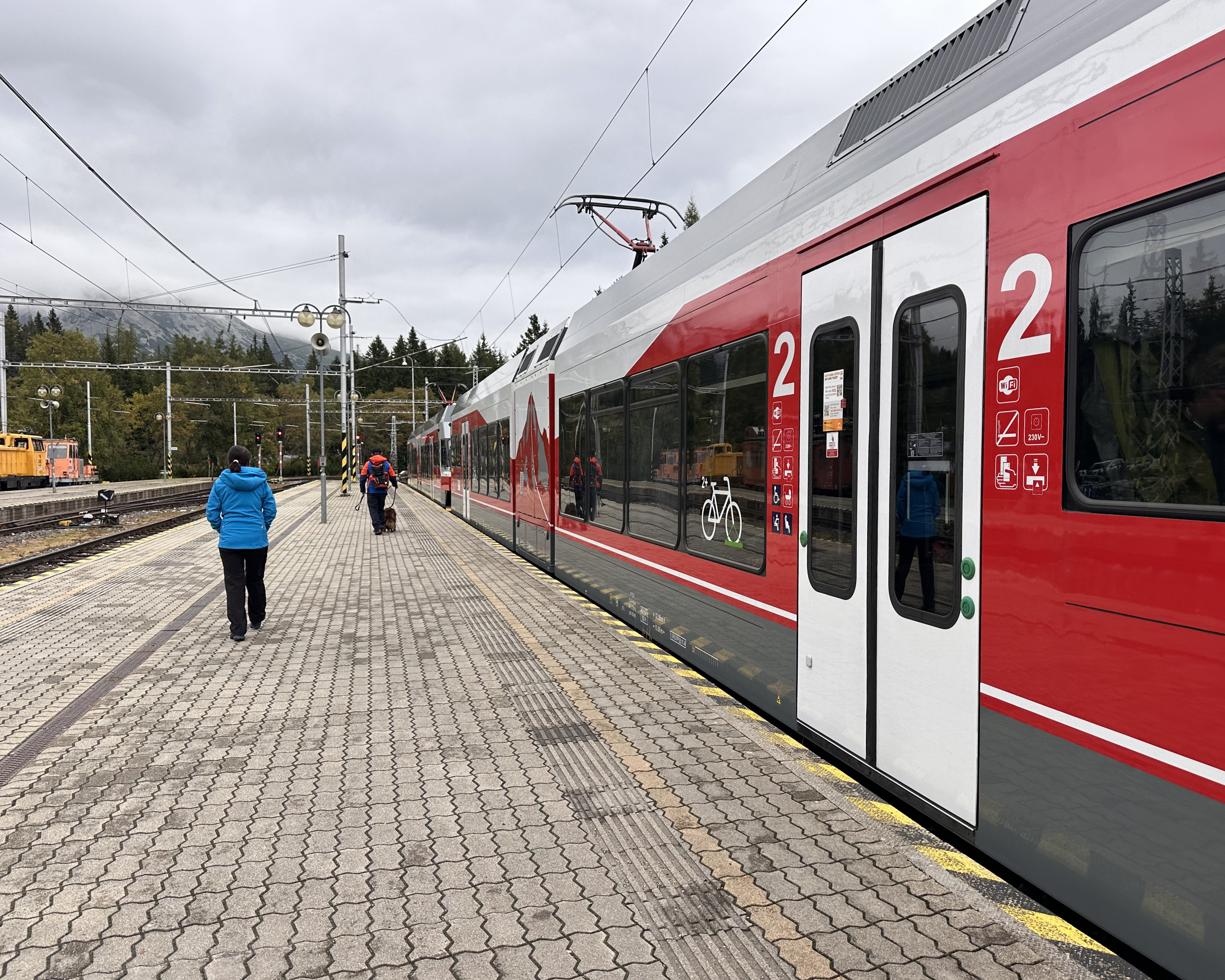
This meant that I’d fly into Kraków, rent a car, drive 2.5 hours to Štrbské Pleso, leave the car in the train station parking lot (used as the trailhead for those hiking Rysy from the Slovak side), catch a 42-minute train (8 stops) to Vysoké Tatry Starý Smokovec, transfer to a small bus (the A45), then to another local bus from Bukowina Tatrzánska Dolna to Zakopane. There is also a route called the A15 that runs direct from Vysoké Tatry to Zakopane twice a day, but that wasn’t coming up as an option when I was making the journey. All-in, the trip from the parking lot in Štrbské Pleso to central Zakopane took just under 3 hours.
So, at 10:16am, the first leg of the journey kicked off with a perfectly on-time departure. This was important, because missing the next bus would mean a 6-hour wait before the next one, as well as cascading delays for the bus after that. One successful 15-minute transfer later, and I was the only one on the small A45 bus headed for Bukowina Tatrzánska Dolna. It was essentially a private shuttle…no one got on for the 52-minute journey.
The next transfer was even more stressful, as it would be only 5 minutes. It took a minute to orient myself / cross the road to the next bus stop, and that one came 3 minutes early…making my transfer window more like 1 minute. I made it! But, unlike the transportation on the Slovak side…this bus was cash-only. I’d gone from euro world to złoty world, with no time to stop at an ATM. If I’d missed that bus, the next would be in over 3 hours. I attempted to explain the situation in extremely broken Polish and offered to pay in euros or stop at an ATM in Zakopane. When we got there, he just waved me off the bus with a head shake (thank you, driver 😅), and I headed off to meet Sara! She’d come from Amsterdam via 13 hours of trains. We grabbed a late lunch, some groceries for the next day, and our hotel room keys before heading to sleep pretty early.
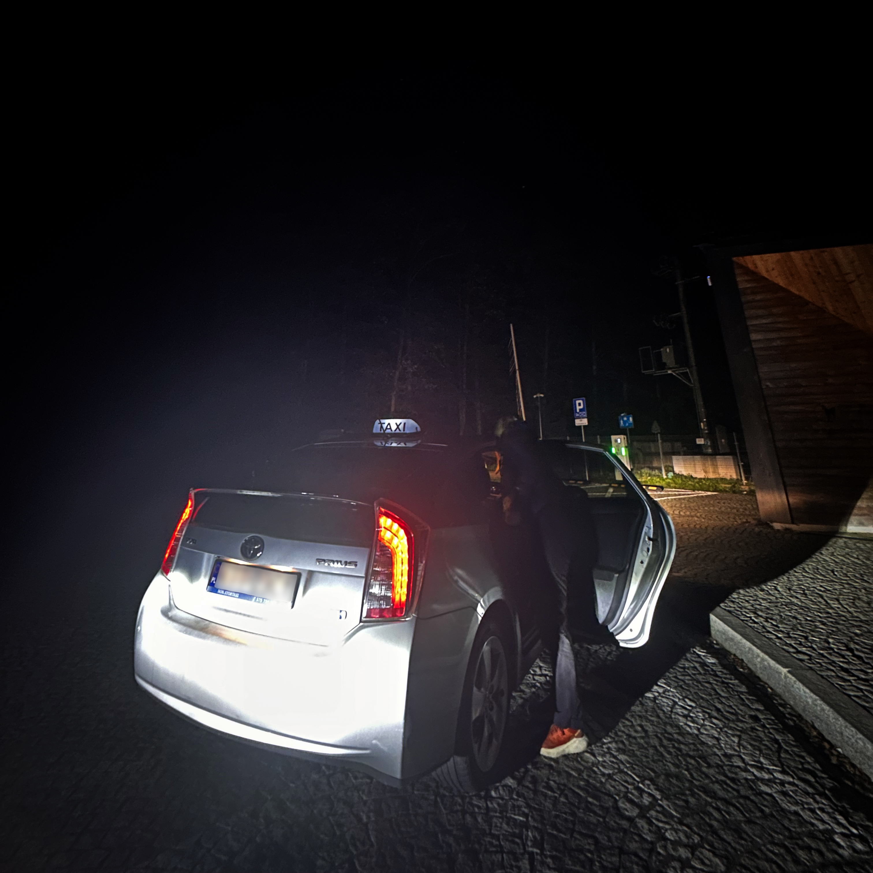
Just like with Triglav and Moldoveanu, we’d be waking up way before the sun. I’d reserved a cab for 4am through Komfortowe Taxi Zakopane 24h, which had been confirmed via WhatsApp and would cost 140 złoty (around 33 euros) to go from our hotel to Palenica Białczańska. That’s the closest you can be dropped off without taking a horse-drawn carriage (during daylight hours). This part didn’t go to plan.
With no sign of the cab at 4:04am, I called the WhatsApp number. No answer. We were on a pretty tight schedule, since we’d need to make it back to Kraków that evening to return the rental car (that we’d be crossing the Tatras on foot to retrieve from Slovakia). After a few more minutes, we called the number directly, and they answered nonchalantly saying they’d be there in about an hour. That wasn’t going to work…thankfully, there was a Bolt driver available who arrived within 5 minutes. We were on our way!
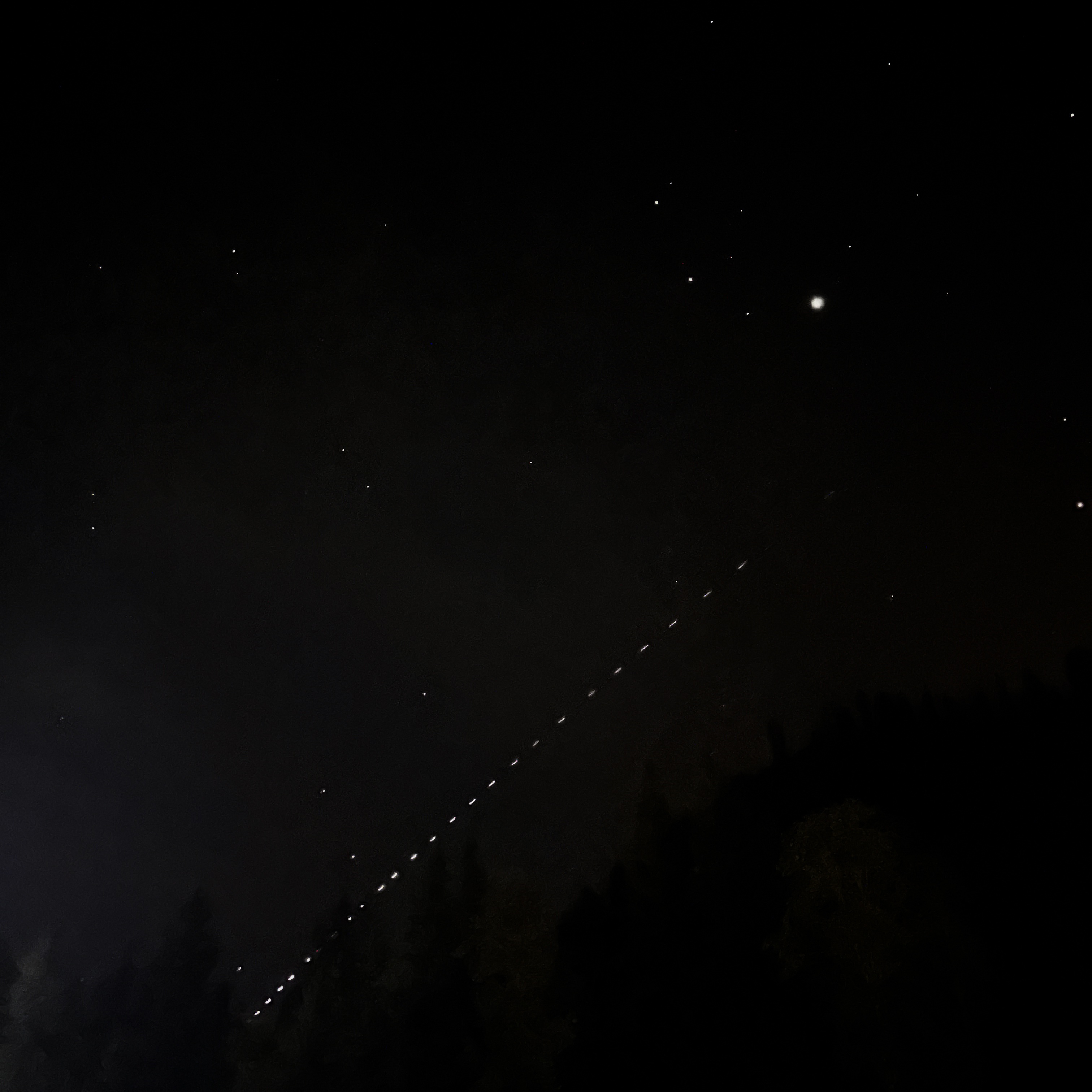
At around 4:45am, shortly after being dropped off, the Starlink satellite train appeared. After a toilet break (this trailhead has toilets!), we set off in the darkness, headlamps lighting the way.
The Hike
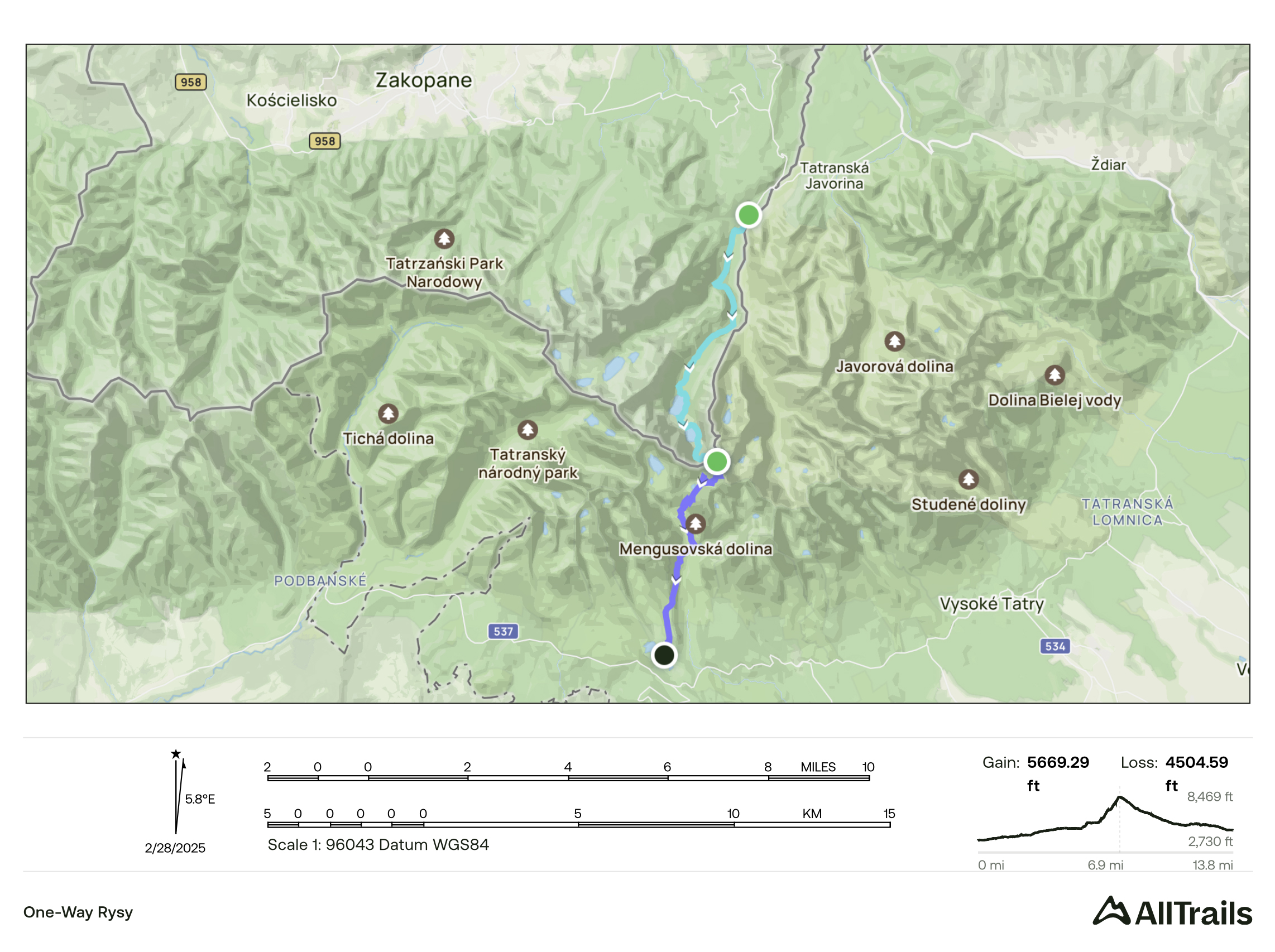
The one-way route we followed from Poland to Slovakia was over 22 kilometers, 1,730 meters of ascent, and 1,375 meters of descent. My recording got pretty messed up, so below is the custom route I’d made in AllTrails.
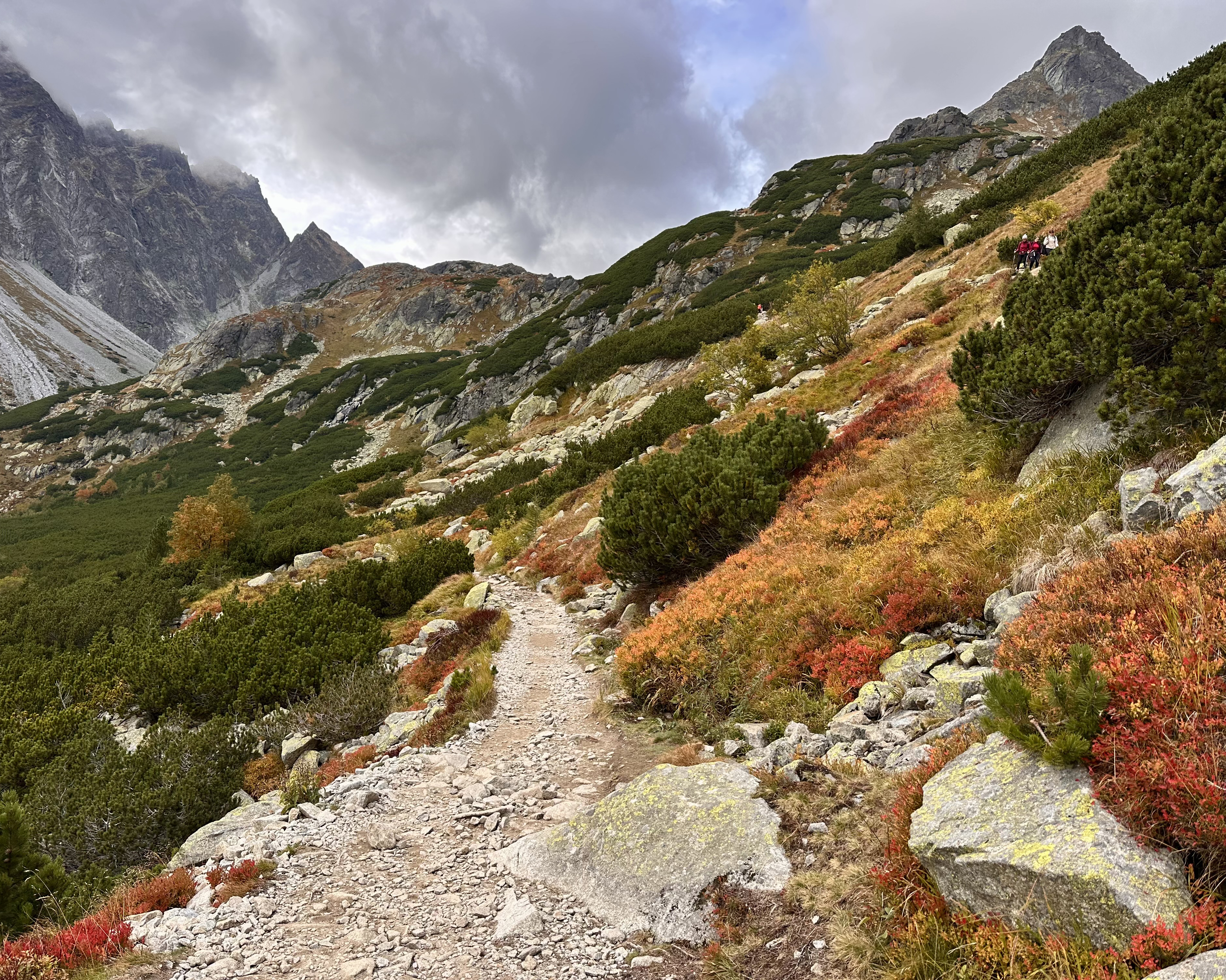
We hiked for the first hour in darkness, on a mostly empty trail. This was the last Sunday of “summer conditions”, as there was snow in the forecast for the 2 days following it, and…it’s Poland. This meant that when I saw what looked like an animal eye reflecting back, I should have thought, “oh, probably another hiker”. Instead, my eyes tricked my brain into seeing that eye quickly moving toward us, and after momentary panic (I might need a visit to the eye doctor), we hung back so some hikers behind us could catch up. As we kept walking and saw a reflector on a hiker’s backpack, we realized it was probably just that all along.
After an hour, the sun started coming up. It was a misty morning, with early autumn colors peeping out. We reached the Morskie Oko hut at by 6:30am, where a handful of other hikers were seated at tables outside. The lake was stunning, especially without crowds! We hung around until the hut opened for breakfast at 7, taking in the views as fog rolled in and out.
When we set off again, visibility was great.
We snapped a few more photos at the lake before heading up.

The path continued around Morskie Oko…
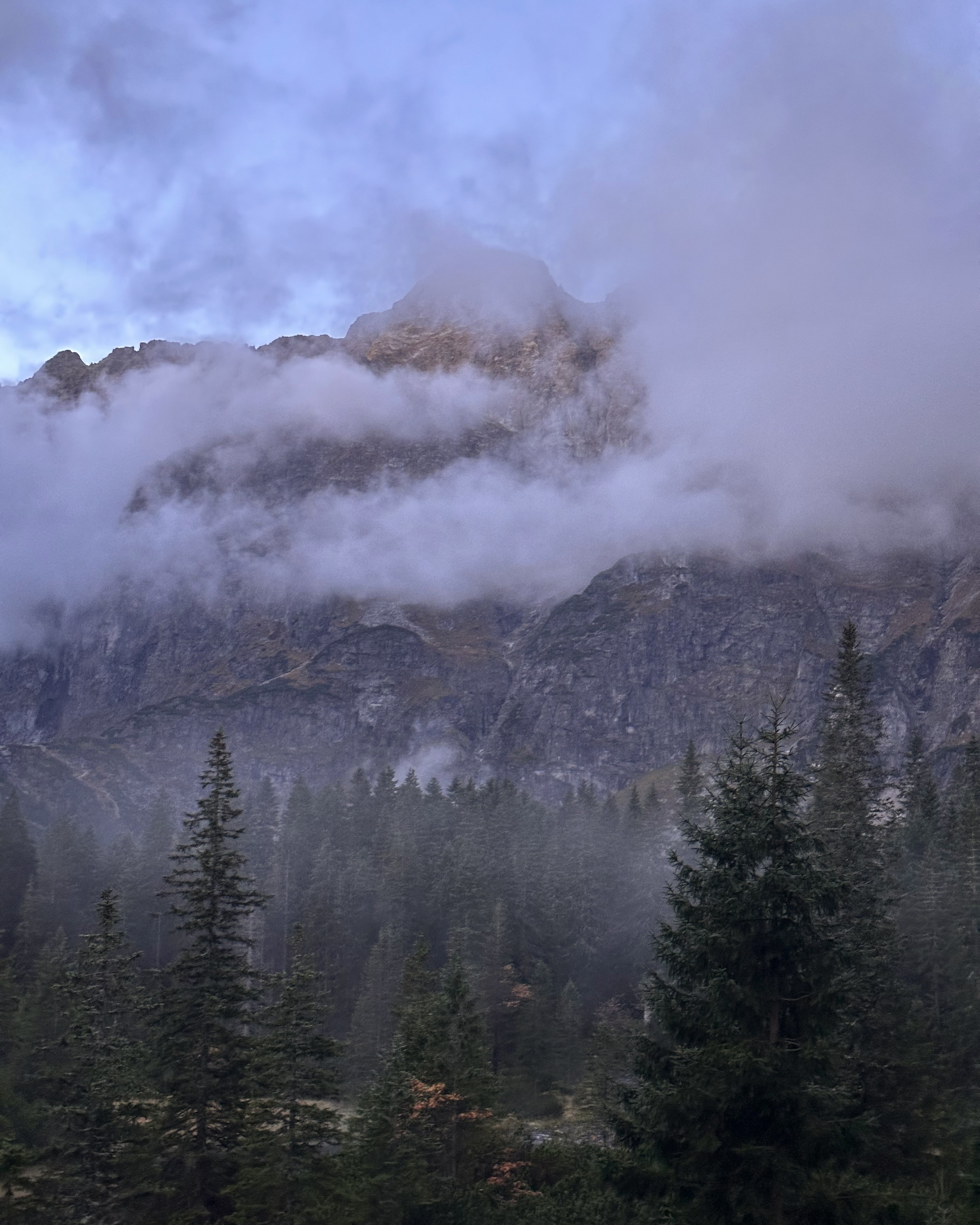
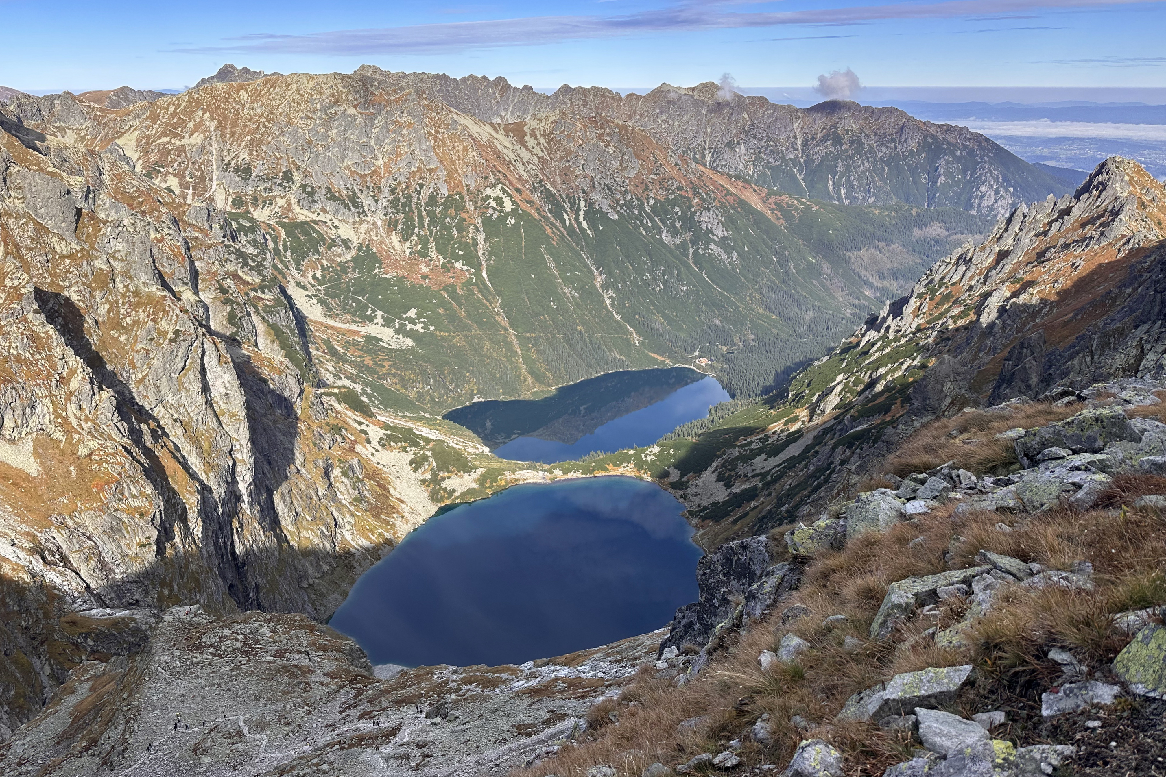
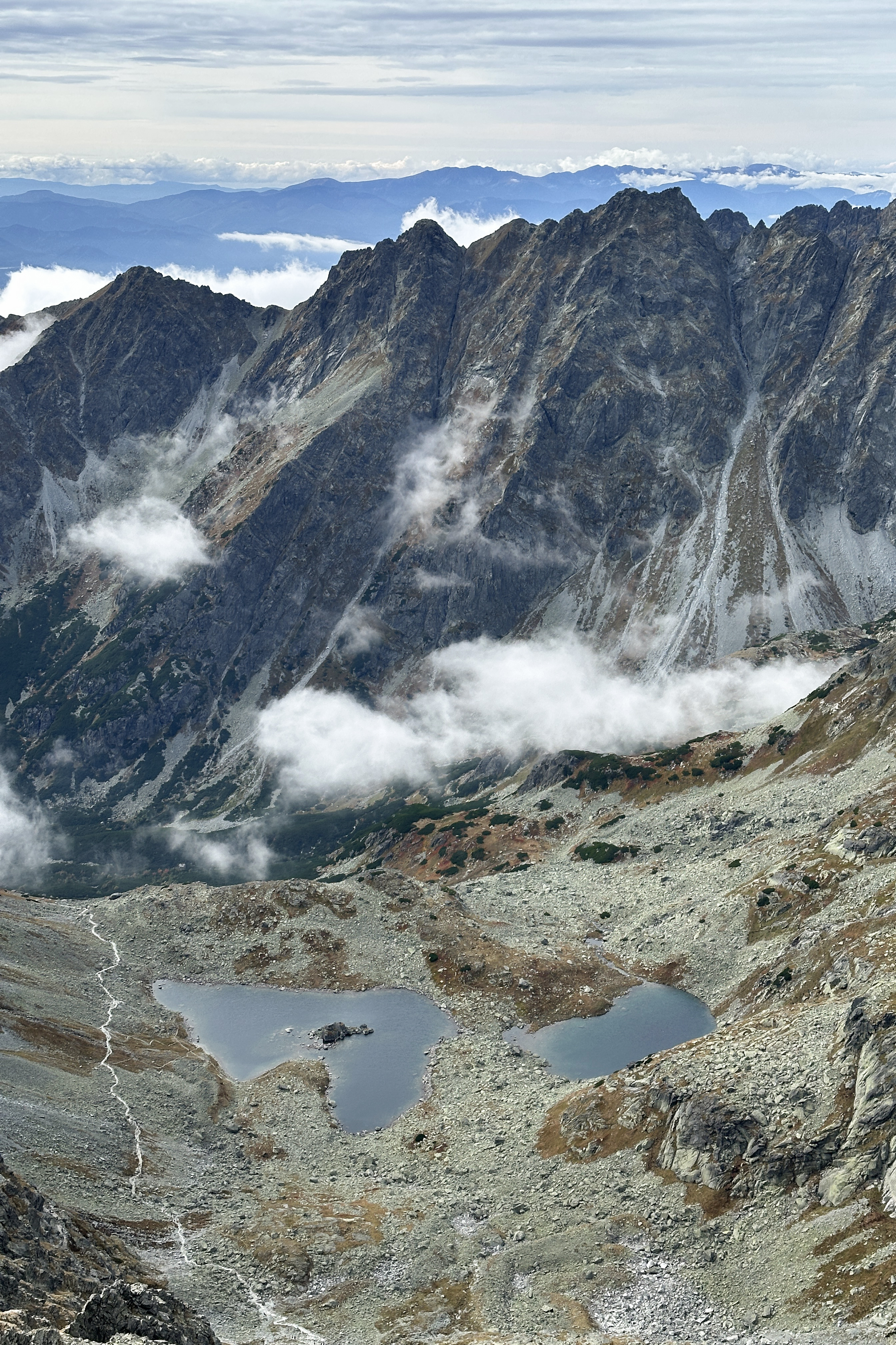
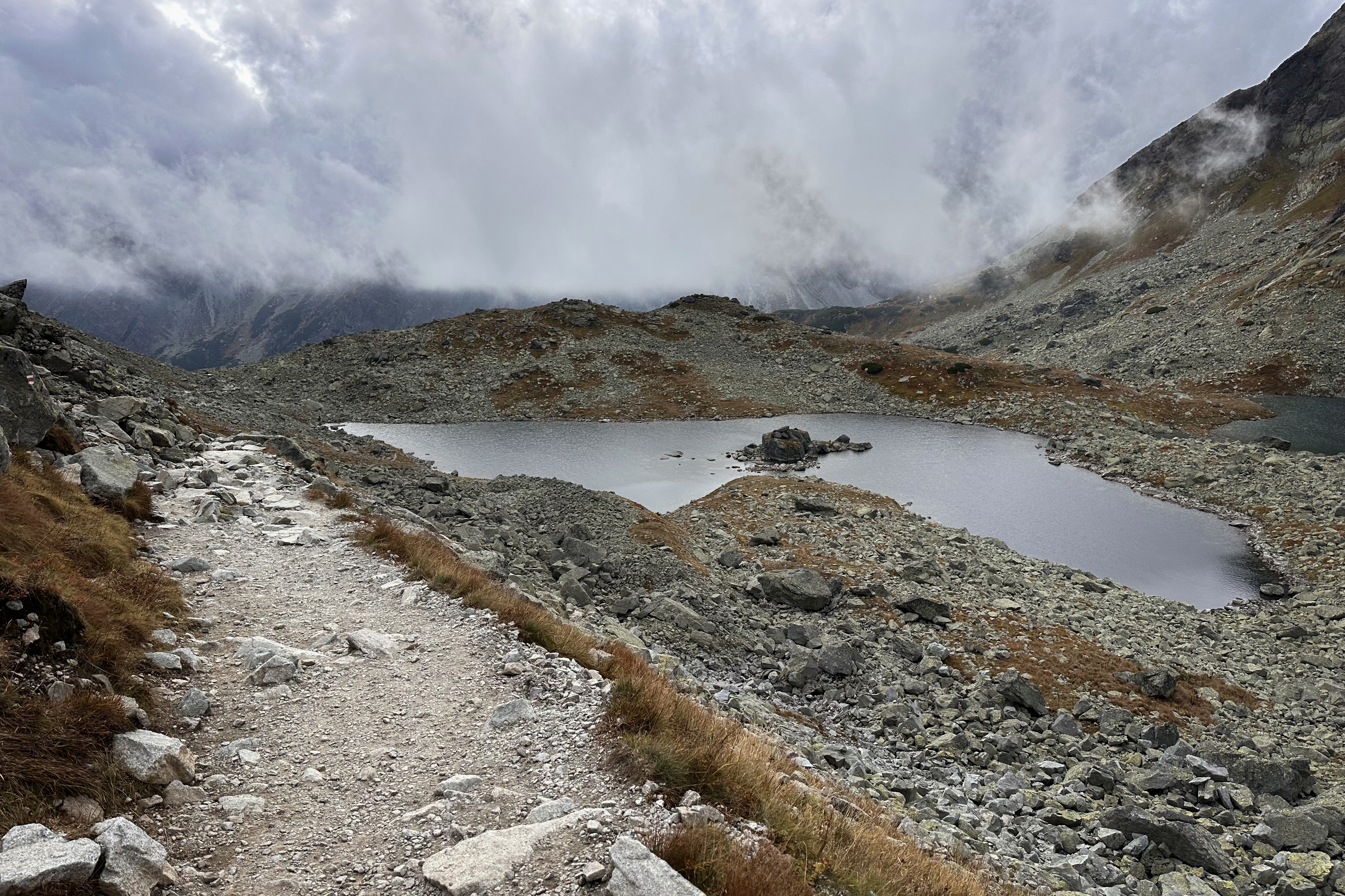
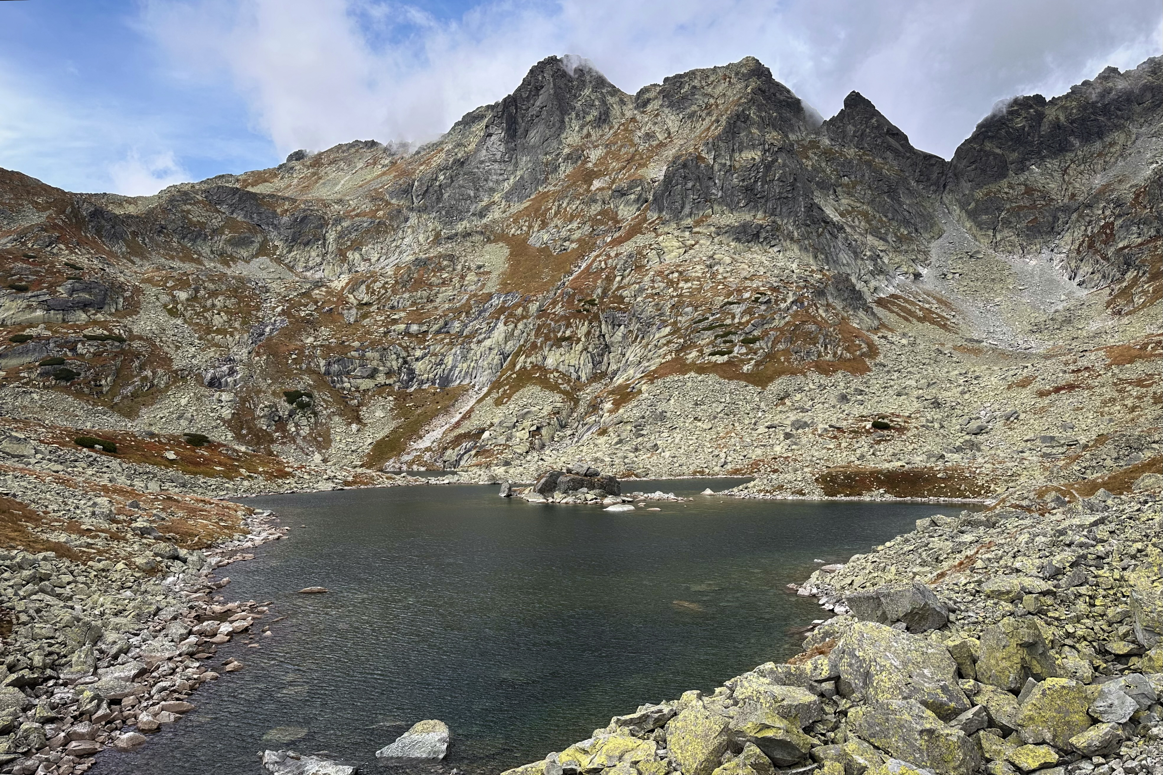
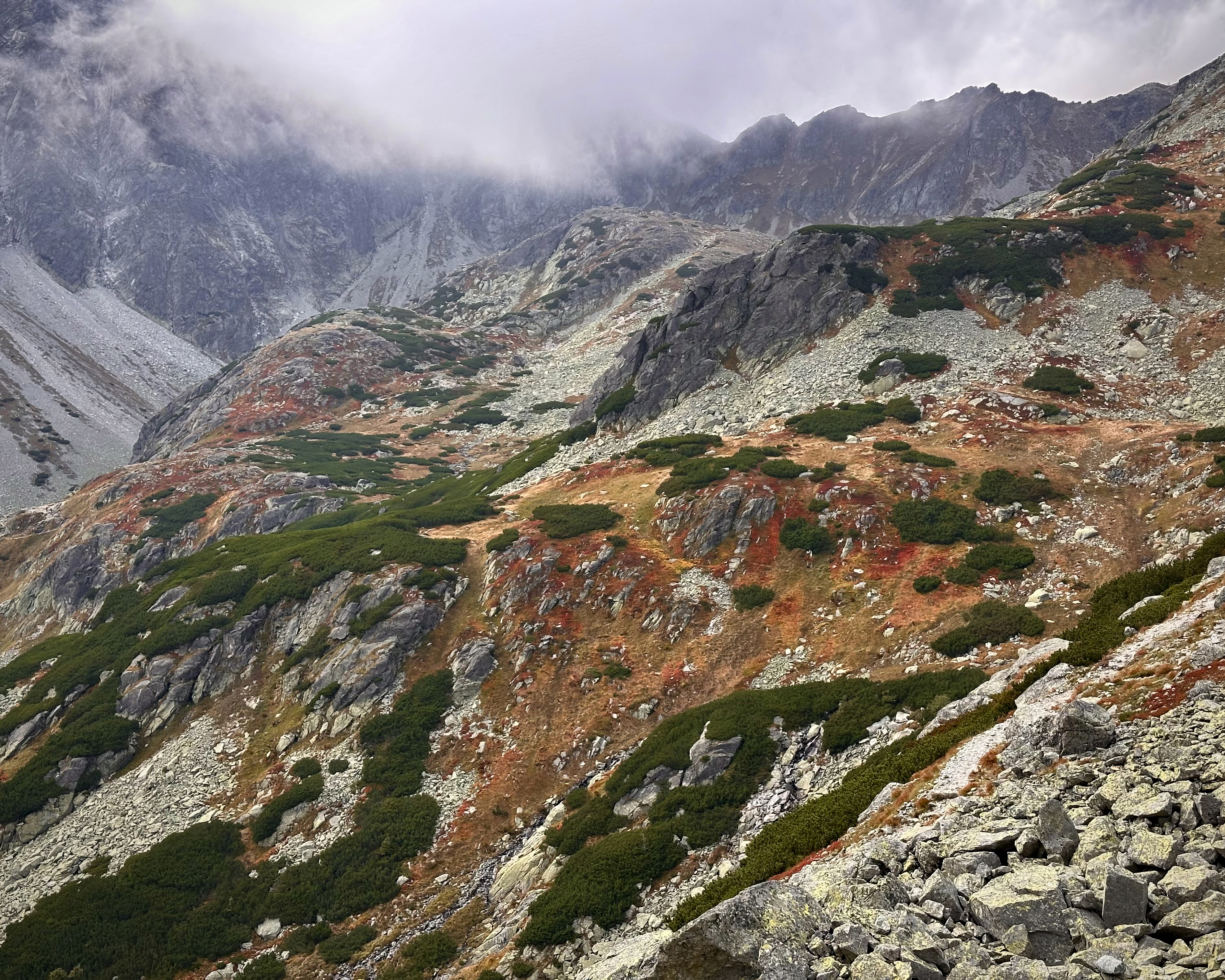
…and up to Czarny Staw pod Rysami (“Black Lake below Rysy”). As with many high mountain ranges, conditions can change quickly. Soon, we were in the clouds above that second lake.
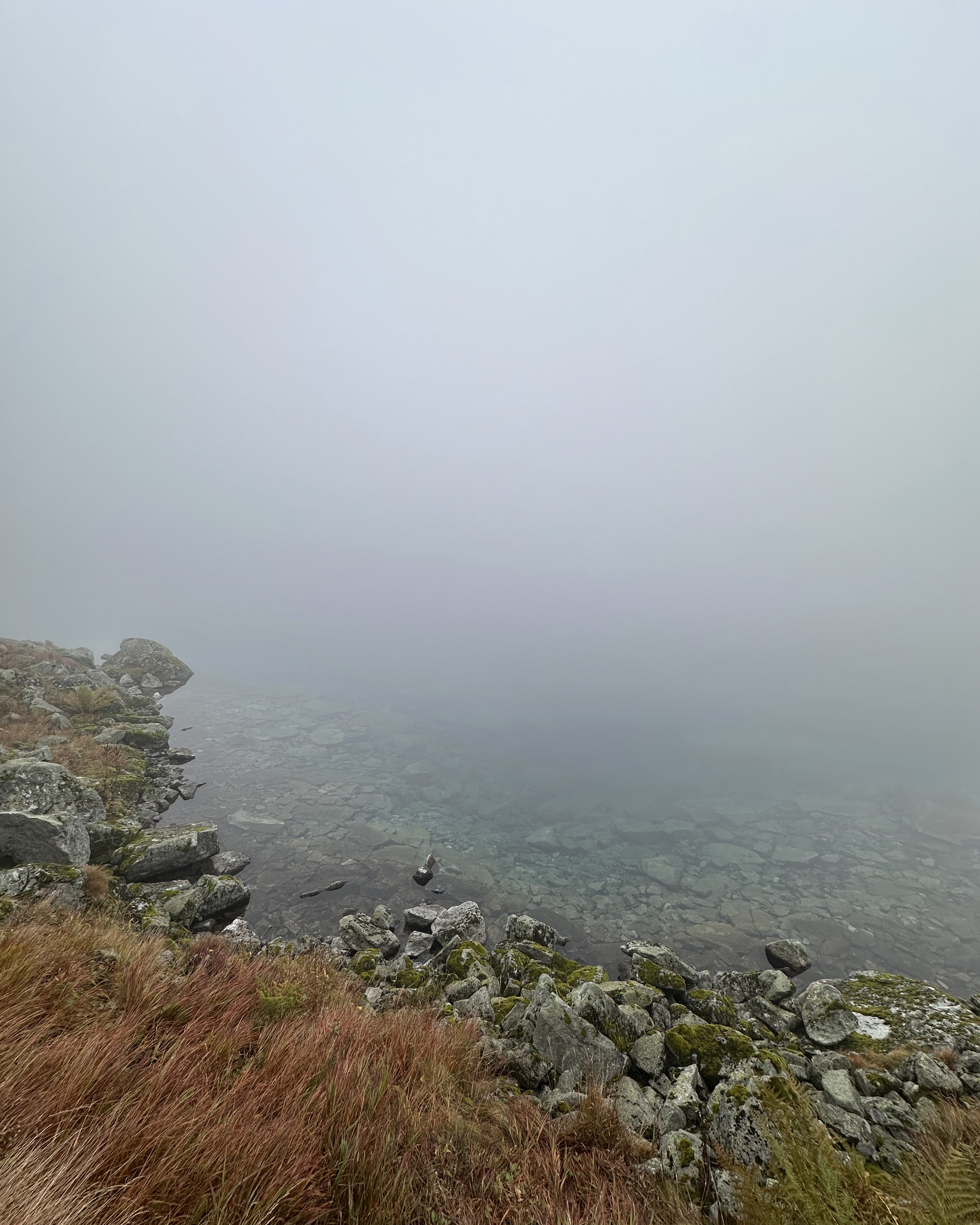
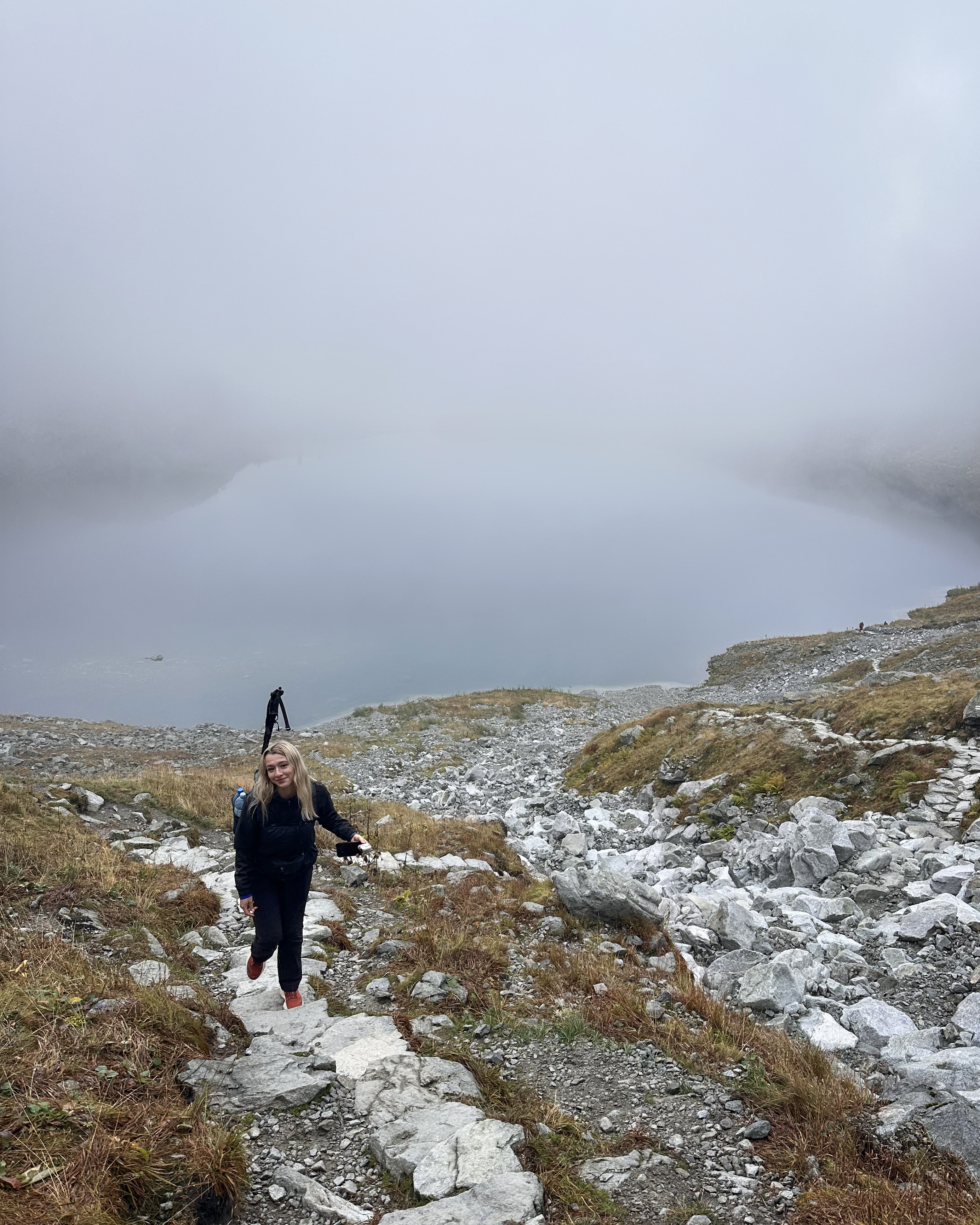
This continued for another hour or so, until we started to emerge above them.
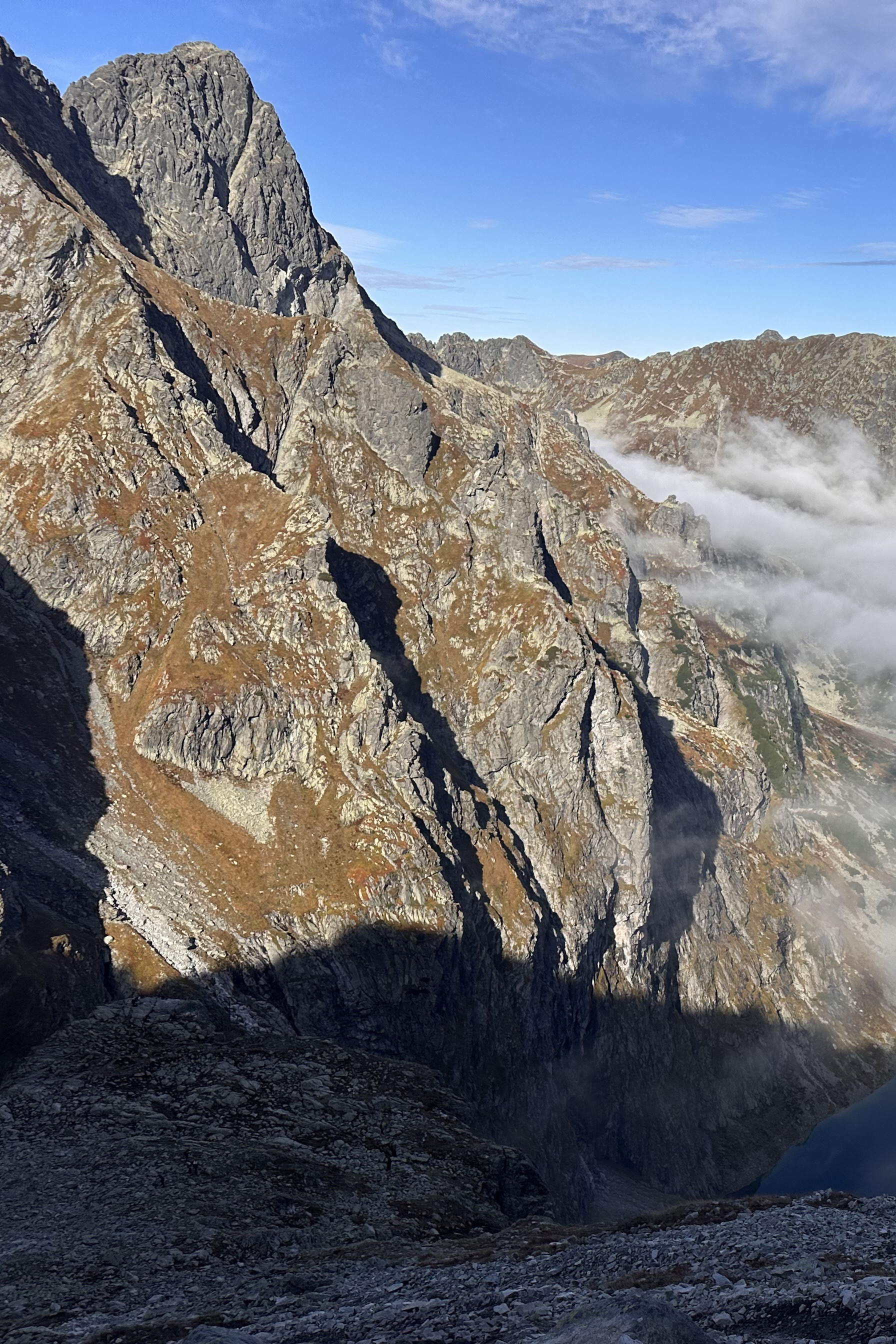
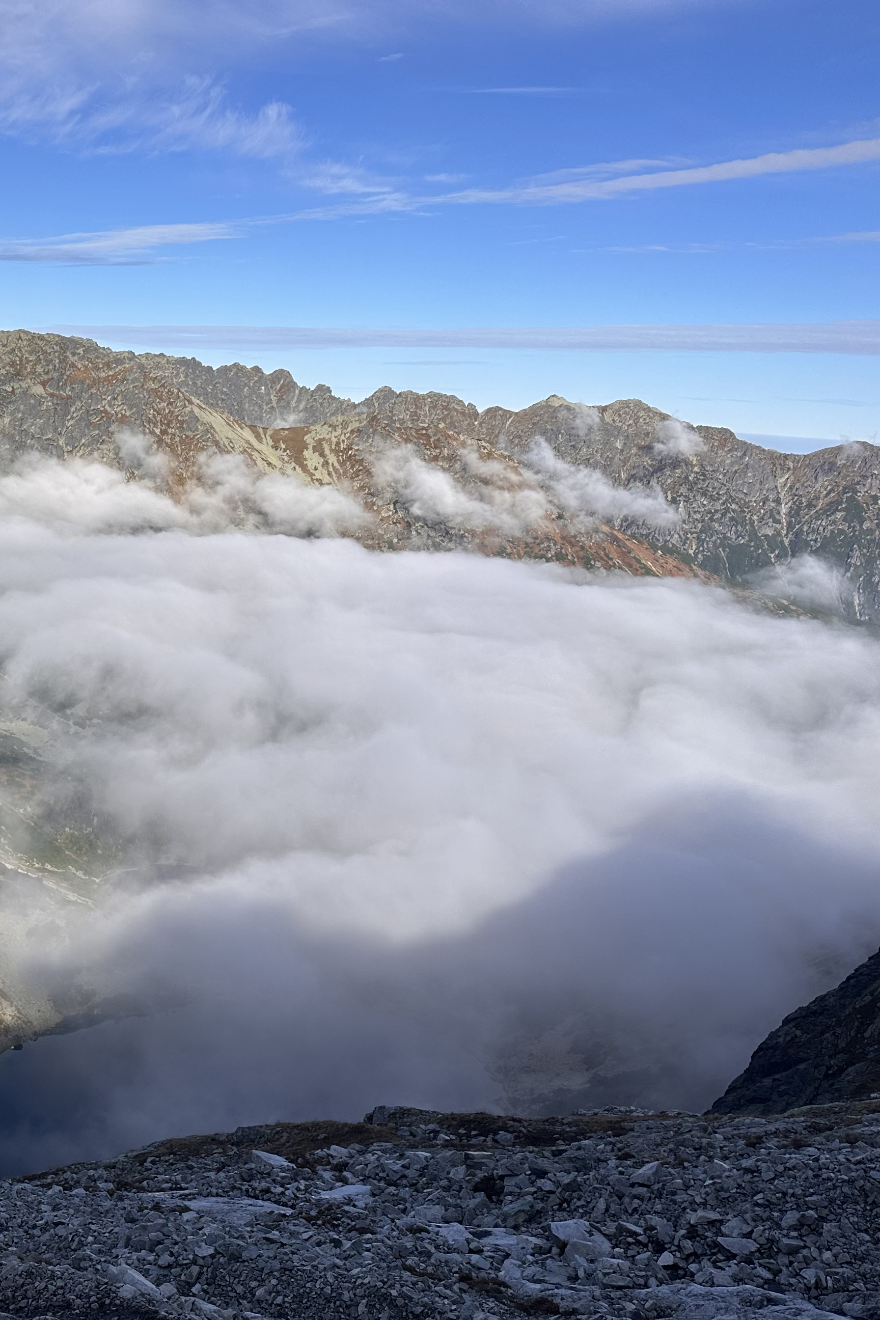
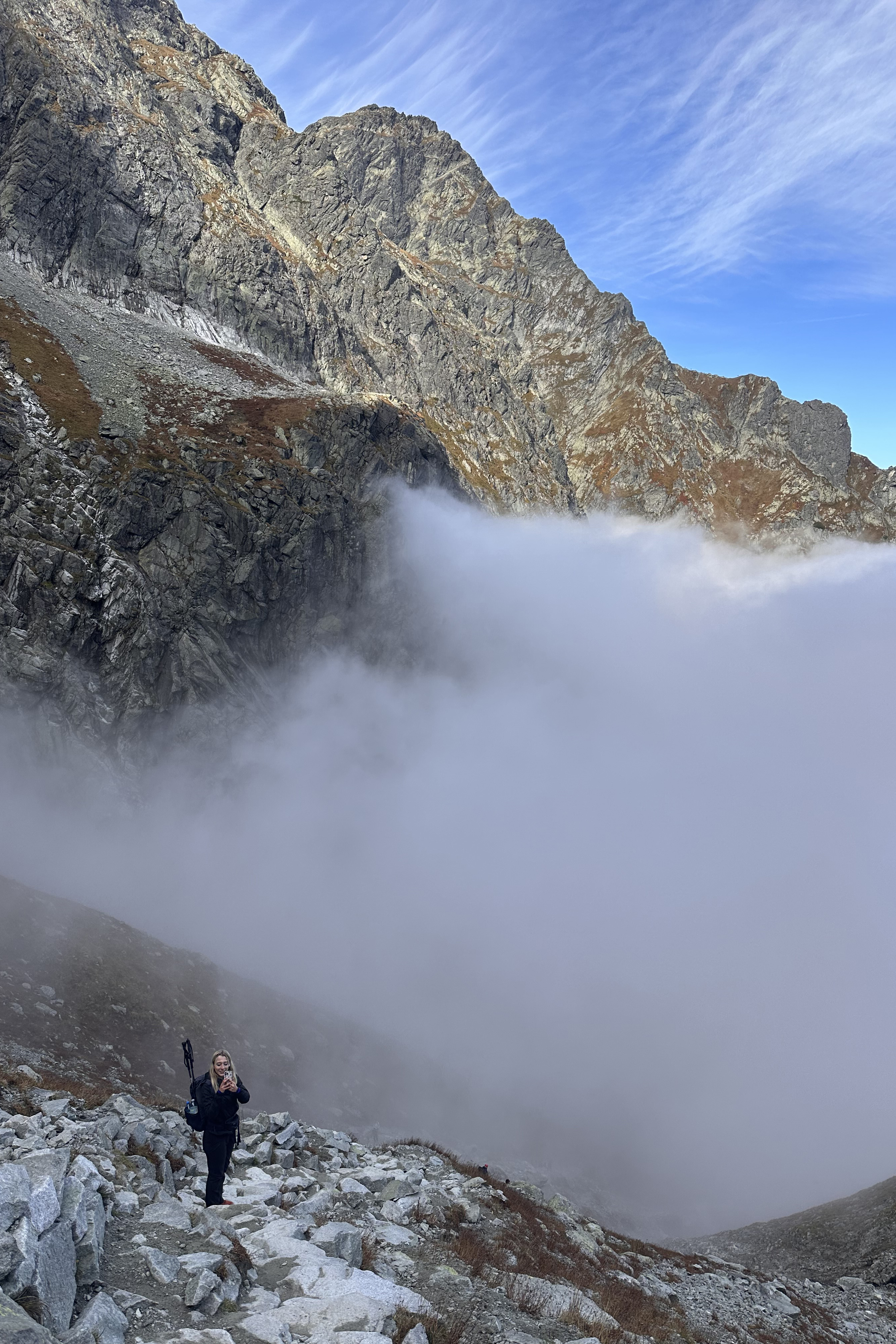
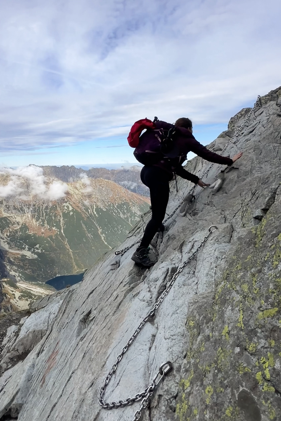
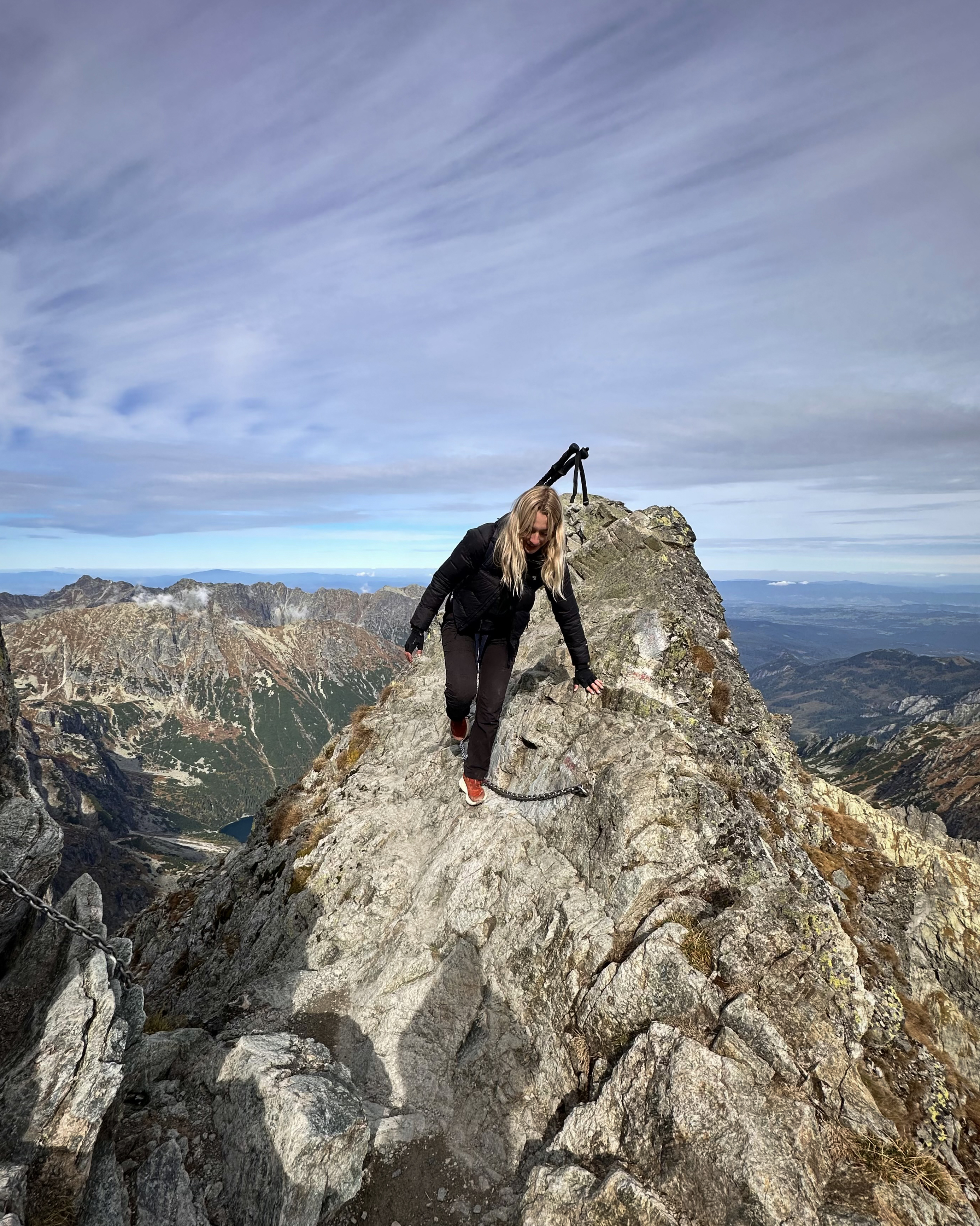
So, just in time for the best part of the route (the scramble), the clouds dissipated, revealing incredible views of the two lakes.
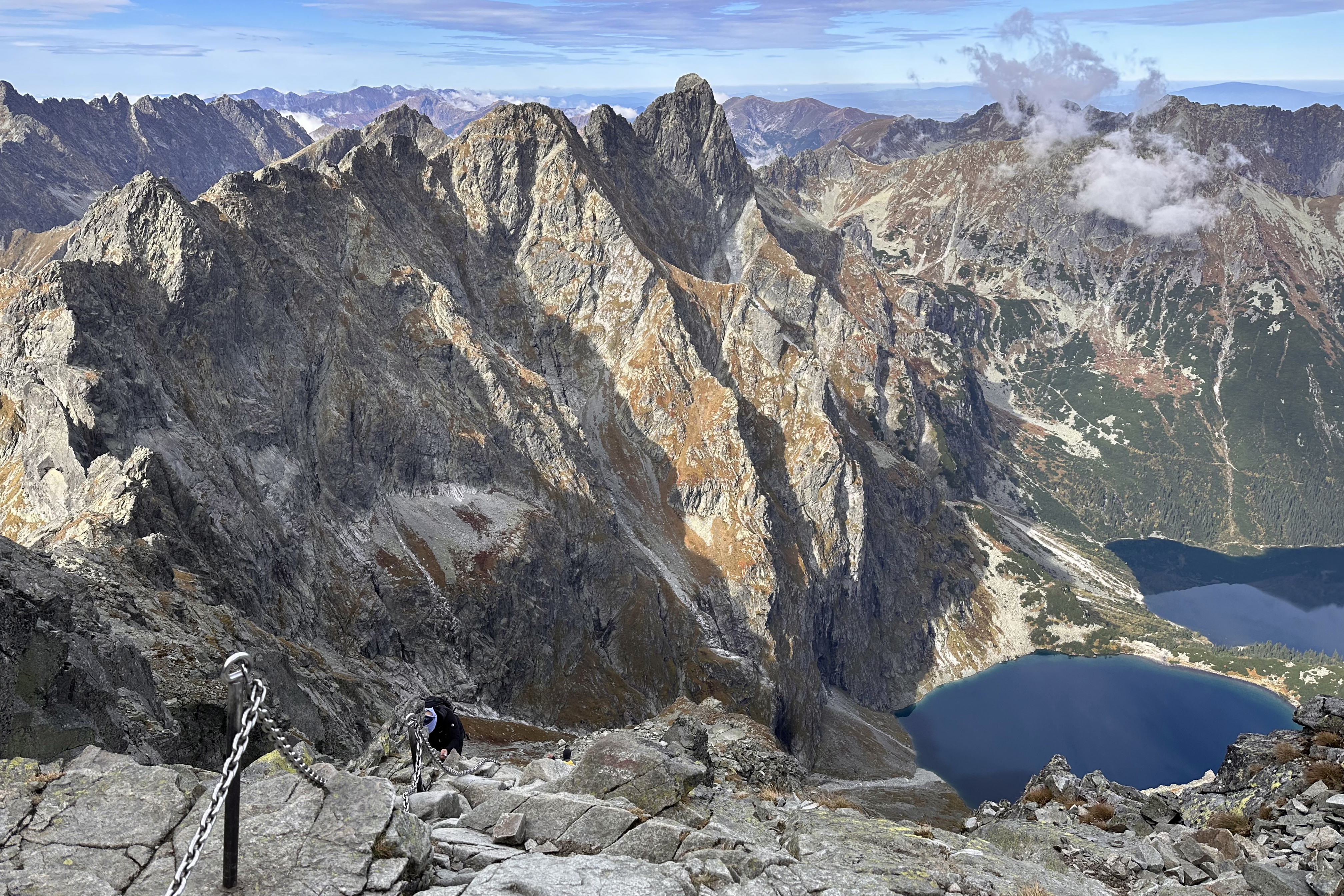
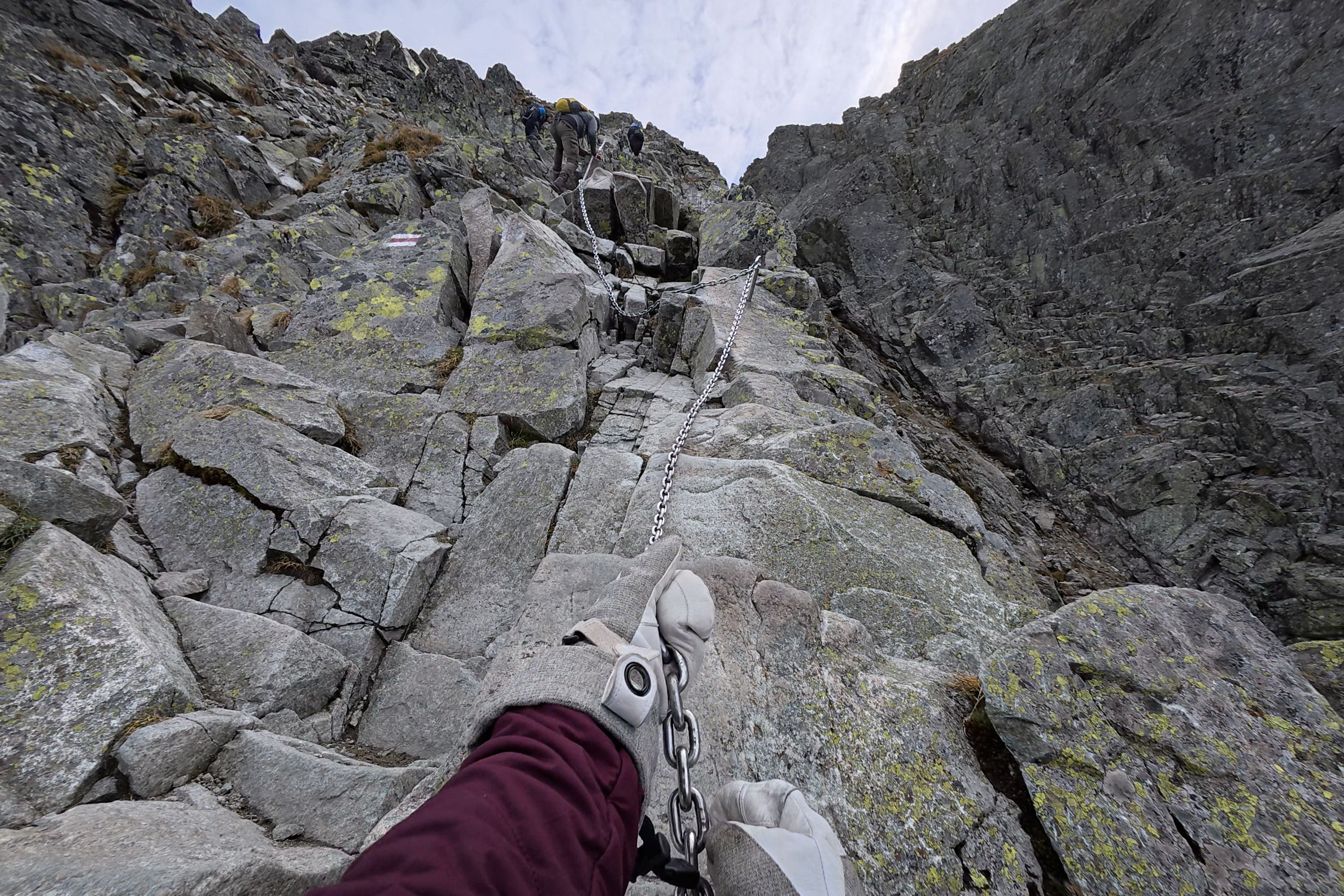
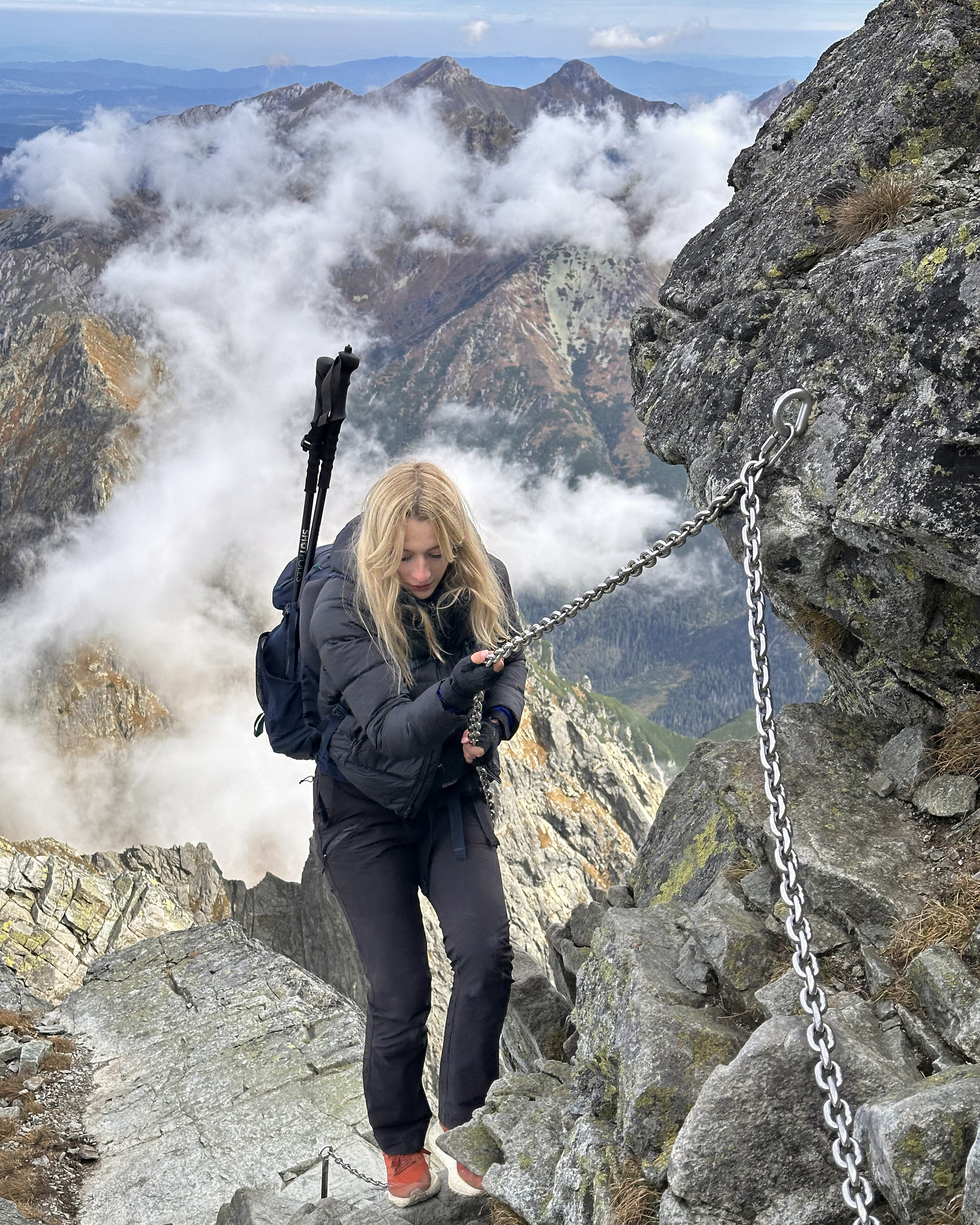
The scramble itself has many sections secured by chains (not cables, so a via ferrata set wouldn’t be the most practical or necessary). I found the difficulty similar to Triglav, just with less exposure most of the time. The sun wasn’t hitting this side of the mountain, so I was doing most of this with mittens. Easily-cold hands or not, I’d still recommend bringing at least some grippy gloves along for this part. Helmets would be a good idea as well. We didn’t have them (half of those we saw out there did), and there was zero falling rock…but it’s still best to have one on (especially earlier in the season with less stable rock and more crowds).
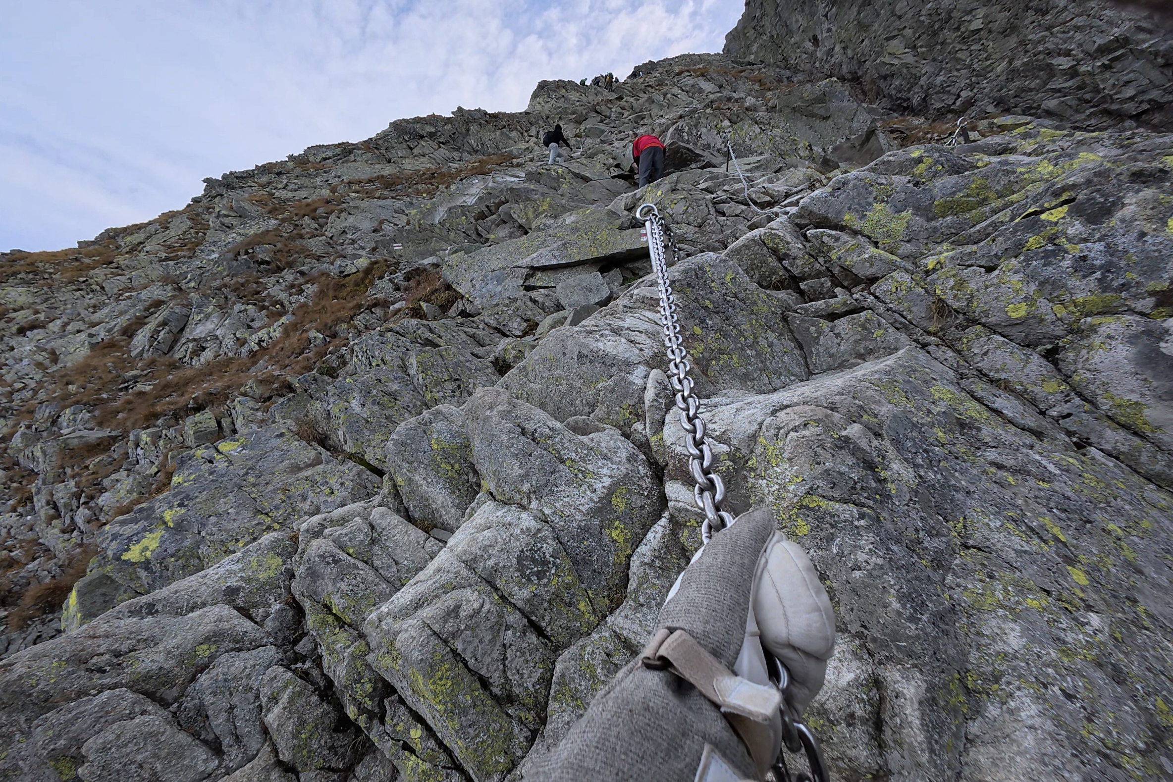
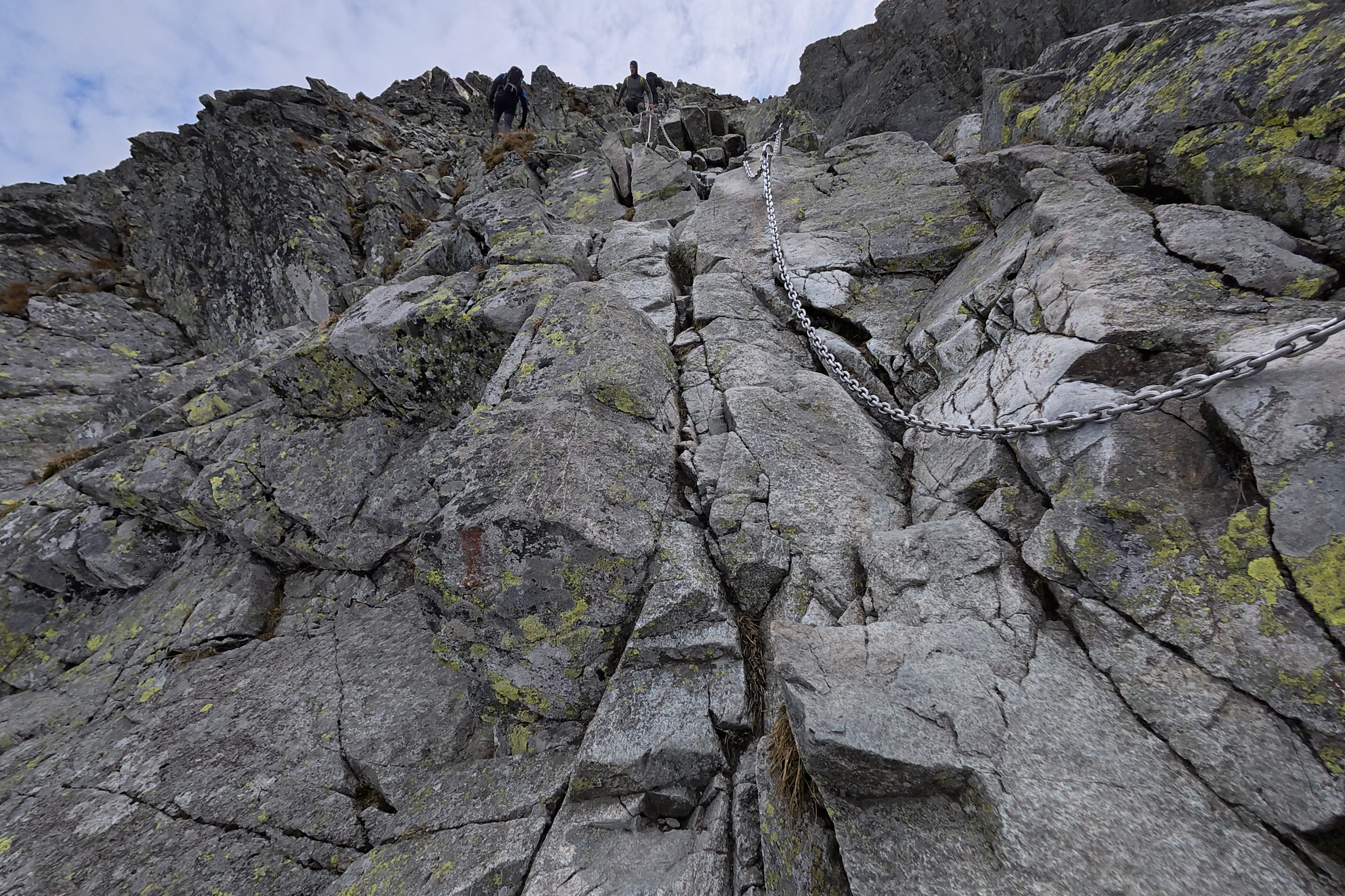
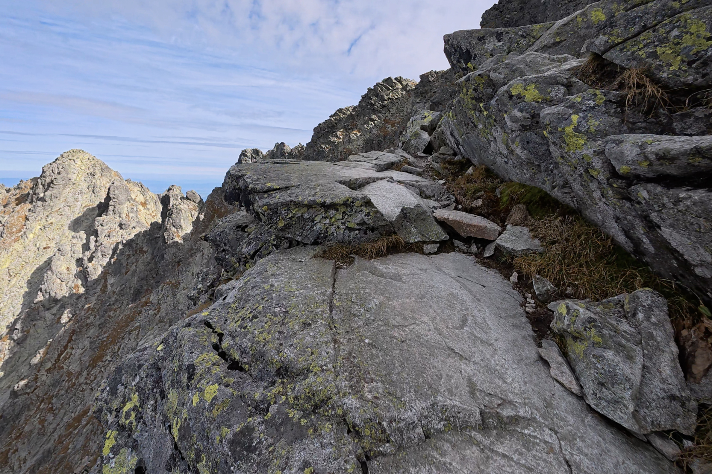
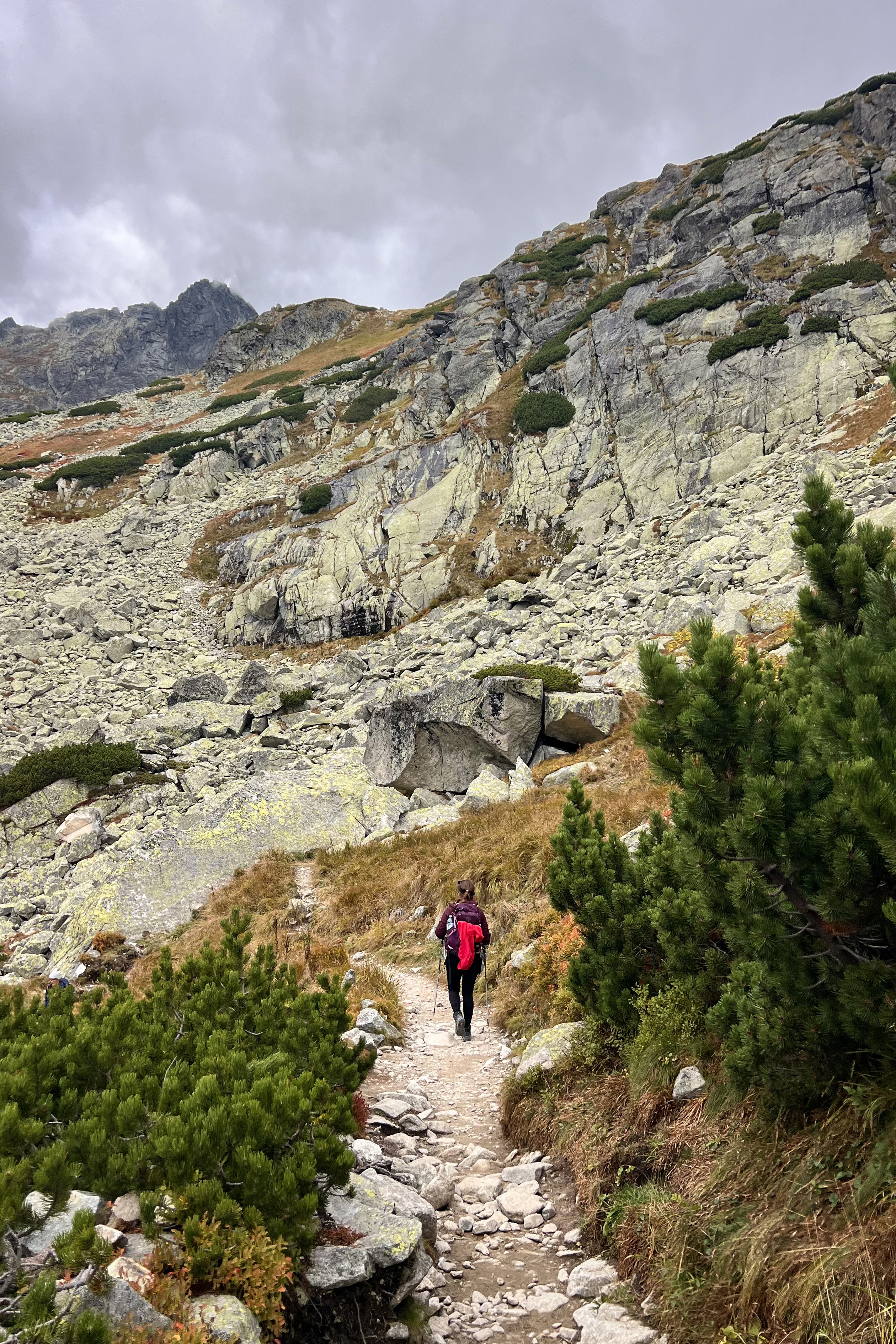
I quickly understood why it’s recommended to summit Rysy from the Polish side. It’s fun, and the views just get better and better.
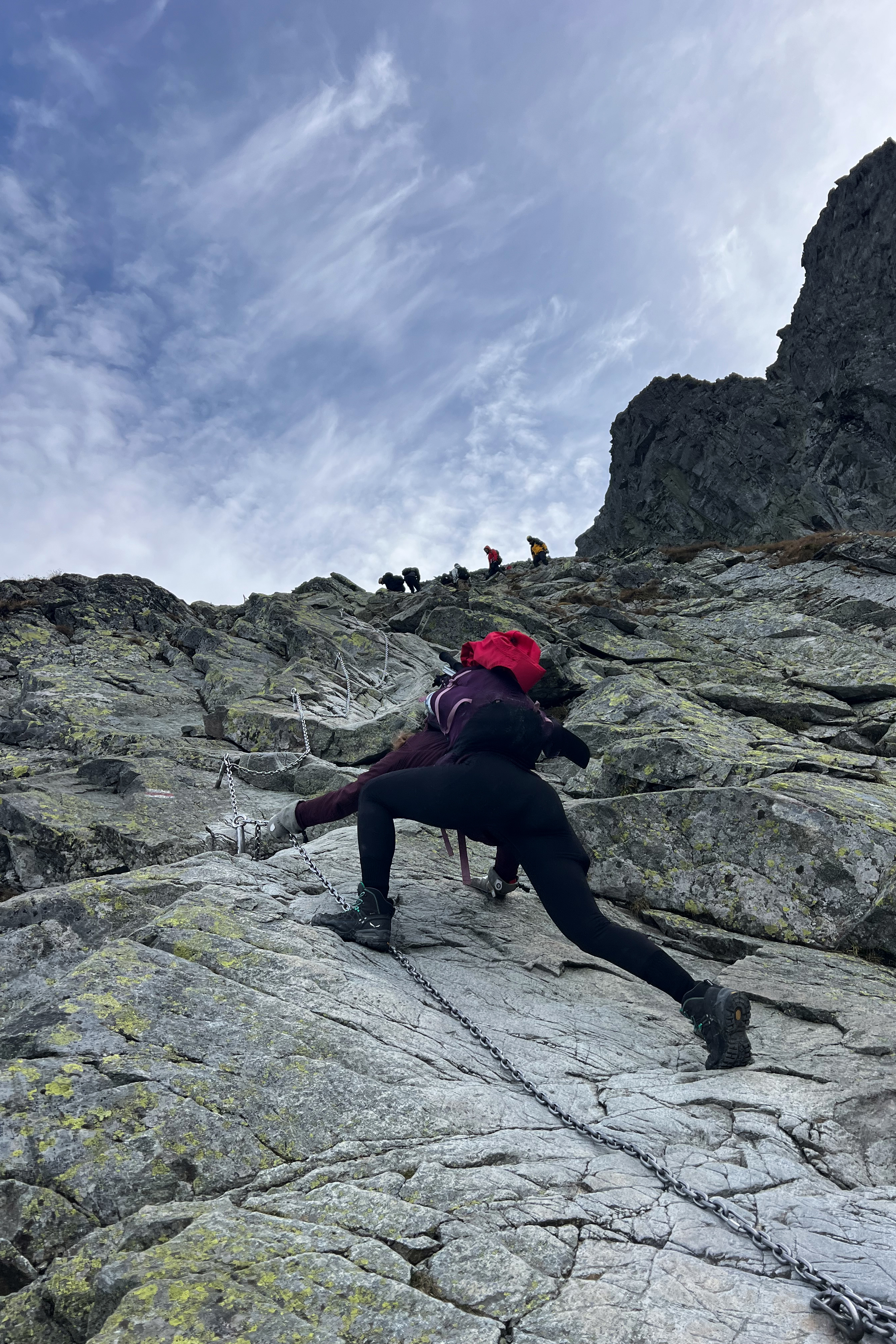
While many sections are steep, no-stopping zones, there are plenty of spots for snack and view breaks. We didn’t run into any queueing issues that the mountain is typically known for. The early start and late-season ascent was paying off!
The summit came into view, and we started the final push.
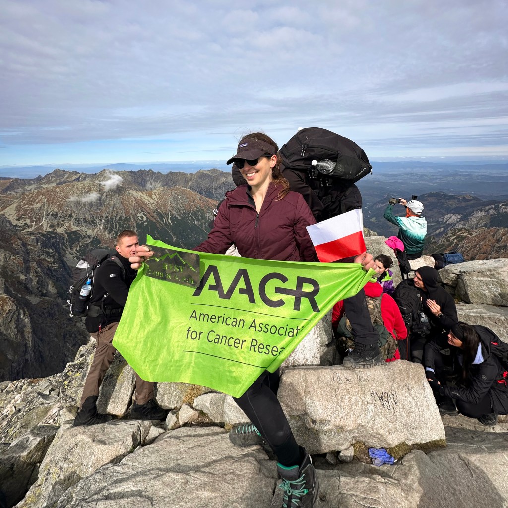
Within 10 minutes of those photos above, we were standing on the top of Poland!
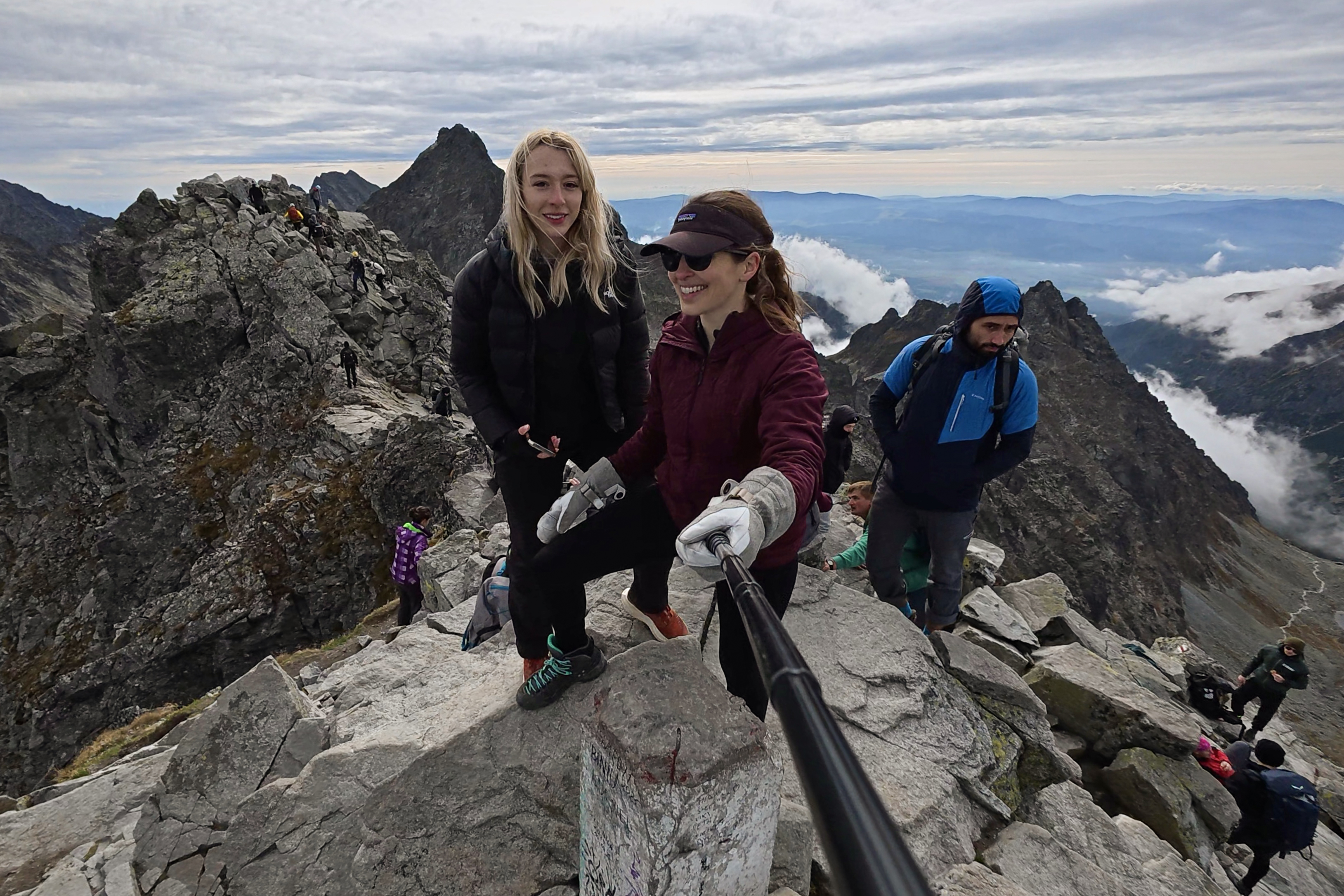
Rysy has twin summits, one in Poland and one in Slovakia. It doesn’t count for both countries, unfortunately, because Gerlach in Slovakia is higher. That one is actually the highest point of this whole mountain range, and it’s visible from Rysy! We didn’t stay long on the Polish summit…it was a tad crowded, if it wasn’t obvious from the summit photo at the top of the post. The Slovak summit has a great view of it, though. (:
We had summited by 11:30am, so pacing was going perfectly.
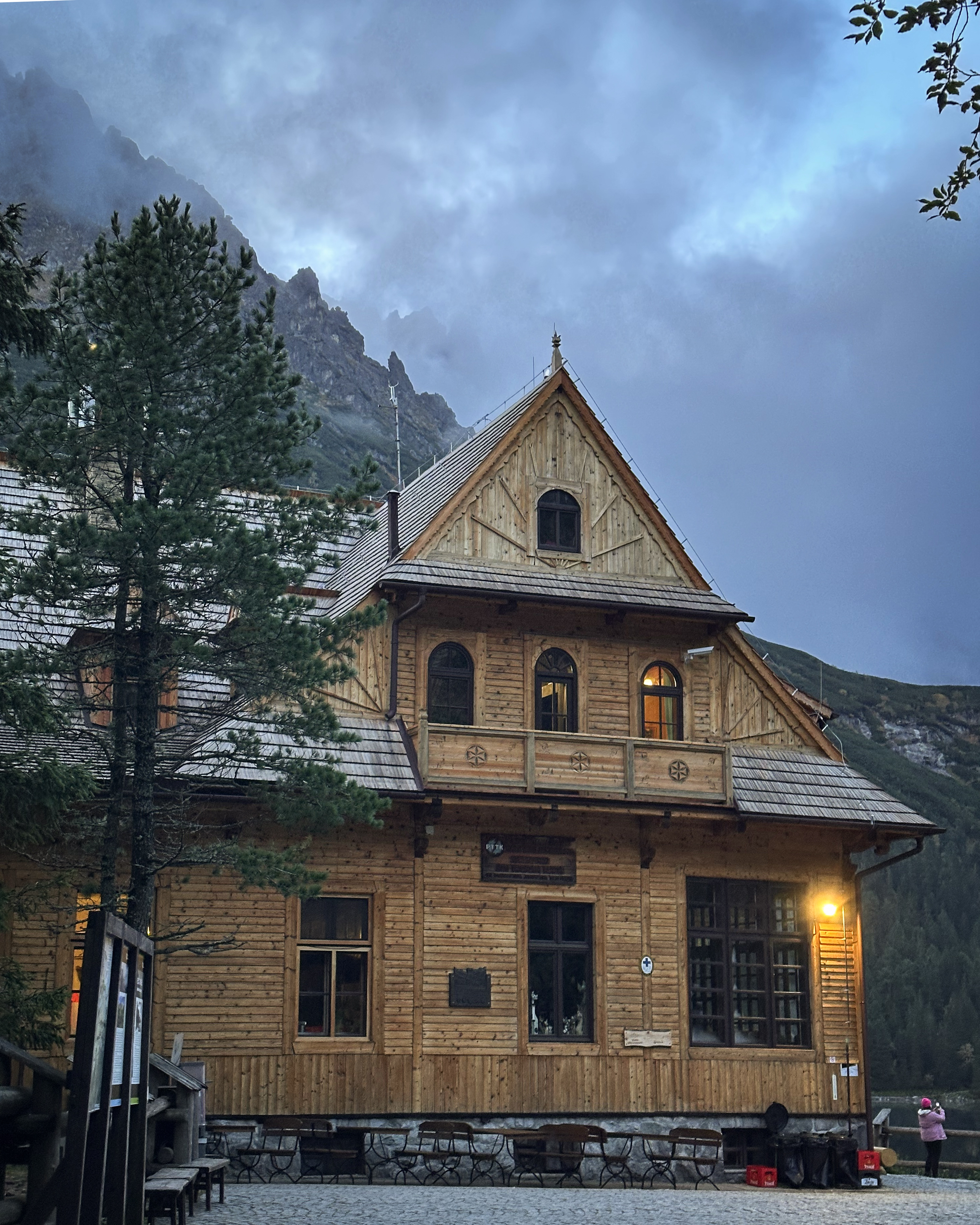
Less than an hour down the mountain, on the Slovak side, was Chata pod Rysmi (“Hut under Rysy”), the highest mountain hut in the Tatras. We stopped for a hot lunch and to use the nearby facilities (toilet with a view).
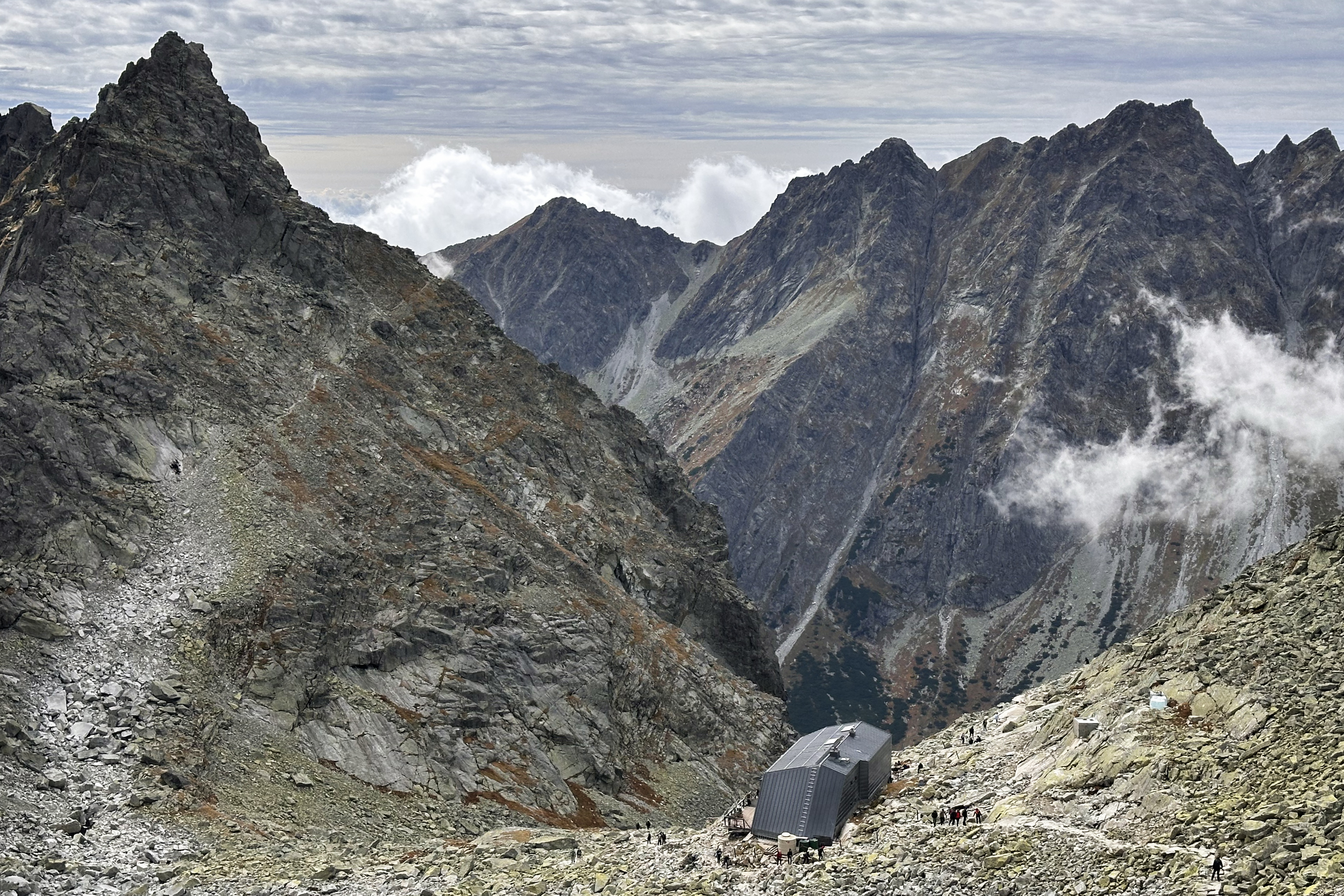
See the shape of the hut? The much smaller original version took one year to build and included just a dining hall and 24-person dorm. It was built in an avalanche path, which meant that it was destroyed and rebuilt several times, until it was almost entirely destroyed in 2000. They thought about moving the location of the hut entirely, but they ended up changing the design to the more avalanche-proof slanted roof it now has. It reopened in September 2013 (took a while because of budget and back-and-forth about the best plan for the hut).
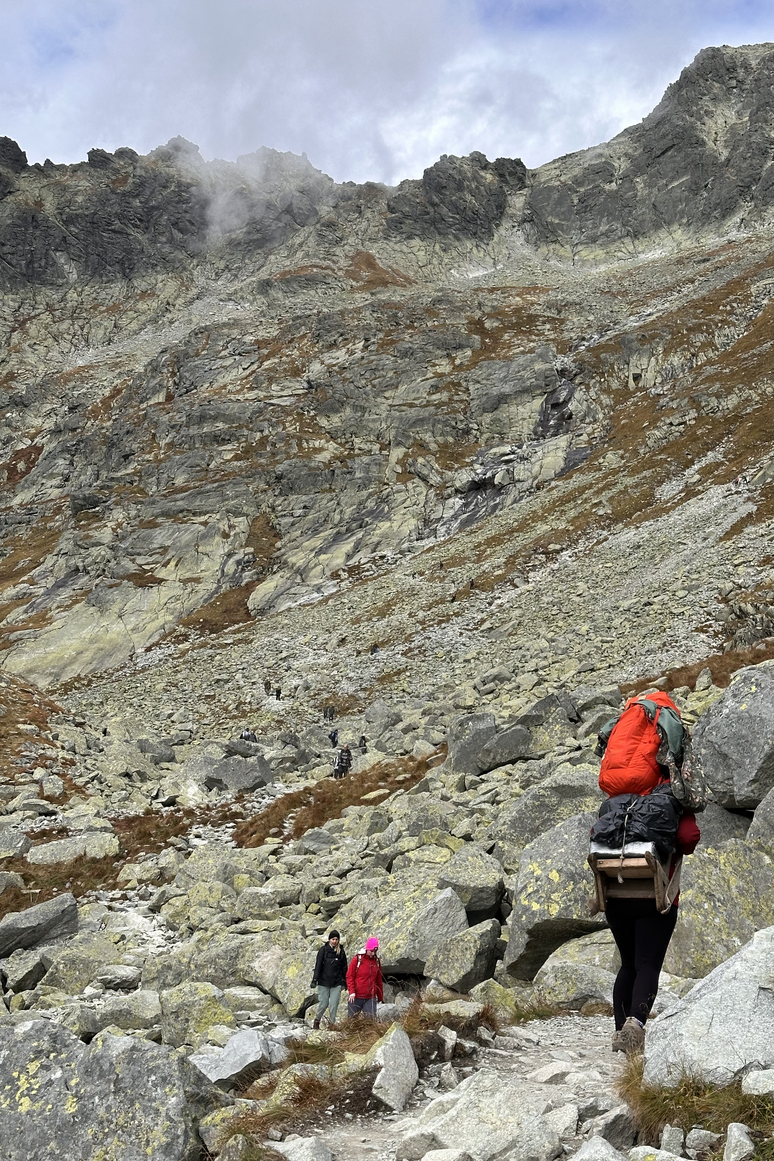
As we resumed our descent, we saw several people carrying very large loads on wooden krošňi, or backpacks. A krošňa is visible in the photo above.
When researching what this was about, I came across a really well-made YouTube video published only a month ago, by Backpacker Felipe, called “I Tried the Extreme Job of Europe Last Sherpas“. In it, he explains that Slovakia is one of the last countries to use human porters (šerpa or nosič) to shuttle supplies up to their high mountain huts. They carry loads of up to 100 kilos on unpadded, wooden frames with old fire hoses used for straps. There are no helicopters or cable cars here, just humans to supply everything you can get in the hut. There is no equivalent on the Polish side of Rysy, as Morskie Oko hut has a proper road leading to it.
While the Slovak side is known to be significantly easier than our ascent route, it’s no stroll, especially not with such large packs. There is a section with chains and a steep ladder, which is shown in my Instagram highlights and that nosič video! I was on this mountain in perfect conditions, but they head up even on snowy, icy days. It’s the only way the hut can operate.
I would really recommend watching that YouTube video for more information, as it shows this tradition better than I could possibly explain it here. I also learned from it that only last month, the hut’s keeper of almost 50 years, Viktor Beránek, was replaced by Ján Ševčík after a controversial selection process. To read more, I’m linking an article by the Slovak Spectator and the petition created by those loyal to Beránek who felt the process was unfair. It seemed that some of it had to do with modernizing the hut (introducing WiFi at minimum for communication with mountain rescuers, as well as digital payment options). I have no context beyond that, but I’m happy to have seen this historic mountaineering spot before it goes through more significant changes.
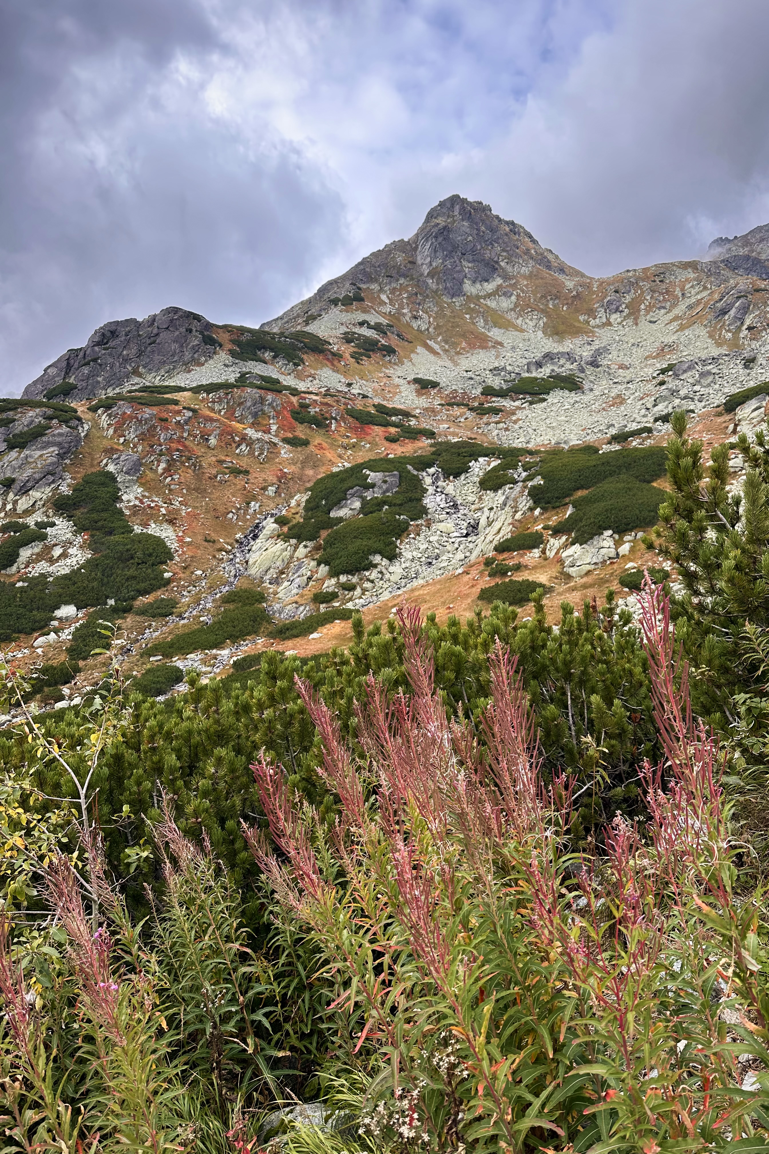
The Slovak side was full of vibrant autumn colors. As Felipe mentioned in the YouTube video, there are many rock benches along the way called stands, built for nosiči to rest from the added weight of their packs. I was using these to rest the toes, as it was the first hike since the post-Gjeravica evacuation 7 weeks earlier!
After the obligatory soul-crushing final descent through the woods that every high point hike seems to include, we made it back to the car. The one-way logistics had actually worked! (:
Here’s how the timing of our day broke down, for those interested in trying this route: 4:10 departure from Zakopane, 4:35 arrival to the trailhead, 5:00 hike start, 6:30 arrival to the hut, breakfast break until 7:30, summit at 11:30, break & at the “Hut below Rysy” by 13:15, descent resumed at 14:00, down by 17:45, to the hotel by 20:45 (then a quick drop-off of the rental car at the confusing airport parking lot with half-floors: 0, .5, 1.0, 1.5, etc.), in time to get a bit of rest before an early flight out the next morning. I’d recommend checking weather conditions on the Windy app (includes multiple weather models) and planning your day accordingly.
Tat(r)a For Now!
Those working toward the Crown of Europe might wonder why I didn’t tackle Gerlach in the same trip, as the starting point is very close to where we ended on the Slovak side (and where I’d already gone to drop the car off, pre-Rysy). This was the plan, but the weather had other ideas. So, it was goodbye to the Tatras for now, until 2026!
THANK YOU ❤
Thanks for reading my twenty-second Crown of Cureope blog post! At the time I stood on Rysy, we had raised $1,670 for the American Association for Cancer Research to fund lifesaving discoveries. As of publishing this post, we are at $2,675 raised of our $2,500 2025 target. We’ve crushed that, but contributions are still very much appreciated! (: Thank you so much to everyone who’s donated and spread the word to help hit the fundraising goal, and to fellow hikers for tips and company along the way to these summits. I’m excited to see what 2026 brings!!
P.S. This wasn’t my only Crown of Cureope trip involving Poland in 2025 – Sněžka, the highest point of Czechia, sits right on the border of Czechia and Poland! This was peak #7, and you can read that blog post here.

Leave a comment