
Early Snow
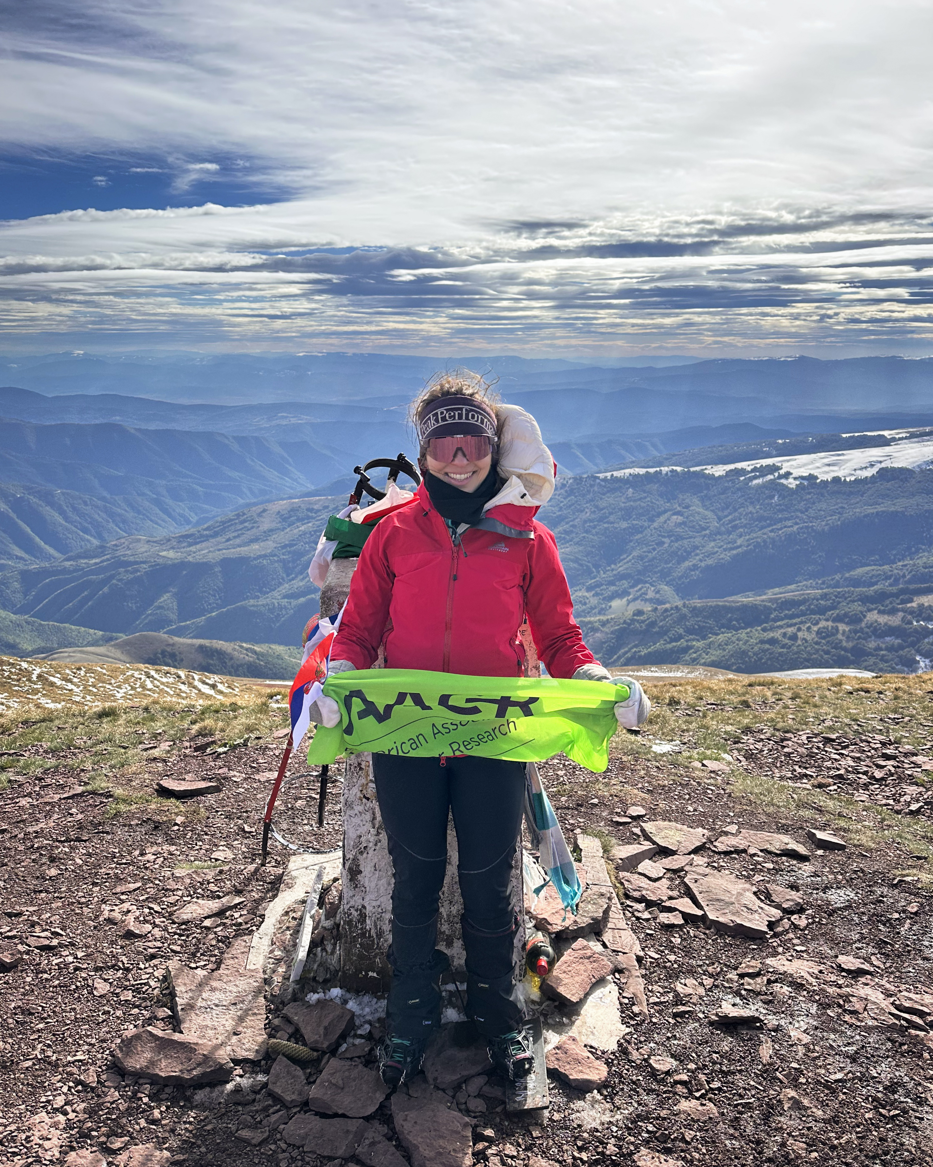
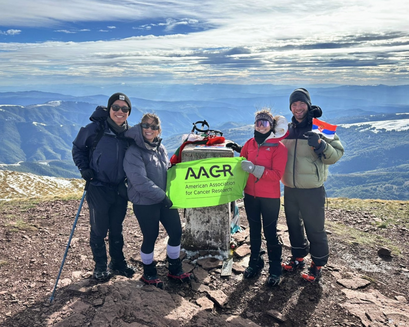
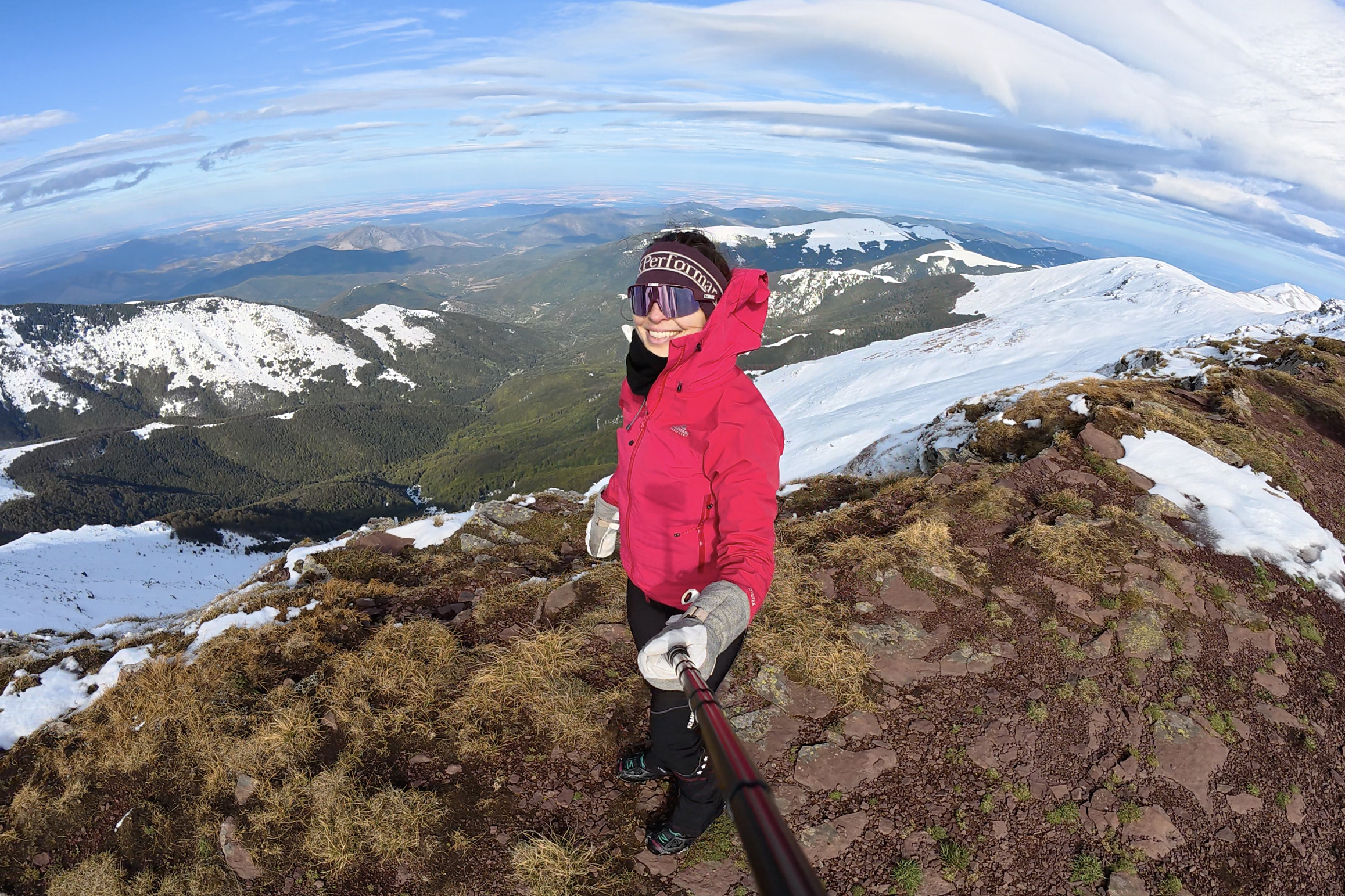
It might not be apparent from this photo (that doesn’t quite match the section header above), but this was my most challenging ascent of the year. The giveaway is maybe my failure to ensure I got a fully usable solo summit photo with the flag 😅. In case you forgot what it looks like, here’s the group shot with it not scrunched up (:
The plan formed a bit chaotically, when 4 hikers came together from as far as Vancouver (Geoff of @ajourneyinspired!) to tackle Mt. Olympus (Mytikas) in Greece. We were aiming to go at the start of October, but as we started to plan more in September, the weather was looking concerning. The peak was already at near-freezing temperatures, and given that there’s a Class III scramble from Skala to Mytikas…snow or ice would make it a much different experience. We pivoted and flew into Sofia, Bulgaria, so that we’d have Musala and Midžor as backups. Both are very doable in October, with the right gear and stable conditions. If Greece somehow looked more promising before our hotels’ free cancellation windows, we could pivot to still head down that way (it’s around 5 hours by car/bus from Sofia). Unfortunately, there was no space available in any of the Greek huts, so the only possibility would be a single-day ascent.
As October approached, it became clear that Mytikas would be too risky. We decided to go for Musala on Saturday and MIdžor on Sunday (from the Bulgarian side). Days before our departure, though…the forecast got even wilder. Both peaks would be hit with almost a meter of snow between the Thursday and Friday before. Mytikas would be dumped on as well. This is very atypical for early October. We didn’t have winter mountaineering gear, so we threw some micro spikes and gaiters into our bags and hoped for the best. Both Musala and Midžor are out-and-backs, so we planned to just see how far we could get on each. Forecasts have been wrong before, anyway…
Lakatnik Rocks
When we arrived to Sofia on Friday, we grabbed some food and drove to Borovets, the starting point for Musala. In the morning, I awoke to a surprise: another sudden onset of my delightful toe issue (the one that cut my Balkans trip short 2 months before). We drove to the trailhead anyway, at which point it was clear we’d be the first footsteps punching through an unstable first snowfall on a cold, windy day, up to the highest point in the entire Balkan region. No crampons, no axes, no winter boots. It was windy, so drifts could easily exceed a meter. I had zero good feelings about pushing forward, figured we had a zero percent chance of summiting (especially with the devolving toe), and made the call to bail before we’d begun. I have a no-chairlift rule in this challenge, but we still headed to the Yastrebets lift, hoping to make a day out of it and see the conditions up there for ourselves. It was closed. I decided I’d try to self-treat at our hotel later, contact my doctor, and potentially drop the others off at Midžor or some other hike the next day.
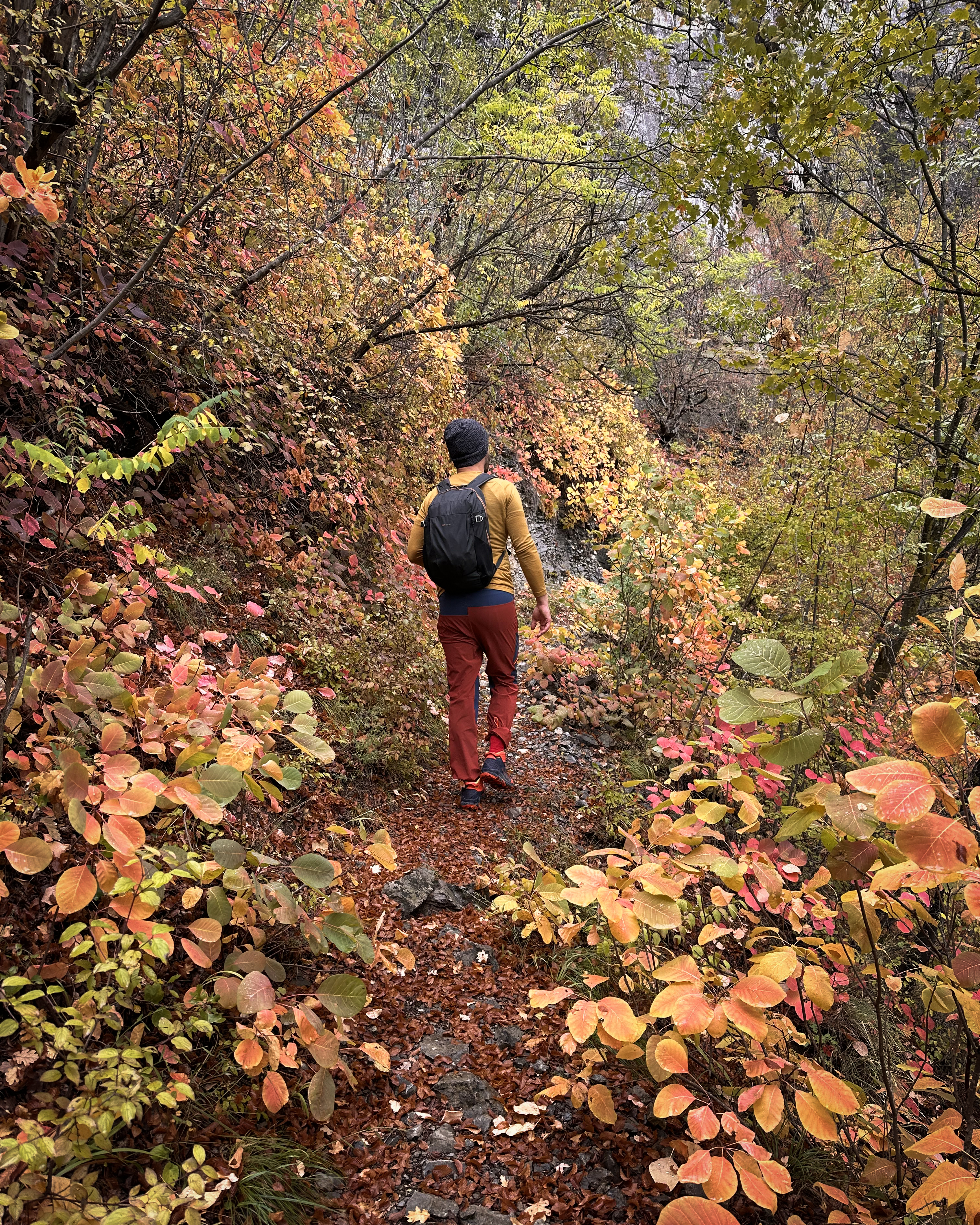
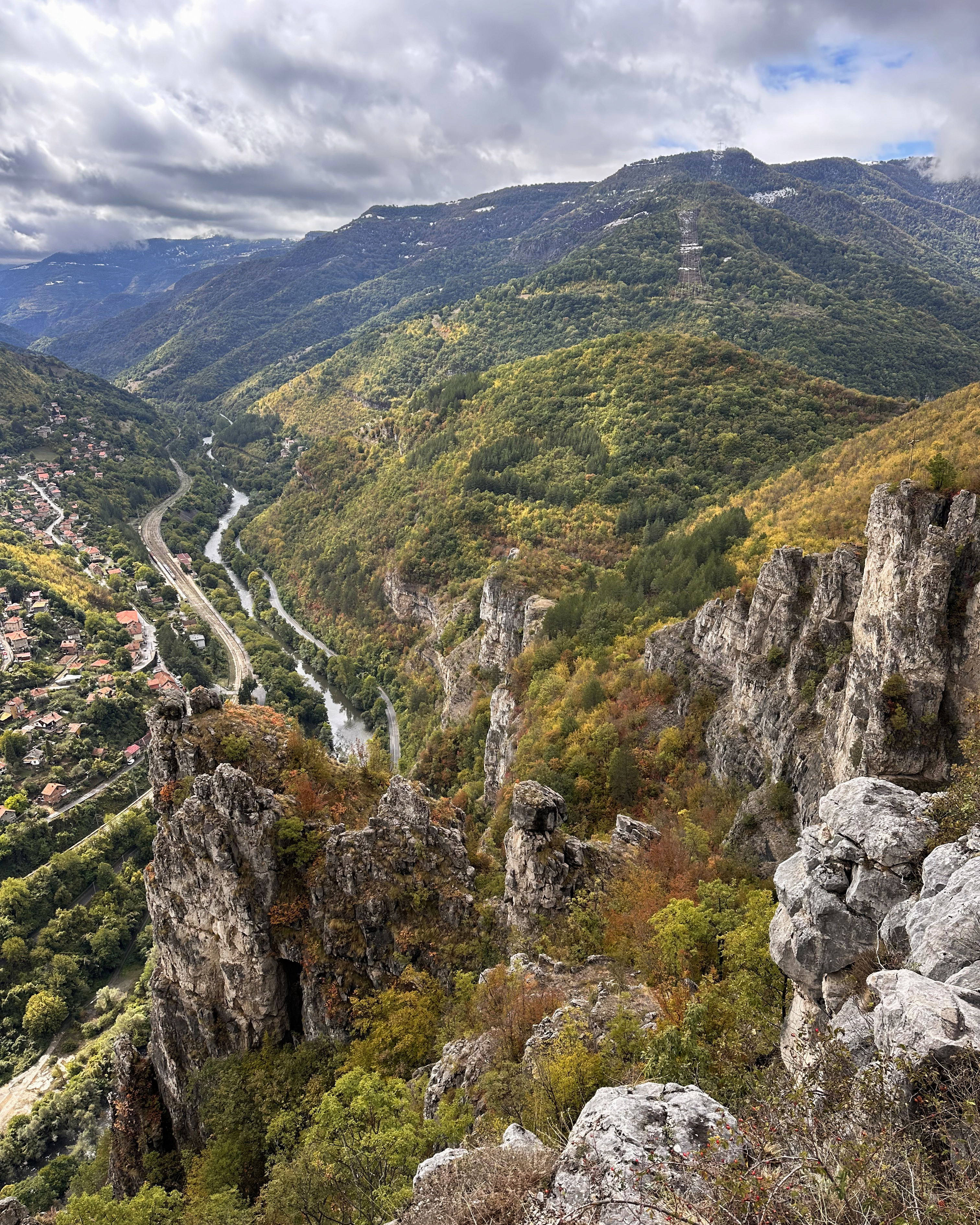
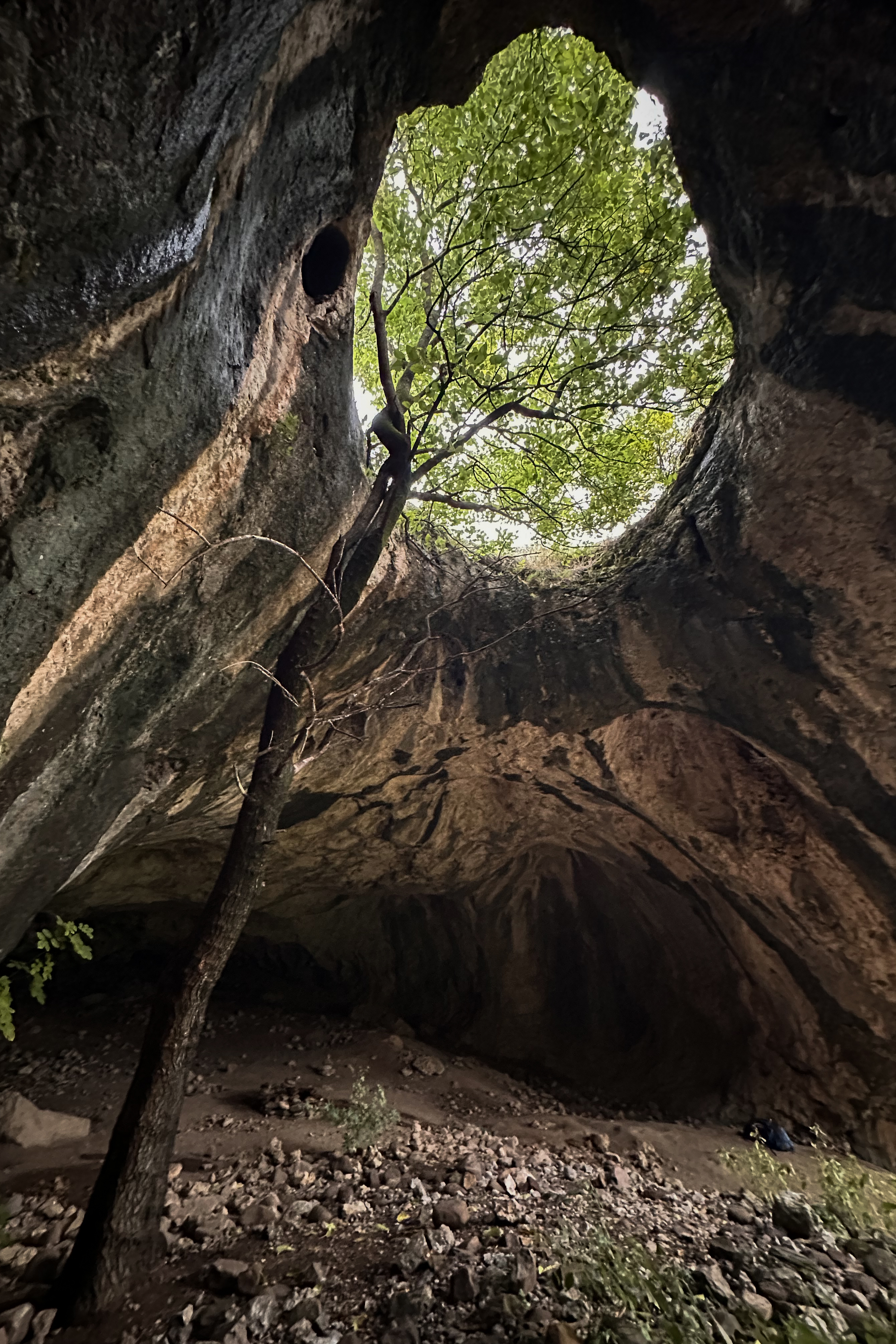
We had the whole day to make the 3-hour drive from Borovets to Montana, so we made a few stops at whatever looked interesting along the way. The first was Lakatnik Rocks! There are apparently over 100 caves within the limestone cliffs, so there’s a lot to explore. We parked along the side of the road, across from a restaurant that looked closed. No one was really around, and we started along a short loop hike that would lead to an overlook. In the second photo below, can you spot the tiny red-orange dot (our car)?
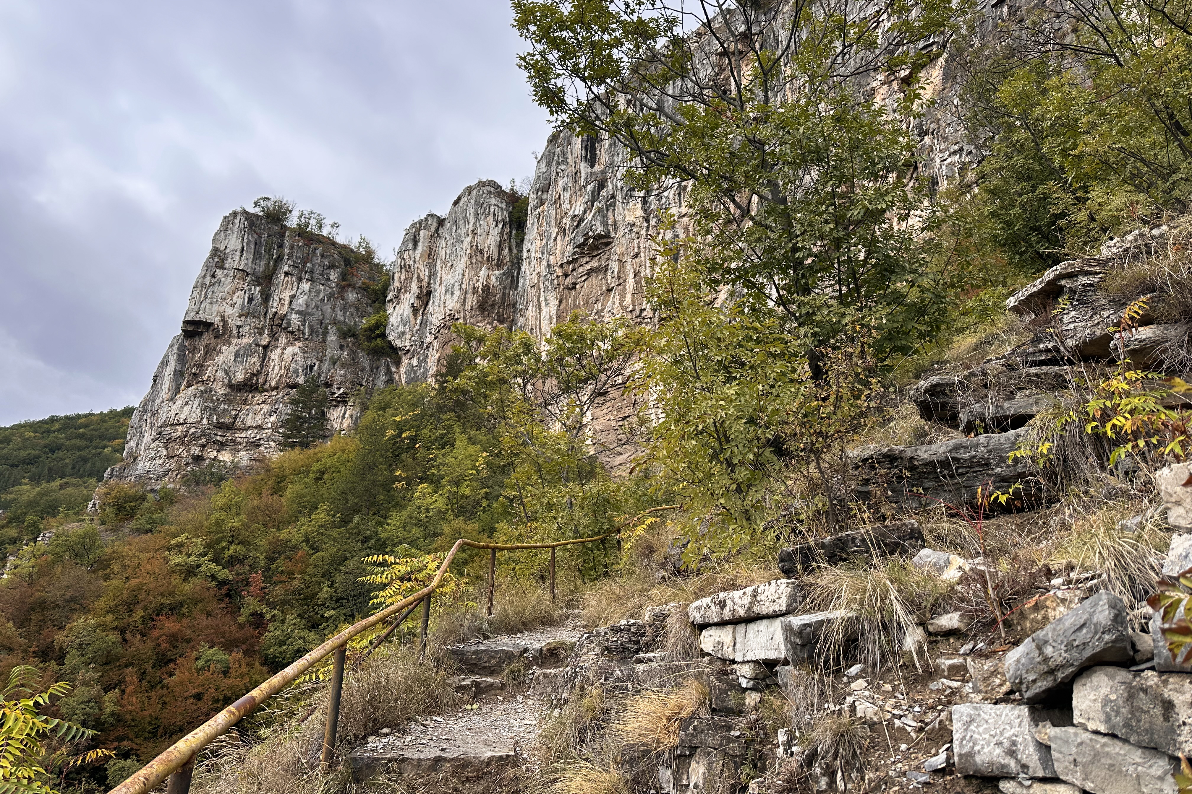
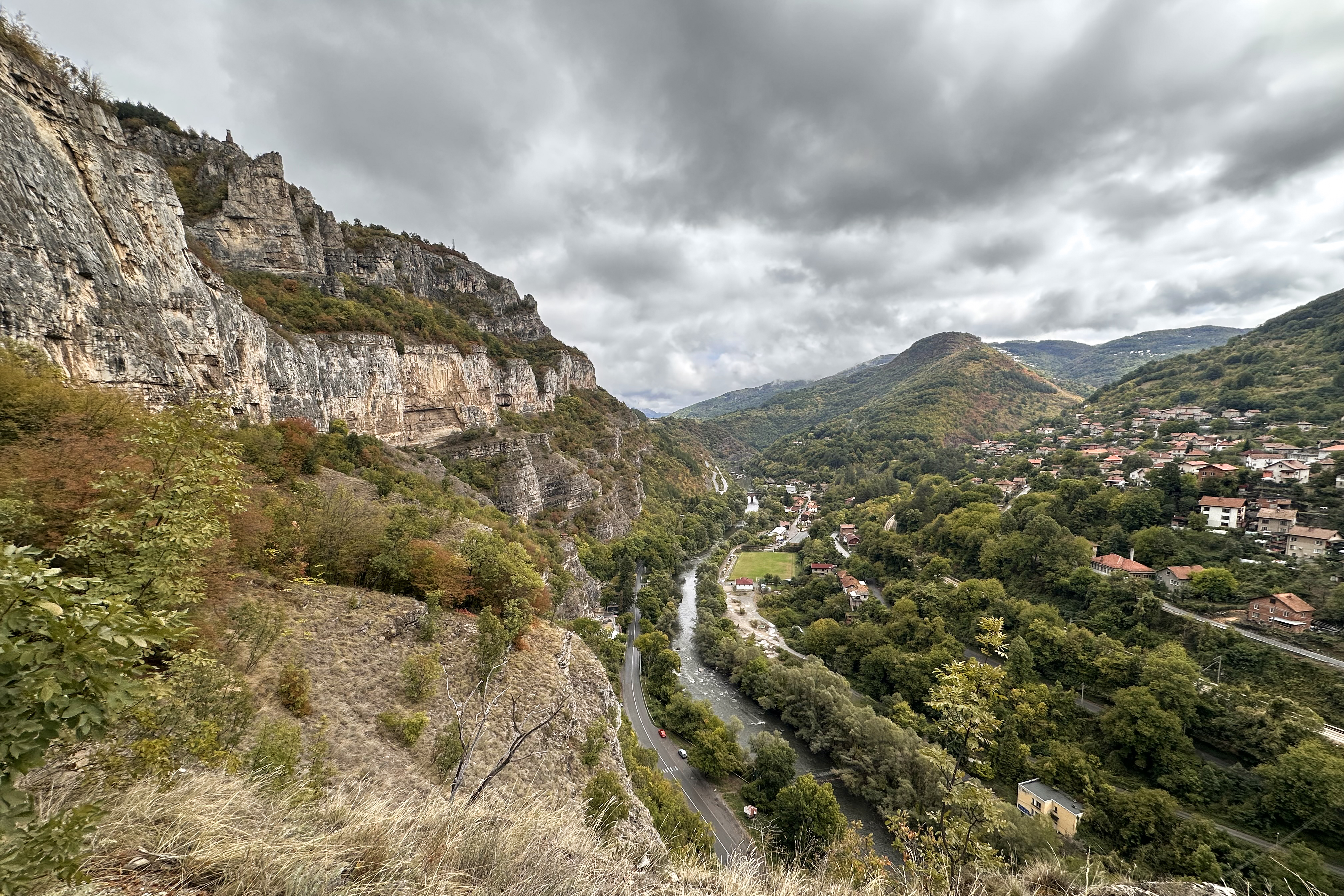
The first half of the trail switchbacked along the edge of the mountain on well-maintained steps. Further along, there were some rockier and steeper bits, but nothing too strenuous (doable in my Teva sandals, which I was glad I’d brought). When the sweeping views disappeared, vibrant autumn colors surrounded the path. It took under an hour to reach the top, which was marked by a brick tower/monument. More videos of this are in the Instagram highlights.
When we descended, we walked over to the restaurant. The inside surprised us…very full for 3pm on a Saturday. We had some hot beverages and snacks before heading to the next Google Maps-inspired spot: a tree growing through a cave!
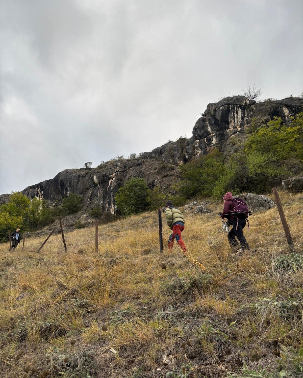
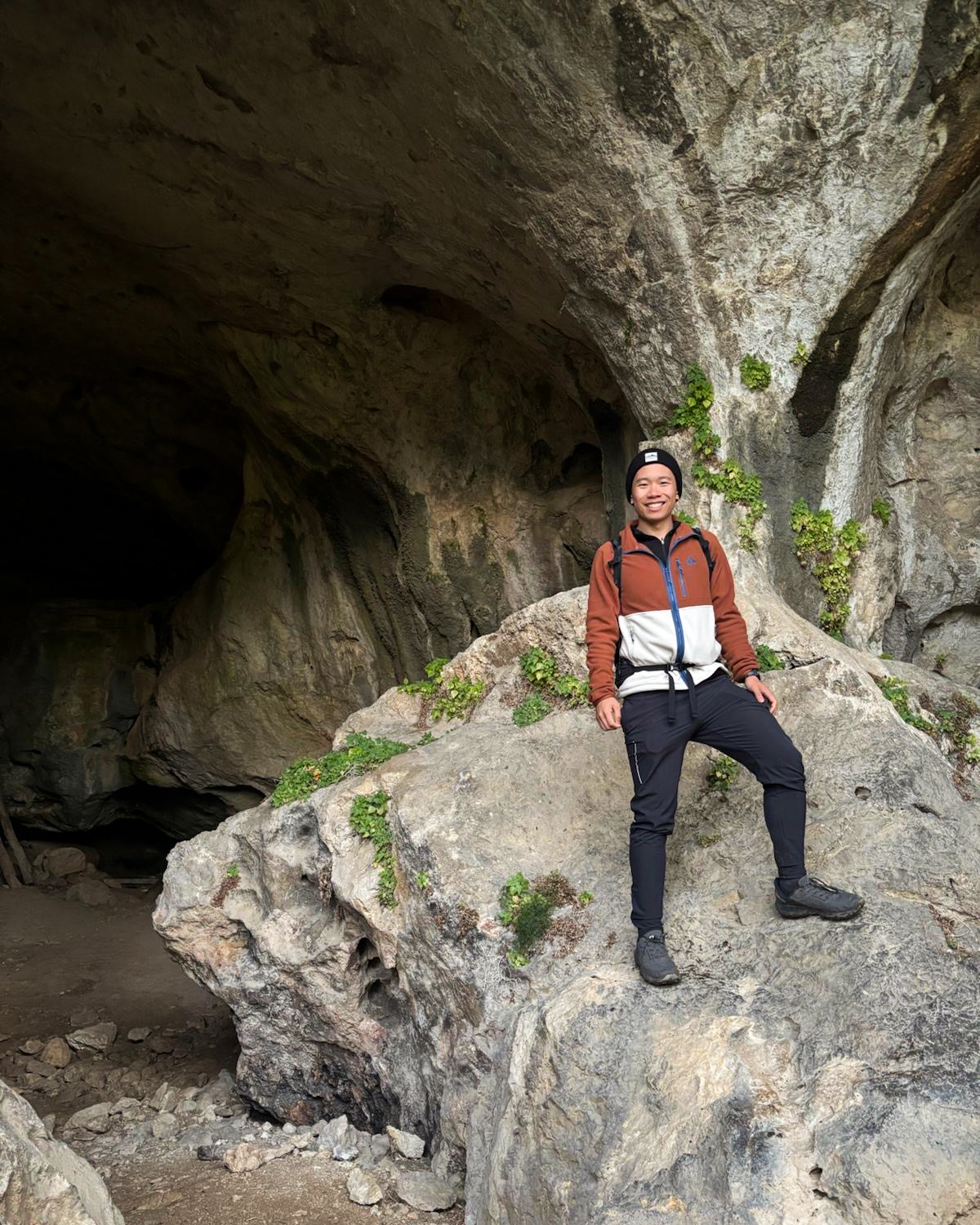
The Tree Cave of Botunya
For this next spot, I do not recommend Tevas. It’s barely a hike, but the short ascent can get preeeetty muddy and slippery!! There are 2 caves to visit: one large one with the tree, and a smaller one. I just headed right to the large one, while the others took a quick peek at the other.
And…here’s the tree!
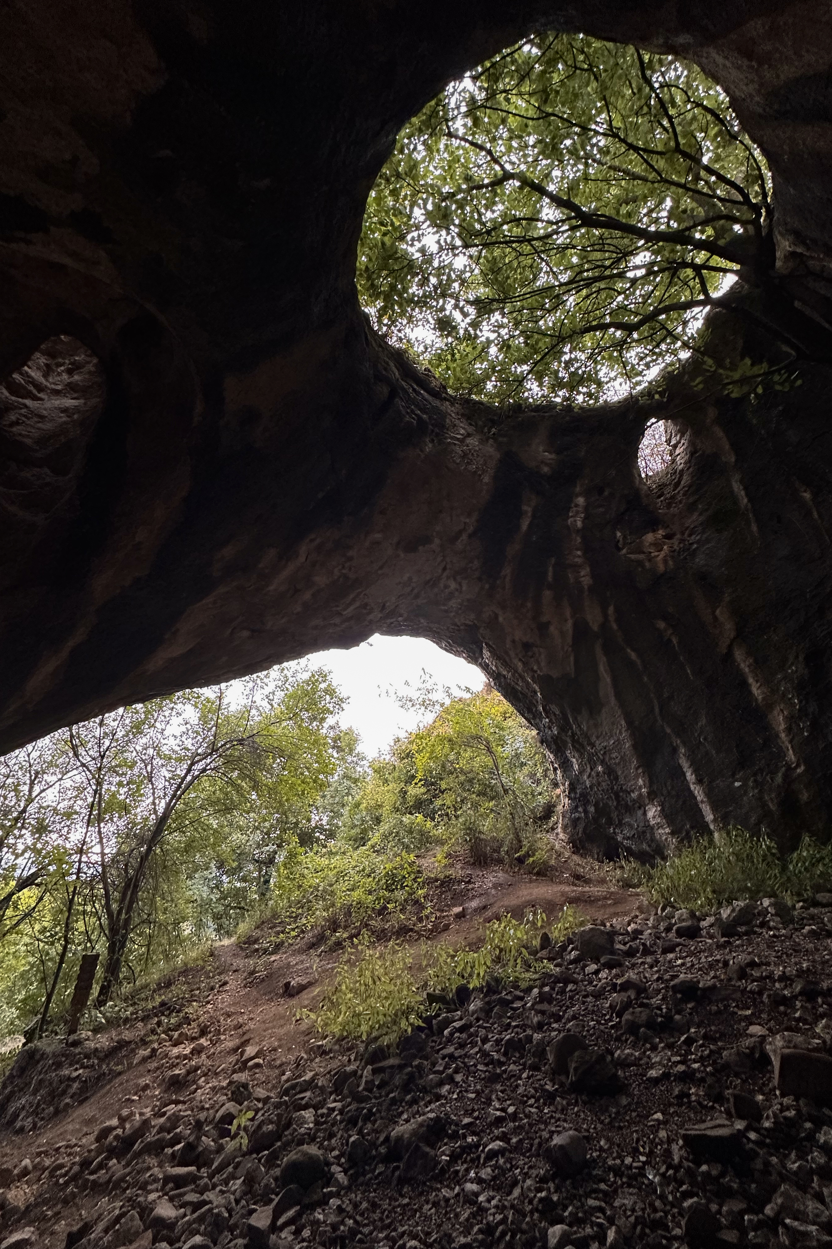
It was a pretty cool spot for a quick stop, complete with a deeper cave (with animal bones…maybe not somewhere to venture alone). Removing the mud from my Tevas was less quick. After that and a few minutes of stopping for a herd of cows to pass around our car (Instagram highlights…), we ended the evening in Montana, an hour from the Midžor (Миџор) trailhead.
The Hike
First, a quick blurb about why we decided to tackle the Serbian high point from Bulgaria. When driving around the Balkans in a rental car, it’s important to consider the cost of “green cards” for non-Schengen countries. These fees can be 100 euros or more simply for the insurance needed to drive across borders. On top of costs, there’s also time…my only experience with this was the crossing from Albania to North Macedonia (near Ohrid) taking over 1.5 hours, but Sven had gone to/from Serbia twice already by bus, each time taking 2.5 hours.
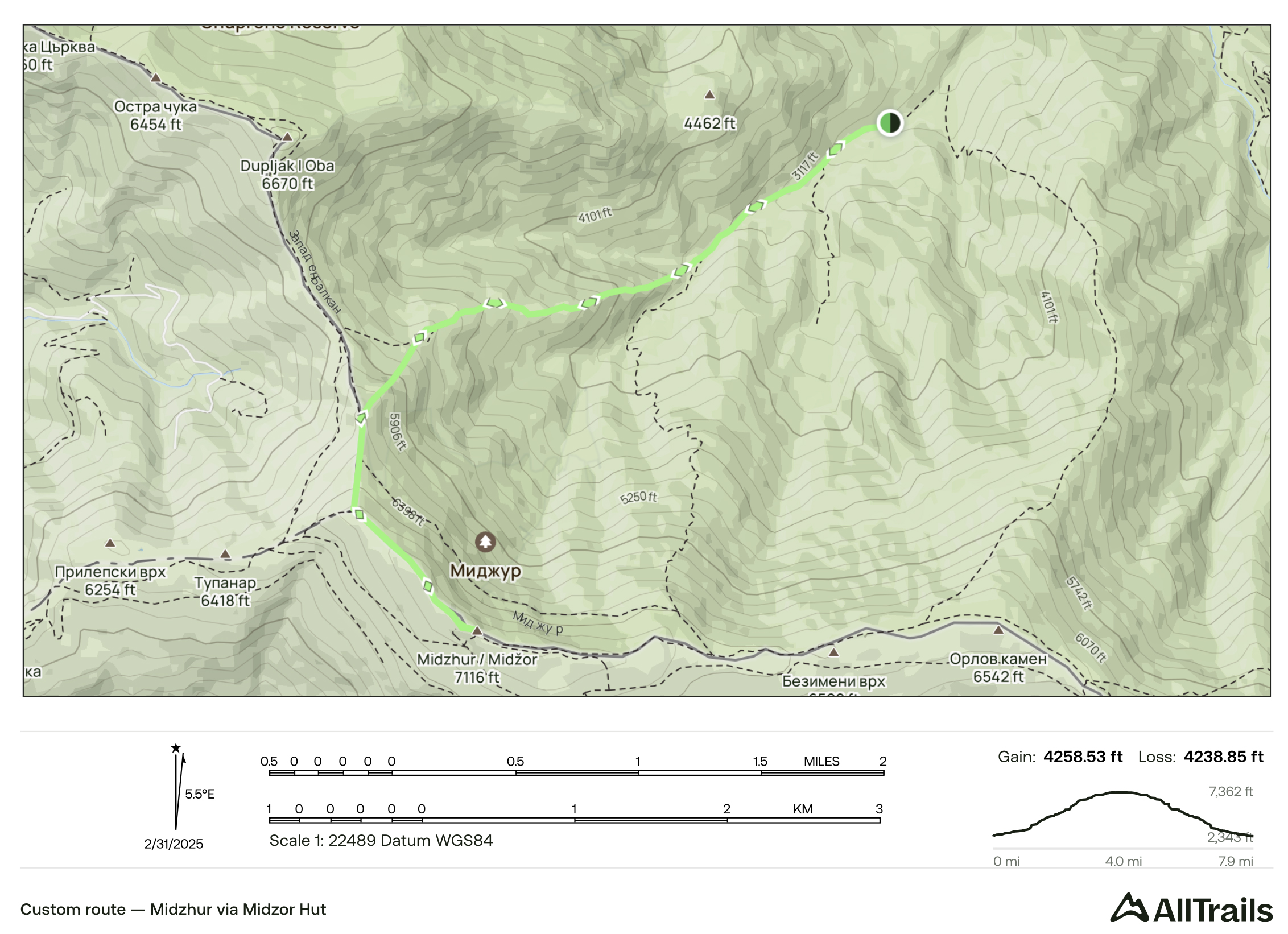
Given our short trip and knowing the weather could already cause delays, we opted for the Bulgarian route, avoiding border crossings by vehicle. This meant we’d be on a path with 75% more elevation gain than the standard Serbian route (and 20% less distance…so it gets pretty steep!). 1,300 meters of ascent is pretty normal for a Crown of Europe hike, but compared with the 740-meter ascent from the Serbian side, along with other complicating factors (detailed more in this section)…this became the most difficult 1,300 meters I’ve ever done.
The night before the hike, I was attempting to self-treat the toe as much as possible with a headlamp and first-aid supplies. I told the group, “I give myself a 5% chance of doing the hike tomorrow”, but that I’d set a morning alarm and see. The backup plan was a castle they found nearby. In the morning (and I’ll spare you the graphic details), my interventions had worked just enough that things weren’t worsening like on the Balkans trip, and my doctor had replied with a surgery appointment for the next afternoon (right after landing). We went ahead.
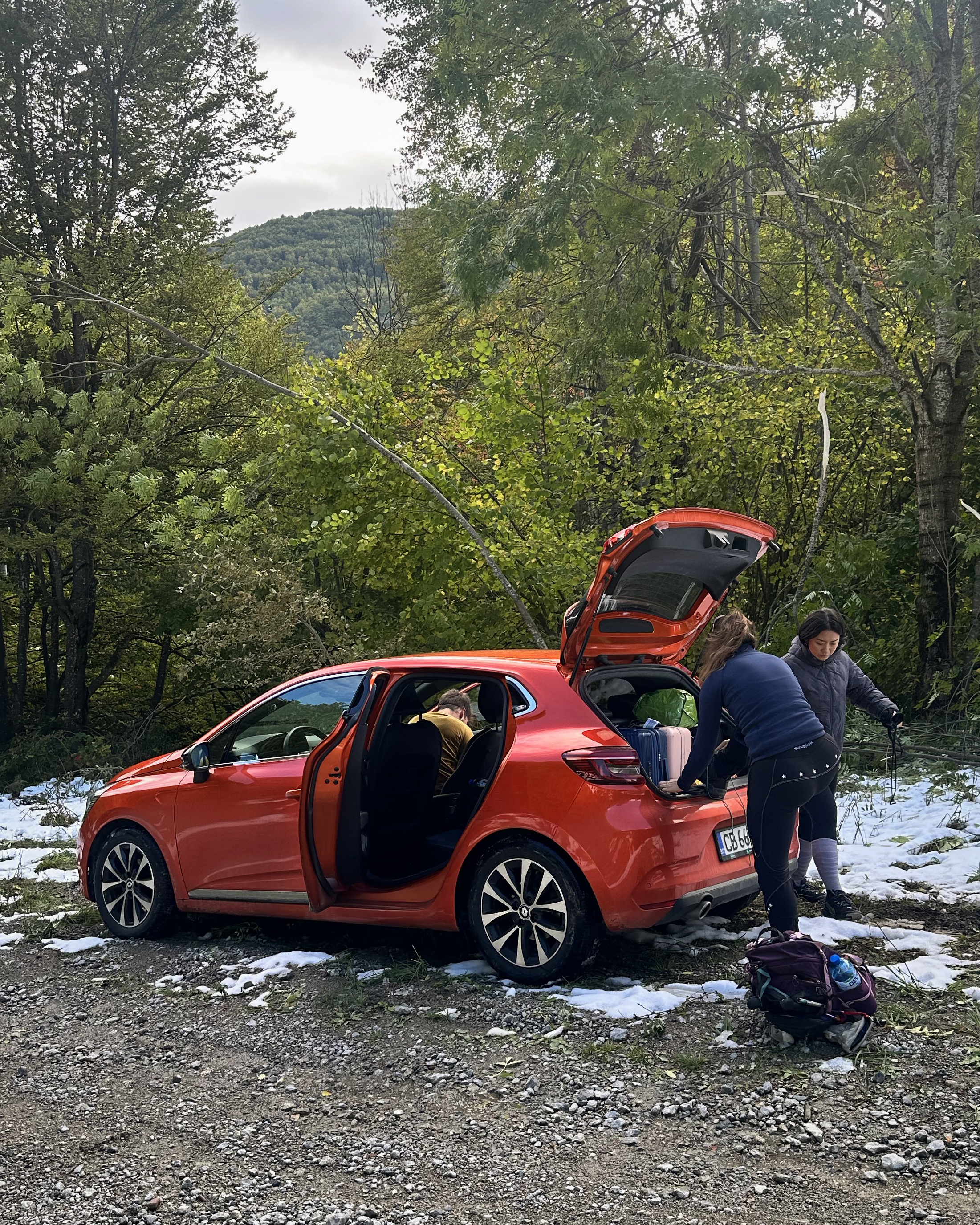
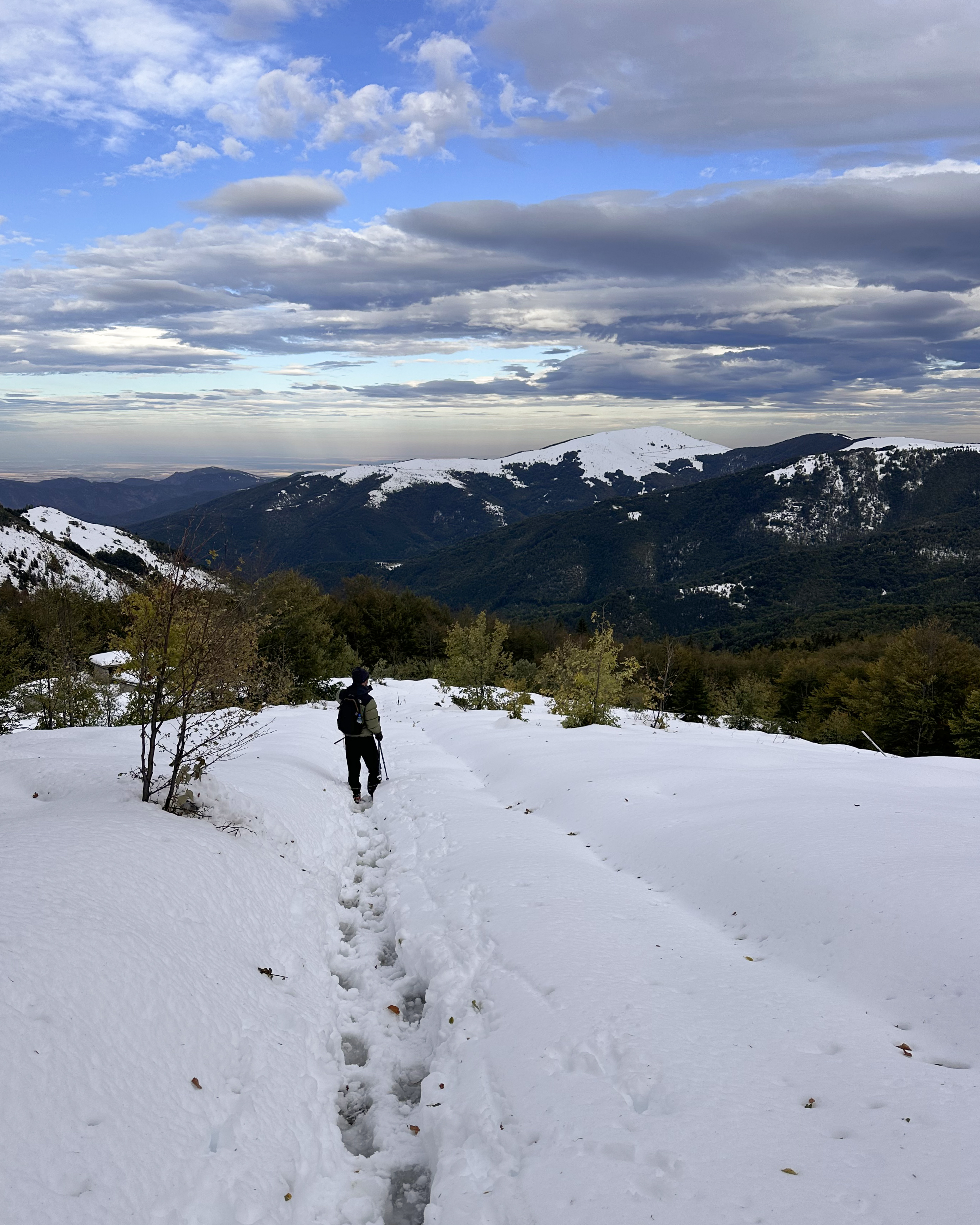
The approach to the trail involves some pretty bad roads, which were made worse by the snowstorm that had ripped through in the days prior. Branches were down everywhere, and we didn’t have the most suitable car. Sven ran ahead for maybe 50 meters, clearing branches, until we decided that we’d gone far enough and pulled over.

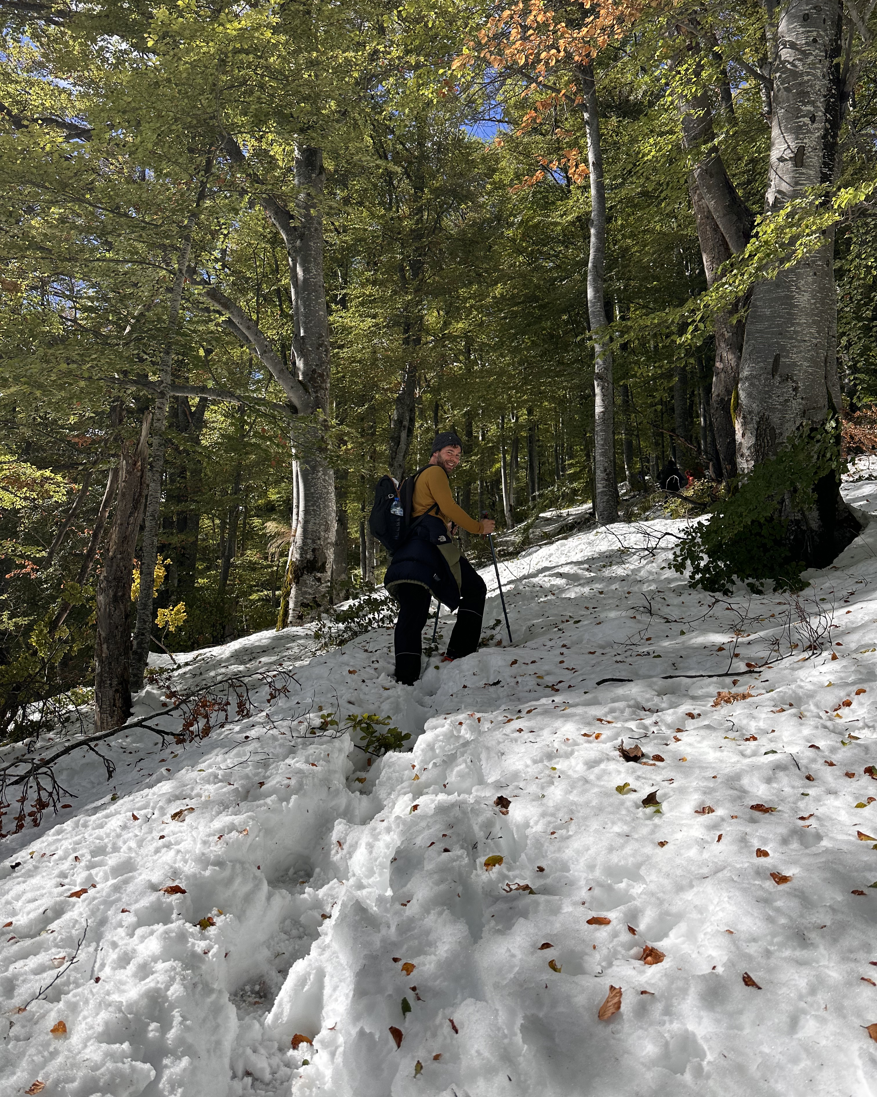
The sun was shining, and the trail wasn’t too snowy! Maybe we had lucked out. The storm was meant to hit Musala much harder, after all. I set off alone at first, to test out closed-toe shoes for the first time in a day. While waiting for the others, a group of five Bulgarian hikers strolled by. They would turn out to be an important part of this summit effort.
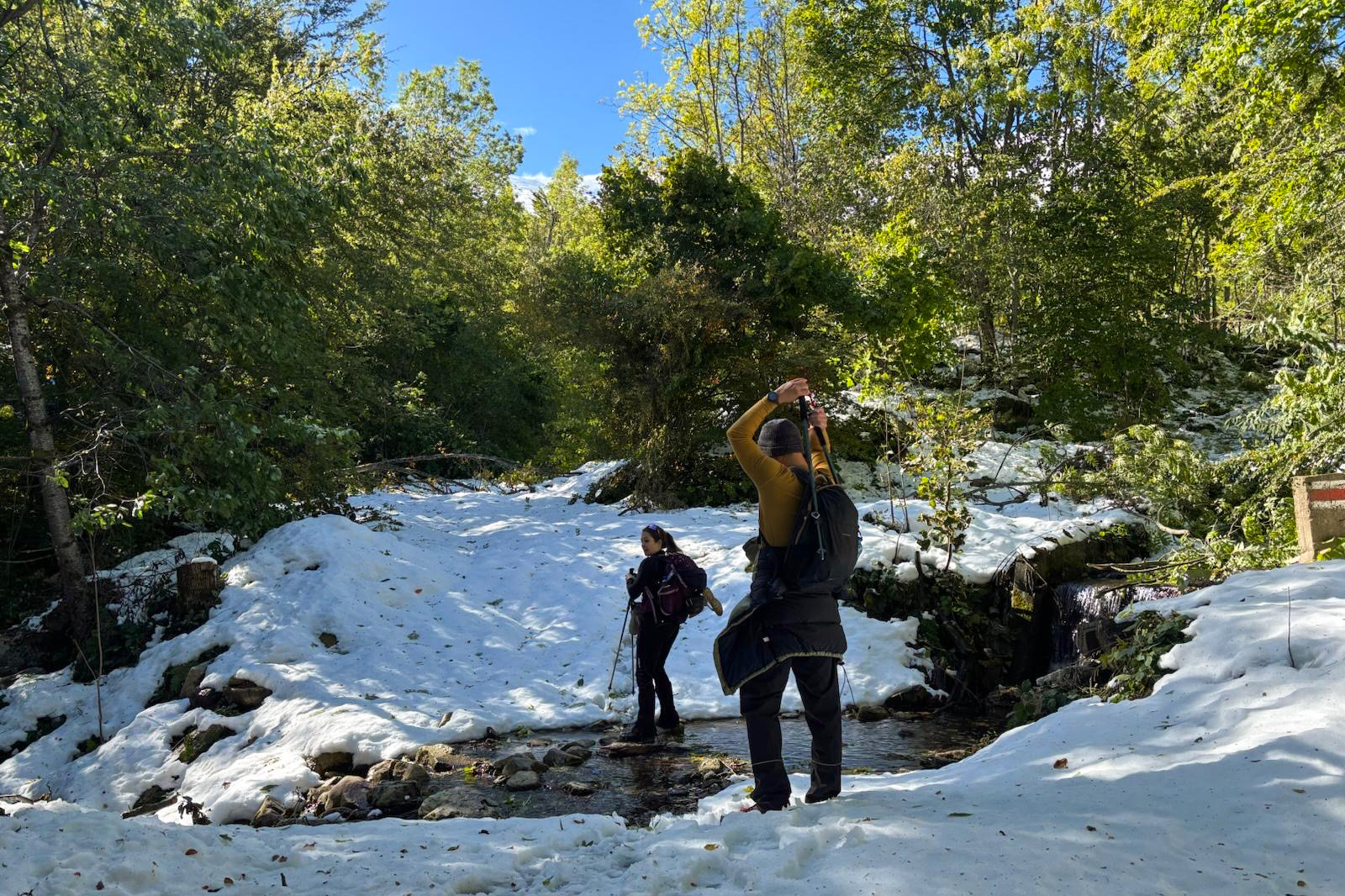
There was a small river crossing early in the trail.
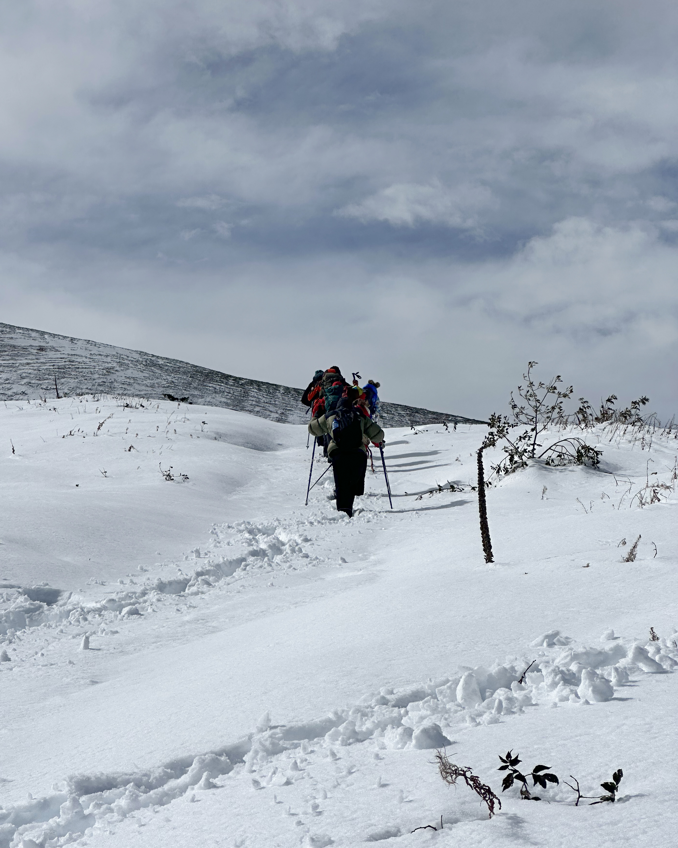
As we continued ascending, the snow became deep enough and the trail steep enough for spikes and gaiters. However…the group ahead was making the first tracks in the season’s first snow. Despite the path being quite well-marked on trees through the wooded section, it was helpful to have their footprints for more mindless navigation and saving energy. I was also much less likely to jam the bad toe into something while blindly kicking in new steps in uneven terrain.
As we started to emerge higher up by the treeline, the snow deepened from mid-calf to above-knee (slightly lower for the less vertically challenged). Thankfully, this only went on for 15 minutes or so before we caught up to the other group at a small shelter.
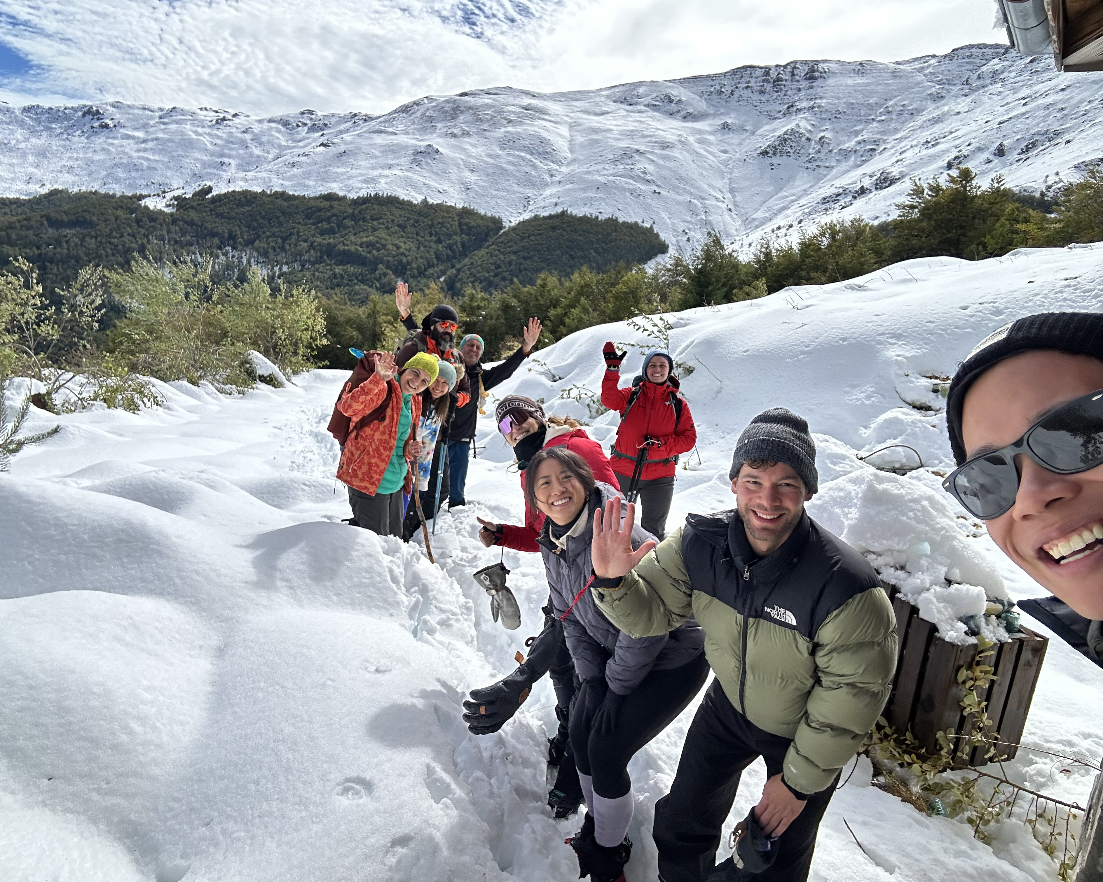
They might be the friendliest group of people I’ve ever met on a hike! They’d packed a full picnic and were sharing everything with us, from traditional potato salad (they’d even packed along extra utensils) to shots of rakia. It wasn’t their first time on Midžor, so they weren’t completely set on summiting that day. The conditions were worse than they expected, and they said they weren’t feeling prepared. I glanced at their gear and ours…no different, really. They just thought they’d be too cold. They decided to head out and see how the trail looked a bit further up, so we took a group goodbye photo, in case they turned back before we resumed our ascent.

Knowing that I’d possibly be slower on the way down (toe), I didn’t want to wait around much longer, so Sven and I set off not too far behind that group. It was around 1pm, and we’d started a bit before 11am, so there was still a long day ahead.
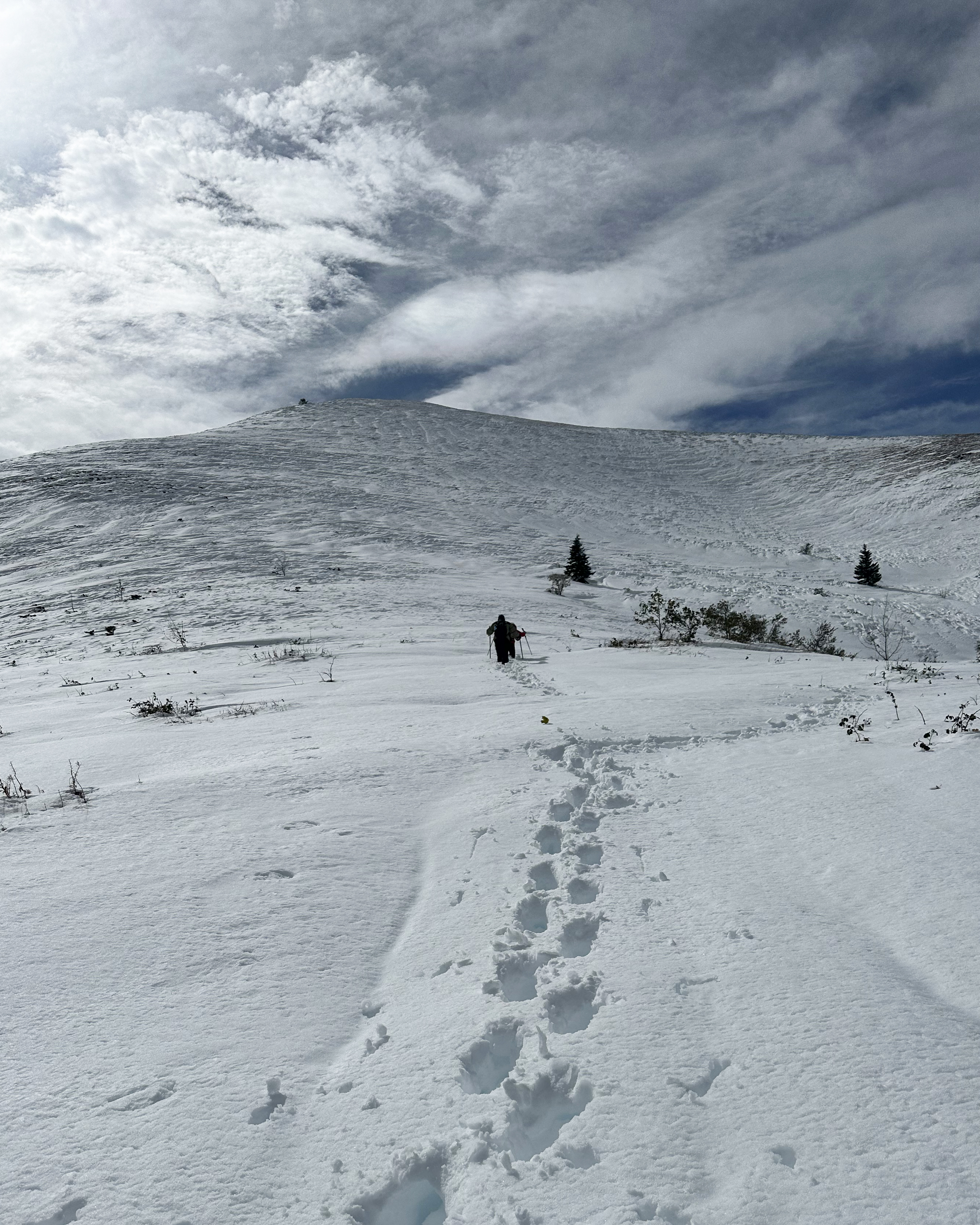
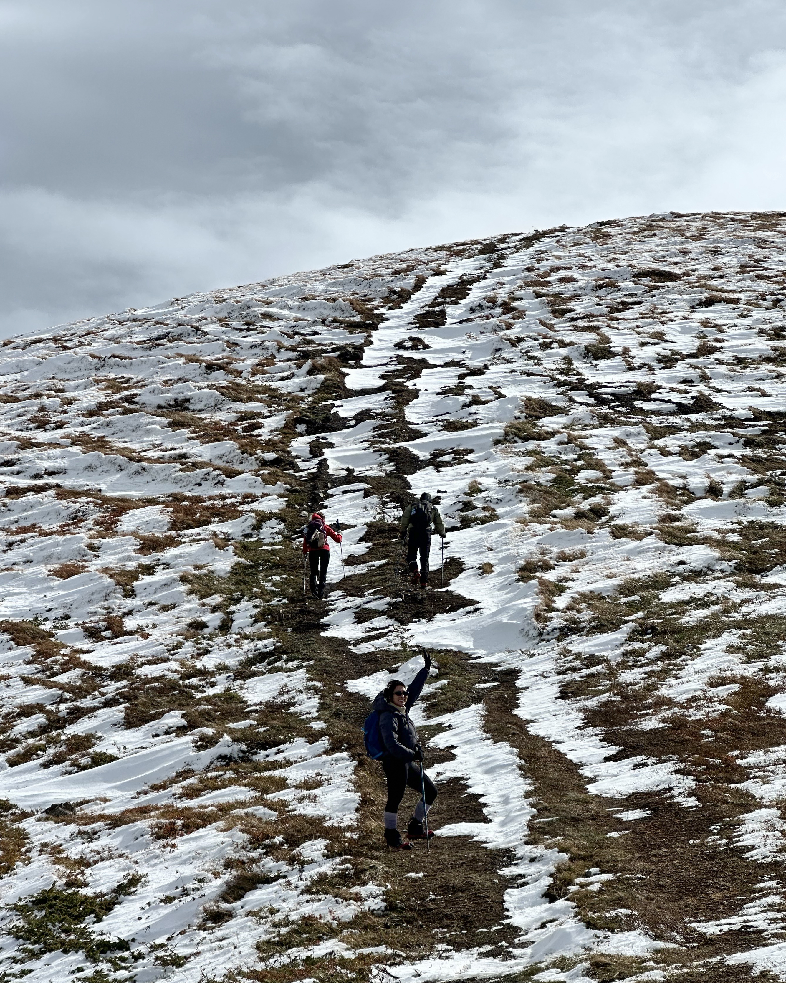
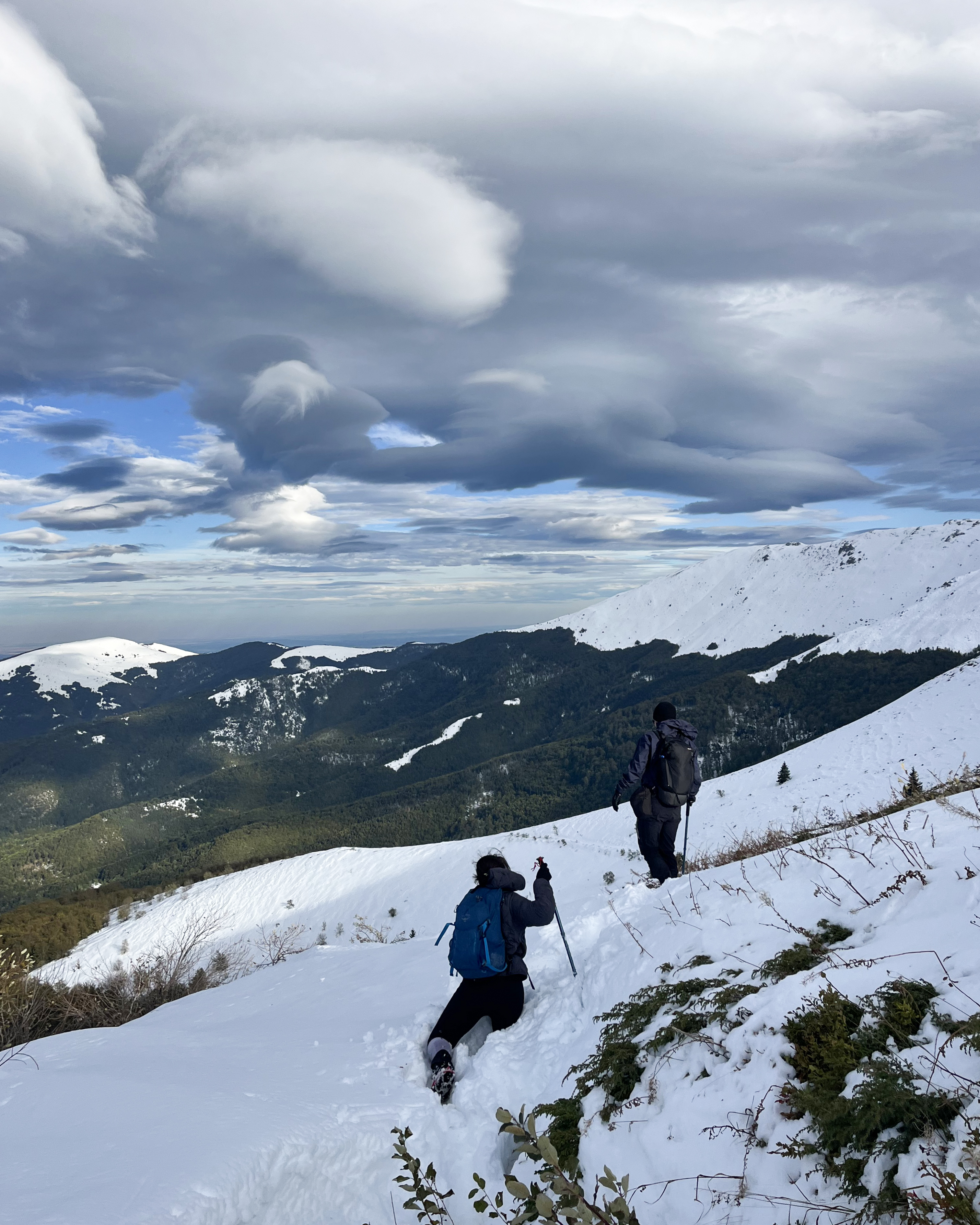
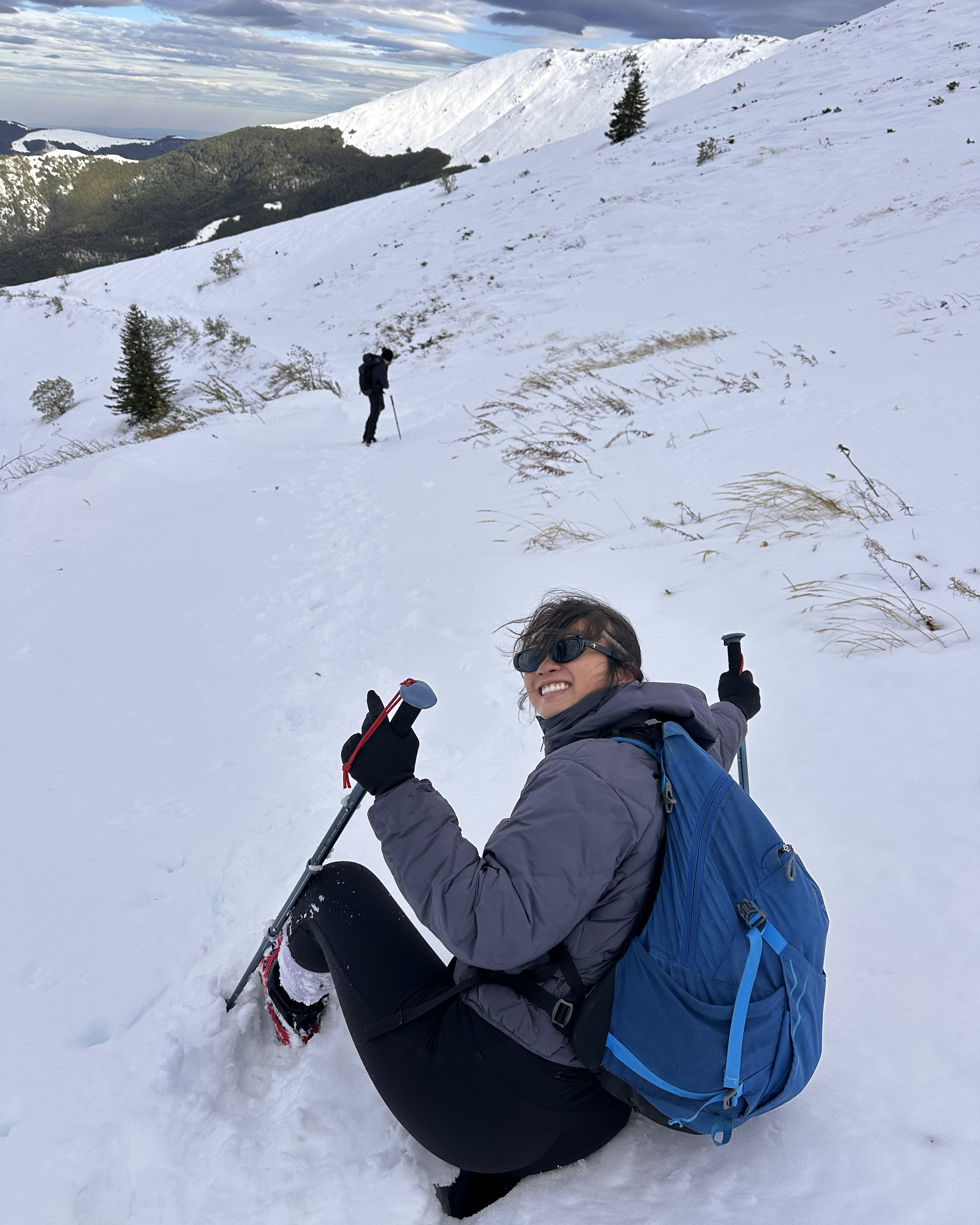
As Geoff and Jess set off and caught up again, they snapped the above photos! The first is right before we parted from our new trail buddies. The snow had deepened significantly…around mid-thigh for me. While everyone stopped to have a final chat, I kept moving, trying to decide if it would make more sense for us to turn back as well. The skies looked calm, and it didn’t feel too cold, but the snow swirling around summits and ridges suggested much higher winds ahead. I was also worried about frostbite…I wasn’t exactly wearing winter boots or even snow pants. With each step, it was clear that the deep snow would persist at least until the pass. While I was feeling more confident earlier in the hike, the probability of a summit started to feel more like my guess from the previous night: 5%.
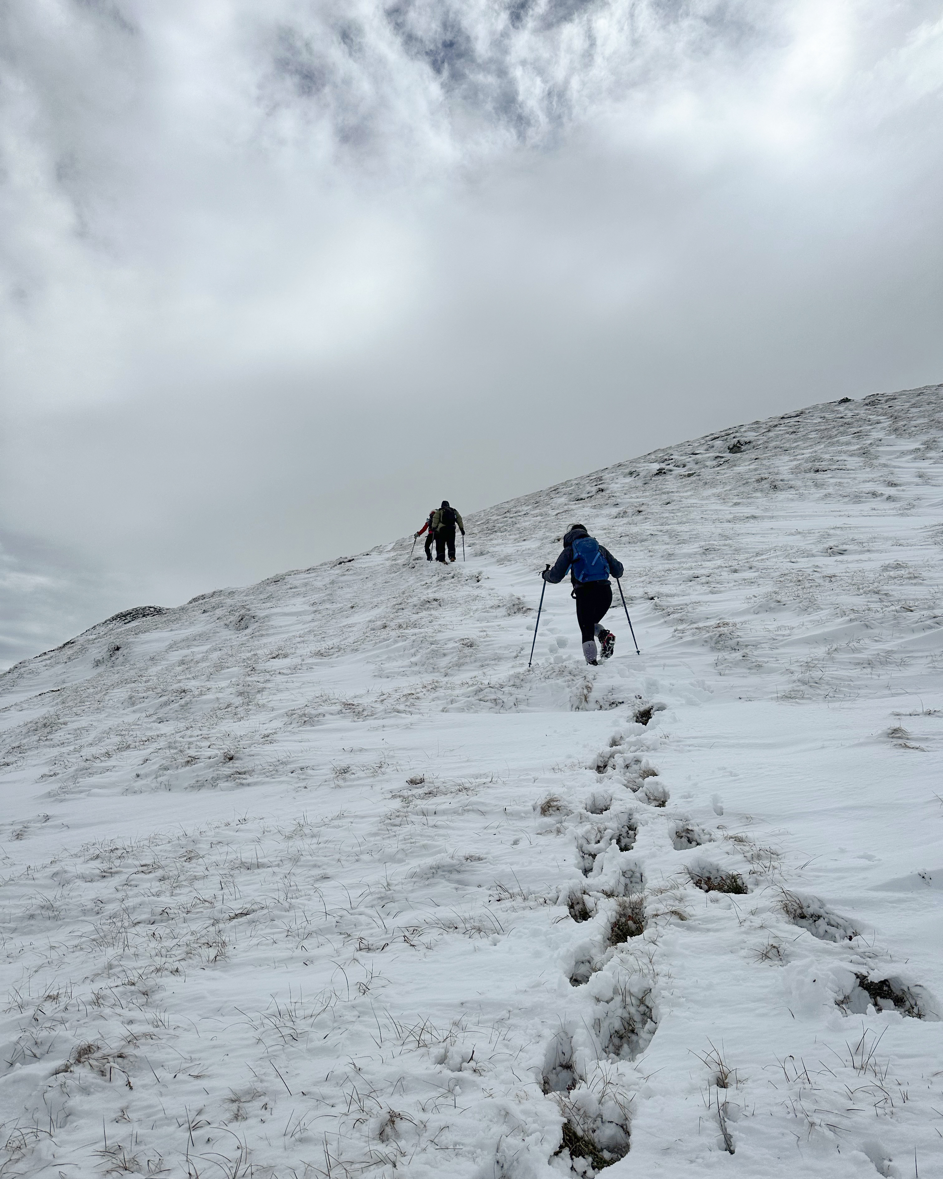
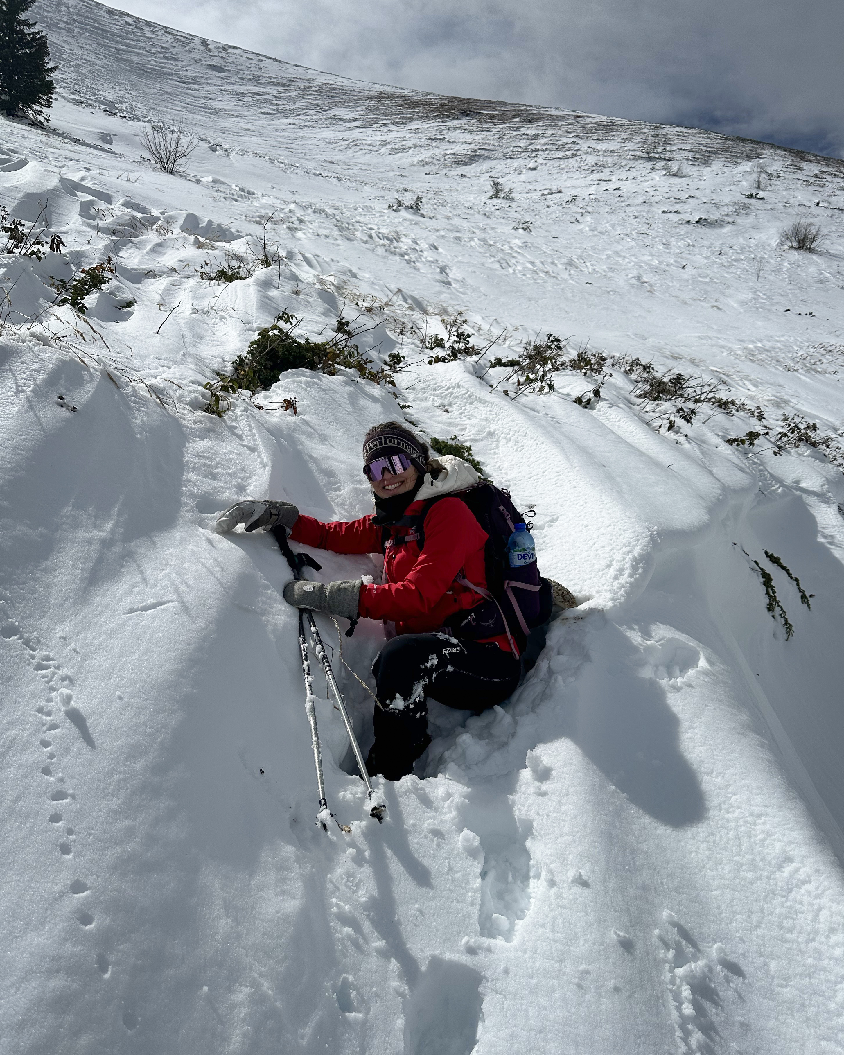
Shortly after the photo above, my legs were so exhausted from breaking trail that I decided to alternate between that and army-crawling over the surface. Every time it looked like the wind was pushing the snow into drifts, maybe clearing shallower paths to step in, it turned out to be a sort of illusion…it never went below knee-height. There were some moments of false hope as I’d balance along the surface for a few steps, before dropping down to my waist. Still, partly because there was nowhere to have a warm rest, we made fast progress. Geoff went to the front to help make tracks for the last push. We arrived at the pass by 2:30pm, where we were greeted by near-gale-force winds. There were some sketchy clouds forming over peaks in the distance, so we kept moving.
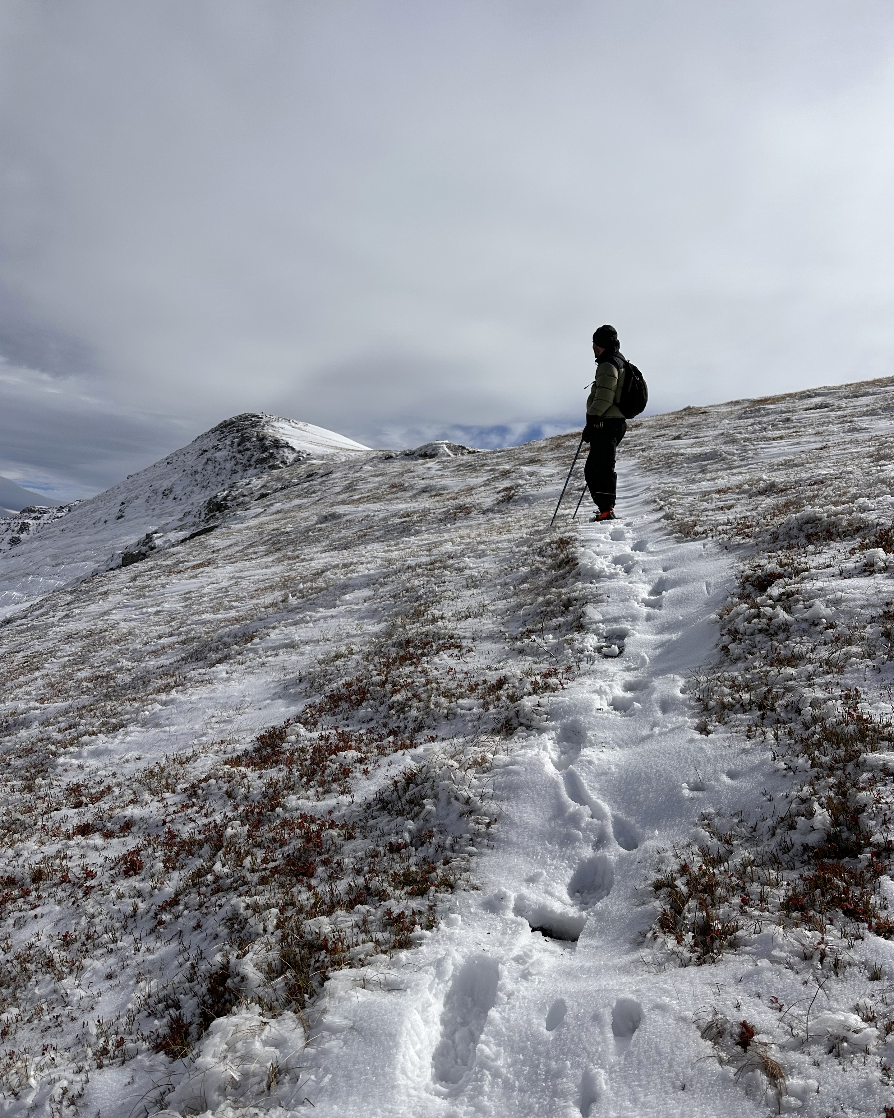
This part was still pretty steep, and the winds pretty brutal, but it was a relief to be walking on more comfortable terrain. The wind had kept the snow below mid-calf.
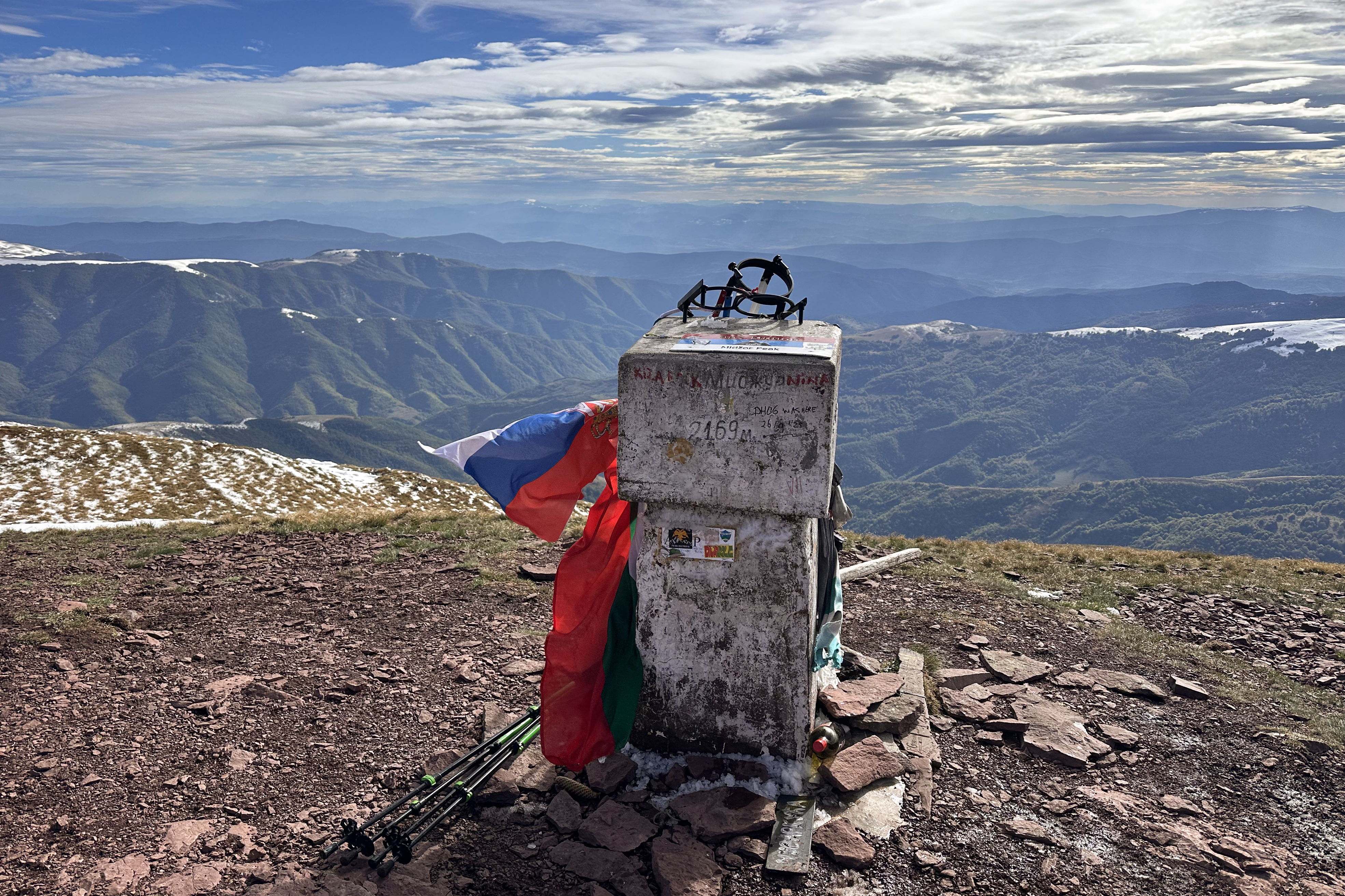
After feeling like we must surely be at the summit any second, we saw a short, steep ascent to what looked like a summit marker. I left my bag below, got the flag out, and was all set to take the official photos before descending. Up there, I looked at the marker more closely. There was no Serbian flag, and no point around us looked higher, but it still just didn’t look right (based on photos I’d seen). Sven pulled up the map, and sure enough…there was another half kilometer to go. It wasn’t too steep, but every step hurt at that point. Finally, we made it!!!
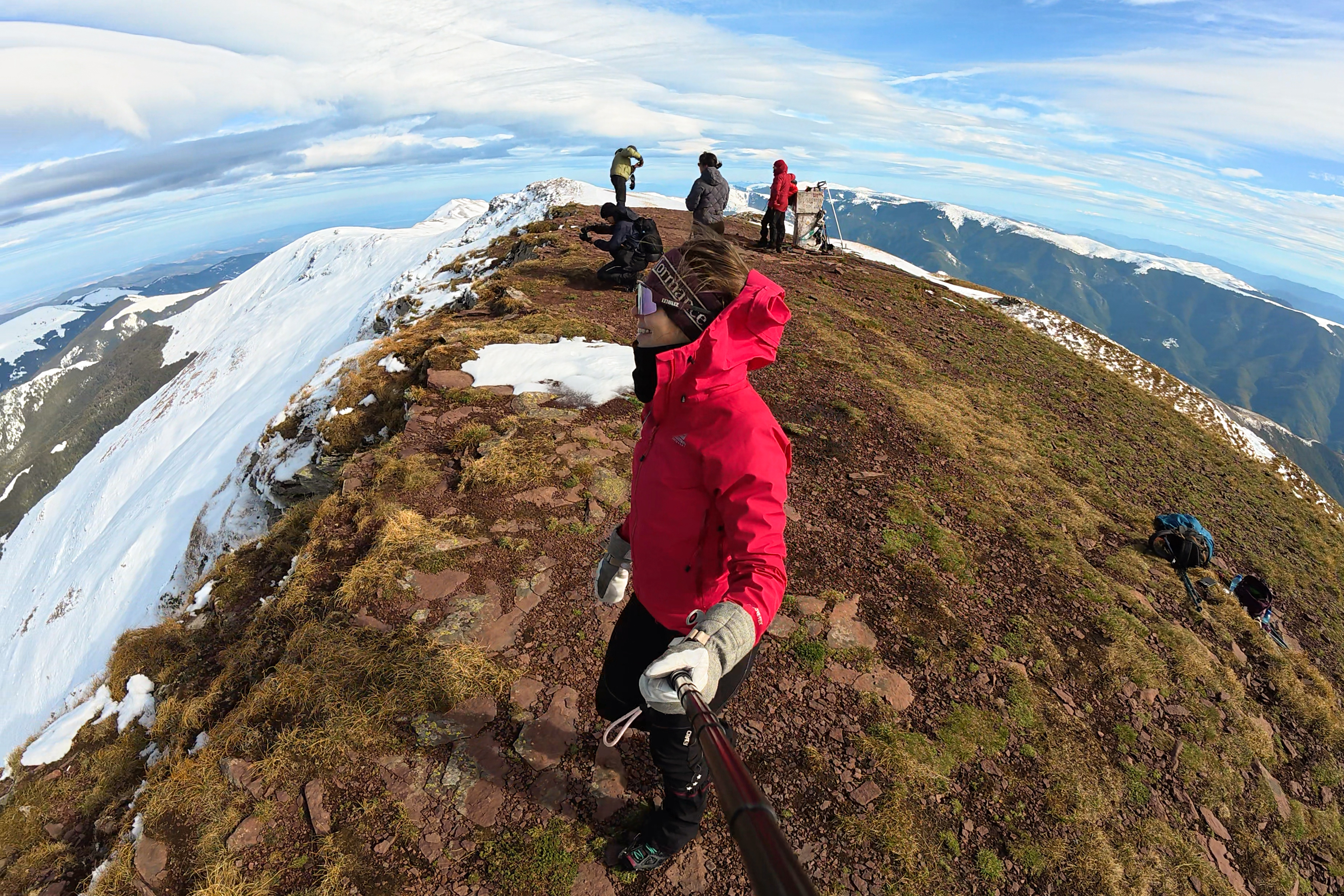
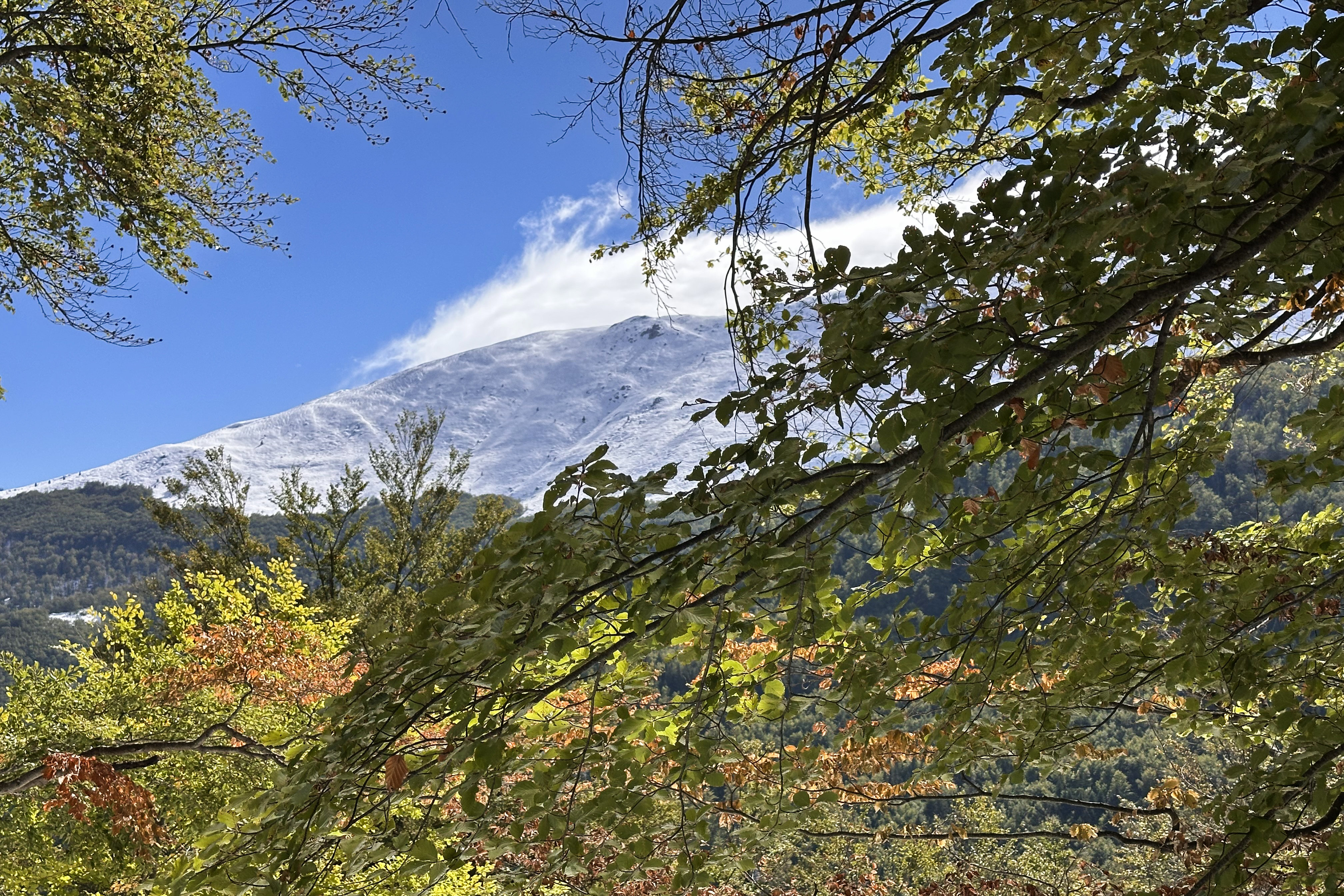
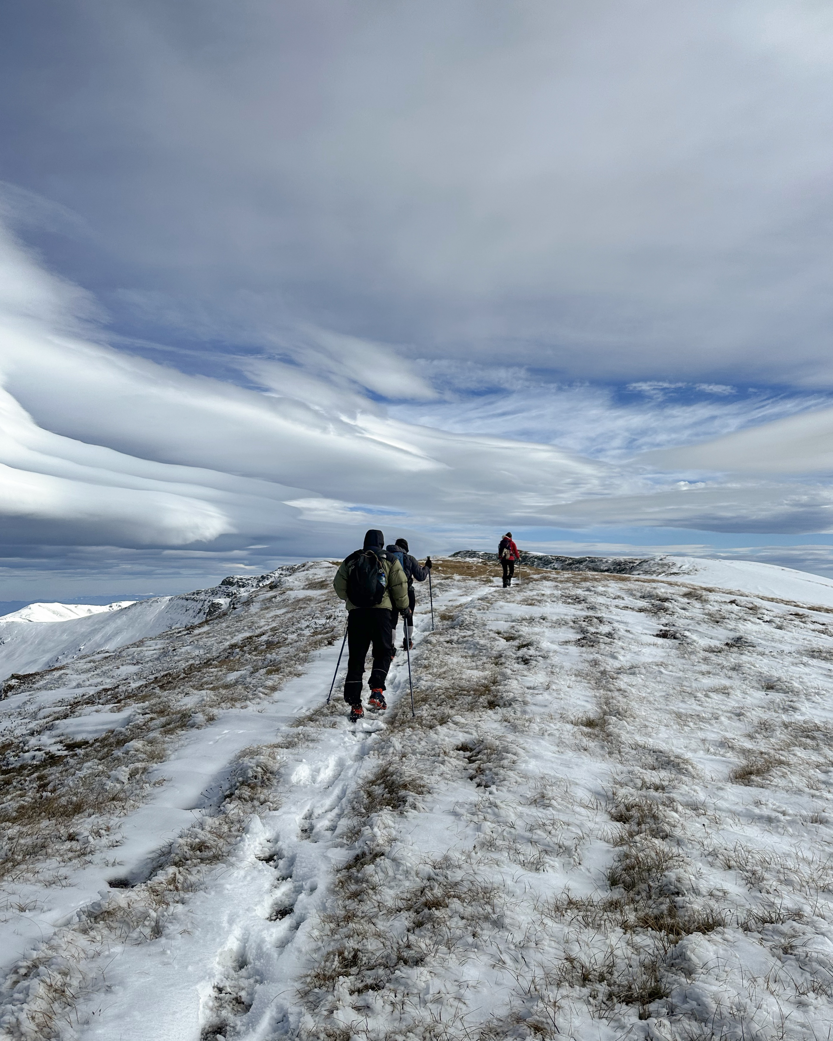
There were just 2 other hikers at the summit, and they’d come up the classic Serbian route. From the summit, it was clear that it wasn’t just the elevation gain making the Bulgarian approach extra challenging. The Serbian side was nearly free of snow. All of it dumped in Bulgaria. On Musala, and on the Bulgarian side of Midžor, apparently. Or, Serbia’s snow just melted sooner. Either way, the difference was striking.
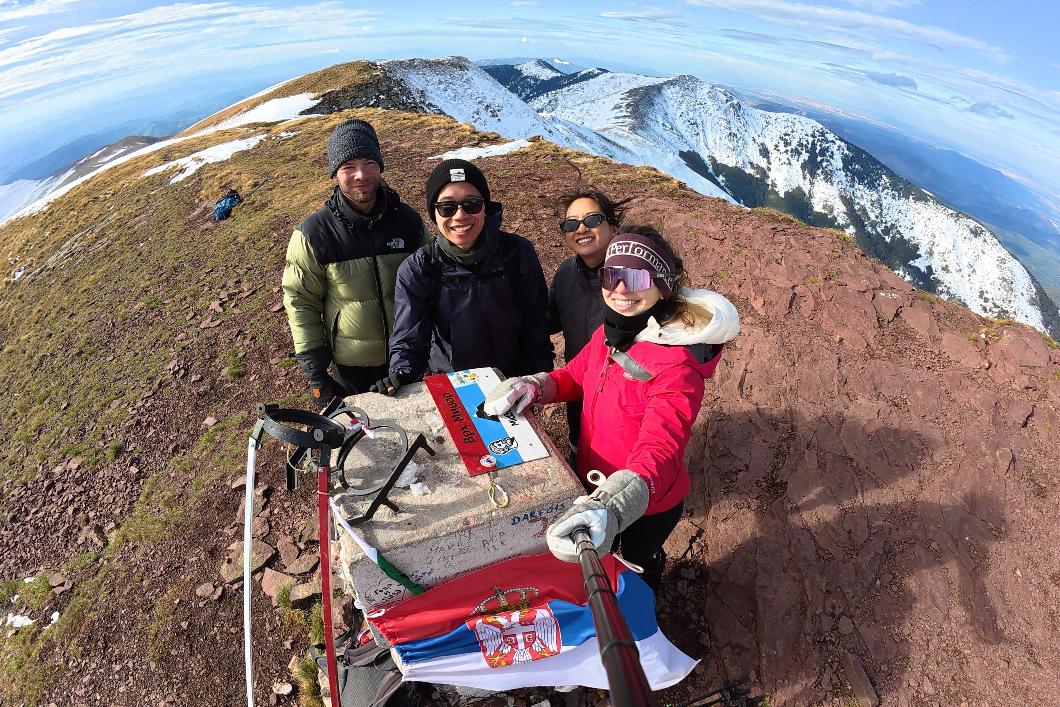
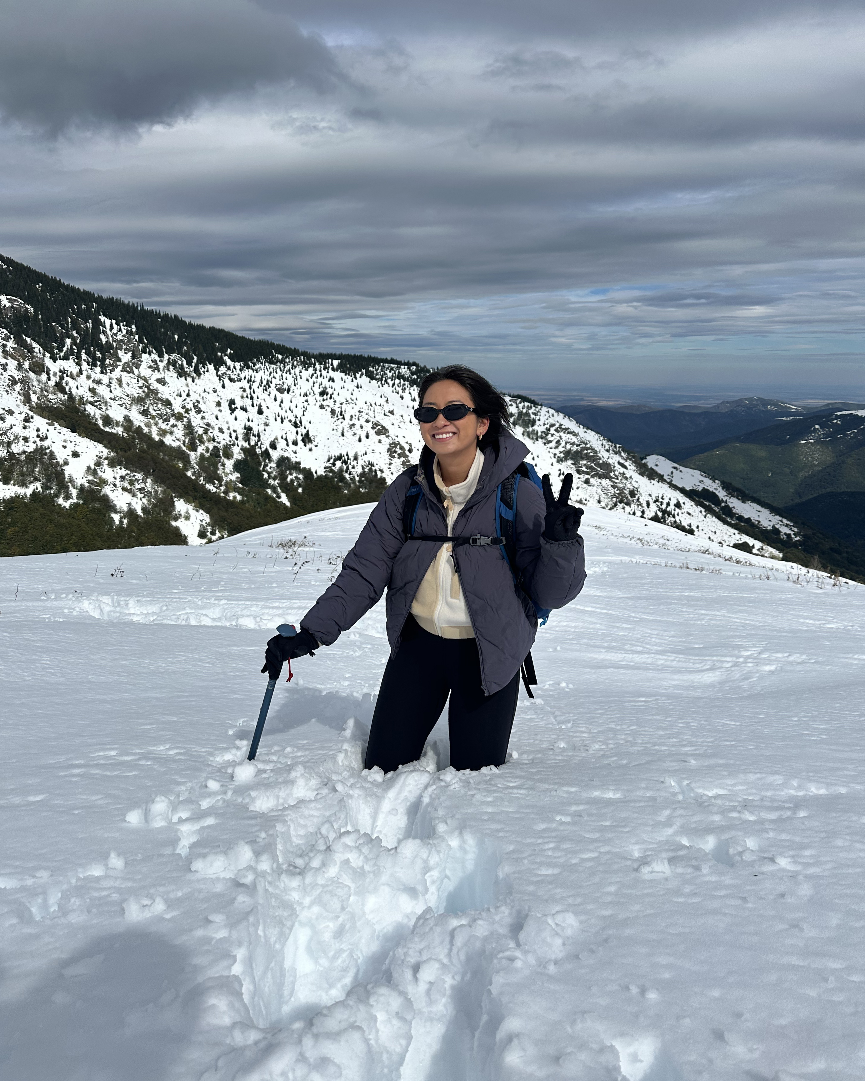
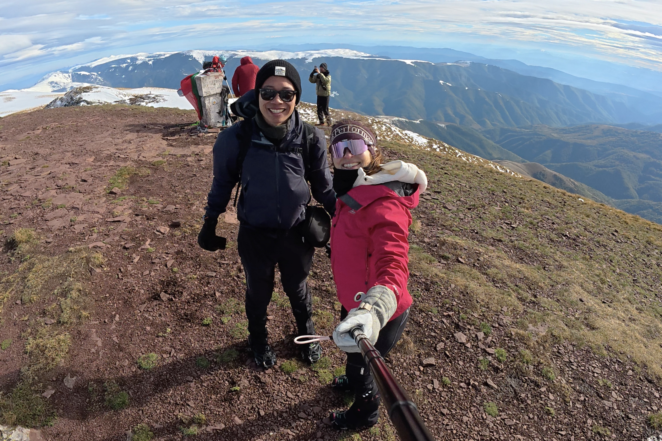
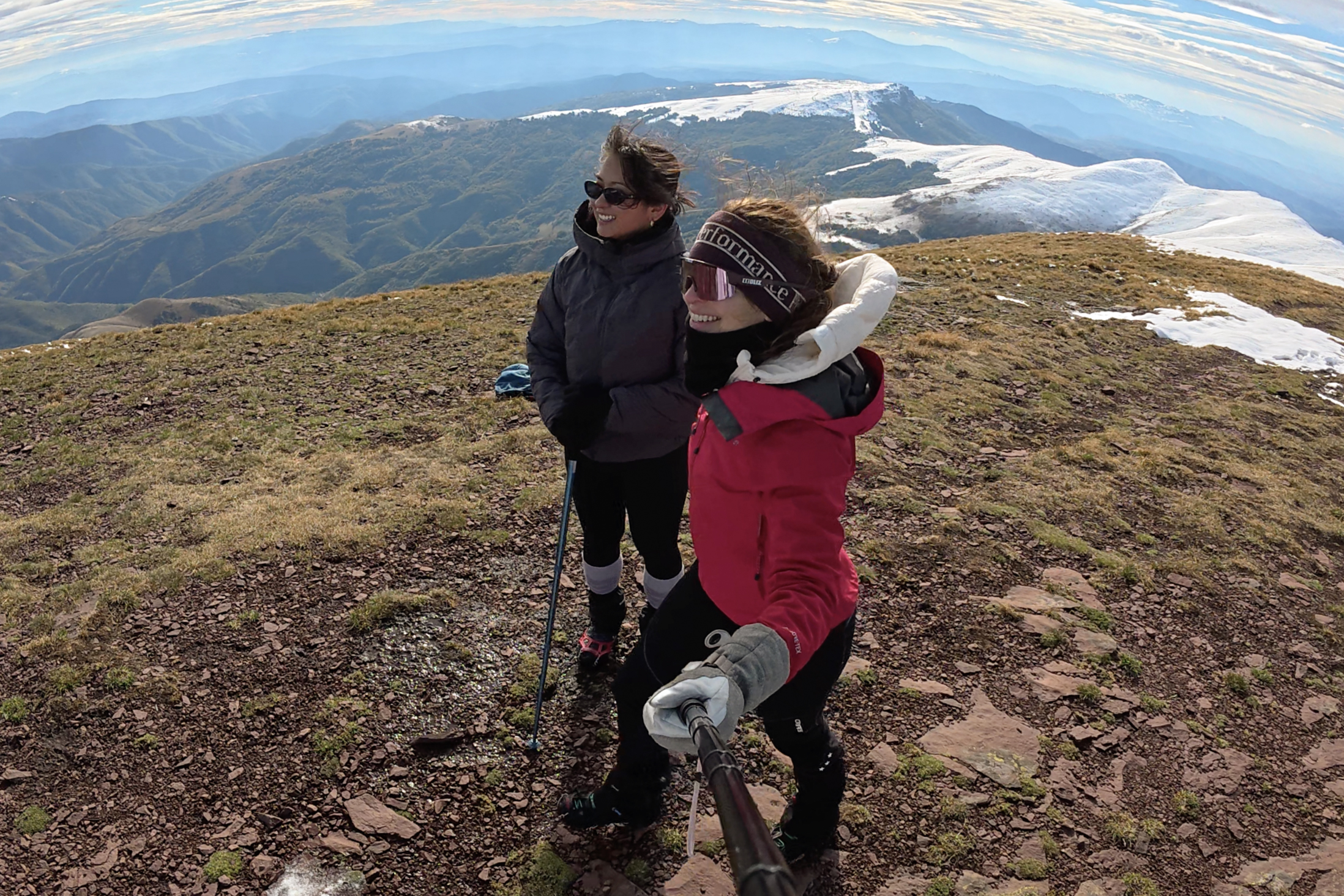
We really felt like we earned this summit. I thought it was pretty cool that my first crossing into Serbia was on foot, with this whole section of the country laid out in front of us. No border control, no passport stamps, not even a record that we were ever there outside of our camera rolls. For Jess and Geoff, it was their first time in Serbia, too!
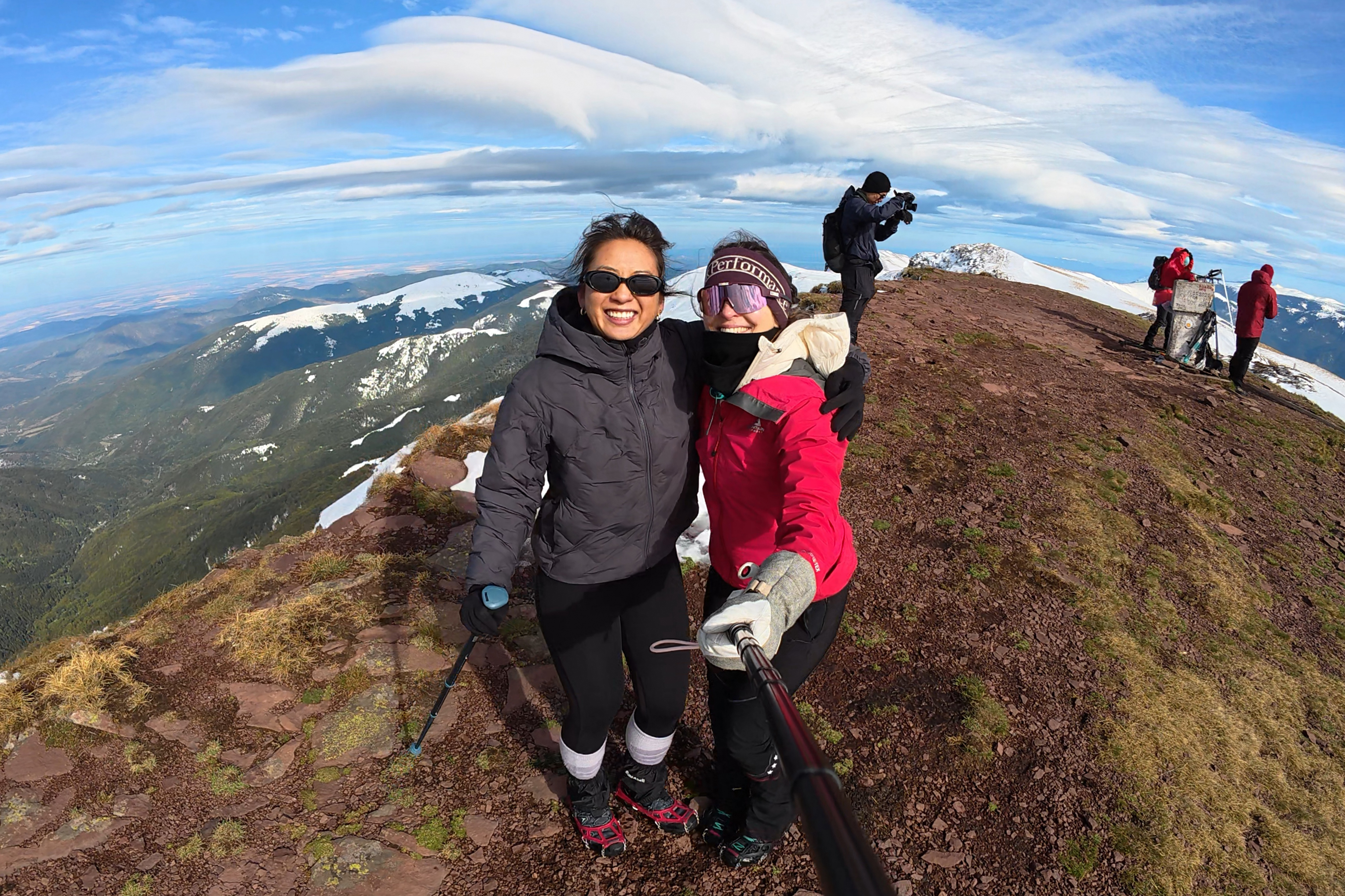
It was also cool that we’d done the first trail-breaking of the season, with no one else summiting from Bulgaria all day. These are all thoughts I had after making it back safely. In the moment, on the summit, I was mostly just in pain and freezing my hands off. We didn’t hang around long, and I didn’t even manage to get a proper flag photo (as you can see at the top…it’s not readable). At least you can see it in the group photo! (:
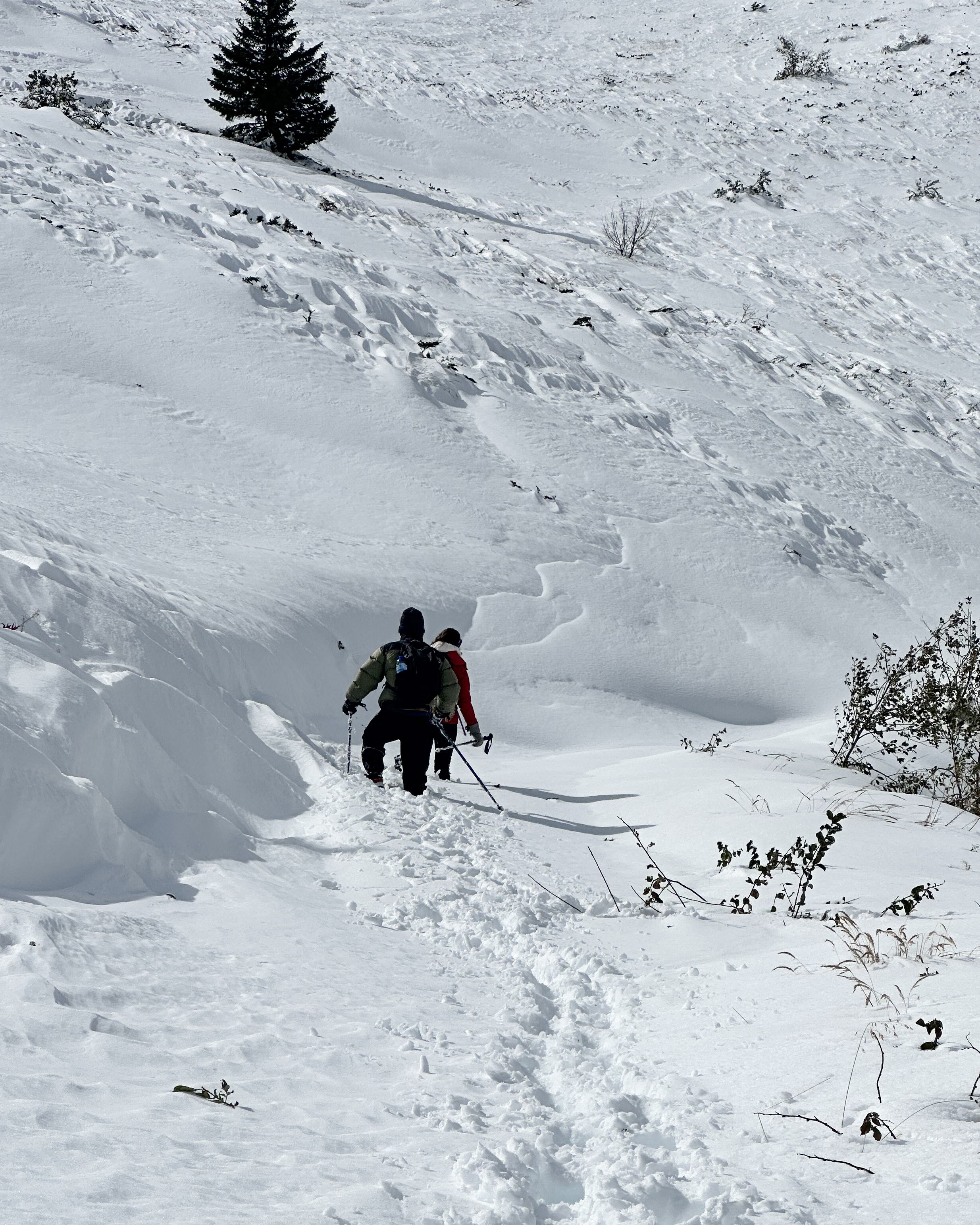
It was time for the part I’d been dreading…the descent. This is where the snow actually made up for the grueling ascent it caused. Once we were back below the pass and away from the wind, it was even kind of warm out. We “skied” and butt-scooted down the soft terrain, which was perfect for not stubbing messed-up toes into fronts of boots. It had taken over 4 hours to get up there, but under 3 to get down.
Something about careening down still-deep snow like kids on a snow day made this a highlight of the whole challenge so far. I finally processed that we had succeeded, that the pain in my toe was temporary (and would be fixed <24 hours from then, anyway), and that our chaotic plans for a short trip had somehow worked out.

As we approached the shelter where we’d met our trail buddies before, we could already see that the sun melted a lot of the snow in the afternoon, while we summited. We took a short break and followed our increasingly shallower tracks back down. My legs were screaming, and I flopped in the snow a few times to cool them down. I thought about how important those 5 Bulgarian hikers were. I felt that I used nearly every ounce of my energy on that hike, so had they not helped out with their early tracks (and probably even the food they shared), I don’t think I’d have managed a summit. Then there was my group- keeping up morale, never voicing doubts, and stepping in when I was too tired to lead. As much as I love solo hiking, this was a time I was grateful to not be doing that.
It wasn’t easy, but we all made it! No new injuries. No frostbite or hypothermia. No flat tires (maybe my biggest fear, with no cell signal where we’d parked). It was a great note to end the 2025 hiking season on.
THANK YOU ❤
Thanks for reading my twenty-third Crown of Cureope blog post! At the time I stood on Midžor, we had raised $1,670 for the American Association for Cancer Research to fund lifesaving discoveries. As of publishing this post, we officially ended 2025 at $2,725 raised of our $2,500 target. There’s still plenty of time to donate in 2026, as the fundraising won’t stop until the hiking challenge is complete! (: Thank you so much to everyone who’s donated and spread the word so far, and to fellow hikers for tips and company along the way to these summits. HAPPY NEW YEAR!!!

Leave a comment