
This hike was a LONG time coming.
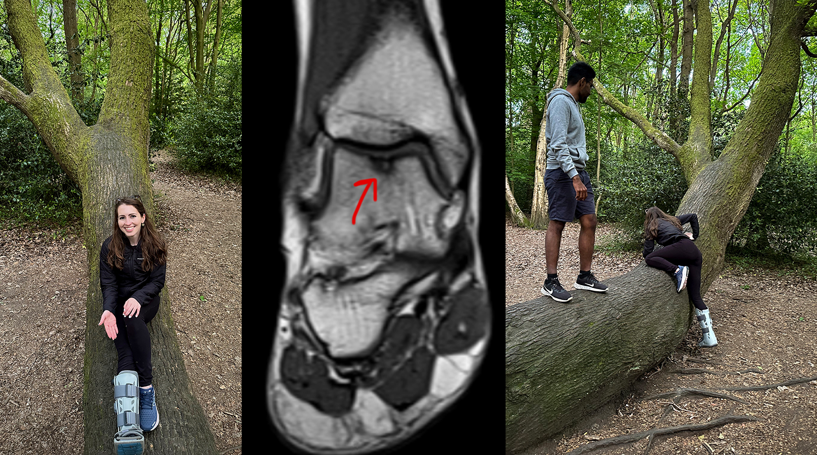
When I first moved to London back in May 2023, I had plans to complete the Welsh 14 Peaks Challenge for my birthday that June. That challenge typically begins with the Crib Goch ridge route up to the summit of Yr Wyddfa, before continuing on to 13 more Welsh peaks above 3,000 feet in elevation. (Technically, there are 15, but some combine Garnedd Ugain with Yr Wyddfa as it’s a short walk from one to the next. At least, I think that’s the reason for the discrepancy. Anyway- this long route is a bit technical and quite exposed in many places, but it rewards you with stunning panoramic views for most of the way. Unfortunately, while training for a mountain race in NY (yes, NY has mountains & scrambling not too far from the city!), I wound up with an “osteochondral lesion of the talus” and was put in a boot just days before my move.
It’s essentially an overuse ankle injury involving cartilage, which is very difficult to repair naturally or surgically. It’s still not healed today, but it’s been stable for the past year (the bone bruising has cleared up, so now it’s just the damaged cartilage where the red arrow is pointing). My doctor has approved a ‘common sense’ approach with no high-impact activities. This European high points challenge meets that requirement 🙂
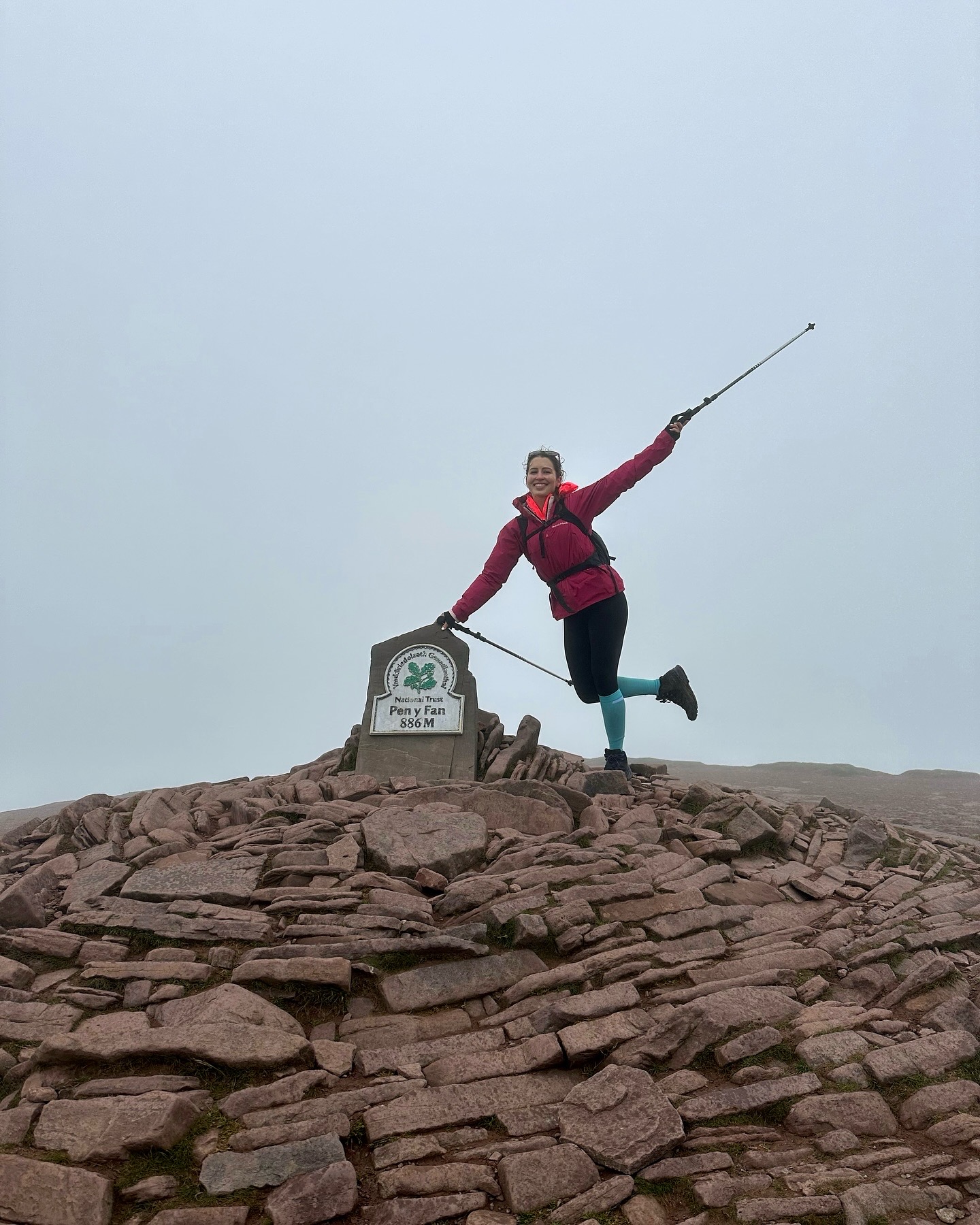
When I decided to try hiking again last summer (2024), Wales was my first stop, on a walk up to Pen Y Fan and Corn Du in Bannau Brycheiniog (Brecon Beacons). And…what a beautiful first UK summit it was…?
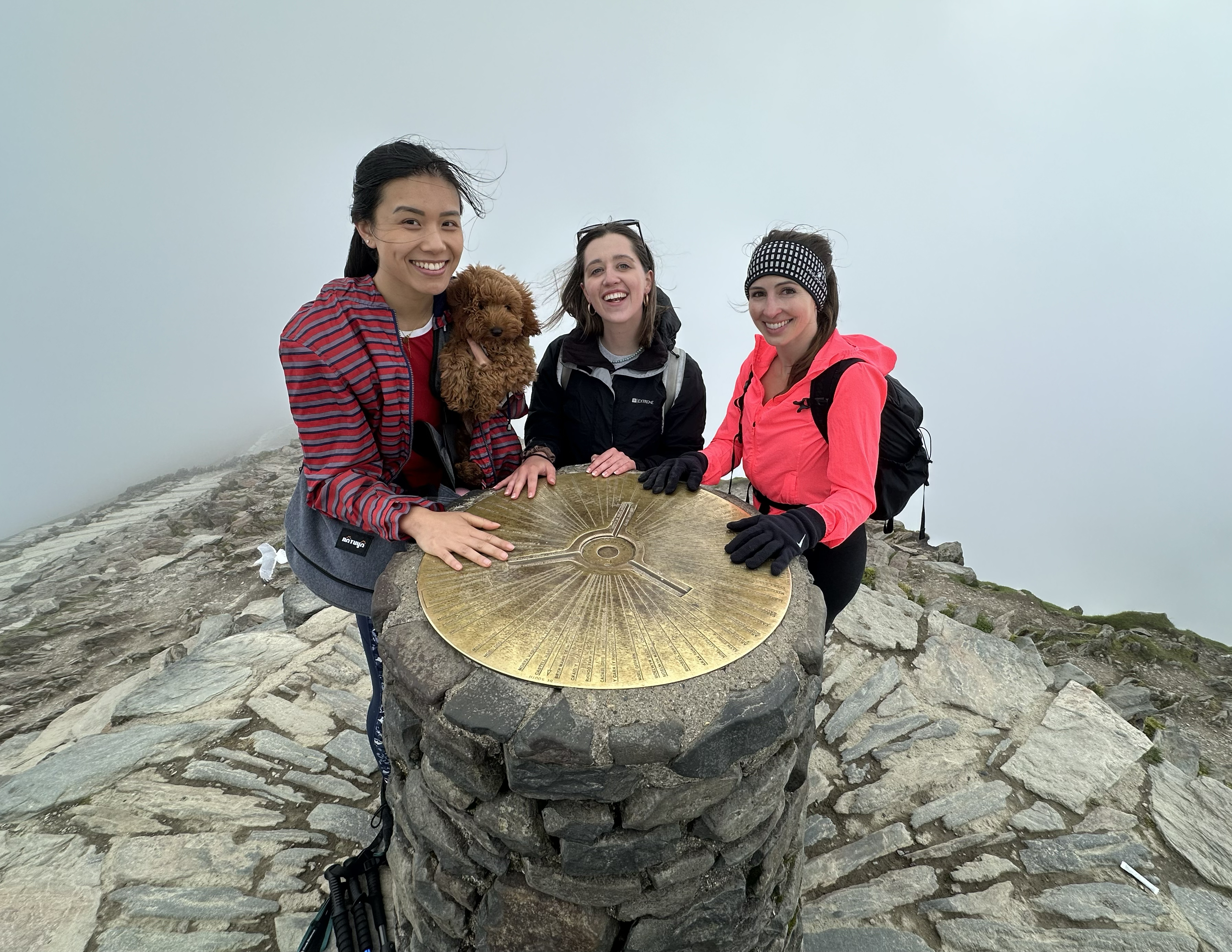
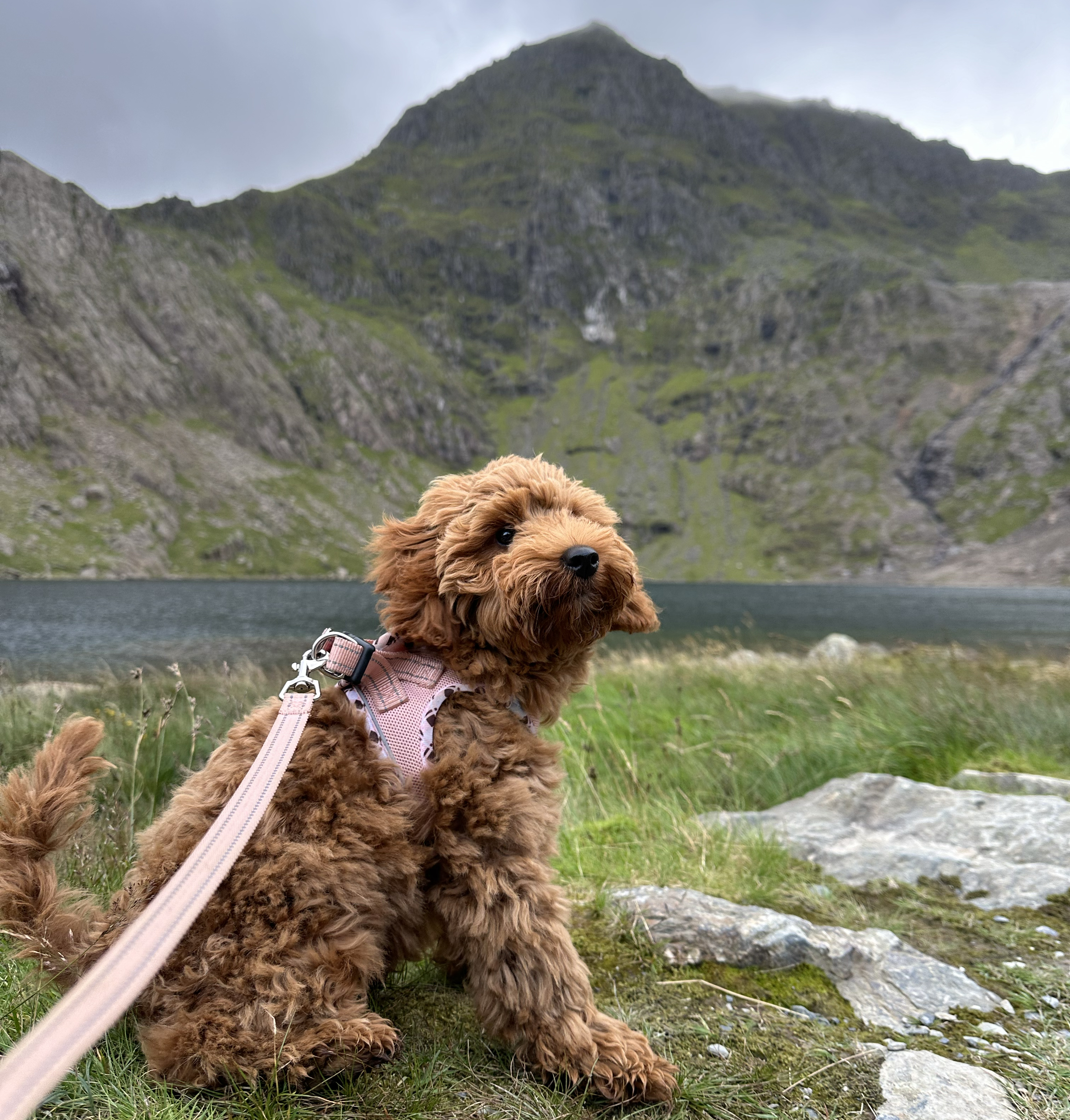
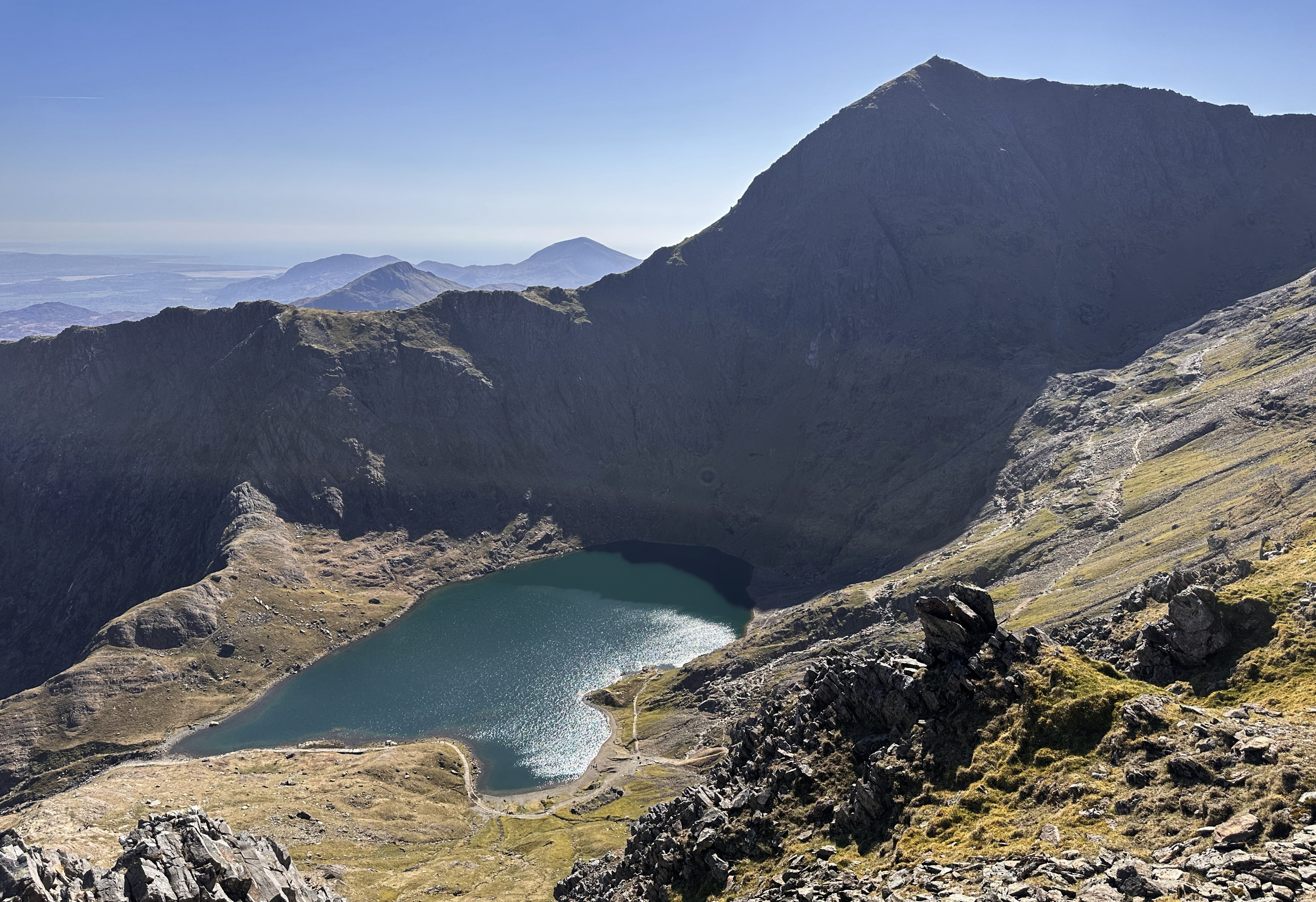
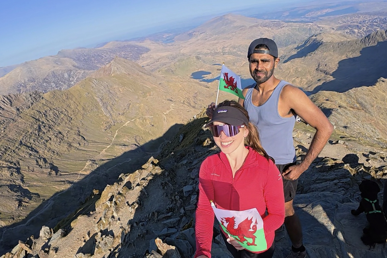
A few weeks later, I took on Yr Wyddfa for the first time, going up the Pyg Track and down the Miners’ Track. So it was really the first ‘Crown of Europe’ peak I’d already reached before starting this challenge. It was also little Maisie’s first hike, ever. Another summery summit in Wales, of course. This area is said to have its own microclimate, and we’d begun the hike with cloudless, sunny skies. It was only as we were halfway to the summit that winds picked up, and clouds enveloped the summit. I remember looking up at the little dots on Crib Goch at the time, 1) hoping they were all prepared for this and 2) feeling grateful to be on a more sheltered route.
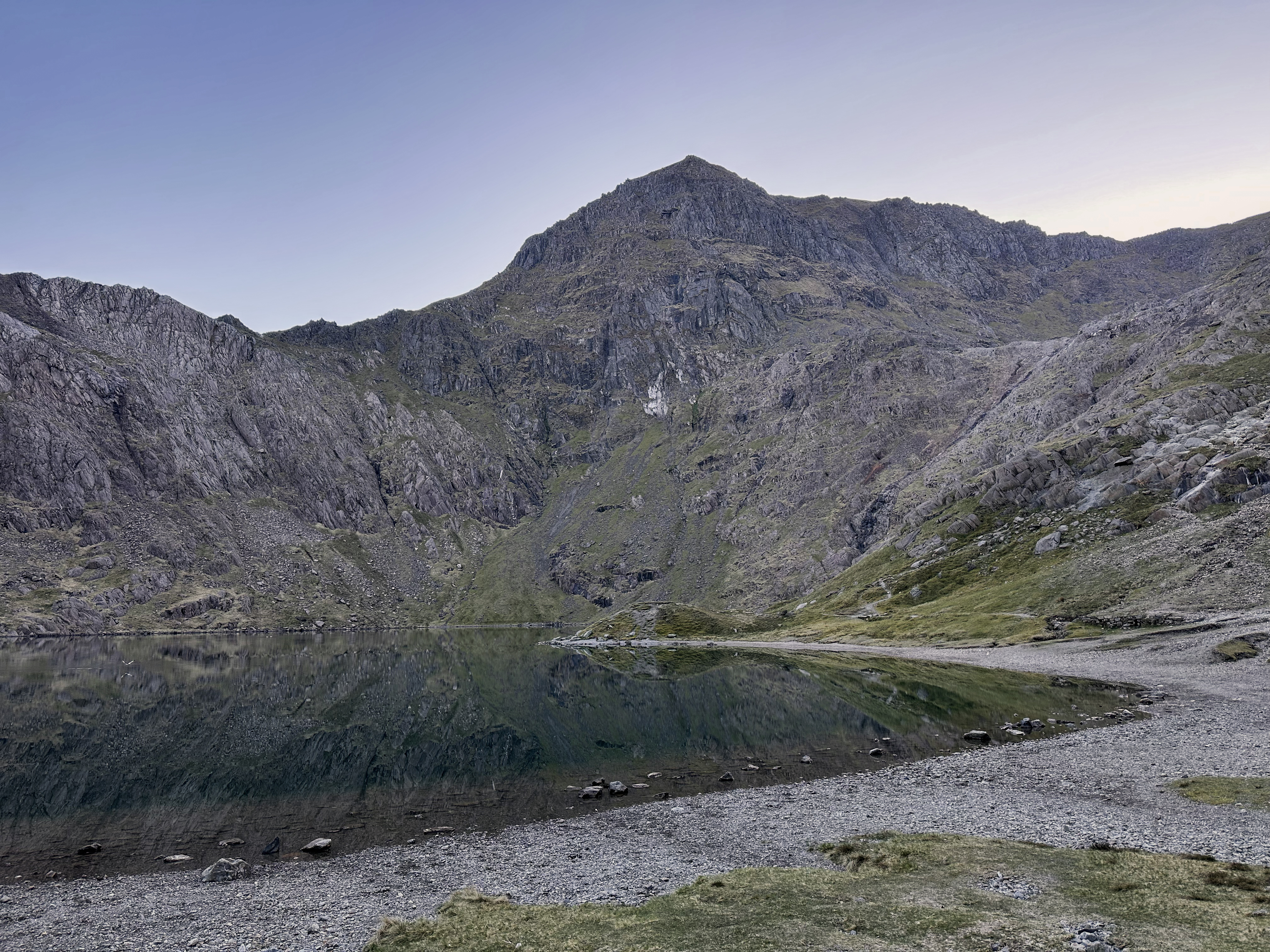
Despite already having reached the highest point in Wales, I hadn’t done the route I’d missed out on nearly two years before: Crib Goch. I decided to go for this high point again. Crib Goch is a grade 1, exposed scramble along a knife-edge (in parts) ridge. The Welsh name translates to red ridge, as it’s made up of Ordovician volcanic rocks.
Continued geology sidebar you can skip over if not interesting to you: if you’re on Yr Wyddfa in warm weather, and you come across streaks in the mountains that look like snow or a ton of bird s***, these are actually “quartz veins”. They’re further remnants of the area’s volcanic history. They were formed as molten quartz (and other minerals) entered gaps in the rock and crystallized. Glacial activity has also played a big role in the unique shape of Yr Wyddfa itself, as well as the sharpness of Crib Goch. There’s even more information on the national park’s website.
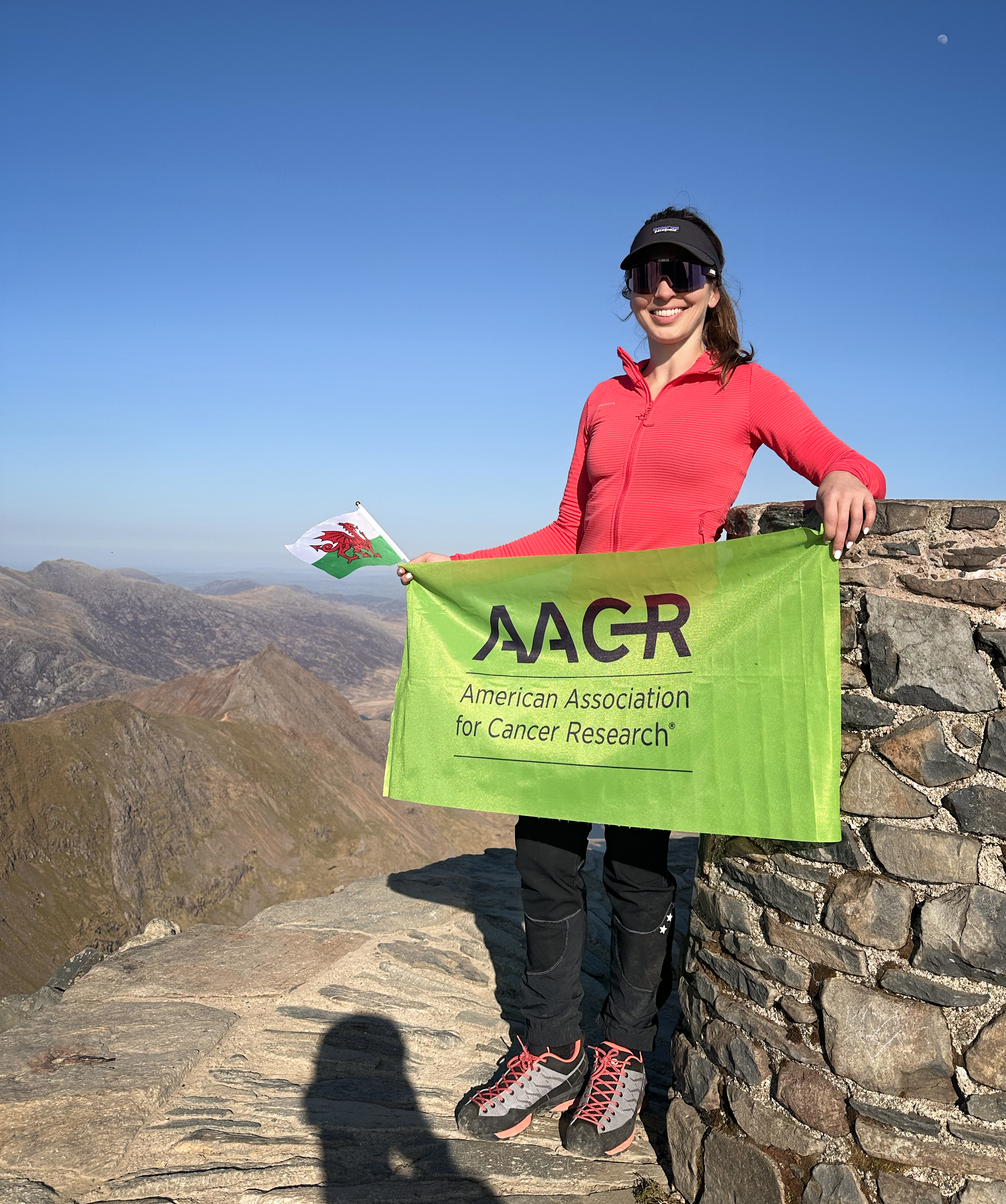
Given this history with Wales pre-Crown of Cureope, it felt fitting that it would be the first ‘hiking’ high point of the challenge (as Portugal was a drive-up). I wish I could say I planned it that way, but it was a last-minute decision. The UK was having an unusual streak of cloudless, windless, sunny weather: perfect conditions for having a go at an exposed ridge. This mountain essentially has its own microclimate, so the forecast should never be trusted fully…but this was a special situation of persistently clear weather. So special that NASA even wrote an article about a rare, cloud-free satellite image over the UK and Ireland. It would be my third time hiking in Wales, and third time’s a charm, right?
A friend and I were able to coordinate some last-minute plans, which involved going there and back in a day (NOT RECOMMENDED). So, we hopped in the car at 5am and started the 5-hour drive to Eryri (Snowdonia), taking our time hydrating and fueling (ourselves and the car) at rest stops (check out the Instagram highlights for our gourmet lunch selection), as my parking reservation wasn’t until later that afternoon. It’s still worth an early departure to avoid traffic out of London and around Birmingham!
The parking reservation system had JUST started for the season, and morning spots had already been booked up. I had one reserved for the early afternoon, but as it wasn’t really ‘busy season’ just yet, we decided to chance heading up to the lot a few hours before to see if they’d let us in for an earlier start. We got very lucky- they did, but I wouldn’t recommend trying this in peak season, as it’ll just cause a bottleneck around an already small lot. There are other parking areas with shuttles, but I found it worth the £20 to not have to worry about missing the last shuttle (7:30pm at time of writing). We ultimately finished an hour after that, so it was a good decision. It’s the JustPark lot at Pen-y-Pass, which can be reserved here. It’s the same starting point for the Pyg, Miners’, and Crib Goch routes. There are technically 6 ‘official’ routes up Snowdon: Llanberis, Watkin, Ranger, Rhyd Ddu, Miners, and Pyg. Llanberis is the most popular and beginner-friendly of the six, with many opting to take the train one-way and hiking the other.
The Crib Goch route follows the Pyg track for the first mile before branching off at the start of the ridge, and the Miners’ comes back from the other side (but to the same lot). There are restrooms in the parking area, but there isn’t always drinking water available, so bring plenty with you (or a good filter, as there are some streams along the way back). As you’re facing away from the road (toward the back of the parking lot), the Pyg/Crib Goch start is ahead to the right, and the Miners’ start is to the left.
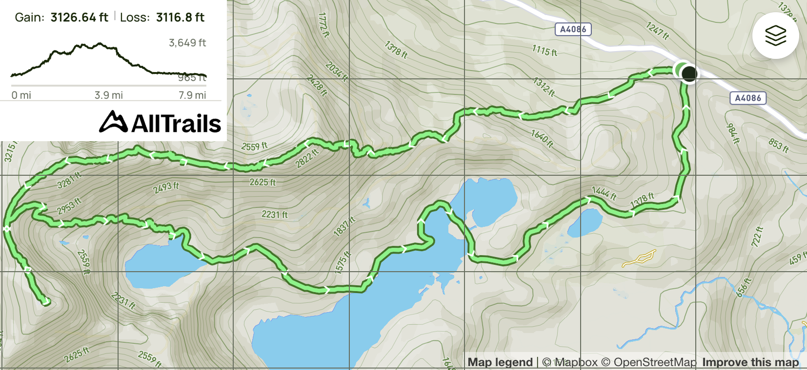
Here’s the map of the route we’d be following, with ~7.5 miles (~12 km) and ~3,100 ft (~950m) of elevation gain (it’s not just Americans measuring summits in feet – the UK still does it too!):
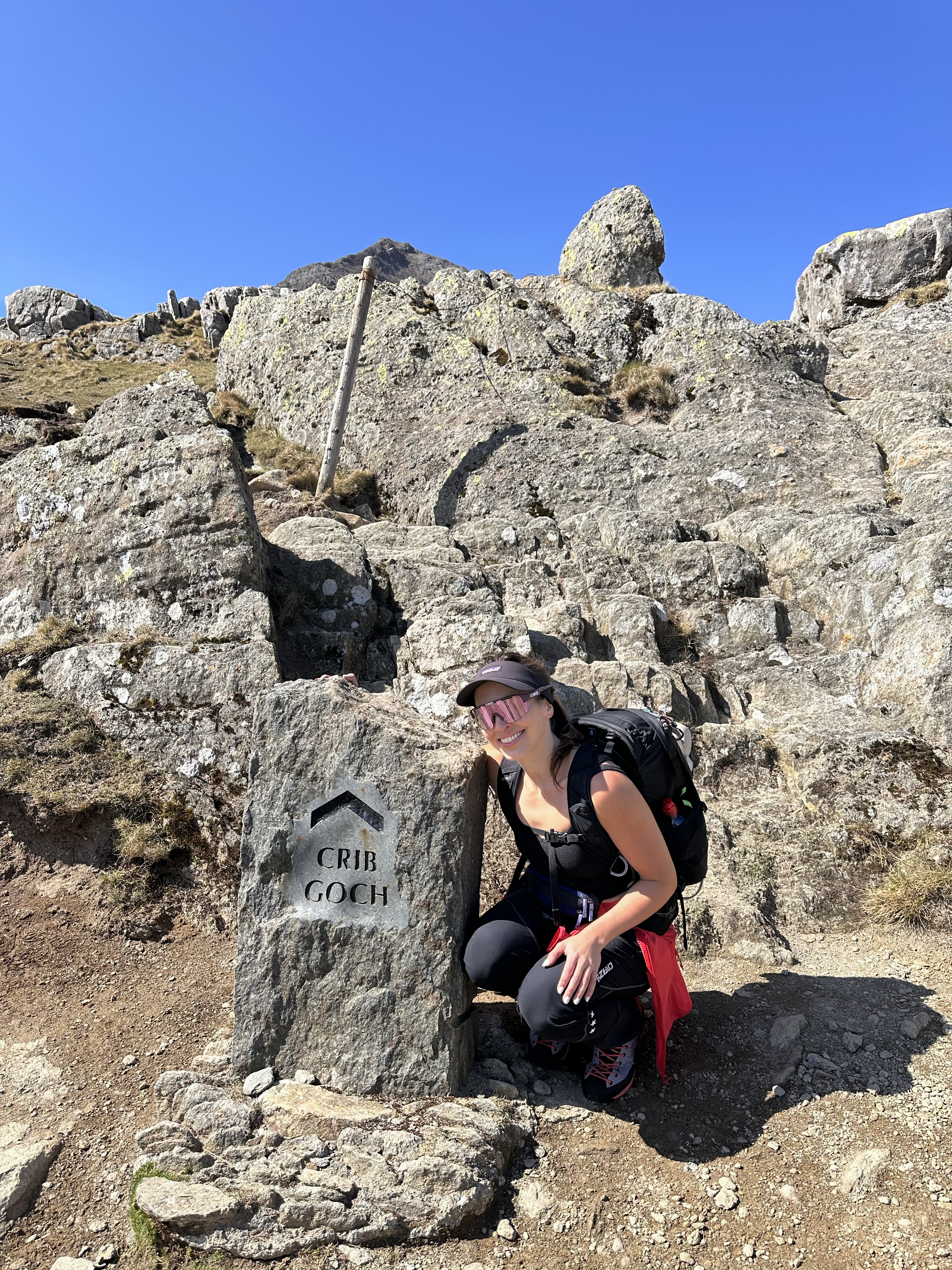
The conditions were amazing. It was almost too hot, and it was only the first week of April! Before long, we arrived at the offshoot from the Pyg track that would lead us up toward Crib Goch. You can’t miss it – it’s right near where you hop over a gate with a ladder (not sure what these are called – the ones to stop sheep from crossing). Right after turning off that path, we came to a Crib Goch marker.
The adventure begins!
I’d heard that route-finding could be tricky on this route, and I wondered how…don’t you just follow the knife-edge ridge? There’s not much room for interpretation when there are only a few usable inches of rock in places. Hoooowever, his first section is one of three where I would say route-finding isn’t that straightforward. This one is the least problematic though; if you don’t manage to follow the ‘easiest’ way up, all paths that stay toward the middle are doable and not really exposed. As the free-for-all, wide, scrambly section narrows, there’s one final ascent to the start of the classic knife-edge ridge section. That final vertical bit has decent routes around to the left, as well as to the right. The left is easier, but the right is still doable (good holds, just slicker rock, so I’d opt for the left side in less-than-perfect conditions).
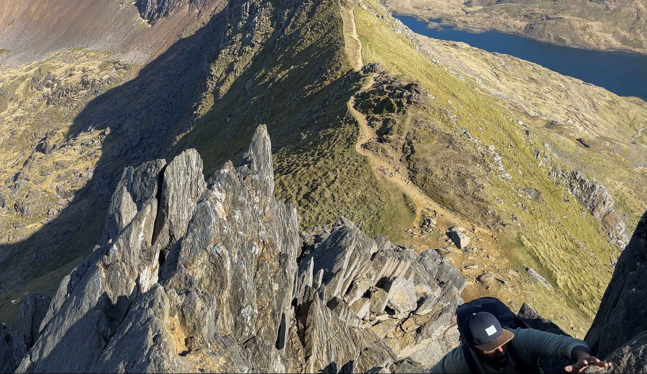
Then, it was time for the infamously narrow portion of the ridge!
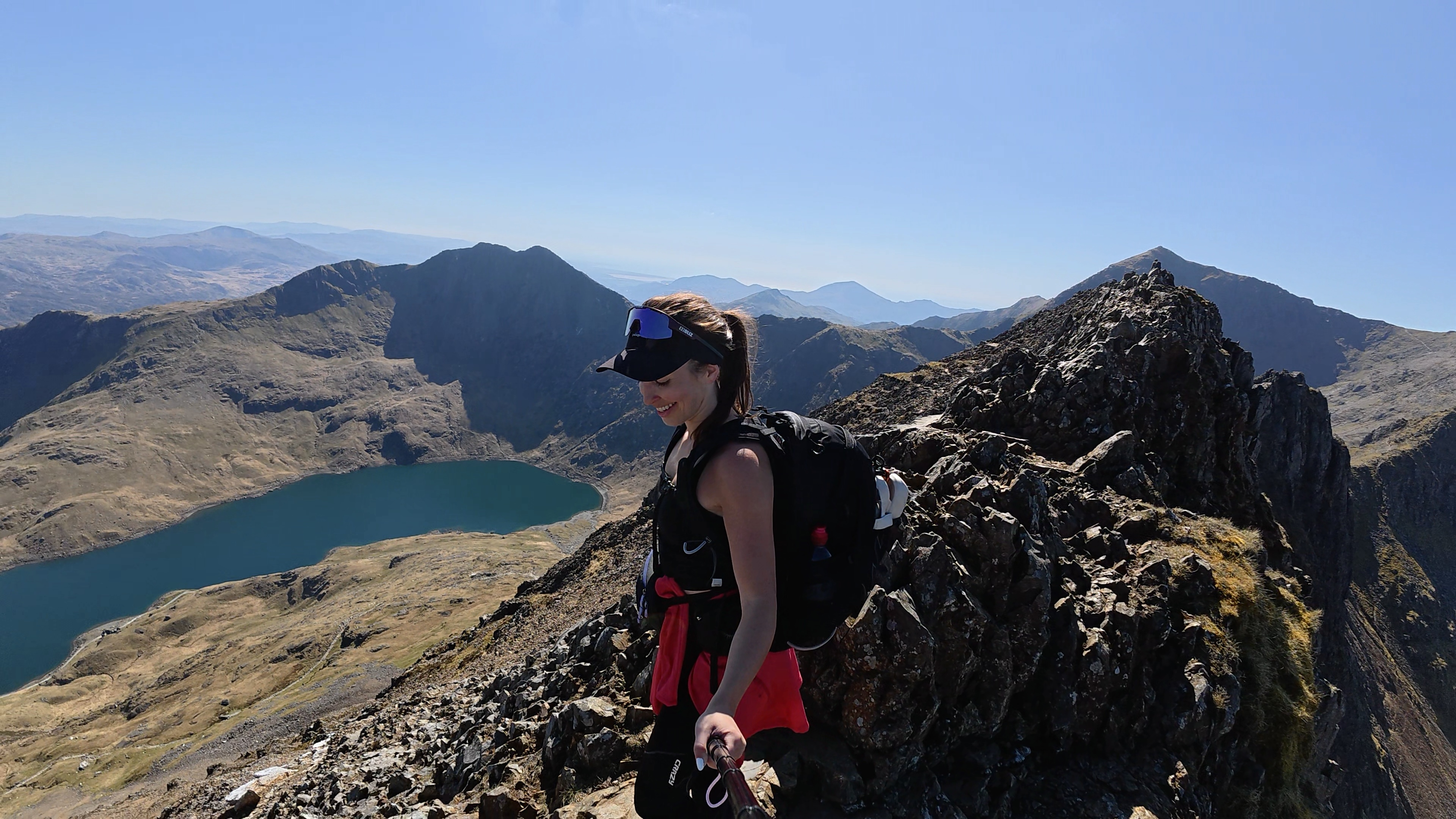
This section is what made the route popular all over social media. Some wide-angle lenses distort it, mountaineers challenge themselves in sketchy winter conditions (in fact, Edmund Hillary and Tenzing Norgay, the first confirmed summiters of Everest, used this mountain range as a training ground), and jokesters film themselves sloth-crawling across some narrow bits. It’s important to know that this route has taken lives. Ultimately, it’s a grade 1 scramble, so it’s not extremely technical. Wear good shoes, always try maintain 3 points of contact when scrambling, check for loose rocks before applying your full weight, consider walking along the side vs. directly on top in some sections (to have those 3 points of contact), and avoid a large backpack that could get caught as you maneuver around. I’m a bit afraid of heights, and I won’t pretend it wasn’t sc-airy (yes, this pun is awful) at times. The important things if you have a fear of heights and are set on trying this are: 1) be prepared (including making sure that weather conditions are in line with your experience level), 2) go slow and steady without stopping in precarious positions (aka avoid ‘freezing’ – it can be hard to unfreeze), and 3) determine your turnaround point (the point after which you’d be uncomfortable reversing your moves and bailing). This was Viven’s first scramble, but we’d climbed indoors and his technique on the initial scramble was secure, so we continued. If the scramble up to the knife edge feels too challenging, it’s better to turn around there, as there’s a more difficult section to downclimb further along. I don’t have footage from the narrowest parts, as I didn’t think to get a proper mount…and I did need both of my hands. That said, if all of this were 10 feet off the ground, it would feel quite easy to anyone with some basic climbing experience. It’s the exposure, loose rock, and sometimes weather that can make it dangerous.
Safety and pep talks aside, the views are truly breathtaking the entire way. The ridge isn’t too sustained in the exposed sections, so there are spots to take a breather and soak in the views.
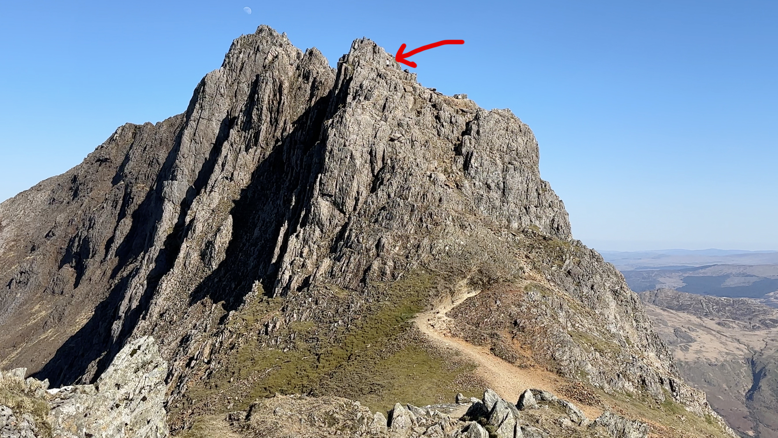
The ridge meanders along for a while, until it comes to what I would consider the second questionable navigation point of the route. It’s also the first “bail point” if you’ve had enough scrambling. There’s a faint trail heading back to join the Pyg track, but to continue on the ridge, you need to skirt left around the base of it, crossing a dip between ridge sections, then regain the ridge by essentially climbing vertically up the next section that wraps around the right side. It looks worse than it is, then it’s immediately followed by the most difficult downclimb of the route (pictured left or above depending on your device). With a controlled descent and dry conditions, it shouldn’t be too difficult. I didn’t take footage of the other side of it, but when it’s clear that there’s really no other way up the ridge without bailing for the Pyg track, the regain-ridge route becomes clear enough.
This felt like a moment to celebrate, and the ridge rewarded us with the softest, spongiest grass I’d ever laid on. We weren’t the only ones to notice this. A few minutes after we’d stopped there to rest, a fell runner faceplanted (intentionally, I believe) into it. Right behind her was a group chatting with a man whose shorts were ripped cleanly down the middle. Thankfully, the undergarments were intact. We caught the middle of what sounded like a mini motivational speech, something to the effect of “I’m almost 60, you’re young, don’t waste your life worrying about anything.” He paused, then added, “Unless you have cancer, you have nothing to worry about.” I do think he was aware of the many other devastating health and other issues out there- the spirit of his statement was to live as full of a life as you’re able. He also didn’t seem like the type of guy who would let worry halt all of his ambitions and little joys. Still, I can’t say I’ve ever had cancer specifically come up as a topic of conversation when out hiking, so it was kind of surreal to hear it on the first hike of this challenge.
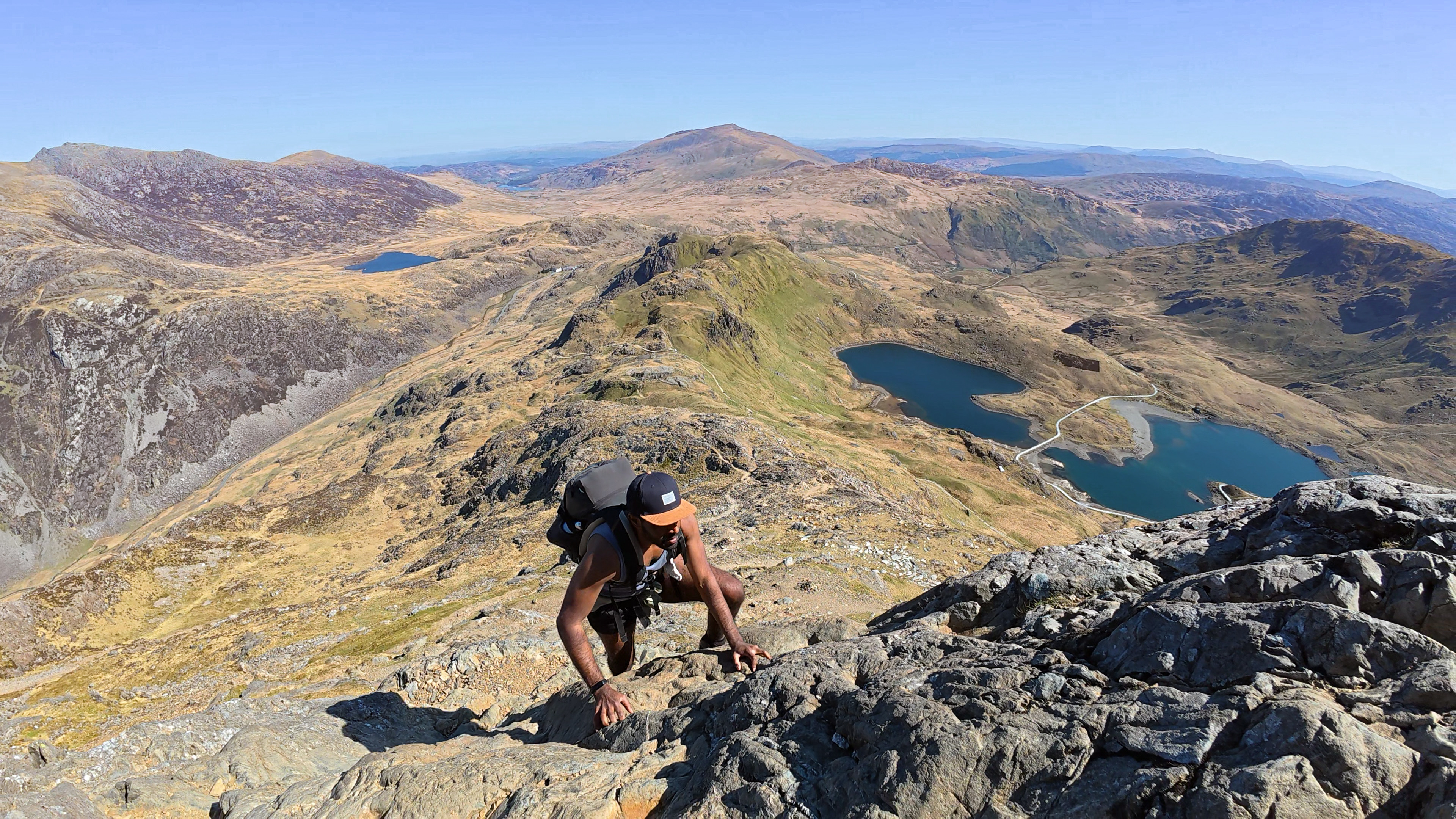
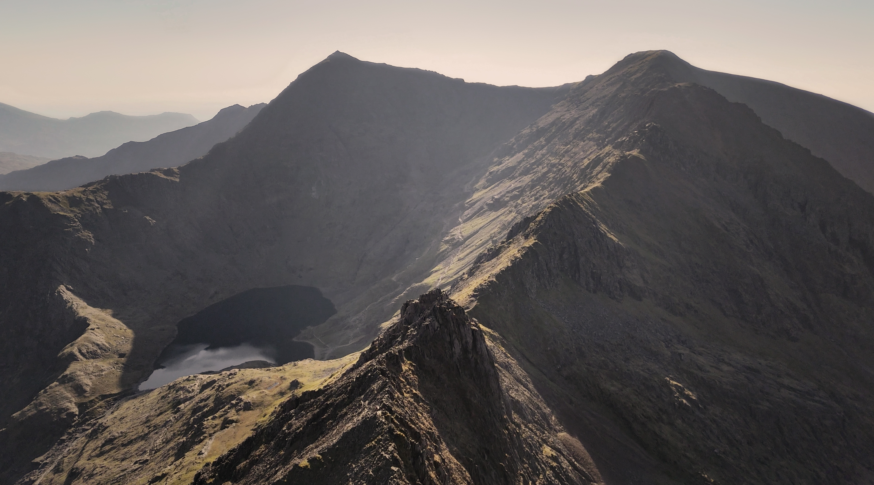
It seemed like the most difficult part of the ridge was behind us, and it mostly was, but there were many false summits still to come. At one point, which I would consider to be the third and final questionable navigation section, there’s a really clear path to rejoin the Pyg track and ascend the final stretch along it, to the saddle. I knew from some familiarity with the route (previous ascent via Pyg, trail map, some YouTube videos) that the route should not rejoin the others that early. It should finish at the very end of that ridge, with no significant departure from it. However, it looked like the scrambling route was clearer to the left. Straight ahead was a jumble of boulders with large gaps and a less clear path. This is the correct route, though. After attempting to find a way up on the left, we retraced our steps and went up the middle. So, when in doubt, stay toward the middle.
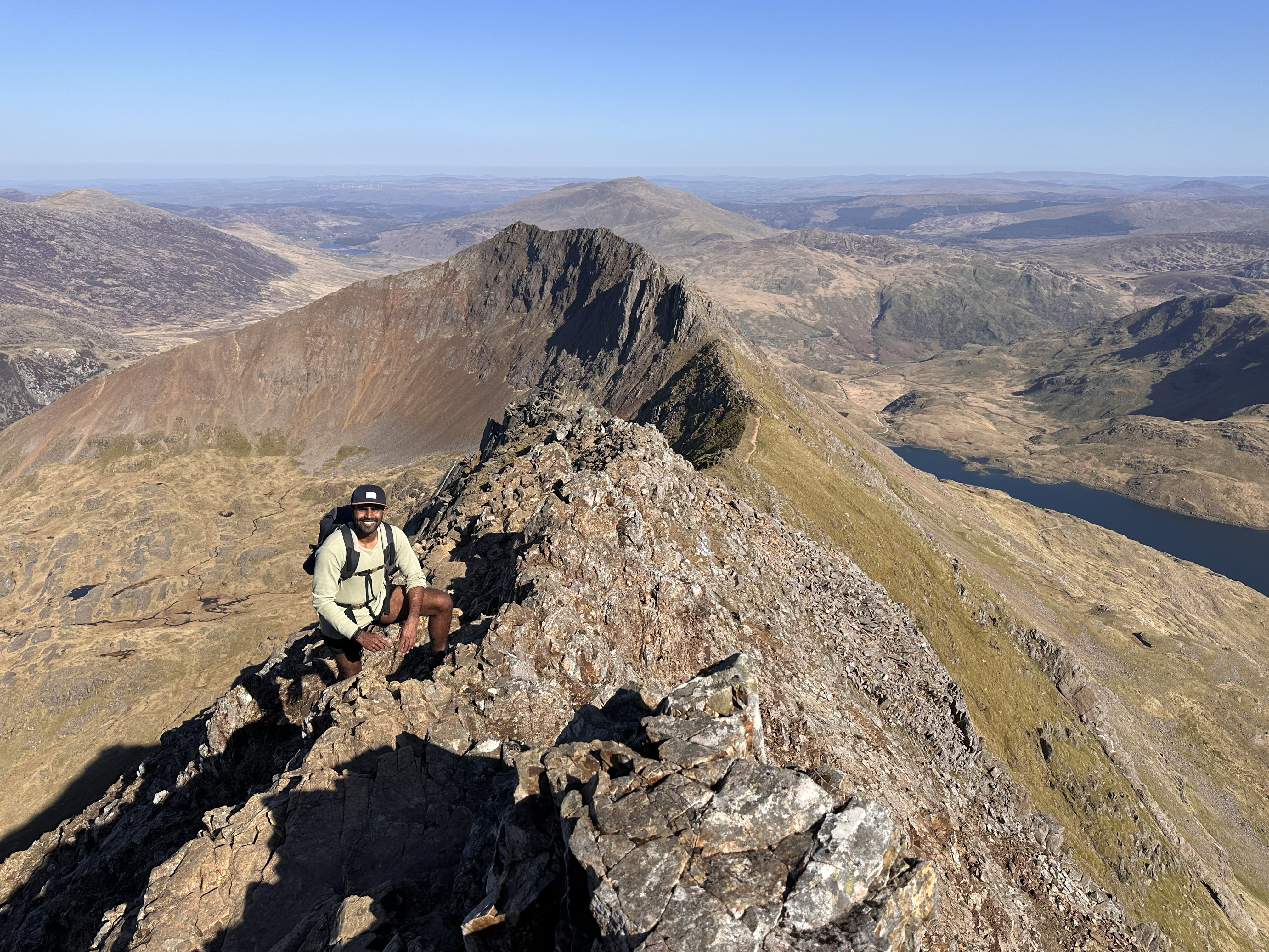
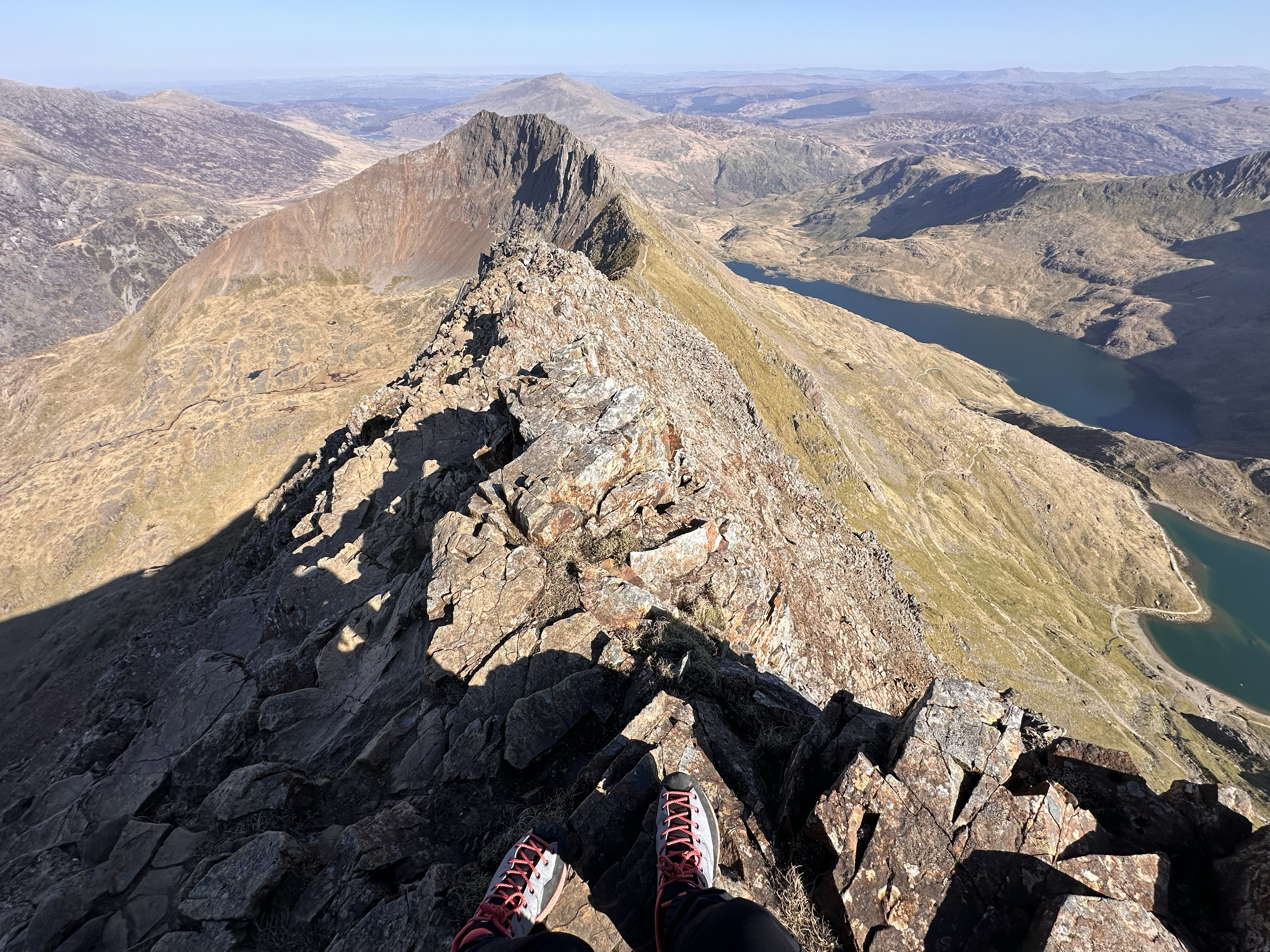
The rest was exposed once again, but still not as much as the first section. The final path to the Yr Wyddfa summit was in view, and before long, we were at the Garnedd Ugain (also called Crib Y Ddysgl) summit marker. I (inaccurately) have referred to it as the Crib Goch summit, as it marks the end of the scrambling and felt more rewarding to reach than the Yr Wyddfa summit itself. It was definitely less crowded.
As I mentioned at the start of this post, Garnedd Ugain is a “3000-er” in its own right (Welsh peak with 3,000+ ft elevation), and it’s often ‘peak 15’ in the Welsh 14 Peaks challenge for those that ascend Yr Wyddfa via Crib Goch. If you bail early from the ridge, you’ll miss it!
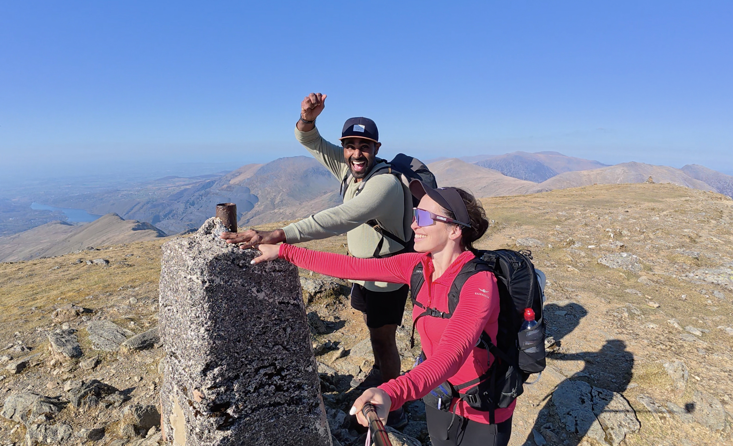
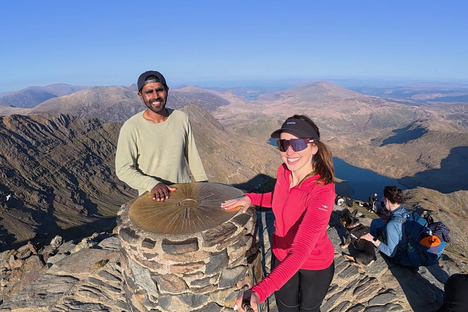
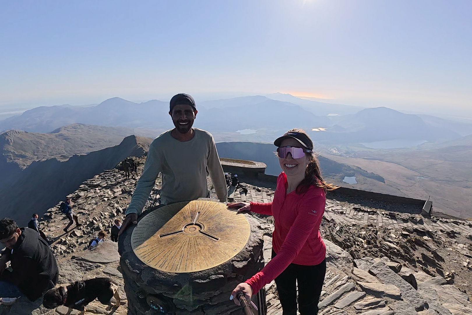
From there, it’s 15-20 minutes following the train tracks (where all 6 main routes converge) up to the highest point of Wales. At the summit, there are stairs up on 2 sides, and there’s often a queue for a photo. On this day, people didn’t really get the queueing memo. They were just hanging about, chatting and snacking right at the marker. Still, we managed to snap a few photos up there! Clearly, third Wales hike was a charm in terms of clear views (:
On the way up, we found out that the café hadn’t yet opened for the season. I’d been looking forward to rehydrating with some teas, and it didn’t even cross my mind to check when it would open. Parking reservations had started, and the train to the summit had started running the week before, so I’d naively just assumed the café would be open too. Big mistake! We’d drunk all of our water and had none for the descent. I had liked to think that I’m always prepared in the mountains, but I was so reliant on the café’s tea that I hadn’t even brought my water filter along. So, after a short break at the summit, we headed back down, eager for the extra water waiting in the car.
The descent down the Miners’ Track is pretty comfortable in dry conditions, and you get most of the descent out of the way early. I went down the whole thing in socks & Tevas due to foot issues (unrelated to my ankle), and I really owe Teva for existing 🙂 impressive traction and so comfortable, even to walk 3,000 ft down a rocky path from the highest point of Wales (NOT SPONSORED, but @Teva- if you’d like to drop us a donation, feel free hehe).
There is a large lake at the end of the steep descent, Llyn Llydaw, where we stopped for Viven to take a dip, while I attempted to refuel with a military-ready-to-eat (MRE) meal (another company I was grateful for on this hike, Omeals, for making already-hydrated meals that happen to meet my dietary restrictions). I restock on these every time I’m in the US. @Omeals – come to Europe, we’re very interested in them over here (I get a lot of questions when out with them)!!
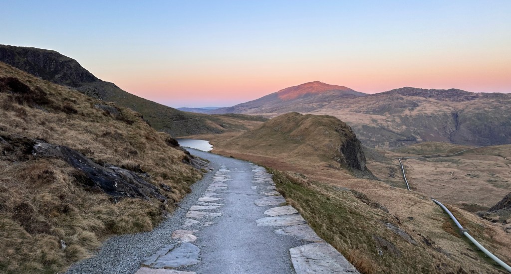
From there, it was a leisurely walk for a couple of hours back to the car. The sun was setting in a blend of pastels, keeping with the beautiful sunset tradition of this challenge so far. I’ve never chugged a half liter water bottle so fast in my life, nor knocked out so many lentil chips in one sitting.
This was a day trip, so there were still 5 hours of driving left to do. Finally, exhausted but happy, we returned to London.
I know this post is focused on Yr Wyddfa / Snowdon, but there is SO MUCH more to do in Wales. I have not done nearly enough to make my own map for this one, but for some Instagram inspiration, here are some accounts to start with for ideas: @visitwales, @ohwhataknight_, @visit_eryri, @conorhikes (not just Wales but has a lot about it).
THANK YOU ❤
Thanks for reading my second Crown of Cureope blog post. At the time I stood on the top of Wales, only the second peak, we had raised $875. I really appreciate your contributions- they’re all going directly to the American Association for Cancer Research to fund lifesaving discoveries.
Next up, BeNeLux! 🙂

Leave a reply to #7: Czechia (Sněžka) – Crown of Cureope Cancel reply