
Just a warning…this post is a bit like a recipe site, in which (if you’re most interested in England’s high point), you may need to scroll through photos of sheep and alpacas, ramblings about Google Maps routings, and (of course) some mentions of the weather (I’m keeping this post as authentically British as possible!!).
Plans Come Together
Clear skies, with weather sunny enough for a tank top for most of the hike?
Welcome to my country of residence (for 2 years AS OF TODAY 🙂 ), England (:
As the longest bank holiday weekend of the year approached (Easter), I was monitoring the forecast for Ben Nevis (Glencoe) and Scafell Pike (the Lake District), hoping to make it to both. The Lake District is halfway between Glencoe and London, so it would have been a nice way to break up the 9-hour drive north. Given how 2024 went in the UK, weather-wise, my expectations were quite low of doing either of these in April. Plenty of hikers tackle them in suboptimal conditions, but I figured that since they’re are the easiest for me to get to on a whim, I’d wait for a clear weather window. My first-ever UK summits were shrouded in clouds (Pen Y Fan & Snowdon summit #1), and I wanted the reward of panoramic views for each British high point! (: It worked out for Wales, and it was about to work out for England. …Scotland would have to wait a bit longer.
On the first day of the bank holiday weekend (Friday), I got this message from my friend Anna: “Remind me are you in town this weekend or on the mtns somewhere?”. I told her my tentative plans of leaving the next day for the Lake District to catch a good weather window. Anna, who had just run a half marathon the previous weekend and was meant to be cleaning the house pre-hosting family for a few weeks, was packed and ready to join 24 hours later. In that time, I called around to a few campsites, and it seemed that everyone had the same idea! Fortunately, Fisherground Campsite had availability at a reasonable price. Less fortunately, we ended up spending so little time there that the owners called us the next evening, concerned for our safety (we’d gotten in late, left early, and were still out exploring at almost 9pm).
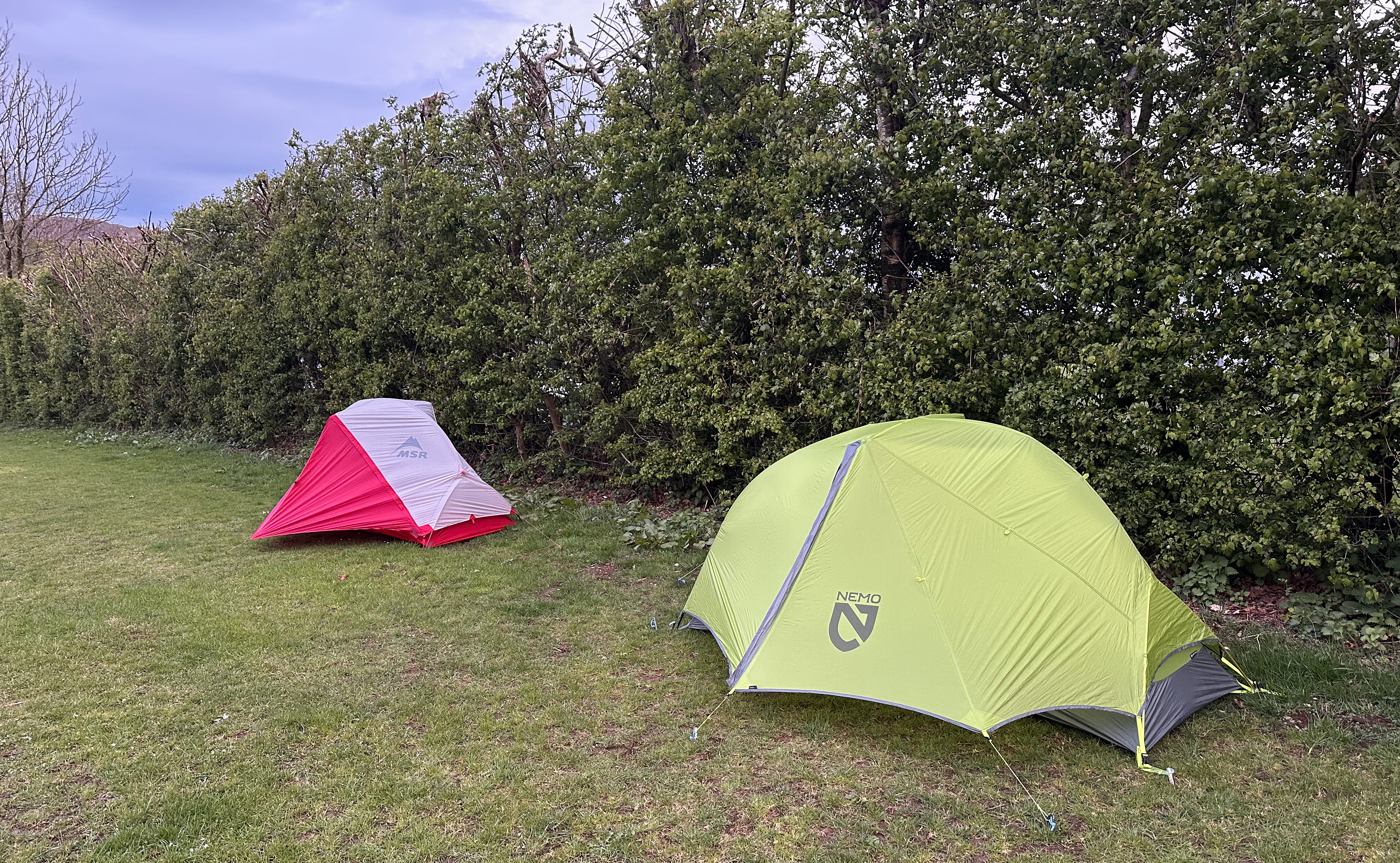
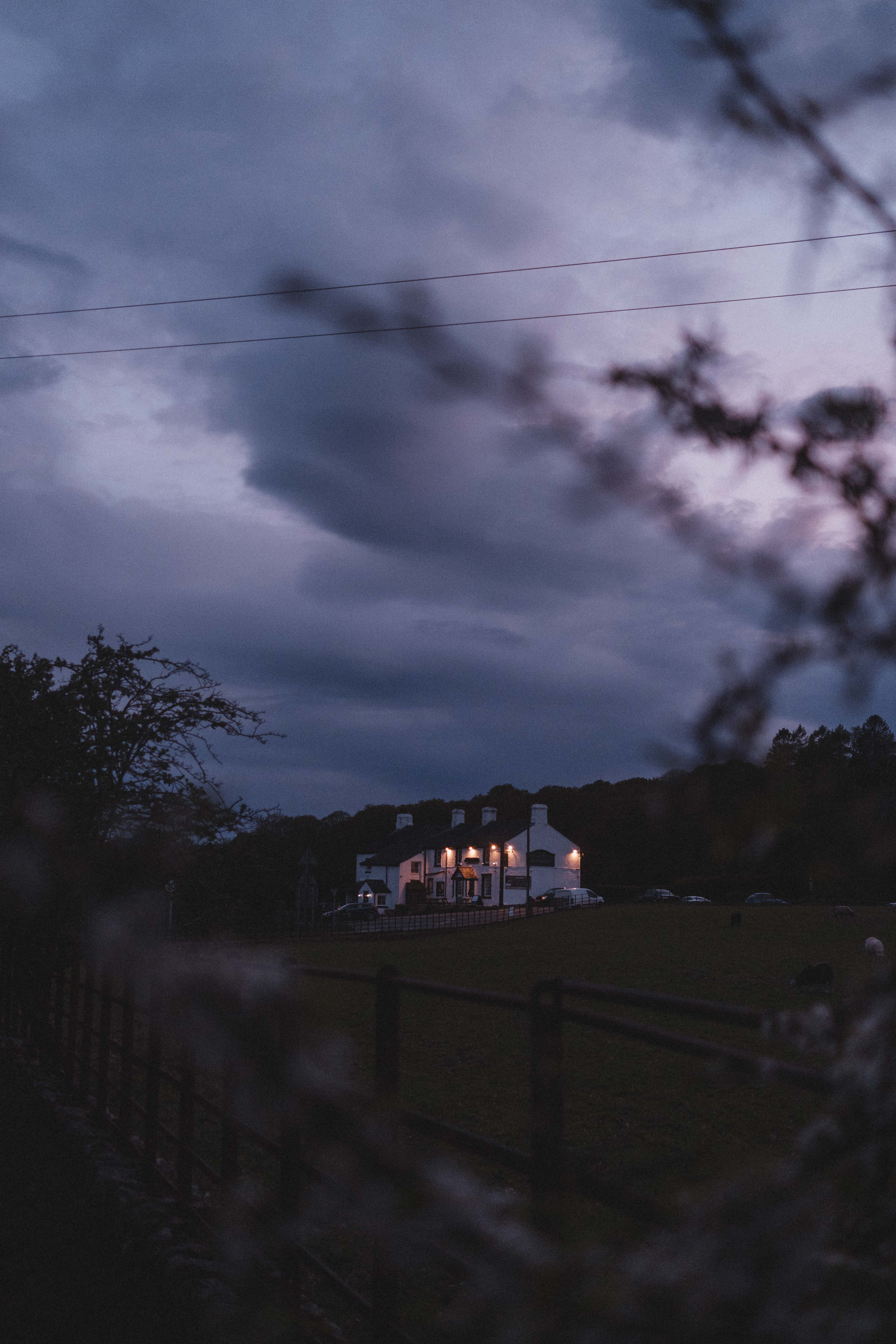
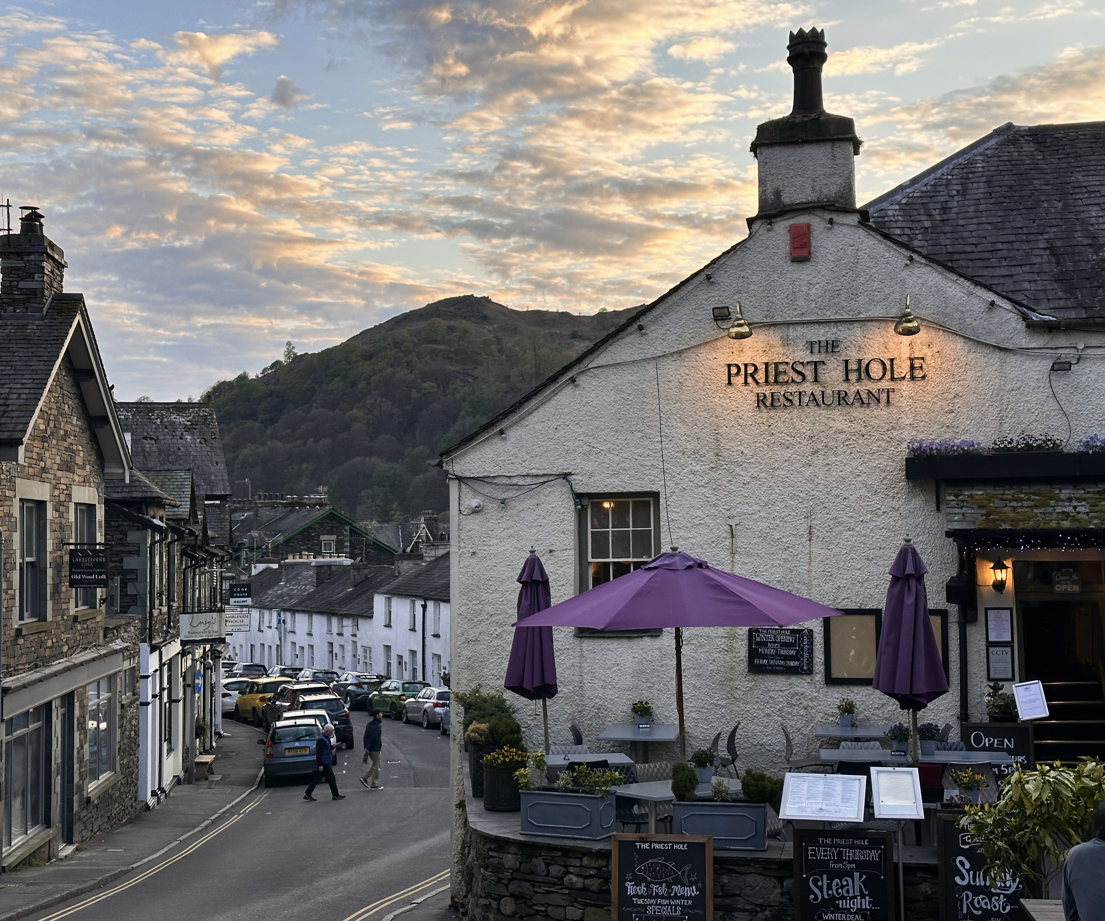
From London, it takes around 5-6 hours to reach the Lake District. I think our après-ski playlist (that Spotify served up with some yodeling selections) helped to pass the highway drive time. After a quick grocery run on the way, we headed through the final stretch of narrow, scenic roads to the campsite to settle in. Not until after pitching our tents did we discover that the campground was larger than we’d thought, and there was a bit more peace/quiet/shelter-from-wind in another area. So, we entertained our fellow campers with our unstaking and carrying of the pitched tents, one at a time (sleeping bags inside and all) across the campground. We had noticed a restaurant (in Anna’s photo here!) on the way in, so we wandered over there in search of hot food. It turned out that the kitchen had just closed, so we resorted to the “girl dinner” that had become the standard on our recent ski trip.
Pre-sunrise alarms set, we said goodnight to the local sheep and headed to bed for the evening.
The High Point (“the Highest Point in England, mate!!”)
Not bright and quite early, we unzipped the tents and tended to our ailments (taping our aging knees, mainly). The drive from this campsite to the trailhead parking at Wasdale Head was an incredibly scenic, 30-minute drive, of which half was spent behind a car going <20 mph along Wast Water. At least this was the most beautiful part of the drive! This is in the England highlights on Instagram.
The parking here is kind of expensive, nearly 10 quid for the day. Parking at National Trust sites like this is free for members, and depending on how often you’re in these areas, it could be more cost-effective to get a membership! The membership and parking fees also support things like keeping the toilets clean (they were). There were representatives there to recruit new members, and the monthly fee isn’t too high. Given this challenge and the amount of outside-UK travel I’m planning for the next couple of years, I held off and just paid the parking fee, for now. (:
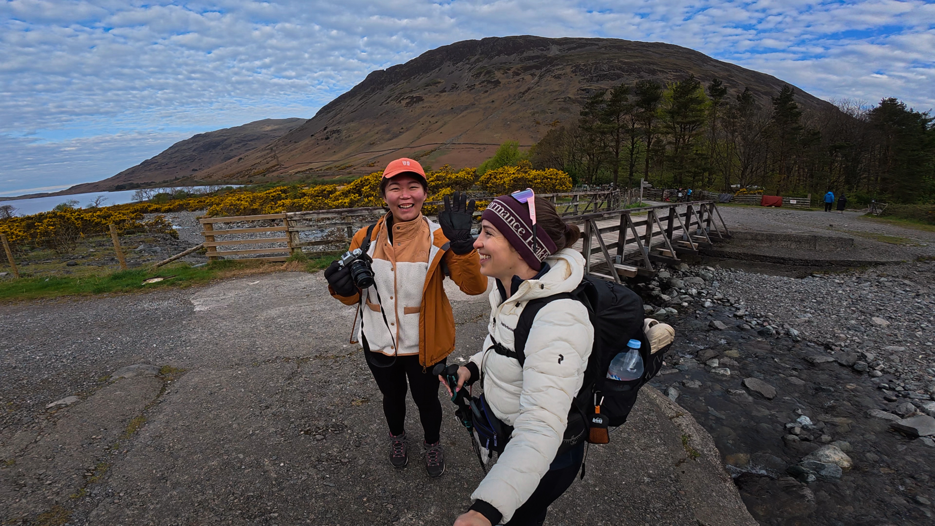
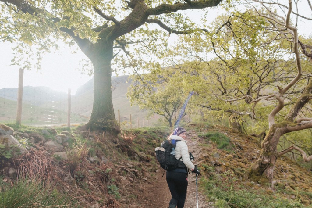
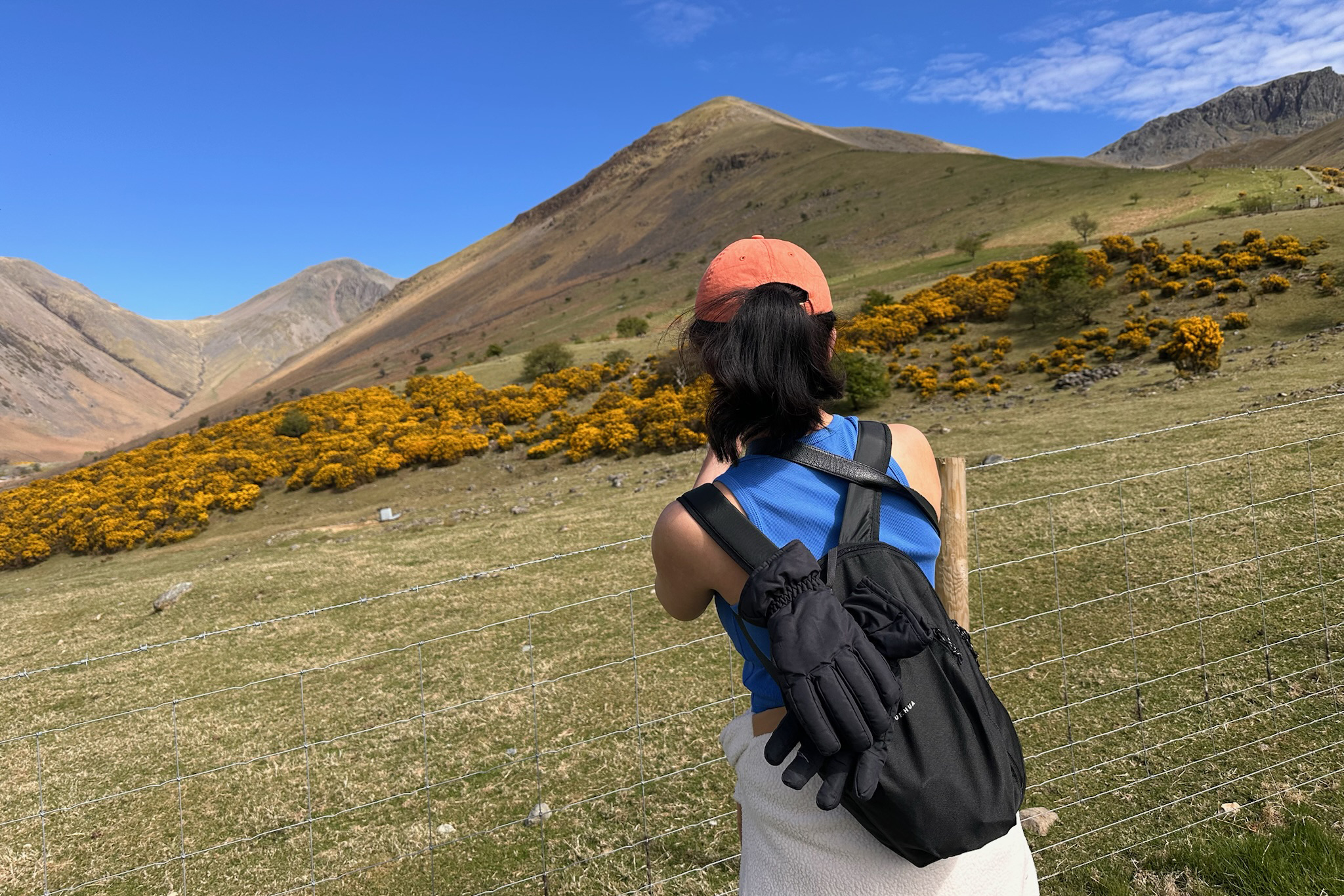
We set off, probably with too many layers, for the trail. Less than a minute in, we made one of many photo stops. The subjects? Sheep, of course.
The shortest and most popular way up to Scafell Pike is from Wasdale Head. The AllTrails map can be found here. It’s a 5.8-mile (9.3 km) out-and-back with ~3,000 feet (~915 meters) of elevation gain. Essentially, you are gaining just over 1,000 feet per mile, without any real “active recovery” flat sections. The trail is very well-maintained and non-technical, though. There are a lot of ways to tackle other peaks as a loop, if you’re collecting the 214 Wainwrights.
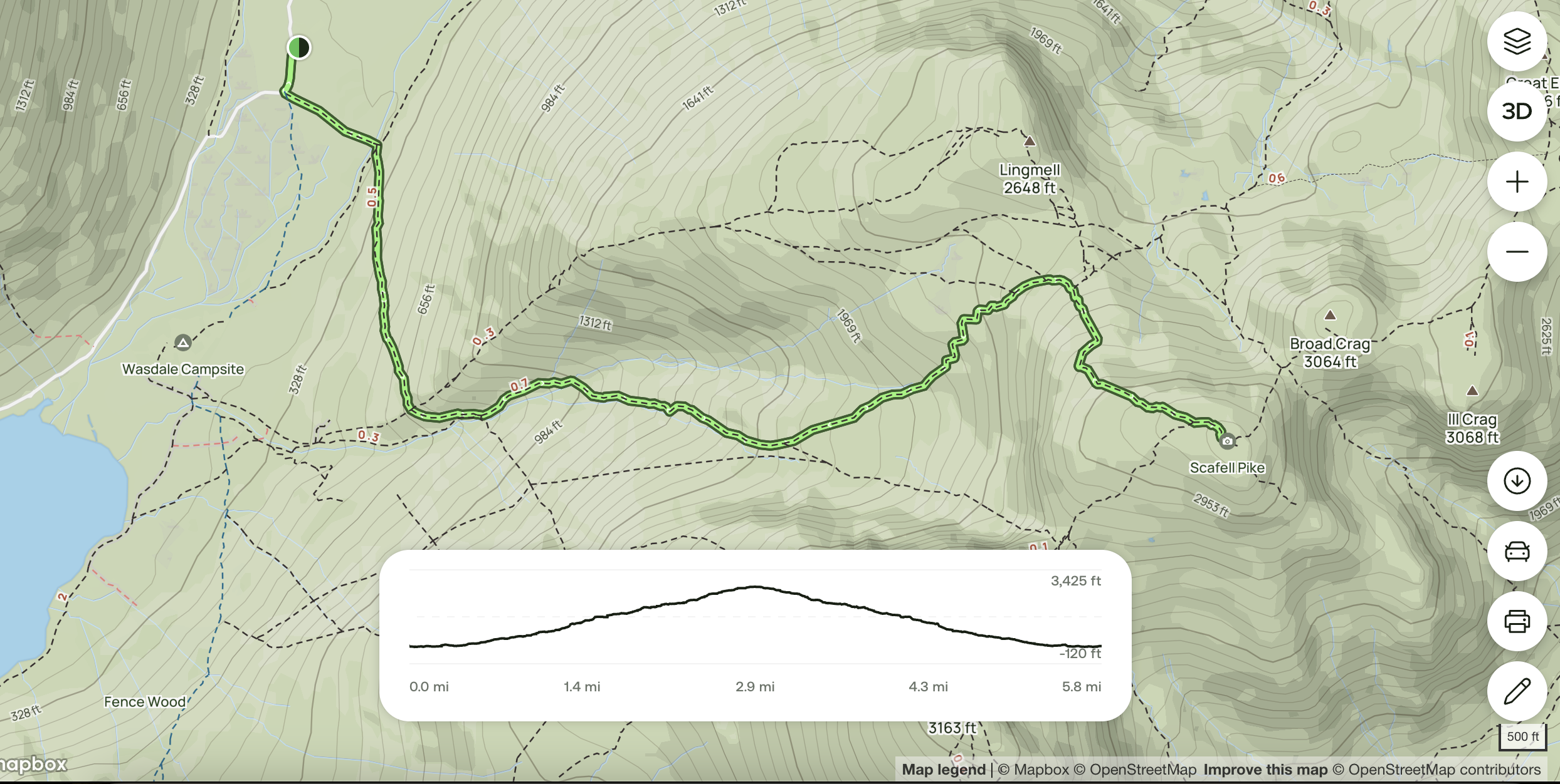
This route approaches the peak from the west, and an alternative (but slightly longer distance- and ascent-wise) route approaches from the north, from Seathwaite. That trail map is here. The Lake District is one area where offline maps can be very useful (both for driving around and for the hikes themselves), I’ve found the mobile signal to be spotty.
England has the stereotype of not being very mountainous…with more “hills” than “real mountains” relative to its neighbor, Scotland. It’s not the Alps, but the Lake District is truly one of the most beautiful places I’ve visited. This was my second trip there – more on the first one at the end of this post, along with the map of my favorite locations around England! (:
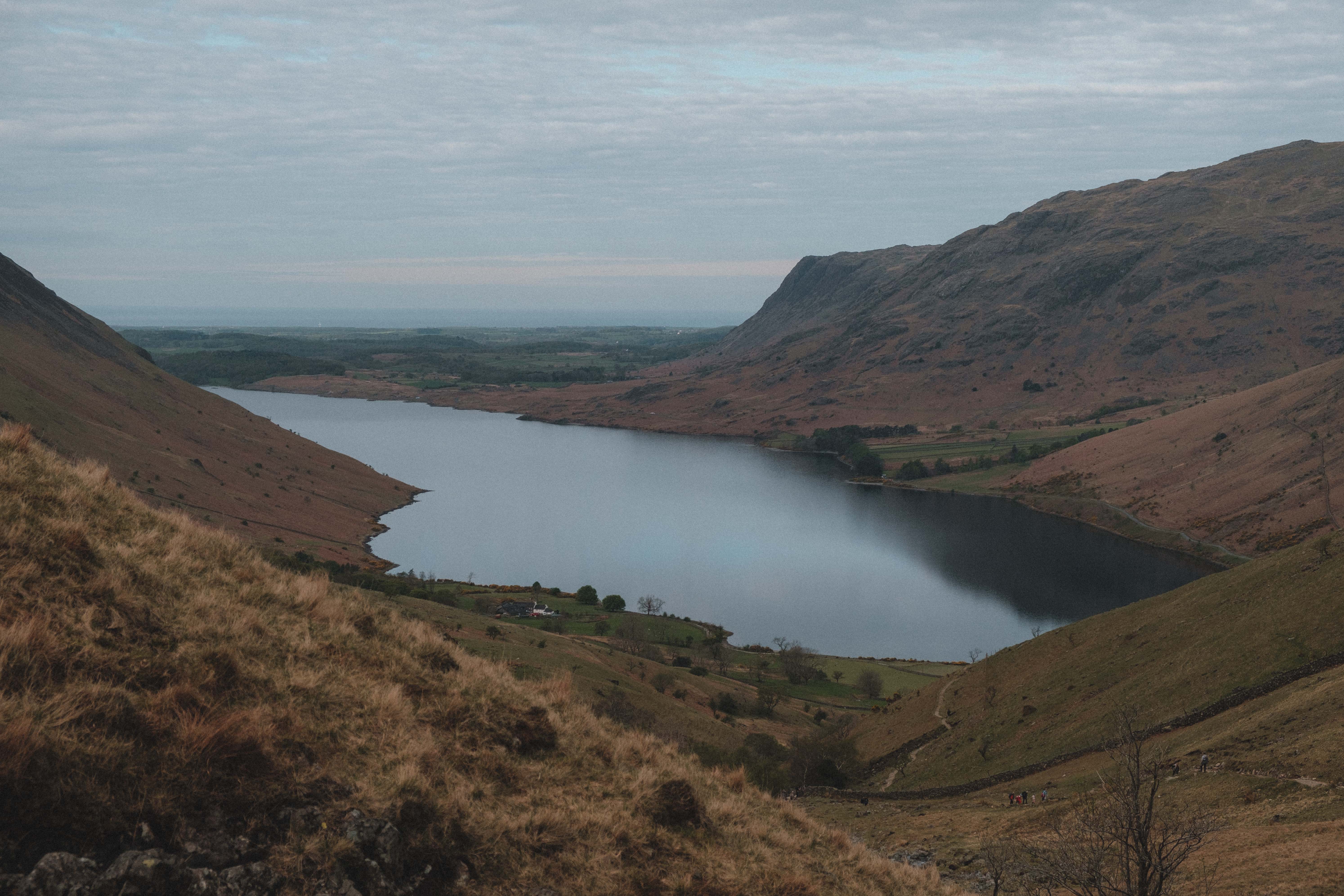
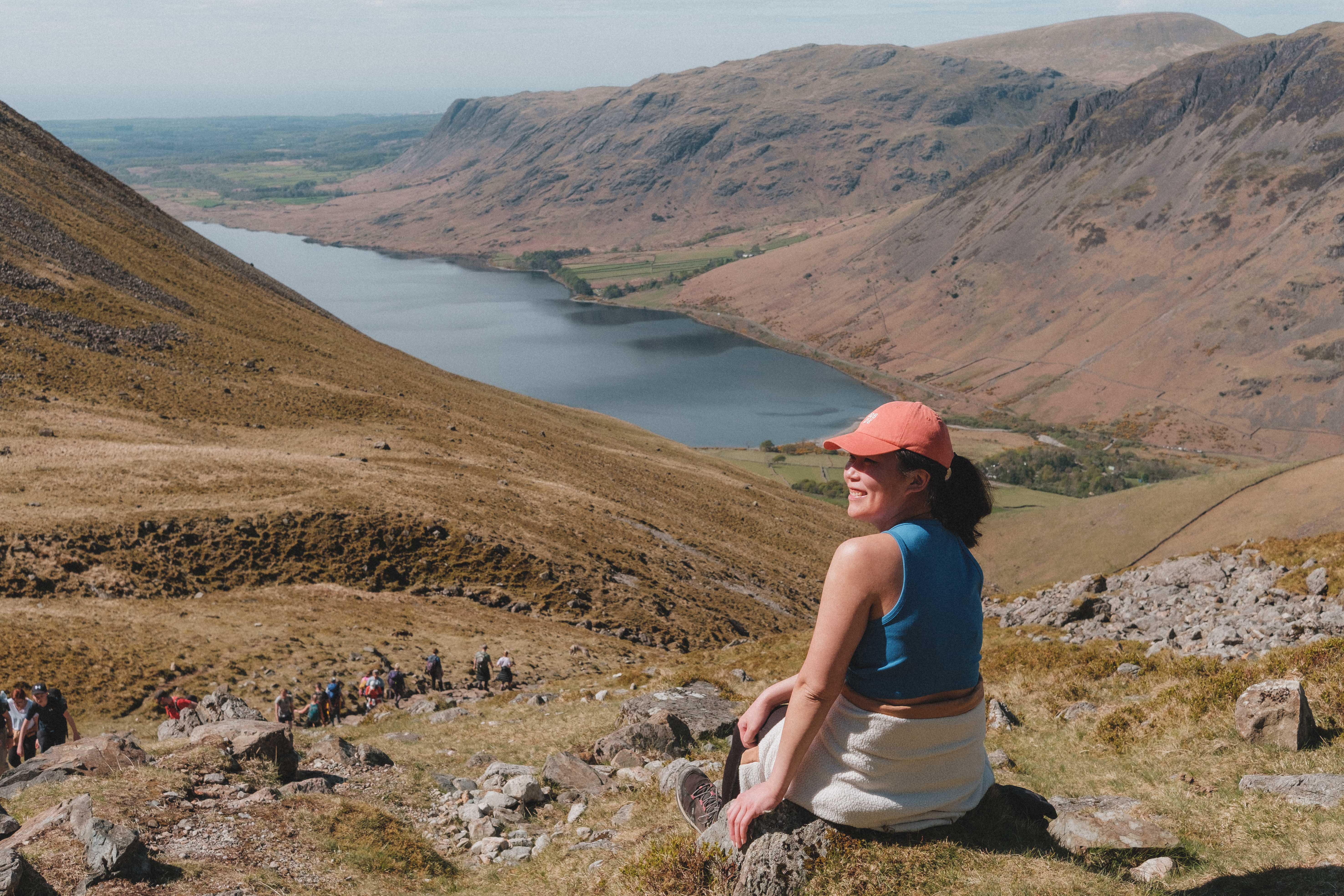
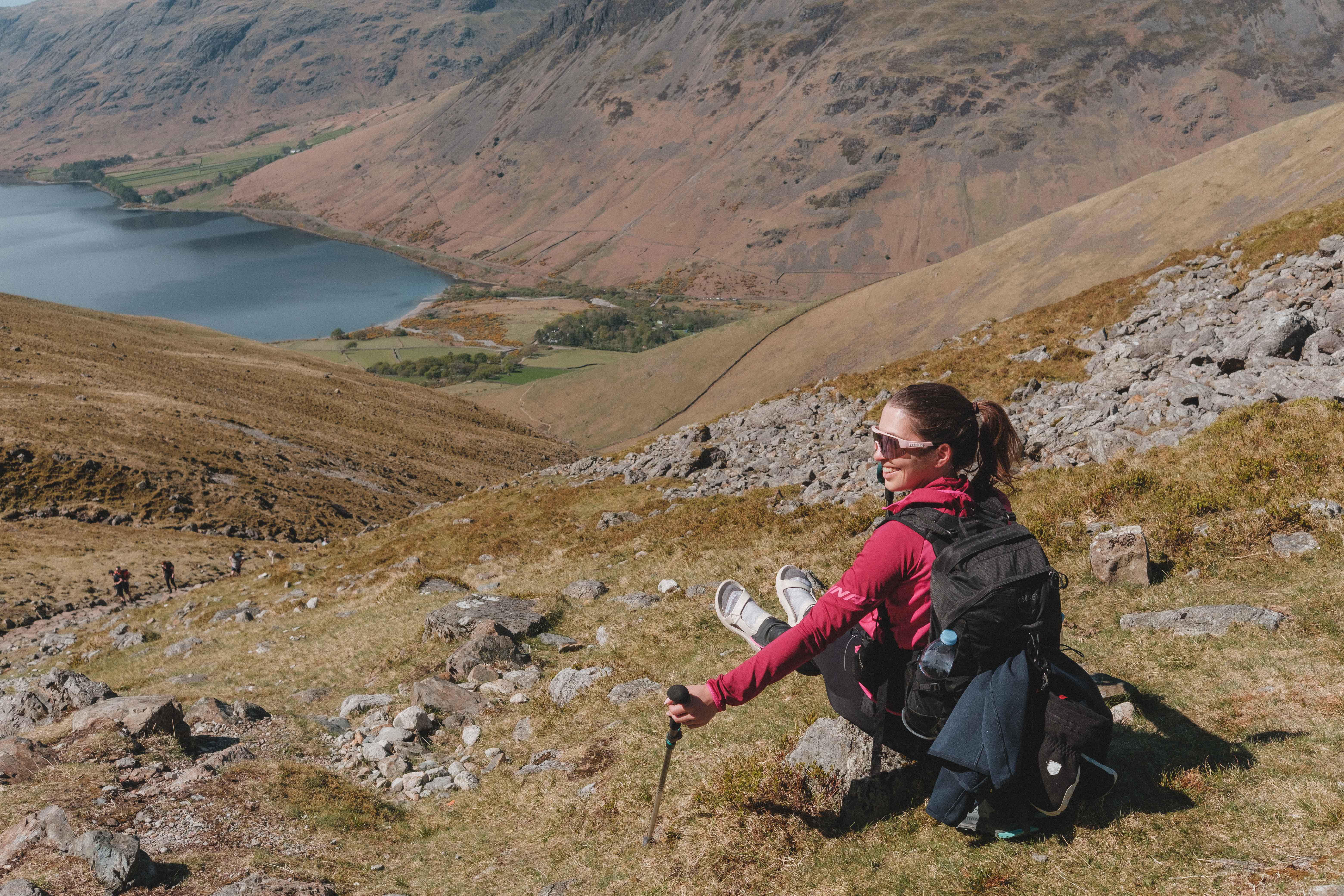
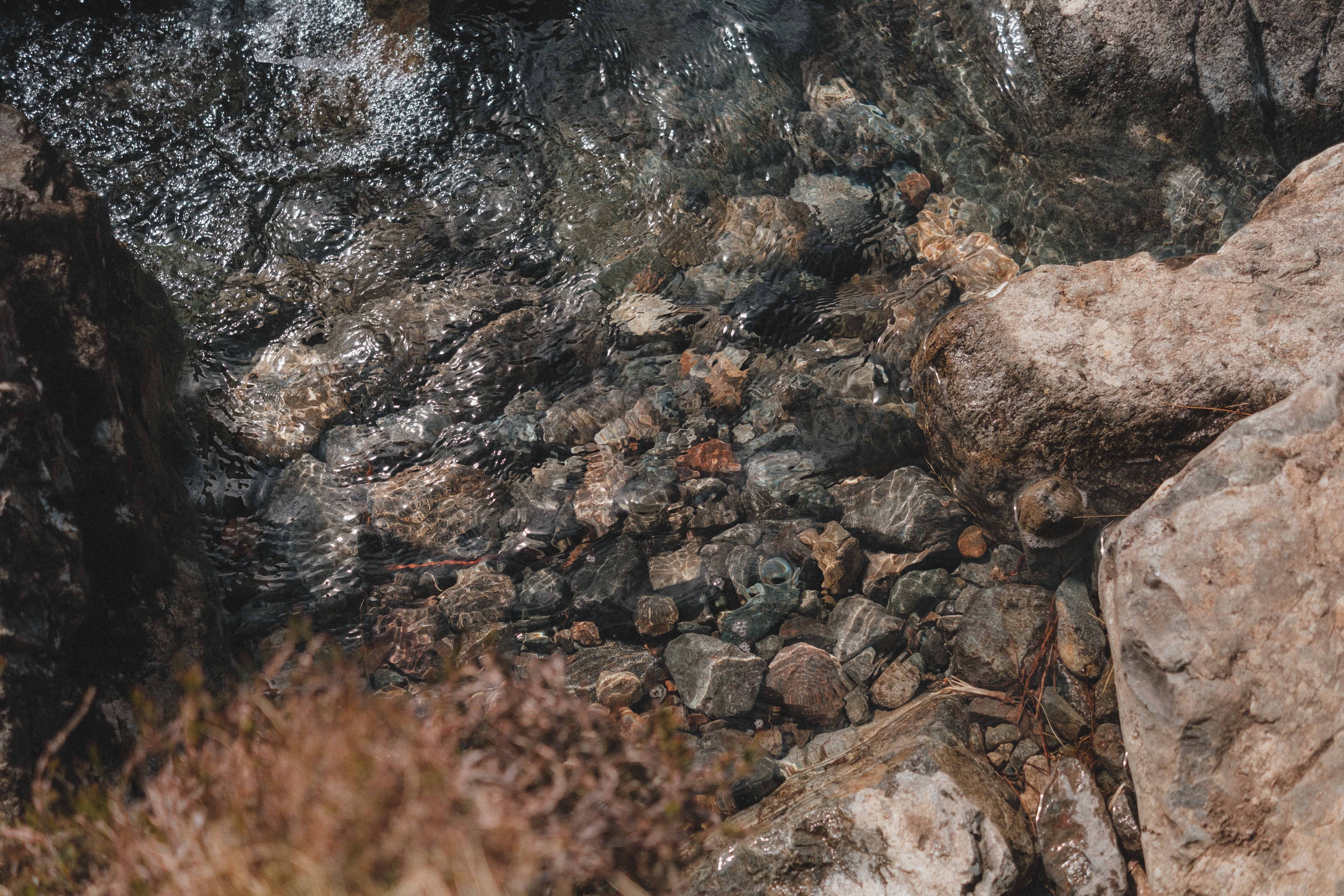
Right from the start of this hike, the views open up over Wast Water, the lake we’d driven along on the way in. There is one uneventful river crossing with plenty of boulders to walk across to stay dry, then it just keeps going up. I tried to film some clips on the action camera along the way, mainly for the YouTube channel I’m working on. I still haven’t gotten the hang of what to say while out of breath, walking up a mountain, so I found myself repeating our destination: “THE HIGHEST POINT IN ENGLAND”. It became a sort of motivational phrase that turned into a delirious joke by summit time.
It feels like there are two phases to this hike. One: rocky steps up to a very brief plateau. Two: scree ascent with at least two false summits.
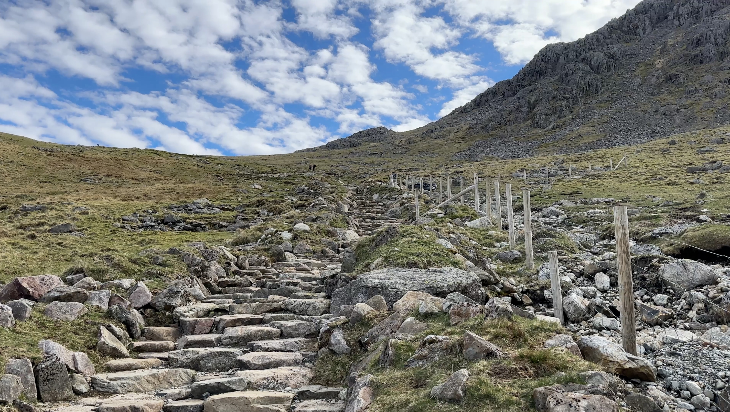
Right at the top of the hill shown here, views opened up over more of the valley on the other side. It’s not quite 360 degree views until the summit, but they open up more and more with each section of the ascent (and with each false summit). There is no real “through the forest” section of the hike for more than a couple of minutes, which also means there’s no shade. It’s England, so the UV index is never really too scary, but you can still burn. Bring sunscreen! It was such a clear day that the sky looked fake. It’s not AI! (;
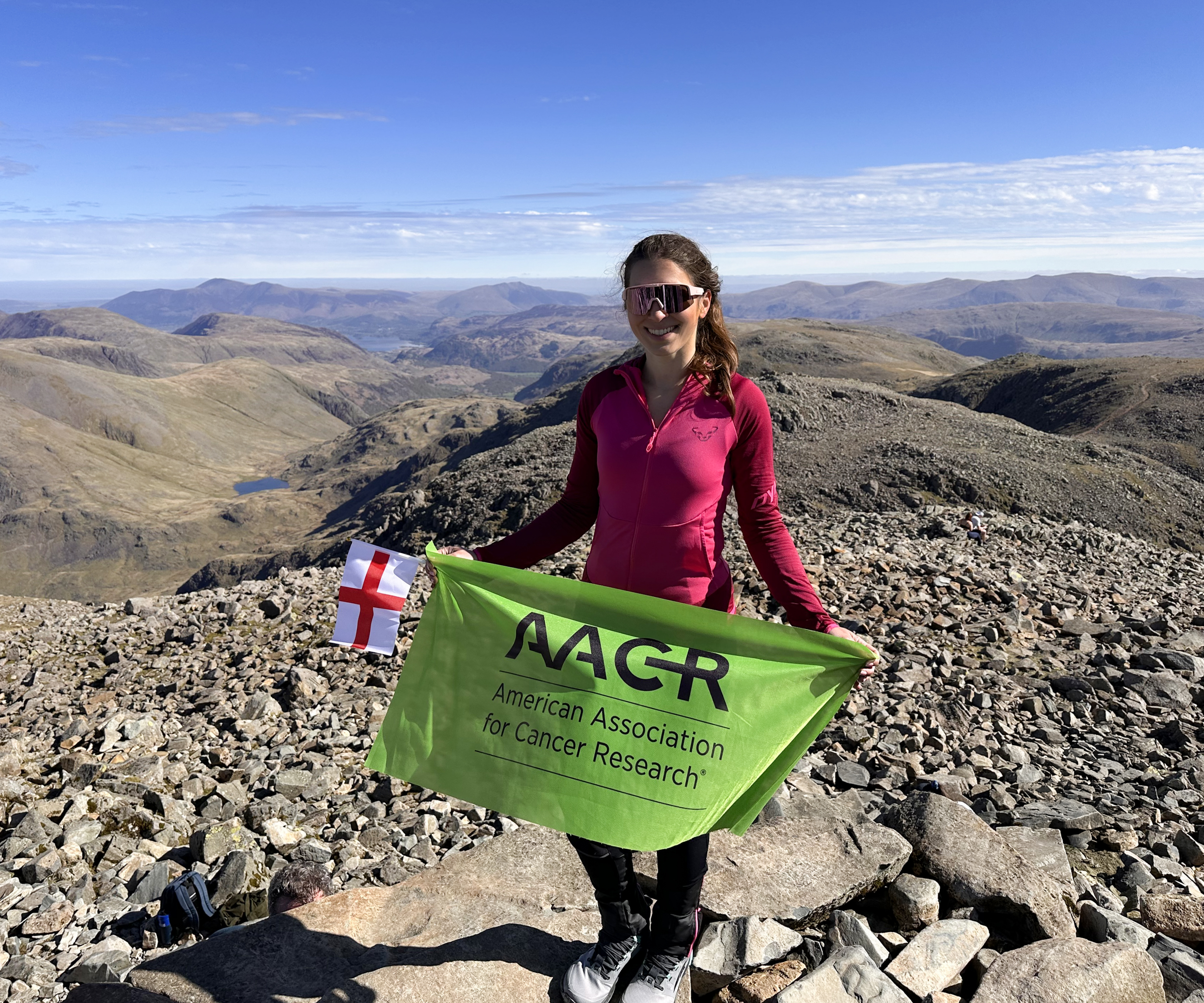
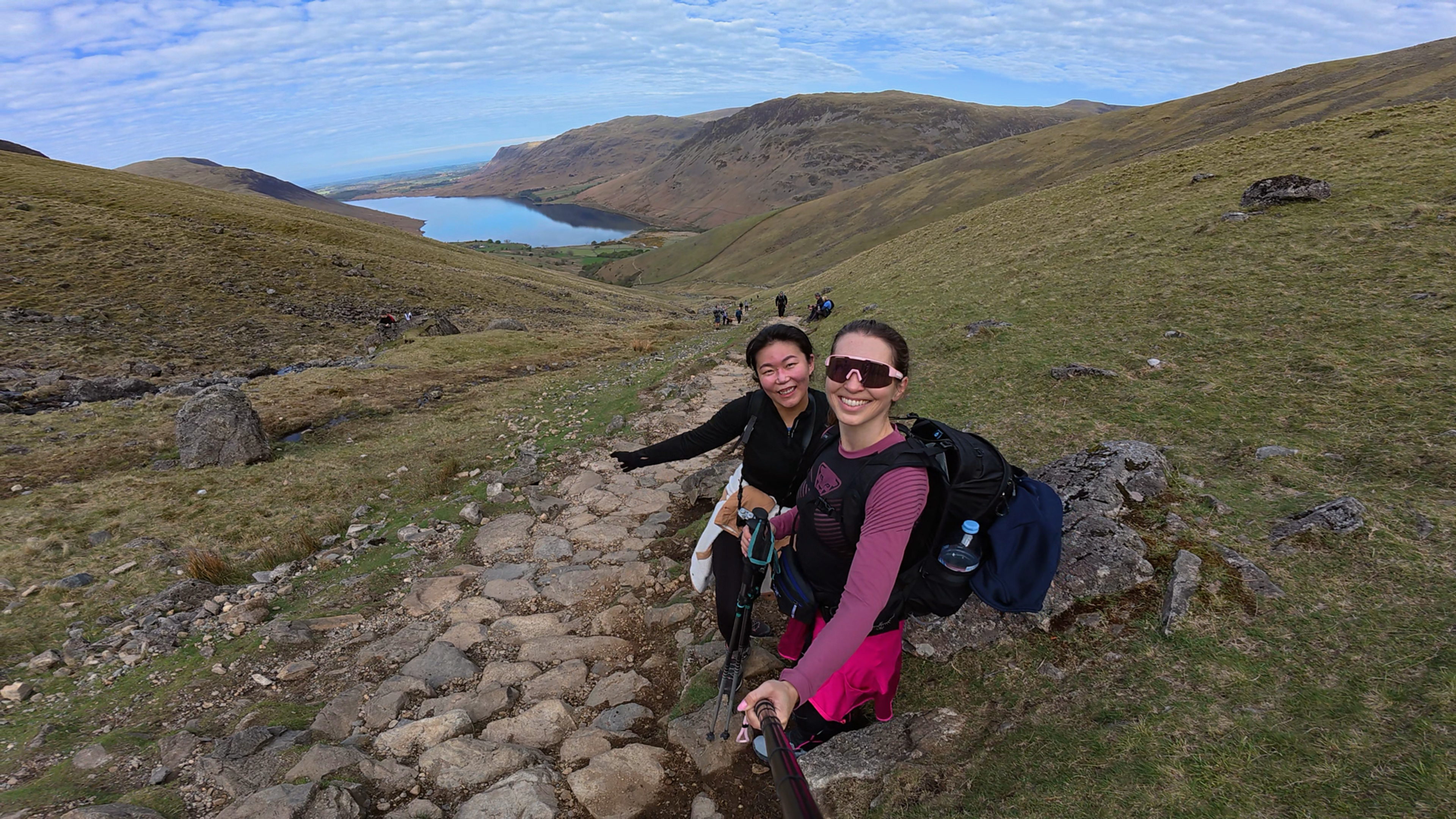
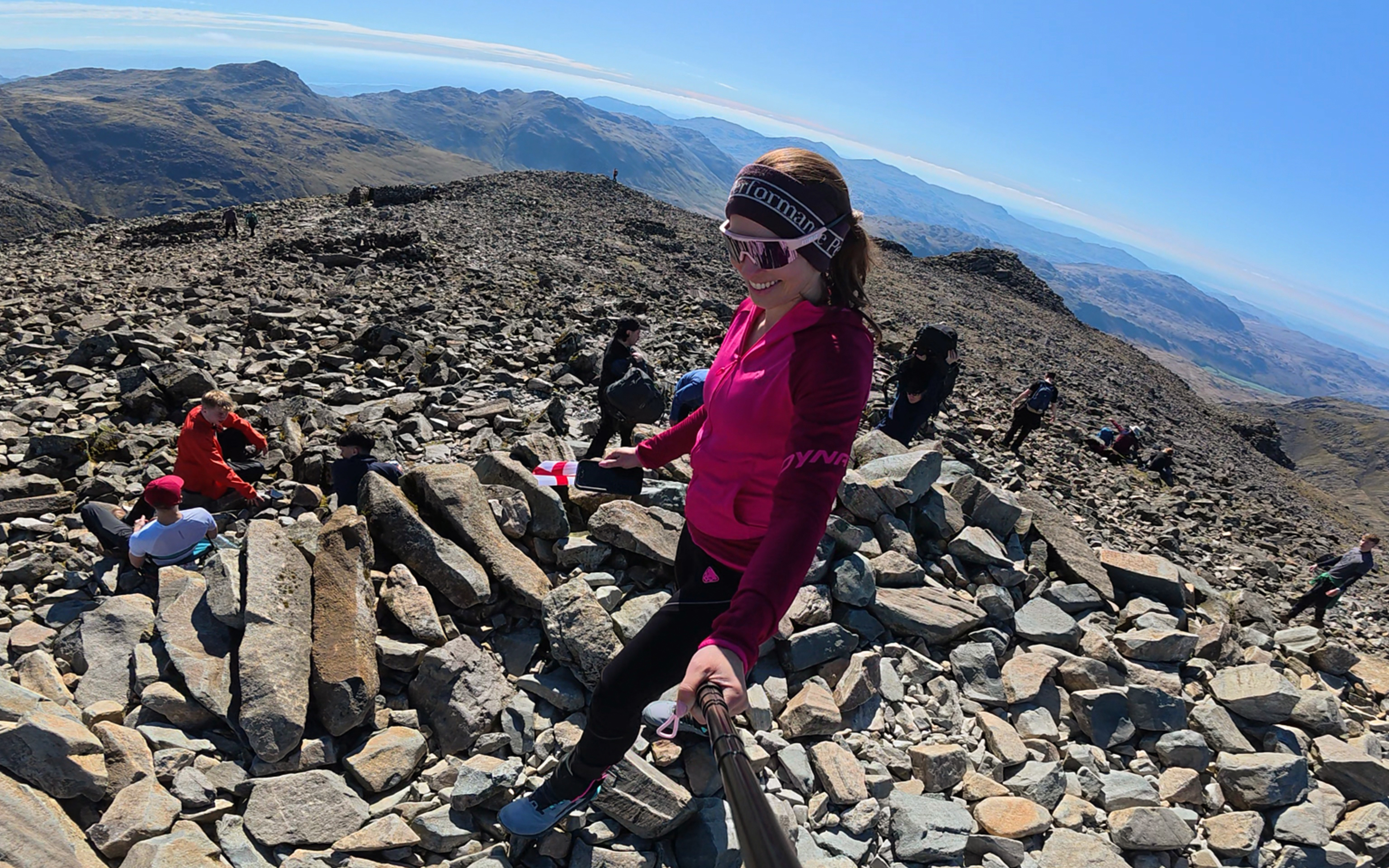
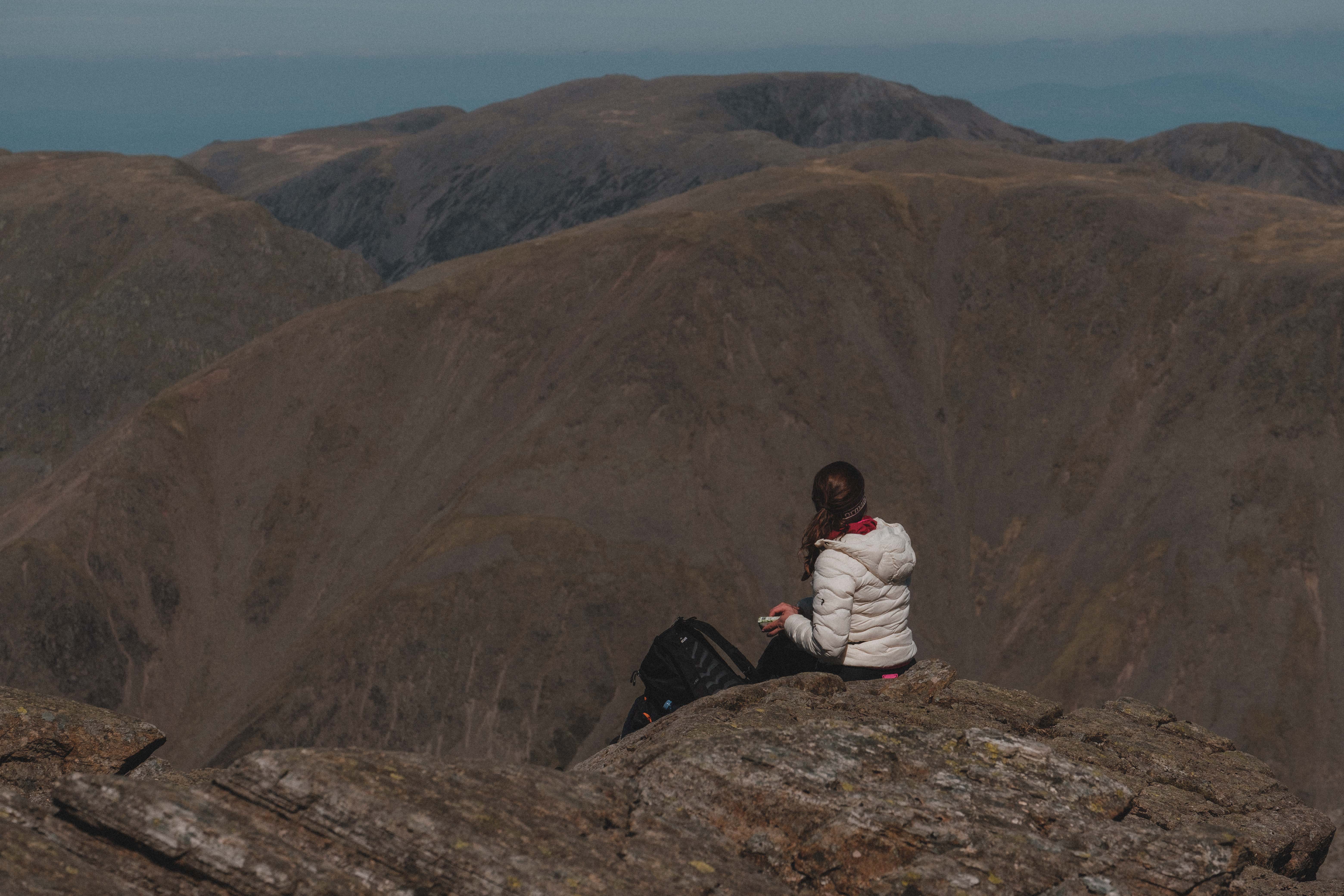
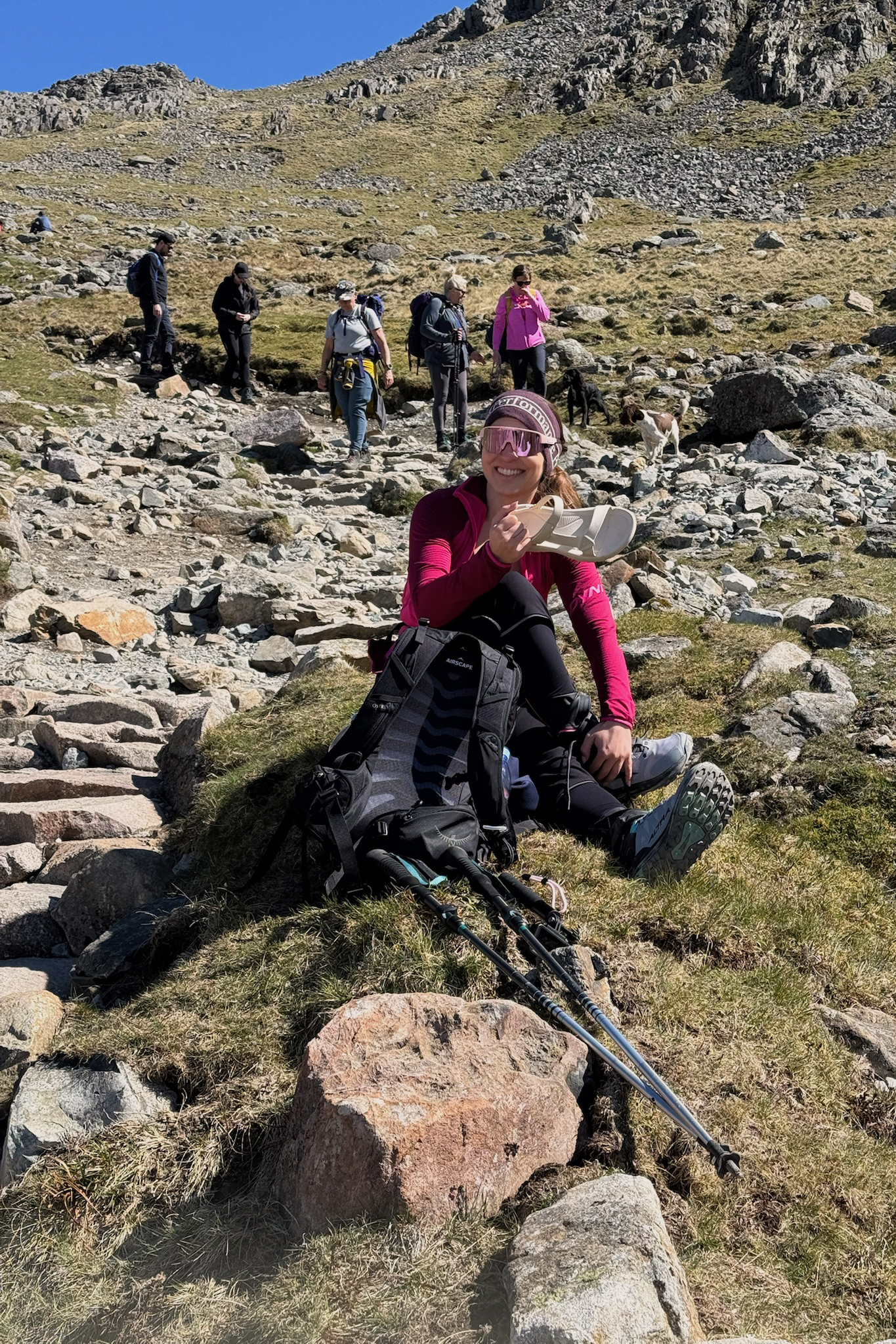
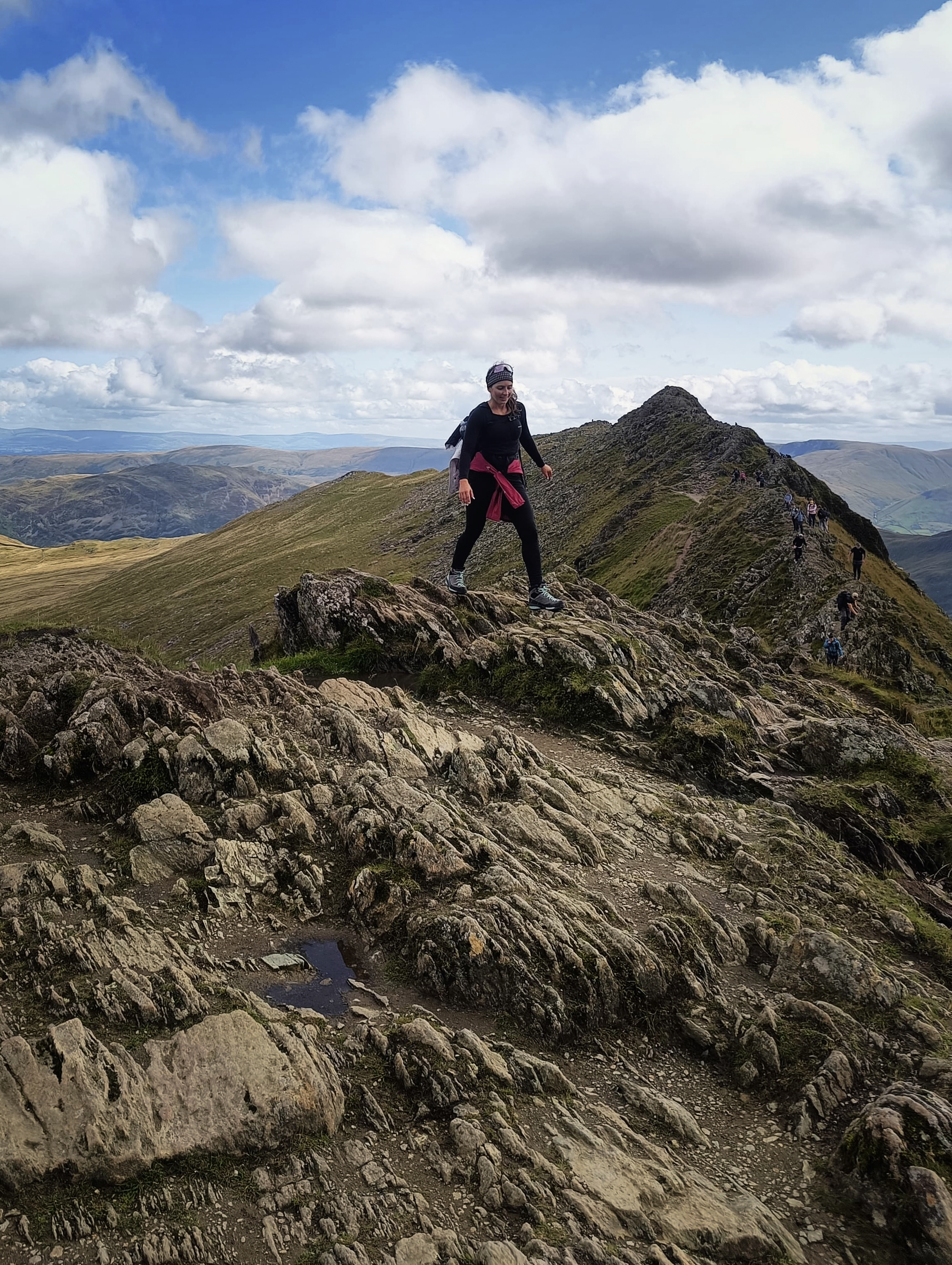
At this point, it feels like you’re nearly at the top, but there’s still more to go. We powered through and stood on the summit around 2 hours in, after tapping the trig point. I heard several people telling one another at the trig point “this is the real summit, we need to tap it!” While it is meant to be good luck to tap the trig point, and I did so myself…it’s not reeeeally the highest point! The trig points were built as part of efforts dating back to 1935 to “retriangulate” Great Britain. It helped to built more accurate maps, and they’re generally placed on or close to mountains’ summits. In the case of Scafell Pike, the real summit is somewhere under the massive summit cairn you can walk on. So, it’s worth popping up there for your summit photos! (:
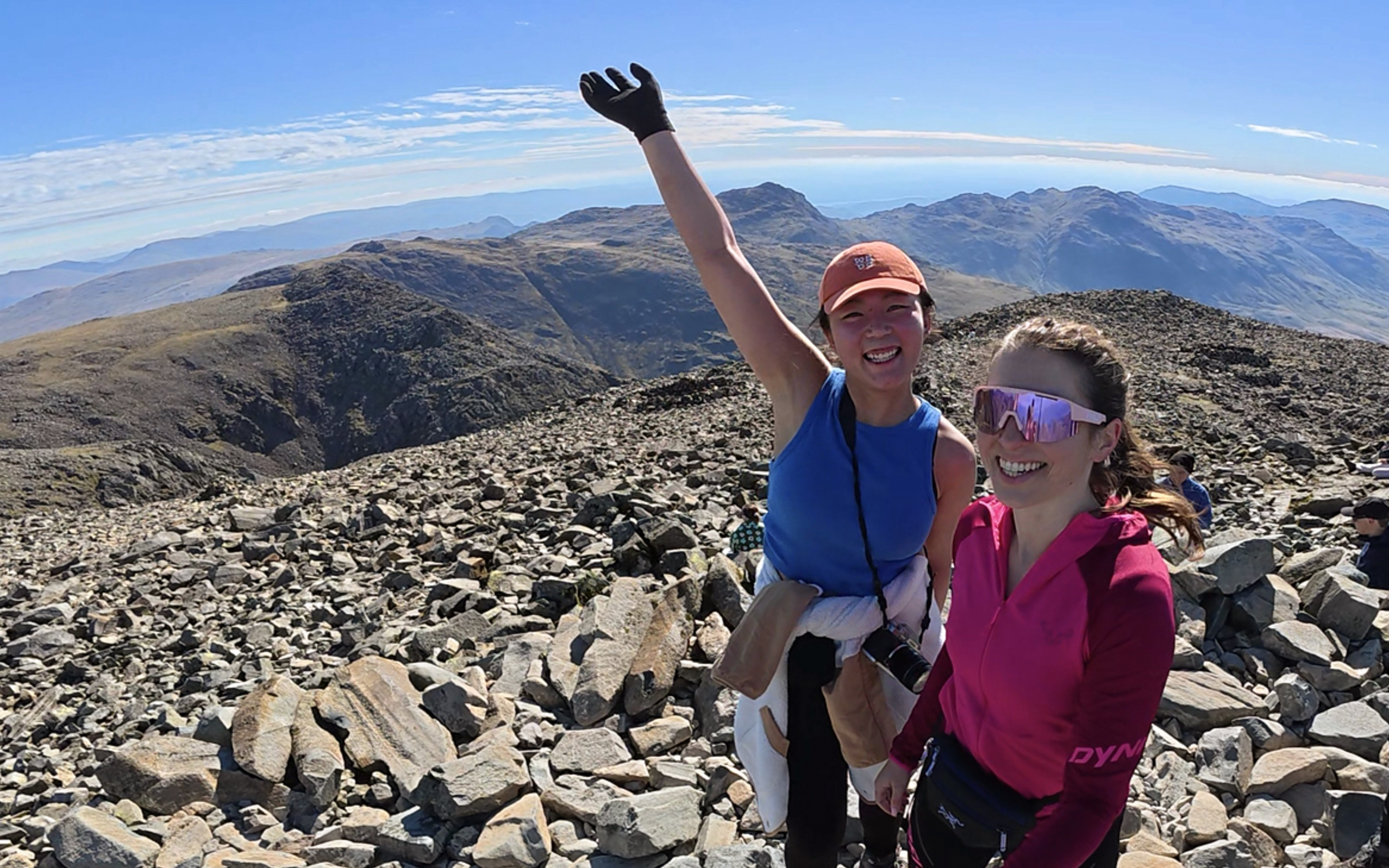
On the summit, we heard a guy say to his friend, “this is the highest point in England, mate!” I wasn’t the only one unable to resist announcing that.
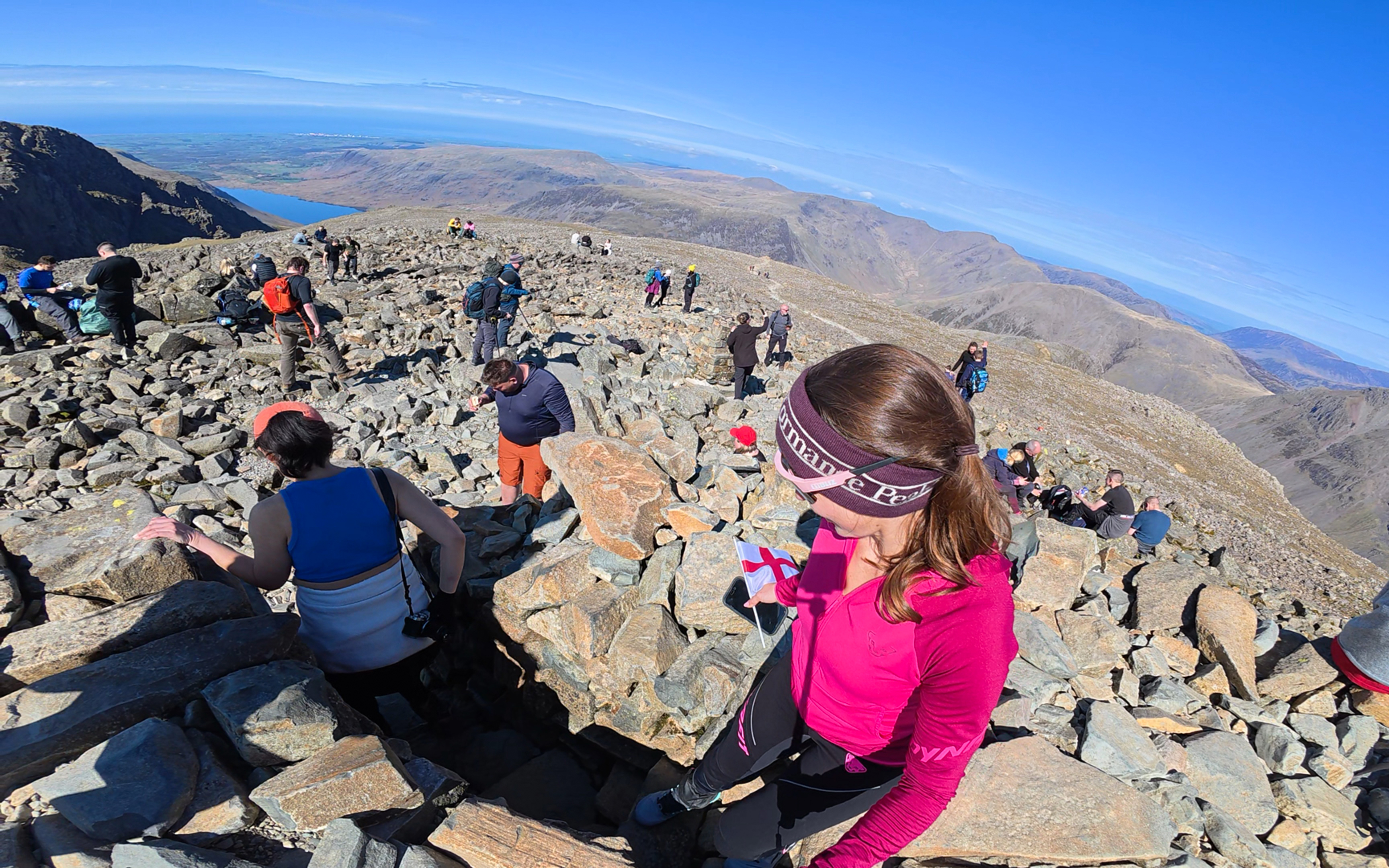
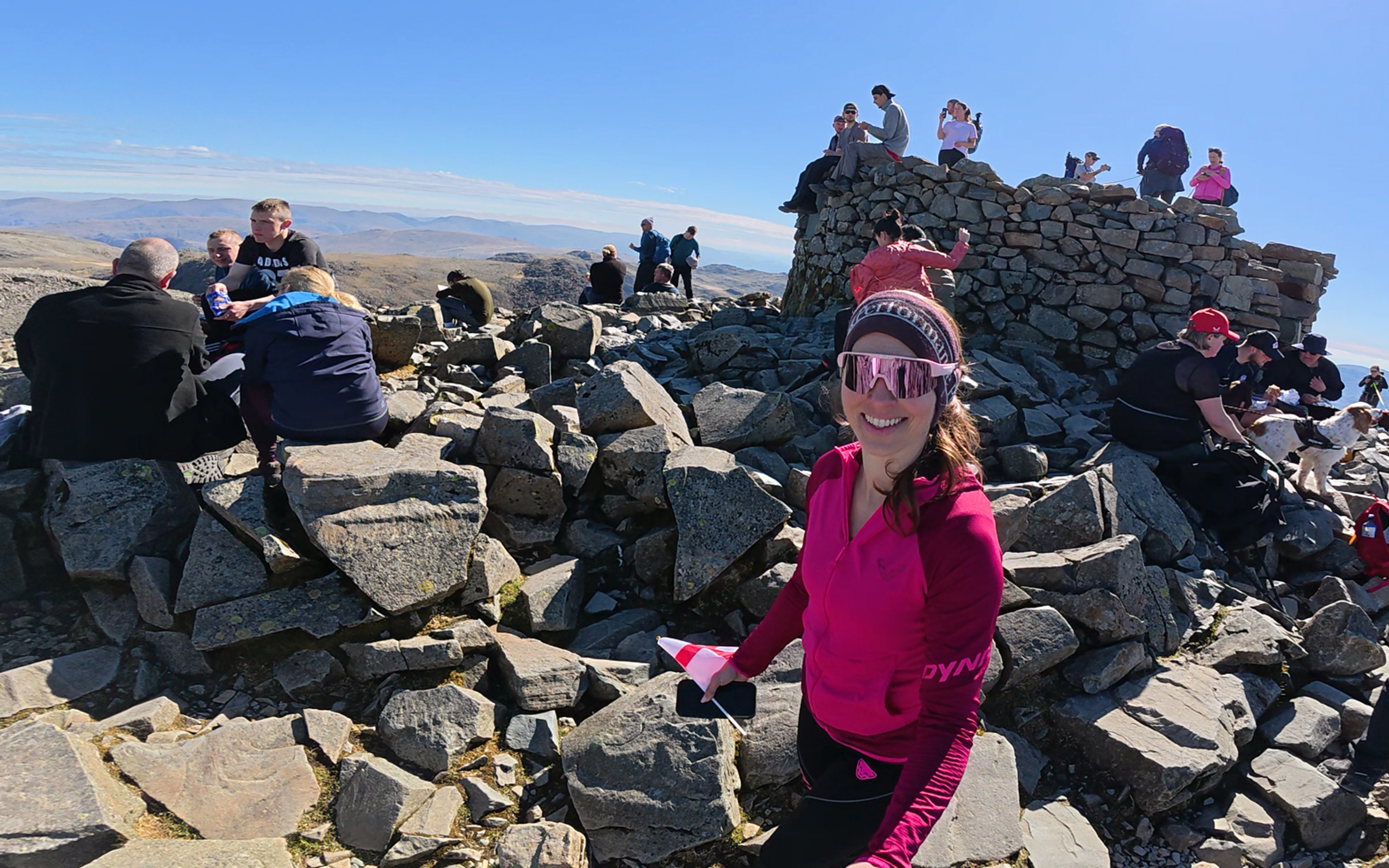
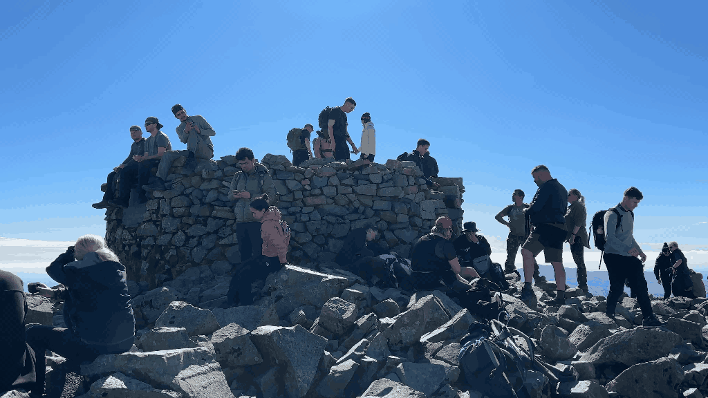
As it was Easter Sunday, the masses were assembling at the summit. Sorry for the continued puns. Anyway, we were lucky to have the summit to ourselves for a few minutes at one point! I took some 360-degree videos from the top, we took in our final minutes of summit views, and then we started back down. We had spotted some possible snack spots on the way up that would be a bit more peaceful than the increasingly crowded summit…
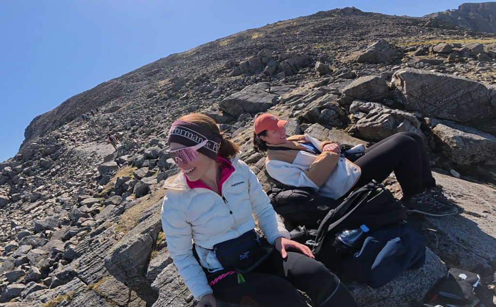
There, refueling and resting on a rocky outcrop, our peace was only disturbed by a couple of guys coming over and exclaiming “tell me that’s not f***ing gorgeous!” <pause> “This is why we do this.” If you haven’t seen what a sunny day does to the British psyche, it’s really something to behold.
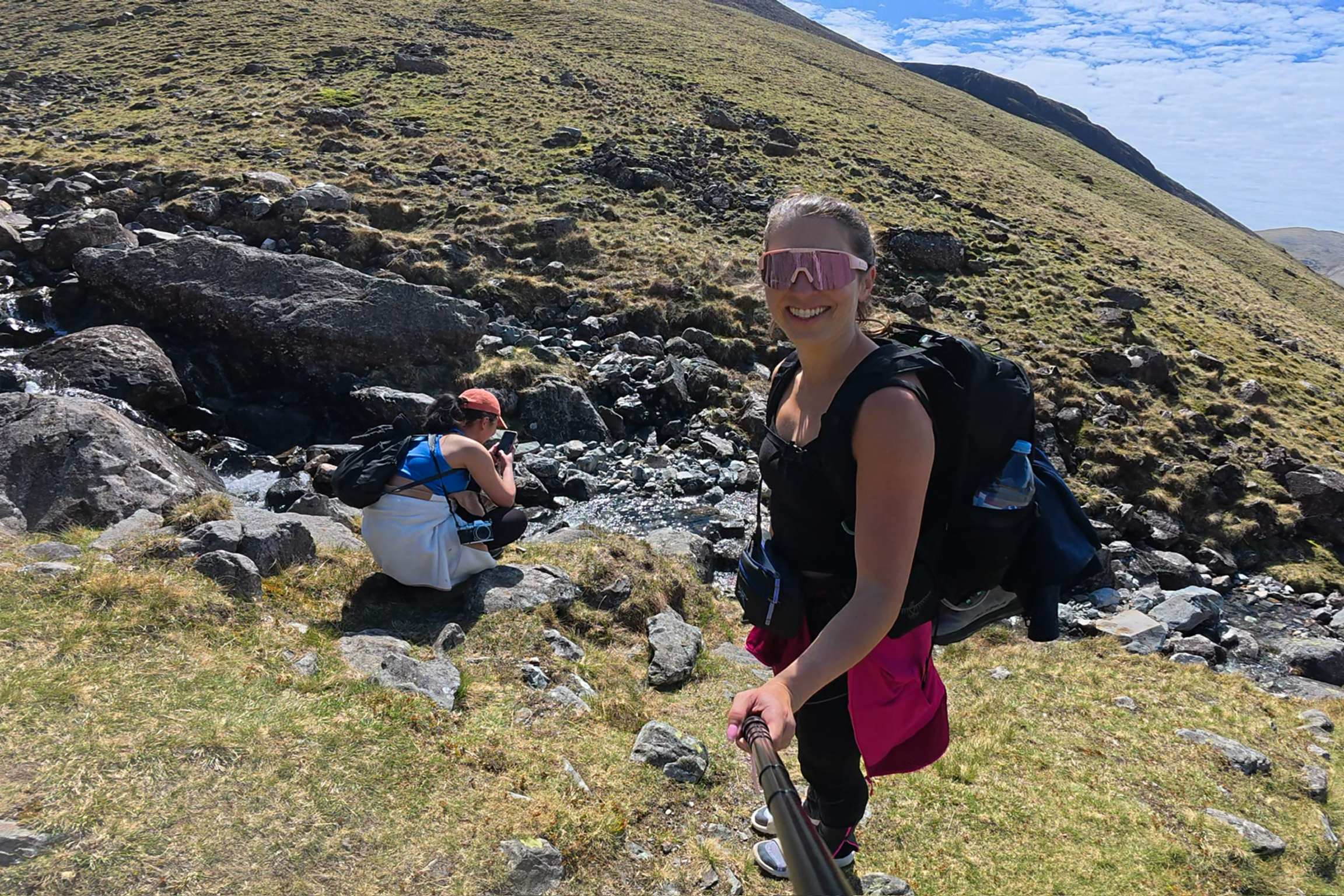
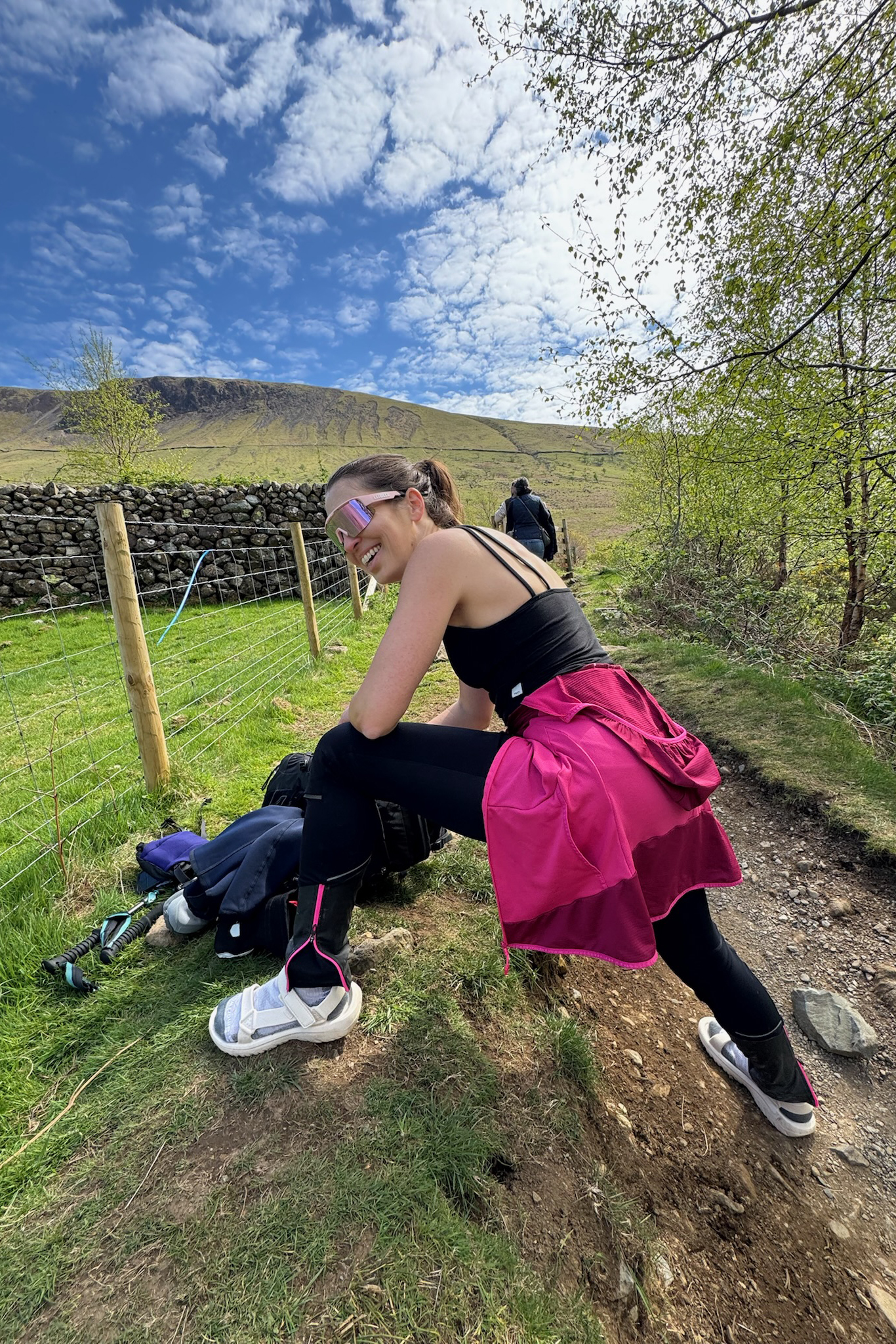
After the scree section, I switched to my Teva sandals for the rest of the hike down. You might expect the descent to be much faster, but it was really pretty similar to the ascent. Why? Here are a few explanations:
Explanation #1: Photoshoots of Us Hikers
Explanation #2: Photoshoots of Farm Animals and Inanimate Objects (Water)
And here are some results of Anna’s efforts:
My photography style: try to optimize lighting conditions, locations, times and places with less crowds, etc…then show up to press the button. Anna’s photography style: carry full camera everywhere with a couple of lenses, even up a mountain, and come back with bangers like these on a day that did not seem conducive to photography (crowded, full midday sun, tired selves).
Explanation #3: We are over 30 (thank you for existing, Altra + Teva)
Ghost Towns and Alpacas
After the descent, we were very ready for food. Problem: it was Easter Sunday, and the few places that were open were all booked up. We managed to find one with availability, in a coastal town we’d seen from the summit: Whitehaven. Mountain vibes and beach vibes in one weekend…or so we thought!
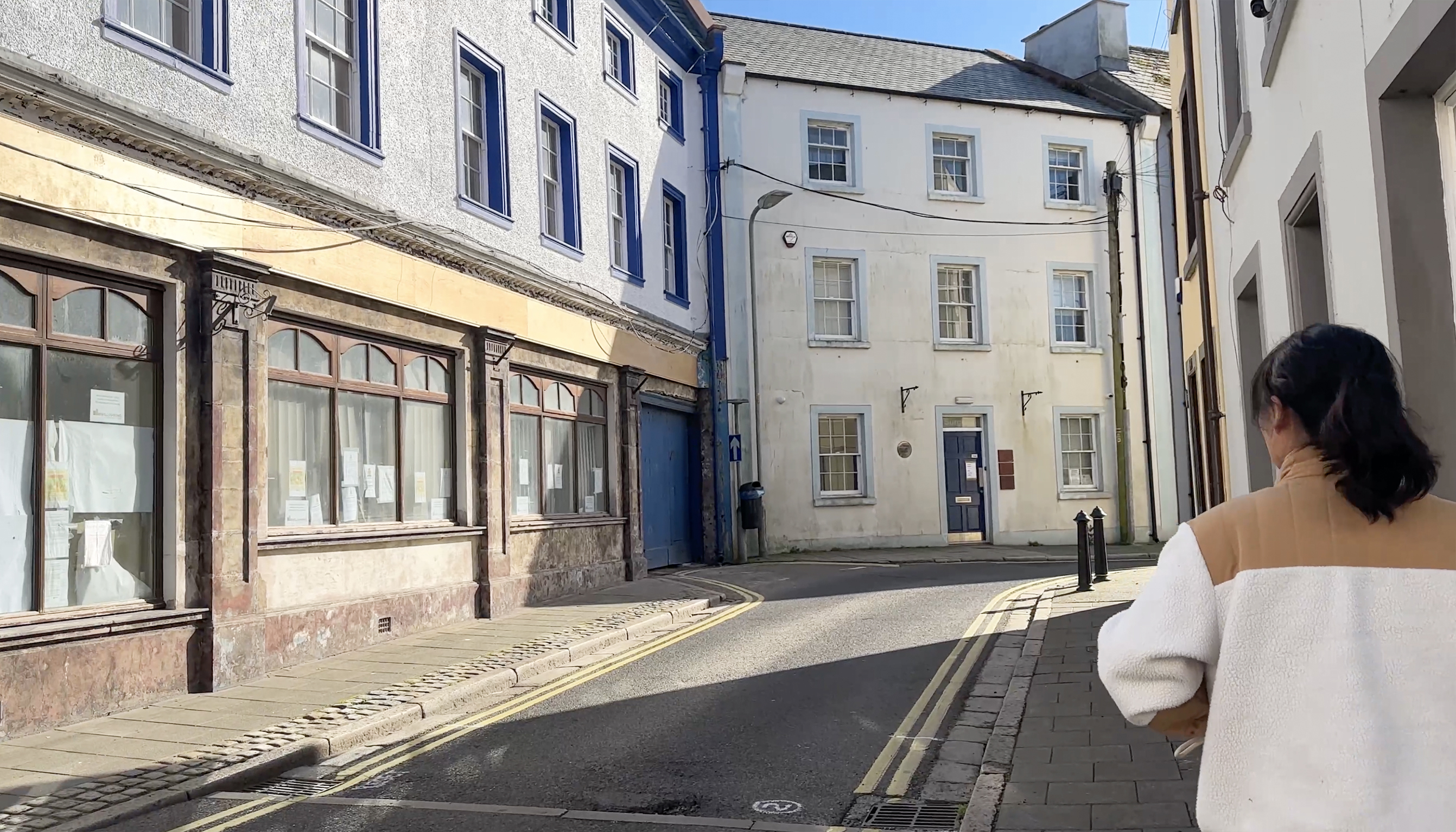
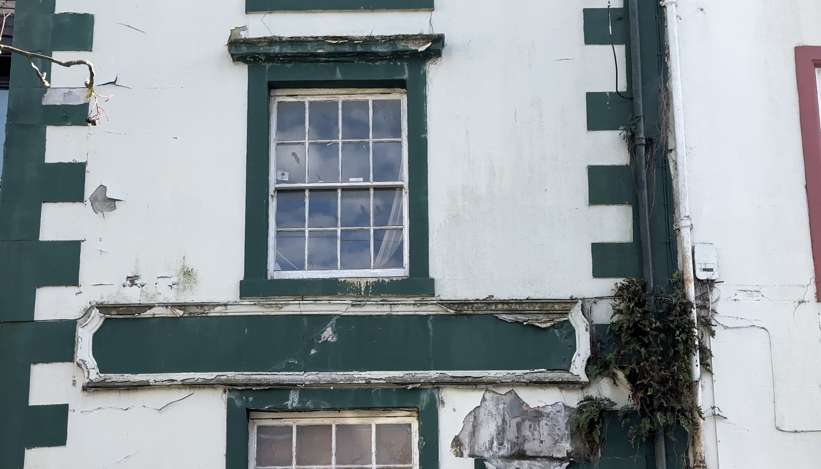
It turned out that Whitehaven isn’t exactly Brighton, and it’s had a bit of a difficult history, dating back to its formation in 1630. Americans invaded it in 1778. It wasn’t totally effective, as they’d intended to burn all of their ships down to disrupt trade, but the fires were put out quickly. The town had its boom as the mining industry took off, and they were also a major port for a while (with a shipbuilding industry). As that started declining, their economy did as well. Now, there’s still a mix of vacant buildings and quaint seaside pubs. The ‘ghost town’ feel was probably exacerbated by the Easter holiday; that day was the sunniest, warmest day of the long weekend, so residents may have been out enjoying nature. The day before we were there, the BBC put out an article about the abandoned buildings, though.
On the way to the restaurant, which turned out to be a bit more like a uni pub (not that our hungry selves minded), we had stopped at a petrol station to grab some firewood for a campfire that evening. In my hasty packing, I’d brought no lighter (just stormproof matches), no firewood, no fire starters, no camp chairs…none of that. The night before, a nearby restaurant had given us a few small logs, and we tried collecting some twigs and dried grass as fire starters…but they weren’t dry enough, apparently, and the wood was too thick anyway (no axe). The stormproof matches turned out to be pretty flimsy and finicky (and weren’t enough to overcome the other problems anyway). After those failed efforts, we were set on a proper fire that evening and stocked up properly. (:
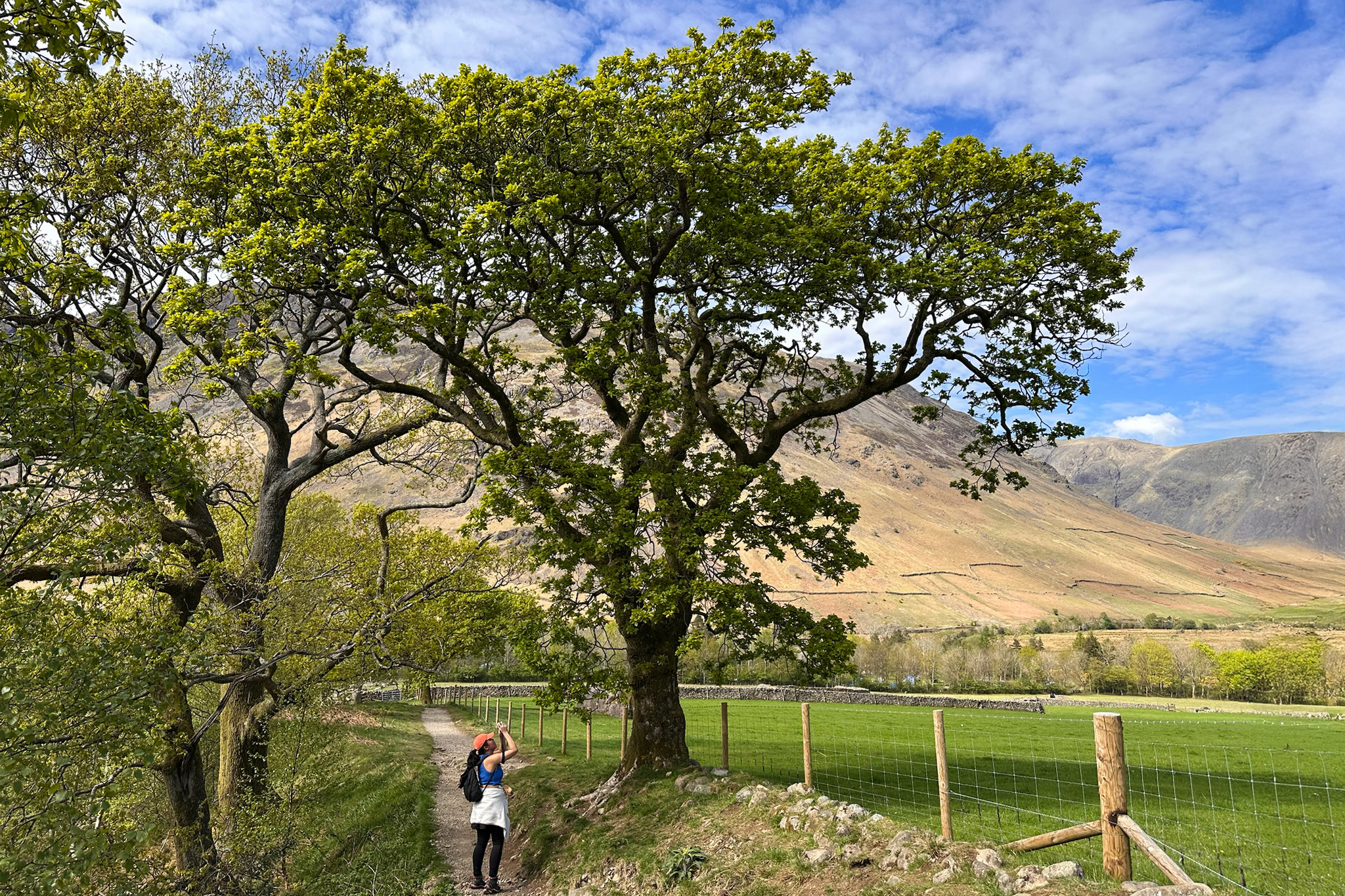
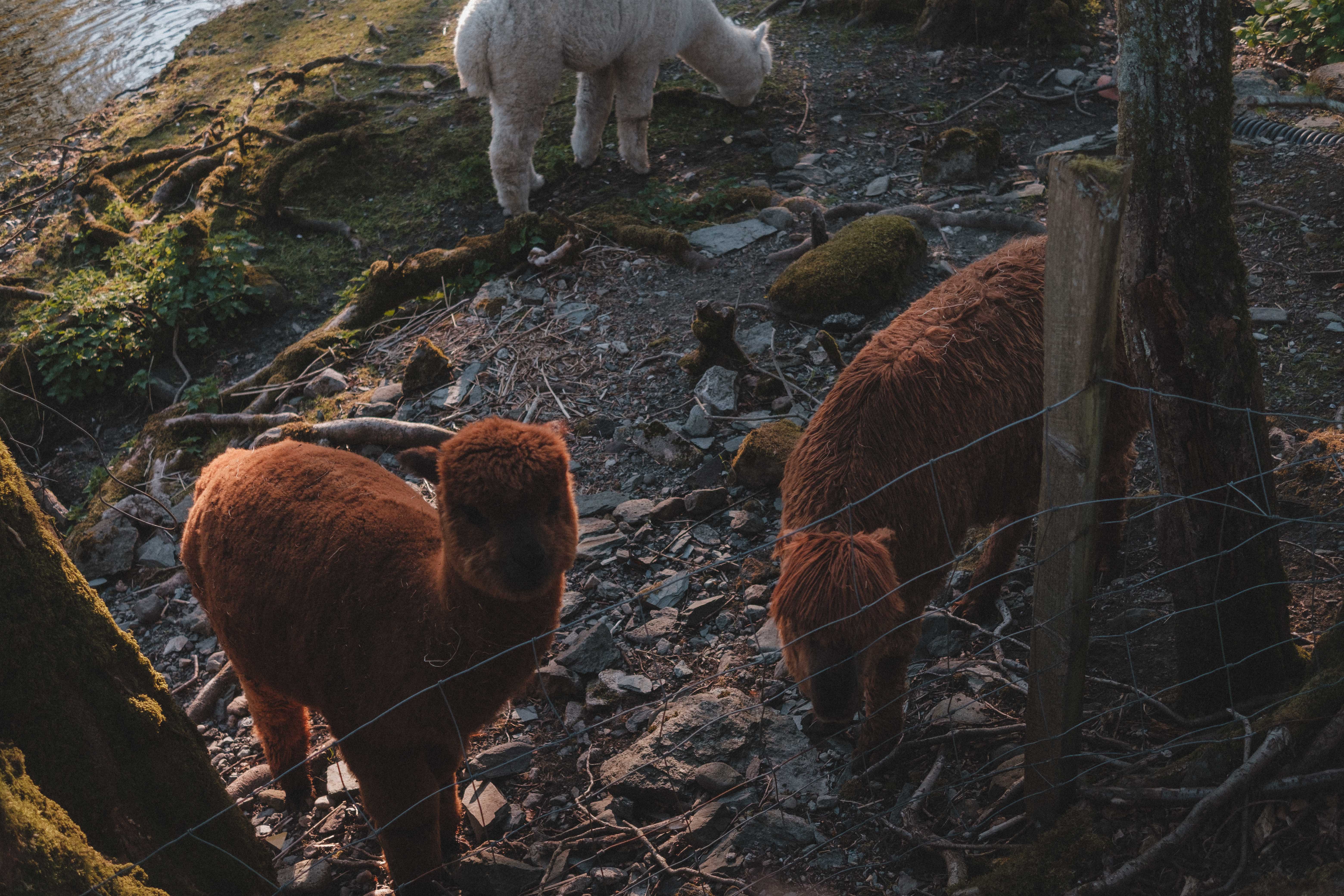
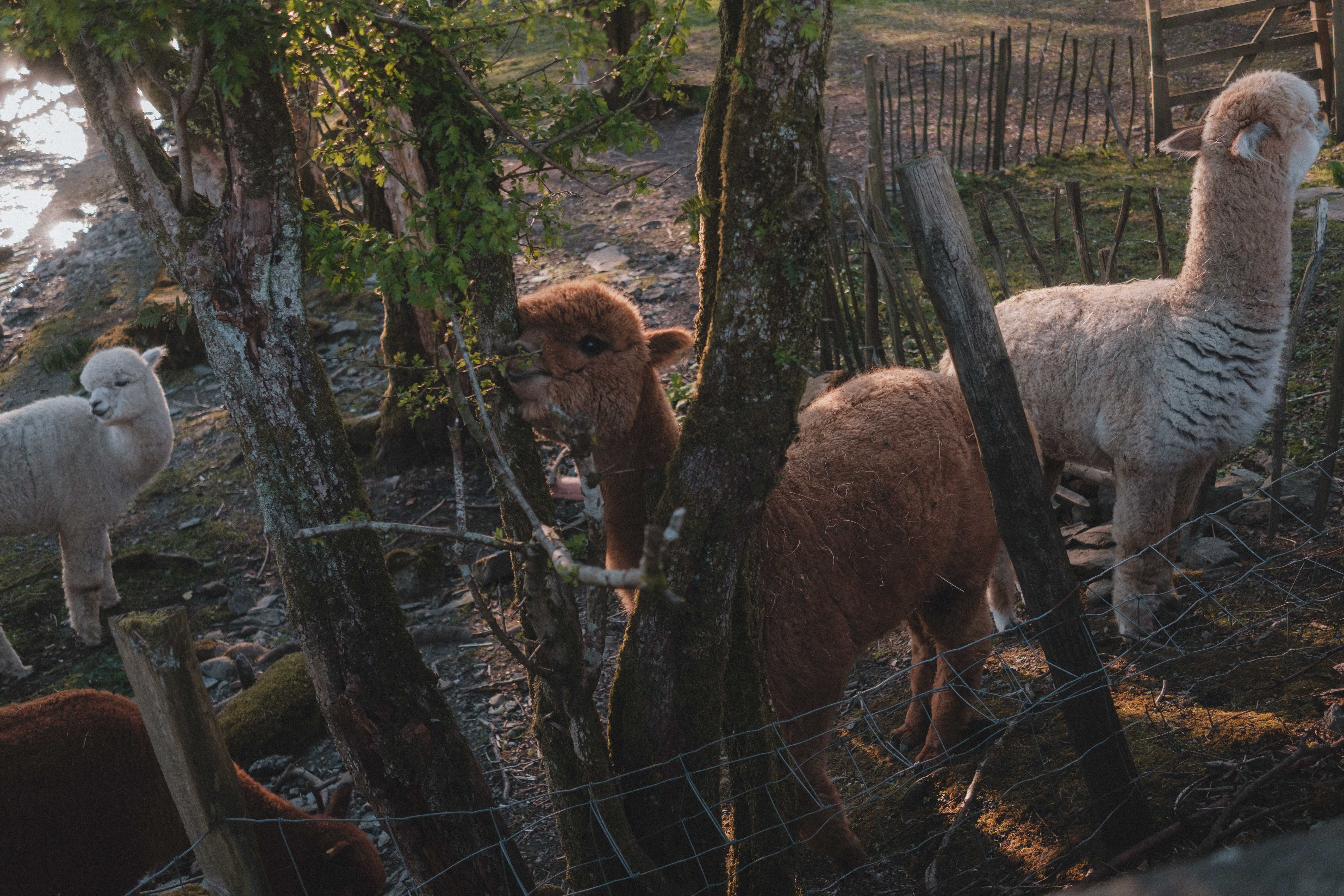
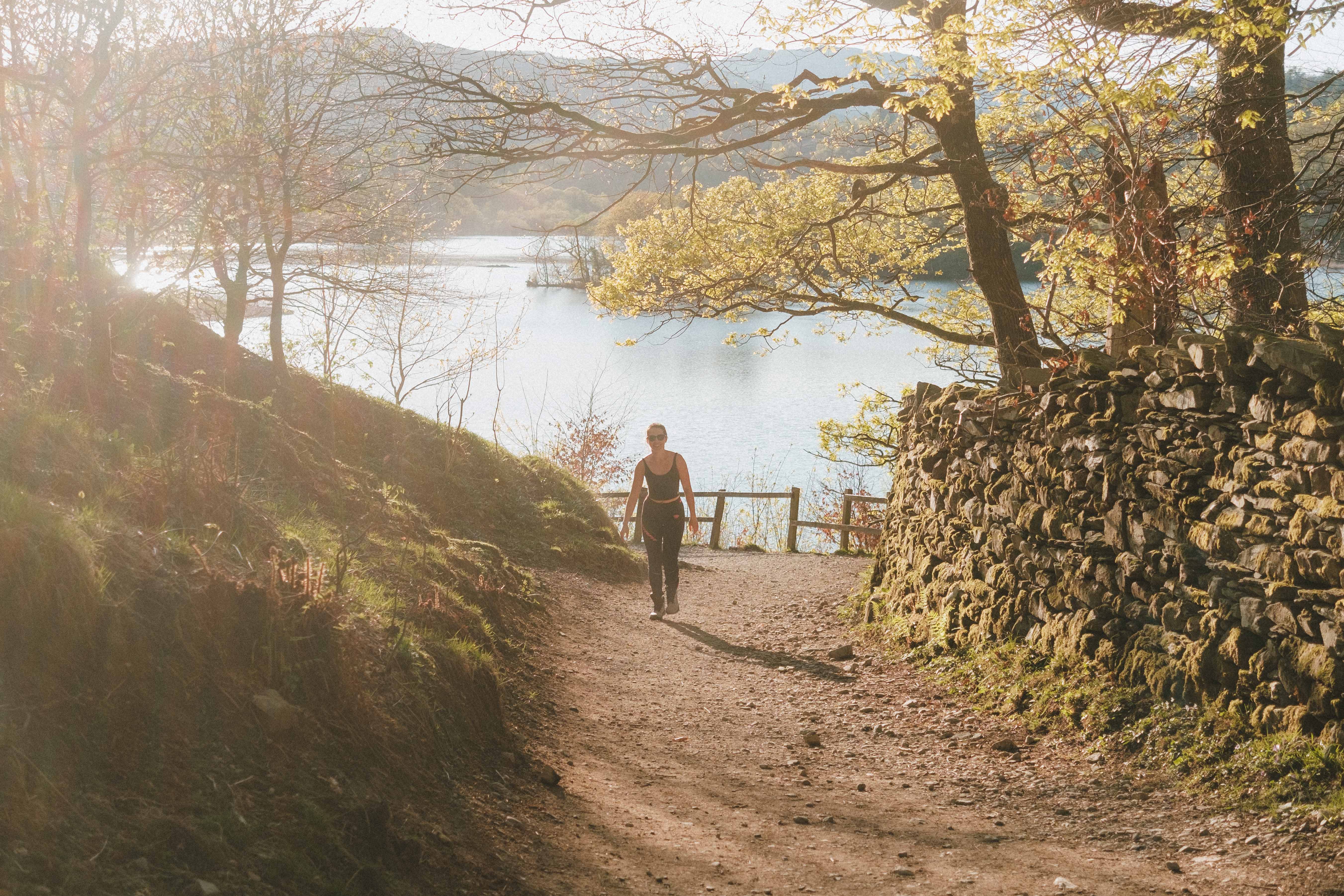
After our food, we continued our loop around the Lake District to Rydal Cave. It was used as a filming location for The Witcher, but we were more interested in the small alpaca farm we stumbled across on the way to the parking area. There’s a 33-second video of these cuties in the England highlights on Instagram! Photos by Anna:
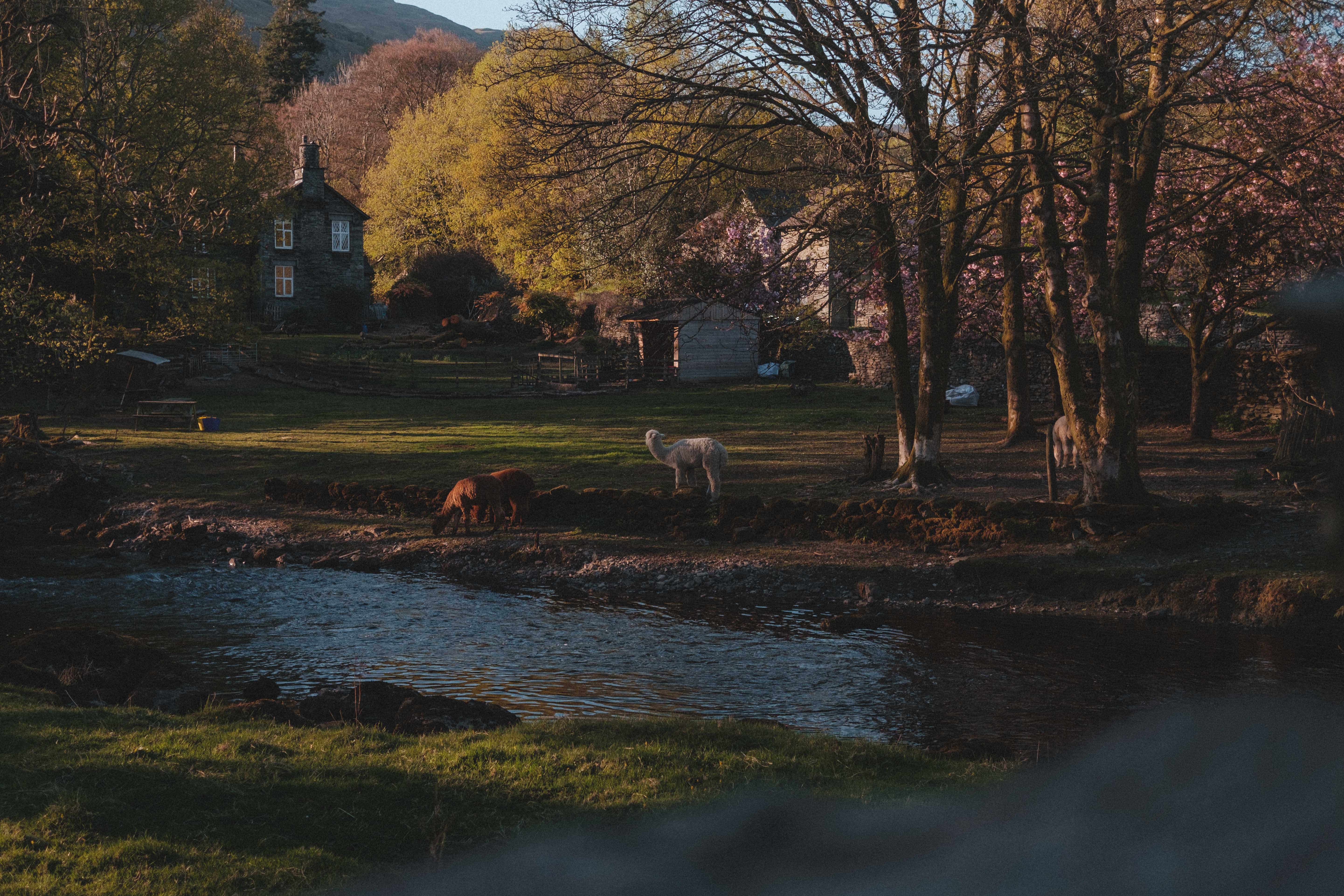
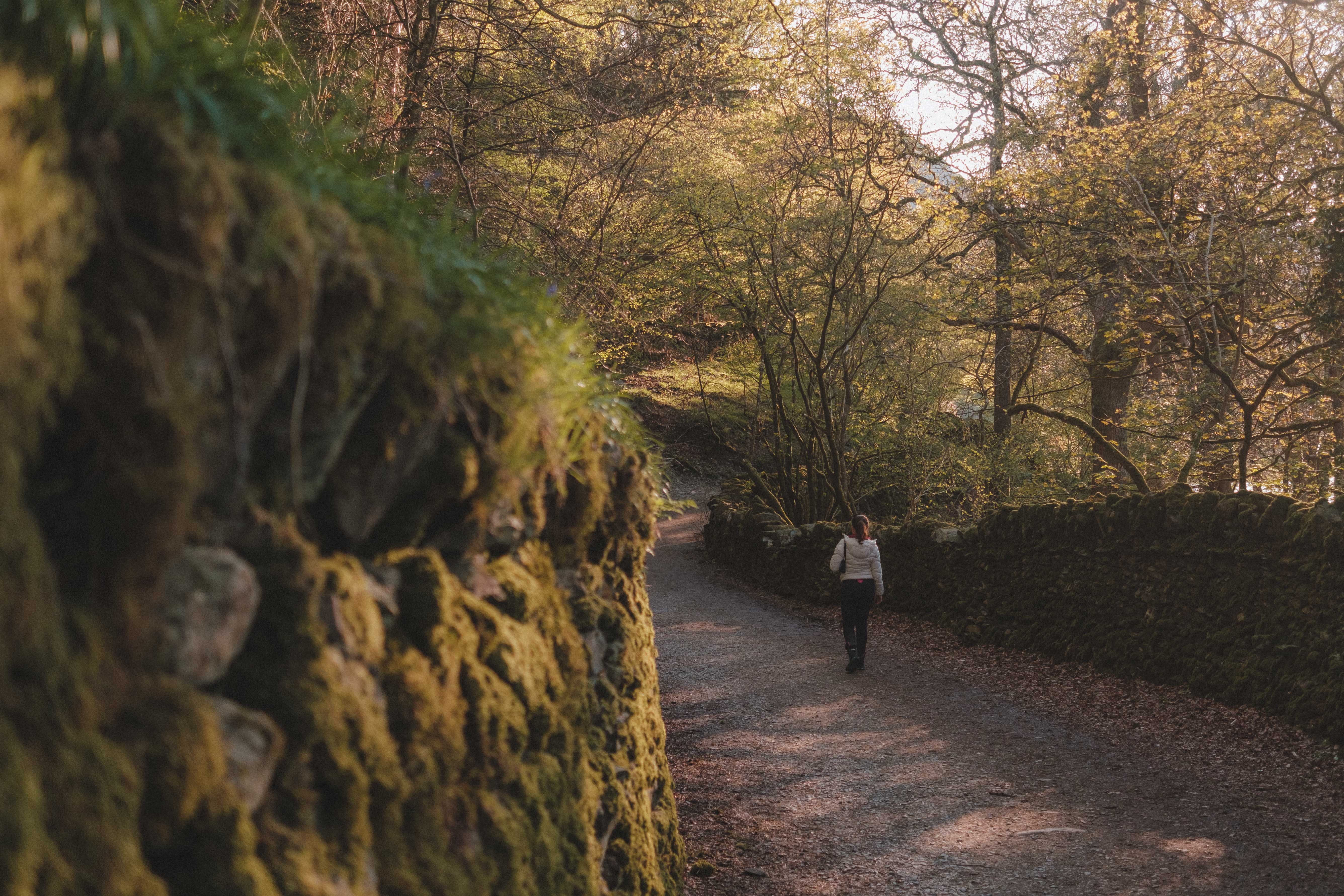
I’d bookmarked two caves around the Lake District, Rydal Cave and Cathedral Cave. The latter’s description referenced a steep climb through the trees, so after the morning’s hike, we opted for the one that seemed like a short, easy walk. It ended up being more uphill than anticipated (those parts not pictured), but there were so many unexpected, beautiful views along the way!
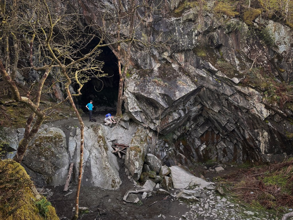
When we arrived at what we thought was the cave, it looked like it would be a bit too much effort for our tired legs to climb up to it, and the views were good enough from across the way. We watched some kids struggle back down the slick rock holding a sketchy tree root (pictured here – hard to describe otherwise).
We saw the path continue upward, to what appeared to be an overlook with 360-degree views. Having already suffered a bit earlier that day for even higher views, we opted to save our legs. But…it turned out that we’d actually missed out on the main cave. We hadn’t really seen “Rydal Cave”, after all. I’m not entirely sure what we saw. For an idea of what it’s supposed to look like, check out this YouTube video by Lake District Films.
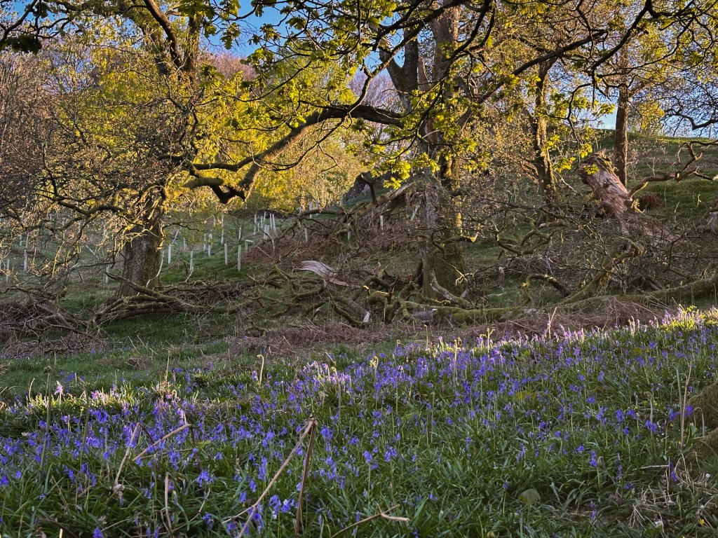
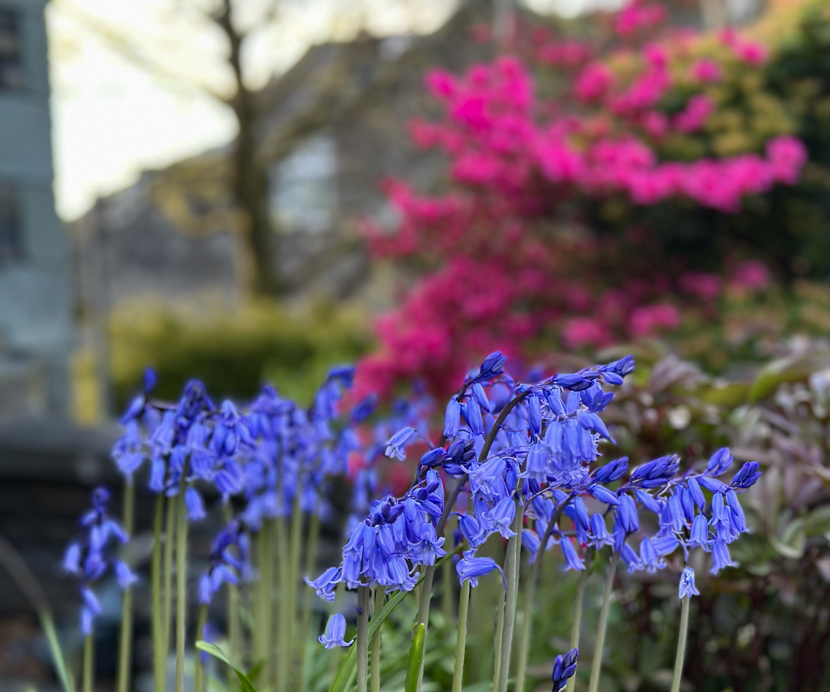
Anna was on the hunt for bluebells, and we did see a few small patches along the (part)way to Rydal Cave. Still, there was a forest she’d found called Skelghyll Woods, just a bit further along the road. We attempted to drive to it, but couldn’t find a road to access it (the Google Maps way was a private road), and the sun was setting.
We abandoned that effort in favor of a Tesco Express run in nearby Ambleside. It would be nice to come back to this town. A lot of the homes had slate exteriors, as this is historically a readily available material in the Lake District. The uniform stone look reminded me a bit of Piódão in Portugal, which makes some sense given both regions’ histories dating back to medieval times. A lot of that medieval style has been preserved, so the villages around the Lake District are really beautiful and worth spending some time in. If you’re not into camping, they’re nice areas to stay in (but can be pricey…then again, so can the campsites!).
We learned weeks later (via someone’s Instagram post) that there were more bluebells to be found further along the route to Rydal Cave. We have a few reasons to come back to this area next year.
Google Maps Sends Us Along the Wildest Road in England
On the way back to the campsite, Google Maps sent us along a route that seemed no different from any other we’d taken thus far. It looked like a fairly straight shot, with just under an hour of drive time. The sun had just set, and we were looking forward to some blue hour views for the final drive of the day.
Back to what I mentioned about the stereotype of England being more “hilly” than “mountainous”…this is a place where I didn’t think to research potentially dangerous mountain passes. The route started off innocently enough, with the usual narrow, sharply switchbacking roads characteristic of many parts of the Lake District. Hooooowever, the quality of the road soon declined, it steepened, and the turns became even tighter. I’m a short person, so in my tiny Honda (“Jazzie”), there were times the drop-off was so steep that I could barely see the grade of the descent until the car crested the hill. The conditions were dry, Jazzie was up-to-date on maintenance, and I have plenty of mountain driving experience. If any of those statements did not apply to the situation, I’d think twice about following Google Maps this way. Anna noticed a sign that said “Hardknott Pass”. We joked that the name tracked. Once we were safely back on the more standard narrow roads of the Lakes, I forgot about the pass, until I began writing this blog post.
I decided to look up some more info on that road. It turns out that it’s known to be one of the worst roads in the whole UK. There are hairpin turns with 25% gradients, and a final ascent reaching 33%. This is steeper than the stairs I just wrote about in the Belgium blog post. It’s actually hard to know if this is the steepest road in England, as I can’t find a clear ranking anywhere, but I can’t find any roads with officially steeper measurements. This article talks about it in more dramatic detail, including the advice: “even when the road seems to rise like a wave in front of you, don’t hesitate” to avoid rolling backwards. I’d just add, “but be ready to slam on the brakes for oncoming traffic doing the same on the other side”. All of this aside, the road is really scenic, so if you’re comfortable with it, go for it!
I don’t have any photos of it, and the videos are a bit wobbly to try screen grabbing, so feel free to check out Instagram highlights for the last stretch of it, or this YouTube video for the whole thing!
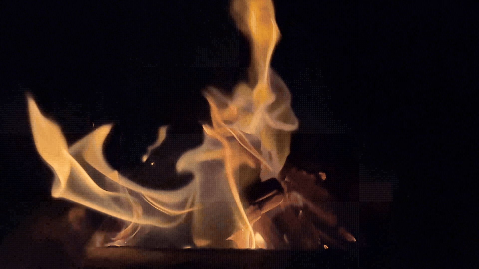
We arrived back at the campsite and quickly started up the fire. This April in the UK might feel unseasonably warm during the day, but the nights are still pretty chilly. We squatted on tiny logs with towels over them. I may just start keeping a couple of camping chairs in the car to avoid this. (:
The next morning, we packed up and headed out early to beat the holiday traffic back to London. And that’s a wrap on a lovely English summit!
In Summary
| Failures | Wins |
|---|---|
| Scotland’s weather | England’s weather |
| Tent pitch location #1 | Tent pitch location #2 |
| Campfire night #1 | Campfire night #2 (minus proper chairs) |
| Making it more than 5 minutes into the hike without a sheep photo stop | Clean toilets at the trailhead |
| Healthy knees on the descent | Reaching the HIGHEST POINT IN ENGLAND |
| Avoiding crowds on the way down | Avoiding crowds on the way up |
| Sunday restaurant choices #1-4 | Sunday restaurant choice #5 |
| Locating Rydal Cave | Hanging with alpacas for a solid 30 minutes |
| Not worrying the campground manager with our absence | Jazzie powering through the “wildest road in the UK” while receiving the concerned campground manager’s call |
| Stealing the cute lambs in the road | Not hitting the cute lambs in the road |
Other Lake District Adventures
This trip was my second time in the Lake District – so here’s a quick blurb about the first trip, in case this helps to plan a larger trip around the English summit! (:
This was also a bank holiday weekend: the “Late August Bank Holiday” we have here in the UK. Not particularly creative naming, but straightforward. I ran into a similar difficult situation when attempting to find a campsite (another case of relatively last-minute planning), so we ended up getting one about an hour outside the Lakes, on the way from London. This was a Friday night, and Saturday morning was spent checking the hourly weather forecast. It had indicated pretty horrendous weather all weekend, but there was the possibility of it clearing sometime that day. The morning started with drizzle, and we were prepared to tackle it in wet conditions. This proved unnecessary, as not long into the hike up to Helvellyn (via Striding Edge down Swirral Edge), England surprised with a warm, sunny few hours. This scramble is excellent for beginners, as there are multiple points where you can descend from the main ridge and follow a lower path. It’s not too exposed and has some pretty fun sections. The section with the most accidents (particularly in poor conditions) is called the “Bad Step”, and there are a few YouTube videos for you to get a sense of whether this is within your downclimbing abilities. It’s a good idea to do Striding Edge or Sharp Edge (Blencathra) before attempting Crib Goch (Snowdon/Yr Wyddfa). If those still feel too exposed, there are many beginner scrambles in the Peak District with less exposure.
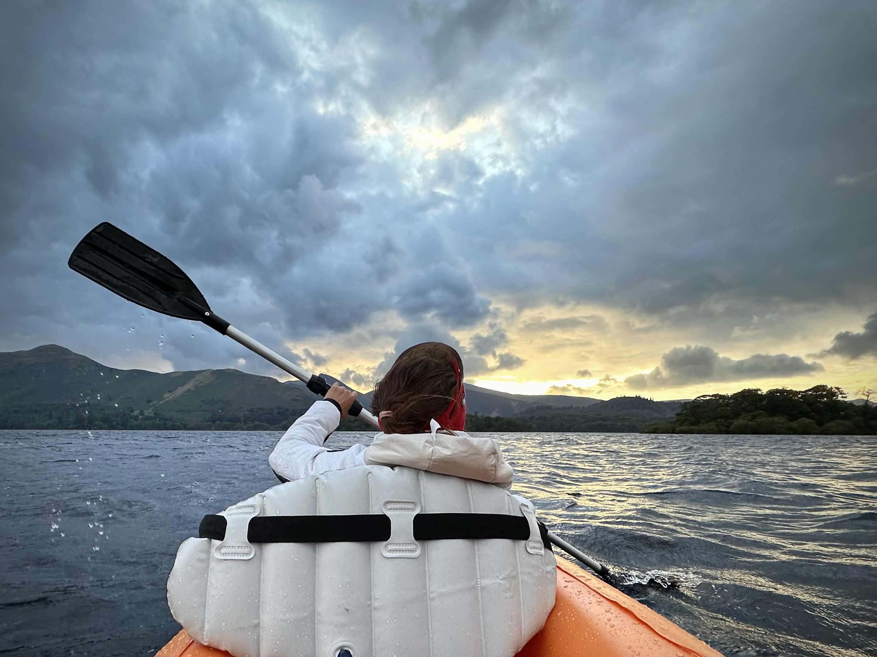
For the next two nights, we had no campsites booked. We had packed along an inflatable kayak and raft, so we found a random island to paddle to and camp on, with the camping gear loaded onto the raft that we towed behind the kayak. Conditions were quite rough, and inflatable boats don’t necessarily have the best hydrodynamics. This is a great way to find a quiet (and free) campsite on a bank holiday weekend though. The Lakes are full of islands like these of varying sizes and ease of access. The next morning, conditions were even worse, and we were actually unable to make it against the current back to our original launch point. We ended up a bit further down, deflated the rafts, and hauled everything back up a trail to the road. I fetched the car, we loaded things up, then it was time to figure out where to head for the last night.
We settled on an ‘easy, flat 5-mile hike to a bothy’. A bothy is essentially a free shelter, a mountain cabin you just show up to. They’re maintained by volunteers every now and then, but no one is manning it. You just use it as a shelter, bring your own camping gear (you can leave the tent behind, unless you suspect it’ll be too crowded!), and tidy up after yourself before heading out. I wouldn’t recommend going for one of the more accessible and/or popular bothies on a bank holiday weekend, but we suspected these conditions may deter crowds. By the time we pulled up to the trailhead, the wind and rain had really kicked up. We attempted to unpack and repack our bags within the very stuffed little car (full of rafts, paddles, firewood, gear, and clothing), which was a challenge itself. Anything to stay dry for a bit longer!
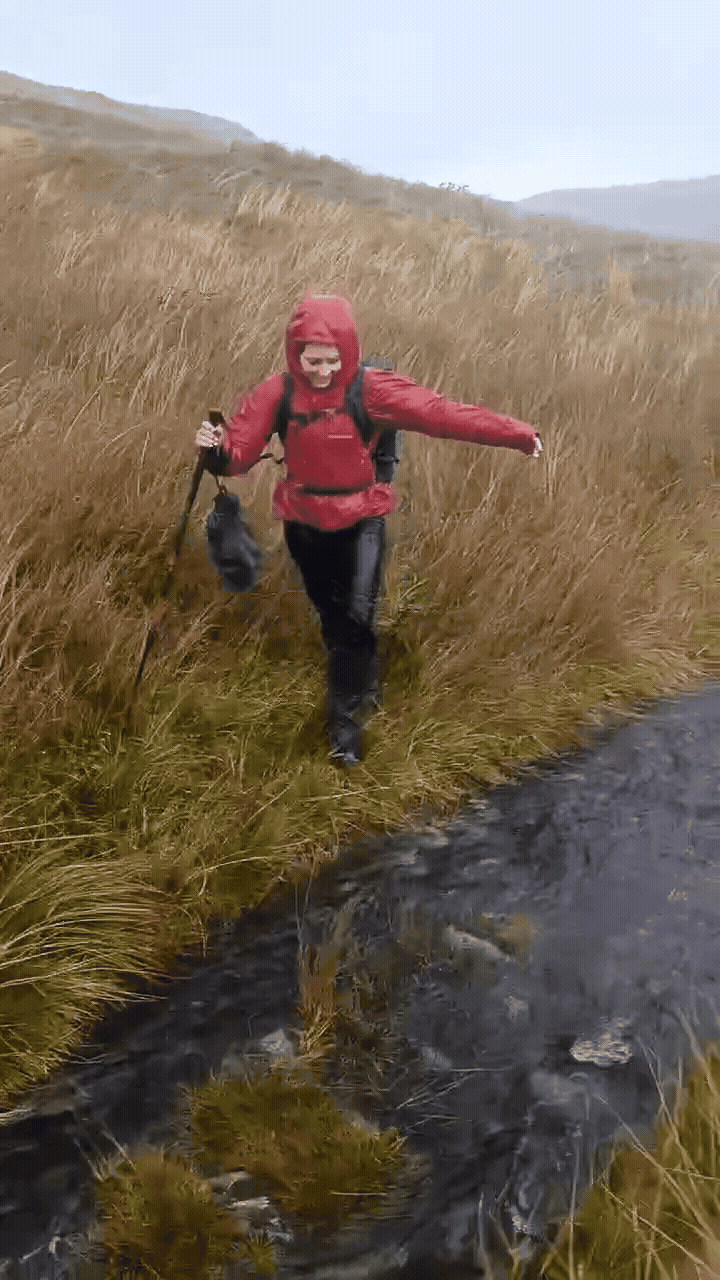
We decided to proceed to the bothy. No one else made that decision that day. It took over 3 hours, as we chose a path over a hill in an attempt to avoid having to swim there (given the levels of flooding). Still, we were often sinking knee deep in muddy, grassy puddles, and the wind + rain combo made me wish I’d brought along a face shield from pandemic days. I don’t think I’ve ever been so happy to see a basic house in the middle of nowhere (and it wasn’t just because there were cute cows out front to greet us). Still, it took probably another 30 minutes to make it the last 25 meters. This is because there is a river to cross…and the flow was so strong that it took a bit to determine the safest spot to cross. We were also looking for a path that wouldn’t involve drenching our shoes even further…but soon gave that up. The GIF doesn’t depict that river. We were too tired, and the wind and rain were too strong to try operating a touchscreen camera phone anyway.
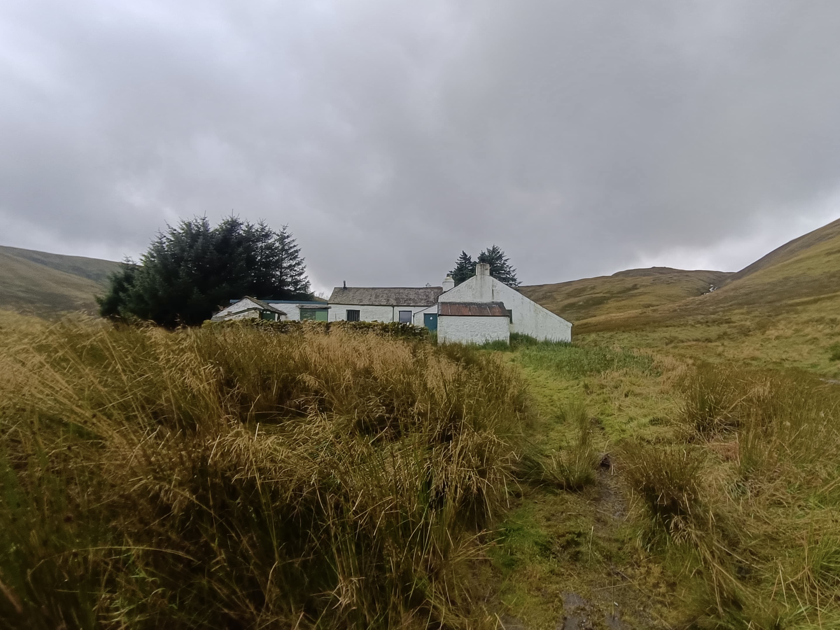
The bothy was pretty luxurious, with an outhouse and oven (need to bring wood though, which we opted not to try carrying in these conditions). Someone had left a large jug behind- helpful for filling up water from the river to filter/boil/put tablets in inside. The rooms were simple: one with a bunk bed, another with just a larger platform that could fit a few people. There was a third room that looked to be a kitchen to prep food. The main area had a long table and hooks for hanging wet clothing, though there’s really no point if you haven’t brought firewood (the bothy is still cold and damp, just without the wind and rain from outside). In an effort to lower my pack weight, given the state of my still-sketchy ankle at this point, I hadn’t brought many extra layers. I ended up pulling out my emergency bivvy (brand = SOL) for the first time. It had been stuffed at the bottom of my hiking backpacks for years, unused. I recommend everyone to carry one of these, even just for traveling (if there’s a possibility of being stranded in the cold anywhere). It was surprisingly comfortable and warm to sit around in!
The next morning, other hikers started arriving, one with a cute dog. (: Conditions were much better on the hike out, and it became more type 1 than type 2 fun.
That was it for the Lakes. It was time to join the end-of-bank-holiday queues back to London. I had no idea that I’d be back there <8 months later to take on the 6th peak of a challenge I wouldn’t have thought possible at the time (given the ankle damage). Nor did I suspect April to have infinitely better weather than August. The locations visited in both trips, as well as other favorite (favourite) spots around England, are in the map at the end of this post.
THANK YOU ❤
Thanks for reading my sixth Crown of Cureope blog post. At the time I stood on the top of England, less than a month in and just the second “real hike” of the challenge, we had raised $950. I really appreciate your contributions- they’re all going directly to the American Association for Cancer Research to fund lifesaving discoveries.
Next up, Czechia! (:
MAP OF MY FAVORITE LOCATIONS IN MY CURRENT COUNTRY:

Leave a reply to #7: Czechia (Sněžka) – Crown of Cureope Cancel reply