
Lucky 13
After my bag was lost on my previous trip (BiH & Croatia), and a black cat crossed my path early into my time in the microstate of Andorra, I was a bit skeptical that everything would go smoothly for this attempt. However, this peak is dedicated to my abuela, and 13 was her lucky number. Spoiler: everything about peak 13 was perfect (:
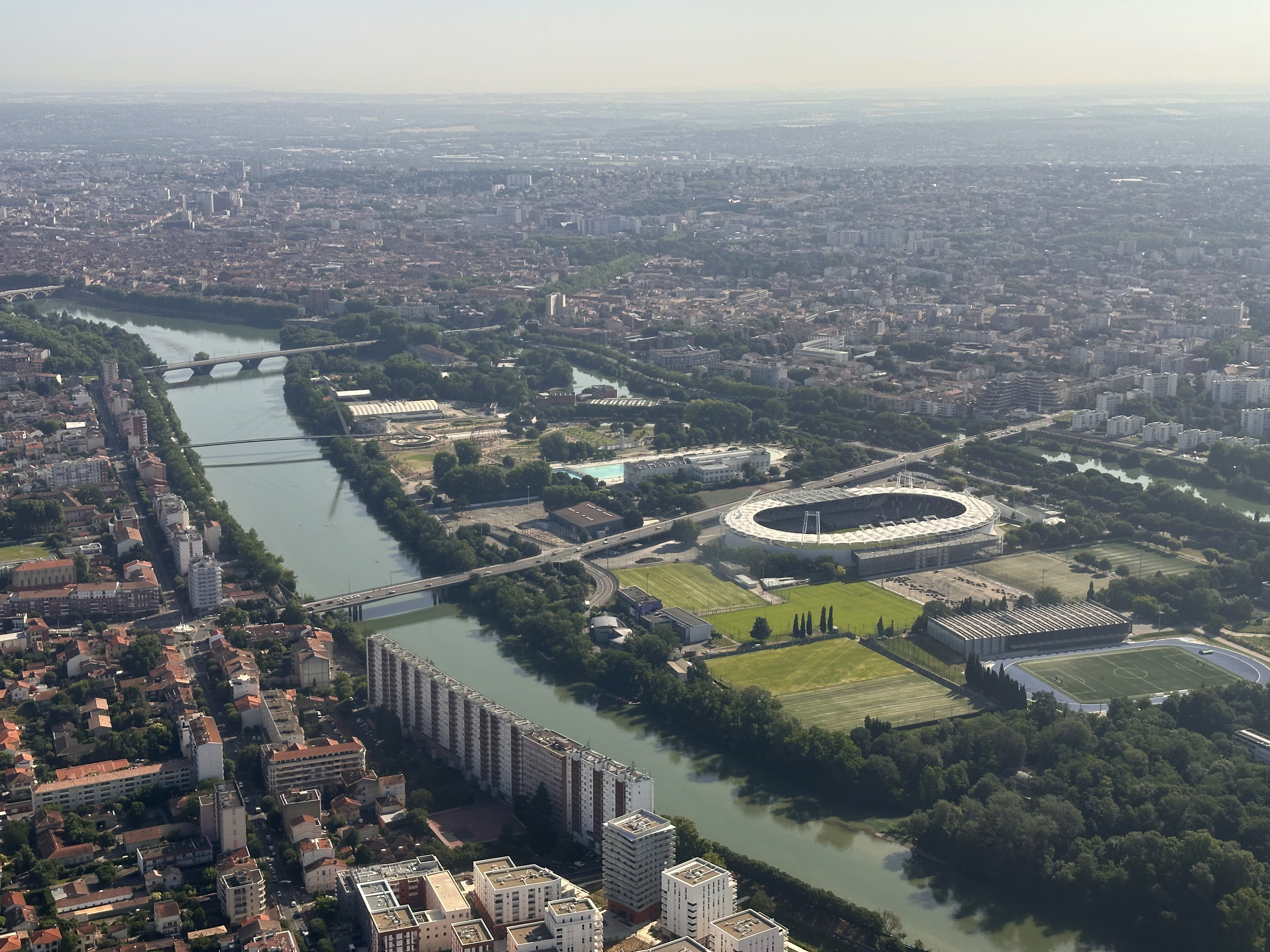
I landed in Toulouse, France, at around 10am on a Wednesday in June. I recommend coming from this side of the Pyrenees if you’re looking to avoid traffic around Barcelona. From London, the flights and car rentals were also cheaper for these dates. If you prefer public transportation from Toulouse Airport, there is a bus – it just isn’t too frequent and wasn’t going to work with my flight timings. The drive takes just under 3 hours, just about the same as from Barcelona without traffic. Interestingly, it’s one of just five countries in the world without its own airport (alongside Monaco, San Marino, Liechtenstein, and Vatican City – helipads don’t count), and only one of three with no airport nor train station (Liechtenstein and San Marino). All of these are European micro states.
I’ve heard quite a few people ask if Andorra is in Spain or France. It’s fully a sovereign state, but the question isn’t silly when you learn about its governance: it’s one of few countries with two heads of state (like San Marino)…except one of them is the president of France. The other is the Bishop of Urgell (in Catalonia, Spain). Its ties to Catalonia are strong, and it’s actually the only country with Catalan as its official language!
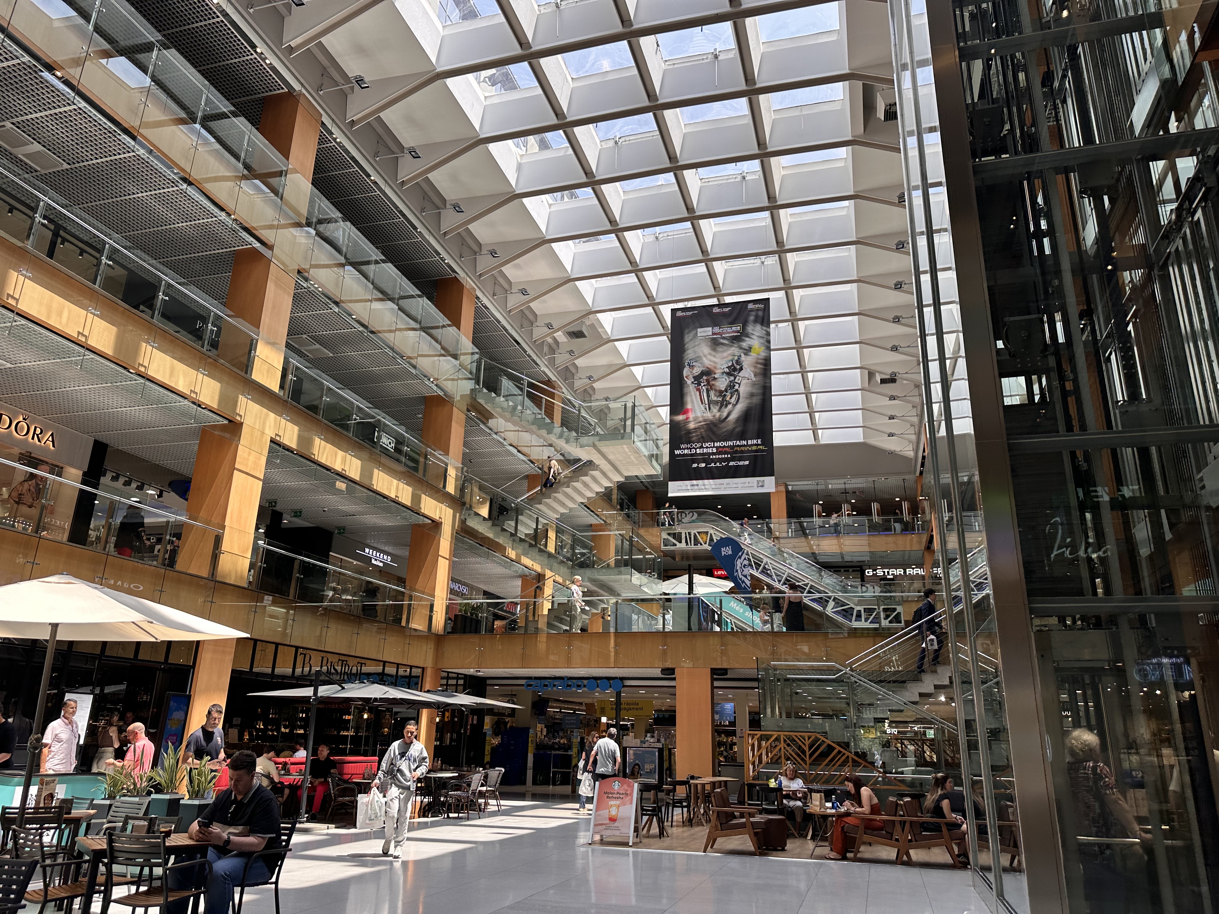
My first stop in the country was Andorra la Vella, the highest capital city in Europe. It’s a popular destination for shopping, with the country’s very low VAT of 4.5%. I hadn’t planned to shop, but the heat was so unbearable that I bought my first pair of hiking shorts. It wasn’t something I expected to need for a peak sitting at almost 3,000 meters, but as you can see from the summit photo…it was quite the heat wave that week. I also discovered a new brand that didn’t have my size in stock, but I ordered from later: NNormal. I don’t usually recommend brands here and don’t get paid to, but their shorts are perfect. The brand was founded by Kilian Jornet, a Catalan trail runner and mountaineer who just completed his States of Elevation project the month I’m writing this (October 2025). He summited 72 “14ers” (peaks at altitudes of over 14,000 feet) in 31 days, running over 600 miles, connecting each peak with over 2,500 miles of cycling, and ascending more than 400,000 feet!
Back to my smaller challenge here, I headed to Arinsal, where I’d be staying to acclimate a bit before starting the ascent the next day.
The Hike
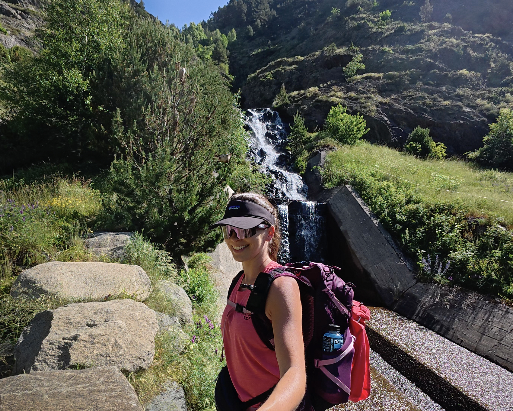
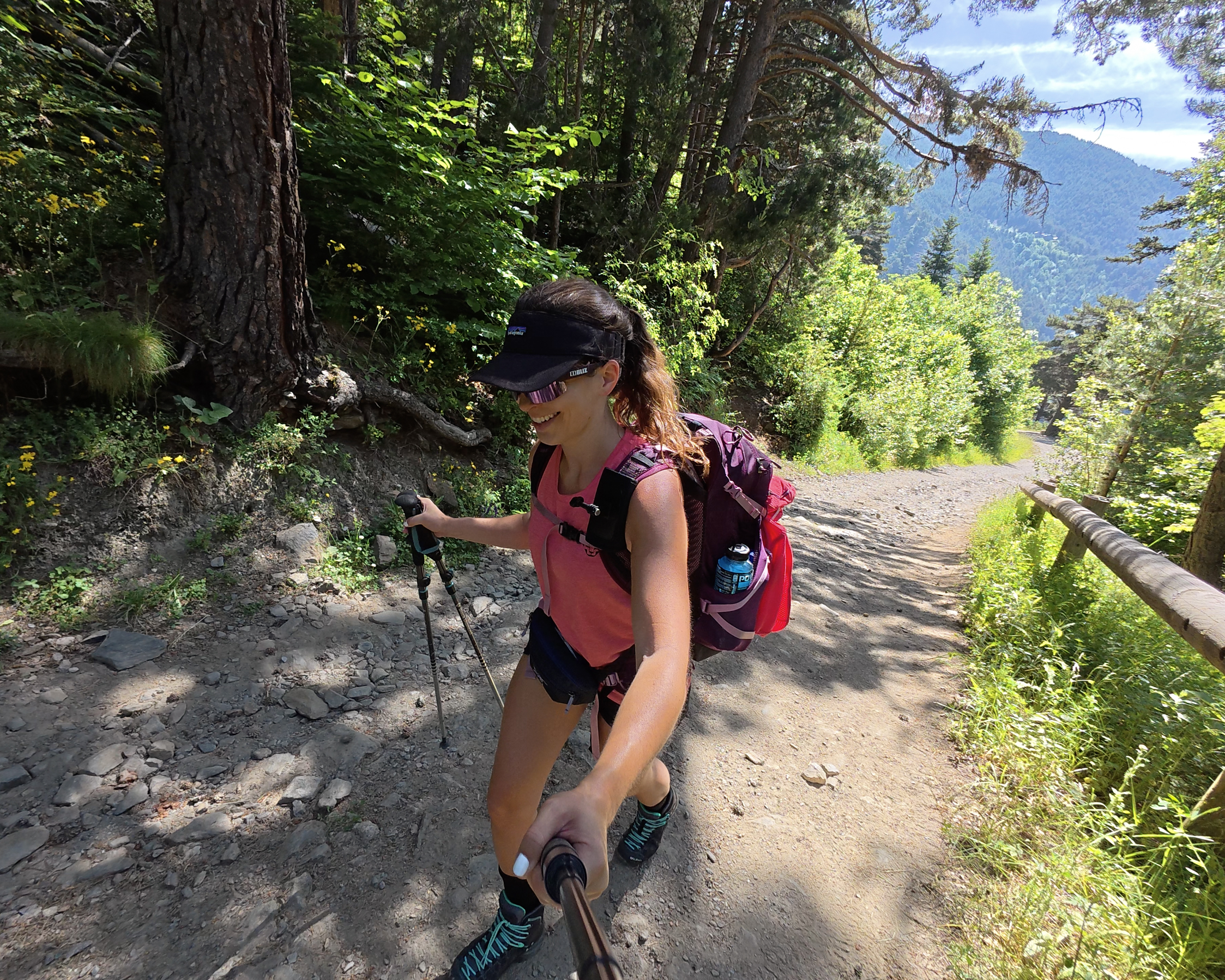
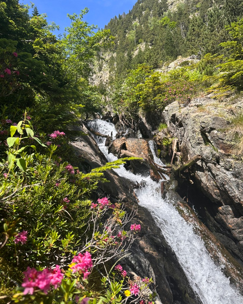
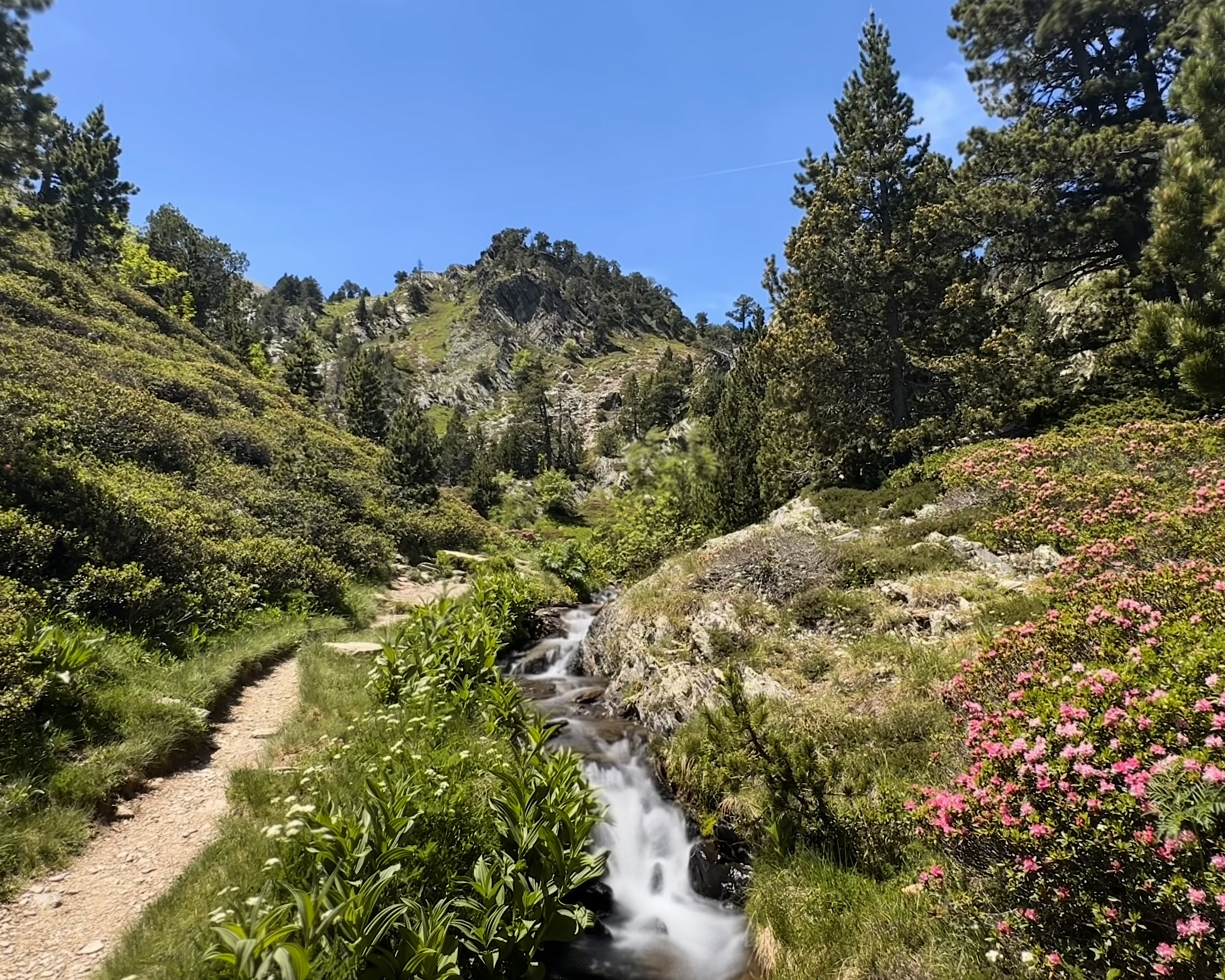
I had a Thursday night reservation for the Refugi Comapedrosa, and I planned to head up just in time for dinner. However, given the heat, I opted for an earlier start. After a quick stop to buy electrolytes I’d forgotten to pack, I parked at Hotel Yomo Patagonia, which was right by the trail start and had free overnight parking (when I was there, at least). The early trail is gradual, first passing by a waterfall and then heading up through the trees.
The path to the hut covers 3.5 kilometers and 650m of ascent. The hut itself sits at 2,265 meters, so it’s right around the halfway point in terms of both distance and elevation. The full out-and-back I did covered nearly 15 kilometers and 1,400m of ascent, round trip. The full map is below:
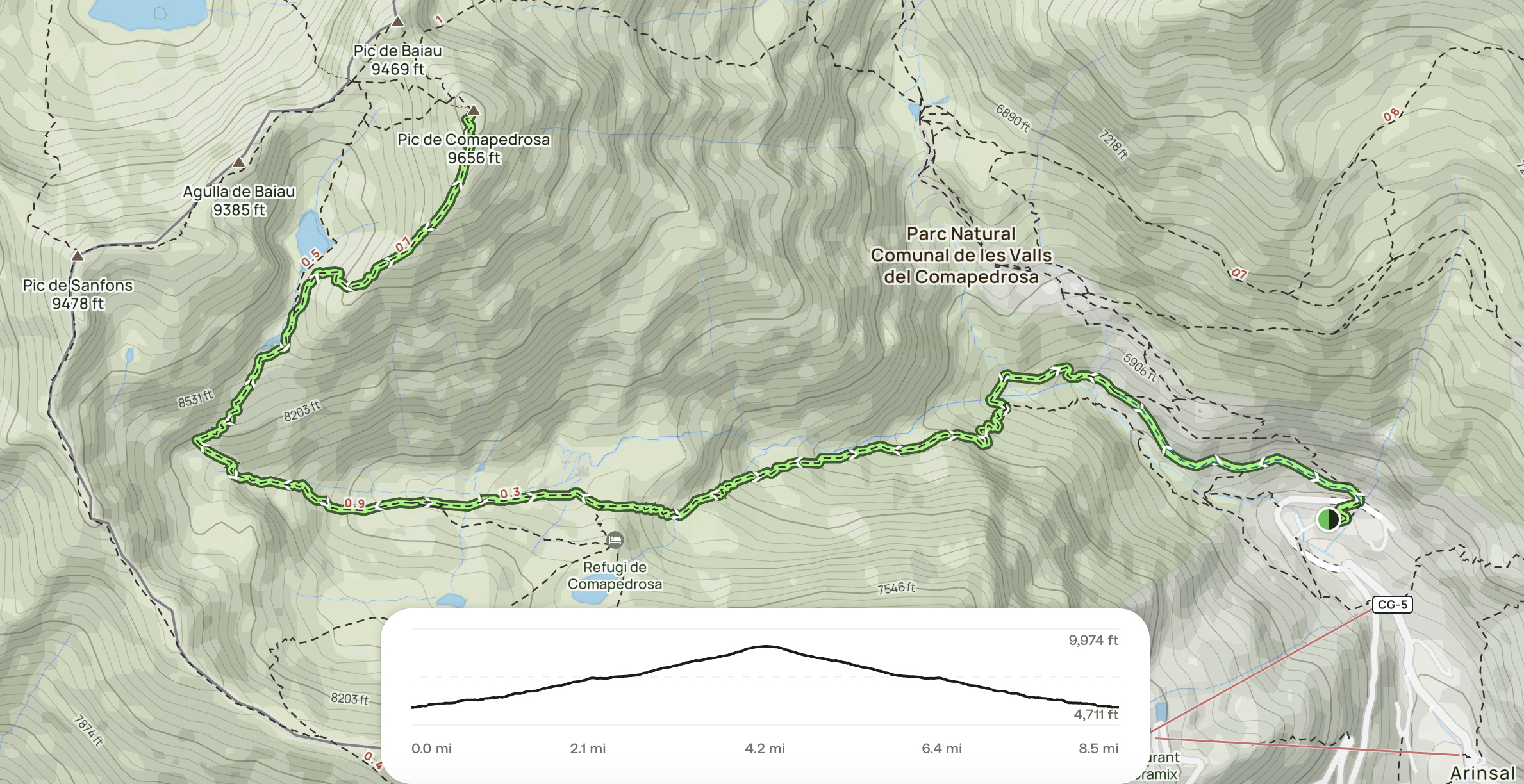
As you might see above, there is an option to turn this into a loop by continuing clockwise from the summit (or approaching the summit counterclockwise direction and stopping at or staying over in the hut before descending. There’s also an even longer option along the ridge further toward the edge of the map, directly along the border with Spain. Any of these variations adds pretty significant difficulty versus the main route. I opted for the common out-and-back this time around!
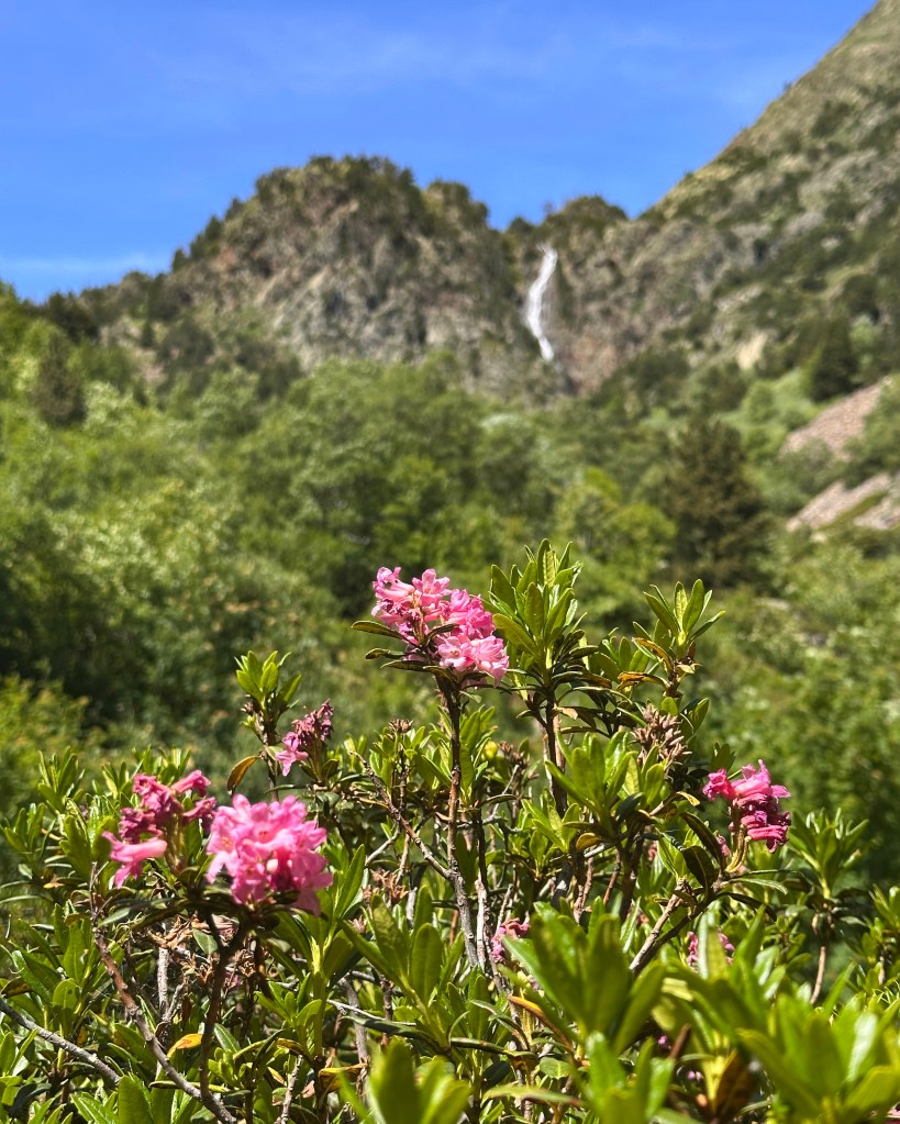
June is such a great time for this peak. The snow is mostly melted, with water sources everywhere (bring a filter), and the mountains are blanketed in pink flowers. I unintentionally matched my outfit to them. I only found out later that these are called alpine “roses”…and my abuela’s favorite flowers were roses (regular ones, but still!).
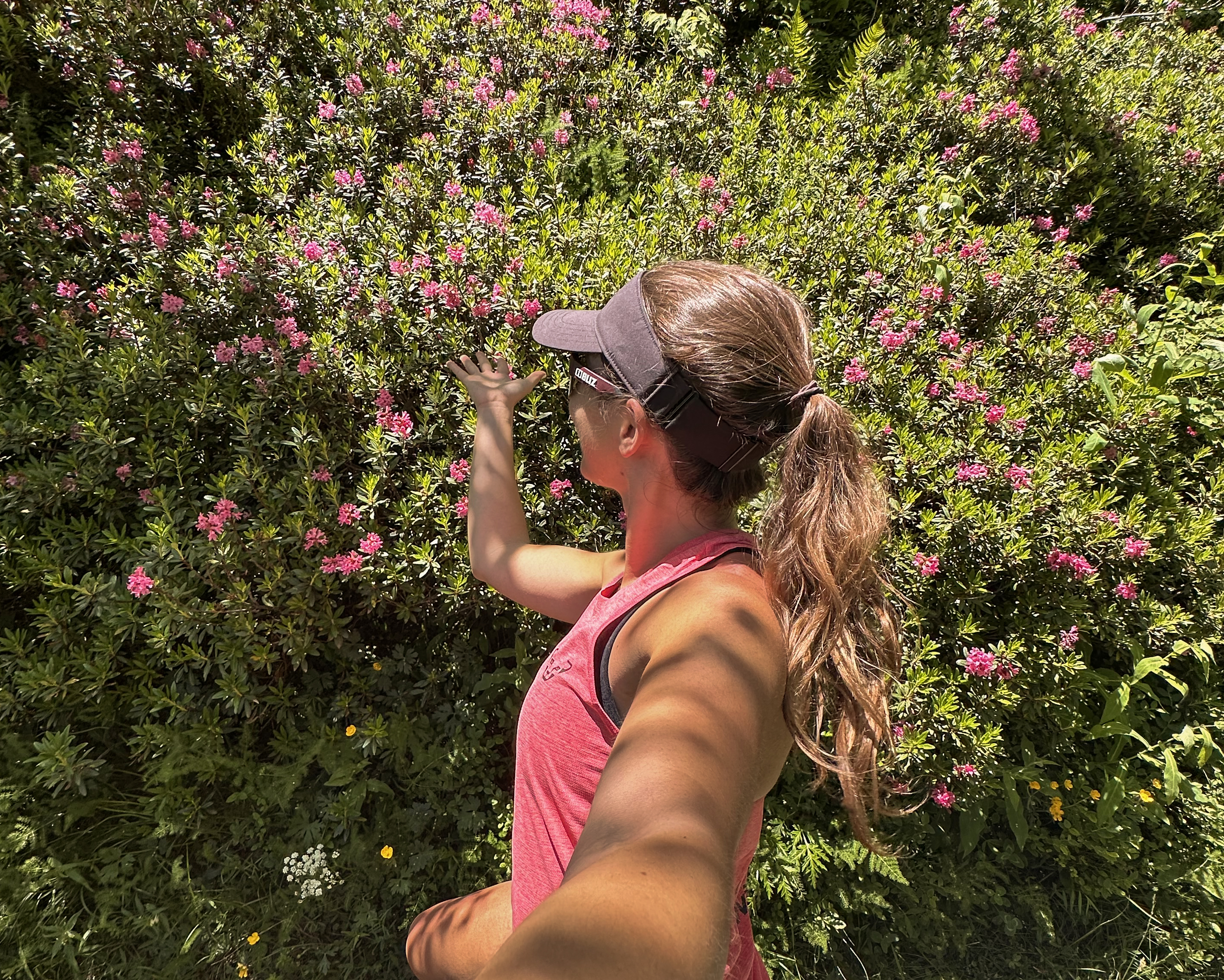
The route goes through the Parc Natural Comunal de les Valls de Comapedrosa. Quite a big name for only 15 square kilometers of protected area, but it’s still a special and beautiful place with so much flora and fauna. There are signs along the route explaining more about different species found in the park.
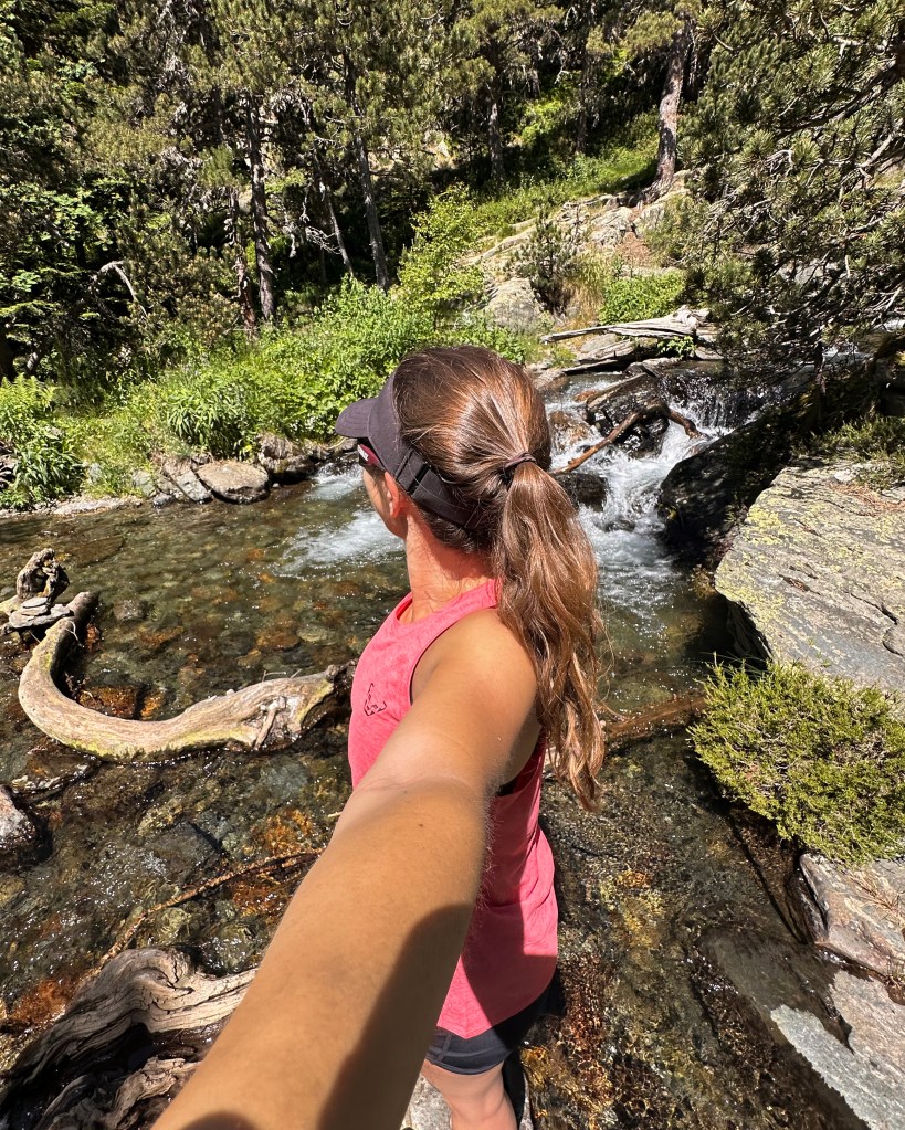
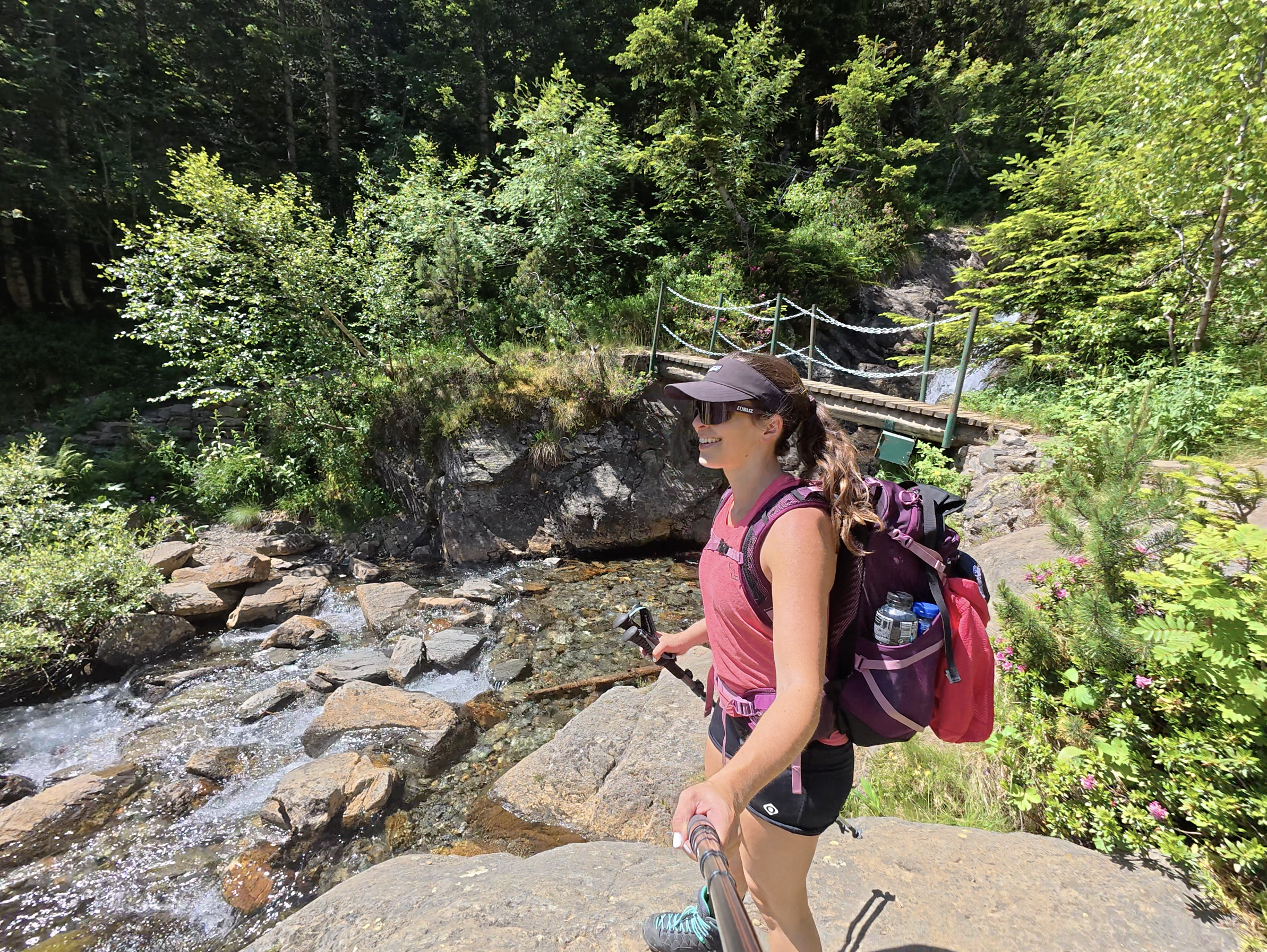
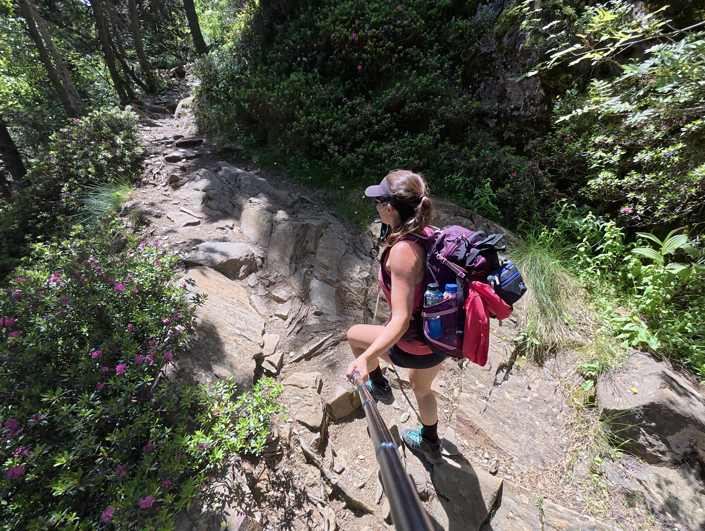
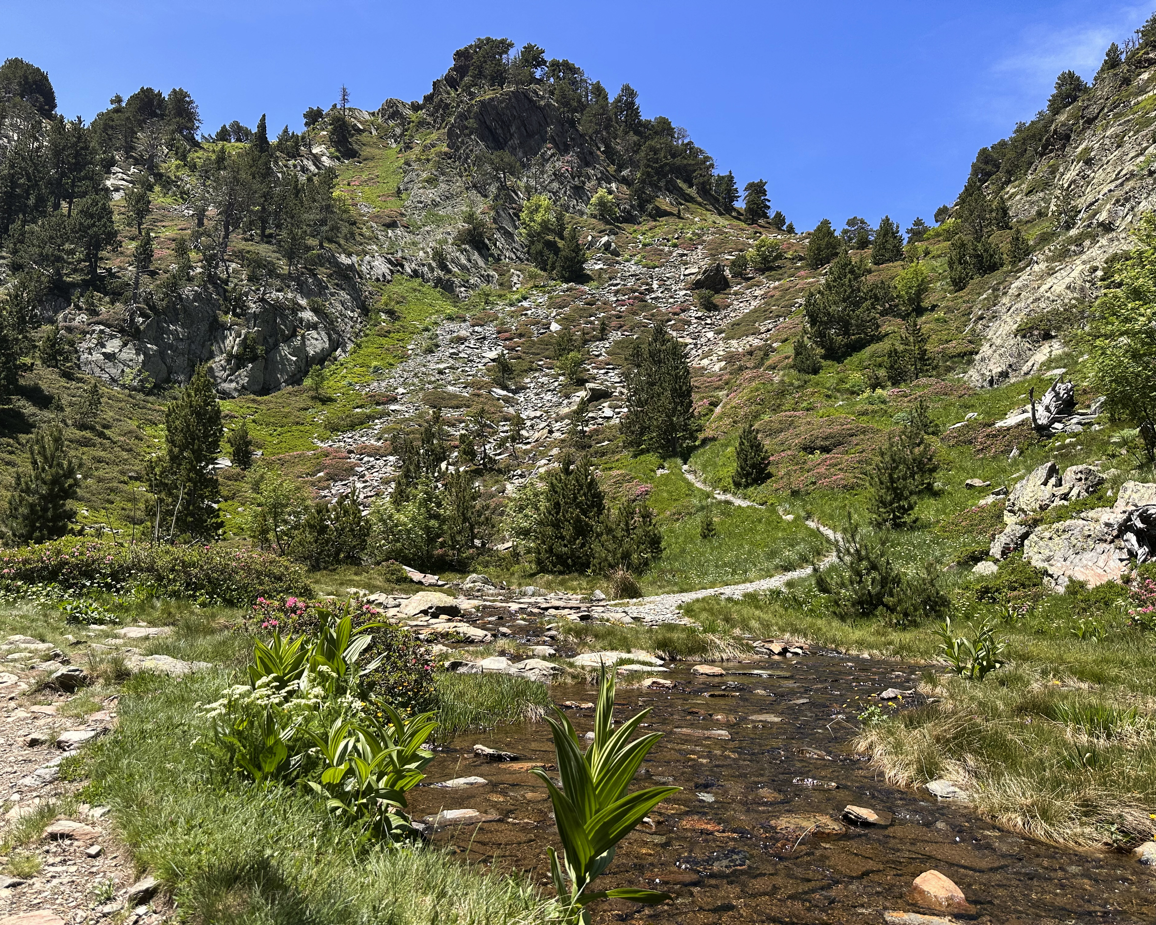
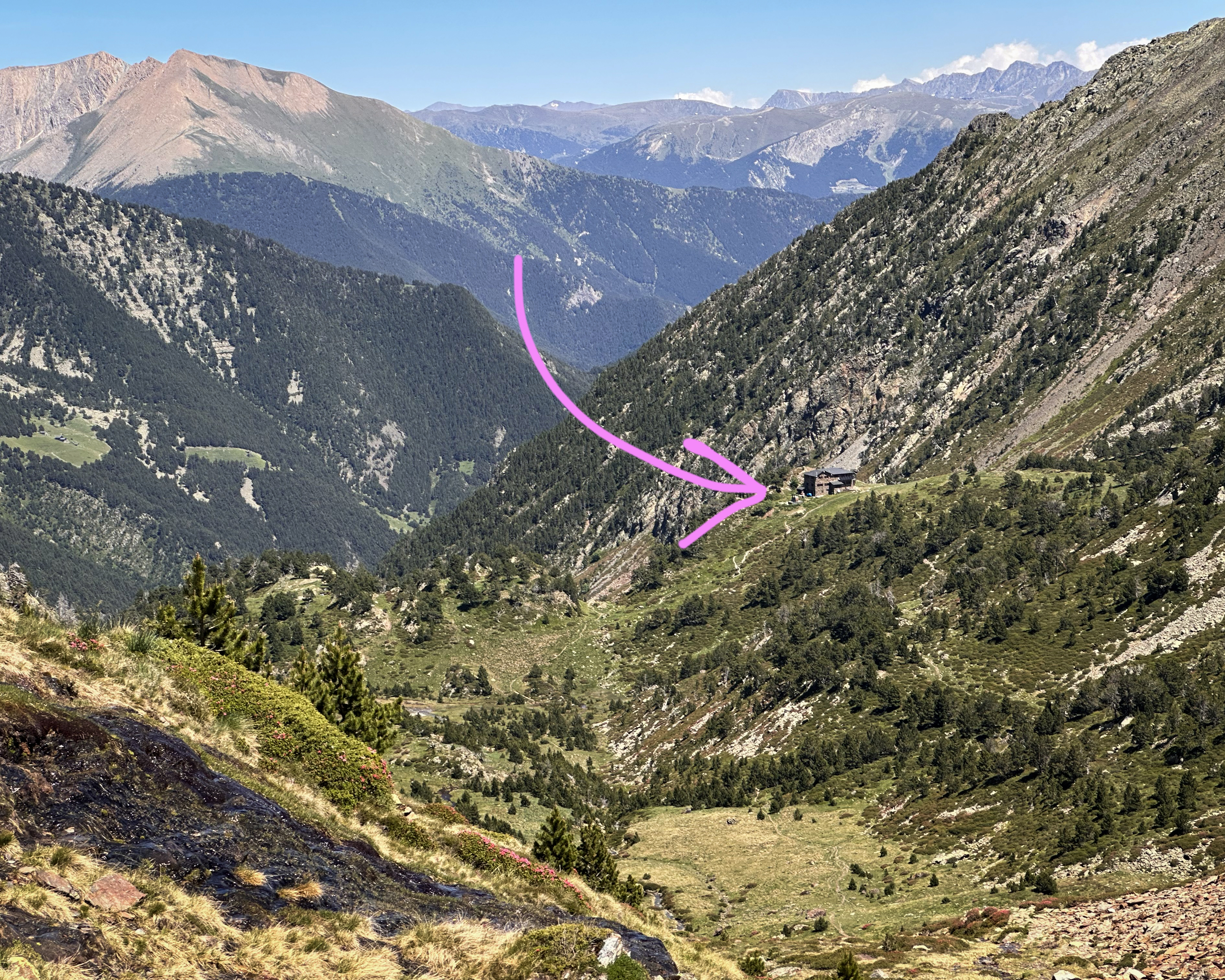
After a few river crossings, which were a mix of proper bridges and rock hopping, the path starts to flatten before a final ascent to the hut. In the photos below, you can see the route winding over the hillside.
At around 2pm and after quite a few photo stops, I arrived at the refuge.
It was still early, so few people were around. A couple had just returned from the summit, and they’d apparently made it round trip from the hut in under 3 hours. I was unsure of whether to tack on the summit that day (not the original plan), or head up first thing in the morning. By the time I was ready at around 3pm, it meant I’d have 4.5 hours to make it back by dinner.
I decided to go for it – after all, it’s an out-and-back, so there’s always the option of turning around early and trying again the next day. I had a headlamp and extra food, so missing dinner wouldn’t be the worst sacrifice, either.
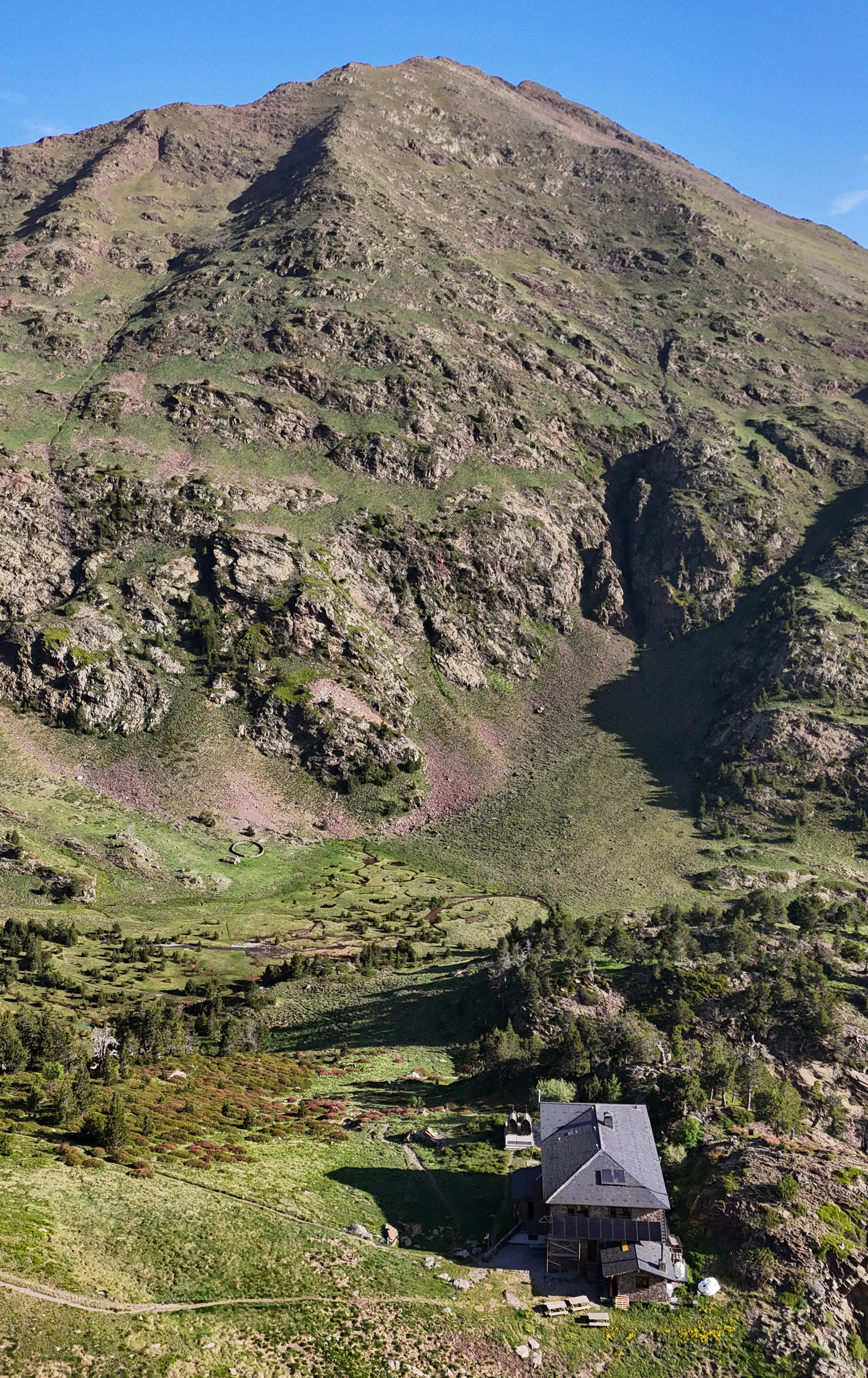
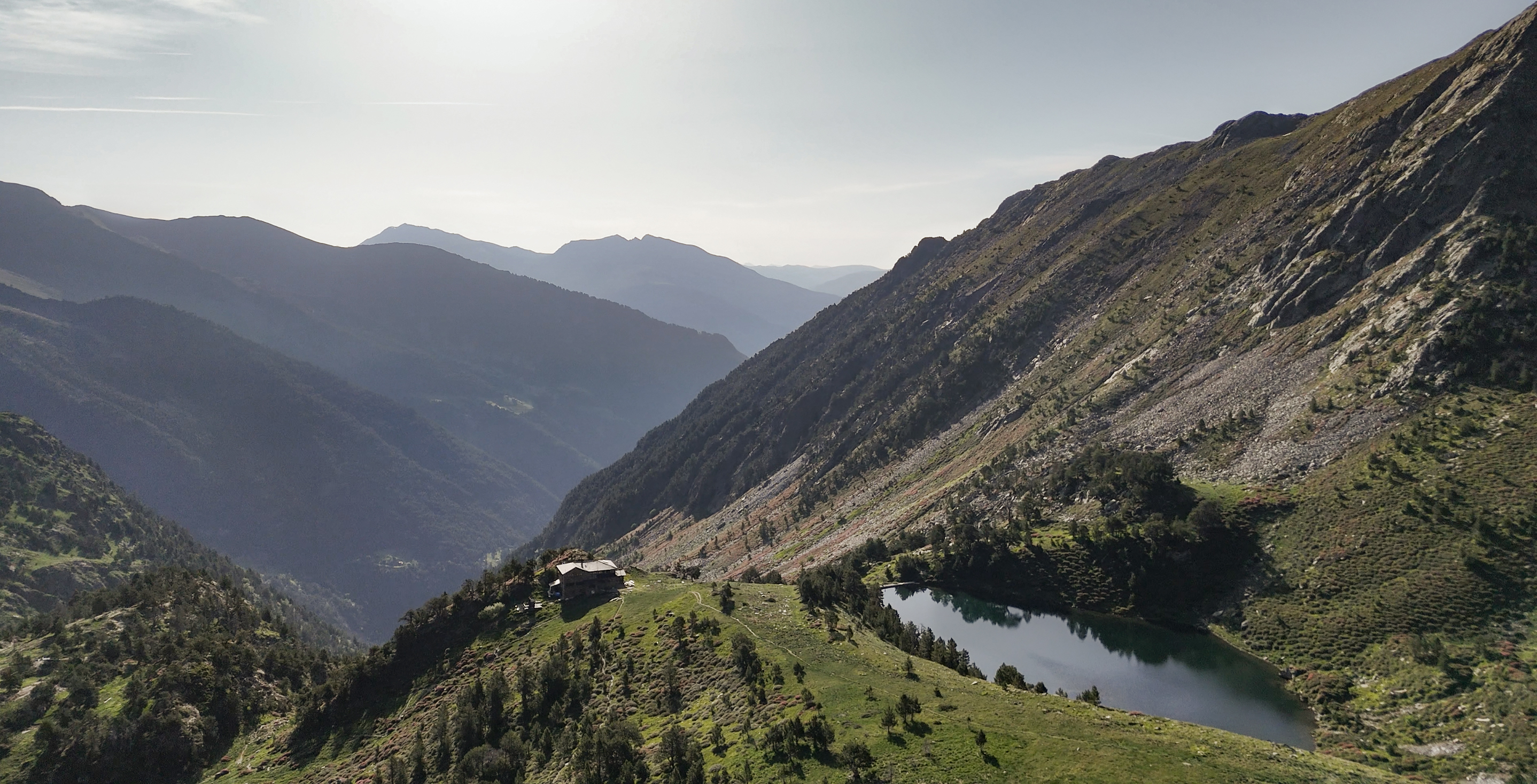
The trail continues past the hut, cutting through a grassy valley with a straightforward, initially quite flat, path. Soon, it begins to ascend the mountains visible behind the hut in the above photo (cut off in this image, but the ascent starts off to the left). For such a beautiful (though hot) day, the trail wasn’t nearly as busy as I expected. No one else seemed to be heading up, just returning, so I was optimistic about few crowds on the summit.
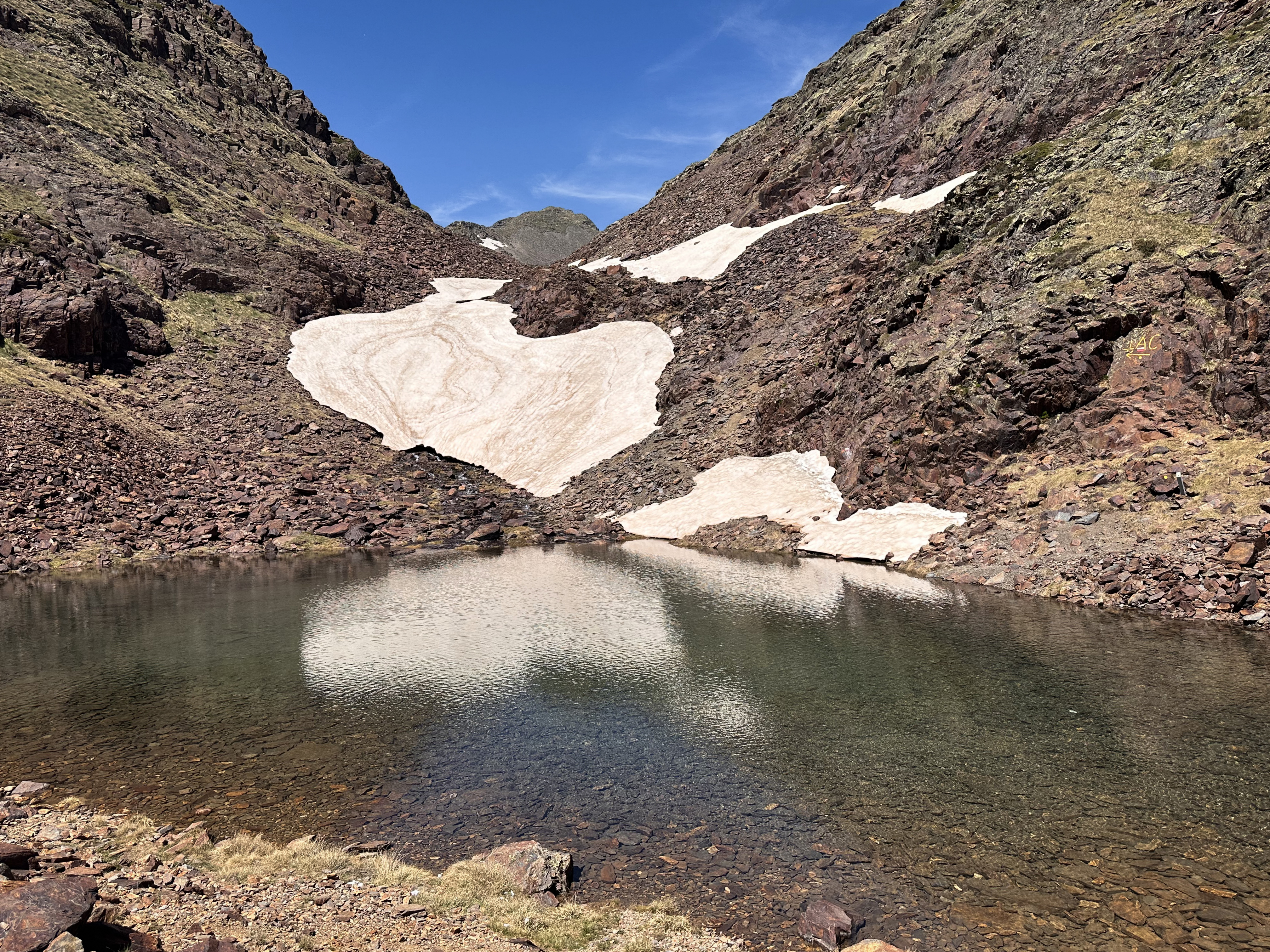
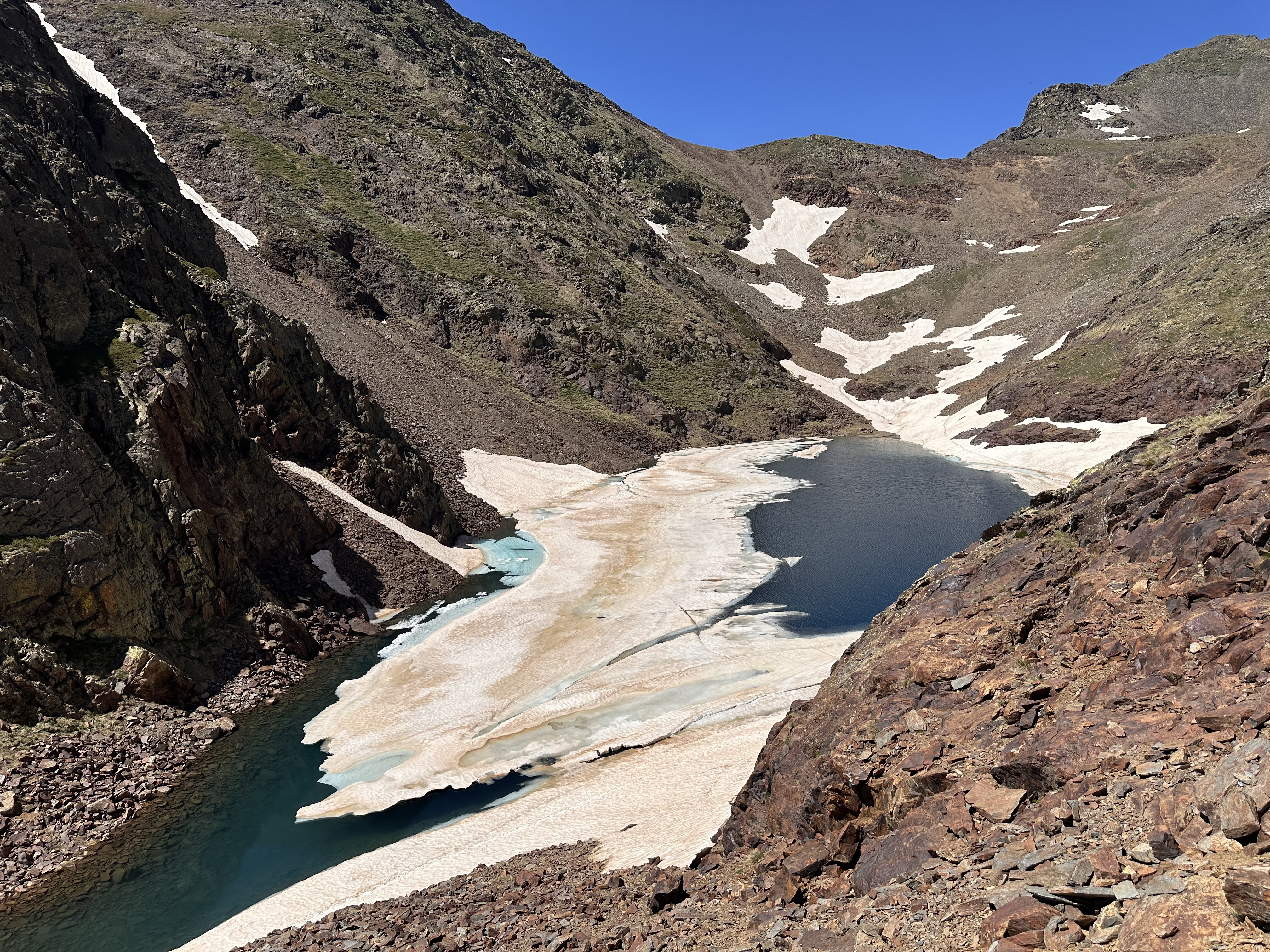
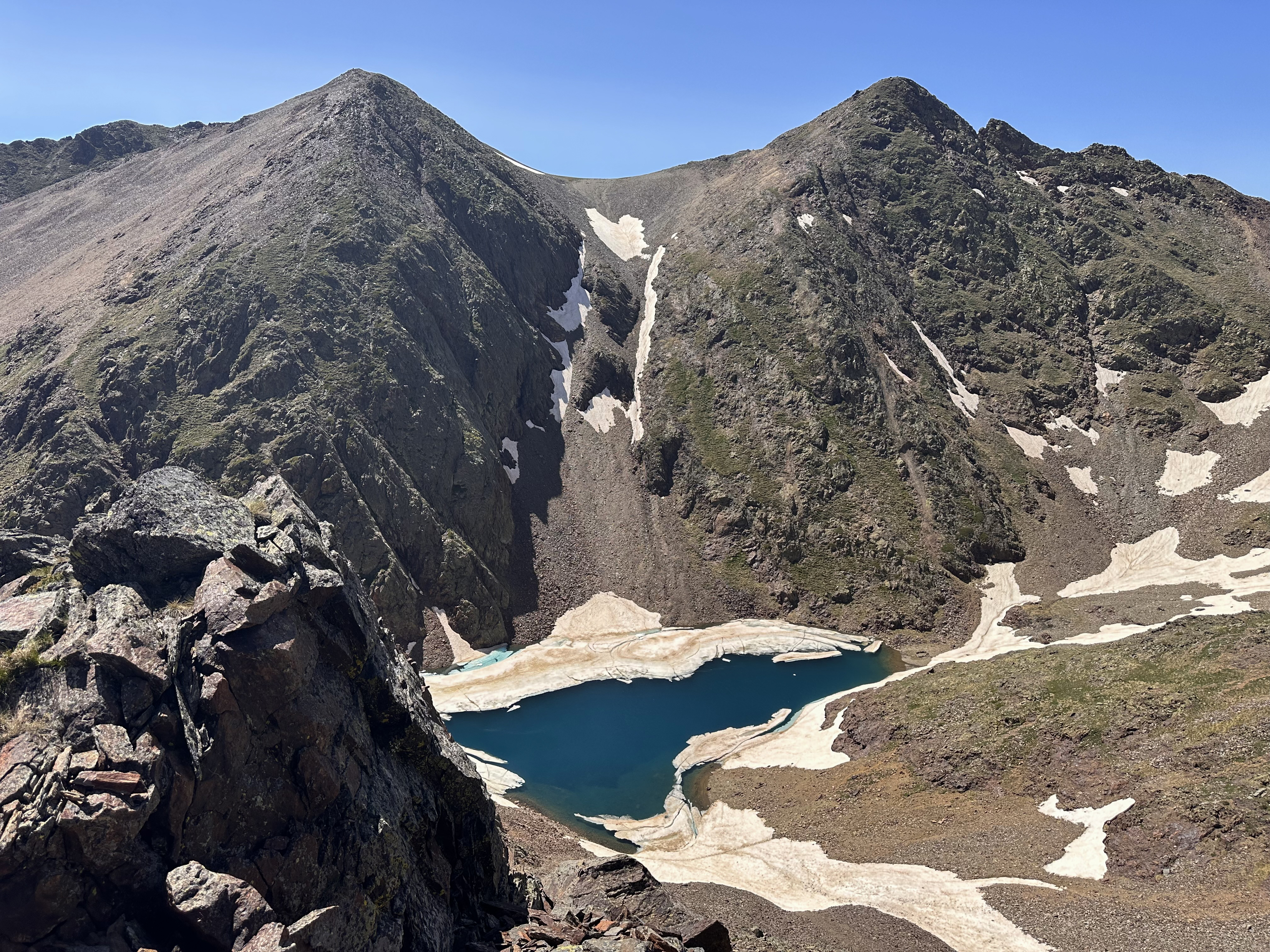
In the hut, the couple had mentioned a point where the trail branched off. I didn’t really know what they meant at the time, as it wasn’t clear from the map. Apparently, in the winter, there’s an alternative route to the main ridge (the ridge is the one AllTrails follows), which crosses a snowfield before ascending a much steeper scree section to the summit. It avoids a bit of exposure on the ridge and that climb, and if done as a loop with the ridge, allows for some varied scenery.
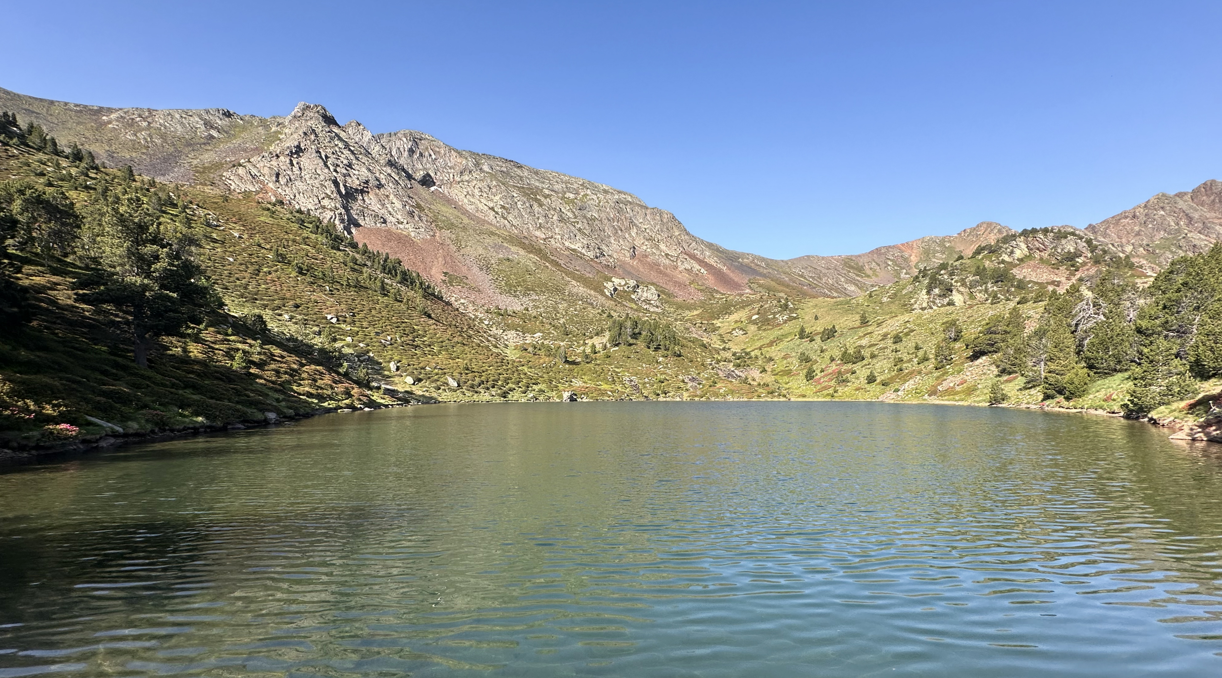
However, I’m very glad that I stuck to the main route. The snow would have been pretty slushy this late in the day, which can be risky this late in the season. The views of the vibrant blue lake from the ridge were incredible, framed by mountains and with equally stunning views in all directions. The snowfield route skirted along the bottom side of the blue lake in the second and third photos below, I believe. My route still involved crossing the snowfield visible in the first photo, which continued a bit further past what’s visible there. There is a point that is pretty well marked where I turned right to gain the ridge. Views really open up quickly from there!
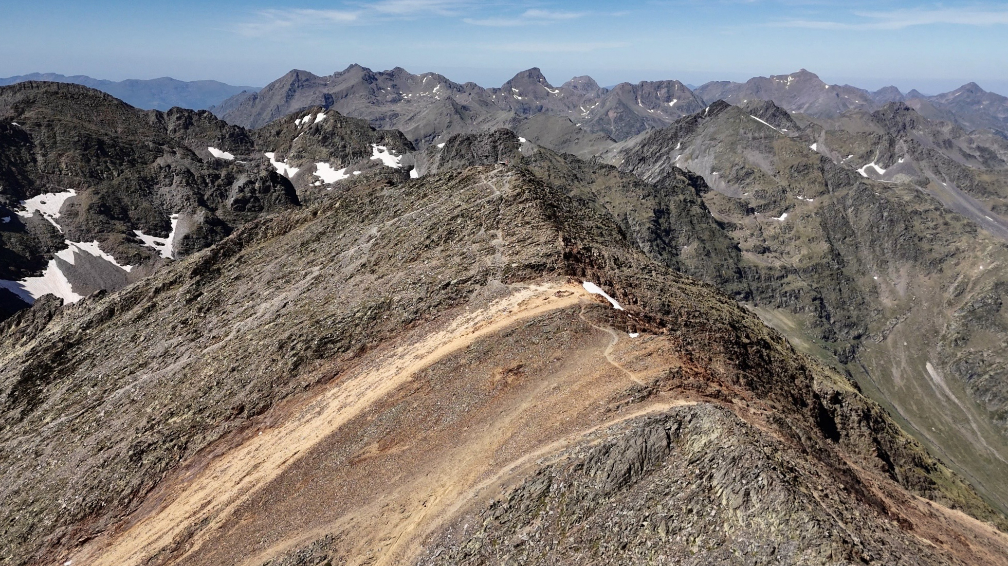
At this point, the time remaining to the summit was truly deceiving. The summit felt so close, but it still took just over 30 minutes to traverse over to it.
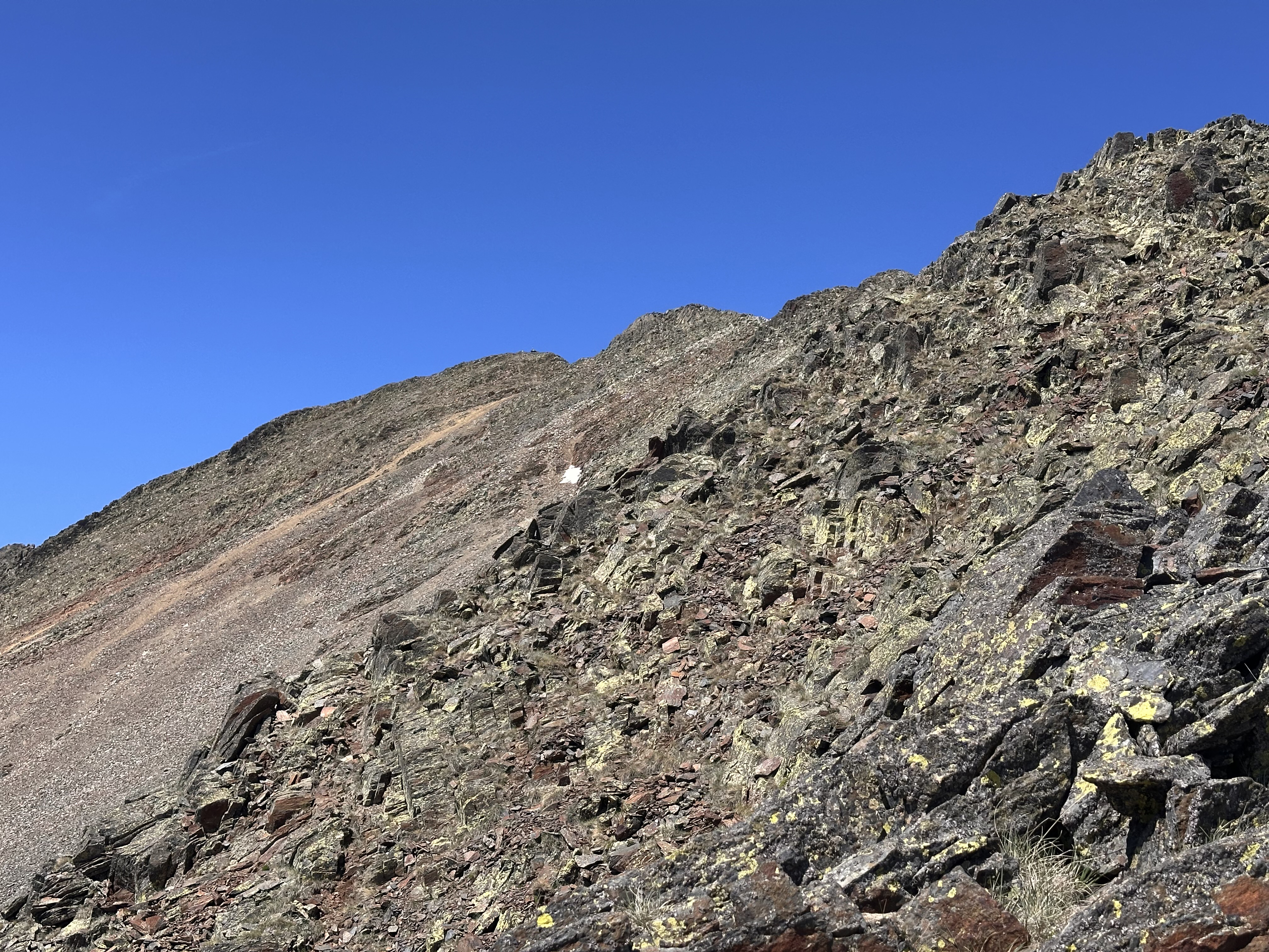
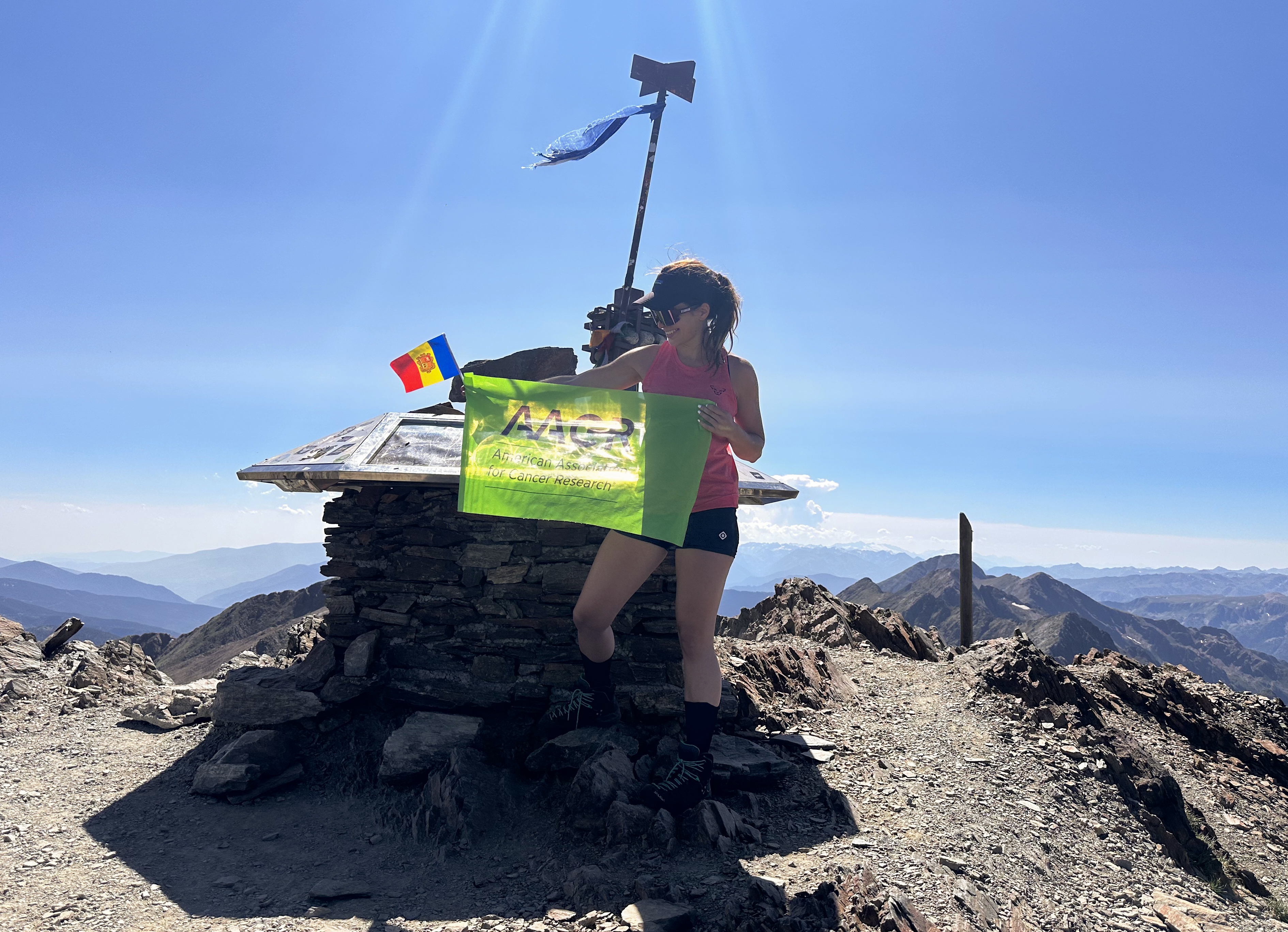
The exposure is way less than I expected and not technical, but it still required attention and less speed. I arrived at around 5pm. It was still probably 20 degrees (Celsius) at the summit, despite the sun dipping toward the horizon.
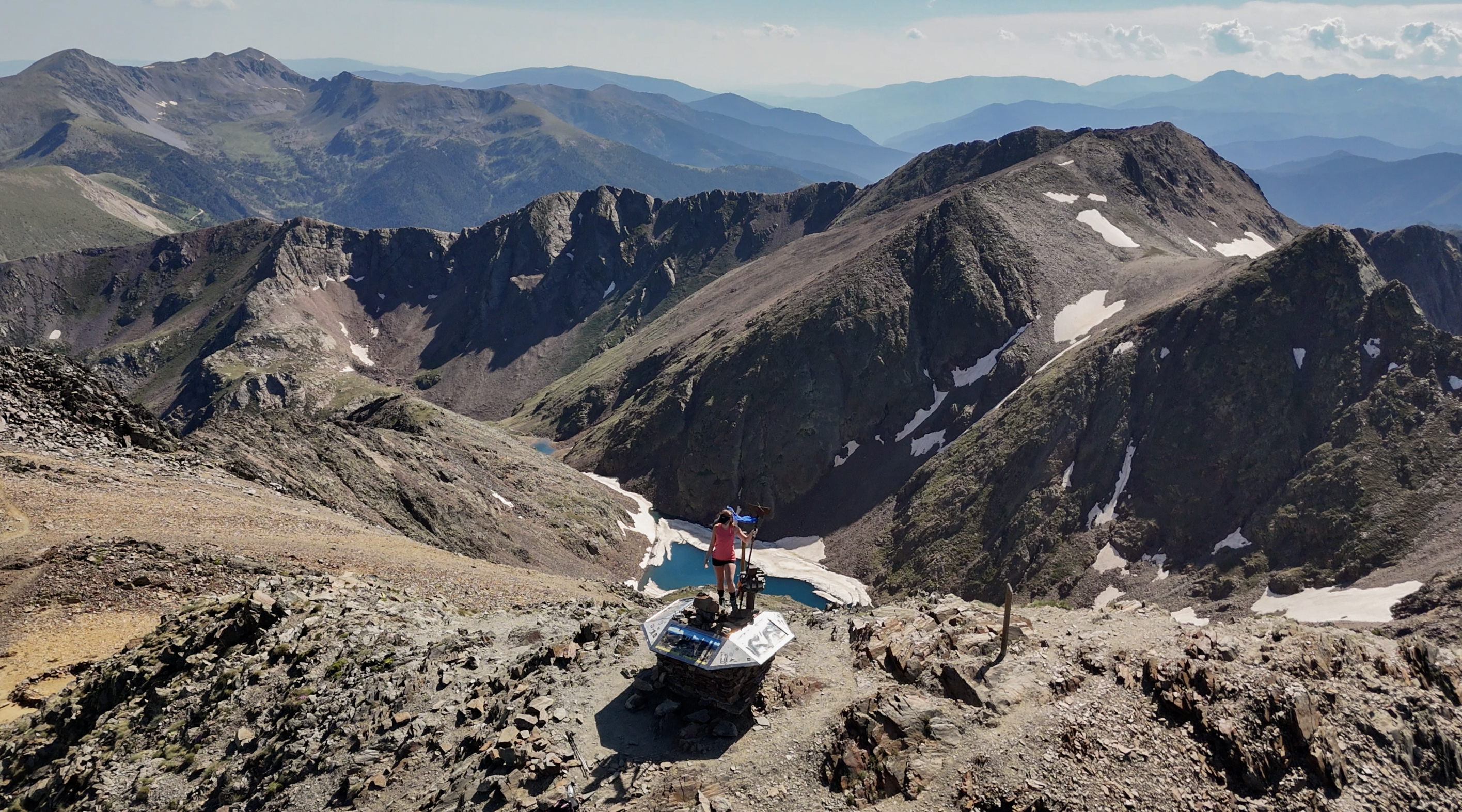
The views were incredible…possibly my favorite of any in this challenge so far.
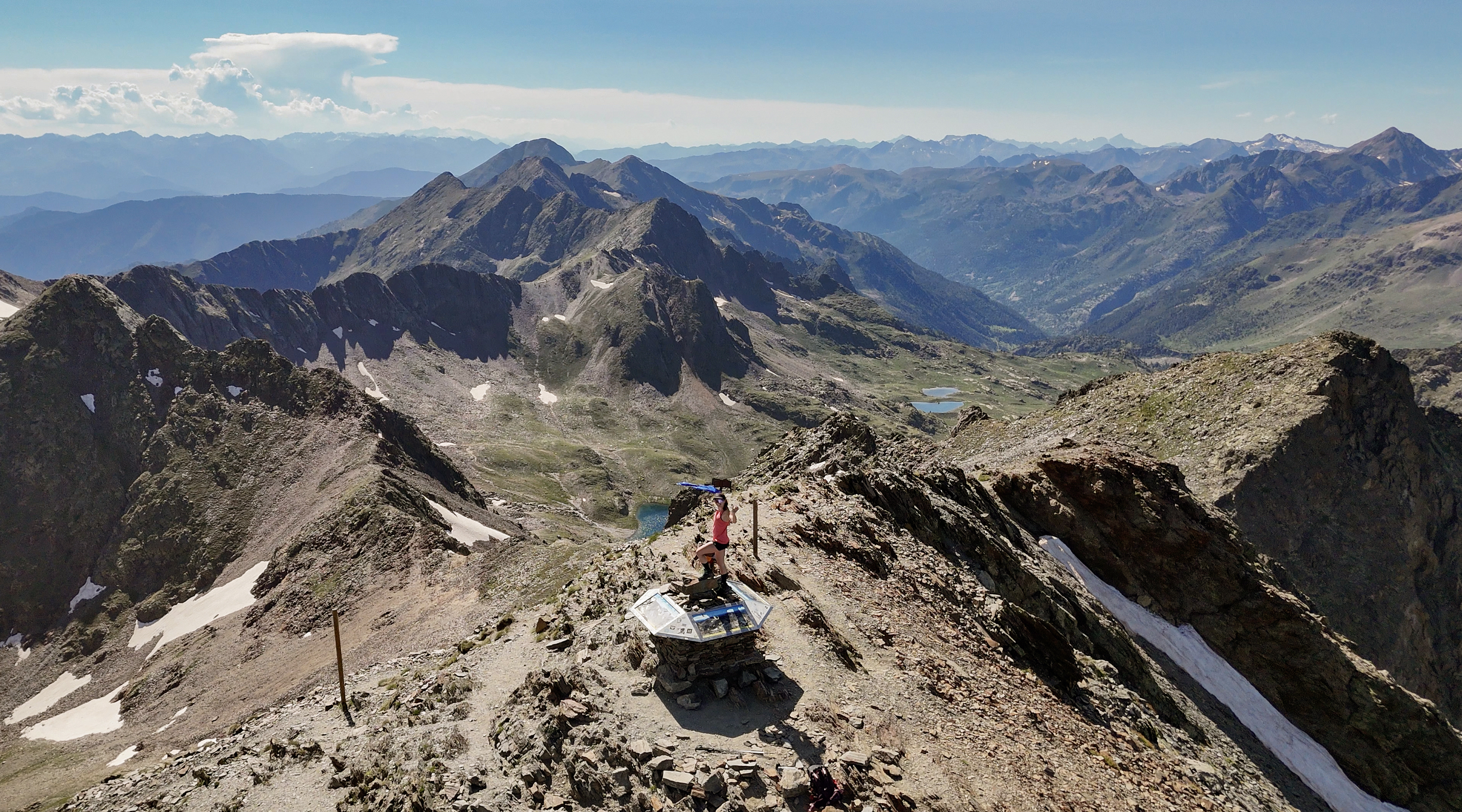
It was great to finally be back up there with the AACR flag, after the lost bag chaos on the previous two peaks. I’m happy that neither that flag nor my drone flew away up there. The drone really tried!! For some reason, I didn’t really register the altitude of this peak at the time I was up there, despite mentioning it multiple times in this blog post. So, I couldn’t really figure out why my drone seemed more out of shape than me up there…I was feeling fine! It turned out that the maximum takeoff altitude of my drone is 3,000 meters…and this was really close to that. In thin air, the drone has a tough time staying stable, especially as I had it trying to circle around. I really thought it was a goner a few times!
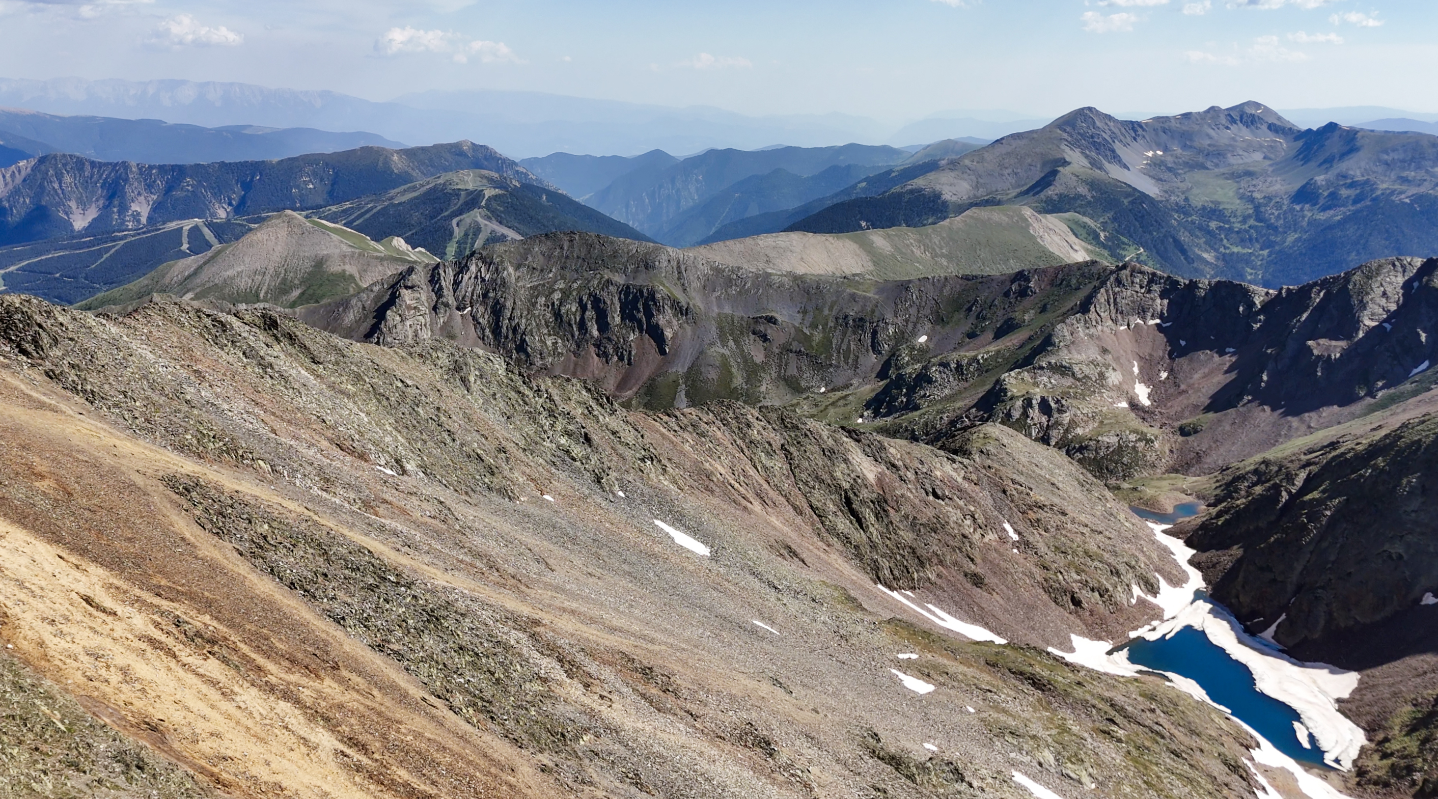
I think I was most blown away by the mix of colors here. I hadn’t seen any springtime photos of these mountains, with white snow to contrast vibrant blue lakes and multicolored, iron-rich schist.
A few resources I used to prepare for this hike were the blog post by Jarda Zaoral and the YouTube video by Natasha Bergen. The former was full winter conditions in skis, and the latter further into summer. Neither of these conditions involved the alpine roses, so I was so grateful to see these!
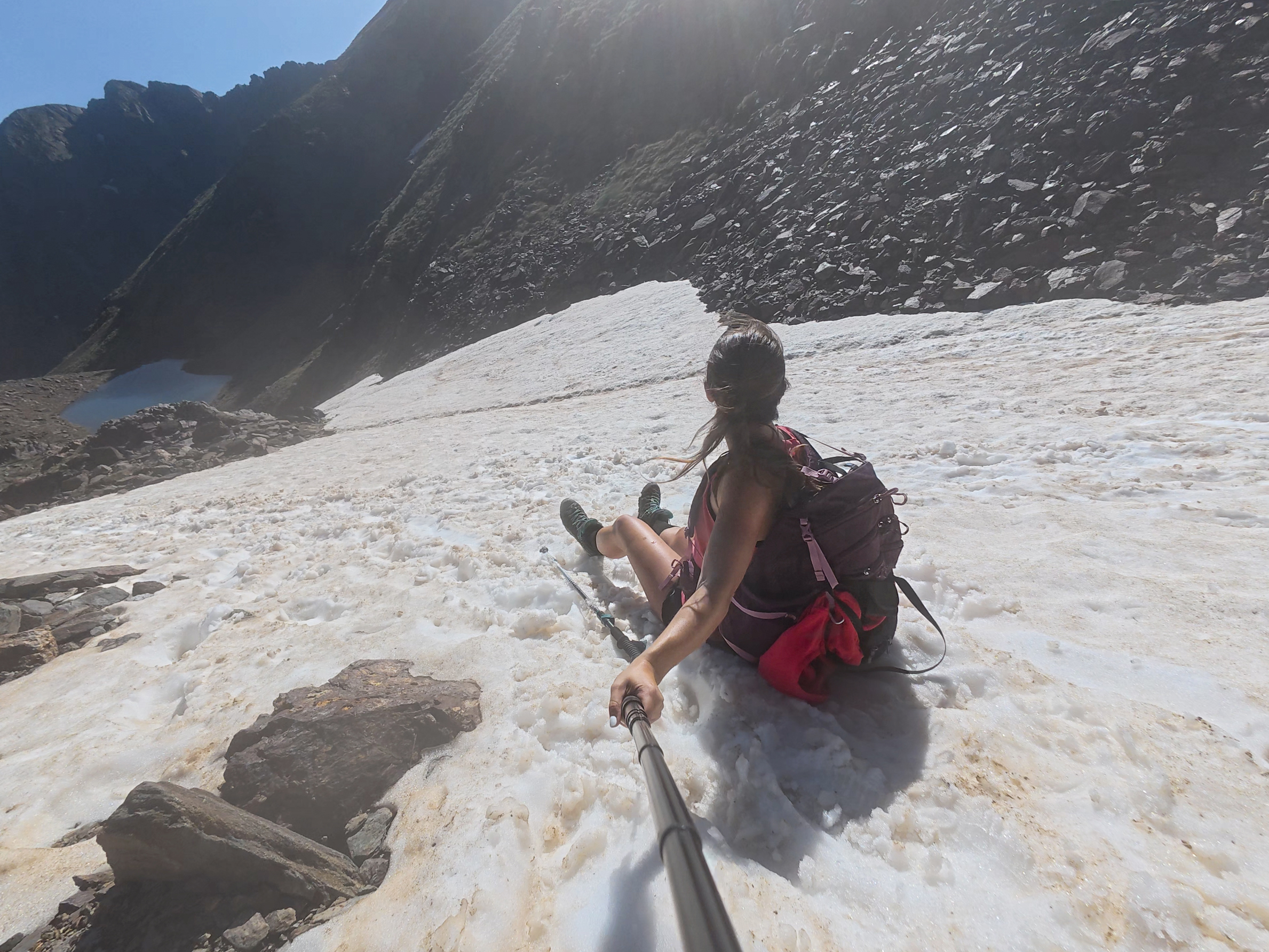
I didn’t want to head back down yet, but it was already after 5:30pm, which meant under 2 hours to complete the descent. I started the race against the setting sun and my growing appetite. Maybe I had a bit too much fun racing down the now-very-soft snowfield, because…I ate it. Landed as shown in the photo, then just sat there. It was still so hot out. Tank top + shorts + snow = normal body temperature finally restored. The layers stuffed in my bag never made it out…weighted pack training, I guess. The views weren’t bad from there!
I’ll make one more gear recommendation here…my shoes, the Salewa Alp Trainer Mid GTX boots. I was never a boots person before my ankle injury, but these are flawless. Toe room, no break-in period or hot spots, not too heavy, comfortable, secure, and sometimes most importantly, SO waterproof!! The waterproofing would be put to the test even more on peak #23, Midžor, in Serbia.
I made one short stop on the way down, at the first icy lake, since my physio had instructed me to ice my Achilles (tendinopathy) during this hike…
This helped, and the rest of the descent was pretty deserted and peaceful. The hut is visible for most of the way to and from it, so the reward was in sight.
With six minutes to spare, I took a seat for dinner. I’ve found that any hut I’ve stayed in within Europe has been pretty accommodating for gluten-free meals, and this one was no exception. I didn’t take a photo of my food and was too wiped from the day to remember what I ate, but I’m sure it was great.
I chatted with some other hikers at the hut. Surprisingly, it seemed that most weren’t there for the summit, and some didn’t even plan to head up there. Several groups were doing Coronallacs, a 92-kilometer hut-to-hut trek that’s typically done across four or five days. I had never heard of it, so I was surprised to see so many travelers from around the world completing it, even some all the way from Seattle! For most, it seemed that they’d planned their trips too late in the season to secure a spot on treks like the Tour du Mont Blanc or Haute Route in the Alps, the Alta Via 1 in the Dolomites, or others in increasingly popular hiking destinations like Slovenia (my next country in this challenge after Andorra, incidentally!). They were all so thrilled about how things worked out, as this was apparently not crowded and very scenic. The only downside was the heat wave…these trekkers had everything from chafed (more accurately described as severely wounded) shoulders from backpack straps to extremely swollen knees.
As I was mentioning my hiking challenge to the group from Seattle, they pointed out a couple from Poland that they believed was doing the European country high points as well. It turned out, they were! And that’s how I met my first fellow Crown of Europe hikers “in the wild”, Karolina and Jan. I’ve since met quite a few through Instagram, and it’s been so fun to join up for some of these hikes.
It was soon time for bed. The beds are essentially thick gym mats side-by-side in a large dorm room. Not the comfiest, but good enough and better than hauling camping gear along.
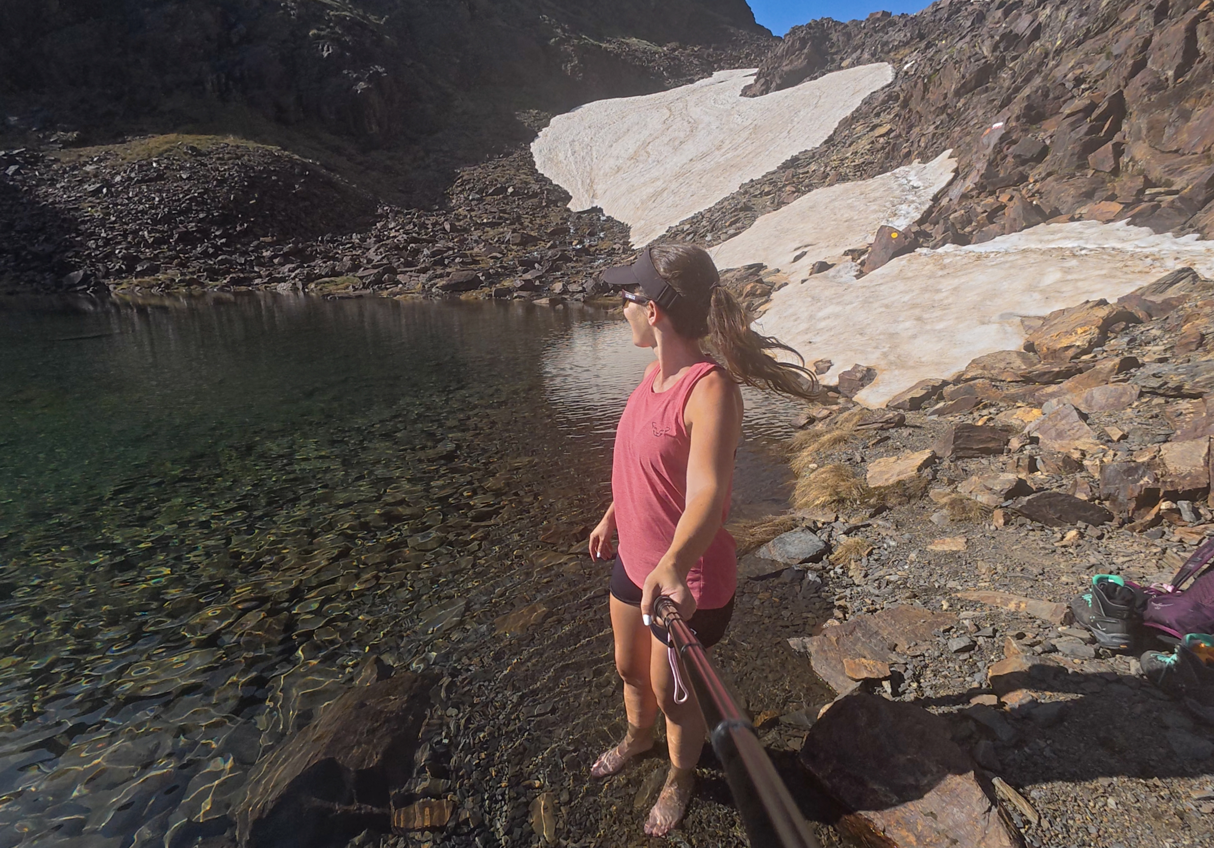
In the morning, after some breakfast, I decided to check out the lake right behind the hut. I was in no rush that day, as I’d already completed the summit and wouldn’t be meeting up with Laura until later that evening. Laura is my friend of 15 years from (and living in) Barcelona, and she’d be driving up for a quick weekend catch-up.
This lake is called Estany de les Truites, which translates to Trout Pond. I did see quite a few fish in there!
After flying the drone for a bit, I headed down, taking my time to enjoy the nice weather. The temperature wasn’t so bad without uphill exertion, and it definitely beat the oppressive heat down in the capital.
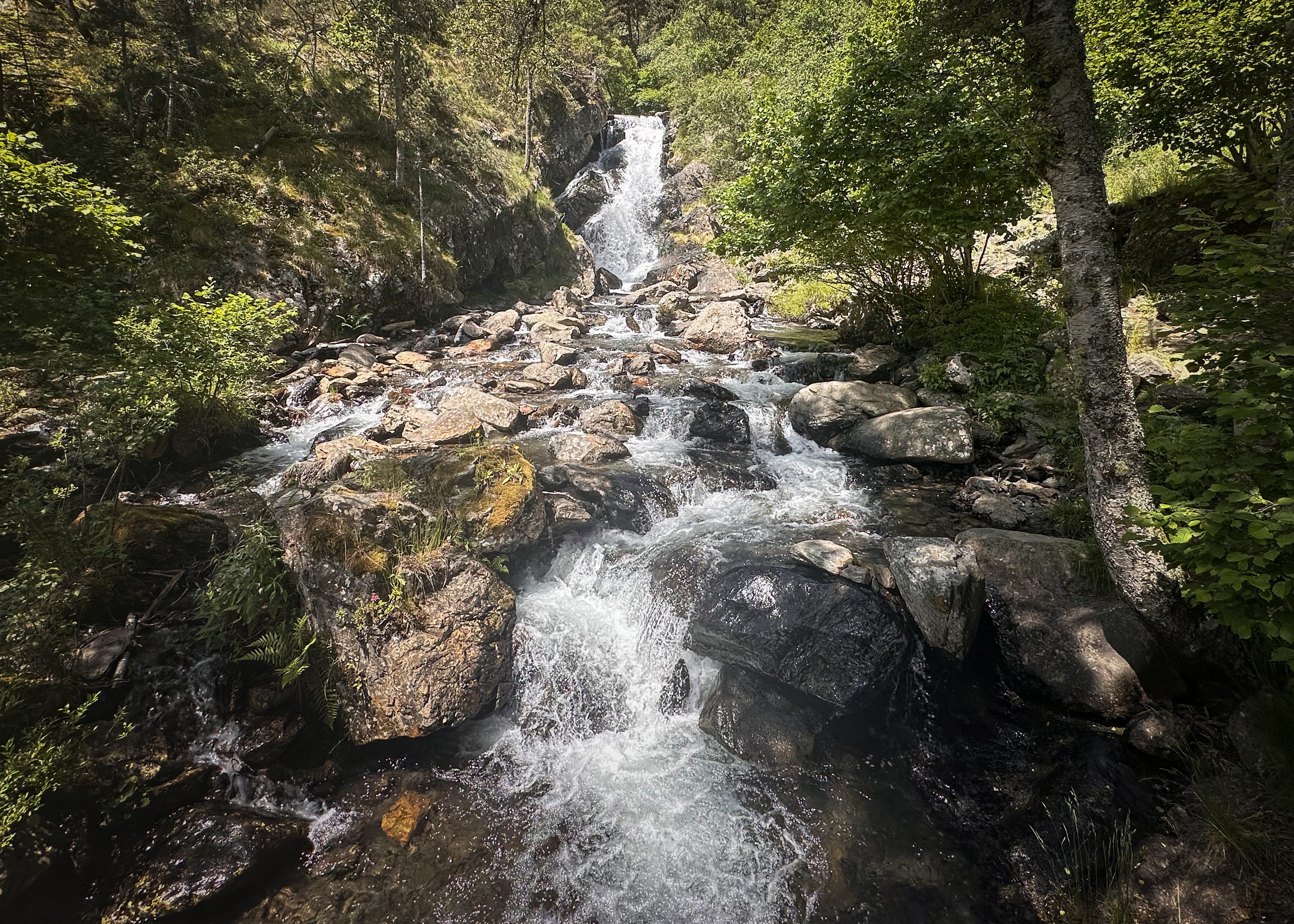
On the way down, I took a slightly different path back to the trailhead, which passed by a nice waterfall. It’s just off the road, so there were people there enjoying lunch at picnic tables or sitting by the water, cooling off.
From there, I headed back through the tunnel to where I’d parked my car. It’s just half a kilometer, but if you try to use Google Maps, it shows a 2-hour detour up through the mountains for the walking route. I’m not sure why…maybe the tunnel is officially just for cars. There’s a sidewalk, so it’s really not an issue (as of when I was there)!
Then, it was a short drive to another hotel I’d booked, still in Arinsal. Laura arrived in the evening as planned, and we grabbed dinner in the area. Laura had mentioned that a must-do in Andorra is to visit a borda, a traditional restaurant (in a rustic style) with traditional cuisine. Unfortunately, with my dietary restrictions, there were easier options that we went with, but I’d recommend it for anyone else going! The national dish is called escudella, which is a meat and vegetable stew that often includes carbs like pasta.
Arinsal isn’t the liveliest town outside of ski season. I’ve found mixed data around how much of Andorra’s GDP comes from skiing and snowboarding tourists, but it seems to be a lot. It’s still a nice, quiet place to stay, and it’s pretty cheap in off-seasons.
Andorra la Vella
Saturday was another extremely hot day, up to nearly 40 degrees Celsius. Little did I know that these wouldn’t be the hottest temperatures I’d experience during this challenge (the Balkans in July and August…)! Still, this was a shock to my London-based system. Laura and I decided to explore a bit of the capital and do some shopping, hopping from one air-conditioned shop to another.
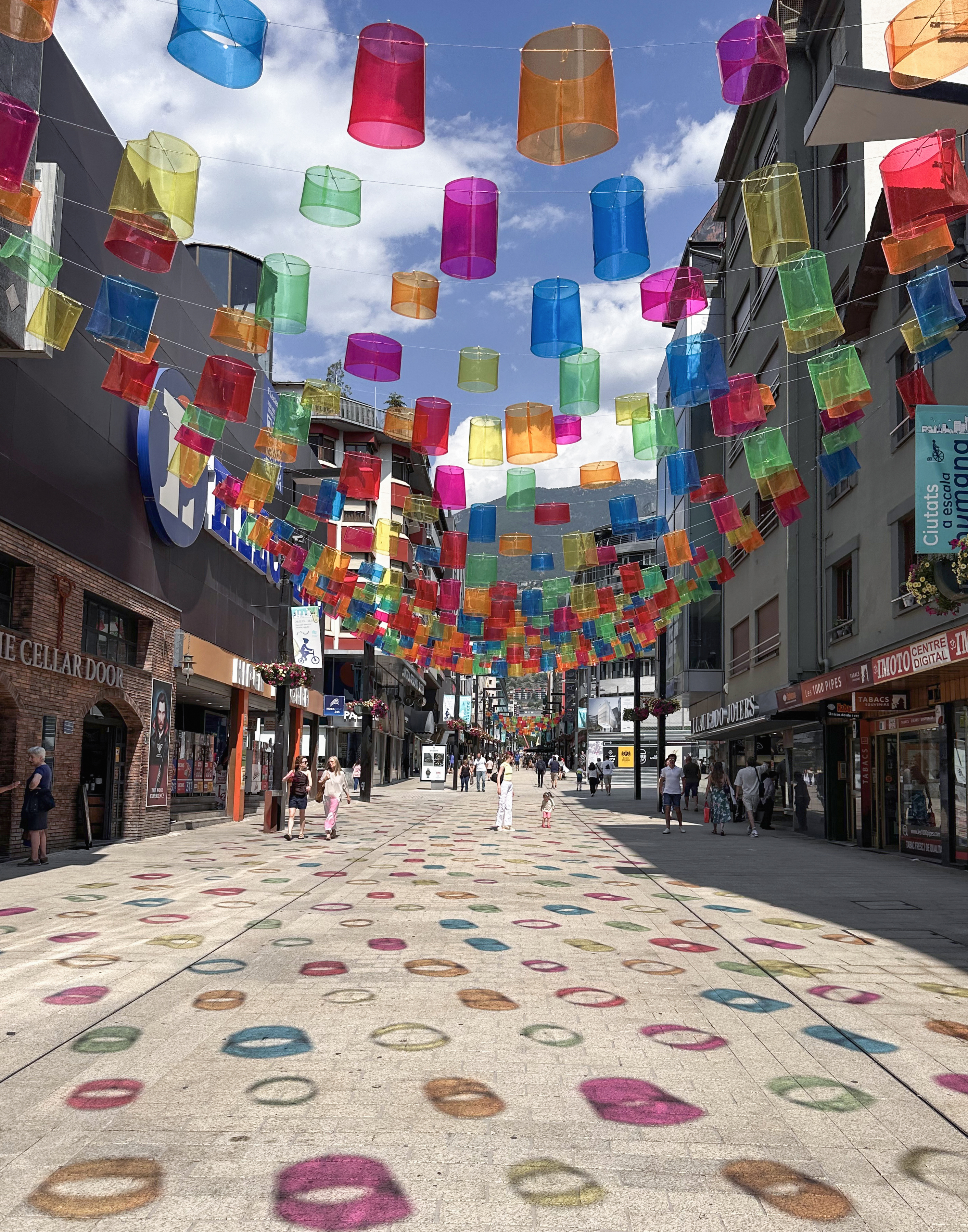
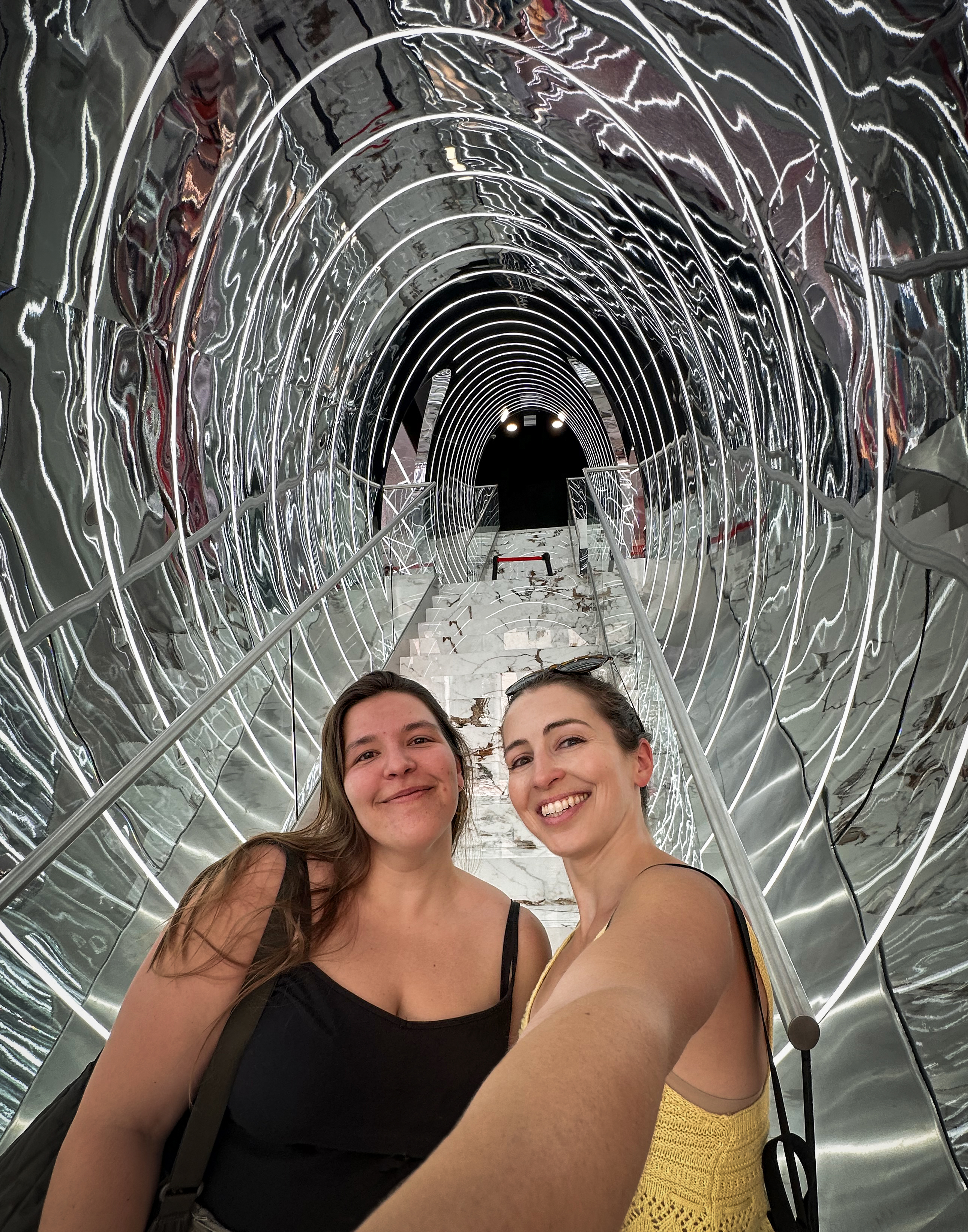
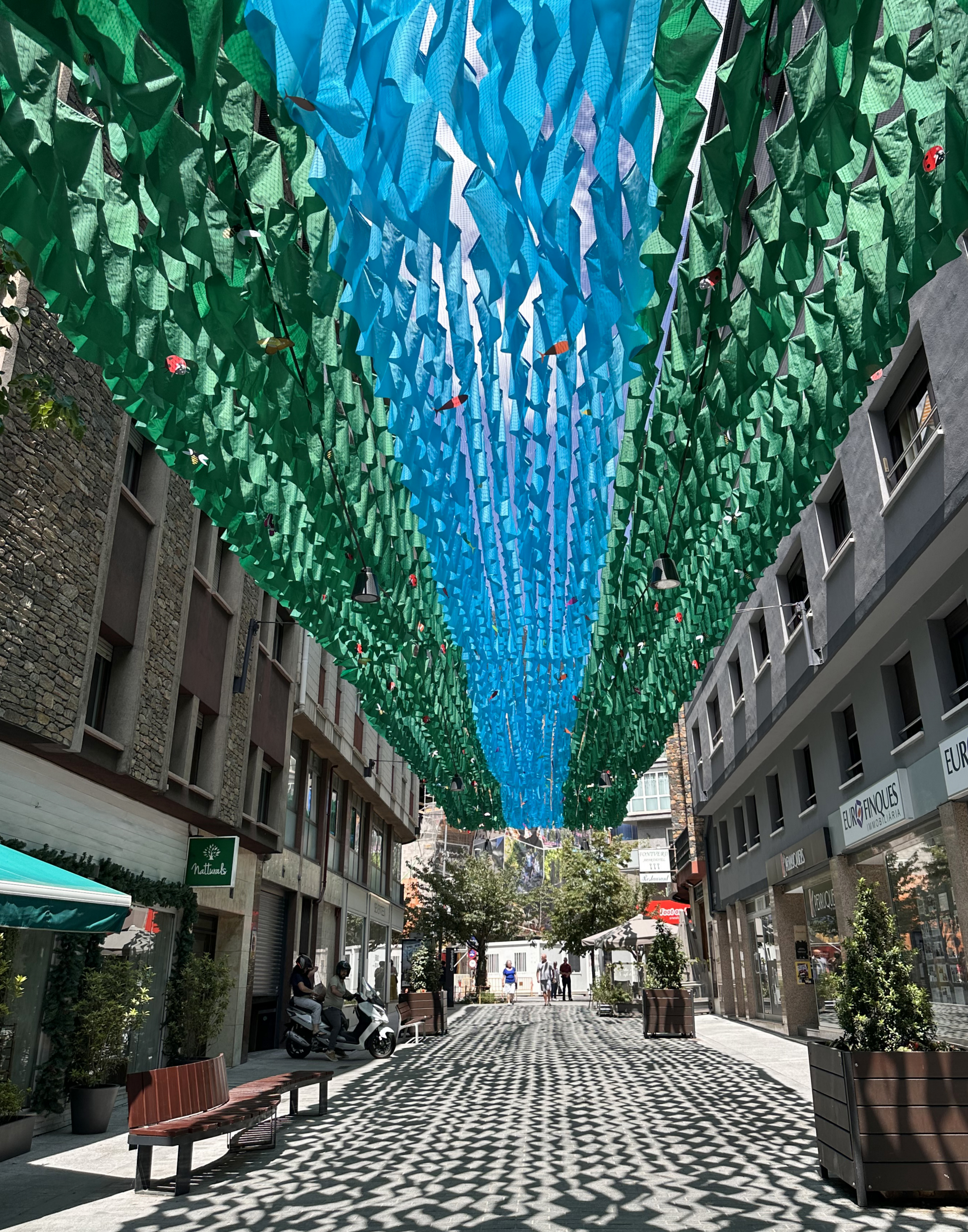
It’s a small but nice city, with plenty of art!
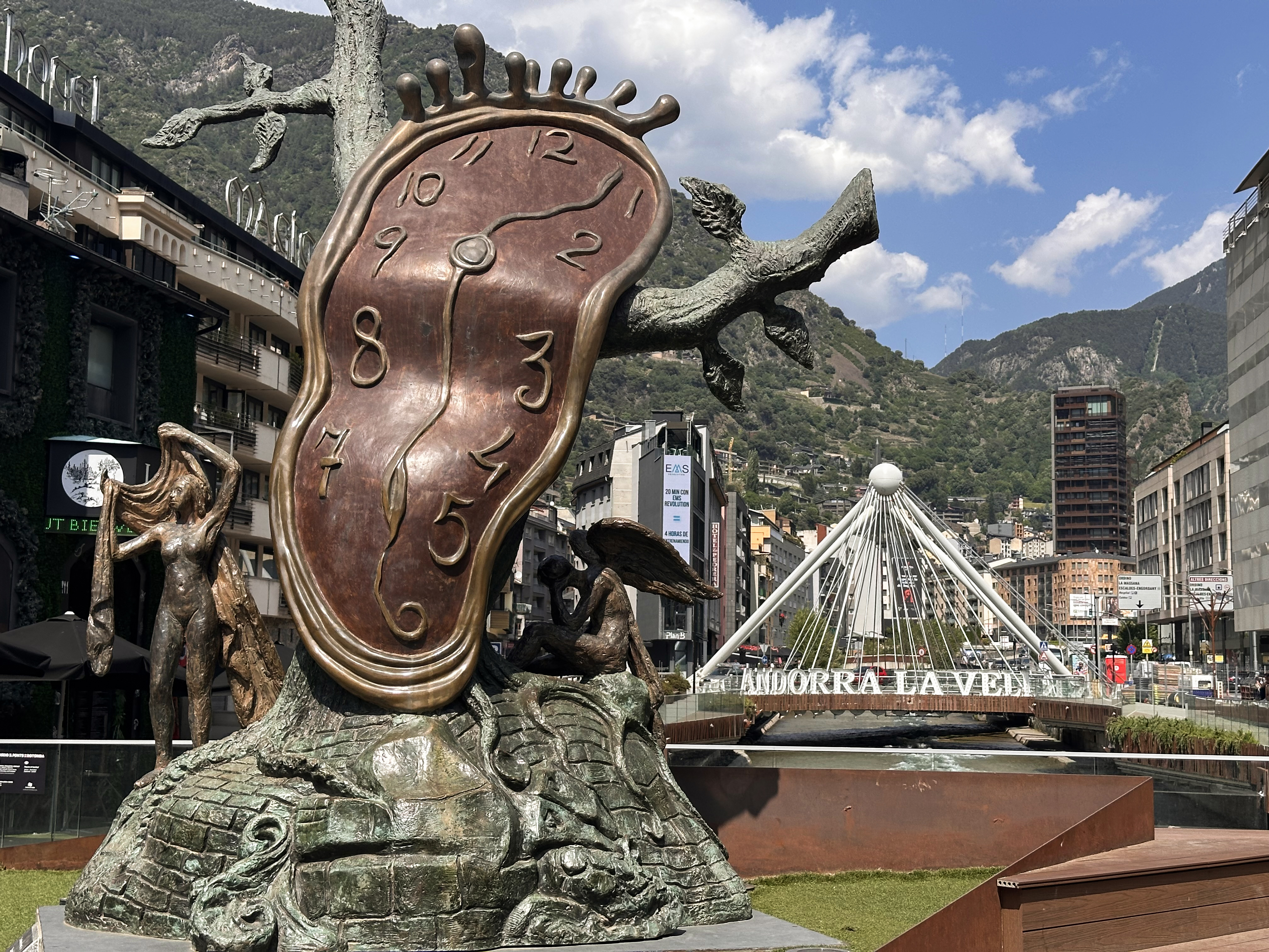
The style of the clock sculpture may look familiar, if you’ve seen the work of Salvador Dalí. If one sculpture (a real one, as it was donated to Andorra by a collector in 1999) isn’t enough for you, you can drive 3 hours toward the coast to Girona, where thousands of his works are on display at the Dalí Theatre-Museum Figueres.
Once we’d had enough of the heat wave there, we headed back up to Arinsal. I’m not sure why we didn’t think to do that sooner, because the temperature difference was significant. If you find yourself in Andorra during a heat wave, I really recommend heading to higher altitudes for some fresh air. There are some nice terraces to grab drinks and take in the mountain views.
That evening, it was already time to drive back to stay near Toulouse Airport, as my flight would be leaving at 8am the next morning.
THANK YOU ❤
Happy Halloween, and thanks for reading my thirteenth Crown of Cureope blog post! At the time I stood on the top of Andorra, we had raised $1,595 for the American Association for Cancer Research to fund lifesaving discoveries. As of publishing this post, we are at $1,685 raised of our $2,500 2025 target. There’s still a bit further to go to hit this year’s goal – any donations are appreciated!!

Leave a reply to #16: Northern Ireland (Slieve Donard) – Crown of Cureope Cancel reply