
Why Not?
Early February 2025 was when I had the first thought of doing a challenge like this. Right as I started to research the peaks on the list and plan the year…someone I’d been in touch with on Instagram for a few years, Tia (@teetravels_), posted about a summer trip through her new travel business: Why Not Adventures. It would be covering four of the peaks on my list: Golem Korab (Albania / North Macedonia), Rudoka (Kosovo, though some count it for Serbia), Gjeravica (Kosovo), and Zla Kolata (Montenegro). Why do I have 2 peaks for Kosovo on my list? The history of this region has involved a lot of fairly recent border changes (within my lifetime, at least). Given that, wherever there is any doubt about the “true high point”, I aim to do both. I might add Bobotov Kuk (many Montenegrins consider it their real high point, as it sits fully within Montenegro, similar to Gran Paradiso in Italy), among others. Golem Korab is a 2-for-1 anyway, so this still made it 4 peaks and 4 countries for this itinerary!
My first thought was how nice it would be to meet up with Tia and other hikers on one or more of these summits. After looking into her trip in more detail, my next thought was: solo logistics (especially to do 4 peaks in 10 days, even with other activities mixed in) and bear risk for the Balkan peaks isn’t ideal. I officially signed up that same month! With the first trip of the whole challenge booked…I was committed. (: Little did I know that I’d have ticked off 19 summits before August!
On August 2nd, 16 hikers from 6 countries met in Tirana, Albania, with the Balkan heat wave still going strong. It was only 2 days after I’d returned from Moldova, and my London activities consisted of unpacking, packing again, and getting a small surgery on the opposite toe from pre-Romania (that one was mostly healed). 24 hours before my flight, I still didn’t know if I’d be able to go, as it was dependent on how extensive the additional procedure would be. Thankfully, all went well, and I hopped back east to continue the adventures.
Tirana to Ohrid
The group met up for lunch in Tirana before piling into the van for a 2.5-hour drive to Ohrid. This turned into 4 hours, as the border crossing took an hour and 36 minutes (yes, I timed it). This is something to keep in mind for your Balkan travels and when planning your bio breaks. There wasn’t much time left for Ohrid exploring that evening, but we took a nice walk along the lake to our dinner spot before heading back to the hotel. We more than made up for it the next day!
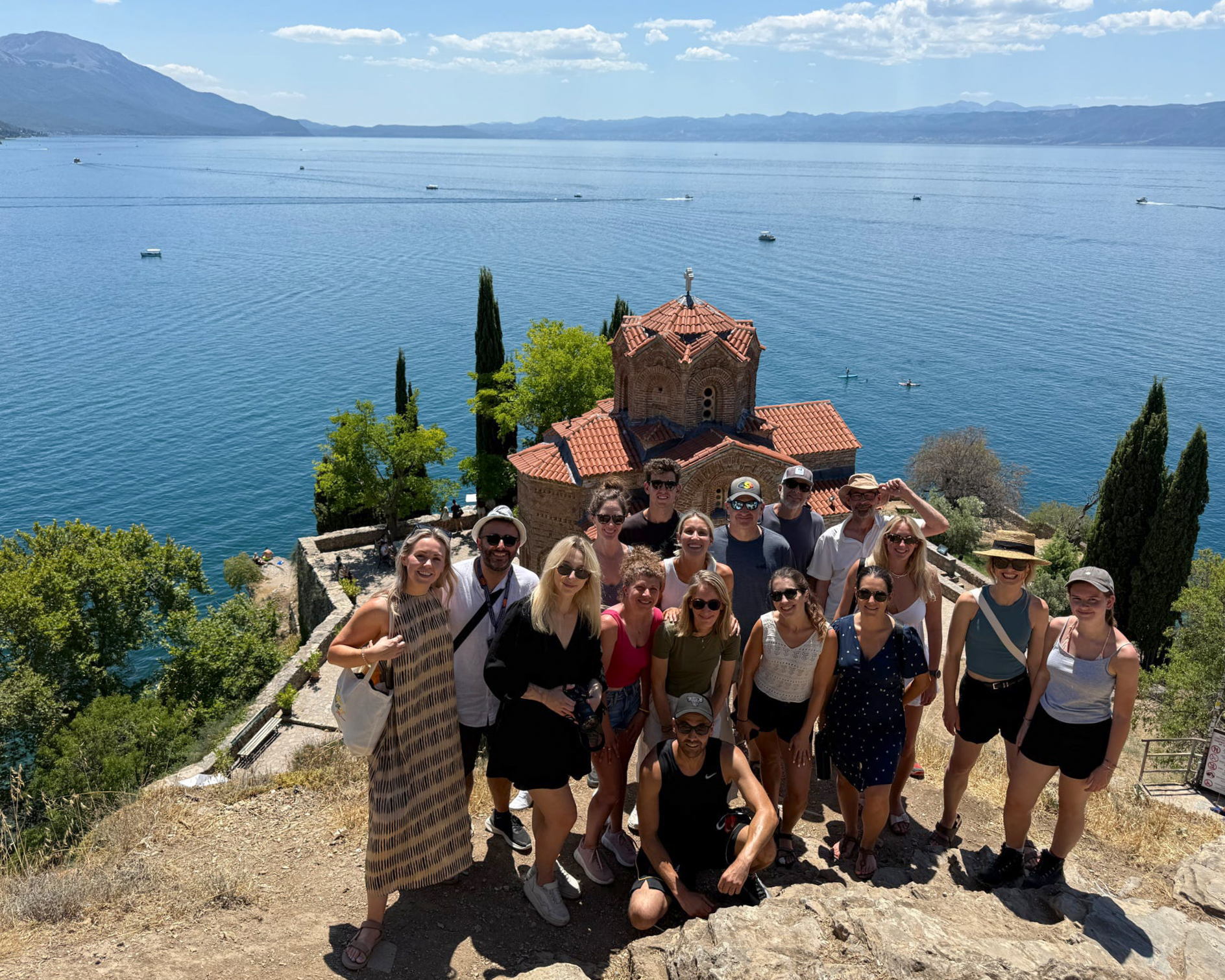
In the morning, we walked down the road to breakfast, along the lake. After loading up the van again, we met our guide for our first activity of the trip: a walking tour of Ohrid! (:
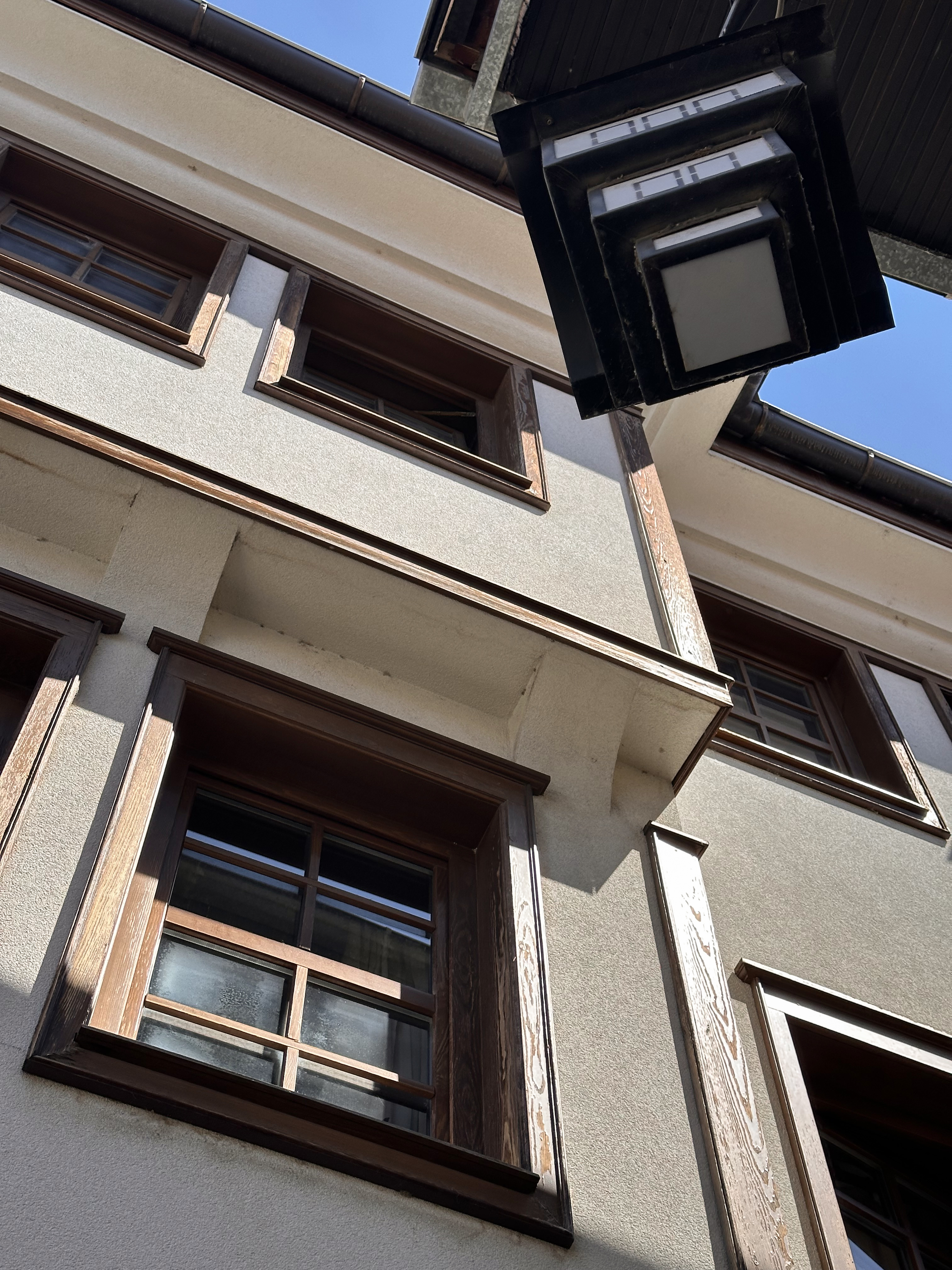
The town isn’t that big, but that says nothing about the history behind it. Lamps that I might have otherwise just walked past and thought “nice style” actually mimic the structure of buildings in Ohrid. They were built wider at the top to maximize living space over the walkways below.
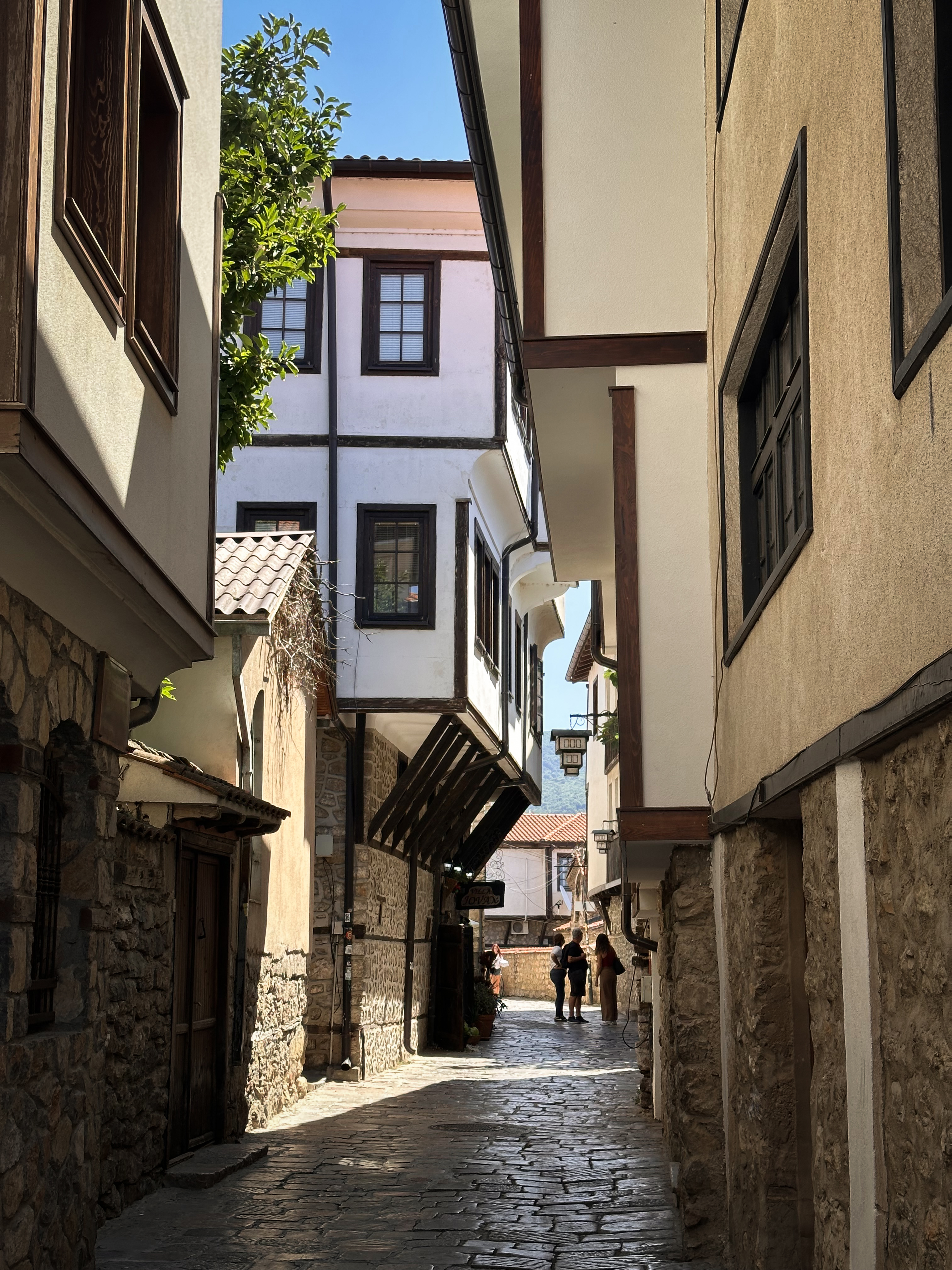
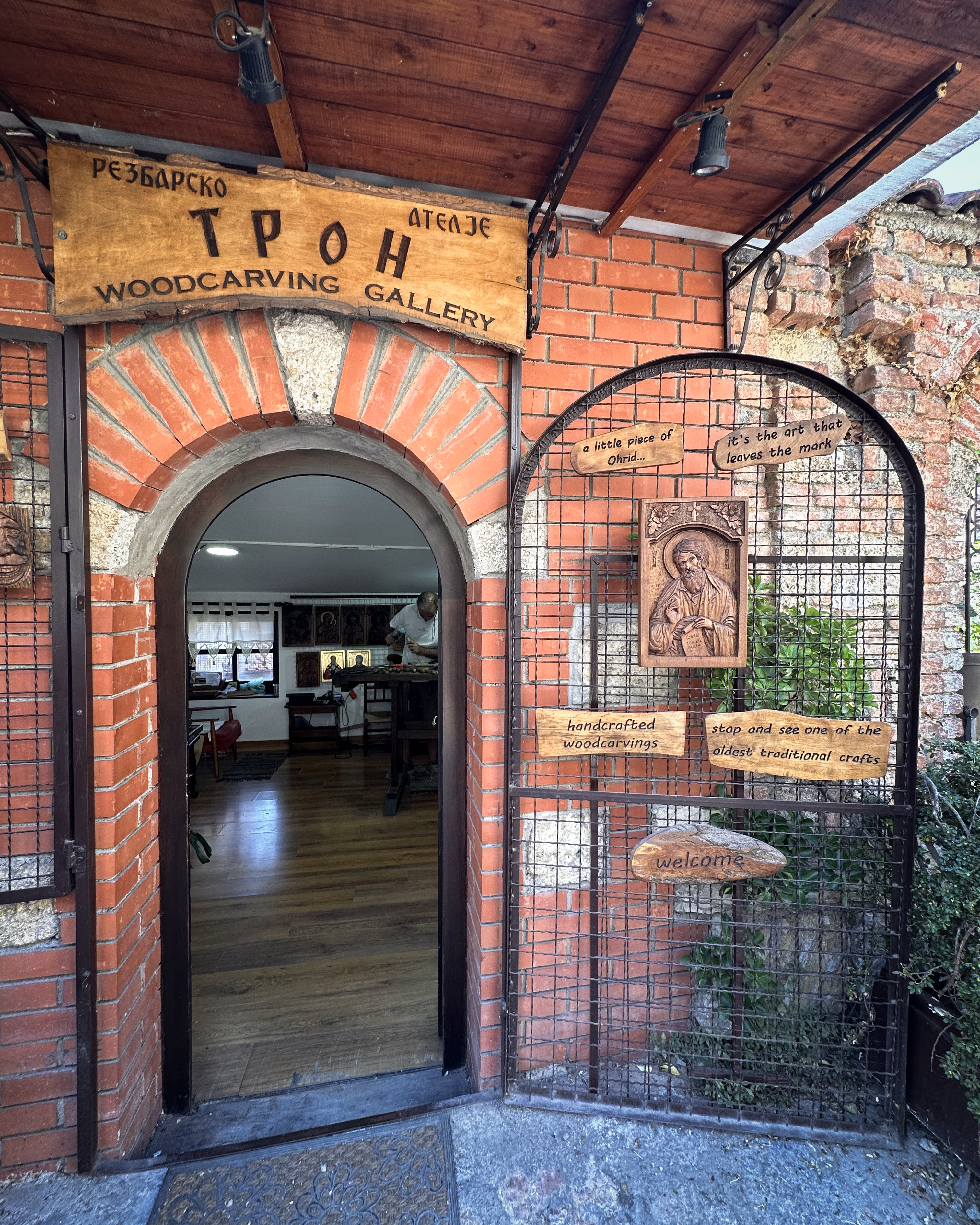
Our first stop was a shop selling Ohrid pearls. These aren’t normal pearls, as they’re not from oysters. They’re made from shells shaped into beads and coated with scales of Lake Ohrid’s Plashica fish. It’s a tradition unique to this region, along with other crafts passed down through generations. These include papermaking and woodcarving. We were able to see these artists at work in each of the shops below!
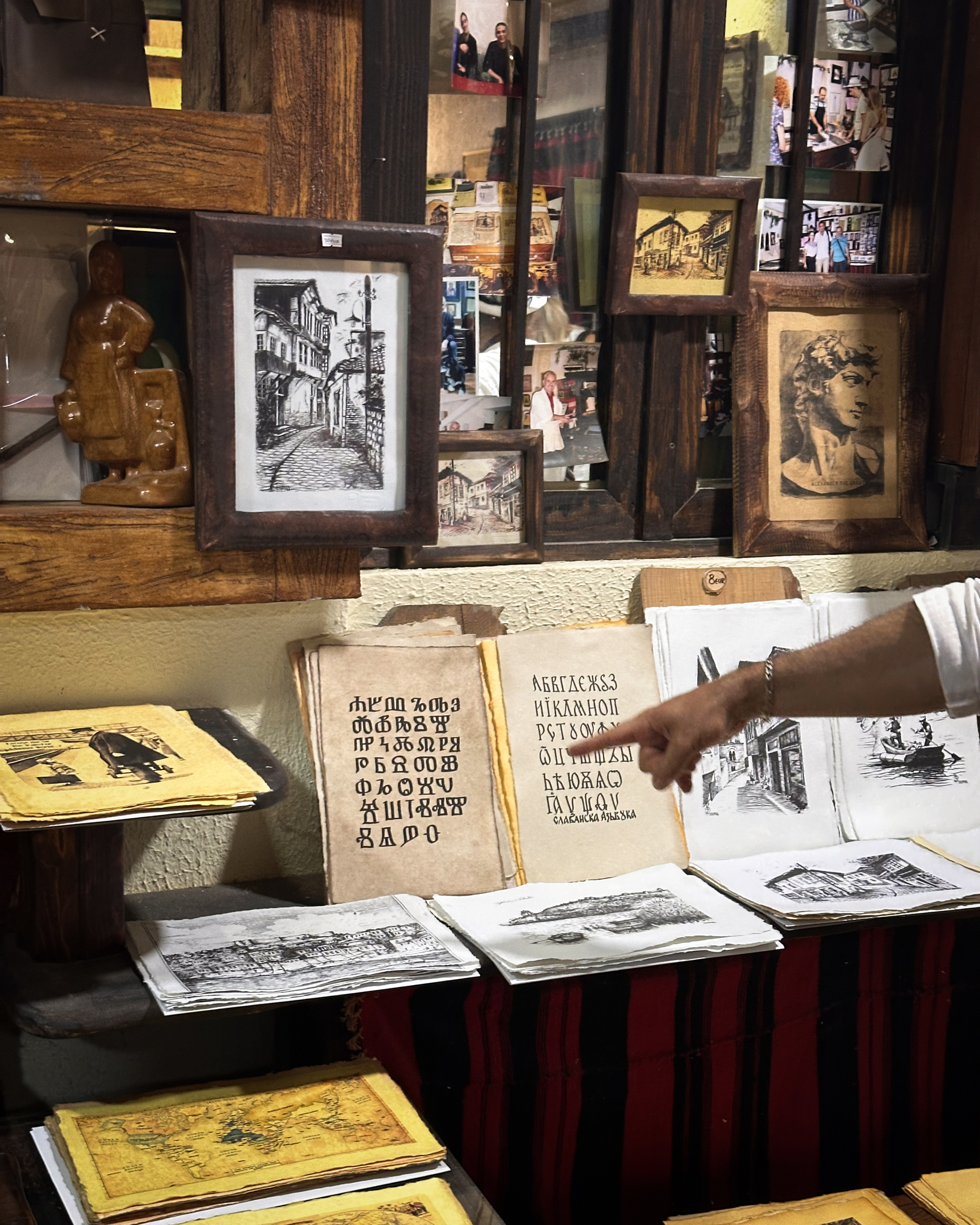
At the papermaking shop, we learned about the history of the Cyrillic alphabet and its ties to Macedonia. Our guide then took us up a hill to some beautiful overlooks. The heat made it feel a bit like training for the next day’s hike, but we’d be approaching the water soon…
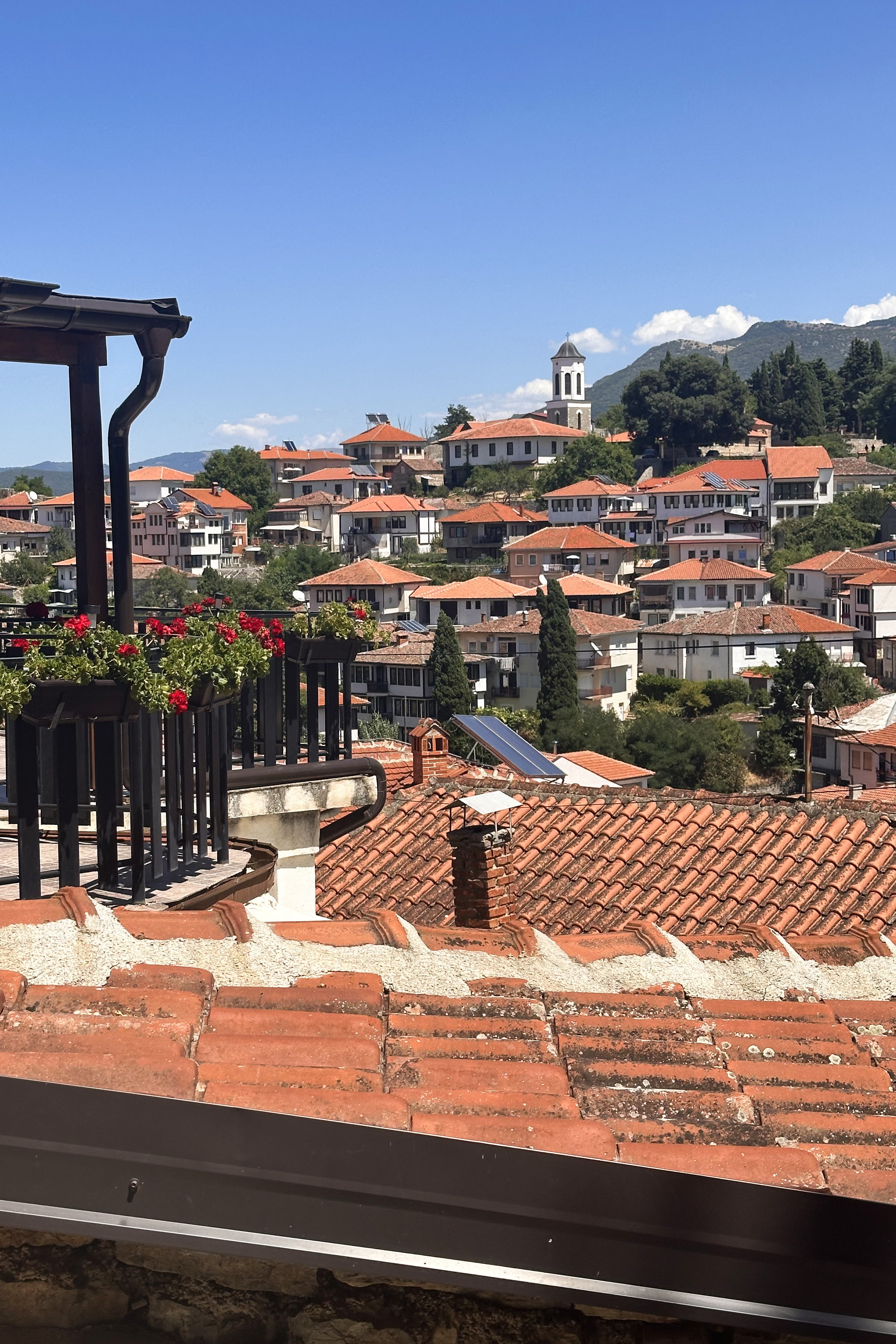
Finally, we arrived at the last stop of our tour: the Church of Saint Jovan (John) the Theologian at Kaneo, built in the 13th century. It’s not even the oldest church in Ohrid…that’s the Church of Saint Sophia, which was an earlier stop on the tour (with turtles on the lawn!). I cannot find any consistent information about when that one was originally built. Ohrid itself is one of the oldest human settlements in Europe, with archaeological remains dating back to the Bronze Age. The lake has been a target of conservation efforts, as it has 17 native fish species, 10 of which have not been found anywhere else. In 1979, it was added to the UNESCO World Heritage List.
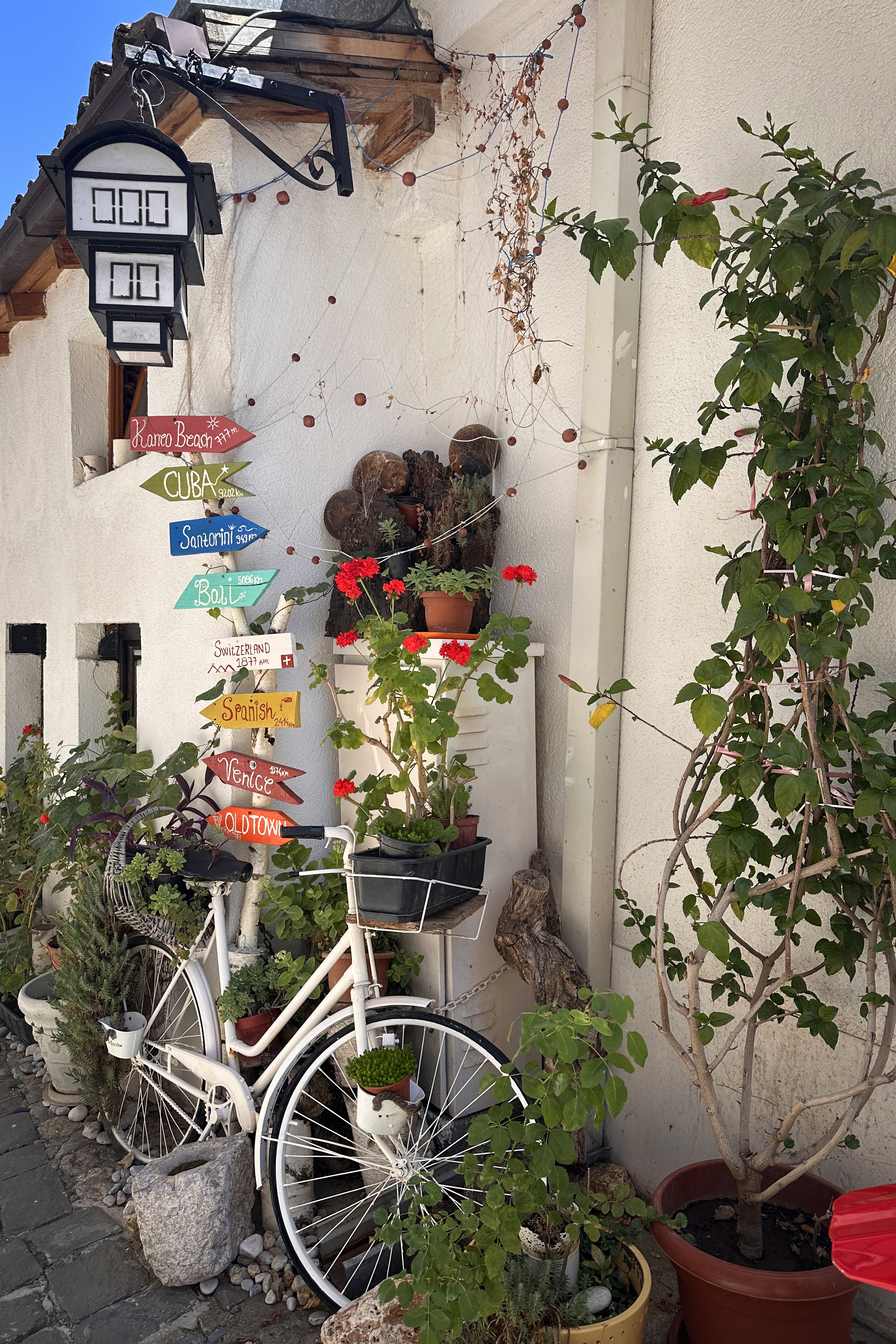
After the tour ended, the group split off into more-hungry-than-overheated and more-overheated-than-hungry. The former group (myself included) went back to the town in search of food, while the latter stayed near the church to swim. There are some nice food options in Ohrid, including vegan and gluten-free! After food, we still went back for a dip before it was time for everyone to meet back at the van. Then, we headed back across the border to our next stop: Radomirë, to a hotel right across the road from the trailhead for Mount Korab.
The Hike
We set off at around 8:30am on a beautiful August morning. My recording of the route is below:
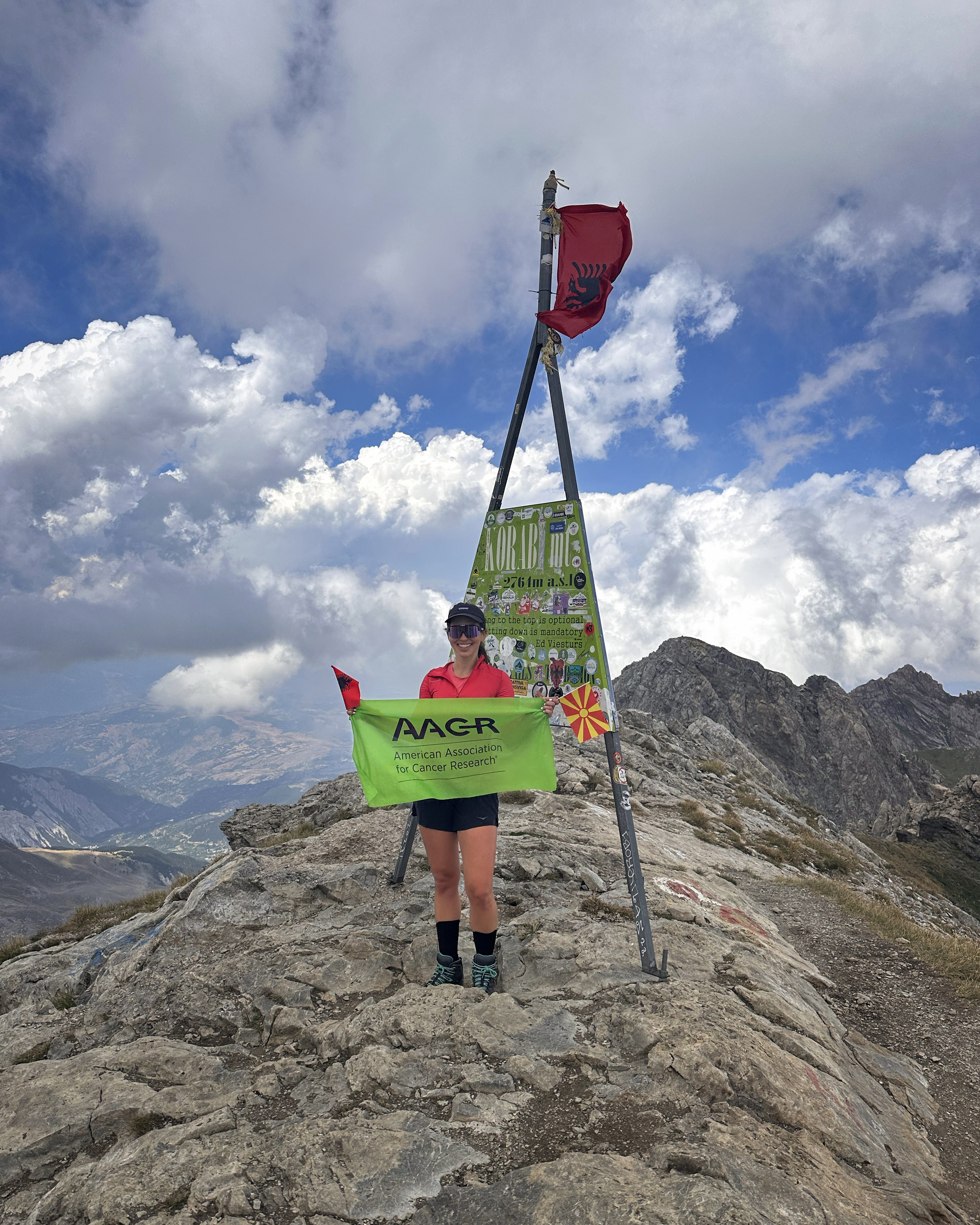
As you might notice above, there was a bit of a glitch about 3/4 of the way to the peak. AllTrails thought I was abandoning the mission, I guess. Anyway, comparing it to another recording from the group, the true stats seem to be: 17.7 kilometers of distance and 1,500 meters of elevation gain, round trip. Moving time was 6 hours and 15 minutes, with apparently over an hour of breaks, bringing total time to 7.5 hours. For a group of 16, not too bad! (: And then there’s Adrian Mazur…current Guinness World Record holder for the whole Crown of Europe as of this year (61 days), who knocked this out in 3.5 hours (including ~25 minutes for photo stops).
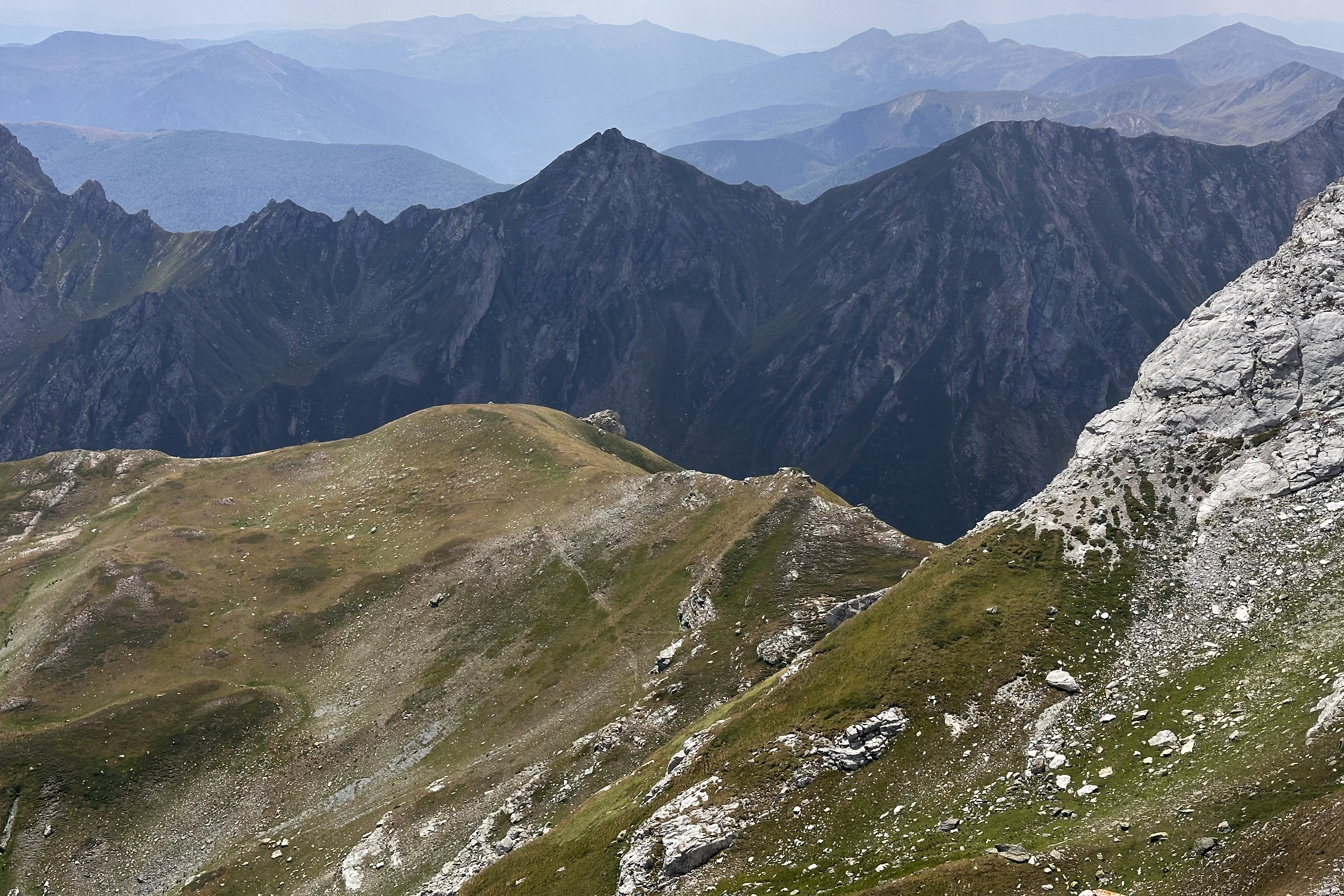
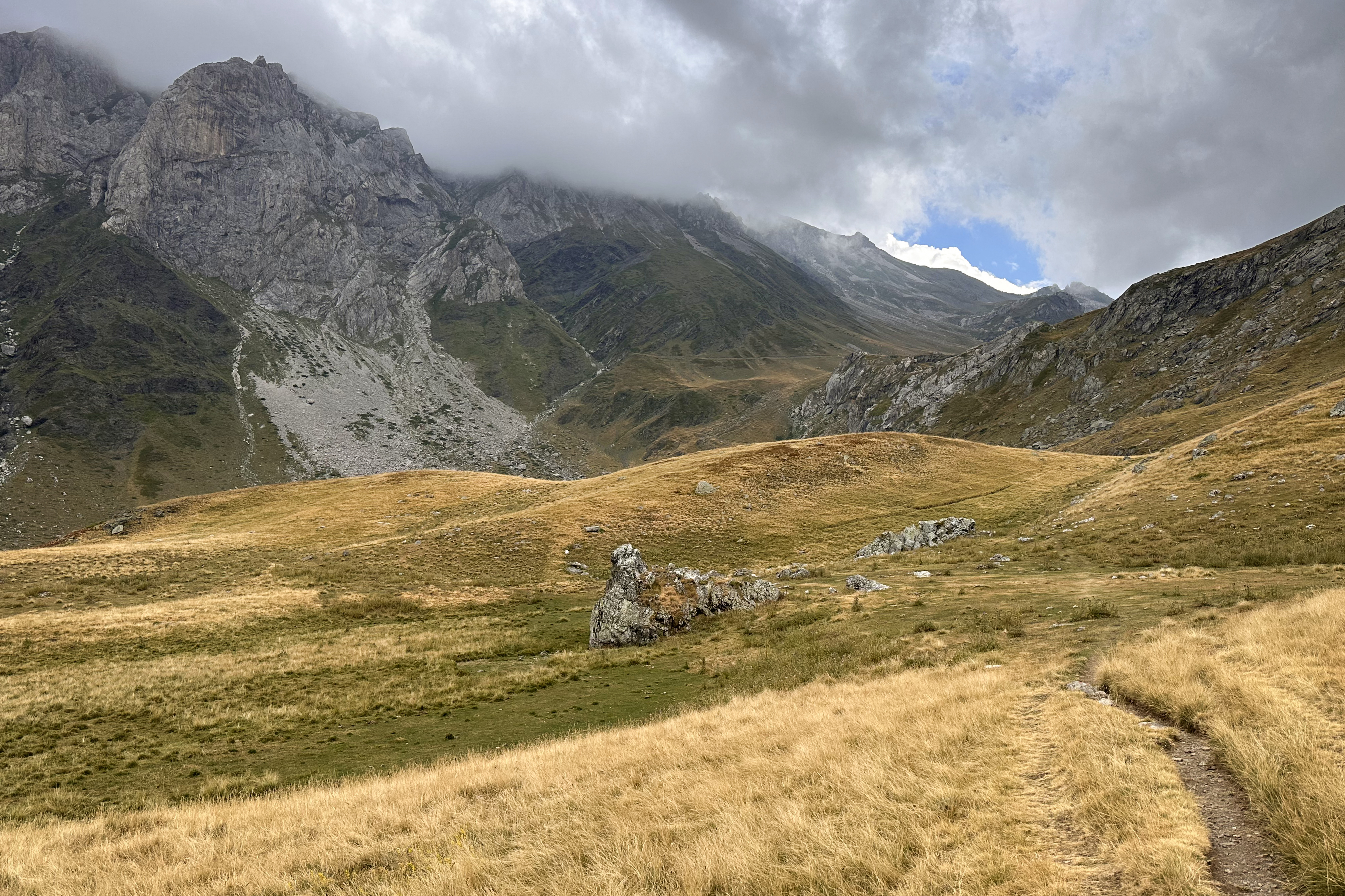
Our guide, Vuk, led the group through rolling hills and steeper sections of ascent. The summit was in view for most of the way up, so the views didn’t change too much until we came to a pass, which opened up some panoramic views:
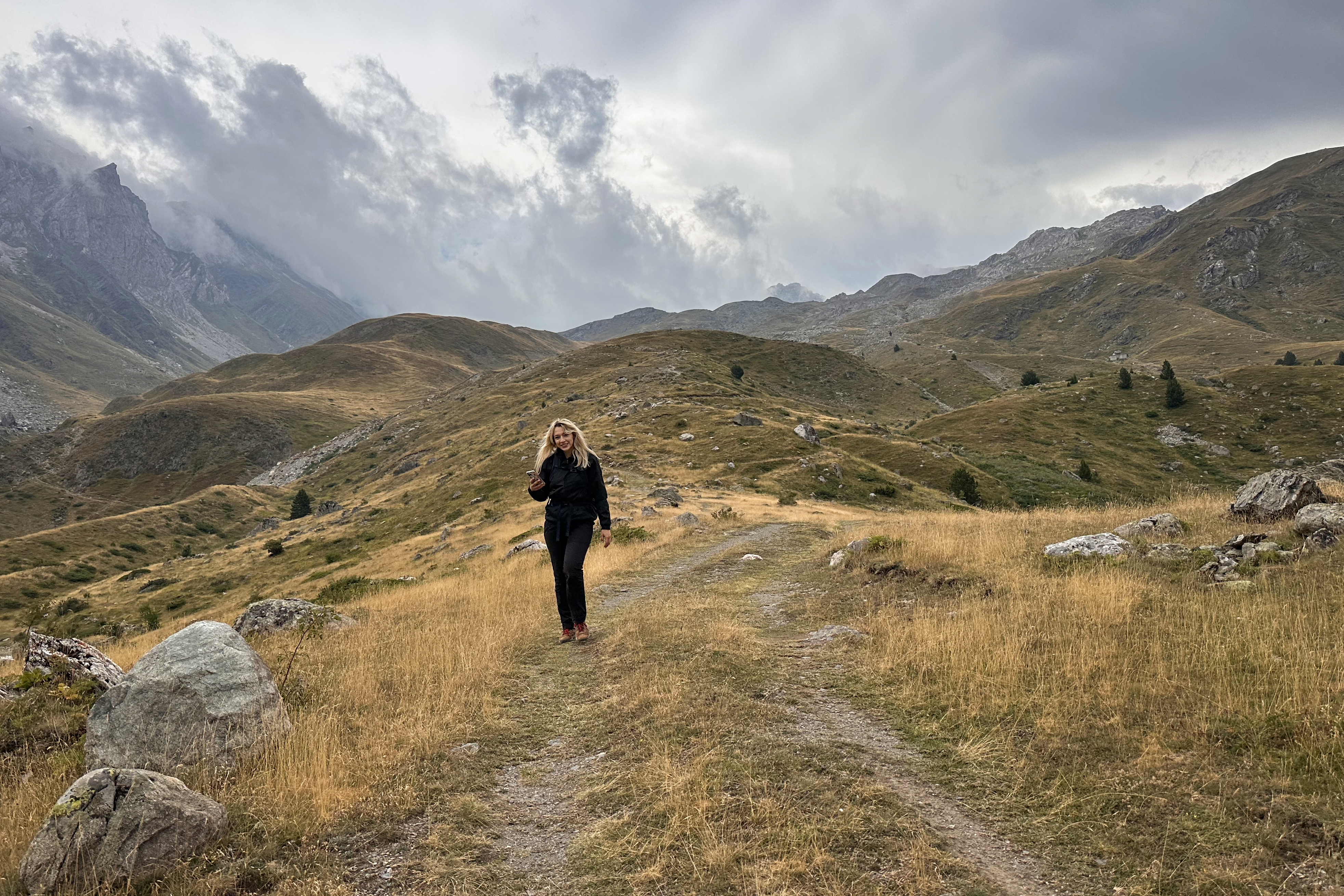
Photos of the earlier parts of the trail are included below (the way down), as it’s an out-and-back. I didn’t take too many photos on the way up, and the lighting was a lot cooler on the descent, anyway. (:
The group had taken a longer break at the spring not far below the pass, but Imogen and I wanted to keep moving (we were the two semi-injured people on the trip at this point, as she’d broken her foot just weeks before). Ben joined us, and we waited for a bit at the pass.
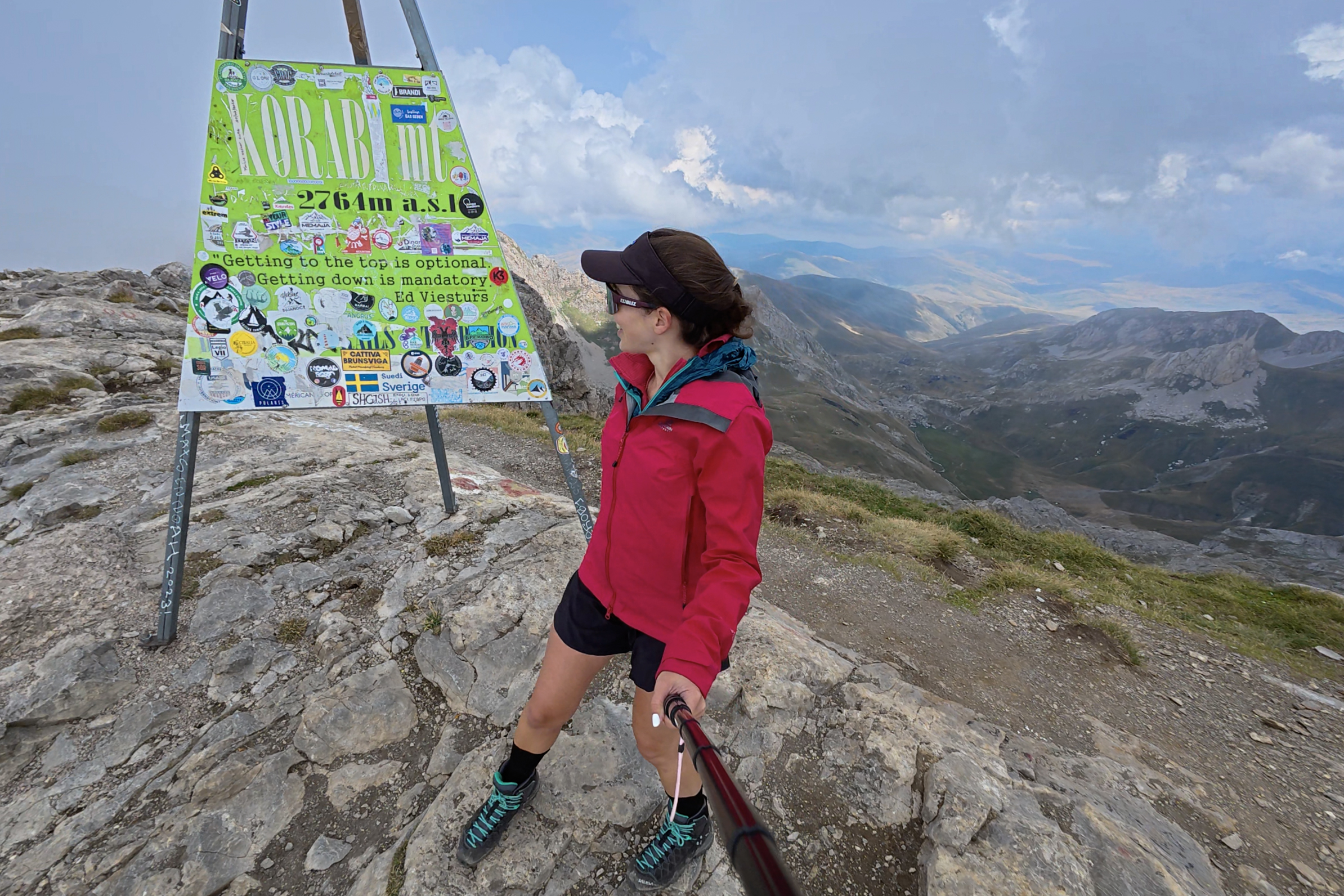
If you read my Germany and Romania blog posts, you might remember that Windy is my new must-use app for any hike. For this one…a few models had been showing some thunderstorm risk from around 1pm, likelier from 2pm. I knew going into the day that my downhill pace would be slower with the toe situation. From the pass, Sara joined me for last quick push to the summit, getting there in under 20 minutes.
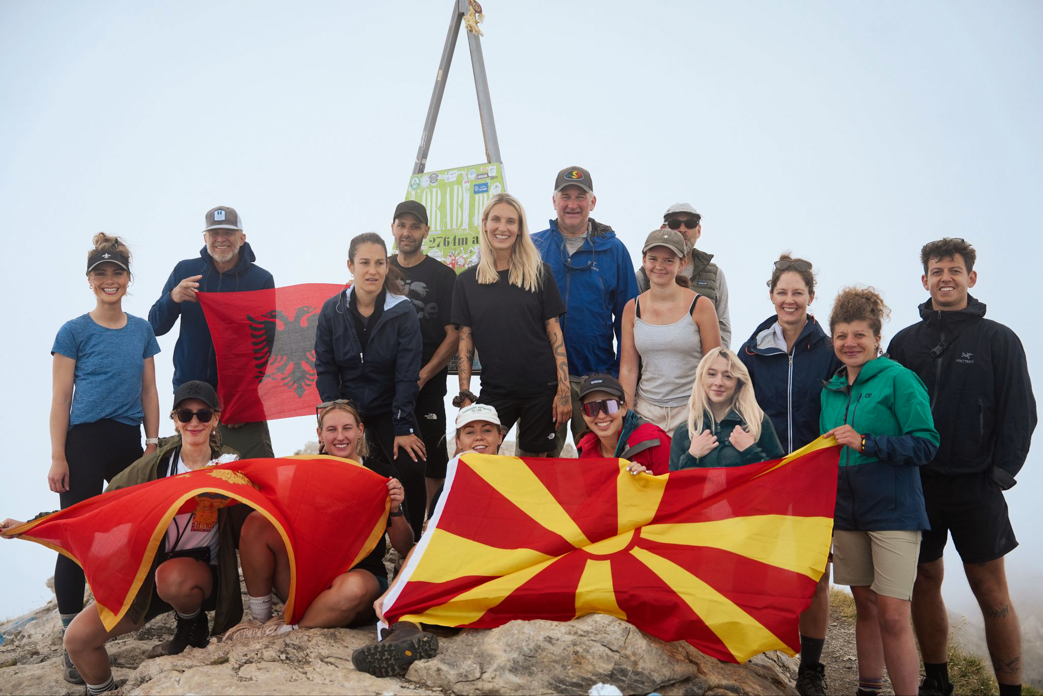
We arrived right at noon, so it had been 3.5 hours to the summit. My plan was to quickly snap some photos and head right back down again, while the rest of the group took a lunch break and their own photos. Just as I wrapped up the footage and the others arrived, clouds enveloped the summit.
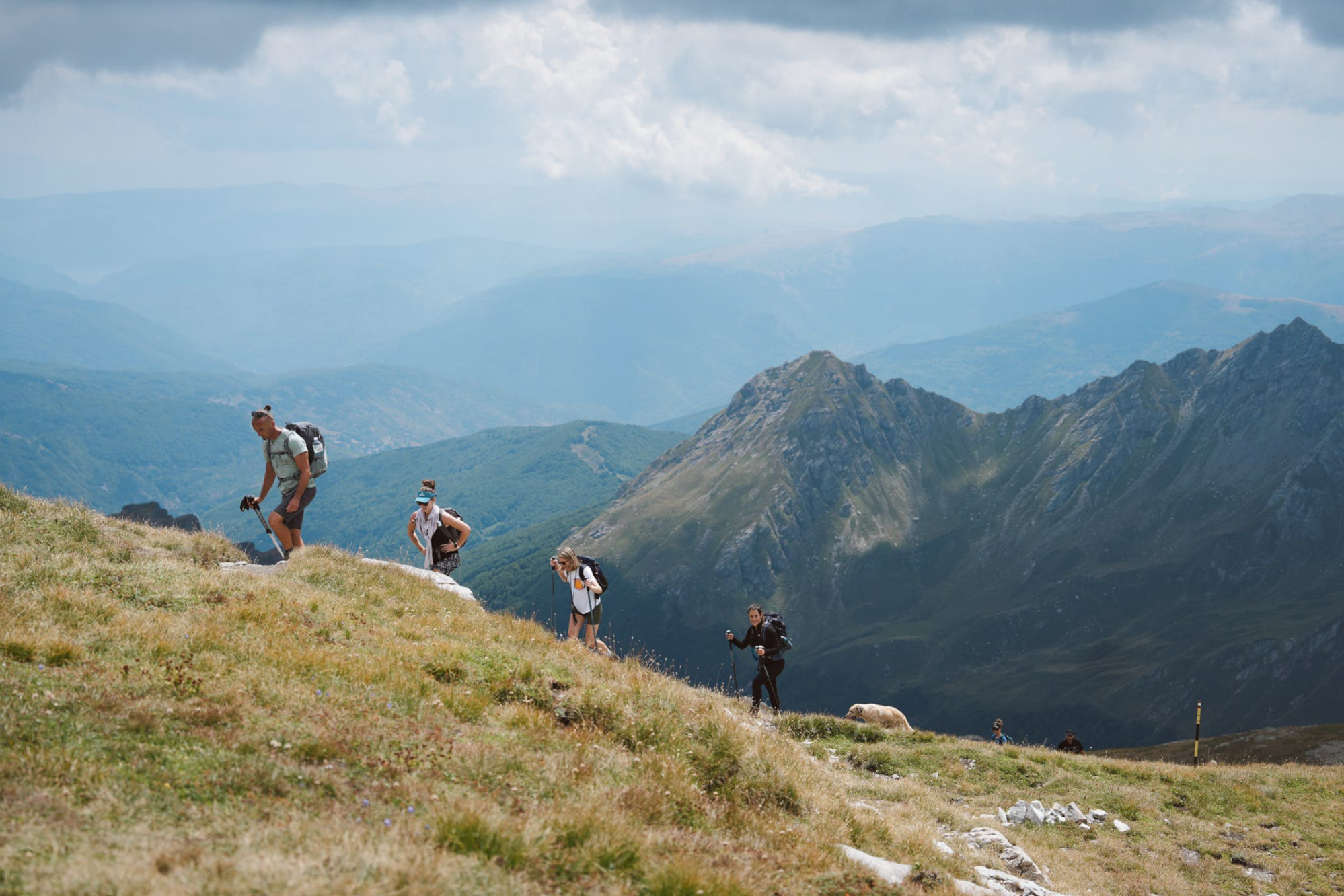
See the dog in the photo above? It turned out that it had just taken James (@summit2do_adventure) and his group up the mountain before us. I only knew James through Instagram, and we didn’t recognize each other- only later, after realizing we were up there the same day (check out this post of his), did we connect the dots that we’d briefly met along the trail. It’s a small world out there with the Crown of Europe!
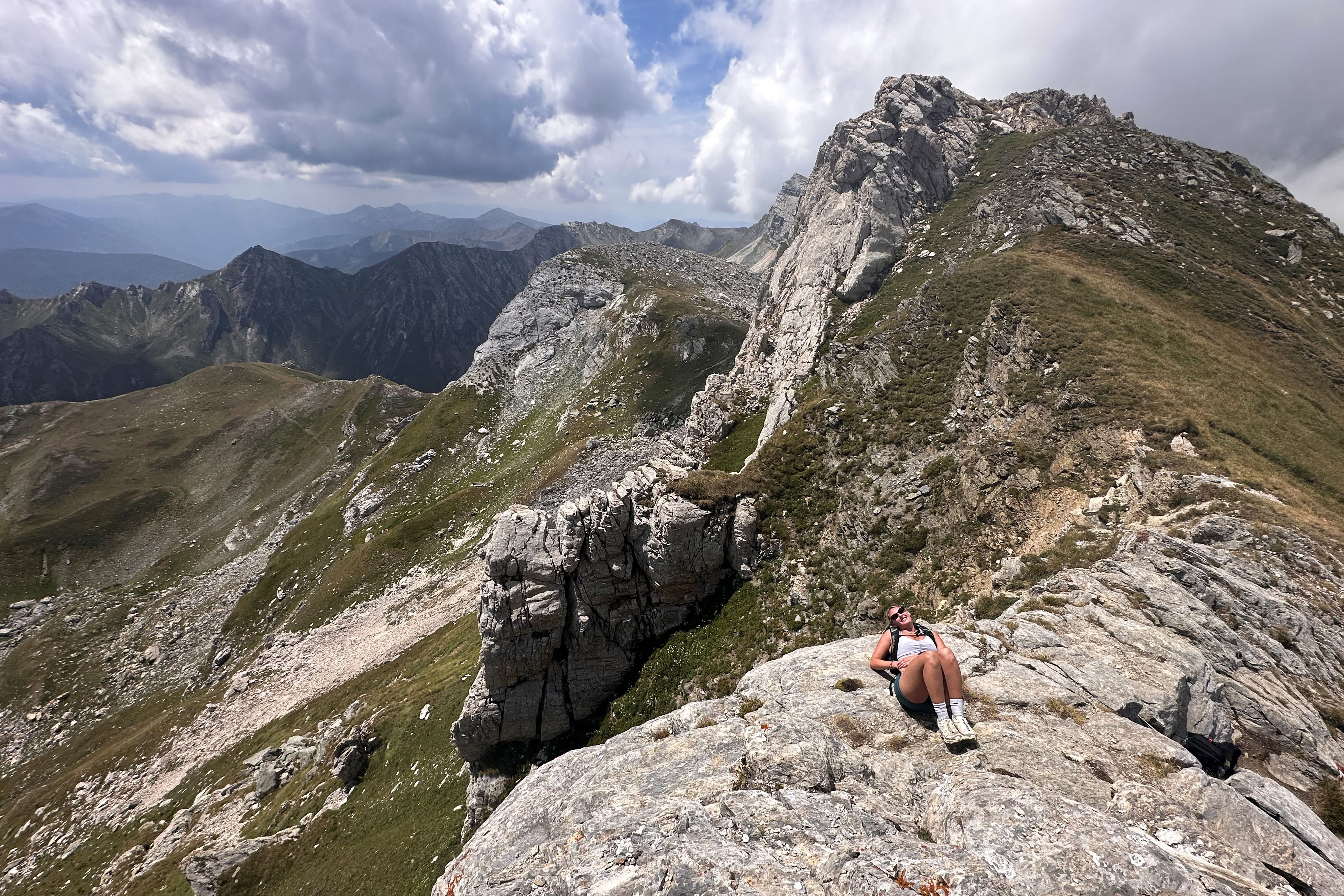
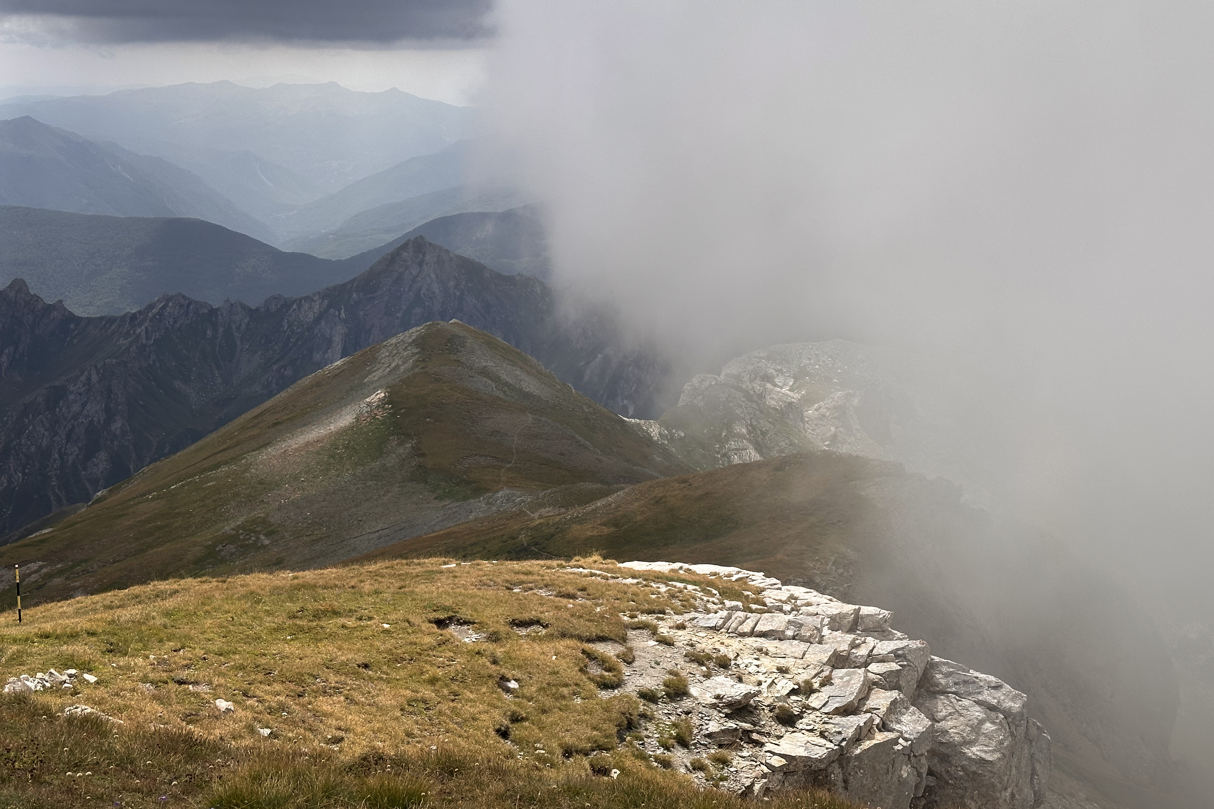
Once everyone arrived at the summit, we took a quick snap together, after which I started my slower descent with Ben, Sara, Imogen, and Craig. If you don’t remember my summit photo, scroll up to the top of this post to see just how quickly the skies changed in the short time I was up there (the photo just above already shows the fog rolling in)!
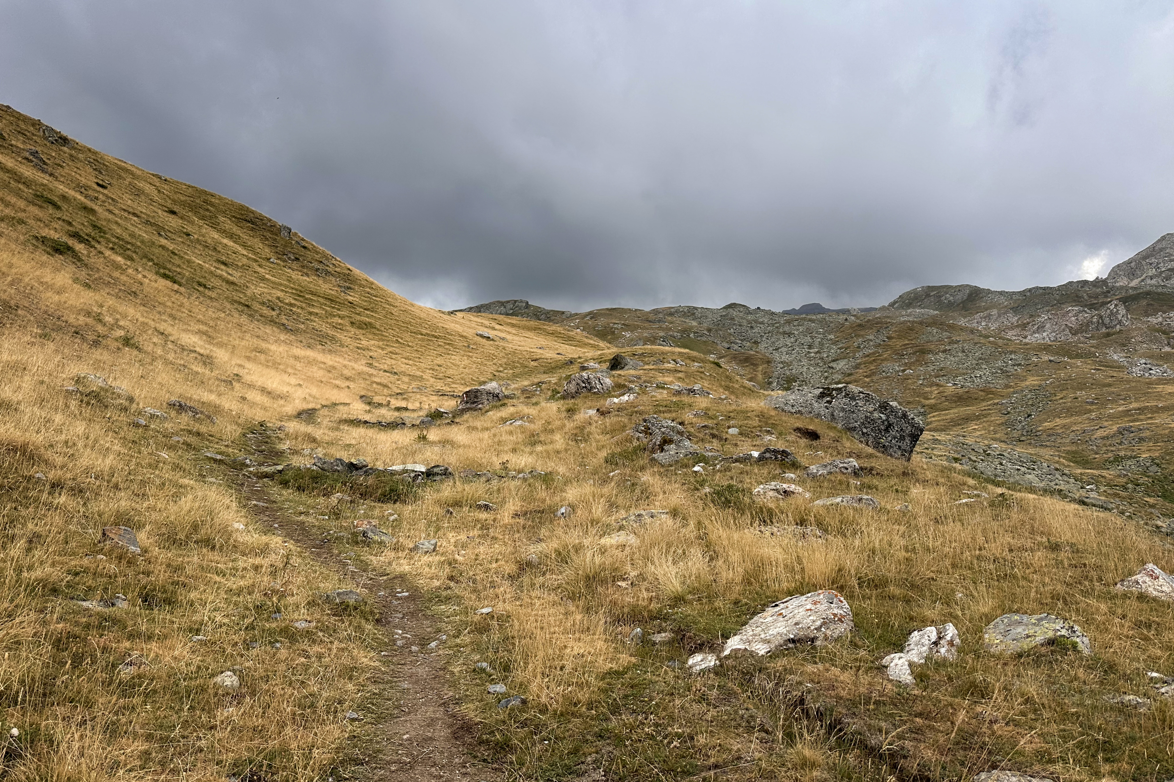
As much as clear skies would have made for a less stressful descent…you really couldn’t ask for cooler lighting. So beautiful!


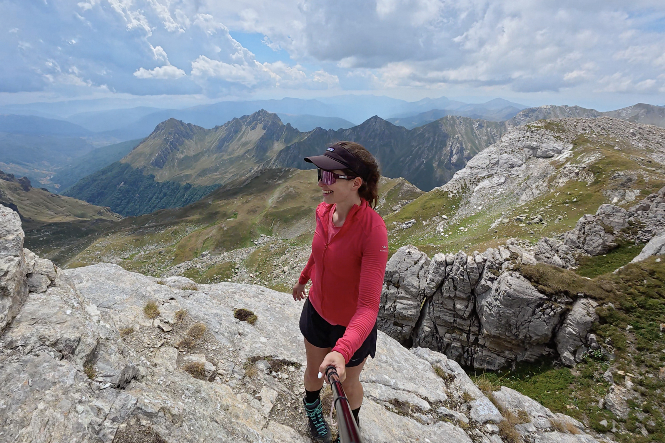
Fully expecting the skies to crack open any minute, I had donned every piece of my rain gear before leaving the summit. It was really cold up there! Somehow, though, the main storm front seemed to be stuck on the other side of the pass, building but unable to break across.

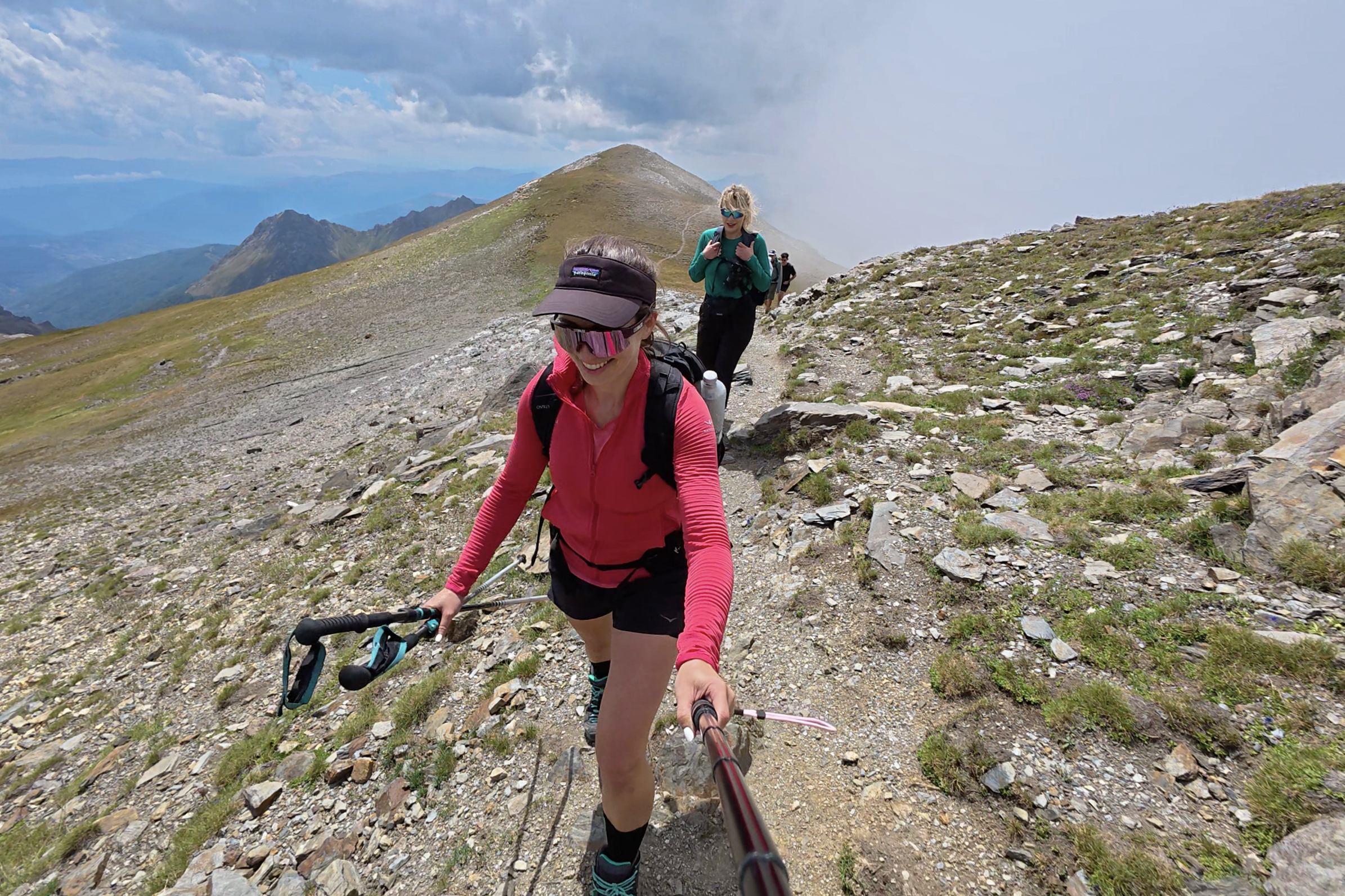
My absurd backwards technique was actually faster than expected. It was also a de(s)cent workout, so the rain gear had to come off again pretty quickly. Even with the clouds, it was a warm day. Very soon, we were back on the pass and descending into the valley. The sky continued to darken.
Partway across the valley, we heard the first rumblings of thunder. There isn’t much shelter on this trail, even below “treeline” (there aren’t many trees), but it was clear that this wouldn’t be an Alps-speed storm. We’d make it back before it hit. There was a group of guys just starting to head up, oblivious to or unbothered by the sky.
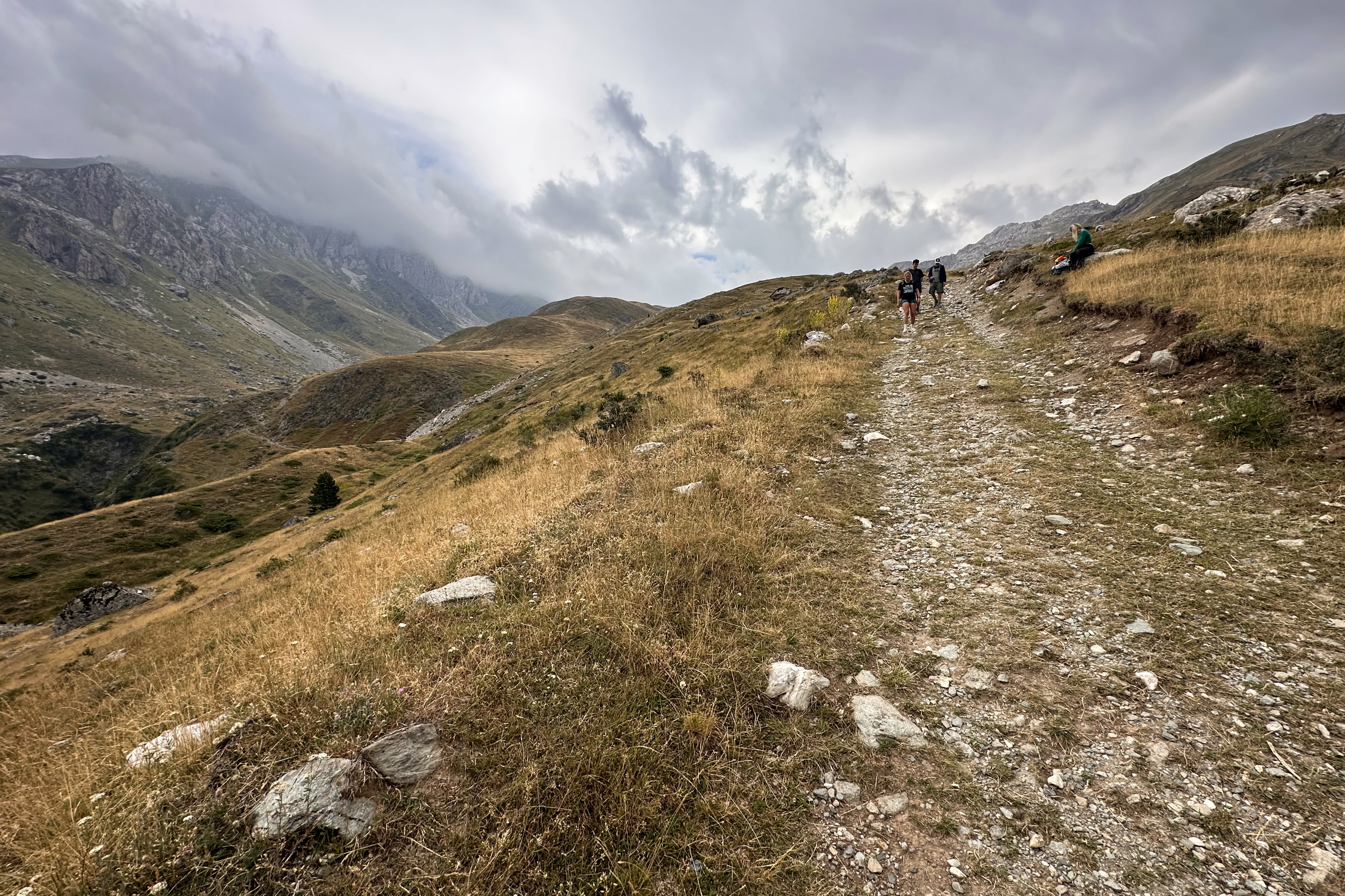
We still couldn’t see the rest of our group anywhere, though. Near the end, we took more breaks, and they finally came into view. We all made it! (: 5 minutes before 4pm, we were back at the hotel rehydrating and refueling. Not even 30 minutes after that…the skies opened. The storm was operating on Balkan time, thankfully.
Onward to Kosovo
From Radomirë, we headed across another border into Kosovo. Since this was a 10-day trip covering a lot of ground, it meant never staying in one place for too long. Tonight, however, we checked into a wonderful spa hotel in Prizren, where we’d be staying for 2 nights. Tia really did an amazing job keeping the trip reasonably priced and finding gems like this. The next day, we’d hike Rudoka and return to relax at the same hotel. Unfortunately, that hike did not include a summit (more on that in the Kosovo blog post). Fortunately, Kosovo is a beautiful and very affordable country, so I’m actually looking forward to returning to tackle Rudoka again! (:
A Final Stop in Tirana
The plan was always to end the trip back in Tirana, where we’d begun. I ended up there a few days ahead of schedule, after a toe infection took me on a long off-roading journey out of the remote mountain village of Doberdol, in Albania. Videos of this are therefore in the Albania highlights on Instagram, since it was mostly within Albania (with some brief crossings into Montenegro and Kosovo, as it’s near a tri-country border).
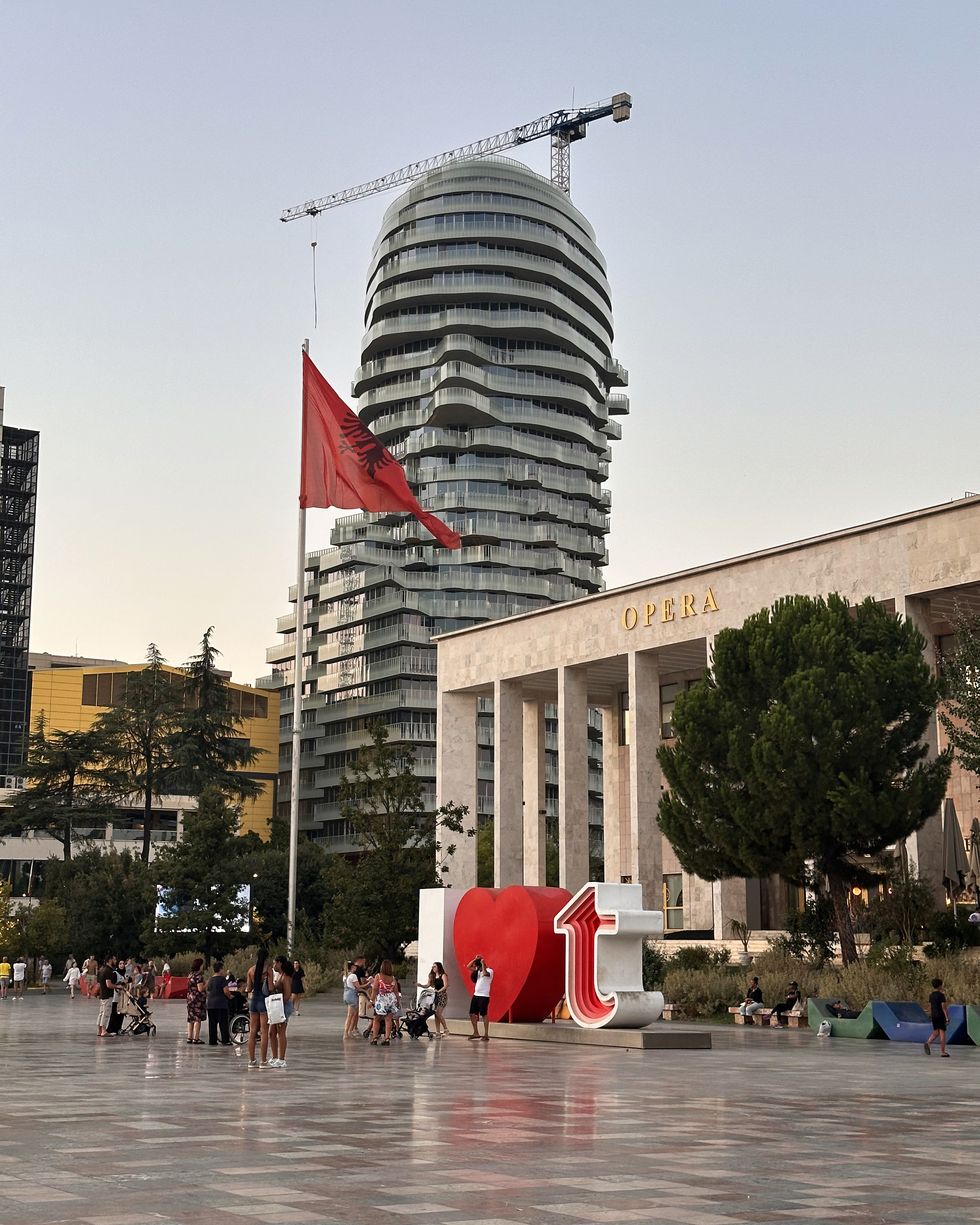
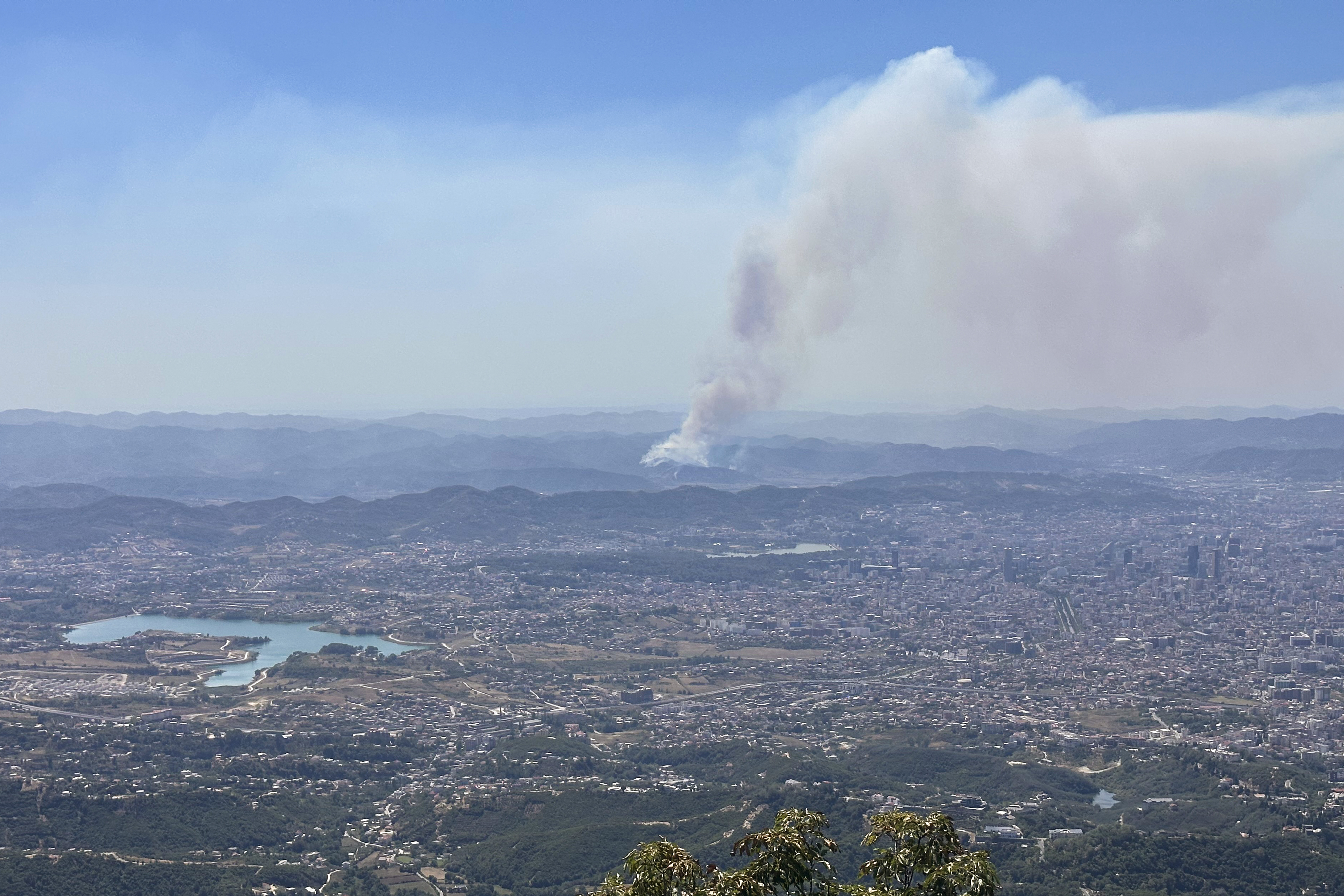
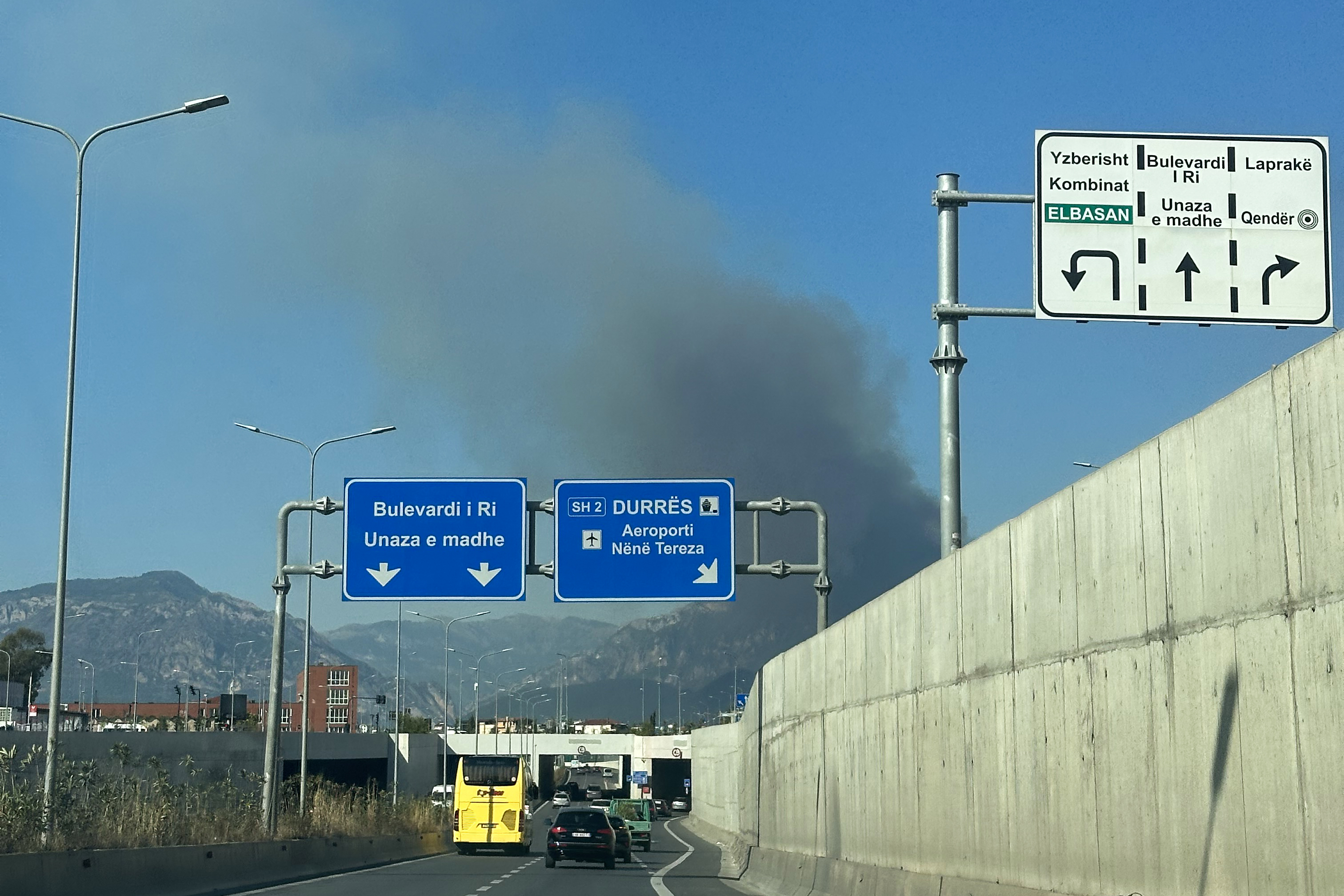
In Tirana, I contacted my doctor back in England and changed my flight to be seen on Monday. This meant I had one final weekend in Tirana, which was mostly spent resting in air conditioning while the Balkan heat wave and wildfires raged on outside.
I did manage to see a bit more of the center; like Bucharest, rideshare options were pretty cheap here. Big names like Uber and Bolt don’t operate there though (as of this post), so I was using an app called Patoko, which had launched less than 3 years earlier. It felt more like 3 months earlier, as I was matched with the same driver on multiple occasions. It lives on in my memory as the potato app.
THANK YOU ❤
Thanks for reading my TWENTIETH Crown of Cureope blog post! At the time I stood on the top of Albania and North Macedonia, we had raised $1,620 for the American Association for Cancer Research to fund lifesaving discoveries. As of publishing this post, we are at $2,525 raised of our $2,500 2025 target. It’s a nice number to end on, with a lot of “25s” this year: the year itself, 25 high points completed, and the donation total with a double 25. As beautiful as that looks, contributions are still very much appreciated! (: If you’d like to wait until next year, the campaign continues until all peaks are completed, so there’s still plenty of time. Thank you so much to everyone who’s helped us reach the fundraising goal, and to everyone who’s helped me reach my peaks goal. I set this as a solo challenge initially, so I never expected to meet so many amazing people along the way. I’m excited to see what 2026 brings!!

Leave a reply to #22: Poland (Rysy) – Crown of Cureope Cancel reply