
(photo by Nicole)
From “2 Countries, 1 Peak” to “2 Peaks, 1 Country”
The previous post about Albania and North Macedonia involved one peak (Korab) covering two countries. Partly to make up for that, partly because of discrepant definitions of Kosovo’s “official” high point, and partly because they are both amazing peaks, I’ve decided to have Gjeravica (highest on Albanian side of Kosovo, at 2,656 meters) and Rudoka (highest on Serbian side of Kosovo, at 2,660 meters) on the list. They differ in height by only 4 meters, anyway!
Many people who complete both Rudoka and Gjeravica in this challenge do so because Rudoka can also be considered the highest point of Serbia (replacing Midžor, my 23rd peak). I will stay away from the politics of this and just include facts: the United Nations does not officially recognize Kosovo as an independent state, while over 100 UN Member States individually recognize it as such. States recognizing it include the US and Ireland (my two countries of citizenship), the UK (my country of residence), and most of Europe (and this is a Europe-focused challenge). For these reasons…I refer to it as a country.
Part of the reason I signed up for the trip with Why Not Adventures (more about this in the previous blog post) is that Tia included both of these peaks in the itinerary. While all four of the peaks on this trip are doable solo from a technical and navigational standpoint, hiking in the Balkans does involve more frequent “wildlife encounters” than many other parts of Europe. In fact, I have not heard of a single person completing Zla Kolata (Montenegro) solo without some sort of run-in with a bear, wolf, or unidentifiable animal sounds. Large groups are a pretty solid deterrent to this.
Right after completing Korab, the group headed to Prizren to prepare for Rudoka the next day. Ultimately, dense fog turned the group around before the summit, so I’ll be back there another day. It still turned into a beautiful afternoon in the mountains, so a recap of that first attempt will be included with the eventual (hopefully) successful reattempt blog post! (: I’ll link it here once published.
After spending a day in the historic city of Prizren, the group headed onward to Plav, Montenegro. This is an area of the Balkans where three countries meet: Albania, Kosovo, and Montenegro. Therefore, anything associated with the Gjeravica hike will be included here, despite some parts happening within Montenegro and Albania. Without further ado, back to the trip!
The Last Supper
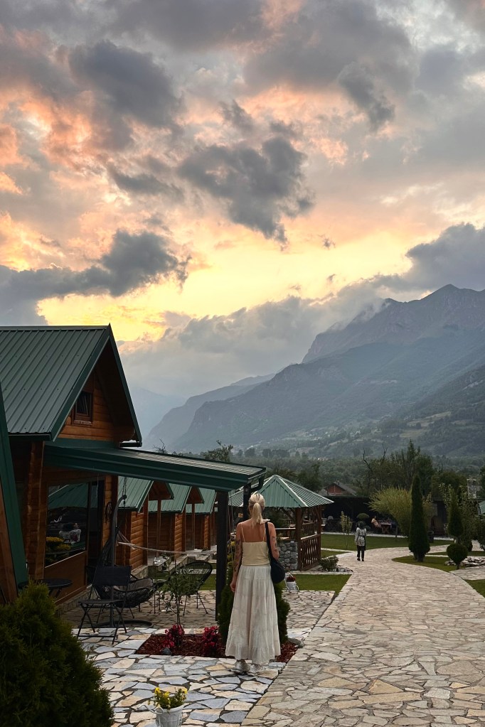
We arrived in Plav at a beautiful hotel with a mix of A-frames and other cabins.
This would be our final night with our main luggages before packing our things into a day pack for the second half of the trip (5 nights). As difficult as it was to leave behind the luxurious spa hotel, we were there to hike, and the Peaks of the Balkans trail is best done as a thru-hike! (: This next spot had its own special perks. We were immediately greeted by beautiful lake views, an adorable dog (continuing a trip trend), and an amazing home-cooked meal. We sat at a long table, listening to our Montenegrin guide Vuk teaching us some of the history of the region and explaining the plan for the next leg of the trip. After some chats about everything from the (more promising than Korab/Rudoka) weather forecast to astrocartography, we headed back to our cabins to finish packing and prepare for a morning departure.
That morning, it’s really an achievement that we managed to leave Plav. We discovered the owner’s kitten…check out the Instagram highlights for footage of one of the cutest animals I’ve seen in my life (I took videos, but sadly no photos).
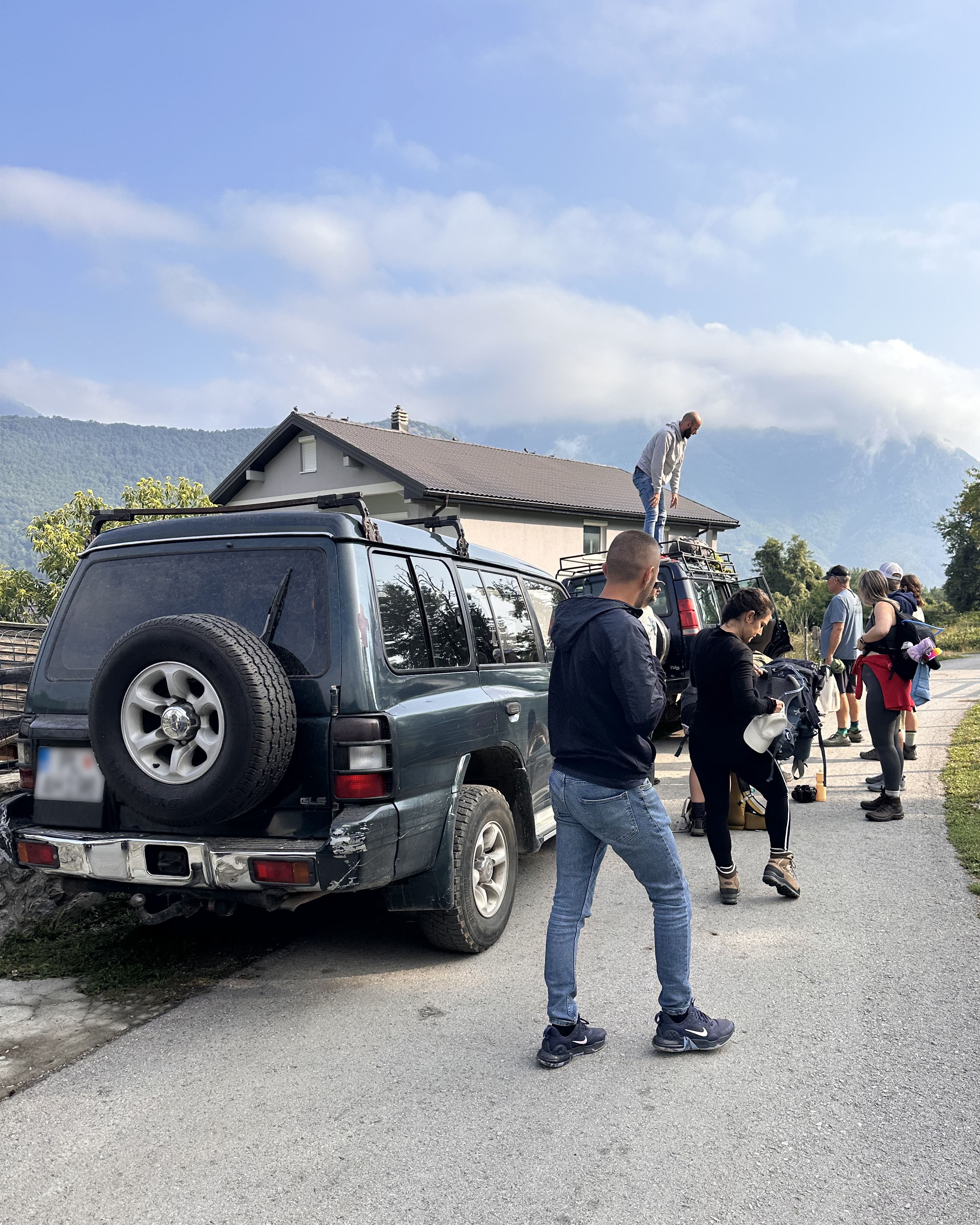
Still, there was more adventure ahead. The van set off for Podgorica with our luggage, while we loaded into three 4×4 vehicles. The mission: get as far up the off-roading bit as possible before continuing on foot.
On the way, there is a stopping point to check passes for entry to Prokletije National Park (called Bjeshkët e Nemuna National Park on the Kosovo side). If you do this route, I would recommend leaving a bit of extra time for possible delays here (~20 minutes).
As we passed a hut a bit further in, our car suddenly pulled over. What transpired next was F1-pit-level activity not understood until several minutes later. We gathered, from the driver’s attempt to explain, that he had a headache and wasn’t feeling too great, so his sister (who works in the hut?) brought him some tea, medicine that looked like taking a shot (it was not), and a banana.
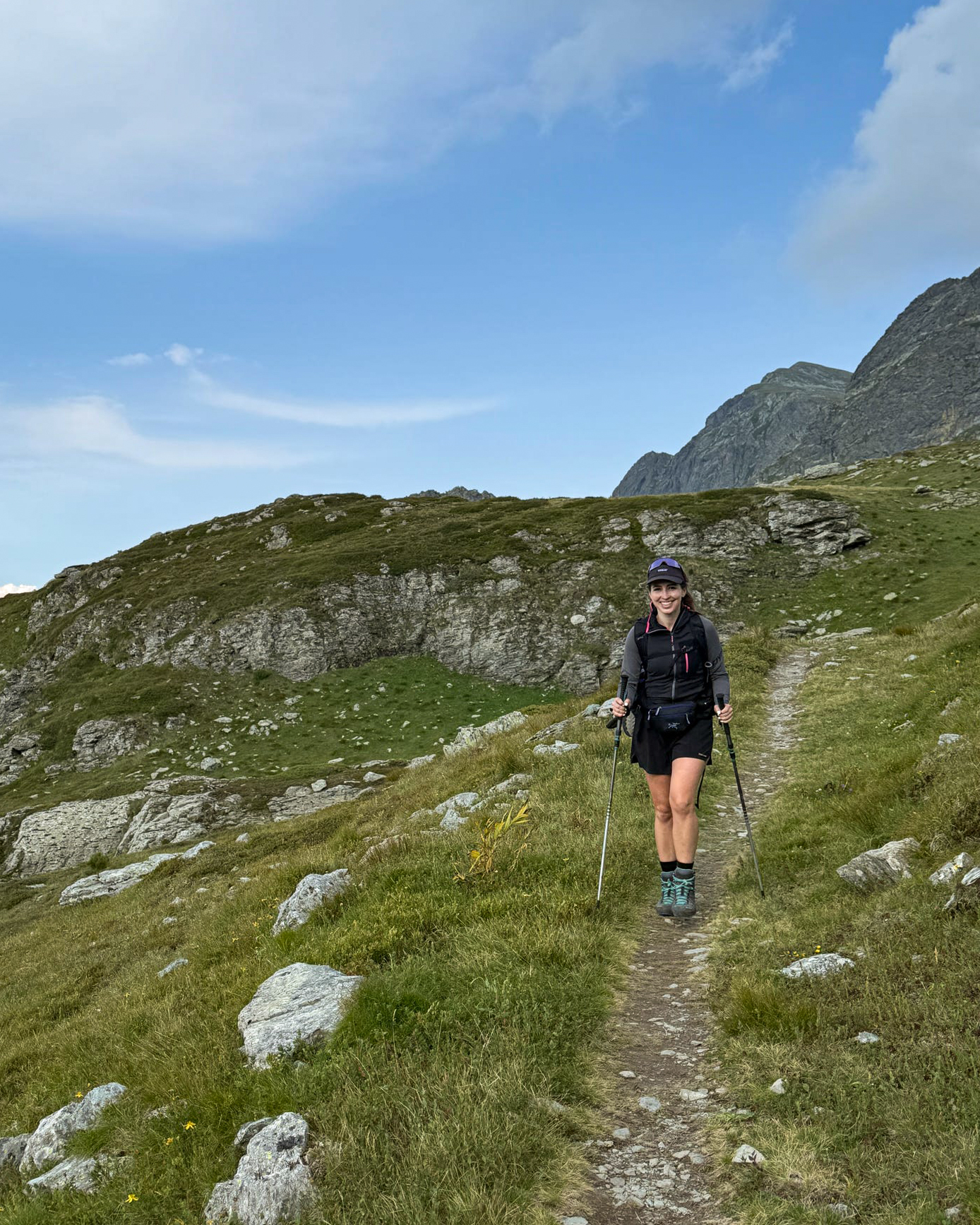
The views heading up the switchbacking mountain road were beautiful, and there weren’t many others around. Sections of the Peaks of the Balkans trail can get pretty busy in summer, particularly between Valbonë and Theth, but you can find solitude along many segments of it. This was definitely one of the quieter parts. At around 10:15am, we started our journey on foot through the “Accursed Mountains”. I didn’t know it at the time, but this name would be pretty appropriate for me! :’)
The Hike
We got pretty far up the road in the 4x4s, so the final stats for our hike are below:
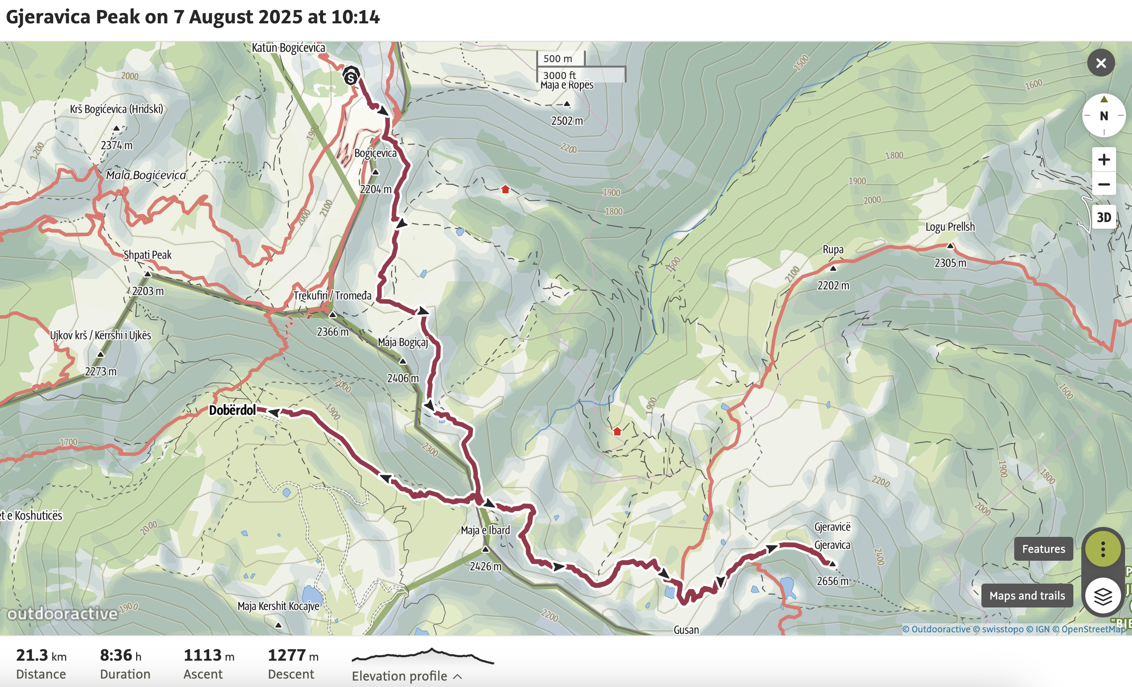
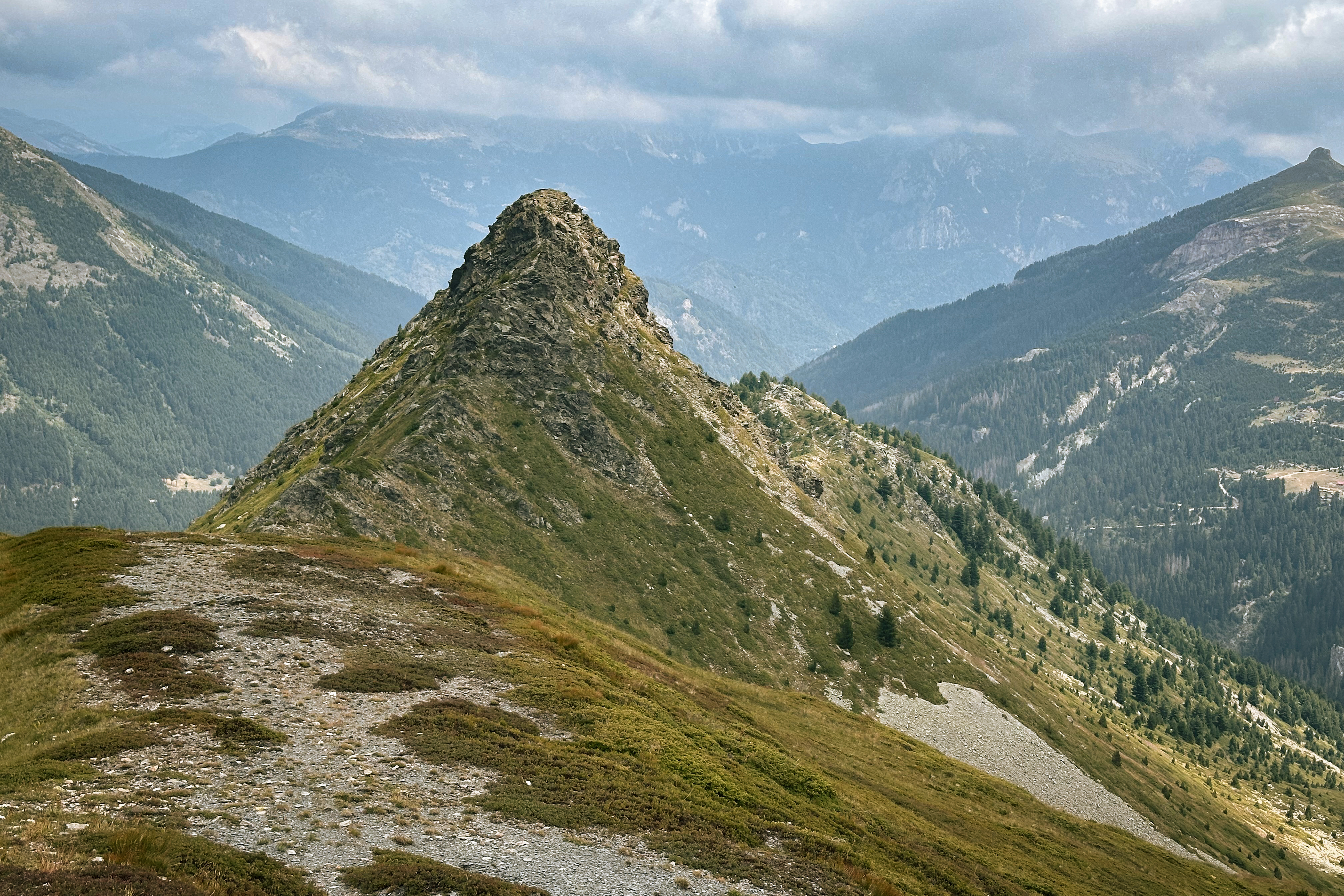
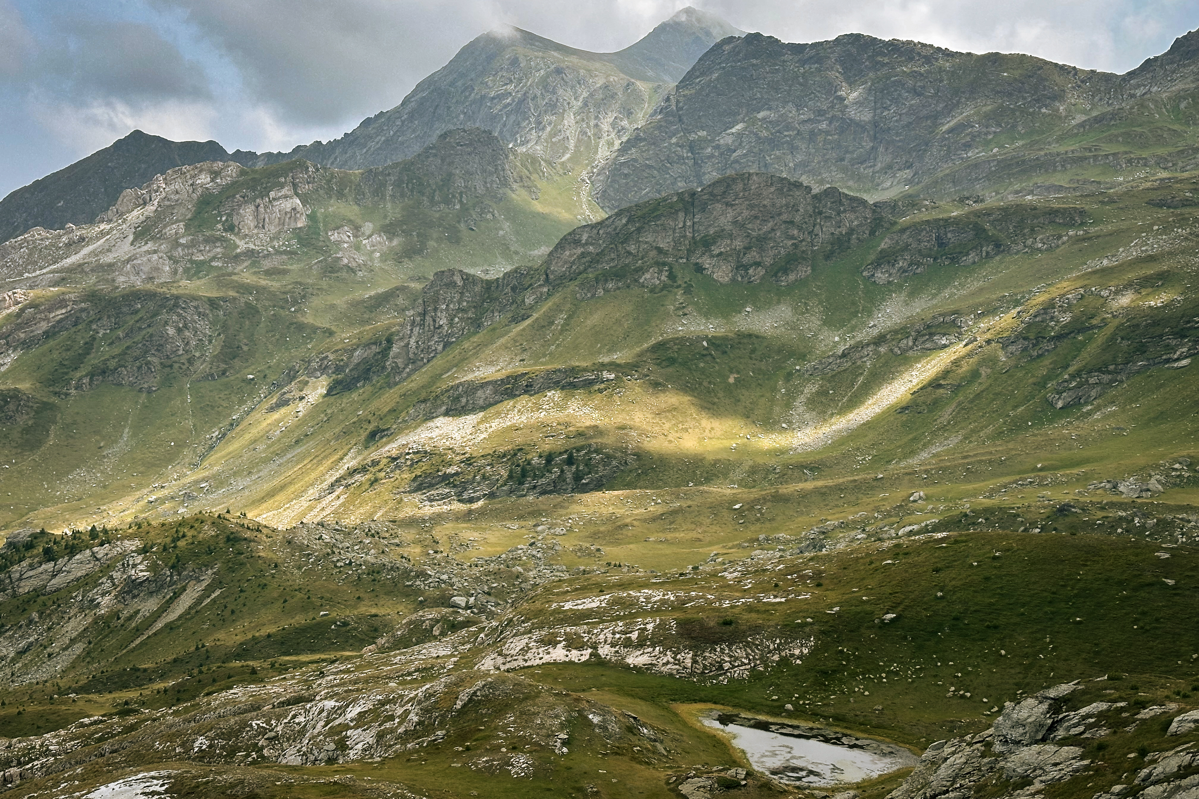
The plan was to get to the turn-off toward Gjeravica and evaluate our pacing, ideally pushing toward the summit before doubling back and descending into Dobërdol, where we’d be staying overnight. The trail here is pretty straightforward…a welcome change from the grassy meandering on Rudoka 2 days prior.
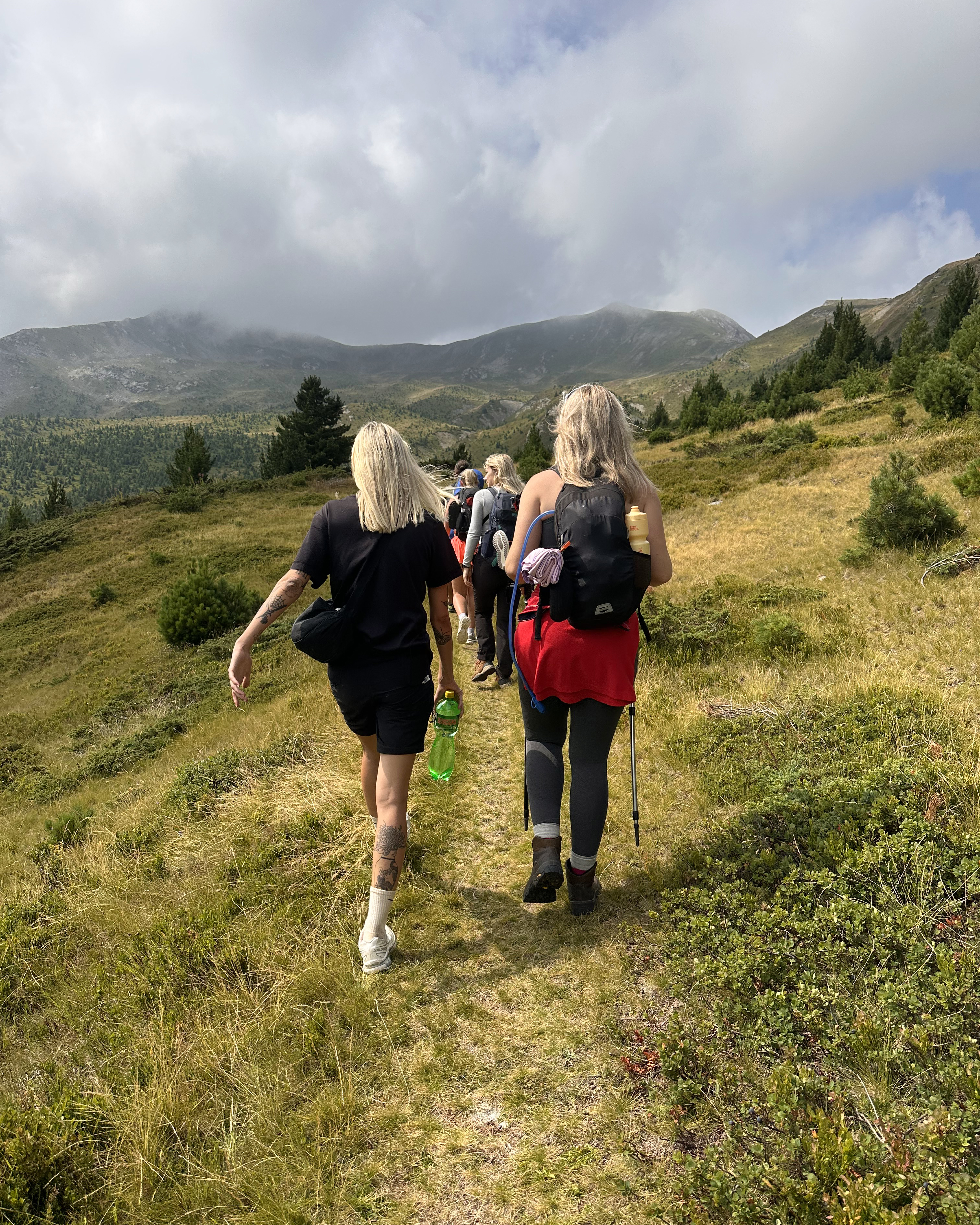
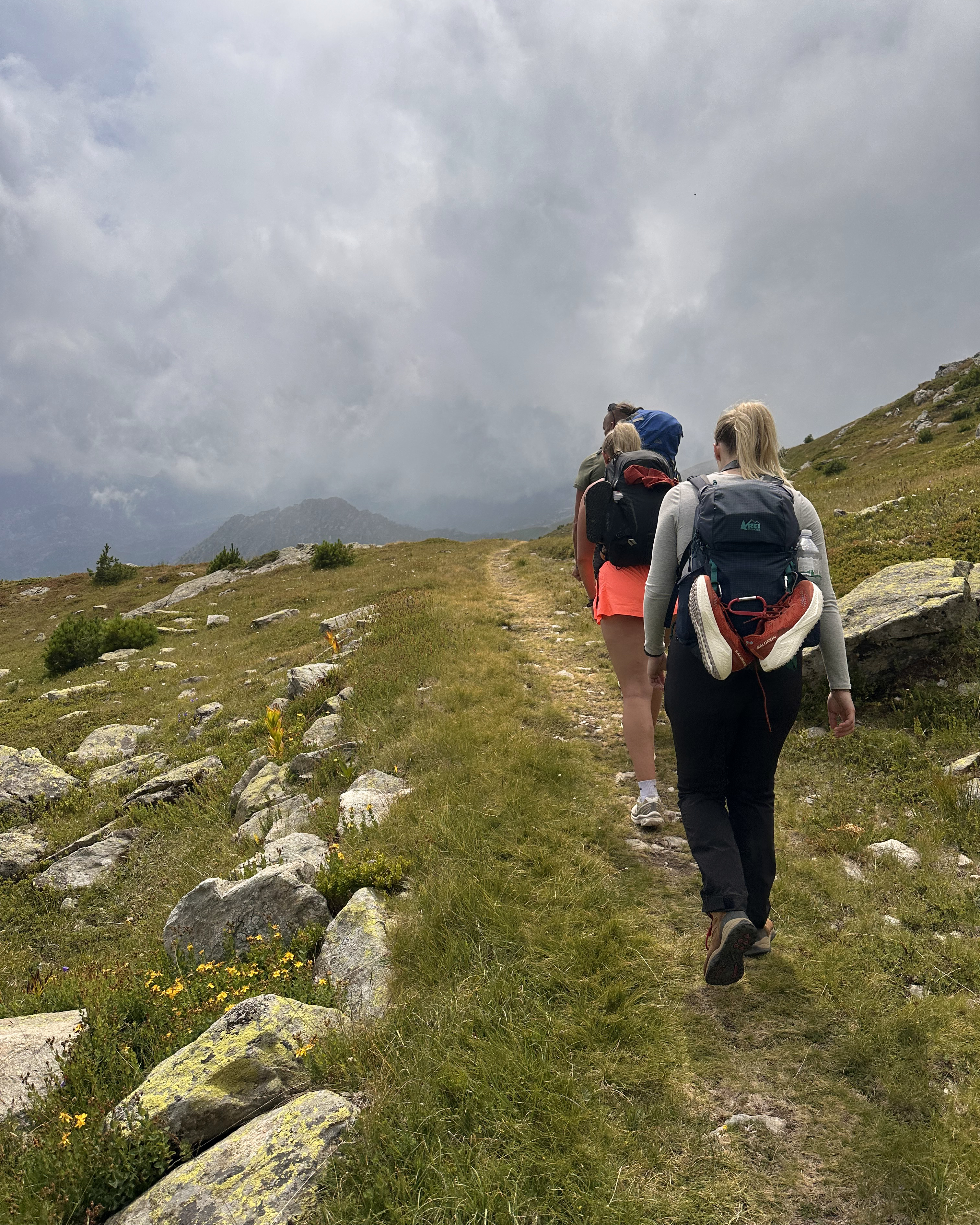
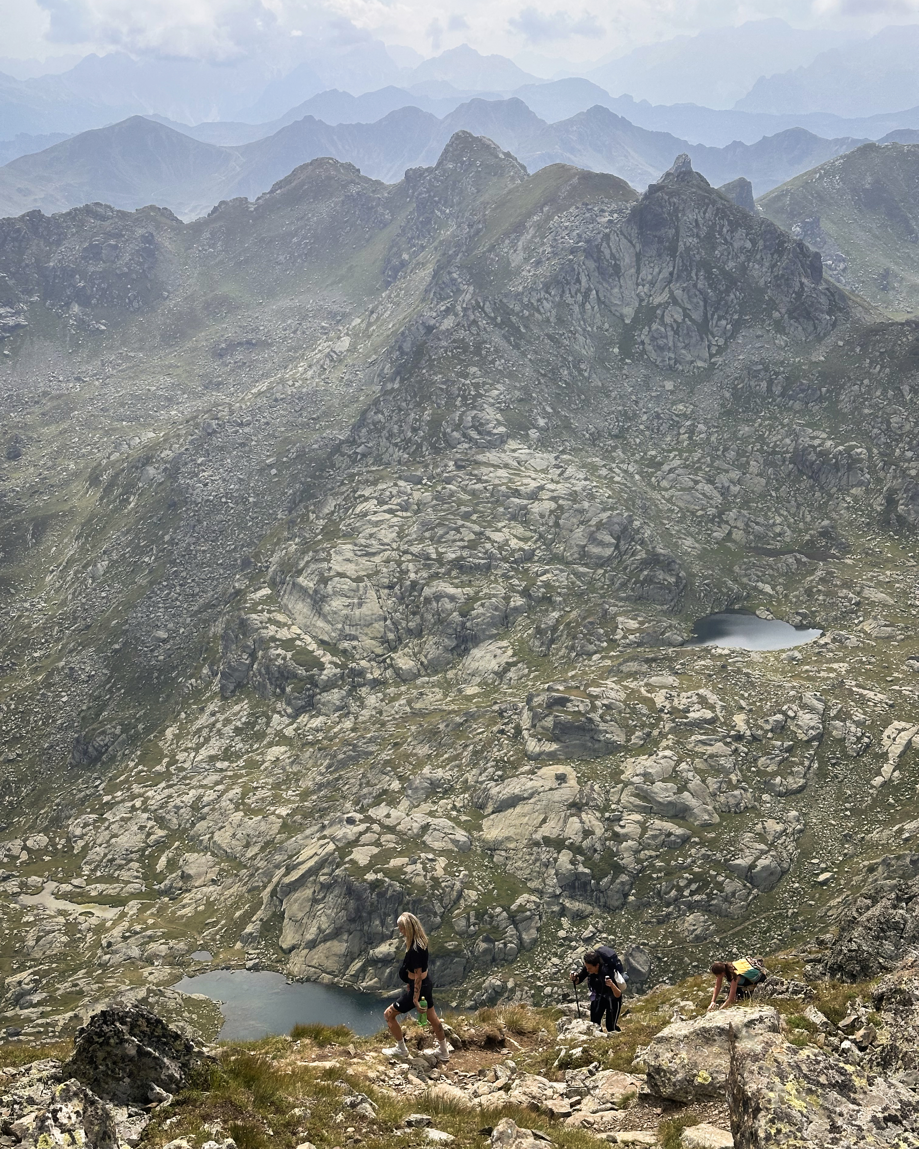
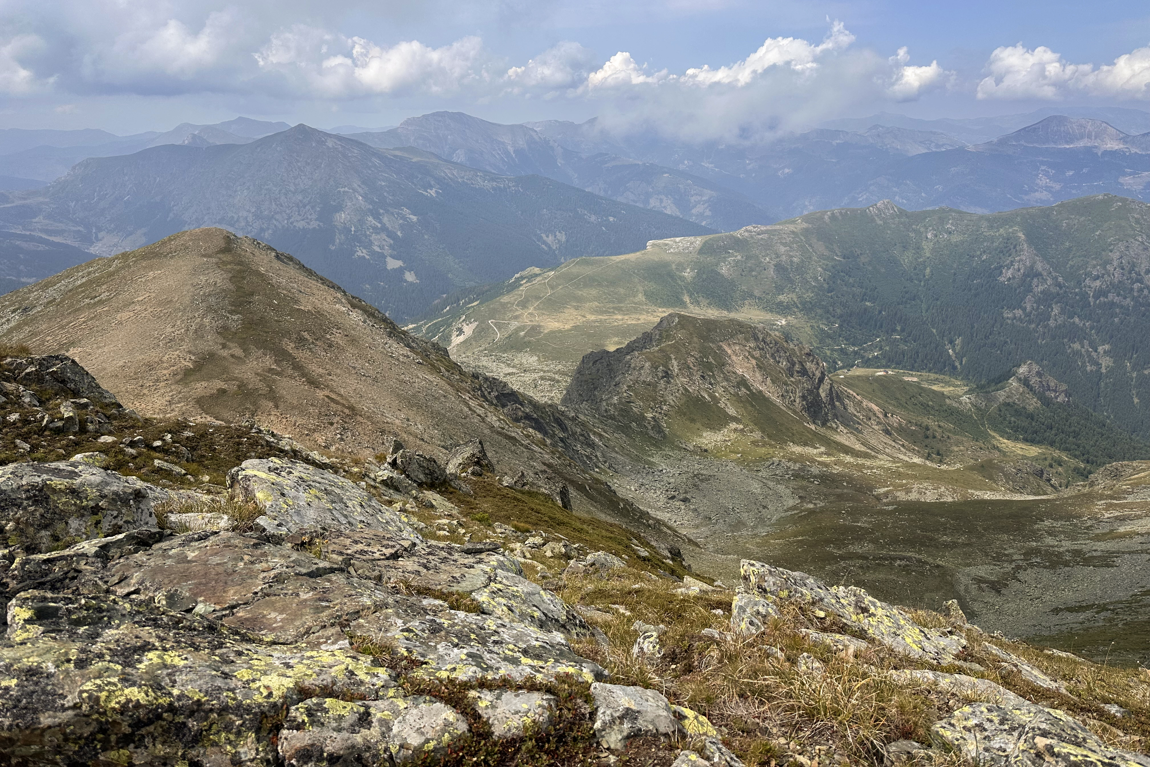
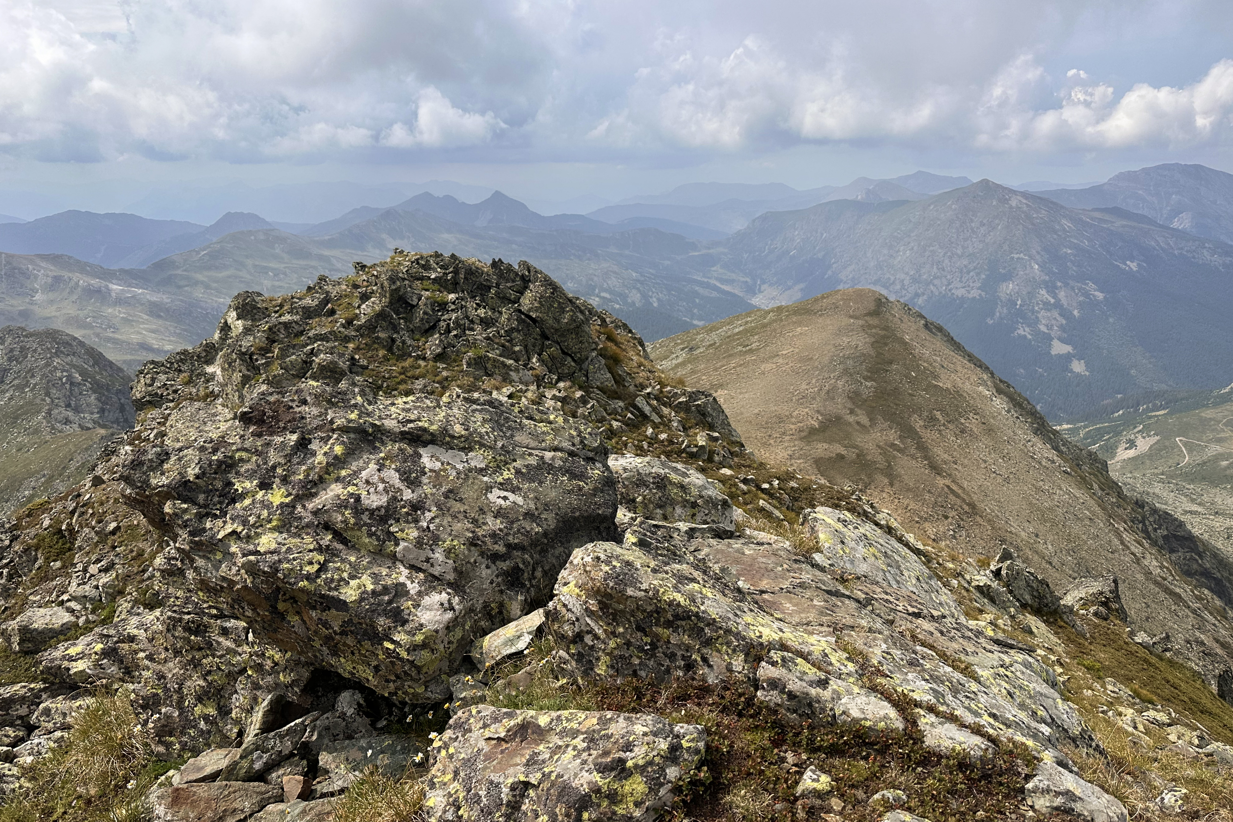
Much of the trail skirts the edges of mountains, with open views across the valley. None of the trail is technical, and the ascent is never too sustained, so we were pacing pretty well.
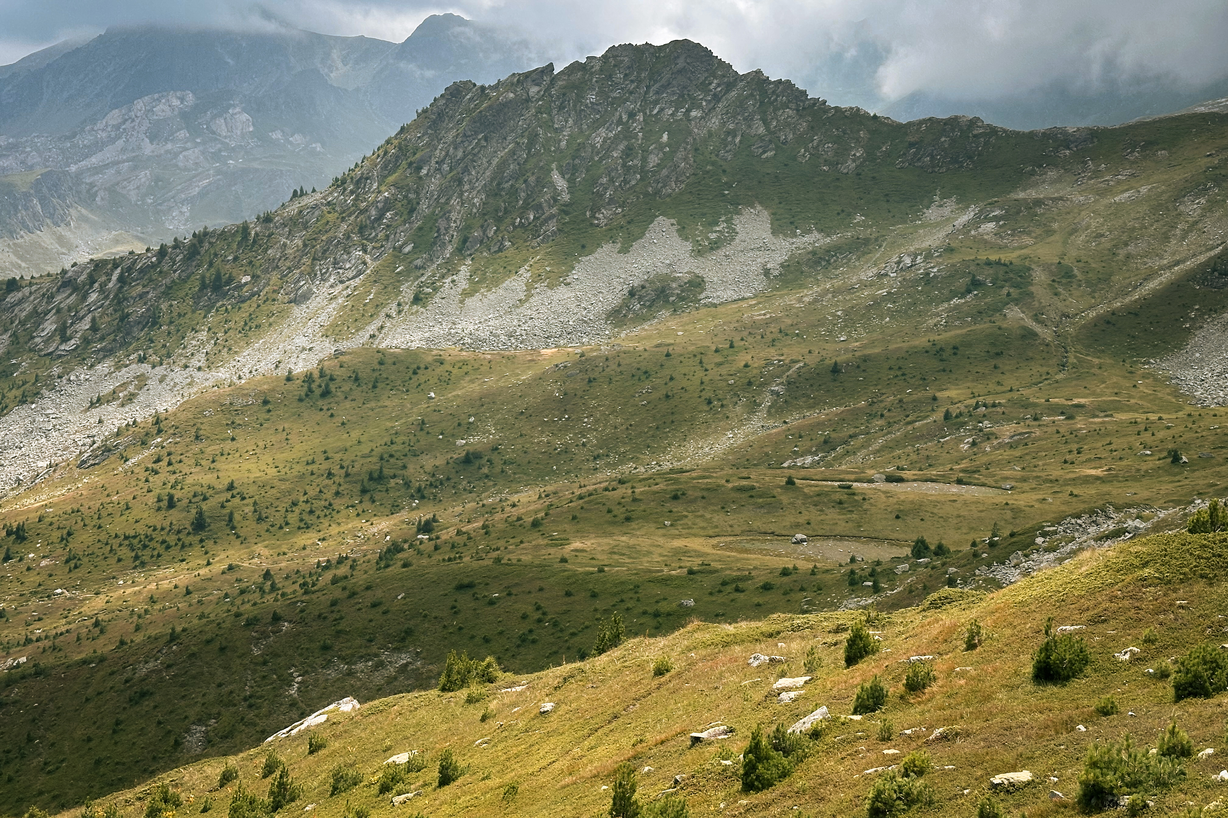
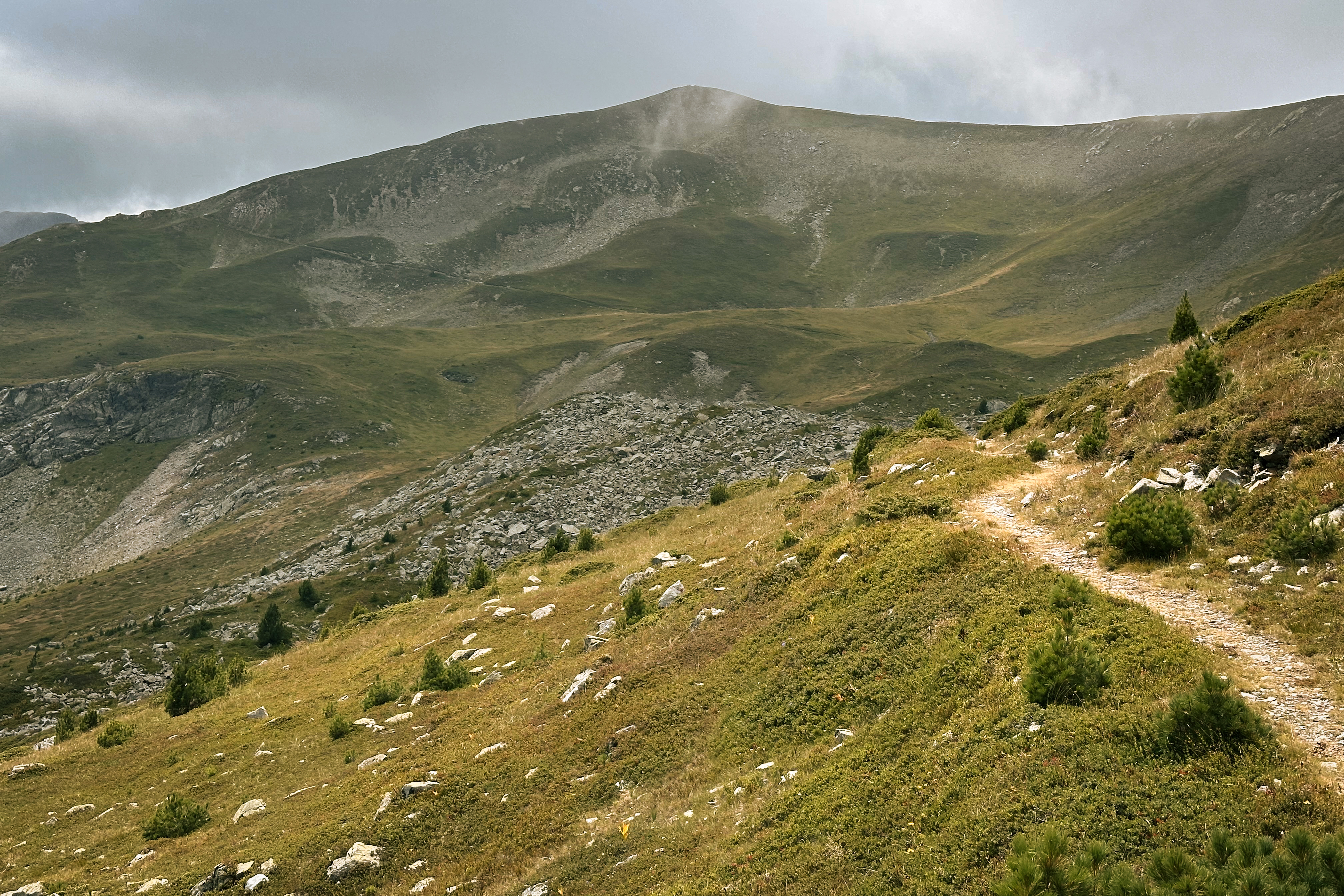
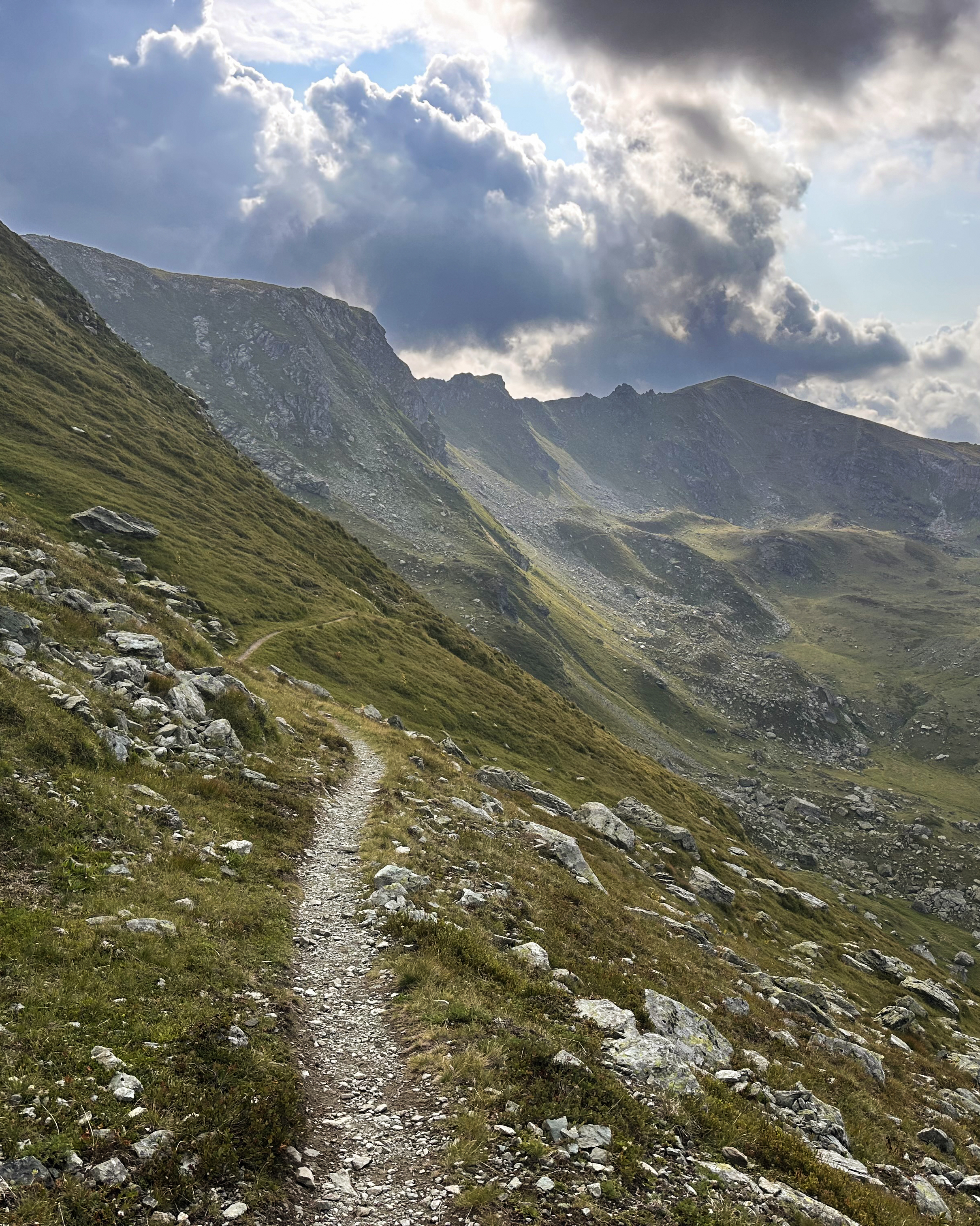
The clouds and afternoon sun made for some beautiful lighting:
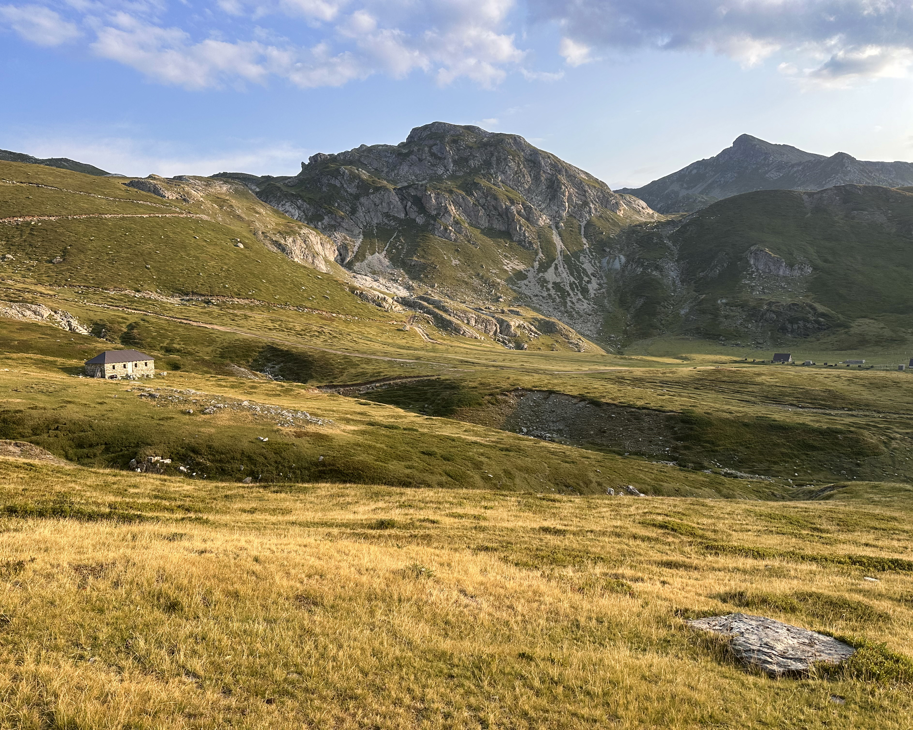
Before the final summit push, there are two lakes that make great lunch/snack spots. We stopped briefly at the first, then had lunch at the second.
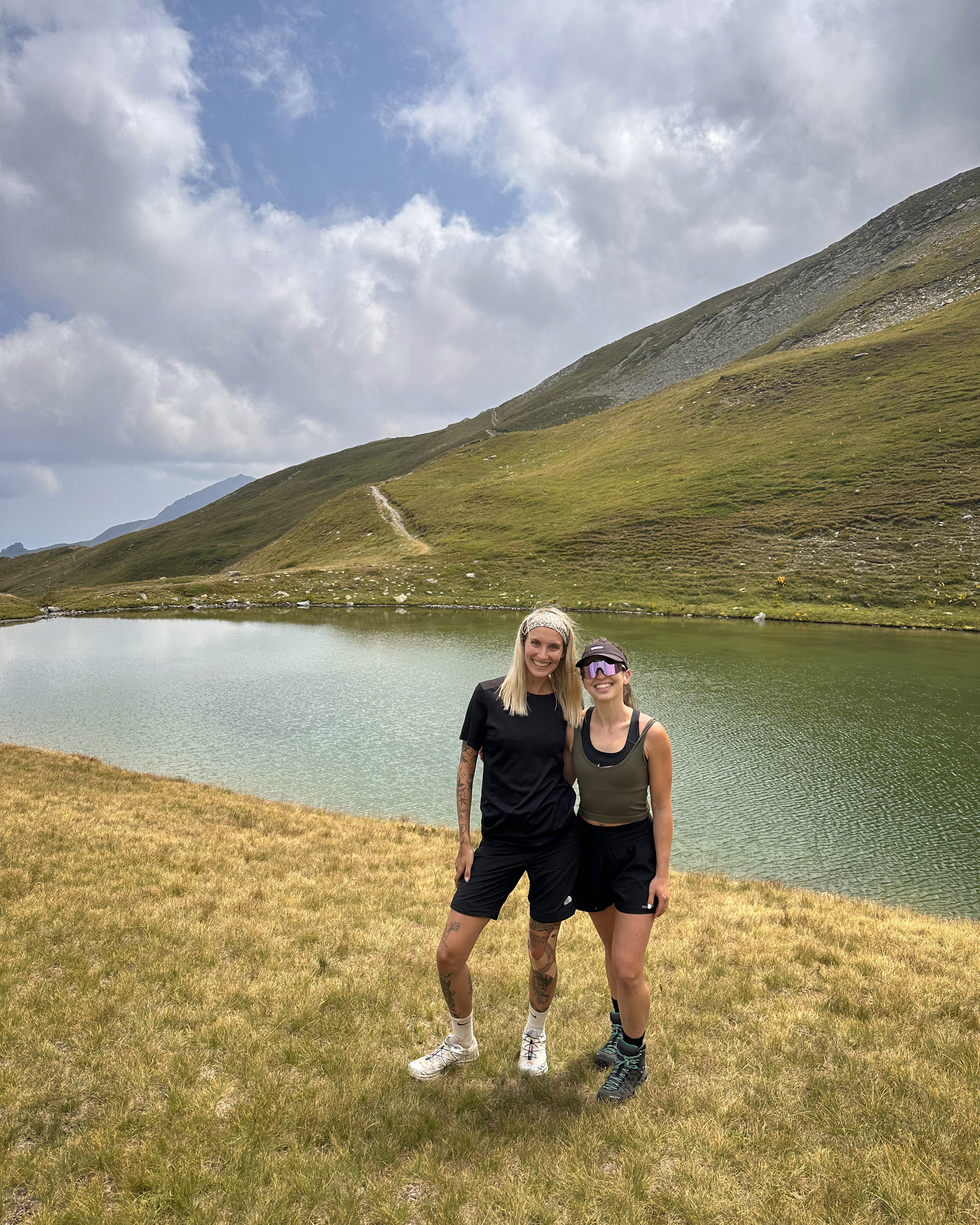
The first photo above is with Tia, the founder of Why Not Adventures and leader of the trip! She’s been one of the most supportive people throughout this European peaks challenge, even offering to head back to Rudoka for a reattempt in the few days between her hosted trips (the next one would be in Montenegro). If you value meeting genuine, fun people in not-so-crowded destinations, without spending a fortune, I really recommend joining one of her trips. Some people in this Balkans group were on their second or third already (after Egypt and/or Pakistan).
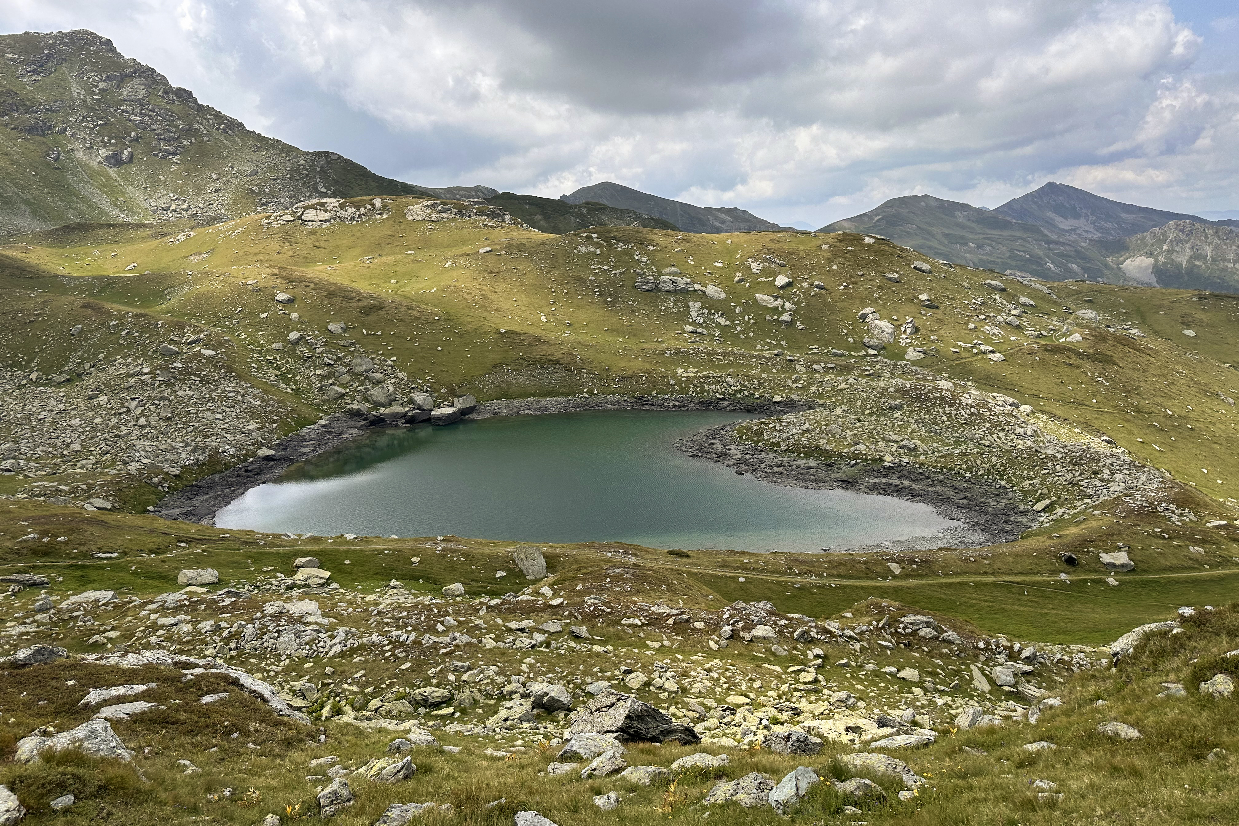
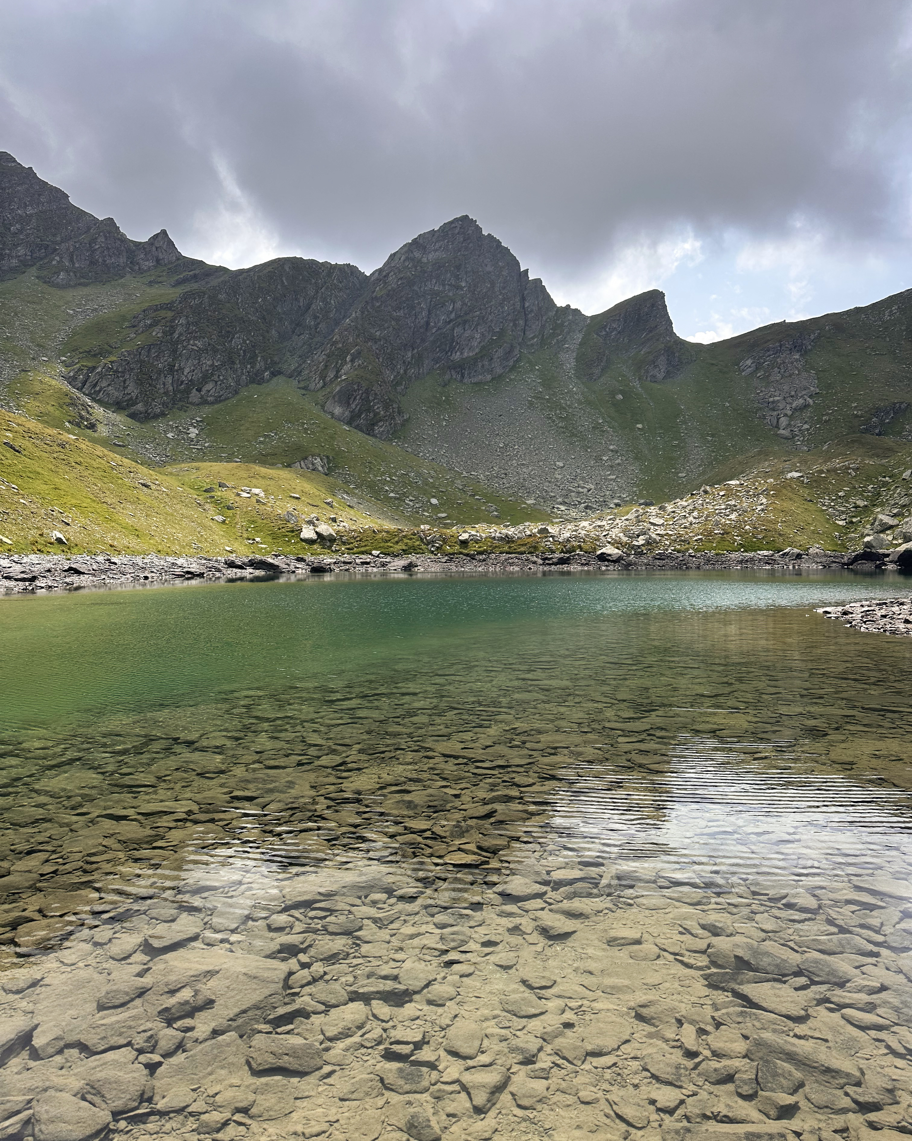
From the lake, the rest of the ascent is pretty sustained, taking just over an hour from there to the summit. From this angle, it looks heart-shaped! (: Believe it or not, it’s not the only heart-shaped lake on a Balkans high point trail. Maglić in Bosnia (peak #11), if done as a circular, involves views of the Montenegrin Trnovačko Lake. Unfortunately, the fog didn’t allow us to see its shape from above. Tia’s Montenegro trip after this one also visited that lake!
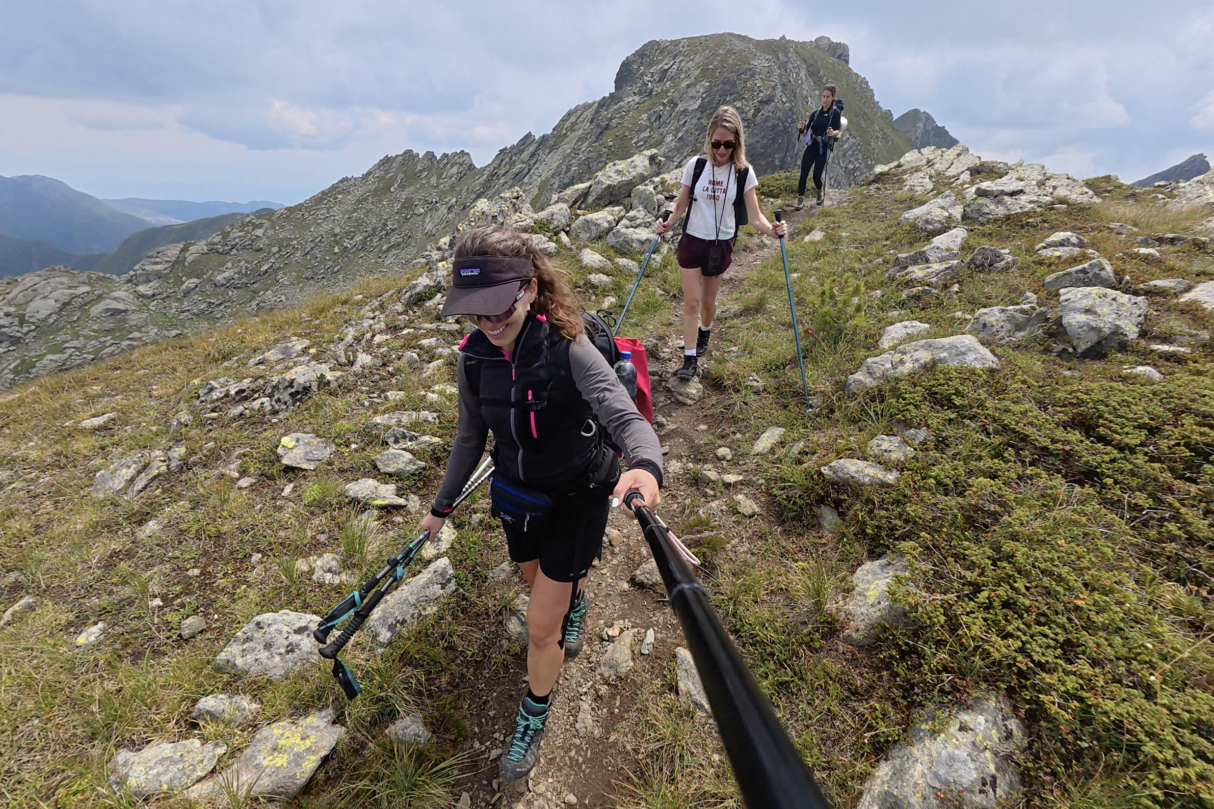
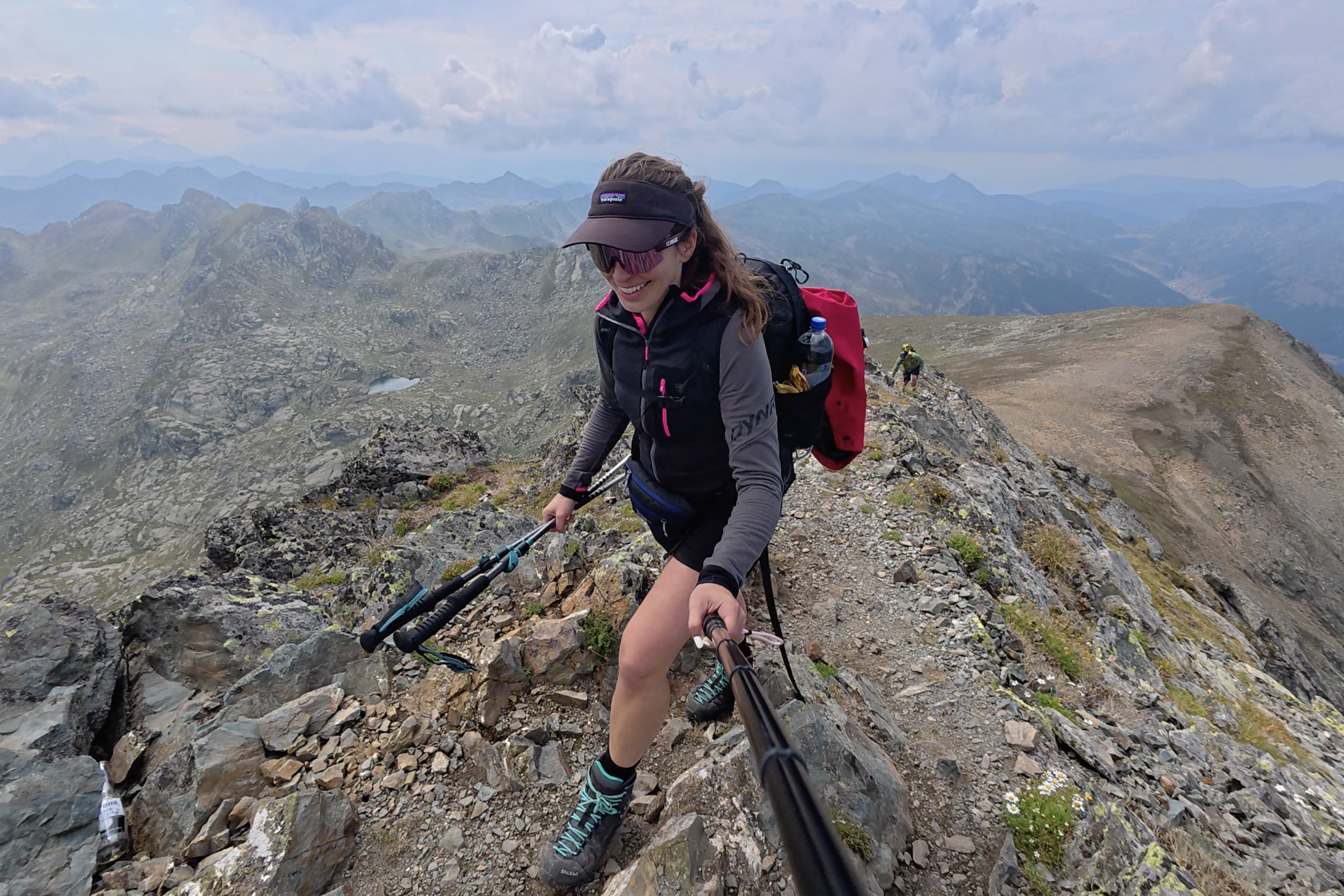
There’s a tiny bit of scrambling along the way, but still nothing technical. The whole final push is very scenic, with views opening more with each step. (: Rudoka was beautiful as well, but I could see why Kosovo considers this its official peak. It stands fully within Kosovo, near the Albanian border (whereas Rudoka sits on the border with North Macedonia), and you really can’t top the 360-degree views throughout the approach to this one.
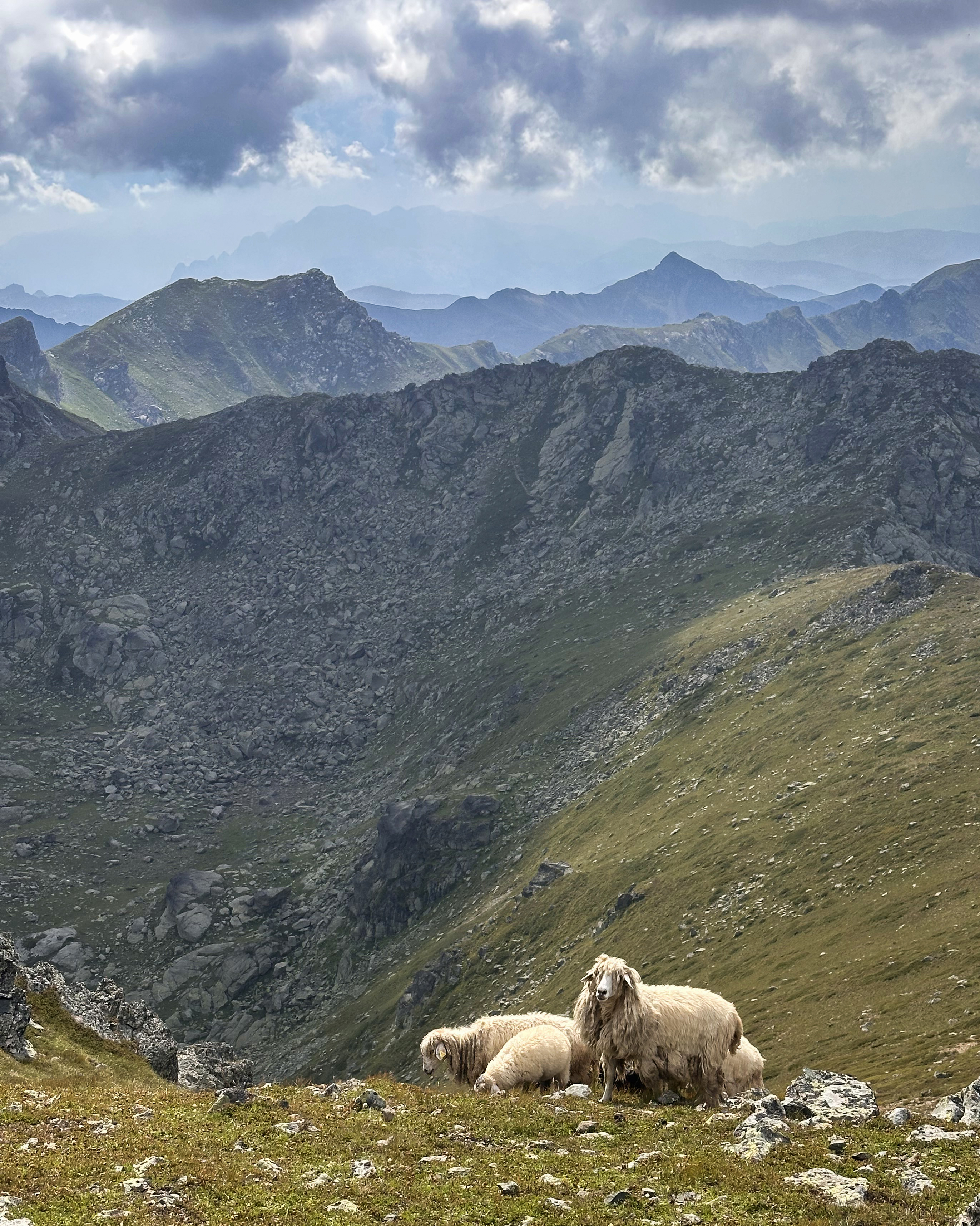
The sheep really added to the atmosphere. Similar to Moldoveanu, they are guided along by shepherds and dogs, which is another reason why hiking solo is a bit less ideal here. With a large group like ours, there’s much less caution needed, and we ended up passing between a dog and a herd of running sheep (and some goats?) on the way down without issue.
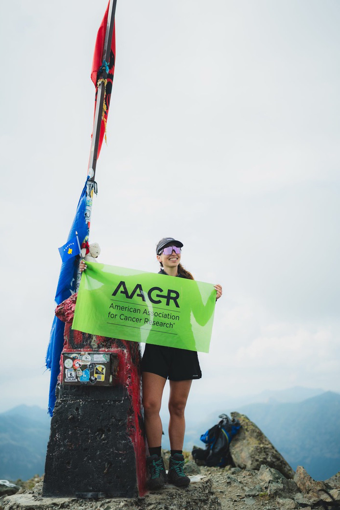
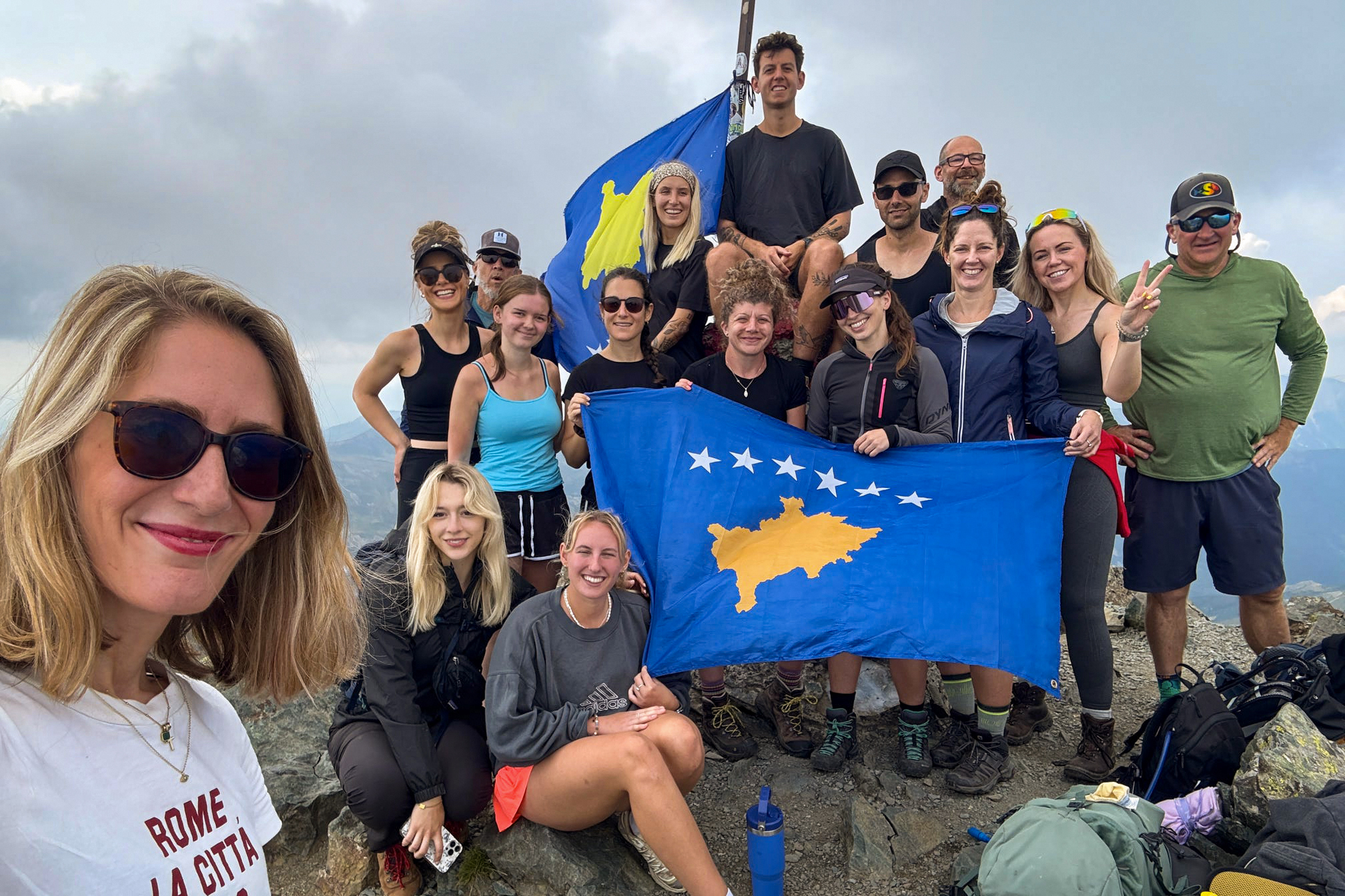
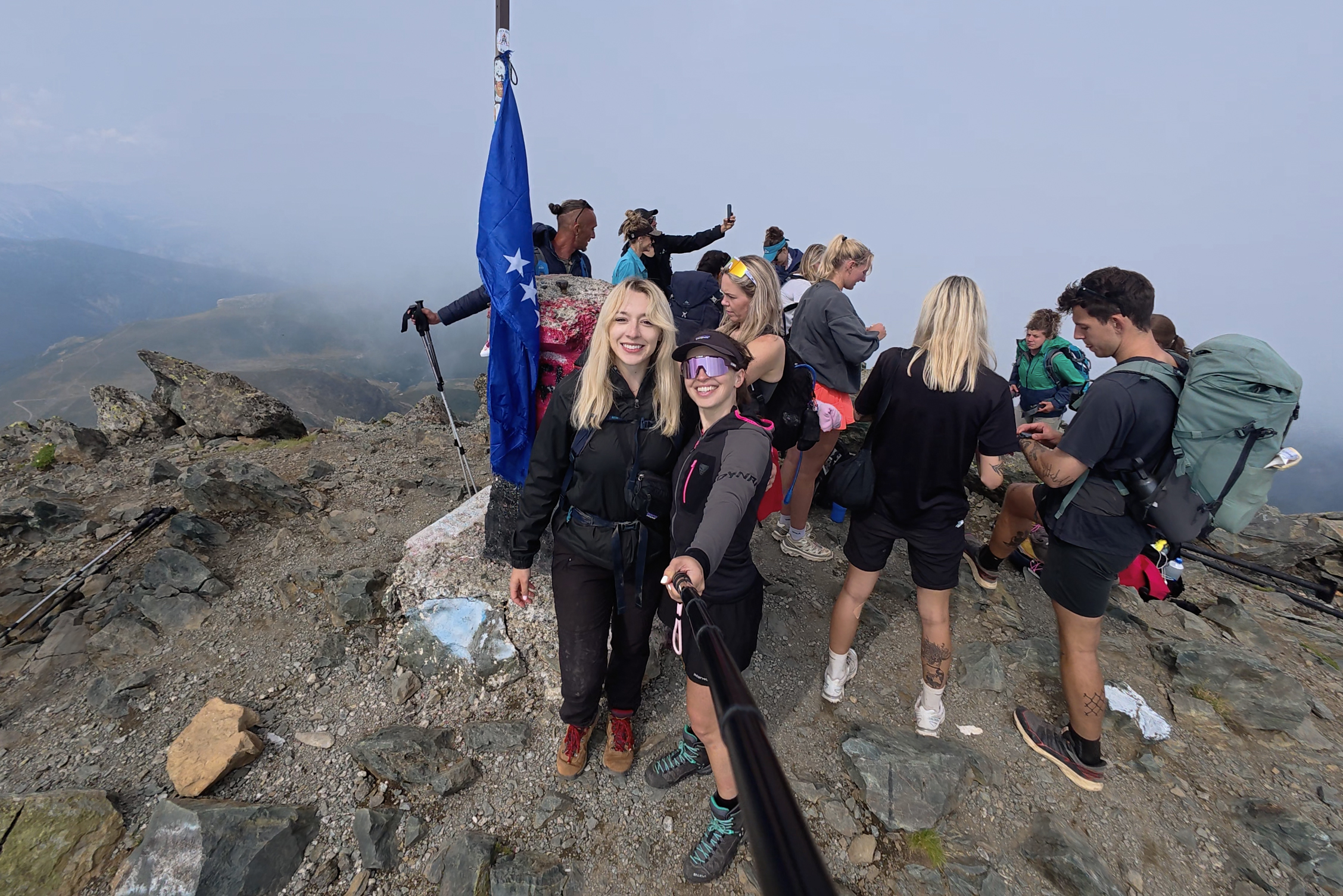
By 3pm, we were standing on the summit! Here are some of the photos taken by Ben on my phone:
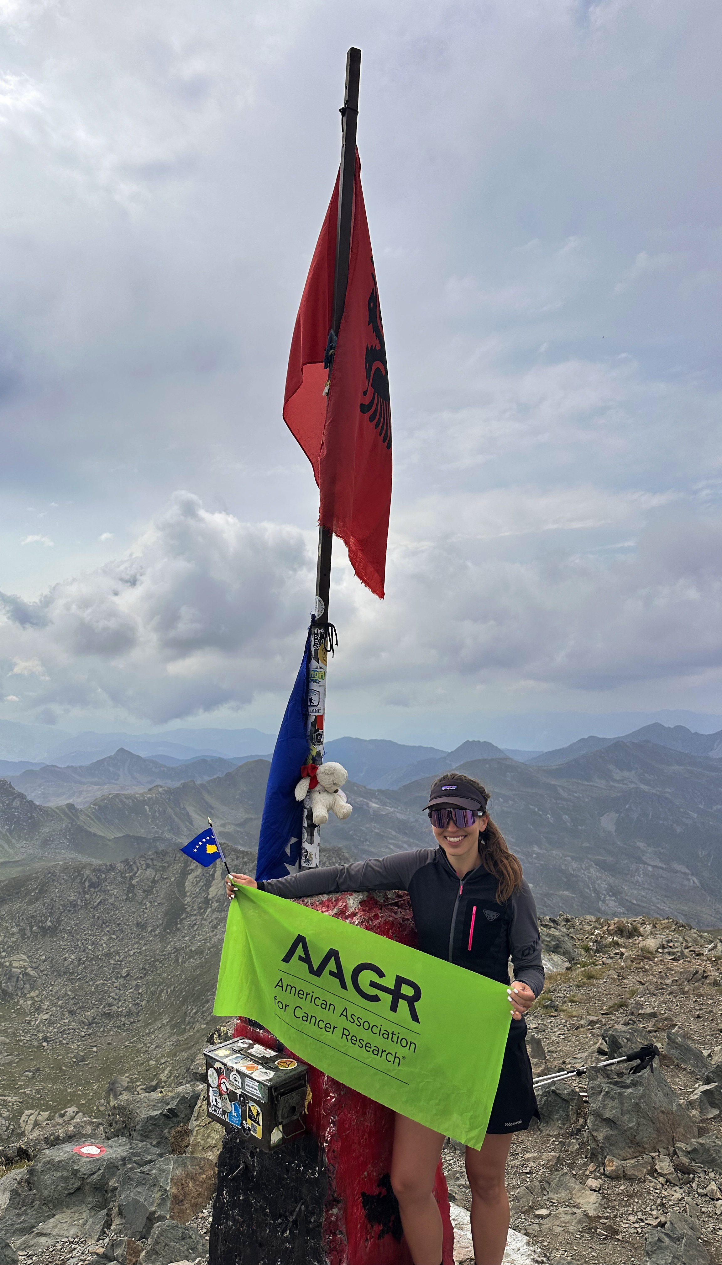
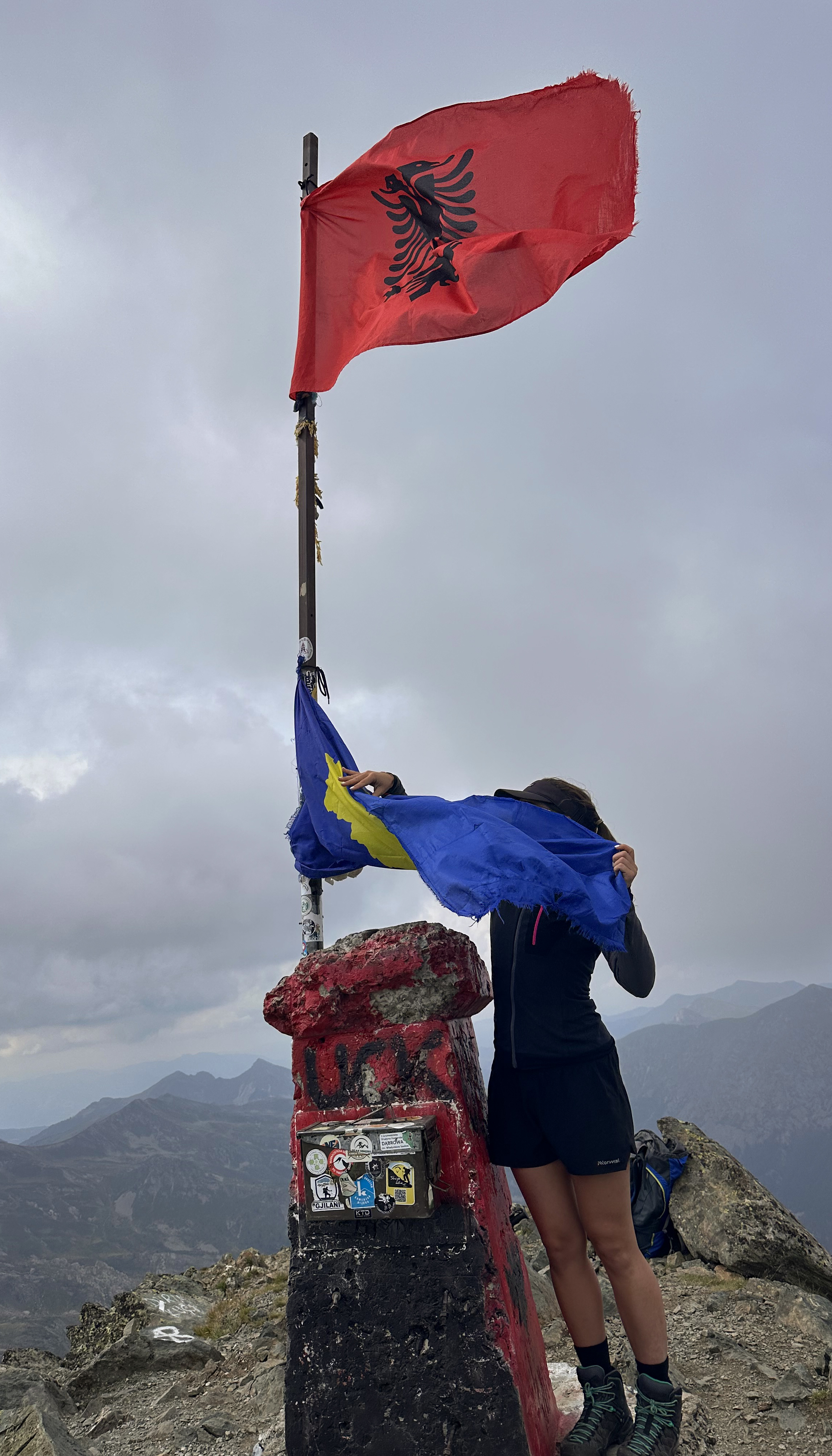
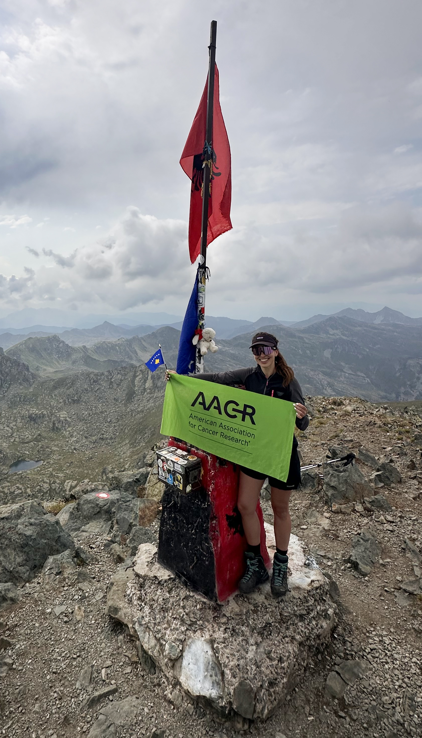
The great part about an uncrowded summit and a group of skilled photographers means that you end up with plenty of viable photos! (: The one at the top of this post was taken by Nicole on her proper camera, as a candid. The middle one above is me attempting to hold the flag of Kosovo (that had been fixed to the flagpole upside down) properly. There was a separate, large flag left there that worked a bit better for our group photos:

After this, it was time to head down! This is where things started to head pretty south for my toe. Not the one that had surgery two days before this trip…that one was fine, of course. The ‘healed’ one! 😦 The mostly-backwards hiking technique resumed.
Still, it was hard not to appreciate the beautiful golden hour lighting as Dobërdol came into view. These last 3 kilometers really dragged on, though.
Just before 7pm, we checked into our cabins and settled in before dinner. Both Achilles tendons were a mess from the toe-preserving backwards descent, which made the non-Western toilets with no support bars a biiiit challenging. (: We had a great dinner together in the warm hut, before I headed back to mine to investigate the devolving toe situation. It was worse than expected…in the span of a day, the infection looked to be traveling down from the toe. That was the one instance that my doctor had advised would be game over, and it naturally happened right when we got to an inaccessible location.
Tia, Ben, and Vuk (our guide) went to speak with the campsite staff, who arranged to have me transported out to Tirana in the morning…more on that in the next section. In the meantime, I took antibiotics that I’d (thankfully) brought along, while Sara, Imogen, and Ben were helping out with first-aid skills and supplies 😅.
The Early Exit
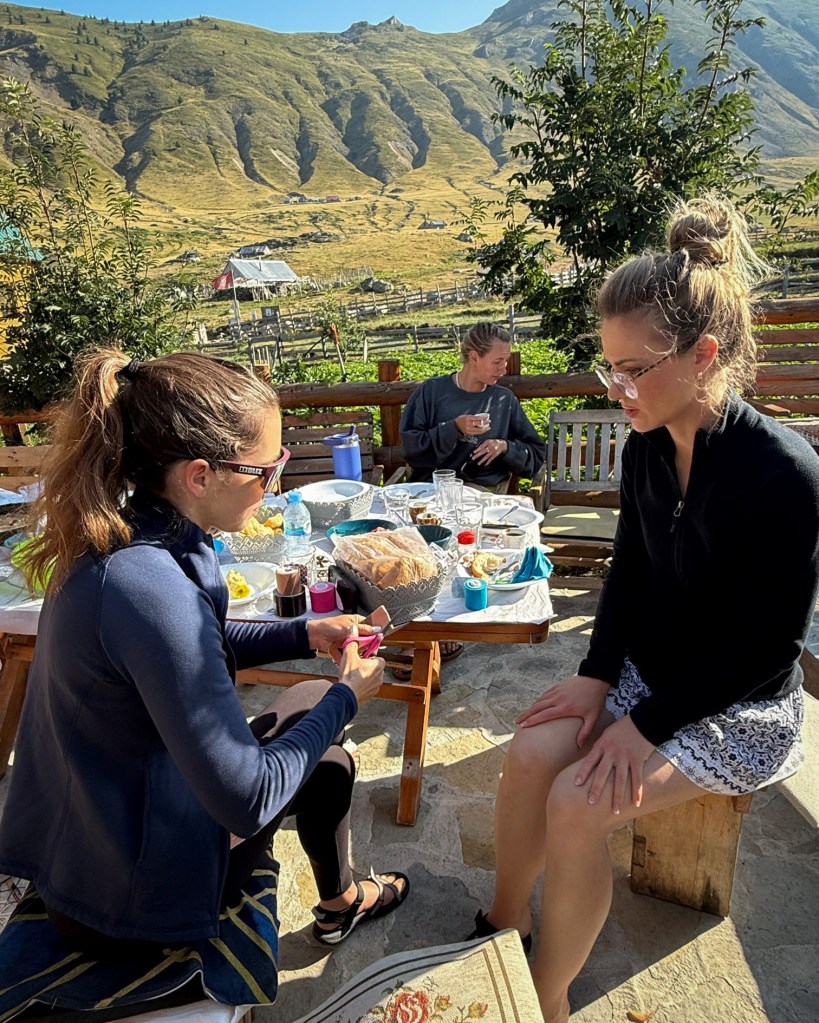
While I was grateful to have met this great group of people and summit 2 peaks with them, it was sad to say goodbye so early and miss the next four amazing days, including a visit to the stunning Lumi i Shales and the summit of Zla Kolata. After having breakfast together, there was just one thing to do before they set off and I waited for my transport out: prep the ladies’ knees for the next leg (pun intended) of their journey.
KT Tape has been an important part of keeping my knees intact throughout this challenge, along with trekking poles (I really recommend Black Diamond – I’ve put mine through a LOT for the last 6 years and they’re still perfect). If you struggle with painful knees on descents (especially around the patella), the full knee support video is a helpful one. The more recent videos you’ll find don’t include the double half-strips to anchor below the patella, and it’s probably not fully necessary, but I do it!
Thankfully, the antibiotics seemed to kick in overnight. I was still in no condition to hike out, but the evacuation became slightly less urgent- I wasn’t septic. The owner of where we were staying had to drive around 4 hours to reach me, so after unloading supplies onto horses, he had a coffee with his family, and we hit the road just before noon. I didn’t know who’d be driving me out, so while I was waiting, I used the campground’s shockingly fast WiFi to research some useful phrases like “is there somewhere to stop for a toilet?” I later found out that they had brought a Starlink out there, which is how the connection was so good. Previously, there was no way to communicate from there. I learned all of this and more, because the owner spoke perfect English! I could delete my cringey Google Translate screenshots.
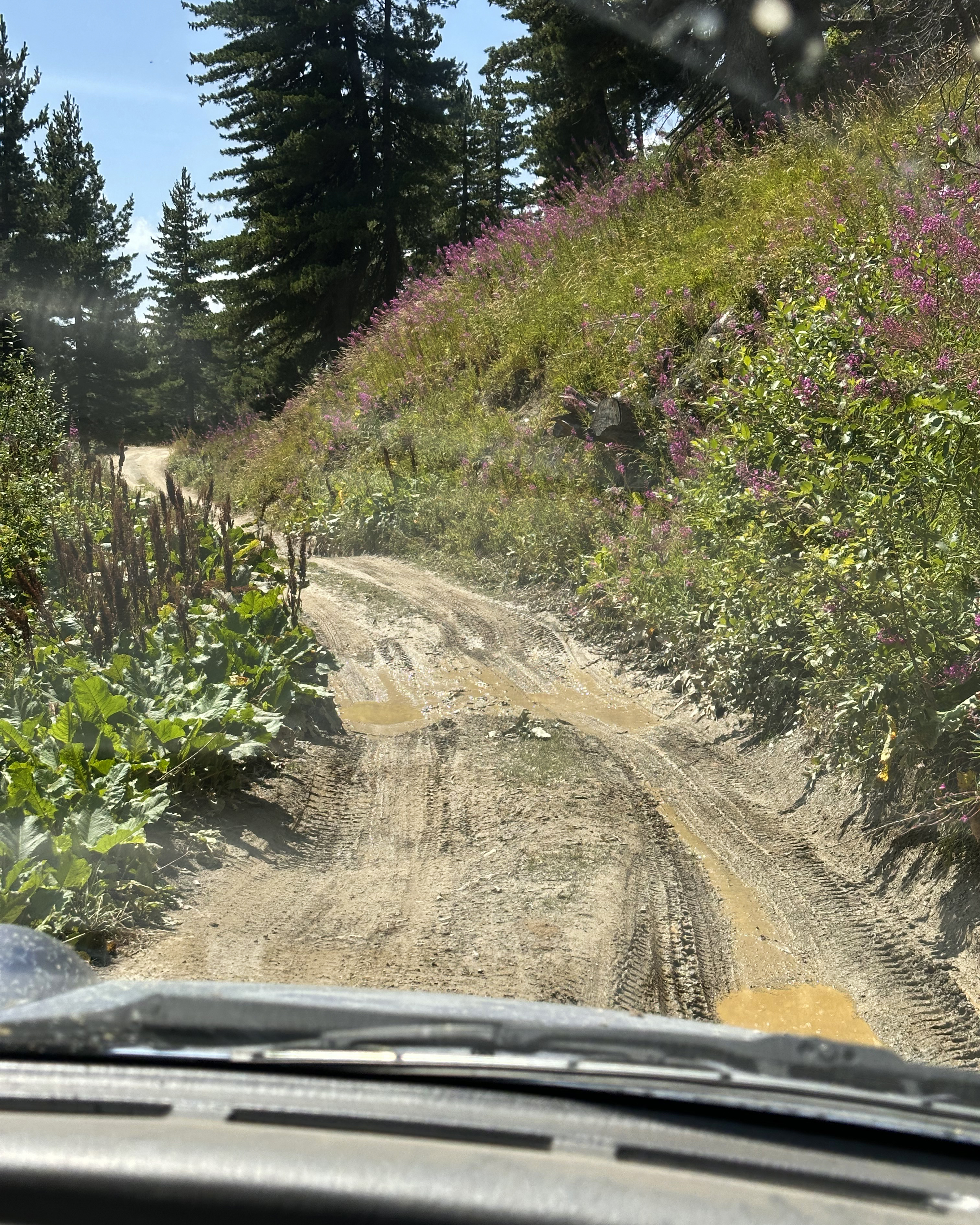
They had warned me that it would be over 3 hours in an off-roading vehicle, followed by an additional 4 hours to reach Tirana. The idea was that those were the closest proper hospital facilities, if things did take a bad turn.
They really were not kidding about the challenging road conditions, though:
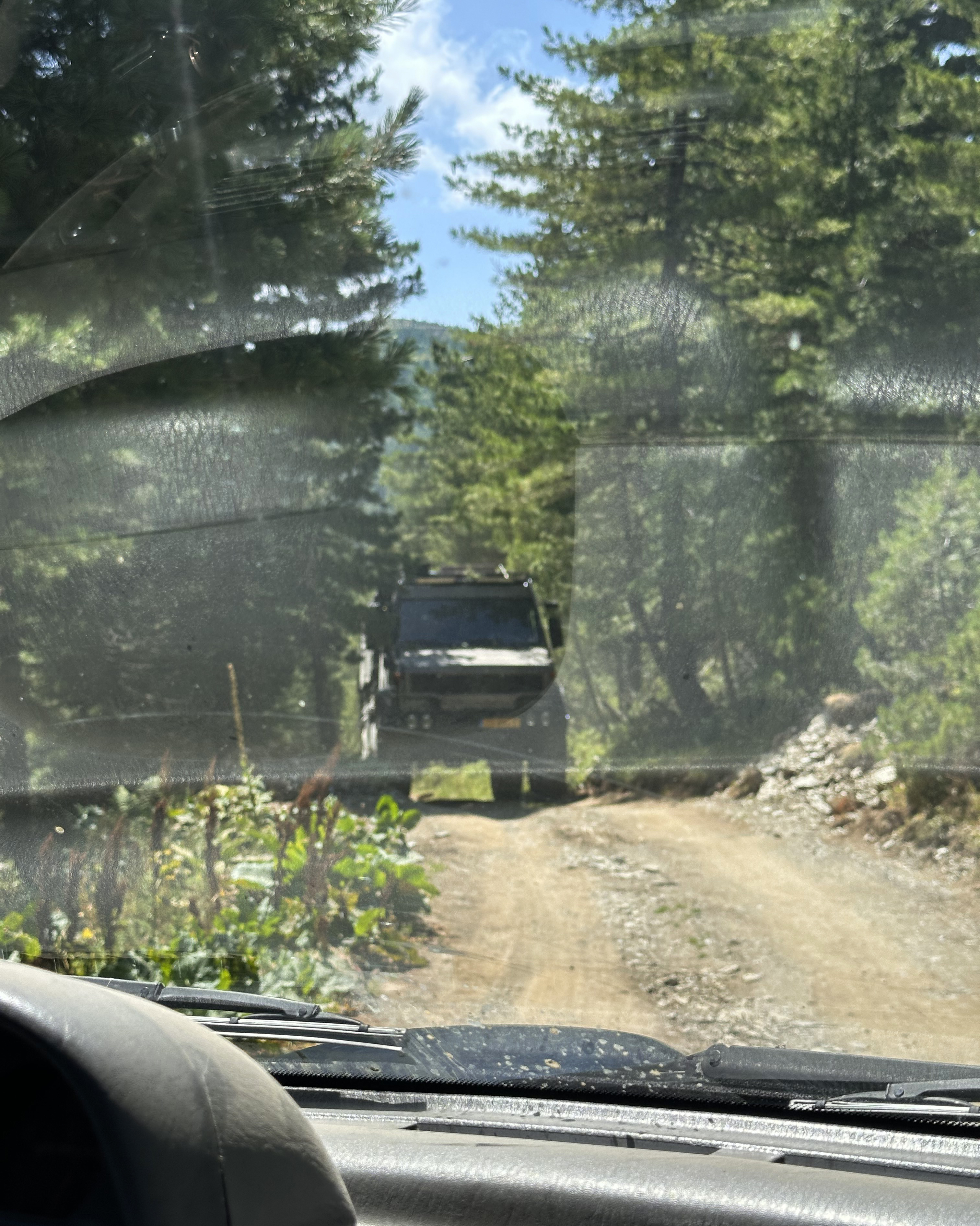
I have a video of the massive vehicle above in the Instagram highlights, if you’re curious about how we ultimately managed to get past it.
45 minutes in, we stopped to help a car with a blown tire. They had unfortunately broken something critical to swapping the tire (stripped a bolt or something), so it was deemed a hopeless situation, and we continued along. I hope they made it out okay. Our next stop wasn’t too far beyond that, in Çerem, at the owner’s cousin’s guesthouse. It turned out that it would be where my group would be spending that night, and I was using the toilet hours before their arrival! (: Still non-western. Next, we passed through Gjakova, Kosovo. The owner knew the border control agents, as I guess he’s constantly passing through to head up to the mountains. This crossing and the one back into Albania were very quick! At some point, we had to change vehicles, and by the time we got into Tirana, it was 7pm. The specialist wasn’t in (it was Friday evening – he’d be back on Monday), so I was seen by a nurse who prescribed topical antibiotics and said to return if it spread further. It had been 24 hours since I’d started oral antibiotics, and it was already improving quite a bit! I was in touch with my doctor back in London, and another surgery later (that Monday), it was finally time to rest for the next 7 weeks.
This meant that I’d have to return not just for Rudoka, but for Zla Kolata as well. It’s such a beautiful region that I’m looking forward to this. (:
THANK YOU ❤
Thanks for reading my twenty-first Crown of Cureope blog post! At the time I stood on Gjeravica, we had raised $1,620 for the American Association for Cancer Research to fund lifesaving discoveries. As of publishing this post, we are at $2,575 raised of our $2,500 2025 target. Contributions are still very much appreciated! (: If you’d like to wait until next year, the campaign continues until all peaks are completed, so there’s still plenty of time. Thank you so much to everyone who’s helped us reach the fundraising goal, and to everyone who’s helped me reach my peaks goal. I set this as a solo challenge initially, so I never expected to meet so many amazing people along the way. I’m excited to see what 2026 brings!!

Leave a reply to #22: Poland (Rysy) – Crown of Cureope Cancel reply